
Anandpur Sahib Tehsil is a tehsil of Rupnagar district in the Puadh region of Punjab, India, headquartered in Anandpur Sahib city, the birthplace of the Khalsa. The largest tehsil of the district, it had 194,445 people in 190 villages and its towns at the Census of 2011.
- ਪੰਜਾਬੀ ਨਾਂ
- ਅਨੰਦਪੁਰ ਸਾਹਿਬ ਤਹਿਸੀਲ
- ਕਿਸਮ
- ਤਹਿਸੀਲ
- ਜ਼ਿਲ੍ਹਾ
- ਰੂਪਨਗਰ
- Headquarters
- Anandpur Sahib city, a Municipal Council of 13 wards
- ਇਲਾਕਾ
- Puadh (Rupnagar district falls in the Puadh region, except the Nurpur Bedi sub-tehsil side of this tehsil, which is geographically Doaba; the old entry label Malwa is not used)
- ਸੂਬਾ
- ਪੰਜਾਬ
All 25 facts
- ਦੇਸ਼
- ਭਾਰਤ
- ਆਬਾਦੀ
- 194,445 in 37,331 households (Census 2011, the most populous tehsil of Rupnagar district). Split stated two ways: district portal rural 170,618 plus urban 23,827; census village and town listings 178,163 in 190 villages plus Anandpur Sahib town 16,282. The two splits differ by 7,545 people; the total agrees
- ਰਕਬਾ
- About 400 sq km (district tehsil listing); the 190 census villages alone cover 47,933 hectares, about 479 sq km, in the Census 2011 village directory frame
- ਪਿੰਡ
- 190 villages, all inhabited (Census 2011 village directory, sub-district code 00262); the Jugti tehsil directory lists the same 190 village pages
- Development blocks
- Anandpur Sahib and Nurpur Bedi, two of the five blocks of Rupnagar district; Nurpur Bedi is also the district sub-tehsil, inside this tehsil
- Density and sex ratio
- 486 people per sq km on the 400 sq km frame and 936 women per 1,000 men (Census 2011 tehsil frame); child sex ratio 872
- ਧਰਮ
- Tehsil level (Census 2011, Table C-01): Hindu 56.61%, Sikh 41.41%, Muslim 1.43%, others 0.55%; headquarters town: Sikh 55.39%, Hindu 42.05%, Muslim 1.82%
- ਸਾਖਰਤਾ
- 136,049 literate people in the tehsil, effective literacy 78.89%, male 85.74%, female 71.64% (Census 2011); headquarters town effective literacy 82.44%
- Scheduled Castes
- 40,955 people, about 21.1% of the tehsil (Census 2011); headquarters town 27.5%; no Scheduled Tribe population recorded
- Headquarters town
- Anandpur Sahib (M Cl), 16,282 people in 3,270 houses over 13 wards (Census 2011), elevation 311 m; founded in 1665 as Chakk Nanaki by Guru Tegh Bahadur Ji
- Largest village
- Aggampur, 4,874 people in 872 households over 1,247 hectares (Census 2011 village directory), nearest town Anandpur Sahib
- ਪਿੰਨ ਕੋਡ
- 140118 (headquarters town)
- Vehicle registration
- PB-16 (headquarters town)
- ਆਬਾਦੀ
- 31.235 N, 76.499 E (headquarters town)
- Assembly seat
- Anandpur Sahib (No. 49) assembly constituency for the headquarters town, in the Anandpur Sahib Lok Sabha constituency; some tehsil villages sit in the Rupnagar assembly seat
- ਭਾਸ਼ਾ
- Punjabi; district level at Census 2011: Punjabi 92.6% and Hindi 6.55% as first language (district figure, not a tehsil count)
- Nearest city
- Rupnagar, 31 km south of the headquarters town (Sikh Encyclopedia); Nangal 29 km north; Chandigarh about 85 km (Sikh Missionary Society)
- ਪ੍ਰਸਿੱਧੀ
- Takht Sri Kesgarh Sahib and the creation of the Khalsa in 1699, the Hola Mahalla festival, the Virasat-e-Khalsa museum, and Shivalik foothill villages along the Sutlej
- ਤਹਿਸੀਲ
- ਅਨੰਦਪੁਰ ਸਾਹਿਬ
Where is Anandpur Sahib Tehsil?
Anandpur Sahib Tehsil is a tehsil of Rupnagar district in the Puadh region of Punjab, India, headquartered in the holy city of Anandpur Sahib on the lower Shivalik hills near the Sutlej river. The largest and most populous tehsil of its district, it counted 194,445 people in 190 villages and its towns at the Census of 2011.
Anandpur Sahib is the northern of Rupnagar district's four tehsils, running from the Sutlej lowlands up into the Shivalik foothills toward Himachal Pradesh. The headquarters town stands on a lower spur of the Shivalik range at 31.235 degrees north and 76.499 degrees east, at an elevation of 311 metres. The Sutlej passes within 2 to 5 kilometres of the town, with the Naini Devi hill to the northeast and the Gobind Sagar reservoir beyond the range. The district climate is dry outside the monsoon, temperatures run from about 4 degrees in winter to 45 degrees in summer, average rainfall is 775.6 millimetres, and block soils are undulating, with sandy patches along the river and the cho streams.
The tehsil total used here is 194,445 people, the figure the district portal table and the census tehsil listings agree on. The rural and urban split, though, is stated two ways. The district portal counts 170,618 rural and 23,827 urban people. The census village and town listings count 178,163 people in the 190 villages and 16,282 in Anandpur Sahib town. The two splits differ by exactly 7,545 people, one frame treating that count as urban and the other carrying it on its village side. Area is also framed two ways: about 400 square kilometres in a district listing, while the 190 census villages alone cover 47,933 hectares in the village directory frame.
How the holy city gave the tehsil its name
The tehsil takes its name from its headquarters town, whose story begins at Kiratpur, 8 kilometres to the south. In 1665 Guru Tegh Bahadur Ji bought land covering the ruined mound of the older village of Makhowal from the Rajput hill state of Kahlur, Bilaspur, laid the foundation on 19 June 1665, and named the new habitation Chakk Nanaki after his mother, Mata Nanaki Ji. One Sikh account dates the founding to 1664 and gives the price as 500 rupees; the encyclopedia account gives the purchase and the June 1665 foundation without a price. This page uses 1665.
In May 1675 a group of Kashmiri Brahmins came to Chakk Nanaki seeking the Guru's help against forced conversion in Kashmir. Guru Tegh Bahadur Ji carried their cause to Delhi, named his nine year old son Gobind Das, later Guru Gobind Singh Ji, as his successor, and was executed at Chandni Chowk on 11 November 1675 under the orders of Emperor Aurangzeb. Bhai Jaita brought the Guru's severed head back at great risk, and the young Guru cremated it here, where Gurdwara Sis Ganj Sahib now stands. As the town grew around Guru Gobind Singh Ji, he renamed it Anandpur, after Anandgarh, one of a ring of forts around Kesgarh: Anandgarh, Lohgarh, Holgarh, Fatehgarh and Taragarh.
On Baisakhi day in 1699, at Kesgarh, Guru Gobind Singh Ji created the Khalsa. He initiated the first five, the Panj Pyare: Daya Ram of Lahore, Dharam Das of Hastinapur, Mohkam Chand of Dwarka, Himmat Rai of Jagannath and Sahib Chand of Bidar, gave the Khalsa its five symbols, and then himself received initiation from the five. Anandpur has been known ever since as the birthplace of the Khalsa. Sieges by the hill chiefs and Mughal forces followed, and after a long siege the Guru and his family left Anandpur on the night of 5 to 6 December 1705. The town's shrines passed to the Shiromani Gurdwara Parbandhak Committee in 1923, which still manages them.
The headquarters town of Anandpur Sahib
Anandpur Sahib city, a Municipal Council of 13 wards, counted at the Census of 2011 16,282 people, 8,545 men and 7,737 women, in 3,270 houses. Its sex ratio was 905 women per 1,000 men, its child sex ratio was 932, children aged 0 to 6 numbered 1,774, and Scheduled Castes made up 27.5 percent of its people, with no Scheduled Tribe population recorded. Its effective literacy rate, counting only people aged seven and over, was 82.44 percent, with male literacy of 85.75 percent and female literacy of 78.78 percent. A lower directory figure of 73.46 percent divides the same literate people by the whole population including young children.
Above the town stands Takht Sri Kesgarh Sahib, the third of the five Takhts of Sikhism, on the hillock where the Khalsa was created. The present complex, built between 1936 and 1944, displays in its inner sanctum weapons preserved as relics of Guru Gobind Singh Ji's time, including the khanda used to prepare amrit in 1699. Around it cluster other historic gurdwaras: Sis Ganj Sahib, Bhora Sahib and the fort gurdwaras of Anandgarh, Lohgarh, Holgarh and Fatehgarh.
Every spring the town fills for Hola Mahalla, the festival Guru Gobind Singh Ji began at Holgarh in 1701, the day after Holi, to show martial skill in mock battle. It ends with a procession from the Takht Sahib to Holgarh, with Nihang displays of horsemanship, tent pegging and gatka; a Government of India portal reports a congregation of nearly 20 lakh devotees and tourists. Since 2011 the town has held the Virasat-e-Khalsa museum, built on over a hundred acres near the Takht to mark 300 years of the Khalsa, designed by Moshe Safdie, inaugurated on 25 November 2011, and described as the most visited Sikh museum.
Villages, blocks and the Nurpur Bedi side
Below the tehsil sit two of the district's five development blocks, Anandpur Sahib and Nurpur Bedi. Nurpur Bedi is also the district's one sub-tehsil, inside this tehsil, its side geographically Doaba while the rest of the district falls in Puadh. The Census 2011 village directory lists 190 villages in the tehsil, sub-district code 00262, every one of them inhabited, holding 178,163 people in 34,061 households over 47,933 hectares. The Jugti tehsil directory lists the same 190 village pages, all in the directory below this page.
The largest village is Aggampur, with 4,874 people in 872 households over 1,247 hectares, its nearest town Anandpur Sahib. Most villages are far smaller, gram panchayat villages of a few hundred to about two thousand people. Kiratpur Sahib, the older Sikh town south of the headquarters, is a Nagar Panchayat in district town lists, yet the Census 2011 village tables count it in this tehsil as a large village of 2,348 people in 490 families.
People, faith and language
The tehsil's faith pattern surprises readers who know only the holy city. At the Census of 2011, Table C-01 counts Hindus at 56.61 percent and Sikhs at 41.41 percent, with Muslims at 1.43 percent and others at 0.55 percent, because the tehsil reaches into the Hindu majority foothill villages of the Nurpur Bedi side. In the headquarters town it reverses: Sikhs were 55.39 percent there, Hindus 42.05 percent and Muslims 1.82 percent. Scheduled Castes numbered 40,955 people across the tehsil, about 21.1 percent of its people.
136,049 people were literate, an effective literacy rate of 78.89 percent, with male literacy of 85.74 percent and female literacy of 71.64 percent. The sex ratio was 936 women per 1,000 men, the child sex ratio was 872, and children aged 0 to 6 numbered 21,993. Punjabi is the language of the tehsil: at district level, labelled here as a district figure, 92.6 percent of Rupnagar district spoke Punjabi as a first language at the Census of 2011 and 6.55 percent Hindi. The district is placed in the Puadh region, and the older Malwa label on this entry is dropped, since the district account puts Rupnagar in Puadh.
Farming, work and getting there
Farming follows the land: paddy and wheat on the flatter Sutlej side ground, and harder undulating fields toward the hills, where seasonal cho streams cut the slopes. Beyond the fields, work runs through the headquarters town: its markets and district market committee, the sarais, langars and shops serving pilgrims, the Virasat-e-Khalsa museum, and the tehsil and block offices. Politically, the town gives its name to the Anandpur Sahib assembly constituency, seat number 49, inside the Anandpur Sahib Lok Sabha constituency. Not all tehsil villages sit in that seat: village records place some, such as Hiyatpur, in the Rupnagar assembly seat, in the same Lok Sabha constituency.
National Highway 503 is the tehsil's spine, linking Kiratpur Sahib and Chandigarh to Nangal, Una and Kangra. Distances are labelled by source: the Sikh Encyclopedia puts the headquarters town 31 kilometres north of Rupnagar and 29 kilometres south of Nangal, while the Sikh Missionary Society gives about 40 kilometres from Ropar and 85 kilometres from Chandigarh. The town has its own railway station, Anandpur Sahib, code ANSB, named in village records as the nearest station; a Government of India portal puts the station 2.4 kilometres from the town and Chandigarh airport at 69.75 kilometres.
ਅਨੰਦਪੁਰ ਸਾਹਿਬ ਤਹਿਸੀਲ ਕਿੱਥੇ ਹੈ?
ਅਨੰਦਪੁਰ ਸਾਹਿਬ ਤਹਿਸੀਲ ਭਾਰਤ ਦੇ ਪੰਜਾਬ ਸੂਬੇ ਦੇ ਪੁਆਧ ਖੇਤਰ ਵਿੱਚ ਰੂਪਨਗਰ ਜ਼ਿਲ੍ਹੇ ਦੀ ਇੱਕ ਤਹਿਸੀਲ ਹੈ, ਜਿਸ ਦਾ ਸਦਰ ਮੁਕਾਮ ਸਤਲੁਜ ਦਰਿਆ ਦੇ ਨੇੜੇ ਹੇਠਲੀਆਂ ਸ਼ਿਵਾਲਿਕ ਪਹਾੜੀਆਂ ਉੱਤੇ ਪਵਿੱਤਰ ਸ਼ਹਿਰ ਅਨੰਦਪੁਰ ਸਾਹਿਬ ਹੈ। ਆਪਣੇ ਜ਼ਿਲ੍ਹੇ ਦੀ ਸਭ ਤੋਂ ਵੱਡੀ ਅਤੇ ਸਭ ਤੋਂ ਵੱਧ ਆਬਾਦੀ ਵਾਲੀ ਤਹਿਸੀਲ, ਇਸ ਵਿੱਚ 2011 ਦੀ ਮਰਦਮਸ਼ੁਮਾਰੀ ਵਿੱਚ 190 ਪਿੰਡਾਂ ਅਤੇ ਇਸ ਦੇ ਕਸਬਿਆਂ ਵਿੱਚ 194,445 ਲੋਕ ਸਨ।
ਰੂਪਨਗਰ ਜ਼ਿਲ੍ਹਾ ਚਾਰ ਤਹਿਸੀਲਾਂ ਵਿੱਚ ਵੰਡਿਆ ਹੈ: ਰੂਪਨਗਰ, ਸ੍ਰੀ ਅਨੰਦਪੁਰ ਸਾਹਿਬ, ਸ੍ਰੀ ਚਮਕੌਰ ਸਾਹਿਬ ਅਤੇ ਨੰਗਲ। ਅਨੰਦਪੁਰ ਸਾਹਿਬ ਜ਼ਿਲ੍ਹੇ ਦੀ ਉੱਤਰੀ ਤਹਿਸੀਲ ਹੈ, ਜੋ ਸਤਲੁਜ ਦੇ ਹੇਠਲੇ ਮੈਦਾਨਾਂ ਤੋਂ ਸ਼ਿਵਾਲਿਕ ਦੀਆਂ ਤਲਹਟੀਆਂ ਵਿੱਚ ਹਿਮਾਚਲ ਪ੍ਰਦੇਸ਼ ਵੱਲ ਚੜ੍ਹਦੀ ਹੈ। ਸਦਰ ਮੁਕਾਮ ਕਸਬਾ ਸ਼ਿਵਾਲਿਕ ਲੜੀ ਦੇ ਇੱਕ ਹੇਠਲੇ ਢਲਾਣ ਉੱਤੇ 31.235 ਡਿਗਰੀ ਉੱਤਰ ਅਤੇ 76.499 ਡਿਗਰੀ ਪੂਰਬ ਉੱਤੇ, 311 ਮੀਟਰ ਉਚਾਈ ਉੱਤੇ ਖੜ੍ਹਾ ਹੈ। ਸਤਲੁਜ ਕਸਬੇ ਤੋਂ 2 ਤੋਂ 5 ਕਿਲੋਮੀਟਰ ਅੰਦਰ ਲੰਘਦਾ ਹੈ, ਨੈਣਾ ਦੇਵੀ ਦੀ ਪਹਾੜੀ ਉੱਤਰ ਪੂਰਬ ਵੱਲੋਂ ਝਾਕਦੀ ਹੈ, ਅਤੇ ਭਾਖੜਾ ਨੰਗਲ ਪ੍ਰਾਜੈਕਟ ਦਾ ਗੋਬਿੰਦ ਸਾਗਰ ਸਰੋਵਰ ਲੜੀ ਦੇ ਪਾਰ ਪੈਂਦਾ ਹੈ। ਜ਼ਿਲ੍ਹੇ ਦਾ ਮੌਸਮ ਮੌਨਸੂਨ ਤੋਂ ਬਾਹਰ ਖੁਸ਼ਕ ਹੈ, ਤਾਪਮਾਨ ਸਰਦੀਆਂ ਵਿੱਚ ਲਗਭਗ 4 ਡਿਗਰੀ ਤੋਂ ਗਰਮੀਆਂ ਵਿੱਚ 45 ਡਿਗਰੀ ਤੱਕ ਜਾਂਦਾ ਹੈ ਅਤੇ ਸਾਲਾਨਾ ਔਸਤ ਬਾਰਸ਼ 775.6 ਮਿਲੀਮੀਟਰ ਹੈ, ਜਿਸ ਦਾ ਲਗਭਗ 78 ਫੀਸਦੀ ਹਿੱਸਾ ਜੂਨ ਤੋਂ ਸਤੰਬਰ ਵਿੱਚ ਪੈਂਦਾ ਹੈ। ਅਨੰਦਪੁਰ ਸਾਹਿਬ ਬਲਾਕ ਦੀਆਂ ਮਿੱਟੀਆਂ ਉਚੀਆਂ ਨੀਵੀਆਂ ਹਨ, ਦੋਮਟ ਤੋਂ ਗਾਦ ਵਾਲੀ ਚਿਕਣੀ ਦੋਮਟ, ਦਰਿਆ ਅਤੇ ਮੌਸਮੀ ਚੋਅ ਨਾਲਿਆਂ ਕੋਲ ਰੇਤਲੇ ਟੁਕੜਿਆਂ ਨਾਲ।
ਇਸ ਪੰਨੇ ਉੱਤੇ ਵਰਤੀ ਤਹਿਸੀਲ ਕੁੱਲ ਗਿਣਤੀ 194,445 ਲੋਕ ਹੈ, ਉਹ ਅੰਕੜਾ ਜਿਸ ਉੱਤੇ ਜ਼ਿਲ੍ਹਾ ਪੋਰਟਲ ਦੀ ਤਹਿਸੀਲ ਸਾਰਣੀ ਅਤੇ ਮਰਦਮਸ਼ੁਮਾਰੀ ਤਹਿਸੀਲ ਸੂਚੀਆਂ ਦੋਵੇਂ ਸਹਿਮਤ ਹਨ। ਪੇਂਡੂ ਅਤੇ ਸ਼ਹਿਰੀ ਵੰਡ ਦੋ ਤਰੀਕਿਆਂ ਨਾਲ ਦਿੱਤੀ ਜਾਂਦੀ ਹੈ, ਅਤੇ ਫ਼ਰਕ ਖੁੱਲ੍ਹਾ ਛੱਡਿਆ ਗਿਆ ਹੈ। ਜ਼ਿਲ੍ਹਾ ਪੋਰਟਲ 170,618 ਪੇਂਡੂ ਅਤੇ 23,827 ਸ਼ਹਿਰੀ ਲੋਕ ਗਿਣਦਾ ਹੈ। ਮਰਦਮਸ਼ੁਮਾਰੀ ਪਿੰਡ ਅਤੇ ਕਸਬਾ ਸੂਚੀਆਂ 190 ਪਿੰਡਾਂ ਵਿੱਚ 178,163 ਲੋਕ ਅਤੇ ਉਹਨਾਂ ਸੂਚੀਆਂ ਦੇ ਇਕਲੌਤੇ ਨਗਰ ਕੌਂਸਲ ਕਸਬੇ ਅਨੰਦਪੁਰ ਸਾਹਿਬ ਵਿੱਚ 16,282 ਲੋਕ ਗਿਣਦੀਆਂ ਹਨ। ਦੋਵੇਂ ਵੰਡਾਂ ਵਿੱਚ ਠੀਕ 7,545 ਲੋਕਾਂ ਦਾ ਫ਼ਰਕ ਹੈ, ਇੱਕ ਛੋਟੇ ਕਸਬੇ ਜਿੱਡੀ ਗਿਣਤੀ ਜਿਸ ਨੂੰ ਇੱਕ ਢਾਂਚਾ ਸ਼ਹਿਰੀ ਮੰਨਦਾ ਹੈ ਅਤੇ ਦੂਜਾ ਆਪਣੇ ਪਿੰਡਾਂ ਵਾਲੇ ਪਾਸੇ ਰੱਖਦਾ ਹੈ। ਖੇਤਰ ਵੀ ਦੋ ਤਰੀਕਿਆਂ ਨਾਲ ਦਿੱਤਾ ਜਾਂਦਾ ਹੈ: ਇੱਕ ਜ਼ਿਲ੍ਹਾ ਸੂਚੀ ਤਹਿਸੀਲ ਨੂੰ ਲਗਭਗ 400 ਵਰਗ ਕਿਲੋਮੀਟਰ ਦਿੰਦੀ ਹੈ, ਜਦਕਿ ਸਿਰਫ਼ 190 ਮਰਦਮਸ਼ੁਮਾਰੀ ਪਿੰਡ ਹੀ ਪਿੰਡ ਡਾਇਰੈਕਟਰੀ ਢਾਂਚੇ ਵਿੱਚ 47,933 ਹੈਕਟੇਅਰ, ਲਗਭਗ 479 ਵਰਗ ਕਿਲੋਮੀਟਰ, ਘੇਰਦੇ ਹਨ।
ਪਵਿੱਤਰ ਸ਼ਹਿਰ ਨੇ ਤਹਿਸੀਲ ਨੂੰ ਆਪਣਾ ਨਾਂ ਕਿਵੇਂ ਦਿੱਤਾ
ਤਹਿਸੀਲ ਆਪਣਾ ਨਾਂ ਆਪਣੇ ਸਦਰ ਮੁਕਾਮ ਕਸਬੇ ਤੋਂ ਲੈਂਦੀ ਹੈ, ਜਿਸ ਦੀ ਕਹਾਣੀ ਦੱਖਣ ਵੱਲ 8 ਕਿਲੋਮੀਟਰ ਦੂਰ ਕੀਰਤਪੁਰ ਤੋਂ ਸ਼ੁਰੂ ਹੁੰਦੀ ਹੈ। 1665 ਵਿੱਚ ਗੁਰੂ ਤੇਗ ਬਹਾਦਰ ਜੀ ਨੇ ਰਾਜਪੂਤ ਪਹਾੜੀ ਰਿਆਸਤ ਕਹਿਲੂਰ, ਬਿਲਾਸਪੁਰ, ਤੋਂ ਪੁਰਾਣੇ ਪਿੰਡ ਮਖੋਵਾਲ ਦੇ ਖੰਡਰ ਟਿੱਬੇ ਨੂੰ ਘੇਰਦੀ ਜ਼ਮੀਨ ਖਰੀਦੀ, 19 ਜੂਨ 1665 ਨੂੰ ਨਵੀਂ ਬਸਤੀ ਦੀ ਨੀਂਹ ਰੱਖੀ, ਅਤੇ ਆਪਣੀ ਮਾਤਾ ਮਾਤਾ ਨਾਨਕੀ ਜੀ ਦੇ ਨਾਂ ਉੱਤੇ ਇਸ ਦਾ ਨਾਂ ਚੱਕ ਨਾਨਕੀ ਰੱਖਿਆ। ਇੱਕ ਸਿੱਖ ਬਿਰਤਾਂਤ ਸਥਾਪਨਾ ਨੂੰ 1664 ਦੱਸਦਾ ਹੈ ਅਤੇ ਕੀਮਤ 500 ਰੁਪਏ ਦਿੰਦਾ ਹੈ; ਗਿਆਨਕੋਸ਼ ਵਾਲਾ ਬਿਰਤਾਂਤ ਖਰੀਦ ਅਤੇ ਜੂਨ 1665 ਦੀ ਨੀਂਹ ਬਿਨਾਂ ਕੀਮਤ ਦੇ ਦਿੰਦਾ ਹੈ। ਇਹ ਪੰਨਾ 1665 ਵਰਤਦਾ ਹੈ, ਉਹ ਸਥਾਪਨਾ ਸਾਲ ਜਿਸ ਉੱਤੇ ਬਿਰਤਾਂਤ ਸਾਂਝੇ ਹਨ।
ਮਈ 1675 ਵਿੱਚ ਕਸ਼ਮੀਰੀ ਬ੍ਰਾਹਮਣਾਂ ਦਾ ਇੱਕ ਸਮੂਹ ਕਸ਼ਮੀਰ ਦੇ ਮੁਗਲ ਹਾਕਮ ਅਧੀਨ ਜ਼ਬਰੀ ਧਰਮ ਬਦਲੀ ਵਿਰੁੱਧ ਗੁਰੂ ਜੀ ਦੀ ਮਦਦ ਮੰਗਣ ਚੱਕ ਨਾਨਕੀ ਆਇਆ। ਗੁਰੂ ਤੇਗ ਬਹਾਦਰ ਜੀ ਨੇ ਉਹਨਾਂ ਦਾ ਪੱਖ ਦਿੱਲੀ ਲੈ ਜਾਣ ਦਾ ਫ਼ੈਸਲਾ ਕੀਤਾ, ਆਪਣੇ ਨੌਂ ਸਾਲ ਦੇ ਪੁੱਤਰ ਗੋਬਿੰਦ ਦਾਸ, ਜੋ ਬਾਅਦ ਵਿੱਚ ਗੁਰੂ ਗੋਬਿੰਦ ਸਿੰਘ ਜੀ ਬਣੇ, ਨੂੰ ਆਪਣਾ ਵਾਰਸ ਥਾਪਿਆ, ਅਤੇ ਬਾਦਸ਼ਾਹ ਔਰੰਗਜ਼ੇਬ ਦੇ ਹੁਕਮਾਂ ਨਾਲ 11 ਨਵੰਬਰ 1675 ਨੂੰ ਚਾਂਦਨੀ ਚੌਕ ਵਿੱਚ ਉਹਨਾਂ ਨੂੰ ਸ਼ਹੀਦ ਕਰ ਦਿੱਤਾ ਗਿਆ। ਭਾਈ ਜੈਤਾ ਜੀ ਵੱਡਾ ਜੋਖਮ ਲੈ ਕੇ ਗੁਰੂ ਜੀ ਦਾ ਸੀਸ ਵਾਪਸ ਲਿਆਏ, ਅਤੇ ਨੌਜਵਾਨ ਗੁਰੂ ਜੀ ਨੇ ਇੱਥੇ ਉਸ ਦਾ ਸਵਾਗਤ ਕਰ ਕੇ ਸਸਕਾਰ ਕੀਤਾ, ਉਹ ਥਾਂ ਜਿੱਥੇ ਹੁਣ ਗੁਰਦੁਆਰਾ ਸੀਸ ਗੰਜ ਸਾਹਿਬ ਹੈ। ਜਿਵੇਂ ਜਿਵੇਂ ਕਸਬਾ ਗੁਰੂ ਗੋਬਿੰਦ ਸਿੰਘ ਜੀ ਦੇ ਦੁਆਲੇ ਵਧਿਆ, ਉਹਨਾਂ ਨੇ ਇਸ ਦਾ ਨਾਂ ਅਨੰਦਪੁਰ ਰੱਖਿਆ, ਅਨੰਦਗੜ੍ਹ ਦੇ ਨਾਂ ਉੱਤੇ, ਉਹਨਾਂ ਕਿਲ੍ਹਿਆਂ ਦੀ ਲੜੀ ਵਿੱਚੋਂ ਇੱਕ ਜੋ ਉਹਨਾਂ ਇੱਥੇ ਬਣਾਏ: ਵਿੱਚ ਕੇਸਗੜ੍ਹ, ਅਤੇ ਇਸ ਦੇ ਦੁਆਲੇ ਅਨੰਦਗੜ੍ਹ, ਲੋਹਗੜ੍ਹ, ਹੋਲਗੜ੍ਹ, ਫ਼ਤਹਿਗੜ੍ਹ ਅਤੇ ਤਾਰਾਗੜ੍ਹ।
1699 ਵਿੱਚ ਵਿਸਾਖੀ ਵਾਲੇ ਦਿਨ, ਕੇਸਗੜ੍ਹ ਵਿਖੇ ਵੱਡੀ ਸੰਗਤ ਸਾਹਮਣੇ, ਗੁਰੂ ਗੋਬਿੰਦ ਸਿੰਘ ਜੀ ਨੇ ਖਾਲਸੇ ਦੀ ਸਾਜਨਾ ਕੀਤੀ। ਉਹਨਾਂ ਨੇ ਪਹਿਲੇ ਪੰਜਾਂ, ਪੰਜ ਪਿਆਰਿਆਂ, ਨੂੰ ਅੰਮ੍ਰਿਤ ਛਕਾਇਆ: ਲਾਹੌਰ ਦੇ ਦਯਾ ਰਾਮ, ਹਸਤਿਨਾਪੁਰ ਦੇ ਧਰਮ ਦਾਸ, ਦਵਾਰਕਾ ਦੇ ਮੋਹਕਮ ਚੰਦ, ਜਗਨਨਾਥ ਦੇ ਹਿੰਮਤ ਰਾਇ ਅਤੇ ਬਿਦਰ ਦੇ ਸਾਹਿਬ ਚੰਦ, ਖਾਲਸੇ ਨੂੰ ਇਸ ਦੇ ਪੰਜ ਕਕਾਰ ਦਿੱਤੇ, ਅਤੇ ਫਿਰ ਆਪ ਉਹਨਾਂ ਪੰਜਾਂ ਤੋਂ ਅੰਮ੍ਰਿਤ ਛਕਿਆ। ਉਦੋਂ ਤੋਂ ਅਨੰਦਪੁਰ ਖਾਲਸੇ ਦੀ ਜਨਮ ਭੂਮੀ ਵਜੋਂ ਜਾਣਿਆ ਜਾਂਦਾ ਹੈ। ਇਸ ਤੋਂ ਬਾਅਦ ਪਹਾੜੀ ਰਾਜਿਆਂ ਅਤੇ ਮੁਗਲ ਫ਼ੌਜਾਂ ਦੇ ਸਾਂਝੇ ਘੇਰੇ ਪਏ, ਅਤੇ ਲੰਬੇ ਘੇਰੇ ਤੋਂ ਬਾਅਦ ਗੁਰੂ ਜੀ ਅਤੇ ਉਹਨਾਂ ਦਾ ਪਰਿਵਾਰ 5 ਤੋਂ 6 ਦਸੰਬਰ 1705 ਦੀ ਰਾਤ ਨੂੰ ਅਨੰਦਪੁਰ ਛੱਡ ਗਏ। ਕਸਬੇ ਦੇ ਗੁਰਦੁਆਰੇ 1923 ਵਿੱਚ ਸ਼੍ਰੋਮਣੀ ਗੁਰਦੁਆਰਾ ਪ੍ਰਬੰਧਕ ਕਮੇਟੀ ਕੋਲ ਆਏ, ਜੋ ਅਜੇ ਵੀ ਉਹਨਾਂ ਦਾ ਪ੍ਰਬੰਧ ਕਰਦੀ ਹੈ।
ਸਦਰ ਮੁਕਾਮ ਕਸਬਾ ਅਨੰਦਪੁਰ ਸਾਹਿਬ
ਅਨੰਦਪੁਰ ਸਾਹਿਬ ਸ਼ਹਿਰ 13 ਵਾਰਡਾਂ ਦੀ ਇੱਕ ਨਗਰ ਕੌਂਸਲ ਹੈ। 2011 ਦੀ ਮਰਦਮਸ਼ੁਮਾਰੀ ਵਿੱਚ ਇਸ ਨੇ 16,282 ਲੋਕ ਗਿਣੇ, 8,545 ਮਰਦ ਅਤੇ 7,737 ਔਰਤਾਂ, 3,270 ਘਰਾਂ ਵਿੱਚ। ਇਸ ਦਾ ਲਿੰਗ ਅਨੁਪਾਤ ਹਰ 1,000 ਮਰਦਾਂ ਪਿੱਛੇ 905 ਔਰਤਾਂ ਸੀ, ਇਸ ਦਾ ਬਾਲ ਲਿੰਗ ਅਨੁਪਾਤ 932 ਸੀ, 0 ਤੋਂ 6 ਸਾਲ ਦੇ ਬੱਚੇ 1,774 ਸਨ, ਅਤੇ ਅਨੁਸੂਚਿਤ ਜਾਤੀਆਂ ਇਸ ਦੇ ਲੋਕਾਂ ਦਾ 27.5 ਫੀਸਦੀ ਸਨ, ਕੋਈ ਅਨੁਸੂਚਿਤ ਕਬੀਲਾ ਆਬਾਦੀ ਦਰਜ ਨਹੀਂ। ਸਿਰਫ਼ ਸੱਤ ਸਾਲ ਤੋਂ ਵੱਧ ਉਮਰ ਦੇ ਲੋਕਾਂ ਨੂੰ ਗਿਣਨ ਵਾਲੀ ਇਸ ਦੀ ਅਸਲ ਸਾਖਰਤਾ ਦਰ 82.44 ਫੀਸਦੀ ਸੀ, ਮਰਦ ਸਾਖਰਤਾ 85.75 ਫੀਸਦੀ ਅਤੇ ਔਰਤ ਸਾਖਰਤਾ 78.78 ਫੀਸਦੀ ਨਾਲ। ਕਸਬਾ ਡਾਇਰੈਕਟਰੀਆਂ ਵਿੱਚ ਦਿੱਤਾ 73.46 ਫੀਸਦੀ ਦਾ ਘੱਟ ਅੰਕੜਾ ਉਹੀ ਪੜ੍ਹੇ ਲਿਖੇ ਲੋਕ ਹਨ, ਛੋਟੇ ਬੱਚਿਆਂ ਸਮੇਤ ਸਾਰੀ ਆਬਾਦੀ ਨਾਲ ਵੰਡੇ ਹੋਏ, ਇਸ ਲਈ ਇਹ ਪੰਨਾ ਮਿਆਰੀ ਅਸਲ ਦਰ ਵਰਤਦਾ ਹੈ।
ਕਸਬੇ ਦੇ ਉੱਪਰ ਤਖ਼ਤ ਸ੍ਰੀ ਕੇਸਗੜ੍ਹ ਸਾਹਿਬ ਖੜ੍ਹਾ ਹੈ, ਸਿੱਖੀ ਦੇ ਪੰਜ ਤਖ਼ਤਾਂ ਵਿੱਚੋਂ ਤੀਜਾ, ਉਸ ਟਿੱਬੇ ਉੱਤੇ ਜਿੱਥੇ ਖਾਲਸੇ ਦੀ ਸਾਜਨਾ ਹੋਈ ਸੀ। ਮੌਜੂਦਾ ਇਮਾਰਤ ਸਮੂਹ 1936 ਤੋਂ 1944 ਵਿੱਚ ਬਣਿਆ, ਅਤੇ ਇਸ ਦੇ ਅੰਦਰਲੇ ਅਸਥਾਨ ਵਿੱਚ ਗੁਰੂ ਗੋਬਿੰਦ ਸਿੰਘ ਜੀ ਦੇ ਸਮੇਂ ਦੇ ਸ਼ਸਤਰ ਸਾਂਭੇ ਪ੍ਰਦਰਸ਼ਿਤ ਹਨ, ਉਸ ਖੰਡੇ ਸਮੇਤ ਜਿਸ ਨਾਲ 1699 ਵਿੱਚ ਅੰਮ੍ਰਿਤ ਤਿਆਰ ਕੀਤਾ ਗਿਆ ਸੀ। ਇਸ ਦੇ ਦੁਆਲੇ ਕਸਬੇ ਦੇ ਹੋਰ ਇਤਿਹਾਸਕ ਗੁਰਦੁਆਰੇ ਇਕੱਠੇ ਹਨ, ਜਿਨ੍ਹਾਂ ਵਿੱਚ ਸੀਸ ਗੰਜ ਸਾਹਿਬ, ਭੋਰਾ ਸਾਹਿਬ ਅਤੇ ਅਨੰਦਗੜ੍ਹ, ਲੋਹਗੜ੍ਹ, ਹੋਲਗੜ੍ਹ ਅਤੇ ਫ਼ਤਹਿਗੜ੍ਹ ਦੇ ਕਿਲ੍ਹਾ ਗੁਰਦੁਆਰੇ ਸ਼ਾਮਲ ਹਨ।
ਹਰ ਬਸੰਤ ਕਸਬਾ ਹੋਲਾ ਮਹੱਲਾ ਲਈ ਭਰ ਜਾਂਦਾ ਹੈ, ਉਹ ਤਿਉਹਾਰ ਜੋ ਗੁਰੂ ਗੋਬਿੰਦ ਸਿੰਘ ਜੀ ਨੇ 1701 ਵਿੱਚ ਹੋਲਗੜ੍ਹ ਵਿਖੇ, ਹੋਲੀ ਦੇ ਅਗਲੇ ਦਿਨ, ਸਿੱਖਾਂ ਲਈ ਨਕਲੀ ਜੰਗ ਵਿੱਚ ਜੰਗੀ ਕੌਸ਼ਲ ਦਿਖਾਉਣ ਦੇ ਮੌਕੇ ਵਜੋਂ ਸ਼ੁਰੂ ਕੀਤਾ ਸੀ। ਤਿਉਹਾਰ ਤਖ਼ਤ ਸਾਹਿਬ ਤੋਂ ਹੋਲਗੜ੍ਹ ਤੱਕ ਦੇ ਜਲੂਸ ਨਾਲ ਸਮਾਪਤ ਹੁੰਦਾ ਹੈ, ਨਿਹੰਗਾਂ ਦੇ ਘੋੜਸਵਾਰੀ, ਨੇਜ਼ਾਬਾਜ਼ੀ ਅਤੇ ਗੱਤਕੇ ਦੇ ਪ੍ਰਦਰਸ਼ਨਾਂ ਨਾਲ; ਭਾਰਤ ਸਰਕਾਰ ਦਾ ਇੱਕ ਪੋਰਟਲ ਲਗਭਗ 20 ਲੱਖ ਸ਼ਰਧਾਲੂਆਂ ਅਤੇ ਸੈਲਾਨੀਆਂ ਦੀ ਸੰਗਤ ਦੱਸਦਾ ਹੈ। 2011 ਤੋਂ ਕਸਬੇ ਵਿੱਚ ਵਿਰਾਸਤ-ਏ-ਖਾਲਸਾ ਅਜਾਇਬ ਘਰ ਵੀ ਹੈ, ਜੋ ਤਖ਼ਤ ਦੇ ਨੇੜੇ ਸੌ ਏਕੜ ਤੋਂ ਵੱਧ ਜ਼ਮੀਨ ਉੱਤੇ ਖਾਲਸੇ ਦੇ 300 ਸਾਲ ਮਨਾਉਣ ਲਈ ਬਣਾਇਆ ਗਿਆ, ਜਿਸ ਦਾ ਨਕਸ਼ਾ ਆਰਕੀਟੈਕਟ ਮੋਸ਼ੇ ਸਾਫ਼ਦੀ ਨੇ ਬਣਾਇਆ ਅਤੇ ਜਿਸ ਦਾ ਉਦਘਾਟਨ 25 ਨਵੰਬਰ 2011 ਨੂੰ ਹੋਇਆ। ਇਸ ਨੂੰ ਸਭ ਤੋਂ ਵੱਧ ਵੇਖਿਆ ਜਾਣ ਵਾਲਾ ਸਿੱਖ ਅਜਾਇਬ ਘਰ ਦੱਸਿਆ ਜਾਂਦਾ ਹੈ।
ਪਿੰਡ, ਬਲਾਕ ਅਤੇ ਨੂਰਪੁਰ ਬੇਦੀ ਵਾਲਾ ਪਾਸਾ
ਤਹਿਸੀਲ ਹੇਠਾਂ ਦੋ ਵਿਕਾਸ ਬਲਾਕ ਬੈਠਦੇ ਹਨ, ਅਨੰਦਪੁਰ ਸਾਹਿਬ ਅਤੇ ਨੂਰਪੁਰ ਬੇਦੀ, ਜ਼ਿਲ੍ਹੇ ਦੇ ਪੰਜ ਬਲਾਕਾਂ ਵਿੱਚੋਂ। ਨੂਰਪੁਰ ਬੇਦੀ ਜ਼ਿਲ੍ਹੇ ਦੀ ਇਕਲੌਤੀ ਉਪ ਤਹਿਸੀਲ ਵੀ ਹੈ, ਅਤੇ ਇਹ ਇਸ ਤਹਿਸੀਲ ਅੰਦਰ ਬੈਠਦੀ ਹੈ, ਹਾਲਾਂਕਿ ਜ਼ਿਲ੍ਹਾ ਬਿਰਤਾਂਤ ਨੋਟ ਕਰਦਾ ਹੈ ਕਿ ਨੂਰਪੁਰ ਬੇਦੀ ਵਾਲਾ ਪਾਸਾ ਭੂਗੋਲਿਕ ਤੌਰ ਉੱਤੇ ਦੋਆਬਾ ਖੇਤਰ ਵਿੱਚ ਹੈ, ਜਦਕਿ ਬਾਕੀ ਰੂਪਨਗਰ ਜ਼ਿਲ੍ਹਾ ਪੁਆਧ ਵਿੱਚ ਪੈਂਦਾ ਹੈ। 2011 ਦੀ ਮਰਦਮਸ਼ੁਮਾਰੀ ਪਿੰਡ ਡਾਇਰੈਕਟਰੀ ਤਹਿਸੀਲ ਵਿੱਚ 190 ਪਿੰਡ ਦਰਜ ਕਰਦੀ ਹੈ, ਉਪ ਜ਼ਿਲ੍ਹਾ ਕੋਡ 00262, ਉਹਨਾਂ ਵਿੱਚੋਂ ਹਰੇਕ ਵੱਸਿਆ ਹੋਇਆ, ਜੋ 47,933 ਹੈਕਟੇਅਰ ਉੱਤੇ 34,061 ਘਰਾਂ ਵਿੱਚ 178,163 ਲੋਕ ਰੱਖਦੇ ਹਨ। ਜੁਗਤੀ ਤਹਿਸੀਲ ਡਾਇਰੈਕਟਰੀ ਵੀ ਉਹੀ 190 ਪਿੰਡ ਪੰਨੇ ਦਰਜ ਕਰਦੀ ਹੈ, ਇਸ ਲਈ ਤਹਿਸੀਲ ਦਾ ਹਰ ਪਿੰਡ ਇਸ ਪੰਨੇ ਹੇਠਾਂ ਦਿੱਤੀ ਡਾਇਰੈਕਟਰੀ ਤੋਂ ਖੋਲ੍ਹਿਆ ਜਾ ਸਕਦਾ ਹੈ।
ਸਭ ਤੋਂ ਵੱਡਾ ਪਿੰਡ ਅੱਗਮਪੁਰ ਹੈ, 1,247 ਹੈਕਟੇਅਰ ਉੱਤੇ 872 ਘਰਾਂ ਵਿੱਚ 4,874 ਲੋਕਾਂ ਨਾਲ, ਜਿਸ ਦਾ ਸਭ ਤੋਂ ਨੇੜਲਾ ਕਸਬਾ ਅਨੰਦਪੁਰ ਸਾਹਿਬ ਹੈ। ਜ਼ਿਆਦਾਤਰ ਪਿੰਡ ਇਸ ਤੋਂ ਕਿਤੇ ਛੋਟੇ ਹਨ, ਕੁਝ ਸੌ ਤੋਂ ਲਗਭਗ ਦੋ ਹਜ਼ਾਰ ਲੋਕਾਂ ਵਾਲੇ ਗ੍ਰਾਮ ਪੰਚਾਇਤ ਪਿੰਡ, ਜੋ ਸਤਲੁਜ ਦੇ ਮੈਦਾਨਾਂ ਤੋਂ ਤਲਹਟੀ ਢਲਾਣਾਂ ਤੱਕ ਵਾਹੇ ਜਾਂਦੇ ਹਨ। ਇੱਕ ਬਸਤੀ ਢਾਂਚਿਆਂ ਦਾ ਕੰਮ ਦਿਖਾਉਂਦੀ ਹੈ: ਕੀਰਤਪੁਰ ਸਾਹਿਬ, ਸਦਰ ਮੁਕਾਮ ਦੇ ਦੱਖਣ ਵੱਲ ਪੁਰਾਣਾ ਸਿੱਖ ਕਸਬਾ, ਜ਼ਿਲ੍ਹਾ ਕਸਬਾ ਸੂਚੀਆਂ ਵਿੱਚ ਨਗਰ ਪੰਚਾਇਤ ਵਜੋਂ ਆਉਂਦਾ ਹੈ, ਫਿਰ ਵੀ 2011 ਦੀ ਮਰਦਮਸ਼ੁਮਾਰੀ ਪਿੰਡ ਸਾਰਣੀਆਂ ਇਸ ਨੂੰ ਇਸ ਤਹਿਸੀਲ ਅੰਦਰ 490 ਪਰਿਵਾਰਾਂ ਵਿੱਚ 2,348 ਲੋਕਾਂ ਵਾਲਾ ਇੱਕ ਵੱਡਾ ਪਿੰਡ ਗਿਣਦੀਆਂ ਹਨ।
ਲੋਕ, ਆਸਥਾ ਅਤੇ ਭਾਸ਼ਾ
ਤਹਿਸੀਲ ਦਾ ਧਾਰਮਿਕ ਢਾਂਚਾ ਉਹਨਾਂ ਪਾਠਕਾਂ ਨੂੰ ਹੈਰਾਨ ਕਰਦਾ ਹੈ ਜੋ ਸਿਰਫ਼ ਪਵਿੱਤਰ ਸ਼ਹਿਰ ਨੂੰ ਜਾਣਦੇ ਹਨ। 2011 ਦੀ ਮਰਦਮਸ਼ੁਮਾਰੀ ਵਿੱਚ ਸਾਰੀ ਤਹਿਸੀਲ ਵਿੱਚ ਸਾਰਣੀ C-01 ਹਿੰਦੂਆਂ ਨੂੰ 56.61 ਫੀਸਦੀ ਅਤੇ ਸਿੱਖਾਂ ਨੂੰ 41.41 ਫੀਸਦੀ ਗਿਣਦੀ ਹੈ, ਮੁਸਲਿਮ 1.43 ਫੀਸਦੀ ਅਤੇ ਹੋਰ 0.55 ਫੀਸਦੀ ਨਾਲ, ਕਿਉਂਕਿ ਤਹਿਸੀਲ ਸ਼ਹਿਰ ਤੋਂ ਕਿਤੇ ਪਰੇ ਨੂਰਪੁਰ ਬੇਦੀ ਵਾਲੇ ਪਾਸੇ ਦੇ ਹਿੰਦੂ ਬਹੁਗਿਣਤੀ ਤਲਹਟੀ ਪਿੰਡਾਂ ਤੱਕ ਪਹੁੰਚਦੀ ਹੈ। ਸਦਰ ਮੁਕਾਮ ਕਸਬੇ ਅੰਦਰ ਢਾਂਚਾ ਉਲਟ ਜਾਂਦਾ ਹੈ: ਉੱਥੇ ਸਿੱਖ 55.39 ਫੀਸਦੀ ਸਨ, ਹਿੰਦੂ 42.05 ਫੀਸਦੀ ਅਤੇ ਮੁਸਲਿਮ 1.82 ਫੀਸਦੀ। ਅਨੁਸੂਚਿਤ ਜਾਤੀਆਂ ਸਾਰੀ ਤਹਿਸੀਲ ਵਿੱਚ 40,955 ਲੋਕ ਸਨ, ਇਸ ਦੇ ਲੋਕਾਂ ਦਾ ਲਗਭਗ 21.1 ਫੀਸਦੀ।
ਮਰਦਮਸ਼ੁਮਾਰੀ ਤਹਿਸੀਲ ਢਾਂਚੇ ਵਿੱਚ 136,049 ਲੋਕ ਪੜ੍ਹੇ ਲਿਖੇ ਸਨ, ਅਸਲ ਸਾਖਰਤਾ ਦਰ 78.89 ਫੀਸਦੀ, ਮਰਦ ਸਾਖਰਤਾ 85.74 ਫੀਸਦੀ ਅਤੇ ਔਰਤ ਸਾਖਰਤਾ 71.64 ਫੀਸਦੀ ਨਾਲ। ਲਿੰਗ ਅਨੁਪਾਤ ਹਰ 1,000 ਮਰਦਾਂ ਪਿੱਛੇ 936 ਔਰਤਾਂ ਸੀ, ਜਦਕਿ ਬਾਲ ਲਿੰਗ ਅਨੁਪਾਤ 872 ਸੀ, ਅਤੇ 0 ਤੋਂ 6 ਸਾਲ ਦੇ ਬੱਚੇ 21,993 ਸਨ। ਤਹਿਸੀਲ ਦੀ ਭਾਸ਼ਾ ਪੰਜਾਬੀ ਹੈ: ਜ਼ਿਲ੍ਹਾ ਪੱਧਰ ਉੱਤੇ, ਇੱਥੇ ਜ਼ਿਲ੍ਹਾ ਅੰਕੜੇ ਵਜੋਂ ਦਰਜ ਕਰ ਕੇ, ਤਹਿਸੀਲ ਗਿਣਤੀ ਵਜੋਂ ਨਹੀਂ, 2011 ਦੀ ਮਰਦਮਸ਼ੁਮਾਰੀ ਵਿੱਚ ਰੂਪਨਗਰ ਜ਼ਿਲ੍ਹੇ ਦੇ 92.6 ਫੀਸਦੀ ਲੋਕਾਂ ਨੇ ਪੰਜਾਬੀ ਨੂੰ ਆਪਣੀ ਪਹਿਲੀ ਭਾਸ਼ਾ ਦੱਸਿਆ ਅਤੇ 6.55 ਫੀਸਦੀ ਨੇ ਹਿੰਦੀ। ਜ਼ਿਲ੍ਹਾ ਪੁਆਧ ਖੇਤਰ ਵਿੱਚ ਰੱਖਿਆ ਜਾਂਦਾ ਹੈ, ਅਤੇ ਇਸ ਐਂਟਰੀ ਉੱਤੇ ਪਹਿਲਾਂ ਦਿੱਤਾ ਮਾਲਵਾ ਲੇਬਲ ਨਹੀਂ ਵਰਤਿਆ ਜਾਂਦਾ, ਕਿਉਂਕਿ ਜ਼ਿਲ੍ਹੇ ਦਾ ਆਪਣਾ ਬਿਰਤਾਂਤ ਰੂਪਨਗਰ ਨੂੰ ਪੁਆਧ ਵਿੱਚ ਰੱਖਦਾ ਹੈ।
ਖੇਤੀ, ਕੰਮ ਅਤੇ ਉੱਥੇ ਕਿਵੇਂ ਪਹੁੰਚੀਏ
ਖੇਤੀ ਜ਼ਮੀਨ ਦੇ ਮਗਰ ਚੱਲਦੀ ਹੈ: ਸਤਲੁਜ ਵਾਲੇ ਪਾਸੇ ਦੀ ਪੱਧਰੀ ਜ਼ਮੀਨ ਉੱਤੇ ਝੋਨਾ ਅਤੇ ਕਣਕ, ਅਤੇ ਪਹਾੜੀਆਂ ਵੱਲ ਚੜ੍ਹਦੀਆਂ ਔਖੀਆਂ, ਉਚੀਆਂ ਨੀਵੀਆਂ ਜ਼ਮੀਨਾਂ, ਜਿੱਥੇ ਮੌਸਮੀ ਚੋਅ ਨਾਲੇ ਢਲਾਣਾਂ ਨੂੰ ਕੱਟਦੇ ਹਨ ਅਤੇ ਸਿੰਜਾਈ ਪਤਲੀ ਹੈ। ਖੇਤਾਂ ਤੋਂ ਪਰੇ ਕੰਮ ਸਦਰ ਮੁਕਾਮ ਕਸਬੇ ਰਾਹੀਂ ਚੱਲਦਾ ਹੈ: ਇਸ ਦੀਆਂ ਮੰਡੀਆਂ ਅਤੇ ਉੱਥੇ ਸਥਿਤ ਜ਼ਿਲ੍ਹਾ ਮੰਡੀ ਕਮੇਟੀ, ਸਰਾਵਾਂ, ਲੰਗਰ, ਦੁਕਾਨਾਂ ਅਤੇ ਆਵਾਜਾਈ ਸੇਵਾਵਾਂ ਜੋ ਸਾਰਾ ਸਾਲ ਸ਼ਰਧਾਲੂਆਂ ਅਤੇ ਬਸੰਤ ਵਿੱਚ ਹੋਲਾ ਮਹੱਲਾ ਭੀੜਾਂ ਦੀ ਸੇਵਾ ਕਰਦੀਆਂ ਹਨ, ਵਿਰਾਸਤ-ਏ-ਖਾਲਸਾ ਅਜਾਇਬ ਘਰ, ਅਤੇ ਤਹਿਸੀਲ ਅਤੇ ਬਲਾਕ ਦਫ਼ਤਰ ਜੋ 190 ਪਿੰਡ ਵਰਤਦੇ ਹਨ। ਰਾਜਨੀਤੀ ਪੱਖੋਂ ਕਸਬਾ ਅਨੰਦਪੁਰ ਸਾਹਿਬ ਵਿਧਾਨ ਸਭਾ ਹਲਕੇ, ਸੀਟ ਨੰਬਰ 49, ਨੂੰ ਆਪਣਾ ਨਾਂ ਦਿੰਦਾ ਹੈ, ਅਨੰਦਪੁਰ ਸਾਹਿਬ ਲੋਕ ਸਭਾ ਹਲਕੇ ਅੰਦਰ। ਤਹਿਸੀਲ ਦੇ ਸਾਰੇ ਪਿੰਡ ਉਸ ਇੱਕ ਵਿਧਾਨ ਸਭਾ ਸੀਟ ਵਿੱਚ ਨਹੀਂ ਬੈਠਦੇ: ਪਿੰਡ ਰਿਕਾਰਡ ਕੁਝ ਪਿੰਡਾਂ ਨੂੰ, ਜਿਵੇਂ ਹਿਯਾਤਪੁਰ ਨੂੰ, ਉਸੇ ਲੋਕ ਸਭਾ ਹਲਕੇ ਅੰਦਰ ਰੂਪਨਗਰ ਵਿਧਾਨ ਸਭਾ ਸੀਟ ਵਿੱਚ ਰੱਖਦੇ ਹਨ।
ਕੌਮੀ ਰਾਜਮਾਰਗ 503 ਤਹਿਸੀਲ ਦੀ ਰੀੜ੍ਹ ਹੈ, ਜੋ ਕੀਰਤਪੁਰ ਸਾਹਿਬ ਅਤੇ ਚੰਡੀਗੜ੍ਹ ਨੂੰ ਨੰਗਲ, ਊਨਾ ਅਤੇ ਅੱਗੇ ਹਿਮਾਚਲ ਪ੍ਰਦੇਸ਼ ਵਿੱਚ ਕਾਂਗੜਾ ਵੱਲ ਜੋੜਦਾ ਹੈ। ਦੂਰੀਆਂ ਸਰੋਤ ਉੱਤੇ ਨਿਰਭਰ ਹਨ, ਅਤੇ ਇਹ ਪੰਨਾ ਉਹਨਾਂ ਨੂੰ ਦਰਜ ਕਰਦਾ ਹੈ: ਸਿੱਖ ਗਿਆਨਕੋਸ਼ ਸਦਰ ਮੁਕਾਮ ਕਸਬੇ ਨੂੰ ਰੂਪਨਗਰ ਤੋਂ 31 ਕਿਲੋਮੀਟਰ ਉੱਤਰ ਅਤੇ ਨੰਗਲ ਤੋਂ 29 ਕਿਲੋਮੀਟਰ ਦੱਖਣ ਰੱਖਦਾ ਹੈ, ਜਦਕਿ ਸਿੱਖ ਮਿਸ਼ਨਰੀ ਸੋਸਾਇਟੀ ਰੋਪੜ ਤੋਂ ਲਗਭਗ 40 ਕਿਲੋਮੀਟਰ ਅਤੇ ਚੰਡੀਗੜ੍ਹ ਤੋਂ 85 ਕਿਲੋਮੀਟਰ ਦਿੰਦੀ ਹੈ। ਕਸਬੇ ਦਾ ਆਪਣਾ ਰੇਲਵੇ ਸਟੇਸ਼ਨ ਹੈ, ਅਨੰਦਪੁਰ ਸਾਹਿਬ, ਕੋਡ ANSB, ਜਿਸ ਨੂੰ ਤਹਿਸੀਲ ਭਰ ਦੇ ਪਿੰਡ ਰਿਕਾਰਡ ਆਪਣਾ ਸਭ ਤੋਂ ਨੇੜਲਾ ਸਟੇਸ਼ਨ ਦੱਸਦੇ ਹਨ; ਭਾਰਤ ਸਰਕਾਰ ਦਾ ਇੱਕ ਪੋਰਟਲ ਸਟੇਸ਼ਨ ਨੂੰ ਕਸਬੇ ਤੋਂ 2.4 ਕਿਲੋਮੀਟਰ ਅਤੇ ਚੰਡੀਗੜ੍ਹ ਹਵਾਈ ਅੱਡੇ ਨੂੰ 69.75 ਕਿਲੋਮੀਟਰ ਰੱਖਦਾ ਹੈ।
Nearby
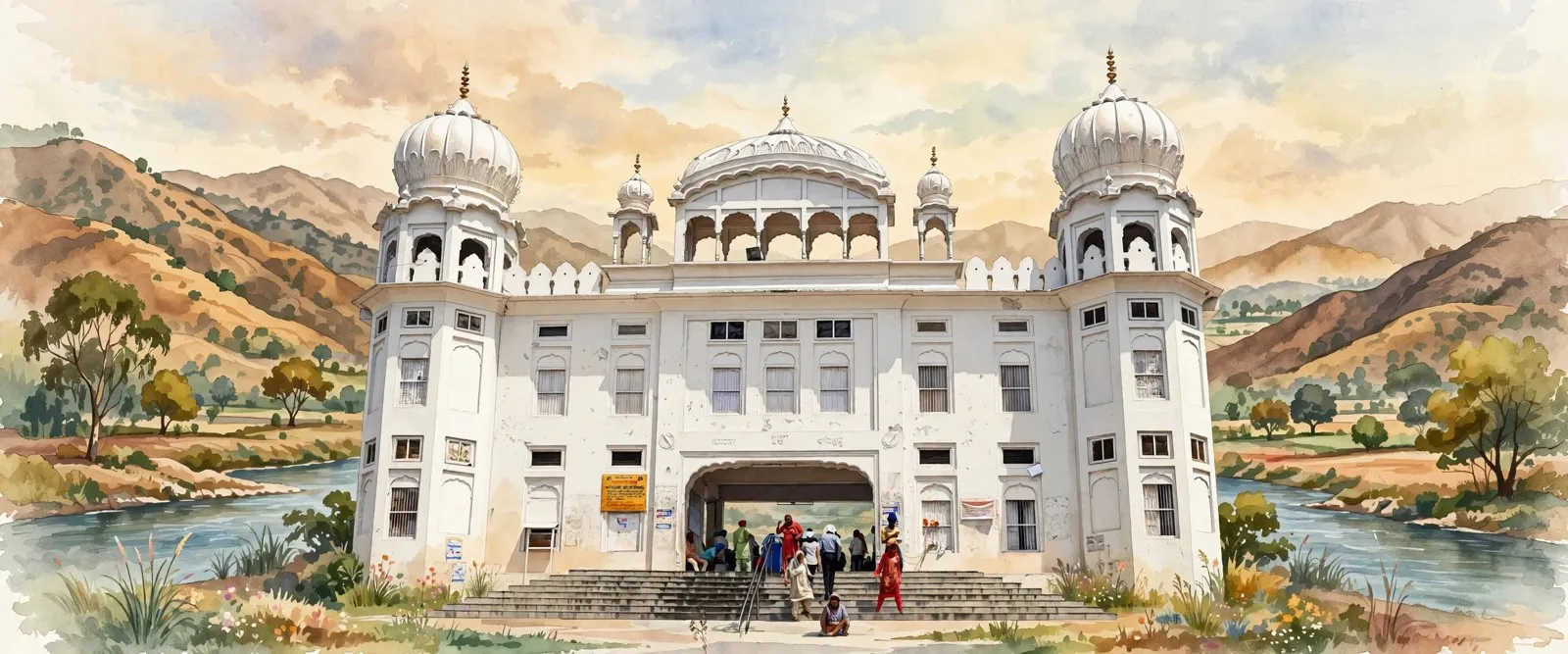 ਰੂਪਨਗਰDistrict, Puadh
 ਰੂਪਨਗਰCity, Puadh
 ਨਂਗਲTown, Puadh
 ਮੋਰਿੰਡਾTown, Puadh
 ਪਟਨਾ ਸਾਹਿਬCity, Patna, Bihar, India
ਸਰੋਤ (17)
- Demography, Rupnagar district portal, rupnagar.nic.in (tehsil wise Census 2011 table: Sri Anandpur Sahib rural 170,618 plus urban 23,827 equals 194,445; district climate, rainfall 775.6 mm, Anandpur Sahib block soils undulating)
- Anandpur Sahib Tehsil, Census 2011 tehsil tables via censusindia.co.in (total 194,445, households 37,331, one town and 190 villages split, literate 136,049, SC 40,955, children 21,993, sex ratio 936; read in full in search results, direct fetch failed)
- Rupnagar District Village Directory, vill.co.in (Anandpur Sahib sub-district 00262: 190 villages, 178,163 people, 34,061 households, 47,933 hectares, largest village Aggampur 4,874; Anandpur Sahib post office PIN 140118)
- Rupnagar district tehsil listing, villagedatabase.com (Anandpur Sahib tehsil area 400 sq km, population 194,445, density 486, largest tehsil of the district; read in search results)
- Anandpur Sahib (M Cl) City Population, Census 2011, censusindia2011.com (town 16,282, 13 wards, 3,270 households, sex ratio 905, SC 27.5%, crude literacy 73.46%, town religion table)
- Anandpur Sahib, Wikipedia (coordinates 31.235 N 76.499 E, elevation 311 m, PIN 140118, PB-16, NH 503, founded June 1665 as Chakk Nanaki, Khalsa 1699, town 16,282, effective literacy 82.44%)
- Rupnagar district, Wikipedia (four tehsils, district in Puadh except Nurpur Bedi sub-tehsil in Doaba, Sutlej 2 to 5 km from Anandpur Sahib, tehsil religion table from Census Table C-01, district languages Punjabi 92.6% and Hindi 6.55%)
- Anandpur, The Sikh Encyclopedia (31 km north of Ropar, 29 km south of Nangal, foundation 19 June 1665 on Makhowal land bought from Kahlur, Kiratpur 8 km south, 1675 martyrdom account, Panj Pyare, forts, evacuation December 1705, SGPC 1923, Kesgarh complex 1936 to 1944, Holgarh and Hola Mahalla 1701)
- Sri Kesgarh Sahib, Sikh Missionary Society UK (founded 1664 account with foundation stone 19 June 1665 and 500 rupees, Khalsa Baisakhi 1699, Hola Mahalla started by Guru Gobind Singh Ji, about 40 km from Ropar and 85 km from Chandigarh)
- In the footsteps of the Guru: Hola Mohalla in Punjab, The Hindu BusinessLine (Hola Mahalla crowds, Nihang displays, Charan Ganga stadium, Sutlej south of town, Naini Devi and Gobind Sagar, Virasat-e-Khalsa by Moshe Safdie)
- Virasat-e-Khalsa, Wikipedia (Khalsa Heritage Complex, over 100 acres, designed by Moshe Safdie, inaugurated 25 November 2011, most visited Sikh museum, over ten million visits)
- Ropar District, punjabdata.com (seven towns including Anandpur Sahib Municipal Council, Kiratpur Sahib and Nurpur Bedi Nagar Panchayats, five blocks including Anandpur Sahib and Nurpur Bedi, Nurpur Bedi sub-tehsil, Anandpur Sahib market committee)
- Kiratpur Sahib Village Population, Census 2011, census2011.co.in (counted as a large village of Anandpur Sahib Tehsil: 2,348 people in 490 families)
- Hiyatpur Village in Anandpur Sahib, VillageInfo.in (village of the tehsil, Rupnagar assembly seat and Anandpur Sahib Lok Sabha, Anandpur Sahib ANSB nearest railway station)
- Sri Anandpur Sahib, India Cine Hub, indiacinehub.gov.in (Hola Mahalla congregation of nearly 20 lakh reported, railway station 2.4 km, Chandigarh airport 69.75 km)
- Anandpur Sahib Assembly constituency, Wikipedia (constituency No. 49, Rupnagar district, in the Anandpur Sahib Lok Sabha constituency)
- Anandpur Sahib tehsil directory, Jugti (190 village pages listed, counted October 2026)
ਜੁਗਤੀ ਮੁਫ਼ਤ ਅਤੇ ਸੁਤੰਤਰ ਹੈ। ਪਾਠਕਾਂ ਦਾ ਸਹਿਯੋਗ ਕੋਸ਼ ਨੂੰ ਵਧਾਉਂਦਾ ਹੈ।
ਸਹਿਯੋਗ