

Kapurthala is a district in the Doaba region of Punjab, India, with its headquarters in Kapurthala town. Once the capital of an Ahluwalia princely state famed for its French styled palaces and the Moorish Mosque, it also holds Sultanpur Lodhi, where Guru Nanak spent more than fourteen years, and the Rail Coach Factory.
- ਪੰਜਾਬੀ ਨਾਂ
- ਕਪੂਰਥਲਾ
- ਕਿਸਮ
- ਜ਼ਿਲ੍ਹਾ
- ਮੁੱਖ ਦਫ਼ਤਰ
- ਕਪੂਰਥਲਾ
- ਇਲਾਕਾ
- Doaba (Bist Doab)
- ਰਾਜ
- ਪੰਜਾਬ
- ਦੇਸ਼
- ਭਾਰਤ
All 15 facts
- ਰਕਬਾ
- 1,633 sq km (Census 2011)
- ਆਬਾਦੀ
- 815,168 (Census 2011)
- ਸਿੱਖ ਆਬਾਦੀ
- 499 per sq km (Census 2011)
- ਸਾਖਰਤਾ
- 79.07 percent (Census 2011)
- Sex ratio
- 912 females per 1,000 males (Census 2011)
- Tehsils
- 4: Bhulath, Kapurthala, Phagwara and Sultanpur Lodhi
- Blocks
- 5 development blocks
- ਪਿੰਡ
- 688, of which 612 inhabited (Census 2011)
- ਪ੍ਰਸਿੱਧੀ
- Jagatjit Palace and Moorish Mosque, Sultanpur Lodhi and Guru Nanak, Rail Coach Factory, Kanjli Ramsar wetland
Kapurthala district is a small district in the Doaba region of Punjab, India, known for the French styled palaces of a former princely state, the Moorish Mosque, and Sultanpur Lodhi, the town where Guru Nanak spent more than fourteen years. Its headquarters is Kapurthala town, and its fields and factories give it an outsized story.
Where is Kapurthala district?
Kapurthala district lies in the Bist Doab, the tract between the Beas and Sutlej rivers, and it is one of the smallest districts in Punjab in both area and population. The Census of India 2011 recorded an area of 1,633 square kilometres. Hoshiarpur, Gurdaspur and Amritsar lie to the north, the Beas and Amritsar and Tarn Taran to the west, and Jalandhar to the south.
The district is unusual because it stands in two separate parts, divided by about 32 kilometres of Jalandhar district. The larger part holds Kapurthala, Sultanpur Lodhi and Bhulath, while Phagwara tehsil stands apart to the east, ringed by Jalandhar, Hoshiarpur and Shaheed Bhagat Singh Nagar districts. The district is a flat alluvial plain: the low Bet tract between the Beas and the Kali Bein, or Black Bein, the Dona tract of sand and clay south of it, and the White Bein draining the Phagwara side to the Sutlej.
In 2011 the district counted 815,168 people, at a density of 499 people per square kilometre. The sex ratio was 912 females for every 1,000 males, and the literacy rate was 79.07 percent, above the Punjab average of the time. About two thirds of residents, 65.35 percent, lived in villages, and Punjabi is spoken across the district, with Hindi also widely understood. The district sits in the Jalandhar division, with four tehsils, five development blocks, 688 villages and nine towns in 2011.
A princely state shaped by the Ahluwalias
Kapurthala town is said to have been founded in the eleventh century by Rana Kapur, a Rajput from Jaisalmer, and the district takes its name from the town. The power that shaped it, however, was Sikh. The Ahluwalia family took its name from the village of Ahlu, and its real founder, Jassa Singh Ahluwalia, rose during the Sikh struggles of the eighteenth century and made Kapurthala his capital. His successors held it as a princely state, and Fateh Singh, ruling in the early nineteenth century, brought the Phagwara side into the state.
The state never came under direct British rule, and its last great ruler remade its capital. Maharaja Jagatjit Singh succeeded as a child of five in 1877 and received full ruling powers in November 1890. Widely travelled, he filled Kapurthala town with buildings in styles admired in Europe and North Africa. On 20 August 1948 the Kapurthala state merged into the Patiala and East Punjab States Union, known as PEPSU, and Jagatjit Singh became its Up Raj Pramukh, or deputy head. He died in June 1949, and PEPSU later merged into Punjab.
Palaces, a mosque and gardens in Kapurthala town
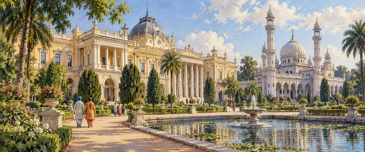
The building that defines the town is the Jagatjit Palace, built between 1900 and 1908 to designs by the French architect M. Marcel. Modelled on Versailles and Fontainebleau, it has a sunken park, the Baija, in front, and plaster of Paris figures and painted ceilings inside. Its Durbar Hall is counted among the finest in India. It now houses the Sainik School, Kapurthala, so the grounds are a working campus rather than a museum.
A short distance away stands the Moorish Mosque, completed in 1930 after construction began in 1927 at a cost of Rs 600,000. Designed by French architect M. Manteaux and patterned on the Koutoubia Mosque of Marrakech, it is marble built, has no external domes, and rises to a square minaret about 40 metres tall. Artists of the Mayo School of Art in Lahore worked on its inner dome. The Sikh Maharaja built it for his Muslim subjects, then a large share of the state population. The older Elysee Palace, from the time of Kanwar Bikrama Singh, now houses the MGN School.
The Panch Mandir holds five small temples in one complex, dates to Sardar Fateh Singh's rule, and its idol of Brahma is noted as a rarity. In the Shalimar Bagh, the royal cenotaphs stand on a plinth built in 1880. The Darbar Hall of 1889, the clock tower and the State Gurdwara complete a townscape that has earned Kapurthala the nickname City of Palaces and Gardens.
Sultanpur Lodhi and Guru Nanak
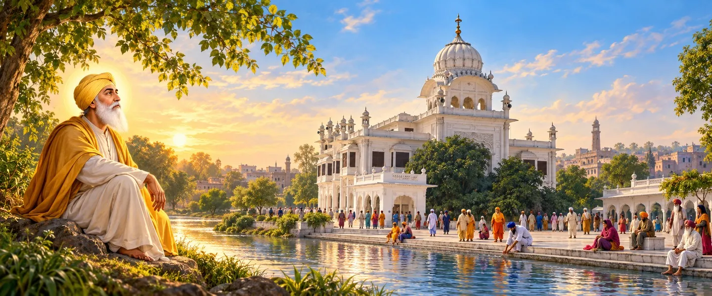
The district's deepest claim on history is Sultanpur Lodhi, about 27 kilometres from Kapurthala town on the south bank of the Kali Bein. Guru Nanak came here to live with his elder sister Bebe Nanki and her husband Jai Ram, and he worked as a Modi, the keeper of the Modi Khana, or provisions store, of the local governor Daulat Khan Lodi. He married here, his two sons were born here, and he spent more than fourteen years of his life in the town.
Here, Sikh tradition holds, Guru Nanak had his enlightenment in the Kali Bein, disappearing in the rivulet and reappearing after three days, declaring that there is no Hindu and there is no Muslim. The town's gurdwaras mark those years: Ber Sahib, where he meditated under a ber tree; Hatt Sahib, recalling the store; Kothri Sahib; Guru Ka Bagh, his family home; Sant Ghat, where he reappeared; and Antaryamta, Sehra Sahib and Bebe Nanaki Ji. The present Ber Sahib building was raised by Maharaja Jagatjit Singh, its cornerstone laid in 1937 and the gurdwara dedicated in 1941, and a large fair gathers here on Guru Nanak's Gurpurab. The Kali Bein ghats were developed under Sant Balbir Singh Seechewal, whose cleaning of the rivulet became a model community effort.
For the 550th birth anniversary of Guru Nanak in 2019, the Union Cabinet decided that Sultanpur Lodhi would be developed as a heritage town on smart city principles, with a heritage complex called Pind Babe Nanak Da depicting life in the Guru's times, and an upgraded railway station. Pilgrims are now a steady part of district life, and the town is the first stop for many visitors.
Work, towns and the Kanjli wetland
Farming remains the district's base: the Central Ground Water Board records a net sown area of about 1,350 square kilometres, and the mandis of its four tehsil towns handle the Doaba harvests. Against that base stands one of Indian Railways' great factories. The foundation stone of the Rail Coach Factory at Kapurthala was laid on 17 August 1985, production began on 19 September 1987, and the first coach rolled out on 31 March 1988. After technology transfer from Linke Hofmann Busch of Germany in 1998 it turned to stainless steel LHB coaches, rolled out India's first Tejas train in 2017, and in September 2024 completed its 45,000th coach.
Phagwara, the separated eastern tehsil, is the district's largest urban centre, an agglomeration of 117,966 people in 2011, and its most industrial town. Between Kapurthala and Jalandhar stands the Pushpa Gujral Science City. Its foundation stone was laid on 17 October 1997 by the then prime minister Inder Kumar Gujral, it is named after his mother, and it was funded jointly by the Government of India and the Punjab government. Opened in 2005, it draws school trips from across the region.
Four kilometres from Kapurthala town, the Kanjli Wetland was created in 1870 by building headworks across the Kali Bein for irrigation. The wetland covers about 490 hectares, of which the lake spreads over about 184 hectares, and on 22 January 2002 it was listed under the Ramsar Convention as a wetland of international importance, site number 1160. Resident and migratory birds use its waters in winter, and a traditional mela is held here at Diwali.
Getting there and the district today
Kapurthala is easy to reach from Jalandhar, about 21 kilometres away by road and rail. The town stands on the Jalandhar to Ferozepur railway line, stations at Kapurthala, Sultanpur Lodhi and Phagwara serve the district, and buses link the Doaba towns through the day. Phagwara sits on the national highway corridor between Jalandhar and Ludhiana. The nearest airport is at Amritsar, roughly 75 kilometres away, and most visitors combine the district with Jalandhar or Amritsar.
Each town keeps a clear character: Kapurthala the heritage core and headquarters, Phagwara the industrial centre, Sultanpur Lodhi the pilgrim town of Guru Nanak, and Bhulath heading its own tehsil in the north, with Nadala, Begowal and Dhilwan serving the villages around them. It is a working district where a morning can start at a gurdwara on the Kali Bein, pass a palace turned school, and end among winter birds at Kanjli.
Few districts of this size hold a princely capital in the French style, a mosque modelled on Marrakech, the town where a world religion found its voice, a Ramsar wetland and a factory that builds coaches for the whole country. The district is still mostly farmland and small towns, but its story reaches far beyond its 1,633 square kilometres.
ਕਪੂਰਥਲਾ ਜ਼ਿਲ੍ਹਾ ਭਾਰਤ ਦੇ ਪੰਜਾਬ ਸੂਬੇ ਦੇ ਦੁਆਬਾ ਖਿੱਤੇ ਦਾ ਇੱਕ ਛੋਟਾ ਜ਼ਿਲ੍ਹਾ ਹੈ। ਇਹ ਆਪਣੀ ਪੁਰਾਣੀ ਰਿਆਸਤ ਦੇ ਫ਼ਰਾਂਸੀਸੀ ਢੰਗ ਦੇ ਮਹਿਲਾਂ, ਮੂਰਿਸ਼ ਮਸਜਿਦ ਅਤੇ ਸੁਲਤਾਨਪੁਰ ਲੋਧੀ ਲਈ ਜਾਣਿਆ ਜਾਂਦਾ ਹੈ, ਜਿੱਥੇ ਗੁਰੂ ਨਾਨਕ ਦੇਵ ਜੀ ਨੇ ਚੌਦਾਂ ਸਾਲਾਂ ਤੋਂ ਵੱਧ ਸਮਾਂ ਬਿਤਾਇਆ। ਇਸ ਦਾ ਮੁੱਖ ਦਫ਼ਤਰ ਕਪੂਰਥਲਾ ਸ਼ਹਿਰ ਹੈ, ਅਤੇ ਇਸ ਦੇ ਖੇਤ, ਕਾਰਖ਼ਾਨੇ ਅਤੇ ਰਾਮਸਰ ਝੀਲ ਇਸ ਨੂੰ ਇਸ ਦੇ ਆਕਾਰ ਤੋਂ ਵੱਡੀ ਪਛਾਣ ਦਿੰਦੇ ਹਨ।
ਕਪੂਰਥਲਾ ਜ਼ਿਲ੍ਹਾ ਕਿੱਥੇ ਹੈ?
ਕਪੂਰਥਲਾ ਜ਼ਿਲ੍ਹਾ ਬਿਸਤ ਦੁਆਬ ਵਿੱਚ ਪੈਂਦਾ ਹੈ, ਯਾਨੀ ਬਿਆਸ ਅਤੇ ਸਤਲੁਜ ਦਰਿਆਵਾਂ ਦੇ ਵਿਚਕਾਰਲੇ ਇਲਾਕੇ ਵਿੱਚ, ਅਤੇ ਇਹ ਰਕਬੇ ਅਤੇ ਆਬਾਦੀ ਦੋਵਾਂ ਪੱਖੋਂ ਪੰਜਾਬ ਦੇ ਸਭ ਤੋਂ ਛੋਟੇ ਜ਼ਿਲ੍ਹਿਆਂ ਵਿੱਚੋਂ ਇੱਕ ਹੈ। ਭਾਰਤ ਦੀ 2011 ਦੀ ਮਰਦਮਸ਼ੁਮਾਰੀ ਅਨੁਸਾਰ ਇਸ ਦਾ ਰਕਬਾ 1,633 ਵਰਗ ਕਿਲੋਮੀਟਰ ਹੈ। ਇਸ ਦੇ ਉੱਤਰ ਵਿੱਚ ਹੁਸ਼ਿਆਰਪੁਰ, ਗੁਰਦਾਸਪੁਰ ਅਤੇ ਅੰਮ੍ਰਿਤਸਰ ਜ਼ਿਲ੍ਹੇ, ਪੱਛਮ ਵਿੱਚ ਬਿਆਸ ਦਰਿਆ ਅਤੇ ਅੰਮ੍ਰਿਤਸਰ ਅਤੇ ਤਰਨ ਤਾਰਨ ਜ਼ਿਲ੍ਹੇ, ਅਤੇ ਦੱਖਣ ਵਿੱਚ ਜਲੰਧਰ ਜ਼ਿਲ੍ਹਾ ਪੈਂਦਾ ਹੈ, ਜਦਕਿ ਮੁੱਖ ਹਿੱਸੇ ਦੇ ਸਤਲੁਜ ਵਾਲੇ ਪਾਸੇ ਫ਼ਿਰੋਜ਼ਪੁਰ ਹੈ।
ਇਸ ਜ਼ਿਲ੍ਹੇ ਦੀ ਇੱਕ ਅਨੋਖੀ ਗੱਲ ਇਹ ਹੈ ਕਿ ਇਹ ਦੋ ਵੱਖ ਵੱਖ ਹਿੱਸਿਆਂ ਵਿੱਚ ਵੰਡਿਆ ਹੋਇਆ ਹੈ, ਜਿਨ੍ਹਾਂ ਵਿਚਕਾਰ ਲਗਭਗ 32 ਕਿਲੋਮੀਟਰ ਜਲੰਧਰ ਜ਼ਿਲ੍ਹਾ ਪੈਂਦਾ ਹੈ। ਵੱਡੇ ਹਿੱਸੇ ਵਿੱਚ ਕਪੂਰਥਲਾ, ਸੁਲਤਾਨਪੁਰ ਲੋਧੀ ਅਤੇ ਭੁਲੱਥ ਆਉਂਦੇ ਹਨ, ਜਦਕਿ ਫਗਵਾੜਾ ਤਹਿਸੀਲ ਪੂਰਬ ਵੱਲ ਵੱਖਰੀ ਖੜ੍ਹੀ ਹੈ ਅਤੇ ਇਸ ਦੇ ਆਲੇ ਦੁਆਲੇ ਜਲੰਧਰ, ਹੁਸ਼ਿਆਰਪੁਰ ਅਤੇ ਸ਼ਹੀਦ ਭਗਤ ਸਿੰਘ ਨਗਰ ਜ਼ਿਲ੍ਹੇ ਹਨ। ਸਾਰਾ ਜ਼ਿਲ੍ਹਾ ਸਮਤਲ ਦਰਿਆਈ ਮੈਦਾਨ ਹੈ। ਬਿਆਸ ਅਤੇ ਕਾਲੀ ਬੇਈਂ ਦੇ ਵਿਚਕਾਰਲਾ ਨੀਵਾਂ ਹਿੱਸਾ ਬੇਟ ਅਖਵਾਉਂਦਾ ਹੈ, ਅਤੇ ਇਸ ਦੇ ਦੱਖਣ ਵੱਲ ਰੇਤ ਅਤੇ ਮਿੱਟੀ ਦੇ ਮਿਸ਼ਰਣ ਵਾਲਾ ਡੋਨਾ ਇਲਾਕਾ ਹੈ। ਚਿੱਟੀ ਬੇਈਂ ਫਗਵਾੜੇ ਵਾਲੇ ਪਾਸੇ ਵਗਦੀ ਹੋਈ ਸਤਲੁਜ ਵਿੱਚ ਜਾ ਮਿਲਦੀ ਹੈ।
ਸਾਲ 2011 ਵਿੱਚ ਜ਼ਿਲ੍ਹੇ ਦੀ ਆਬਾਦੀ 815,168 ਸੀ, ਅਤੇ ਘਣਤਾ 499 ਵਿਅਕਤੀ ਪ੍ਰਤੀ ਵਰਗ ਕਿਲੋਮੀਟਰ ਸੀ। ਲਿੰਗ ਅਨੁਪਾਤ ਹਰ 1,000 ਮਰਦਾਂ ਪਿੱਛੇ 912 ਔਰਤਾਂ ਸੀ, ਅਤੇ ਸਾਖਰਤਾ ਦਰ 79.07 ਫ਼ੀਸਦੀ ਸੀ, ਜੋ ਉਸ ਸਮੇਂ ਦੇ ਪੰਜਾਬ ਦੀ ਔਸਤ ਤੋਂ ਵੱਧ ਸੀ। ਲਗਭਗ ਦੋ ਤਿਹਾਈ ਵਸਨੀਕ, 65.35 ਫ਼ੀਸਦੀ, ਪਿੰਡਾਂ ਵਿੱਚ ਰਹਿੰਦੇ ਸਨ। ਸਾਰੇ ਜ਼ਿਲ੍ਹੇ ਵਿੱਚ ਪੰਜਾਬੀ ਬੋਲੀ ਜਾਂਦੀ ਹੈ, ਅਤੇ ਹਿੰਦੀ ਵੀ ਆਮ ਸਮਝੀ ਜਾਂਦੀ ਹੈ। ਪ੍ਰਸ਼ਾਸਨ ਪੱਖੋਂ ਇਹ ਜ਼ਿਲ੍ਹਾ ਜਲੰਧਰ ਡਿਵੀਜ਼ਨ ਵਿੱਚ ਆਉਂਦਾ ਹੈ, ਅਤੇ 2011 ਵਿੱਚ ਇਸ ਵਿੱਚ ਚਾਰ ਤਹਿਸੀਲਾਂ, ਪੰਜ ਵਿਕਾਸ ਬਲਾਕ, 688 ਪਿੰਡ ਅਤੇ ਨੌਂ ਕਸਬੇ ਸਨ।
ਆਹਲੂਵਾਲੀਆ ਖ਼ਾਨਦਾਨ ਦੀ ਰਿਆਸਤ
ਕਿਹਾ ਜਾਂਦਾ ਹੈ ਕਿ ਜ਼ਿਲ੍ਹੇ ਦੇ ਮੁੱਖ ਦਫ਼ਤਰ ਕਪੂਰਥਲਾ ਸ਼ਹਿਰ ਦੀ ਨੀਂਹ ਗਿਆਰ੍ਹਵੀਂ ਸਦੀ ਵਿੱਚ ਜੈਸਲਮੇਰ ਤੋਂ ਆਏ ਇੱਕ ਰਾਜਪੂਤ ਰਾਣਾ ਕਪੂਰ ਨੇ ਰੱਖੀ, ਅਤੇ ਜ਼ਿਲ੍ਹੇ ਦਾ ਨਾਂ ਇਸੇ ਸ਼ਹਿਰ ਤੋਂ ਪਿਆ। ਪਰ ਇਸ ਨੂੰ ਅਸਲ ਰੂਪ ਦੇਣ ਵਾਲੀ ਤਾਕਤ ਸਿੱਖ ਸੀ। ਆਹਲੂਵਾਲੀਆ ਖ਼ਾਨਦਾਨ ਦਾ ਨਾਂ ਆਹਲੂ ਪਿੰਡ ਤੋਂ ਪਿਆ, ਅਤੇ ਇਸ ਦੇ ਅਸਲ ਬਾਨੀ ਜੱਸਾ ਸਿੰਘ ਆਹਲੂਵਾਲੀਆ ਅਠਾਰ੍ਹਵੀਂ ਸਦੀ ਦੇ ਸਿੱਖ ਸੰਘਰਸ਼ਾਂ ਵਿੱਚ ਉੱਭਰੇ ਅਤੇ ਉਨ੍ਹਾਂ ਨੇ ਕਪੂਰਥਲਾ ਨੂੰ ਆਪਣੀ ਰਾਜਧਾਨੀ ਬਣਾਇਆ। ਉਨ੍ਹਾਂ ਦੇ ਵਾਰਸਾਂ ਨੇ ਇਹ ਇਲਾਕਾ ਇੱਕ ਰਿਆਸਤ ਵਜੋਂ ਸਾਂਭਿਆ, ਅਤੇ ਉਨ੍ਹੀਵੀਂ ਸਦੀ ਦੇ ਸ਼ੁਰੂ ਵਿੱਚ ਰਾਜ ਕਰਨ ਵਾਲੇ ਫ਼ਤਹਿ ਸਿੰਘ ਨੇ ਫਗਵਾੜੇ ਵਾਲਾ ਪਾਸਾ ਵੀ ਰਿਆਸਤ ਵਿੱਚ ਸ਼ਾਮਲ ਕੀਤਾ।
ਇਹ ਰਿਆਸਤ ਕਦੇ ਸਿੱਧੇ ਅੰਗਰੇਜ਼ੀ ਰਾਜ ਹੇਠ ਨਹੀਂ ਆਈ, ਅਤੇ ਇਸ ਦੇ ਆਖ਼ਰੀ ਵੱਡੇ ਰਾਜੇ ਨੇ ਇਸ ਦੀ ਰਾਜਧਾਨੀ ਨੂੰ ਨਵਾਂ ਰੂਪ ਦਿੱਤਾ। ਮਹਾਰਾਜਾ ਜਗਤਜੀਤ ਸਿੰਘ 1877 ਵਿੱਚ ਪੰਜ ਸਾਲ ਦੀ ਉਮਰ ਵਿੱਚ ਗੱਦੀ ਉੱਤੇ ਬੈਠੇ, ਅਤੇ ਨਵੰਬਰ 1890 ਵਿੱਚ ਉਨ੍ਹਾਂ ਨੂੰ ਪੂਰੇ ਰਾਜ ਅਧਿਕਾਰ ਮਿਲੇ। ਦੁਨੀਆ ਭਰ ਘੁੰਮੇ ਇਸ ਰਾਜੇ ਨੇ ਸਿੱਖਿਆ ਅਤੇ ਉਦਯੋਗ ਦੇ ਖੇਤਰ ਵਿੱਚ ਖ਼ਾਸ ਕੰਮ ਕੀਤਾ, ਅਤੇ ਕਪੂਰਥਲਾ ਸ਼ਹਿਰ ਨੂੰ ਯੂਰਪ ਅਤੇ ਉੱਤਰੀ ਅਫ਼ਰੀਕਾ ਦੇ ਢੰਗ ਦੀਆਂ ਇਮਾਰਤਾਂ ਨਾਲ ਭਰ ਦਿੱਤਾ। 20 ਅਗਸਤ 1948 ਨੂੰ ਕਪੂਰਥਲਾ ਰਿਆਸਤ ਪਟਿਆਲਾ ਅਤੇ ਪੂਰਬੀ ਪੰਜਾਬ ਰਾਜ ਸੰਘ, ਯਾਨੀ ਪੈਪਸੂ, ਵਿੱਚ ਰਲ ਗਈ, ਅਤੇ ਜਗਤਜੀਤ ਸਿੰਘ ਇਸ ਦੇ ਉਪ ਰਾਜ ਪ੍ਰਮੁੱਖ ਬਣੇ। ਉਨ੍ਹਾਂ ਦਾ ਦਿਹਾਂਤ ਜੂਨ 1949 ਵਿੱਚ ਹੋਇਆ, ਅਤੇ ਬਾਅਦ ਵਿੱਚ ਪੈਪਸੂ ਵੀ ਪੰਜਾਬ ਵਿੱਚ ਰਲ ਗਿਆ।
ਕਪੂਰਥਲਾ ਸ਼ਹਿਰ ਦੇ ਮਹਿਲ, ਮਸਜਿਦ ਅਤੇ ਬਾਗ਼
ਸ਼ਹਿਰ ਦੀ ਸਭ ਤੋਂ ਪਛਾਣ ਵਾਲੀ ਇਮਾਰਤ ਜਗਤਜੀਤ ਪੈਲੇਸ ਹੈ, ਜੋ 1900 ਤੋਂ 1908 ਦੇ ਵਿਚਕਾਰ ਫ਼ਰਾਂਸੀਸੀ ਉਸਾਰੀ ਮਾਹਿਰ ਐਮ. ਮਾਰਸੇਲ ਦੇ ਨਕਸ਼ਿਆਂ ਅਨੁਸਾਰ ਬਣਿਆ। ਇਹ ਵਰਸਾਏ ਅਤੇ ਫ਼ੌਂਟੇਨਬਲੋ ਦੇ ਮਹਿਲਾਂ ਦੀ ਤਰਜ਼ ਉੱਤੇ ਪੁਨਰਜਾਗਰਣ ਢੰਗ ਵਿੱਚ ਬਣਿਆ ਹੈ, ਇਸ ਦੇ ਸਾਹਮਣੇ ਬੈਜਾ ਨਾਂ ਦਾ ਧਸਿਆ ਹੋਇਆ ਪਾਰਕ ਹੈ, ਅਤੇ ਅੰਦਰ ਪਲਾਸਟਰ ਆਫ਼ ਪੈਰਿਸ ਦੀਆਂ ਮੂਰਤੀਆਂ ਅਤੇ ਰੰਗੀਆਂ ਹੋਈਆਂ ਛੱਤਾਂ ਹਨ। ਇਸ ਦਾ ਦਰਬਾਰ ਹਾਲ ਭਾਰਤ ਦੇ ਸਭ ਤੋਂ ਵਧੀਆ ਹਾਲਾਂ ਵਿੱਚ ਗਿਣਿਆ ਜਾਂਦਾ ਹੈ। ਹੁਣ ਇਹ ਮਹਿਲ ਕਿਸੇ ਰਾਜੇ ਦੀ ਰਿਹਾਇਸ਼ ਨਹੀਂ ਰਿਹਾ। ਇਸ ਵਿੱਚ ਸੈਨਿਕ ਸਕੂਲ ਕਪੂਰਥਲਾ ਚੱਲਦਾ ਹੈ, ਇਸ ਲਈ ਇਸ ਦਾ ਮੈਦਾਨ ਇੱਕ ਚੱਲਦਾ ਸਕੂਲ ਕੈਂਪਸ ਹੈ, ਕੋਈ ਅਜਾਇਬ ਘਰ ਨਹੀਂ।
ਇਸ ਤੋਂ ਥੋੜ੍ਹੀ ਦੂਰੀ ਉੱਤੇ ਮੂਰਿਸ਼ ਮਸਜਿਦ ਖੜ੍ਹੀ ਹੈ। ਇਸ ਦੀ ਉਸਾਰੀ 1927 ਵਿੱਚ ਸ਼ੁਰੂ ਹੋਈ, 1930 ਵਿੱਚ 600,000 ਰੁਪਏ ਦੀ ਲਾਗਤ ਨਾਲ ਮੁੱਕੀ। ਫ਼ਰਾਂਸੀਸੀ ਉਸਾਰੀ ਮਾਹਿਰ ਐਮ. ਮਾਂਤੂ ਨੇ ਇਸ ਦਾ ਨਕਸ਼ਾ ਮੋਰਾਕੋ ਦੇ ਮਾਰਾਕੇਸ਼ ਦੀ ਕੁਤੁਬੀਆ ਮਸਜਿਦ ਦੀ ਤਰਜ਼ ਉੱਤੇ ਬਣਾਇਆ। ਇਹ ਸੰਗਮਰਮਰ ਦੀ ਬਣੀ ਹੈ, ਇਸ ਦੇ ਬਾਹਰ ਕੋਈ ਗੁੰਬਦ ਨਹੀਂ, ਅਤੇ ਇਸ ਦਾ ਚੌਰਸ ਮੀਨਾਰ ਲਗਭਗ 40 ਮੀਟਰ ਉੱਚਾ ਹੈ। ਇਸ ਦੇ ਅੰਦਰਲੇ ਗੁੰਬਦ ਉੱਤੇ ਲਾਹੌਰ ਦੇ ਮੇਓ ਸਕੂਲ ਆਫ਼ ਆਰਟ ਦੇ ਕਲਾਕਾਰਾਂ ਨੇ ਕੰਮ ਕੀਤਾ। ਸਿੱਖ ਮਹਾਰਾਜੇ ਨੇ ਇਹ ਮਸਜਿਦ ਆਪਣੀ ਮੁਸਲਮਾਨ ਰਿਆਇਆ ਲਈ ਬਣਵਾਈ, ਜੋ ਉਸ ਸਮੇਂ ਰਿਆਸਤ ਦੀ ਆਬਾਦੀ ਦਾ ਵੱਡਾ ਹਿੱਸਾ ਸੀ, ਅਤੇ ਇਹ ਅੱਜ ਵੀ ਸ਼ਹਿਰ ਦੀ ਸਭ ਤੋਂ ਅਨੋਖੀ ਯਾਦਗਾਰ ਹੈ। ਕੰਵਰ ਬਿਕਰਮਾ ਸਿੰਘ ਦੇ ਸਮੇਂ ਦਾ ਪੁਰਾਣਾ ਏਲੀਸੀ ਪੈਲੇਸ ਹੁਣ ਐਮ.ਜੀ.ਐਨ. ਸਕੂਲ ਹੈ।
ਰਿਆਸਤੀ ਸ਼ਹਿਰ ਦਾ ਬਾਕੀ ਹਿੱਸਾ ਆਰਾਮ ਨਾਲ ਘੁੰਮਣ ਨਾਲ ਹੀ ਸਮਝ ਆਉਂਦਾ ਹੈ। ਪੰਚ ਮੰਦਰ ਵਿੱਚ ਇੱਕੋ ਘੇਰੇ ਅੰਦਰ ਪੰਜ ਛੋਟੇ ਮੰਦਰ ਹਨ, ਅਤੇ ਇਹ ਸਰਦਾਰ ਫ਼ਤਹਿ ਸਿੰਘ ਦੇ ਰਾਜ ਸਮੇਂ ਦਾ ਹੈ। ਇਸ ਵਿੱਚ ਬ੍ਰਹਮਾ ਜੀ ਦੀ ਮੂਰਤੀ ਇੱਕ ਖ਼ਾਸ ਗੱਲ ਮੰਨੀ ਜਾਂਦੀ ਹੈ। ਸ਼ਾਲੀਮਾਰ ਬਾਗ਼ ਵਿੱਚ ਰਾਜਿਆਂ ਦੀਆਂ ਸਮਾਧਾਂ 1880 ਵਿੱਚ ਬਣੇ ਇੱਕ ਚਬੂਤਰੇ ਉੱਤੇ ਖੜ੍ਹੀਆਂ ਹਨ। ਸਾਲ 1889 ਦਾ ਹਿੰਦ ਸਾਰਾਸੈਨਿਕ ਢੰਗ ਦਾ ਦਰਬਾਰ ਹਾਲ, ਘੰਟਾ ਘਰ ਅਤੇ ਸਰਕਾਰੀ ਗੁਰਦੁਆਰਾ ਇਸ ਸ਼ਹਿਰਕਾਰੀ ਨੂੰ ਪੂਰਾ ਕਰਦੇ ਹਨ, ਜਿਸ ਕਰਕੇ ਕਪੂਰਥਲਾ ਨੂੰ ਮਹਿਲਾਂ ਅਤੇ ਬਾਗ਼ਾਂ ਦਾ ਸ਼ਹਿਰ ਕਿਹਾ ਜਾਂਦਾ ਹੈ।
ਸੁਲਤਾਨਪੁਰ ਲੋਧੀ ਅਤੇ ਗੁਰੂ ਨਾਨਕ
ਇਤਿਹਾਸ ਪੱਖੋਂ ਜ਼ਿਲ੍ਹੇ ਦਾ ਸਭ ਤੋਂ ਵੱਡਾ ਦਾਅਵਾ ਸੁਲਤਾਨਪੁਰ ਲੋਧੀ ਹੈ, ਜੋ ਕਪੂਰਥਲਾ ਸ਼ਹਿਰ ਤੋਂ ਲਗਭਗ 27 ਕਿਲੋਮੀਟਰ ਦੂਰ ਕਾਲੀ ਬੇਈਂ ਦੇ ਦੱਖਣੀ ਕੰਢੇ ਉੱਤੇ ਵਸਿਆ ਹੈ। ਗੁਰੂ ਨਾਨਕ ਦੇਵ ਜੀ ਇੱਥੇ ਆਪਣੀ ਵੱਡੀ ਭੈਣ ਬੇਬੇ ਨਾਨਕੀ ਅਤੇ ਉਨ੍ਹਾਂ ਦੇ ਪਤੀ ਜੈ ਰਾਮ ਕੋਲ ਰਹਿਣ ਆਏ, ਅਤੇ ਉਨ੍ਹਾਂ ਨੇ ਸਥਾਨਕ ਹਾਕਮ ਦੌਲਤ ਖ਼ਾਂ ਲੋਧੀ ਦੇ ਮੋਦੀ ਖ਼ਾਨੇ, ਯਾਨੀ ਰਸਦ ਦੇ ਭੰਡਾਰ, ਦੇ ਮੋਦੀ ਵਜੋਂ ਕੰਮ ਕੀਤਾ। ਉਨ੍ਹਾਂ ਦਾ ਵਿਆਹ ਇੱਥੇ ਹੋਇਆ, ਉਨ੍ਹਾਂ ਦੇ ਦੋਵੇਂ ਸਪੁੱਤਰ ਇੱਥੇ ਜਨਮੇ, ਅਤੇ ਉਨ੍ਹਾਂ ਨੇ ਆਪਣੀ ਜ਼ਿੰਦਗੀ ਦੇ ਚੌਦਾਂ ਸਾਲਾਂ ਤੋਂ ਵੱਧ ਸਮਾਂ ਇਸ ਕਸਬੇ ਵਿੱਚ ਬਿਤਾਇਆ।
ਸਿੱਖ ਮੱਤ ਅਨੁਸਾਰ ਇੱਥੇ ਹੀ ਕਾਲੀ ਬੇਈਂ ਵਿੱਚ ਗੁਰੂ ਨਾਨਕ ਦੇਵ ਜੀ ਨੂੰ ਉਹ ਅਨੁਭਵ ਹੋਇਆ ਜਿਸ ਨੂੰ ਉਨ੍ਹਾਂ ਦੀ ਰੂਹਾਨੀ ਜਾਗਰਤੀ ਕਿਹਾ ਜਾਂਦਾ ਹੈ। ਉਹ ਬੇਈਂ ਵਿੱਚ ਲੋਪ ਹੋ ਗਏ ਅਤੇ ਤਿੰਨ ਦਿਨਾਂ ਬਾਅਦ ਪ੍ਰਗਟ ਹੋਏ, ਅਤੇ ਉਨ੍ਹਾਂ ਨੇ ਕਿਹਾ ਕਿ ਨਾ ਕੋਈ ਹਿੰਦੂ ਹੈ, ਨਾ ਕੋਈ ਮੁਸਲਮਾਨ। ਕਸਬੇ ਦੇ ਗੁਰਦੁਆਰੇ ਉਨ੍ਹਾਂ ਸਾਲਾਂ ਨੂੰ ਇੱਕ ਇੱਕ ਕਰਕੇ ਯਾਦ ਕਰਦੇ ਹਨ। ਬੇਈਂ ਦੇ ਕੰਢੇ ਗੁਰਦੁਆਰਾ ਬੇਰ ਸਾਹਿਬ ਹੈ, ਜਿੱਥੇ ਗੁਰੂ ਜੀ ਬੇਰੀ ਦੇ ਰੁੱਖ ਹੇਠ ਬੈਠ ਕੇ ਸਿਮਰਨ ਕਰਦੇ ਸਨ। ਗੁਰਦੁਆਰਾ ਹੱਟ ਸਾਹਿਬ ਮੋਦੀ ਖ਼ਾਨੇ ਦੀ ਯਾਦ ਹੈ, ਅਤੇ ਕੋਠੜੀ ਸਾਹਿਬ, ਗੁਰੂ ਕਾ ਬਾਗ਼, ਸੰਤ ਘਾਟ, ਅੰਤਰਯਾਮਤਾ, ਸਹਿਰਾ ਸਾਹਿਬ ਅਤੇ ਬੇਬੇ ਨਾਨਕੀ ਜੀ ਵੀ ਇੱਥੇ ਹਨ। ਬੇਰ ਸਾਹਿਬ ਦੀ ਮੌਜੂਦਾ ਇਮਾਰਤ ਕਪੂਰਥਲਾ ਦੇ ਮਹਾਰਾਜਾ ਜਗਤਜੀਤ ਸਿੰਘ ਨੇ ਬਣਵਾਈ, ਇਸ ਦੀ ਨੀਂਹ 1937 ਵਿੱਚ ਰੱਖੀ ਗਈ ਅਤੇ 1941 ਵਿੱਚ ਗੁਰਦੁਆਰਾ ਸੰਗਤ ਨੂੰ ਸਮਰਪਿਤ ਹੋਇਆ, ਅਤੇ ਹਰ ਸਾਲ ਗੁਰੂ ਨਾਨਕ ਦੇਵ ਜੀ ਦੇ ਗੁਰਪੁਰਬ ਉੱਤੇ ਇੱਥੇ ਵੱਡਾ ਮੇਲਾ ਲੱਗਦਾ ਹੈ। ਕਾਲੀ ਬੇਈਂ ਦੇ ਘਾਟ ਪਿਛਲੇ ਦਹਾਕਿਆਂ ਵਿੱਚ ਸੰਤ ਬਲਬੀਰ ਸਿੰਘ ਸੀਚੇਵਾਲ ਦੀ ਅਗਵਾਈ ਹੇਠ ਵਿਕਸਿਤ ਹੋਏ, ਜਿਨ੍ਹਾਂ ਵੱਲੋਂ ਬੇਈਂ ਦੀ ਸਫ਼ਾਈ ਭਾਈਚਾਰਕ ਕੋਸ਼ਿਸ਼ ਦੀ ਮਿਸਾਲ ਬਣੀ।
ਸਾਲ 2019 ਵਿੱਚ ਗੁਰੂ ਨਾਨਕ ਦੇਵ ਜੀ ਦੇ 550ਵੇਂ ਪ੍ਰਕਾਸ਼ ਪੁਰਬ ਲਈ ਕੇਂਦਰੀ ਕੈਬਨਿਟ ਨੇ ਫ਼ੈਸਲਾ ਕੀਤਾ ਕਿ ਸੁਲਤਾਨਪੁਰ ਲੋਧੀ ਨੂੰ ਸਮਾਰਟ ਸਿਟੀ ਸਿਧਾਂਤਾਂ ਅਨੁਸਾਰ ਇੱਕ ਵਿਰਾਸਤੀ ਕਸਬੇ ਵਜੋਂ ਵਿਕਸਿਤ ਕੀਤਾ ਜਾਵੇਗਾ, ਇੱਥੇ ਪਿੰਡ ਬਾਬੇ ਨਾਨਕ ਦਾ ਨਾਂ ਦਾ ਵਿਰਾਸਤੀ ਕੰਪਲੈਕਸ ਬਣੇਗਾ ਜੋ ਗੁਰੂ ਜੀ ਦੇ ਸਮੇਂ ਦੀ ਜ਼ਿੰਦਗੀ ਦਿਖਾਏਗਾ, ਅਤੇ ਰੇਲਵੇ ਸਟੇਸ਼ਨ ਨੂੰ ਸੁਧਾਰਿਆ ਜਾਵੇਗਾ। ਹੁਣ ਸ਼ਰਧਾਲੂ ਜ਼ਿਲ੍ਹੇ ਦੀ ਜ਼ਿੰਦਗੀ ਦਾ ਸਥਾਈ ਹਿੱਸਾ ਹਨ, ਅਤੇ ਕਪੂਰਥਲਾ ਜ਼ਿਲ੍ਹੇ ਆਉਣ ਵਾਲਿਆਂ ਲਈ ਇਹ ਕਸਬਾ ਅਕਸਰ ਪਹਿਲੀ ਮੰਜ਼ਿਲ ਹੁੰਦਾ ਹੈ।
ਕੰਮ, ਕਸਬੇ ਅਤੇ ਕਾਂਜਲੀ ਝੀਲ
ਖੇਤੀ ਜ਼ਿਲ੍ਹੇ ਦੀ ਨੀਂਹ ਅੱਜ ਵੀ ਹੈ। ਕੇਂਦਰੀ ਭੂਮੀਗਤ ਜਲ ਬੋਰਡ ਅਨੁਸਾਰ ਜ਼ਿਲ੍ਹੇ ਵਿੱਚ ਲਗਭਗ 1,350 ਵਰਗ ਕਿਲੋਮੀਟਰ ਰਕਬਾ ਬਿਜਾਈ ਹੇਠ ਹੈ, ਯਾਨੀ ਜ਼ਿਲ੍ਹੇ ਦਾ ਵੱਡਾ ਹਿੱਸਾ, ਅਤੇ ਕਪੂਰਥਲਾ, ਫਗਵਾੜਾ, ਸੁਲਤਾਨਪੁਰ ਲੋਧੀ ਅਤੇ ਭੁਲੱਥ ਦੀਆਂ ਮੰਡੀਆਂ ਦੁਆਬੇ ਦੇ ਪਿੰਡਾਂ ਦੀ ਫ਼ਸਲ ਸੰਭਾਲਦੀਆਂ ਹਨ। ਇਸ ਪੇਂਡੂ ਆਧਾਰ ਦੇ ਨਾਲ ਜ਼ਿਲ੍ਹੇ ਵਿੱਚ ਭਾਰਤੀ ਰੇਲਵੇ ਦਾ ਇੱਕ ਵੱਡਾ ਕਾਰਖ਼ਾਨਾ ਵੀ ਹੈ। ਰੇਲ ਕੋਚ ਫੈਕਟਰੀ ਕਪੂਰਥਲਾ ਦੀ ਨੀਂਹ 17 ਅਗਸਤ 1985 ਨੂੰ ਰੱਖੀ ਗਈ, ਉਤਪਾਦਨ 19 ਸਤੰਬਰ 1987 ਨੂੰ ਸ਼ੁਰੂ ਹੋਇਆ, ਅਤੇ ਪਹਿਲਾ ਕੋਚ 31 ਮਾਰਚ 1988 ਨੂੰ ਬਾਹਰ ਨਿਕਲਿਆ। ਸਾਲ 1998 ਵਿੱਚ ਜਰਮਨੀ ਦੀ ਲਿੰਕੇ ਹੋਫ਼ਮੈਨ ਬੁਸ਼ ਕੰਪਨੀ ਤੋਂ ਤਕਨਾਲੋਜੀ ਮਿਲਣ ਤੋਂ ਬਾਅਦ ਇਸ ਨੇ ਆਧੁਨਿਕ ਸਟੇਨਲੈਸ ਸਟੀਲ ਦੇ ਐਲ.ਐਚ.ਬੀ. ਕੋਚ ਬਣਾਉਣੇ ਸ਼ੁਰੂ ਕੀਤੇ, 2017 ਵਿੱਚ ਭਾਰਤ ਦੀ ਪਹਿਲੀ ਤੇਜਸ ਰੇਲ ਇੱਥੋਂ ਨਿਕਲੀ, ਅਤੇ ਸਤੰਬਰ 2024 ਵਿੱਚ ਇਸ ਨੇ ਆਪਣਾ 45,000ਵਾਂ ਕੋਚ ਪੂਰਾ ਕੀਤਾ। ਫੈਕਟਰੀ ਦੀ ਆਪਣੀ ਬਸਤੀ, ਜਿਸ ਵਿੱਚ ਸਕੂਲ ਅਤੇ ਹਸਪਤਾਲ ਹਨ, ਕਪੂਰਥਲਾ ਸ਼ਹਿਰ ਦੇ ਕਿਨਾਰੇ ਵਸੀ ਹੈ।
ਫਗਵਾੜਾ, ਜ਼ਿਲ੍ਹੇ ਦੀ ਵੱਖਰੀ ਪੂਰਬੀ ਤਹਿਸੀਲ, ਜ਼ਿਲ੍ਹੇ ਦਾ ਸਭ ਤੋਂ ਵੱਡਾ ਸ਼ਹਿਰੀ ਕੇਂਦਰ ਹੈ, ਜਿਸ ਦੀ ਸ਼ਹਿਰੀ ਆਬਾਦੀ 2011 ਵਿੱਚ 117,966 ਸੀ, ਅਤੇ ਇਹ ਦੁਆਬੇ ਦੇ ਮੁੱਖ ਸੜਕ ਅਤੇ ਰੇਲ ਰਸਤੇ ਉੱਤੇ ਵਸਿਆ ਸਭ ਤੋਂ ਉਦਯੋਗਿਕ ਕਸਬਾ ਹੈ। ਕਪੂਰਥਲਾ ਅਤੇ ਜਲੰਧਰ ਦੇ ਵਿਚਕਾਰ, ਕਪੂਰਥਲਾ ਤੋਂ ਜਲੰਧਰ ਸੜਕ ਉੱਤੇ, ਪੁਸ਼ਪਾ ਗੁਜਰਾਲ ਸਾਇੰਸ ਸਿਟੀ ਖੜ੍ਹੀ ਹੈ। ਇਸ ਦੀ ਨੀਂਹ 17 ਅਕਤੂਬਰ 1997 ਨੂੰ ਉਸ ਸਮੇਂ ਦੇ ਪ੍ਰਧਾਨ ਮੰਤਰੀ ਇੰਦਰ ਕੁਮਾਰ ਗੁਜਰਾਲ ਨੇ ਰੱਖੀ, ਇਹ ਉਨ੍ਹਾਂ ਦੀ ਮਾਤਾ ਜੀ ਦੇ ਨਾਂ ਉੱਤੇ ਹੈ, ਅਤੇ ਇਸ ਨੂੰ ਭਾਰਤ ਸਰਕਾਰ ਅਤੇ ਪੰਜਾਬ ਸਰਕਾਰ ਨੇ ਮਿਲ ਕੇ ਫੰਡ ਦਿੱਤਾ। ਸਾਲ 2005 ਵਿੱਚ ਖੁੱਲ੍ਹੀ ਇਹ ਸਾਇੰਸ ਸਿਟੀ ਸਕੂਲੀ ਸੈਰਾਂ ਲਈ ਜ਼ਿਲ੍ਹੇ ਦੀ ਸਭ ਤੋਂ ਵੱਡੀ ਖਿੱਚ ਹੈ।
ਕਪੂਰਥਲਾ ਸ਼ਹਿਰ ਤੋਂ ਚਾਰ ਕਿਲੋਮੀਟਰ ਦੂਰ ਕਾਂਜਲੀ ਝੀਲ ਹੈ, ਜੋ 1870 ਵਿੱਚ ਸਿੰਚਾਈ ਲਈ ਪਾਣੀ ਦੇਣ ਵਾਸਤੇ ਕਾਲੀ ਬੇਈਂ ਉੱਤੇ ਹੈੱਡਵਰਕਸ ਬਣਾ ਕੇ ਬਣਾਈ ਗਈ ਇੱਕ ਮਨੁੱਖ ਦੁਆਰਾ ਬਣੀ ਤਾਜ਼ੇ ਪਾਣੀ ਦੀ ਝੀਲ ਹੈ। ਇਸ ਦਾ ਕੁੱਲ ਰਕਬਾ ਲਗਭਗ 490 ਹੈਕਟੇਅਰ ਹੈ, ਜਿਸ ਵਿੱਚੋਂ ਝੀਲ ਦਾ ਪਾਣੀ ਲਗਭਗ 184 ਹੈਕਟੇਅਰ ਵਿੱਚ ਫੈਲਿਆ ਹੈ, ਅਤੇ 22 ਜਨਵਰੀ 2002 ਨੂੰ ਇਸ ਨੂੰ ਰਾਮਸਰ ਸੰਧੀ ਹੇਠ ਅੰਤਰਰਾਸ਼ਟਰੀ ਮਹੱਤਤਾ ਵਾਲੀ ਝੀਲ ਵਜੋਂ ਸੂਚੀਬੱਧ ਕੀਤਾ ਗਿਆ, ਜਿਸ ਦਾ ਸਾਈਟ ਨੰਬਰ 1160 ਹੈ। ਸਰਦੀਆਂ ਵਿੱਚ ਇੱਥੇ ਸਥਾਨਕ ਅਤੇ ਪ੍ਰਵਾਸੀ ਪੰਛੀ ਆਉਂਦੇ ਹਨ, ਅਤੇ ਦੀਵਾਲੀ ਉੱਤੇ ਇੱਥੇ ਰਵਾਇਤੀ ਮੇਲਾ ਲੱਗਦਾ ਹੈ। ਇਹ ਝੀਲ, ਸਾਇੰਸ ਸਿਟੀ ਅਤੇ ਕੋਚ ਫੈਕਟਰੀ ਮਿਲ ਕੇ ਦਿਖਾਉਂਦੇ ਹਨ ਕਿ ਇੱਕ ਛੋਟੇ ਜ਼ਿਲ੍ਹੇ ਵਿੱਚ ਕਿੰਨੀ ਵਿਭਿੰਨਤਾ ਹੋ ਸਕਦੀ ਹੈ।
ਇੱਥੇ ਪਹੁੰਚਣਾ ਅਤੇ ਅੱਜ ਦਾ ਜ਼ਿਲ੍ਹਾ
ਕਪੂਰਥਲਾ ਜਲੰਧਰ ਤੋਂ ਆਸਾਨੀ ਨਾਲ ਪਹੁੰਚਿਆ ਜਾ ਸਕਦਾ ਹੈ, ਜੋ ਸੜਕ ਅਤੇ ਰੇਲ ਰਾਹੀਂ ਲਗਭਗ 21 ਕਿਲੋਮੀਟਰ ਦੂਰ ਹੈ। ਇਹ ਸ਼ਹਿਰ ਜਲੰਧਰ ਤੋਂ ਫ਼ਿਰੋਜ਼ਪੁਰ ਰੇਲ ਲਾਈਨ ਉੱਤੇ ਪੈਂਦਾ ਹੈ, ਅਤੇ ਕਪੂਰਥਲਾ, ਸੁਲਤਾਨਪੁਰ ਲੋਧੀ ਅਤੇ ਫਗਵਾੜਾ ਸਟੇਸ਼ਨ ਜ਼ਿਲ੍ਹੇ ਦੀ ਸੇਵਾ ਕਰਦੇ ਹਨ। ਬੱਸਾਂ ਸਾਰਾ ਦਿਨ ਦੁਆਬੇ ਦੇ ਕਸਬਿਆਂ ਨੂੰ ਜੋੜਦੀਆਂ ਹਨ। ਫਗਵਾੜਾ ਜਲੰਧਰ ਅਤੇ ਲੁਧਿਆਣਾ ਦੇ ਵਿਚਕਾਰ ਕੌਮੀ ਸ਼ਾਹਰਾਹ ਉੱਤੇ ਪੈਂਦਾ ਹੈ। ਸਭ ਤੋਂ ਨੇੜਲਾ ਹਵਾਈ ਅੱਡਾ ਅੰਮ੍ਰਿਤਸਰ ਵਿੱਚ ਹੈ, ਜੋ ਕਪੂਰਥਲਾ ਸ਼ਹਿਰ ਤੋਂ ਲਗਭਗ 75 ਕਿਲੋਮੀਟਰ ਦੂਰ ਹੈ, ਅਤੇ ਜ਼ਿਆਦਾਤਰ ਸੈਲਾਨੀ ਇਸ ਜ਼ਿਲ੍ਹੇ ਨੂੰ ਜਲੰਧਰ ਜਾਂ ਅੰਮ੍ਰਿਤਸਰ ਦੀ ਯਾਤਰਾ ਨਾਲ ਜੋੜ ਕੇ ਵੇਖਦੇ ਹਨ।
ਜ਼ਿਲ੍ਹੇ ਦੇ ਹਰ ਕਸਬੇ ਦੀ ਆਪਣੀ ਪਛਾਣ ਹੈ। ਕਪੂਰਥਲਾ ਸ਼ਹਿਰ ਵਿਰਾਸਤੀ ਕੇਂਦਰ ਅਤੇ ਪ੍ਰਸ਼ਾਸਨਿਕ ਮੁੱਖ ਦਫ਼ਤਰ ਹੈ। ਫਗਵਾੜਾ ਉਦਯੋਗਿਕ ਅਤੇ ਵਪਾਰਕ ਕੇਂਦਰ ਹੈ। ਸੁਲਤਾਨਪੁਰ ਲੋਧੀ ਗੁਰੂ ਨਾਨਕ ਦੇਵ ਜੀ ਦਾ ਸ਼ਰਧਾ ਵਾਲਾ ਕਸਬਾ ਹੈ। ਮੁੱਖ ਹਿੱਸੇ ਦੇ ਉੱਤਰੀ ਪਾਸੇ ਭੁਲੱਥ ਆਪਣੀ ਤਹਿਸੀਲ ਦਾ ਮੁੱਖ ਕਸਬਾ ਹੈ, ਅਤੇ ਨਡਾਲਾ, ਬੇਗੋਵਾਲ ਅਤੇ ਢਿੱਲਵਾਂ ਵਰਗੇ ਛੋਟੇ ਕਸਬੇ ਆਲੇ ਦੁਆਲੇ ਦੇ ਪਿੰਡਾਂ ਦੀ ਸੇਵਾ ਕਰਦੇ ਹਨ। ਜ਼ਮੀਨ ਉੱਤੇ ਇਹ ਕੋਈ ਸੂਚੀ ਨਹੀਂ ਲੱਗਦੀ। ਇਹ ਇੱਕ ਕੰਮ ਕਰਦਾ ਜ਼ਿਲ੍ਹਾ ਹੈ, ਜਿੱਥੇ ਸਵੇਰ ਕਾਲੀ ਬੇਈਂ ਦੇ ਕੰਢੇ ਗੁਰਦੁਆਰੇ ਤੋਂ ਸ਼ੁਰੂ ਹੋ ਕੇ, ਸਕੂਲ ਬਣੇ ਮਹਿਲ ਕੋਲੋਂ ਲੰਘ ਕੇ, ਕਾਂਜਲੀ ਦੇ ਸਰਦੀਆਂ ਦੇ ਪੰਛੀਆਂ ਕੋਲ ਮੁੱਕ ਸਕਦੀ ਹੈ।
ਇਹੀ ਪਰਤਾਂ ਕਪੂਰਥਲਾ ਜ਼ਿਲ੍ਹੇ ਨੂੰ ਵੇਖਣ ਅਤੇ ਇਸ ਬਾਰੇ ਪੜ੍ਹਨ ਦੇ ਯੋਗ ਬਣਾਉਂਦੀਆਂ ਹਨ। ਇਸ ਦੇ ਆਕਾਰ ਦੇ ਘੱਟ ਹੀ ਜ਼ਿਲ੍ਹਿਆਂ ਵਿੱਚ ਫ਼ਰਾਂਸੀਸੀ ਢੰਗ ਦੀ ਰਿਆਸਤੀ ਰਾਜਧਾਨੀ, ਮਾਰਾਕੇਸ਼ ਦੀ ਤਰਜ਼ ਦੀ ਮਸਜਿਦ, ਉਹ ਕਸਬਾ ਜਿੱਥੋਂ ਇੱਕ ਵਿਸ਼ਵ ਧਰਮ ਨੇ ਆਪਣੀ ਆਵਾਜ਼ ਚੁੱਕੀ, ਇੱਕ ਰਾਮਸਰ ਝੀਲ ਅਤੇ ਸਾਰੇ ਦੇਸ਼ ਲਈ ਕੋਚ ਬਣਾਉਣ ਵਾਲਾ ਕਾਰਖ਼ਾਨਾ ਇਕੱਠੇ ਮਿਲਦੇ ਹਨ। ਅੱਜ ਵੀ ਇਹ ਜ਼ਿਲ੍ਹਾ ਜ਼ਿਆਦਾਤਰ ਖੇਤਾਂ ਅਤੇ ਛੋਟੇ ਕਸਬਿਆਂ ਦਾ ਹੈ, ਪਰ ਇਸ ਦੀ ਕਹਾਣੀ ਇਸ ਦੇ 1,633 ਵਰਗ ਕਿਲੋਮੀਟਰ ਤੋਂ ਕਿਤੇ ਅੱਗੇ ਜਾਂਦੀ ਹੈ।
Nearby

All places in Kapurthala district
618 places in 4 tehsils
Tehsils of Kapurthala
ਸਰੋਤ (11)
- District Census Handbook Kapurthala 2011, Part B, Census of India
- Kapurthala District Population Census 2011, Census2011
- Ground Water Information Booklet, Kapurthala District, Central Ground Water Board
- The District of Kapurthala, Total Punjab
- Sultanpur Lodhi, Wikipedia
- Kanjli Wetland, Wikipedia
- Moorish Mosque, Kapurthala, Wikipedia
- About Us, Rail Coach Factory Kapurthala
- Pushpa Gujral Science City, Kapurthala, Wikipedia
- Cabinet approves commemoration of the 550th birth anniversary of Shri Guru Nanak Devji, Government of India
- Kapurthala, India, Flybreak
ਜੁਗਤੀ ਮੁਫ਼ਤ ਅਤੇ ਸੁਤੰਤਰ ਹੈ। ਪਾਠਕਾਂ ਦਾ ਸਹਿਯੋਗ ਕੋਸ਼ ਨੂੰ ਵਧਾਉਂਦਾ ਹੈ।
ਸਹਿਯੋਗ