
Rupana is the largest village in Muktsar tehsil of Sri Muktsar Sahib district, Punjab, 7 km from Muktsar town. It counted 9,079 people in 2011 and lies on the route Guru Gobind Singh Ji took after the Battle of Muktsar.
- ਪੰਜਾਬੀ ਨਾਂ
- ਰੁਪਨਾ
- ਜ਼ਿਲ੍ਹਾ
- ਸ੍ਰੀ ਮੁਕਤਸਰ ਸਾਹਿਬ
- ਤਹਿਸੀਲ
- Muktsar
- ਬਲਾਕ
- Muktsar
- ਗ੍ਰਾਮ ਪੰਚਾਇਤ
- ਰੁਪਨਾ
- ਆਬਾਦੀ
- 9,079 (Census 2011)
All 13 facts
- ਘਰ-ਪਰਿਵਾਰ
- 1,916 (Census 2011)
- ਰਕਬਾ
- 2,453 hectares
- ਸਾਖਰਤਾ
- 66.02% (Census 2011)
- ਨੇੜਲਾ ਕਸਬਾ
- Sri Muktsar Sahib (7 km)
- ਪਿੰਨ ਕੋਡ
- 152032
- ਮਰਦਮਸ਼ੁਮਾਰੀ ਪਿੰਡ ਕੋਡ
- 035395
- ਪ੍ਰਸਿੱਧੀ
- Village of Muktsar tehsil
Where is Rupana?
Rupana is a large village in Muktsar tehsil of ਸ੍ਰੀ ਮੁਕਤਸਰ ਸਾਹਿਬ district, Punjab, in the Malwa region. It is the biggest village in its tehsil: at the 2011 census its 9,079 people made it larger than every other village in Muktsar tehsil. The town of Sri Muktsar Sahib, which is both the tehsil and district headquarters, stands about 7 kilometres away and was recorded as its nearest town. Rupana falls in the Muktsar community development block and has its own gram panchayat. In the census record it carries village code 035395, covers 2,453 hectares and has PIN code 152032. Villages around it include ਗੋਨਿਆਨਾ, Bhullar, Rohurianwali and Barkandi.
People and work
The 2011 census counted 9,079 people in Rupana, up from 7,620 in 2001: 4,939 men and 4,140 women living in 1,916 households, about 4.7 people to a household. Spread over 2,453 hectares, the density works out to about 370 people per square kilometre. The sex ratio was 838 women for every 1,000 men, low even by the standards of the region. Children up to the age of six numbered 1,154, about 13 per cent of the village. Scheduled Castes made up 4,683 people, a majority of about 52 per cent of the population, and no Scheduled Tribe population was recorded.
Literacy in 2011 stood at 66.02 per cent among residents aged seven and above, with men at 72.03 per cent and women at 58.91 per cent. The census recorded 3,549 workers, about 39 per cent of the village. Of the 2,654 main workers, the largest group, 1,098 people, were other workers in trade, transport and services, ahead of 884 agricultural labourers and 587 cultivators working their own land; a further 895 people were marginal workers, employed for only part of the year. Counting everyone who farmed, the village held just 636 cultivators against 1,413 agricultural labourers, so Rupana's fields support more than twice as many labouring families as landholding ones.
Land and farming
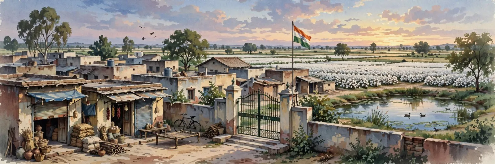
Farming covers most of Rupana's land. Of the village's 2,453 hectares, 2,194 hectares were net sown area in the 2011 record, and every sown hectare was irrigated. All of that water came from canals, which makes Rupana a fully canal-fed village in the cotton and paddy belt of Malwa. About 259 hectares were under non-agricultural uses such as the settlement, roads and ponds. Farm power supply was recorded at 12 hours a day.
On the Guru's road, 1705
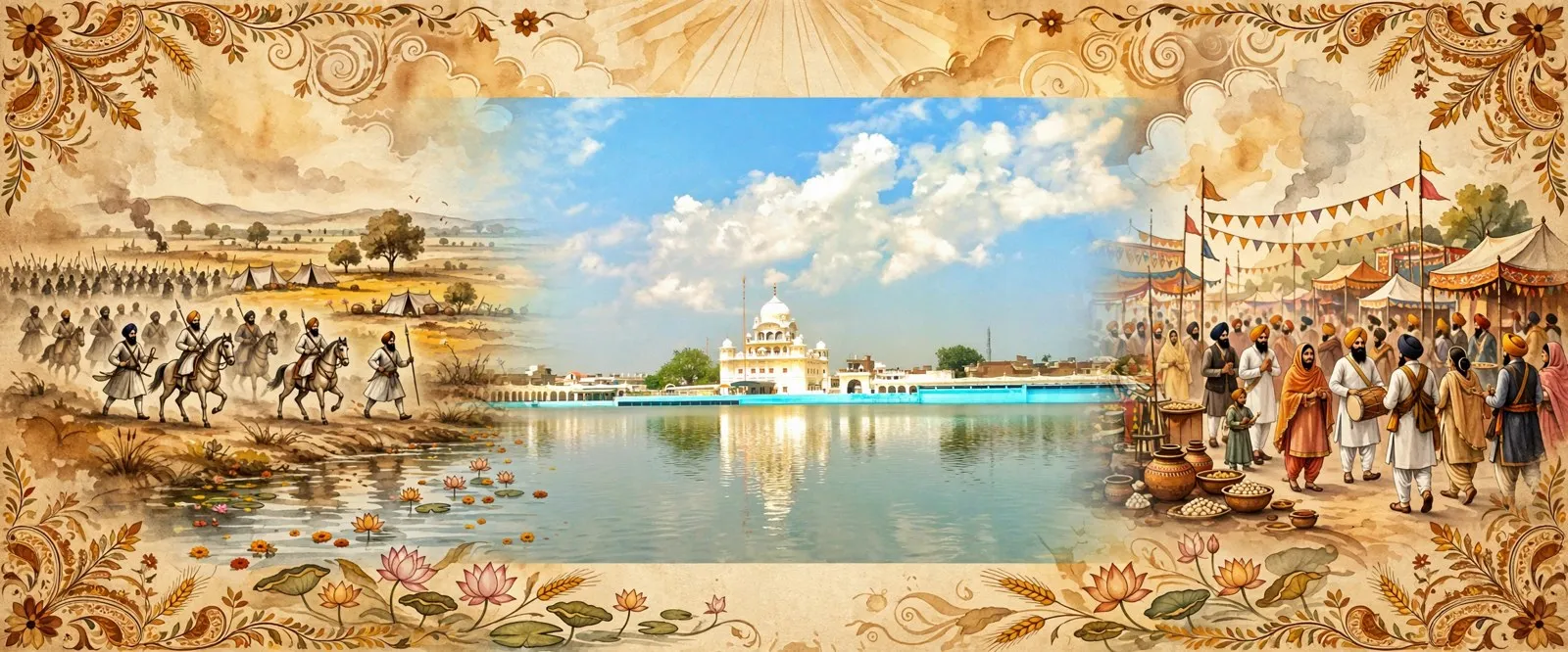
Rupana's name appears in the journey that followed one of the most remembered battles in Sikh history. After the Battle of Muktsar in 1705, ਗੁਰੂ ਗੋਬਿੰਦ ਸਿੰਘ ਜੀ moved on from the battlefield town toward Rupana on his way south through Malwa. A gurdwara in Muktsar town, Gurudwara Taran Taran Sahib, stands on the Muktsar to Bathinda road and marks the place where, according to the town's account, the Guru halted while travelling toward Rupana. The village itself was the next point on that road, which is why its name is carried in the story of the journey even though the best known shrines of 1705 stand in the town, 7 kilometres away.
Schools
Education is one of Rupana's strengths. The 2011 directory recorded two government schools at every level: two primary, two middle, two secondary and two senior secondary schools, so children can study in the village from the first class to Class 12 without leaving it. Directory listings add private pre-primary, primary, middle and secondary schools alongside the government ones. For study beyond school, the nearest government degree college and polytechnic are in Sri Muktsar Sahib town.
Health and daily services
Health cover inside the village is thin. The freshly checked 2011 Village Directory record lists a dispensary and a veterinary hospital, and nothing above them: no community health centre, no primary health centre, no primary health sub-centre and no allopathic hospital was recorded in Rupana, so anything serious means a trip to Muktsar town. The directory recorded treated tap water in the village. Rupana has its own post office, a commercial bank branch and a PDS ration shop, and an anganwadi centre; the sub post office, the cooperative bank, the nearest ATM and the ASHA health worker were all recorded five to ten kilometres away. Mobile phone coverage was recorded, and domestic power supply stood at 18 hours a day, the longest of any village covered in this batch of pages.
Faith in Rupana
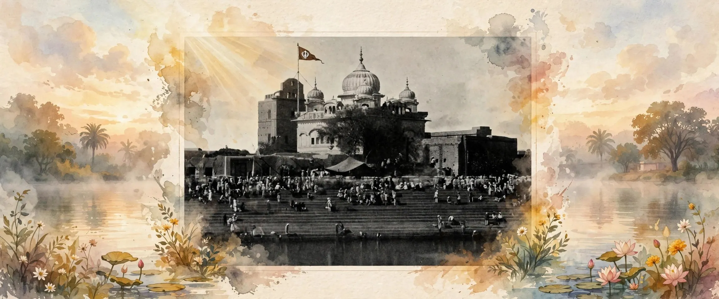
No shrine of Rupana itself appears in the national gurdwara and temple directories opened for this page, and the village's worship is local, centred on its own gurdwaras and temples. The historic sacred geography of this area belongs to Muktsar town, 7 kilometres away, whose gurdwaras commemorate the forty martyrs of 1705 and draw the great Maghi gathering every January.
Getting there
Rupana is reached by pucca, all-weather roads, and the 2011 directory recorded both public and private bus services in the village itself. The nearest railway station was five to ten kilometres away, at Sri Muktsar Sahib, which is the practical hub for administration, banking, hospitals and onward travel.
What is the population of Rupana?
The population of Rupana was 9,079 at the 2011 census, living in 1,916 households in Muktsar tehsil of Sri Muktsar Sahib district. It had grown from 7,620 in 2001 and was the largest village population in the tehsil.
Is Rupana connected to Guru Gobind Singh Ji's journey?
Yes, by the road he took. After the Battle of Muktsar in 1705, Guru Gobind Singh Ji travelled from Muktsar toward Rupana, and Gurudwara Taran Taran Sahib in Muktsar town marks his halt on that journey.
ਰੁਪਨਾ ਕਿੱਥੇ ਹੈ?
ਰੁਪਨਾ ਪੰਜਾਬ ਦੇ ਮਾਲਵਾ ਇਲਾਕੇ ਵਿੱਚ ਸ੍ਰੀ ਮੁਕਤਸਰ ਸਾਹਿਬ ਜ਼ਿਲ੍ਹੇ ਦੀ ਮੁਕਤਸਰ ਤਹਿਸੀਲ ਦਾ ਵੱਡਾ ਪਿੰਡ ਹੈ। ਇਹ ਆਪਣੀ ਤਹਿਸੀਲ ਦਾ ਸਭ ਤੋਂ ਵੱਡਾ ਪਿੰਡ ਹੈ: 2011 ਦੀ ਜਨਗਣਨਾ ਵਿੱਚ ਇਸ ਦੇ 9,079 ਲੋਕਾਂ ਨੇ ਇਸ ਨੂੰ ਮੁਕਤਸਰ ਤਹਿਸੀਲ ਦੇ ਹਰ ਪਿੰਡ ਤੋਂ ਵੱਡਾ ਬਣਾ ਦਿੱਤਾ। ਸ੍ਰੀ ਮੁਕਤਸਰ ਸਾਹਿਬ ਸ਼ਹਿਰ, ਜੋ ਤਹਿਸੀਲ ਅਤੇ ਜ਼ਿਲ੍ਹਾ ਸਦਰ ਮੁਕਾਮ ਦੋਵੇਂ ਹੈ, ਲਗਭਗ 7 ਕਿਲੋਮੀਟਰ ਦੂਰ ਹੈ ਅਤੇ ਇਹੀ ਇਸ ਦਾ ਸਭ ਤੋਂ ਨੇੜਾ ਸ਼ਹਿਰ ਦਰਜ ਹੋਇਆ। ਰੁਪਨਾ ਮੁਕਤਸਰ ਵਿਕਾਸ ਬਲਾਕ ਵਿੱਚ ਪੈਂਦਾ ਹੈ ਅਤੇ ਇਸ ਦੀ ਆਪਣੀ ਗ੍ਰਾਮ ਪੰਚਾਇਤ ਹੈ। ਜਨਗਣਨਾ ਰਿਕਾਰਡ ਵਿੱਚ ਇਸ ਦਾ ਪਿੰਡ ਕੋਡ 035395 ਹੈ, ਰਕਬਾ 2,453 ਹੈਕਟੇਅਰ ਹੈ ਅਤੇ ਪਿੰਨ ਕੋਡ 152032 ਹੈ। ਇਸ ਦੇ ਆਲੇ ਦੁਆਲੇ ਦੇ ਪਿੰਡਾਂ ਵਿੱਚ ਗੋਨਿਆਣਾ, ਭੁੱਲਰ, ਰੋਹੁੜੀਆਂਵਾਲੀ ਅਤੇ ਬਰਕੰਡੀ ਸ਼ਾਮਲ ਹਨ।
ਲੋਕ ਅਤੇ ਕੰਮ
2011 ਦੀ ਜਨਗਣਨਾ ਨੇ ਰੁਪਨਾ ਵਿੱਚ 9,079 ਲੋਕ ਗਿਣੇ, ਜੋ 2001 ਵਿੱਚ 7,620 ਸਨ: 4,939 ਮਰਦ ਅਤੇ 4,140 ਔਰਤਾਂ 1,916 ਪਰਿਵਾਰਾਂ ਵਿੱਚ ਰਹਿੰਦੀਆਂ ਹਨ, ਹਰ ਪਰਿਵਾਰ ਵਿੱਚ ਲਗਭਗ 4.7 ਲੋਕ। 2,453 ਹੈਕਟੇਅਰ ਵਿੱਚ ਫੈਲੇ ਹੋਣ ਕਰਕੇ ਘਣਤਾ ਲਗਭਗ 370 ਲੋਕ ਪ੍ਰਤੀ ਵਰਗ ਕਿਲੋਮੀਟਰ ਬਣਦੀ ਹੈ। ਲਿੰਗ ਅਨੁਪਾਤ ਹਰ 1,000 ਮਰਦਾਂ ਪਿੱਛੇ 838 ਔਰਤਾਂ ਸੀ, ਜੋ ਇਸ ਇਲਾਕੇ ਦੇ ਮਾਪਦੰਡਾਂ ਅਨੁਸਾਰ ਵੀ ਘੱਟ ਹੈ। ਛੇ ਸਾਲ ਤੱਕ ਦੇ ਬੱਚੇ 1,154 ਸਨ, ਪਿੰਡ ਦਾ ਲਗਭਗ 13 ਪ੍ਰਤੀਸ਼ਤ। ਅਨੁਸੂਚਿਤ ਜਾਤੀਆਂ ਦੇ ਲੋਕ 4,683 ਸਨ, ਆਬਾਦੀ ਦਾ ਲਗਭਗ 52 ਪ੍ਰਤੀਸ਼ਤ, ਜੋ ਬਹੁਗਿਣਤੀ ਹੈ, ਅਤੇ ਕੋਈ ਅਨੁਸੂਚਿਤ ਕਬੀਲਾ ਆਬਾਦੀ ਦਰਜ ਨਹੀਂ ਹੋਈ।
2011 ਵਿੱਚ ਸੱਤ ਸਾਲ ਅਤੇ ਉਸ ਤੋਂ ਵੱਧ ਉਮਰ ਦੇ ਵਸਨੀਕਾਂ ਵਿੱਚ ਸਾਖਰਤਾ 66.02 ਪ੍ਰਤੀਸ਼ਤ ਸੀ, ਜਿਸ ਵਿੱਚ ਮਰਦ 72.03 ਪ੍ਰਤੀਸ਼ਤ ਅਤੇ ਔਰਤਾਂ 58.91 ਪ੍ਰਤੀਸ਼ਤ ਸਨ। ਜਨਗਣਨਾ ਨੇ 3,549 ਕਾਮੇ ਦਰਜ ਕੀਤੇ, ਪਿੰਡ ਦਾ ਲਗਭਗ 39 ਪ੍ਰਤੀਸ਼ਤ। 2,654 ਮੁੱਖ ਕਾਮਿਆਂ ਵਿੱਚ ਸਭ ਤੋਂ ਵੱਡਾ ਸਮੂਹ, 1,098 ਲੋਕ, ਵਪਾਰ, ਢੋਆ-ਢੁਆਈ ਅਤੇ ਸੇਵਾਵਾਂ ਵਾਲੇ ਹੋਰ ਕਾਮੇ ਸਨ, ਜੋ 884 ਖੇਤ ਮਜ਼ਦੂਰਾਂ ਅਤੇ ਆਪਣੀ ਜ਼ਮੀਨ ਵਾਹੁਣ ਵਾਲੇ 587 ਕਾਸ਼ਤਕਾਰਾਂ ਤੋਂ ਅੱਗੇ ਸਨ; ਹੋਰ 895 ਲੋਕ ਹਾਸ਼ੀਆ ਕਾਮੇ ਸਨ, ਜੋ ਸਾਲ ਦਾ ਕੁਝ ਹਿੱਸਾ ਹੀ ਕੰਮ ਕਰਦੇ ਸਨ। ਖੇਤੀ ਕਰਨ ਵਾਲੇ ਸਭ ਨੂੰ ਮਿਲਾ ਕੇ ਪਿੰਡ ਵਿੱਚ ਸਿਰਫ਼ 636 ਕਾਸ਼ਤਕਾਰ ਅਤੇ 1,413 ਖੇਤ ਮਜ਼ਦੂਰ ਸਨ, ਇਸ ਲਈ ਰੁਪਨਾ ਦੇ ਖੇਤ ਜ਼ਮੀਨ ਵਾਲੇ ਪਰਿਵਾਰਾਂ ਦੇ ਮੁਕਾਬਲੇ ਦੁੱਗਣੇ ਤੋਂ ਵੱਧ ਮਜ਼ਦੂਰ ਪਰਿਵਾਰਾਂ ਨੂੰ ਰੋਜ਼ੀ ਦਿੰਦੇ ਹਨ।
ਜ਼ਮੀਨ ਅਤੇ ਖੇਤੀ
ਖੇਤੀ ਰੁਪਨਾ ਦੀ ਜ਼ਮੀਨ ਦਾ ਜ਼ਿਆਦਾਤਰ ਹਿੱਸਾ ਢਕਦੀ ਹੈ। ਪਿੰਡ ਦੇ 2,453 ਹੈਕਟੇਅਰ ਵਿੱਚੋਂ 2011 ਦੇ ਰਿਕਾਰਡ ਅਨੁਸਾਰ 2,194 ਹੈਕਟੇਅਰ ਸ਼ੁੱਧ ਬੀਜਿਆ ਰਕਬਾ ਸੀ, ਅਤੇ ਹਰ ਬੀਜਿਆ ਹੈਕਟੇਅਰ ਸਿੰਜਿਆ ਹੋਇਆ ਸੀ। ਇਹ ਸਾਰਾ ਪਾਣੀ ਨਹਿਰਾਂ ਤੋਂ ਆਇਆ, ਜੋ ਰੁਪਨਾ ਨੂੰ ਮਾਲਵੇ ਦੀ ਕਪਾਹ ਅਤੇ ਝੋਨੇ ਵਾਲੀ ਪੱਟੀ ਵਿੱਚ ਪੂਰੀ ਤਰ੍ਹਾਂ ਨਹਿਰੀ ਪਿੰਡ ਬਣਾਉਂਦਾ ਹੈ। ਲਗਭਗ 259 ਹੈਕਟੇਅਰ ਗੈਰ-ਖੇਤੀ ਵਰਤੋਂ ਹੇਠ ਸੀ, ਜਿਵੇਂ ਬਸਤੀ, ਸੜਕਾਂ ਅਤੇ ਛੱਪੜ। ਖੇਤੀ ਬਿਜਲੀ ਸਪਲਾਈ ਦਿਨ ਵਿੱਚ 12 ਘੰਟੇ ਦਰਜ ਹੋਈ।
ਗੁਰੂ ਜੀ ਦੇ ਰਾਹ ਉੱਤੇ, 1705
ਰੁਪਨਾ ਦਾ ਨਾਂ ਉਸ ਸਫ਼ਰ ਵਿੱਚ ਆਉਂਦਾ ਹੈ ਜੋ ਸਿੱਖ ਇਤਿਹਾਸ ਦੀ ਸਭ ਤੋਂ ਯਾਦਗਾਰੀ ਲੜਾਈ ਤੋਂ ਬਾਅਦ ਹੋਇਆ। 1705 ਵਿੱਚ ਮੁਕਤਸਰ ਦੀ ਲੜਾਈ ਤੋਂ ਬਾਅਦ ਗੁਰੂ ਗੋਬਿੰਦ ਸਿੰਘ ਜੀ ਜੰਗ ਦੇ ਮੈਦਾਨ ਵਾਲੇ ਸ਼ਹਿਰ ਤੋਂ ਮਾਲਵੇ ਵਿੱਚ ਦੱਖਣ ਵੱਲ ਜਾਂਦਿਆਂ ਰੁਪਨਾ ਵੱਲ ਵਧੇ। ਮੁਕਤਸਰ ਸ਼ਹਿਰ ਵਿੱਚ ਗੁਰਦੁਆਰਾ ਤਰਨ ਤਾਰਨ ਸਾਹਿਬ, ਜੋ ਮੁਕਤਸਰ ਤੋਂ ਬਠਿੰਡਾ ਸੜਕ ਉੱਤੇ ਹੈ, ਉਸ ਥਾਂ ਨੂੰ ਦਰਸਾਉਂਦਾ ਹੈ ਜਿੱਥੇ ਸ਼ਹਿਰ ਦੇ ਬਿਰਤਾਂਤ ਅਨੁਸਾਰ ਗੁਰੂ ਜੀ ਰੁਪਨਾ ਵੱਲ ਜਾਂਦਿਆਂ ਠਹਿਰੇ ਸਨ। ਪਿੰਡ ਆਪ ਉਸ ਸੜਕ ਉੱਤੇ ਅਗਲਾ ਪੜਾਅ ਸੀ, ਇਸੇ ਲਈ ਇਸ ਦਾ ਨਾਂ ਉਸ ਸਫ਼ਰ ਦੀ ਕਹਾਣੀ ਵਿੱਚ ਆਉਂਦਾ ਹੈ, ਭਾਵੇਂ 1705 ਦੇ ਸਭ ਤੋਂ ਮਸ਼ਹੂਰ ਅਸਥਾਨ 7 ਕਿਲੋਮੀਟਰ ਦੂਰ ਸ਼ਹਿਰ ਵਿੱਚ ਹਨ।
ਸਕੂਲ
ਪੜ੍ਹਾਈ ਰੁਪਨਾ ਦੀ ਤਾਕਤ ਹੈ। 2011 ਦੀ ਡਾਇਰੈਕਟਰੀ ਨੇ ਹਰ ਪੱਧਰ ਉੱਤੇ ਦੋ ਸਰਕਾਰੀ ਸਕੂਲ ਦਰਜ ਕੀਤੇ: ਦੋ ਪ੍ਰਾਇਮਰੀ, ਦੋ ਮਿਡਲ, ਦੋ ਸੈਕੰਡਰੀ ਅਤੇ ਦੋ ਸੀਨੀਅਰ ਸੈਕੰਡਰੀ ਸਕੂਲ, ਇਸ ਲਈ ਬੱਚੇ ਪਿੰਡ ਵਿੱਚ ਹੀ ਪਹਿਲੀ ਜਮਾਤ ਤੋਂ ਬਾਰ੍ਹਵੀਂ ਤੱਕ ਪੜ੍ਹ ਸਕਦੇ ਹਨ। ਡਾਇਰੈਕਟਰੀ ਸੂਚੀਆਂ ਸਰਕਾਰੀ ਸਕੂਲਾਂ ਦੇ ਨਾਲ ਪ੍ਰਾਈਵੇਟ ਪ੍ਰੀ-ਪ੍ਰਾਇਮਰੀ, ਪ੍ਰਾਇਮਰੀ, ਮਿਡਲ ਅਤੇ ਸੈਕੰਡਰੀ ਸਕੂਲ ਵੀ ਦਰਸਾਉਂਦੀਆਂ ਹਨ। ਸਕੂਲ ਤੋਂ ਅੱਗੇ ਦੀ ਪੜ੍ਹਾਈ ਲਈ ਸਭ ਤੋਂ ਨੇੜਾ ਸਰਕਾਰੀ ਡਿਗਰੀ ਕਾਲਜ ਅਤੇ ਪੌਲੀਟੈਕਨਿਕ ਸ੍ਰੀ ਮੁਕਤਸਰ ਸਾਹਿਬ ਸ਼ਹਿਰ ਵਿੱਚ ਹੈ।
ਸਿਹਤ ਅਤੇ ਰੋਜ਼ਾਨਾ ਸੇਵਾਵਾਂ
ਪਿੰਡ ਦੇ ਅੰਦਰ ਸਿਹਤ ਸੇਵਾ ਪਤਲੀ ਹੈ। ਤਾਜ਼ਾ ਦੇਖੇ ਗਏ 2011 ਦੇ ਪਿੰਡ ਡਾਇਰੈਕਟਰੀ ਰਿਕਾਰਡ ਵਿੱਚ ਇੱਕ ਡਿਸਪੈਂਸਰੀ ਅਤੇ ਇੱਕ ਪਸ਼ੂ ਹਸਪਤਾਲ ਦਰਜ ਹਨ, ਅਤੇ ਇਨ੍ਹਾਂ ਤੋਂ ਉੱਪਰ ਕੁਝ ਨਹੀਂ: ਰੁਪਨਾ ਵਿੱਚ ਨਾ ਕਮਿਊਨਿਟੀ ਸਿਹਤ ਕੇਂਦਰ, ਨਾ ਪ੍ਰਾਇਮਰੀ ਸਿਹਤ ਕੇਂਦਰ, ਨਾ ਸਿਹਤ ਉਪ ਕੇਂਦਰ ਅਤੇ ਨਾ ਹੀ ਐਲੋਪੈਥਿਕ ਹਸਪਤਾਲ ਦਰਜ ਹੋਇਆ, ਇਸ ਲਈ ਕਿਸੇ ਗੰਭੀਰ ਗੱਲ ਲਈ ਮੁਕਤਸਰ ਸ਼ਹਿਰ ਜਾਣਾ ਪੈਂਦਾ ਹੈ। ਡਾਇਰੈਕਟਰੀ ਨੇ ਪਿੰਡ ਵਿੱਚ ਸੋਧਿਆ ਨਲਕਾ ਪਾਣੀ ਦਰਜ ਕੀਤਾ। ਰੁਪਨਾ ਵਿੱਚ ਆਪਣਾ ਡਾਕਘਰ, ਵਪਾਰਕ ਬੈਂਕ ਸ਼ਾਖਾ ਅਤੇ ਪੀਡੀਐਸ ਰਾਸ਼ਨ ਦੁਕਾਨ ਹੈ, ਨਾਲ ਹੀ ਆਂਗਣਵਾੜੀ ਕੇਂਦਰ ਹੈ; ਉਪ ਡਾਕਘਰ, ਸਹਕਾਰੀ ਬੈਂਕ, ਸਭ ਤੋਂ ਨੇੜਾ ਏਟੀਐਮ ਅਤੇ ਆਸ਼ਾ ਵਰਕਰ, ਸਭ ਪੰਜ ਤੋਂ ਦਸ ਕਿਲੋਮੀਟਰ ਦੂਰ ਦਰਜ ਹੋਏ। ਮੋਬਾਈਲ ਫ਼ੋਨ ਕਵਰੇਜ ਦਰਜ ਹੋਈ, ਅਤੇ ਘਰੇਲੂ ਬਿਜਲੀ ਸਪਲਾਈ ਦਿਨ ਵਿੱਚ 18 ਘੰਟੇ ਸੀ, ਜੋ ਇਸ ਜਥੇ ਦੇ ਪਿੰਡਾਂ ਵਿੱਚ ਸਭ ਤੋਂ ਲੰਬੀ ਹੈ।
ਰੁਪਨਾ ਵਿੱਚ ਧਰਮ
ਇਸ ਸਫ਼ੇ ਲਈ ਖੋਲ੍ਹੀਆਂ ਗਈਆਂ ਰਾਸ਼ਟਰੀ ਗੁਰਦੁਆਰਾ ਅਤੇ ਮੰਦਰ ਡਾਇਰੈਕਟਰੀਆਂ ਵਿੱਚ ਰੁਪਨਾ ਦਾ ਕੋਈ ਅਸਥਾਨ ਨਹੀਂ ਆਉਂਦਾ, ਅਤੇ ਪਿੰਡ ਦੀ ਪੂਜਾ ਸਥਾਨਕ ਹੈ, ਇਸ ਦੇ ਆਪਣੇ ਗੁਰਦੁਆਰਿਆਂ ਅਤੇ ਮੰਦਰਾਂ ਵਿੱਚ ਹੁੰਦੀ ਹੈ। ਇਸ ਇਲਾਕੇ ਦਾ ਇਤਿਹਾਸਕ ਪਵਿੱਤਰ ਨਕਸ਼ਾ 7 ਕਿਲੋਮੀਟਰ ਦੂਰ ਮੁਕਤਸਰ ਸ਼ਹਿਰ ਦਾ ਹੈ, ਜਿਸ ਦੇ ਗੁਰਦੁਆਰੇ 1705 ਦੇ ਚਾਲੀ ਸ਼ਹੀਦਾਂ ਦੀ ਯਾਦ ਰੱਖਦੇ ਹਨ ਅਤੇ ਹਰ ਜਨਵਰੀ ਮਾਘੀ ਦਾ ਵੱਡਾ ਇਕੱਠ ਖਿੱਚਦੇ ਹਨ।
ਉੱਥੇ ਕਿਵੇਂ ਪਹੁੰਚੀਏ
ਰੁਪਨਾ ਪੱਕੀਆਂ, ਹਰ ਮੌਸਮ ਵਾਲੀਆਂ ਸੜਕਾਂ ਨਾਲ ਜੁੜਿਆ ਹੈ, ਅਤੇ 2011 ਦੀ ਡਾਇਰੈਕਟਰੀ ਨੇ ਪਿੰਡ ਦੇ ਅੰਦਰ ਹੀ ਸਰਕਾਰੀ ਅਤੇ ਪ੍ਰਾਈਵੇਟ ਦੋਵੇਂ ਬੱਸ ਸੇਵਾਵਾਂ ਦਰਜ ਕੀਤੀਆਂ। ਸਭ ਤੋਂ ਨੇੜਾ ਰੇਲਵੇ ਸਟੇਸ਼ਨ ਪੰਜ ਤੋਂ ਦਸ ਕਿਲੋਮੀਟਰ ਦੂਰ ਸ੍ਰੀ ਮੁਕਤਸਰ ਸਾਹਿਬ ਵਿਖੇ ਸੀ, ਜੋ ਪ੍ਰਸ਼ਾਸਨ, ਬੈਂਕਿੰਗ, ਹਸਪਤਾਲਾਂ ਅਤੇ ਅੱਗੇ ਦੇ ਸਫ਼ਰ ਲਈ ਅਸਲ ਕੇਂਦਰ ਹੈ।
ਰੁਪਨਾ ਦੀ ਆਬਾਦੀ ਕਿੰਨੀ ਹੈ?
2011 ਦੀ ਜਨਗਣਨਾ ਵਿੱਚ ਰੁਪਨਾ ਦੀ ਆਬਾਦੀ 9,079 ਸੀ, ਜੋ ਸ੍ਰੀ ਮੁਕਤਸਰ ਸਾਹਿਬ ਜ਼ਿਲ੍ਹੇ ਦੀ ਮੁਕਤਸਰ ਤਹਿਸੀਲ ਵਿੱਚ 1,916 ਪਰਿਵਾਰਾਂ ਵਿੱਚ ਰਹਿੰਦੀ ਸੀ। ਇਹ 2001 ਵਿੱਚ 7,620 ਤੋਂ ਵਧੀ ਸੀ ਅਤੇ ਤਹਿਸੀਲ ਵਿੱਚ ਸਭ ਤੋਂ ਵੱਡੀ ਪਿੰਡ ਆਬਾਦੀ ਸੀ।
ਕੀ ਰੁਪਨਾ ਗੁਰੂ ਗੋਬਿੰਦ ਸਿੰਘ ਜੀ ਦੇ ਸਫ਼ਰ ਨਾਲ ਜੁੜਿਆ ਹੈ?
ਹਾਂ, ਉਸ ਸੜਕ ਕਰਕੇ ਜੋ ਉਨ੍ਹਾਂ ਨੇ ਲਈ। 1705 ਵਿੱਚ ਮੁਕਤਸਰ ਦੀ ਲੜਾਈ ਤੋਂ ਬਾਅਦ ਗੁਰੂ ਗੋਬਿੰਦ ਸਿੰਘ ਜੀ ਮੁਕਤਸਰ ਤੋਂ ਰੁਪਨਾ ਵੱਲ ਤੁਰੇ, ਅਤੇ ਮੁਕਤਸਰ ਸ਼ਹਿਰ ਵਿੱਚ ਗੁਰਦੁਆਰਾ ਤਰਨ ਤਾਰਨ ਸਾਹਿਬ ਉਸ ਸਫ਼ਰ ਵਿੱਚ ਉਨ੍ਹਾਂ ਦੇ ਠਹਿਰਾਅ ਨੂੰ ਦਰਸਾਉਂਦਾ ਹੈ।
Nearby
ਸਰੋਤ (5)
- Rupana (61) Village Code 035395: District Census Handbook Village Directory data, VillageCodes Punjab
- Census of India 2011, Primary Census Abstract (village level), Muktsar district workbook, Office of the Registrar General & Census Commissioner
- Rupana village population 2001 and 2011, CityPopulation (Office of the Registrar General and Census Commissioner data)
- Rupana village details, OneFiveNine (Census 2011 District Census Handbook data)
- Sri Muktsar Sahib, Wikipedia (Gurudwara Taran Taran Sahib and the halt on the way to Rupana)
ਜੁਗਤੀ ਮੁਫ਼ਤ ਅਤੇ ਸੁਤੰਤਰ ਹੈ। ਪਾਠਕਾਂ ਦਾ ਸਹਿਯੋਗ ਕੋਸ਼ ਨੂੰ ਵਧਾਉਂਦਾ ਹੈ।
ਸਹਿਯੋਗ