

Tarn Taran is a border district in the Majha region of Punjab, India, formed from Amritsar district on 16 June 2006, with its headquarters at Tarn Taran Sahib. It holds Tarn Taran Sahib and its great sarovar, Goindwal Sahib, Khadur Sahib and the Harike Wetland, and counted 1,119,627 people in the 2011 Census.
- ਪੰਜਾਬੀ ਨਾਂ
- ਤਰਨ ਤਾਰਨ
- ਕਿਸਮ
- ਜ਼ਿਲ੍ਹਾ
- Headquarters
- Tarn Taran Sahib
- ਇਲਾਕਾ
- ਮਾਝਾ
- ਸੂਬਾ
- ਪੰਜਾਬ
- ਦੇਸ਼
- ਭਾਰਤ
All 16 facts
- Area
- 2,414 sq km
- ਆਬਾਦੀ
- 1,119,627 (Census 2011)
- Density
- 464 per sq km (Census 2011)
- Sex ratio
- 900 females per 1,000 males (Census 2011)
- Literacy
- 67.81 percent (Census 2011)
- ਪਿੰਡ
- 489 (Census 2011, 10 uninhabited)
- Towns
- 4 (Census 2011)
- Formed
- 16 June 2006, from Amritsar district, 19th district of Punjab
- ਪ੍ਰਸਿੱਧੀ
- Tarn Taran Sahib sarovar, Goindwal Sahib Baoli, Khadur Sahib, Harike Wetland
- ਜ਼ਿਲ੍ਹਾ
- ਤਰਨ ਤਾਰਨ
Where is Tarn Taran district?
Tarn Taran is a border district in the Majha region of Punjab, India, with its headquarters at Tarn Taran Sahib, the town Guru Arjan Dev Ji founded around a great sarovar. Formed from Amritsar district on 16 June 2006, it counted 1,119,627 people in the 2011 Census.
The district lies south of Amritsar, which adjoins it to the north, with Kapurthala district to the east, Ferozepur district to the south and Pakistan to the west. Its long western edge is the international border, put at about 240 kilometres in the district profile published by the Krishi Vigyan Kendra. The Beas runs along its south eastern side, and at the southern tip the Beas meets the Sutlej at Harike. Most of the district is a flat, fertile plain between the Beas and the Ravi, given over to farming villages.
For administration the Census of 2011 recorded three tehsils, Tarn Taran, Patti and Khadur Sahib, with eight development blocks, 489 villages, of which ten were uninhabited, and four towns. The headquarters town, Tarn Taran Sahib, stands about 24 kilometres south of Amritsar on the old Delhi to Lahore road.
A young district on old sacred ground
The district is young, but the town at its heart is not. Guru Arjan Dev Ji, the fifth Guru, began the digging of the great sarovar at Tarn Taran in 1590, on a natural pond beside the Delhi to Lahore highway, while the district administration dates the laying of the town foundation to 1596. The name Tarn Taran belonged first to the sarovar itself and means, in the usual rendering, the boat that takes one across the ocean of existence. Tradition holds that the water was found to help people suffering from leprosy, and Guru Arjan made care for them part of the founding of the place, a tradition of healing and service that a leprosy home set up in 1885 later carried on.
After the Guru period the town and its shrine passed under the Bhangi Misl, ruled by a Dhillon family, from 1716 to 1810, and then into Maharaja Ranjit Singh's empire, whose court paid for gold work and a enclosing wall at the sarovar. In 1947, at Partition, Tarn Taran was one of the few tehsils in Punjab with a Sikh majority. The district itself was only created on 16 June 2006, carved out of Amritsar district, when the then Chief Minister declared it during the celebrations marking the 400th martyrdom day of Guru Arjan Dev Ji. It became the 19th district of Punjab.
The border has shaped modern memory too. In the war of 1965 Pakistani forces captured the border town of Khem Karan in early September, and from 8 to 10 September the Battle of Asal Uttar was fought nearby, described in district histories as the largest tank battle since the Second World War. Captured tanks were displayed for a time near Bhikhiwind at a spot remembered as Patton Nagar, and Khem Karan stayed under occupation for about six months, until the Tashkent agreement of 10 January 1966.
The district of the Gurus
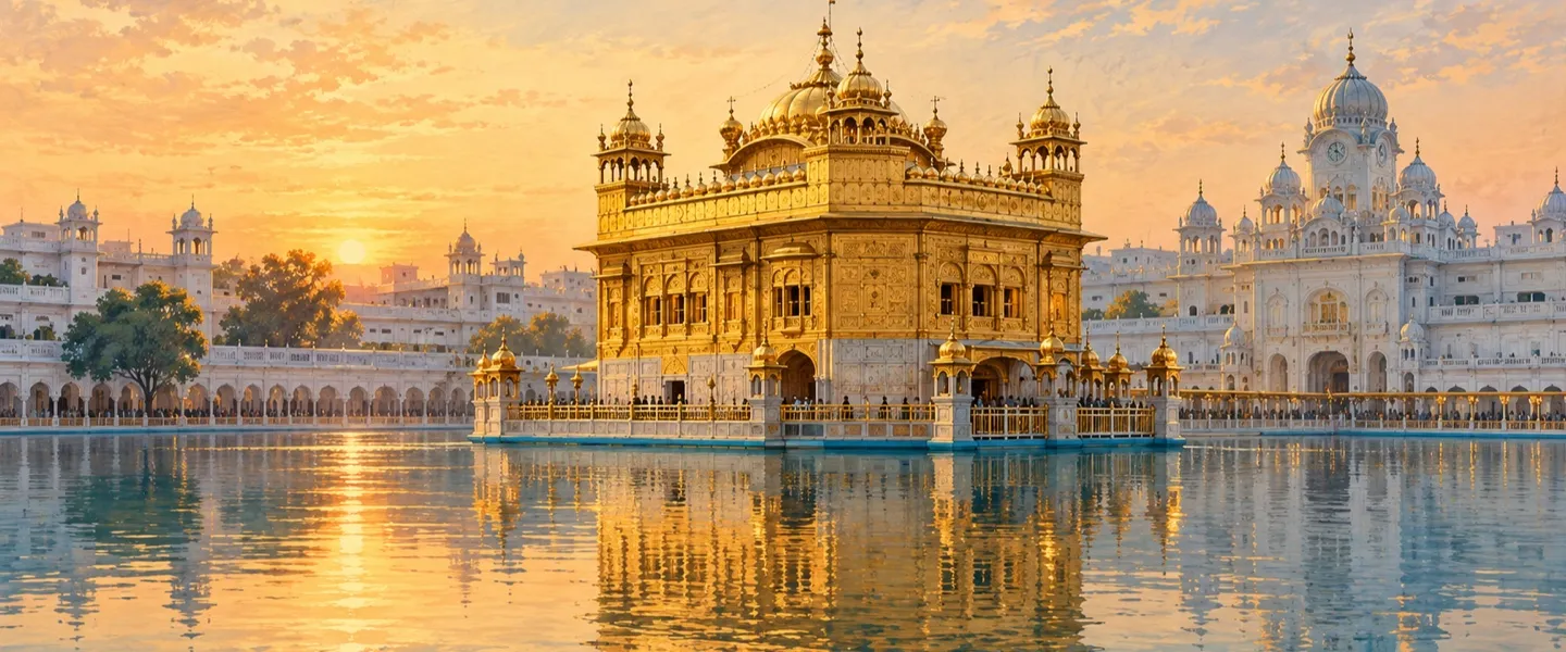
No district in Punjab holds so much early Sikh history in so small a compass. At Tarn Taran Sahib itself, Gurdwara Sri Tarn Taran Sahib stands at the south eastern corner of the sarovar, which is described as the largest sacred pool of any gurdwara. Pilgrims gather in especially large numbers on Amavasya, the night of the new moon, and the town holds a ring of historic shrines around the tank, among them Gurdwara Guru Ka Khuh, Gurdwara Bibi Bhani Da Khuh and Gurdwara Lakeer Sahib, where Baba Deep Singh Ji is remembered to have drawn his line in 1757.
East of the headquarters, on the bank of the Beas and about 23 kilometres from Tarn Taran Sahib, lies Goindwal Sahib. Guru Amar Das Ji, the third Guru, made Goindwal the first formal centre of the Sikh community in the sixteenth century and had the Baoli Sahib dug there, a stepwell of 84 steps. Sikh tradition holds that a devotee who bathes and recites Japji Sahib on each step is freed from the cycle of births and deaths. Guru Arjan Dev Ji was born at Goindwal in 1563, before he went on to found Tarn Taran and Amritsar's Harmandir Sahib.
A short distance north of Goindwal is Khadur Sahib, the home of Guru Angad Dev Ji, the second Guru, who spent about thirteen years there with his wife Mata Khivi Ji, remembered for her service in the langar. At Khadur Sahib the Guru formalised the Gurmukhi script, opened a school to teach it to children and gathered Guru Nanak Dev Ji's hymns, work that gave the young community its own written voice. District tradition also counts visits by eight of the ten Gurus to Khadur Sahib, which is why the Tarn Taran, Goindwal and Khadur Sahib circuit is travelled by pilgrims as a single journey.
People, language and faith
The 2011 Census counted 1,119,627 people in the district over an area of 2,414 square kilometres, a density of 464 people per square kilometre. It is an overwhelmingly rural district: 977,832 people, or 87.34 percent, lived in villages, and 141,795, or 12.66 percent, in its four towns. The sex ratio stood at 900 females for every 1,000 males, and the average literacy rate was 67.81 percent, with male literacy at 73.24 percent and female literacy at 61.85 percent.
By faith the district is the most heavily Sikh in Punjab. The Census counted Sikhs at 93.33 percent, Hindus at 5.40 percent and Christians at 0.54 percent, with Scheduled Castes making up 33.71 percent. Punjabi is the language of daily life, returned by about 99 percent of residents in 2011, and of the district's schools, markets and gurdwaras. That farming countryside and intense Sikh religious life give Tarn Taran a character quite different from commercial Amritsar next door.
Farming and the border economy
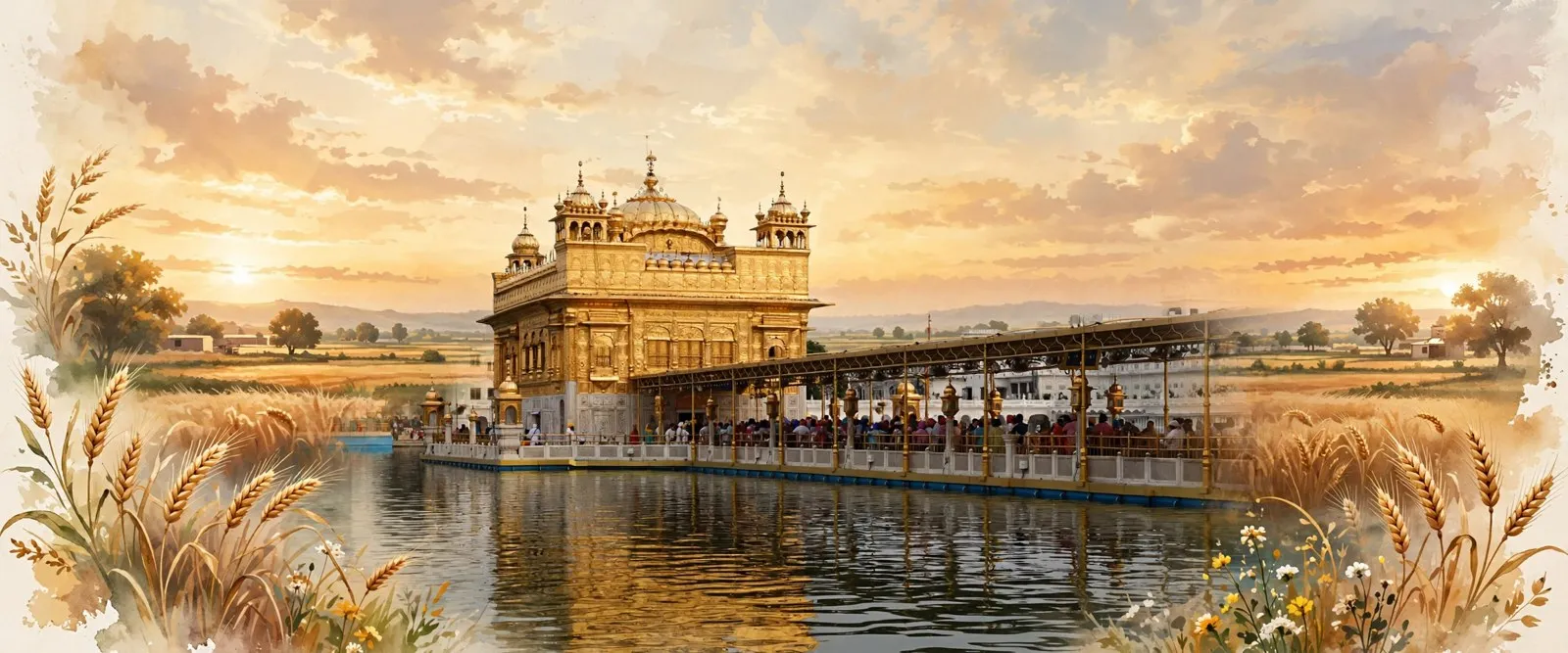
The district administration sums up the local economy plainly: the main occupation is agriculture and agro industry, with very few other industries. The Krishi Vigyan Kendra profile records a rice and wheat cropping system across almost all of the net sown area of about 2.17 lakh hectares, nearly all of it double cropped, with tubewells as the main source of irrigation. Wheat dominates the winter season and paddy the summer, while vegetables, especially peas in winter, and summer moong are growing parts of the rotation, and dairy animals, above all buffaloes, are kept in large numbers across the villages.
The border is an economic fact as well as a line on the map. The district profile records about 4,192 hectares of land lying beyond the border fence, of which about 3,597 hectares remain cultivable, farmed by local families under the arrangements that govern that strip. Average rainfall is put at 482.9 millimetres a year. Grain markets in Tarn Taran, Patti and Bhikhiwind collect the harvest, and work, trade and family life all look naturally toward Amritsar, the nearest large city and market.
Harike and places to see
At the district's southern tip lies its great natural treasure. Harike Wetland, also called Hari-ke-Pattan, formed after headworks were built across the Sutlej in 1953, just below the confluence of the Beas and the Sutlej. The Ramsar Sites Information Service lists Harike Lake as site number 462, designated on 23 March 1990, covering 4,100 hectares, a shallow reservoir with thirteen islands that supports over 200,000 ducks, geese and swans during migration. The wetland was declared a bird sanctuary in 1982, and winter brings large numbers of migratory birds to its waters, making it one of northern India's best known birding places.
For most visitors the district is travelled as a pilgrim circuit first: the great sarovar at Tarn Taran Sahib, the 84 steps of the Baoli at Goindwal Sahib, and the Guru's town at Khadur Sahib. Patti, the old second town, adds a different layer, with its historic fort, built in 1755 and now housing the town police station, a reminder of the misl period. Harike is best combined with that circuit in winter, when the birds are in and the fields are green with wheat.
Getting to Tarn Taran district
There is no commercial airport in the district, and the nearest is Sri Guru Ram Dass Ji International Airport at Amritsar, about an hour's drive from Tarn Taran Sahib town. By rail, the Amritsar to Khem Karan line and the Beas to Tarn Taran line both pass through the district, and Tarn Taran Junction connects the two, with trains toward Amritsar, Beas and the border towns. By road the district is crossed by national highways including NH 54 and NH 354, and buses link Tarn Taran Sahib, Patti, Bhikhiwind and Khadur Sahib with Amritsar and with each other through the day.
ਤਰਨ ਤਾਰਨ ਜ਼ਿਲ੍ਹਾ ਕਿੱਥੇ ਹੈ?
ਤਰਨ ਤਾਰਨ ਭਾਰਤ ਦੇ ਪੰਜਾਬ ਸੂਬੇ ਦੇ ਮਾਝਾ ਖੇਤਰ ਦਾ ਇੱਕ ਸਰਹੱਦੀ ਜ਼ਿਲ੍ਹਾ ਹੈ। ਇਸ ਦਾ ਸਦਰ ਮੁਕਾਮ ਤਰਨ ਤਾਰਨ ਸਾਹਿਬ ਹੈ, ਉਹ ਕਸਬਾ ਜਿਸ ਦੀ ਨੀਂਹ ਗੁਰੂ ਅਰਜਨ ਦੇਵ ਜੀ ਨੇ ਇੱਕ ਵੱਡੇ ਸਰੋਵਰ ਦੁਆਲੇ ਰੱਖੀ ਸੀ। ਇਹ ਜ਼ਿਲ੍ਹਾ 16 ਜੂਨ 2006 ਨੂੰ ਅੰਮ੍ਰਿਤਸਰ ਜ਼ਿਲ੍ਹੇ ਵਿੱਚੋਂ ਕੱਟ ਕੇ ਬਣਾਇਆ ਗਿਆ, ਅਤੇ 2011 ਦੀ ਮਰਦਮਸ਼ੁਮਾਰੀ ਵਿੱਚ ਇੱਥੇ 1,119,627 ਲੋਕ ਗਿਣੇ ਗਏ ਸਨ।
ਜ਼ਿਲ੍ਹੇ ਦੇ ਉੱਤਰ ਵੱਲ ਅੰਮ੍ਰਿਤਸਰ, ਪੂਰਬ ਵੱਲ ਕਪੂਰਥਲਾ ਜ਼ਿਲ੍ਹਾ, ਦੱਖਣ ਵੱਲ ਫ਼ਿਰੋਜ਼ਪੁਰ ਜ਼ਿਲ੍ਹਾ ਅਤੇ ਪੱਛਮ ਵੱਲ ਪਾਕਿਸਤਾਨ ਲੱਗਦਾ ਹੈ। ਇਸ ਦਾ ਲੰਮਾ ਪੱਛਮੀ ਕਿਨਾਰਾ ਅੰਤਰਰਾਸ਼ਟਰੀ ਸਰਹੱਦ ਹੈ, ਜਿਸ ਦੀ ਲੰਬਾਈ ਕ੍ਰਿਸ਼ੀ ਵਿਗਿਆਨ ਕੇਂਦਰ ਵੱਲੋਂ ਛਾਪੀ ਜ਼ਿਲ੍ਹਾ ਜਾਣਕਾਰੀ ਵਿੱਚ ਲਗਭਗ 240 ਕਿਲੋਮੀਟਰ ਦੱਸੀ ਗਈ ਹੈ। ਬਿਆਸ ਦਰਿਆ ਇਸ ਦੇ ਦੱਖਣ ਪੂਰਬੀ ਪਾਸੇ ਵਗਦਾ ਹੈ, ਅਤੇ ਦੱਖਣੀ ਸਿਰੇ ਉੱਤੇ ਹਰੀਕੇ ਵਿਖੇ ਬਿਆਸ ਸਤਲੁਜ ਵਿੱਚ ਮਿਲਦਾ ਹੈ। ਜ਼ਿਆਦਾਤਰ ਜ਼ਿਲ੍ਹਾ ਬਿਆਸ ਅਤੇ ਰਾਵੀ ਵਿਚਕਾਰ ਇੱਕ ਪੱਧਰਾ ਉਪਜਾਊ ਮੈਦਾਨ ਹੈ, ਜੋ ਲਗਭਗ ਪੂਰੀ ਤਰ੍ਹਾਂ ਖੇਤੀ ਵਾਲੇ ਪਿੰਡਾਂ ਨਾਲ ਭਰਿਆ ਹੈ।
ਪ੍ਰਸ਼ਾਸਨ ਲਈ 2011 ਦੀ ਮਰਦਮਸ਼ੁਮਾਰੀ ਵਿੱਚ ਤਿੰਨ ਤਹਿਸੀਲਾਂ ਦਰਜ ਸਨ: ਤਰਨ ਤਾਰਨ, ਪੱਟੀ ਅਤੇ ਖਡੂਰ ਸਾਹਿਬ, ਅਤੇ ਇਨ੍ਹਾਂ ਦੇ ਹੇਠਾਂ ਅੱਠ ਵਿਕਾਸ ਬਲਾਕ, 489 ਪਿੰਡ, ਜਿਨ੍ਹਾਂ ਵਿੱਚੋਂ ਦਸ ਆਬਾਦੀ ਤੋਂ ਖਾਲੀ ਸਨ, ਅਤੇ ਚਾਰ ਕਸਬੇ ਸਨ। ਸਦਰ ਮੁਕਾਮ ਤਰਨ ਤਾਰਨ ਸਾਹਿਬ ਪੁਰਾਣੀ ਦਿੱਲੀ ਤੋਂ ਲਾਹੌਰ ਜਾਣ ਵਾਲੀ ਸੜਕ ਉੱਤੇ ਅੰਮ੍ਰਿਤਸਰ ਤੋਂ ਲਗਭਗ 24 ਕਿਲੋਮੀਟਰ ਦੱਖਣ ਵੱਲ ਹੈ।
ਪੁਰਾਣੀ ਪਵਿੱਤਰ ਧਰਤੀ ਉੱਤੇ ਨਵਾਂ ਜ਼ਿਲ੍ਹਾ
ਜ਼ਿਲ੍ਹਾ ਨਵਾਂ ਹੈ, ਪਰ ਇਸ ਦੇ ਦਿਲ ਵਿੱਚ ਵੱਸਦਾ ਕਸਬਾ ਨਵਾਂ ਨਹੀਂ। ਪੰਜਵੇਂ ਗੁਰੂ, ਗੁਰੂ ਅਰਜਨ ਦੇਵ ਜੀ ਨੇ 1590 ਵਿੱਚ ਦਿੱਲੀ ਤੋਂ ਲਾਹੌਰ ਜਾਣ ਵਾਲੀ ਸ਼ਾਹੀ ਸੜਕ ਕੰਢੇ ਇੱਕ ਕੁਦਰਤੀ ਛੱਪੜ ਵਾਲੀ ਥਾਂ ਉੱਤੇ ਤਰਨ ਤਾਰਨ ਦੇ ਵੱਡੇ ਸਰੋਵਰ ਦੀ ਖੁਦਾਈ ਸ਼ੁਰੂ ਕੀਤੀ, ਜਦੋਂ ਕਿ ਜ਼ਿਲ੍ਹਾ ਪ੍ਰਸ਼ਾਸਨ ਕਸਬੇ ਦੀ ਨੀਂਹ 1596 ਵਿੱਚ ਰੱਖੀ ਦੱਸਦਾ ਹੈ। ਤਰਨ ਤਾਰਨ ਨਾਂ ਪਹਿਲਾਂ ਸਰੋਵਰ ਦਾ ਸੀ, ਅਤੇ ਇਸ ਦਾ ਅਰਥ ਆਮ ਤੌਰ ਉੱਤੇ ਇੰਝ ਸਮਝਾਇਆ ਜਾਂਦਾ ਹੈ: ਉਹ ਬੇੜੀ ਜੋ ਜੀਵ ਨੂੰ ਸੰਸਾਰ ਸਾਗਰ ਤੋਂ ਪਾਰ ਲੈ ਜਾਂਦੀ ਹੈ। ਪਰੰਪਰਾ ਹੈ ਕਿ ਇੱਥੋਂ ਦੇ ਪਾਣੀ ਨਾਲ ਕੋੜ੍ਹ ਤੋਂ ਪੀੜਤ ਲੋਕਾਂ ਨੂੰ ਸਹਾਰਾ ਮਿਲਿਆ, ਅਤੇ ਗੁਰੂ ਜੀ ਨੇ ਉਨ੍ਹਾਂ ਦੀ ਸੇਵਾ ਨੂੰ ਇਸ ਥਾਂ ਦੀ ਨੀਂਹ ਦਾ ਹਿੱਸਾ ਬਣਾਇਆ। ਸੇਵਾ ਦੀ ਇਹ ਪਰੰਪਰਾ ਬਾਅਦ ਵਿੱਚ 1885 ਵਿੱਚ ਬਣੇ ਕੋੜ੍ਹੀਆਂ ਦੇ ਘਰ ਨੇ ਵੀ ਅੱਗੇ ਤੋਰੀ।
ਗੁਰੂ ਕਾਲ ਤੋਂ ਬਾਅਦ ਕਸਬਾ ਅਤੇ ਇਸ ਦਾ ਅਸਥਾਨ 1716 ਤੋਂ 1810 ਤੱਕ ਢਿੱਲੋਂ ਪਰਿਵਾਰ ਦੇ ਰਾਜ ਹੇਠ ਭੰਗੀ ਮਿਸਲ ਕੋਲ ਰਿਹਾ, ਅਤੇ ਫਿਰ ਮਹਾਰਾਜਾ ਰਣਜੀਤ ਸਿੰਘ ਦੇ ਰਾਜ ਵਿੱਚ ਆ ਗਿਆ, ਜਿਸ ਦੇ ਦਰਬਾਰ ਨੇ ਸਰੋਵਰ ਉੱਤੇ ਸੋਨੇ ਦਾ ਕੰਮ, ਪੱਕੀਆਂ ਪਰਿਕਰਮਾਵਾਂ ਅਤੇ ਆਲੇ ਦੁਆਲੇ ਕੰਧ ਉਸਾਰੀ। 1947 ਦੀ ਵੰਡ ਵੇਲੇ ਤਰਨ ਤਾਰਨ ਪੰਜਾਬ ਦੀਆਂ ਉਨ੍ਹਾਂ ਗਿਣਤੀ ਦੀਆਂ ਤਹਿਸੀਲਾਂ ਵਿੱਚੋਂ ਇੱਕ ਸੀ ਜਿੱਥੇ ਸਿੱਖ ਬਹੁਗਿਣਤੀ ਵਿੱਚ ਸਨ, ਅਤੇ ਨਵੀਂ ਸਰਹੱਦ ਪਾਰ ਪਰਿਵਾਰ ਦੋਵੇਂ ਪਾਸੇ ਇਸ ਦੇ ਪਿੰਡਾਂ ਵਿੱਚੋਂ ਲੰਘੇ। ਜ਼ਿਲ੍ਹਾ ਆਪ 16 ਜੂਨ 2006 ਨੂੰ ਹੀ ਬਣਿਆ, ਅੰਮ੍ਰਿਤਸਰ ਜ਼ਿਲ੍ਹੇ ਵਿੱਚੋਂ ਕੱਟ ਕੇ, ਜਦੋਂ ਉਸ ਵੇਲੇ ਦੇ ਮੁੱਖ ਮੰਤਰੀ ਨੇ ਗੁਰੂ ਅਰਜਨ ਦੇਵ ਜੀ ਦੇ 400ਵੇਂ ਸ਼ਹੀਦੀ ਦਿਹਾੜੇ ਦੇ ਸਮਾਗਮਾਂ ਦੌਰਾਨ ਇਸ ਦਾ ਐਲਾਨ ਕੀਤਾ। ਇਹ ਪੰਜਾਬ ਦਾ 19ਵਾਂ ਜ਼ਿਲ੍ਹਾ ਬਣਿਆ।
ਸਰਹੱਦ ਨੇ ਆਧੁਨਿਕ ਯਾਦਾਂ ਨੂੰ ਵੀ ਘੜਿਆ ਹੈ। 1965 ਦੀ ਜੰਗ ਵਿੱਚ ਪਾਕਿਸਤਾਨੀ ਫ਼ੌਜਾਂ ਨੇ ਸਤੰਬਰ ਦੇ ਸ਼ੁਰੂ ਵਿੱਚ ਸਰਹੱਦੀ ਕਸਬਾ ਖੇਮ ਕਰਨ ਕਬਜ਼ੇ ਵਿੱਚ ਲੈ ਲਿਆ, ਅਤੇ 8 ਤੋਂ 10 ਸਤੰਬਰ ਤੱਕ ਨੇੜੇ ਹੀ ਅਸਲ ਉੱਤੜ ਦੀ ਲੜਾਈ ਲੜੀ ਗਈ, ਜਿਸ ਨੂੰ ਜ਼ਿਲ੍ਹੇ ਦੇ ਇਤਿਹਾਸ ਵਿੱਚ ਦੂਜੀ ਵਿਸ਼ਵ ਜੰਗ ਤੋਂ ਬਾਅਦ ਦੀ ਸਭ ਤੋਂ ਵੱਡੀ ਟੈਂਕ ਲੜਾਈ ਦੱਸਿਆ ਜਾਂਦਾ ਹੈ। ਫੜੇ ਗਏ ਪਾਕਿਸਤਾਨੀ ਟੈਂਕ ਕੁਝ ਸਮਾਂ ਭਿੱਖੀਵਿੰਡ ਨੇੜੇ ਪ੍ਰਦਰਸ਼ਿਤ ਕੀਤੇ ਗਏ, ਜਿਸ ਥਾਂ ਨੂੰ ਪੈਟਨ ਨਗਰ ਵਜੋਂ ਯਾਦ ਕੀਤਾ ਜਾਂਦਾ ਹੈ, ਅਤੇ ਖੇਮ ਕਰਨ ਲਗਭਗ ਛੇ ਮਹੀਨੇ ਕਬਜ਼ੇ ਹੇਠ ਰਿਹਾ, 10 ਜਨਵਰੀ 1966 ਦੇ ਤਾਸ਼ਕੰਦ ਸਮਝੌਤੇ ਤੱਕ।
ਗੁਰੂਆਂ ਦਾ ਜ਼ਿਲ੍ਹਾ
ਪੰਜਾਬ ਦੇ ਕਿਸੇ ਵੀ ਜ਼ਿਲ੍ਹੇ ਵਿੱਚ ਇੰਨੇ ਛੋਟੇ ਘੇਰੇ ਵਿੱਚ ਇੰਨਾ ਮੁੱਢਲਾ ਸਿੱਖ ਇਤਿਹਾਸ ਨਹੀਂ ਮਿਲਦਾ। ਤਰਨ ਤਾਰਨ ਸਾਹਿਬ ਵਿਖੇ ਗੁਰਦੁਆਰਾ ਸ੍ਰੀ ਤਰਨ ਤਾਰਨ ਸਾਹਿਬ ਸਰੋਵਰ ਦੇ ਦੱਖਣ ਪੂਰਬੀ ਕੋਨੇ ਉੱਤੇ ਖੜ੍ਹਾ ਹੈ, ਅਤੇ ਇਸ ਸਰੋਵਰ ਨੂੰ ਕਿਸੇ ਵੀ ਗੁਰਦੁਆਰੇ ਦੇ ਸਰੋਵਰਾਂ ਵਿੱਚੋਂ ਸਭ ਤੋਂ ਵੱਡਾ ਦੱਸਿਆ ਜਾਂਦਾ ਹੈ। ਅਮਾਵਸਿਆ, ਭਾਵ ਨਵੇਂ ਚੰਦ ਦੀ ਰਾਤ, ਨੂੰ ਸ਼ਰਧਾਲੂ ਖਾਸ ਤੌਰ ਉੱਤੇ ਵੱਡੀ ਗਿਣਤੀ ਵਿੱਚ ਇਕੱਠੇ ਹੁੰਦੇ ਹਨ, ਅਤੇ ਕਸਬੇ ਵਿੱਚ ਸਰੋਵਰ ਦੁਆਲੇ ਇਤਿਹਾਸਕ ਅਸਥਾਨਾਂ ਦਾ ਘੇਰਾ ਹੈ, ਜਿਨ੍ਹਾਂ ਵਿੱਚ ਗੁਰਦੁਆਰਾ ਗੁਰੂ ਕਾ ਖੂਹ, ਗੁਰਦੁਆਰਾ ਬੀਬੀ ਭਾਨੀ ਦਾ ਖੂਹ ਅਤੇ ਗੁਰਦੁਆਰਾ ਲਕੀਰ ਸਾਹਿਬ ਸ਼ਾਮਲ ਹਨ, ਜਿੱਥੇ ਯਾਦ ਕੀਤਾ ਜਾਂਦਾ ਹੈ ਕਿ ਬਾਬਾ ਦੀਪ ਸਿੰਘ ਜੀ ਨੇ 1757 ਵਿੱਚ ਲਕੀਰ ਖਿੱਚੀ ਸੀ।
ਸਦਰ ਮੁਕਾਮ ਦੇ ਪੂਰਬ ਵੱਲ, ਬਿਆਸ ਦੇ ਕੰਢੇ ਅਤੇ ਤਰਨ ਤਾਰਨ ਸਾਹਿਬ ਤੋਂ ਲਗਭਗ 23 ਕਿਲੋਮੀਟਰ ਦੂਰ, ਗੋਇੰਦਵਾਲ ਸਾਹਿਬ ਹੈ। ਤੀਜੇ ਗੁਰੂ, ਗੁਰੂ ਅਮਰਦਾਸ ਜੀ ਨੇ ਸੋਲ੍ਹਵੀਂ ਸਦੀ ਵਿੱਚ ਗੋਇੰਦਵਾਲ ਨੂੰ ਸਿੱਖ ਭਾਈਚਾਰੇ ਦਾ ਪਹਿਲਾ ਰਸਮੀ ਕੇਂਦਰ ਬਣਾਇਆ ਅਤੇ ਉੱਥੇ ਬਾਉਲੀ ਸਾਹਿਬ ਬਣਵਾਈ, ਜਿਸ ਦੀਆਂ 84 ਪੌੜੀਆਂ ਹਨ। ਸਿੱਖ ਪਰੰਪਰਾ ਹੈ ਕਿ ਜਿਹੜਾ ਸ਼ਰਧਾਲੂ ਇਸ਼ਨਾਨ ਕਰਕੇ ਹਰ ਪੌੜੀ ਉੱਤੇ ਜਪੁਜੀ ਸਾਹਿਬ ਦਾ ਪਾਠ ਕਰਦਾ ਹੈ, ਉਹ ਜਨਮ ਮਰਨ ਦੇ ਚੱਕਰ ਤੋਂ ਮੁਕਤ ਹੋ ਜਾਂਦਾ ਹੈ। ਗੁਰੂ ਅਰਜਨ ਦੇਵ ਜੀ ਦਾ ਜਨਮ ਵੀ 1563 ਵਿੱਚ ਗੋਇੰਦਵਾਲ ਵਿੱਚ ਹੀ ਹੋਇਆ ਸੀ, ਇਸ ਤੋਂ ਪਹਿਲਾਂ ਕਿ ਉਹ ਤਰਨ ਤਾਰਨ ਅਤੇ ਅੰਮ੍ਰਿਤਸਰ ਦੇ ਹਰਿਮੰਦਰ ਸਾਹਿਬ ਦੀ ਨੀਂਹ ਰੱਖਦੇ।
ਗੋਇੰਦਵਾਲ ਤੋਂ ਥੋੜ੍ਹਾ ਉੱਤਰ ਵੱਲ ਖਡੂਰ ਸਾਹਿਬ ਹੈ, ਦੂਜੇ ਗੁਰੂ, ਗੁਰੂ ਅੰਗਦ ਦੇਵ ਜੀ ਦਾ ਘਰ, ਜੋ ਆਪਣੀ ਪਤਨੀ ਮਾਤਾ ਖੀਵੀ ਜੀ ਨਾਲ ਇੱਥੇ ਲਗਭਗ ਤੇਰ੍ਹਾਂ ਸਾਲ ਰਹੇ। ਮਾਤਾ ਖੀਵੀ ਜੀ ਨੂੰ ਲੰਗਰ ਵਿੱਚ ਸੇਵਾ ਲਈ ਯਾਦ ਕੀਤਾ ਜਾਂਦਾ ਹੈ। ਖਡੂਰ ਸਾਹਿਬ ਵਿਖੇ ਹੀ ਗੁਰੂ ਜੀ ਨੇ ਗੁਰਮੁਖੀ ਲਿਪੀ ਨੂੰ ਰੂਪ ਦਿੱਤਾ, ਬੱਚਿਆਂ ਨੂੰ ਇਹ ਸਿਖਾਉਣ ਲਈ ਸਕੂਲ ਖੋਲ੍ਹਿਆ ਅਤੇ ਗੁਰੂ ਨਾਨਕ ਦੇਵ ਜੀ ਦੀਆਂ ਬਾਣੀਆਂ ਇਕੱਠੀਆਂ ਕੀਤੀਆਂ। ਇਸ ਕੰਮ ਨੇ ਨੌਜਵਾਨ ਭਾਈਚਾਰੇ ਨੂੰ ਆਪਣੀ ਲਿਖਤੀ ਆਵਾਜ਼ ਦਿੱਤੀ। ਜ਼ਿਲ੍ਹੇ ਦੀ ਪਰੰਪਰਾ ਖਡੂਰ ਸਾਹਿਬ ਨੂੰ ਦਸਾਂ ਗੁਰੂਆਂ ਵਿੱਚੋਂ ਅੱਠ ਦੇ ਚਰਨ ਪੈਣ ਵਾਲੀ ਥਾਂ ਵੀ ਮੰਨਦੀ ਹੈ, ਇਸੇ ਲਈ ਤਰਨ ਤਾਰਨ, ਗੋਇੰਦਵਾਲ ਅਤੇ ਖਡੂਰ ਸਾਹਿਬ ਦੀ ਯਾਤਰਾ ਸ਼ਰਧਾਲੂ ਇੱਕੋ ਸਫ਼ਰ ਵਜੋਂ ਕਰਦੇ ਹਨ।
ਲੋਕ, ਭਾਸ਼ਾ ਅਤੇ ਧਰਮ
2011 ਦੀ ਮਰਦਮਸ਼ੁਮਾਰੀ ਵਿੱਚ ਜ਼ਿਲ੍ਹੇ ਦੇ 2,414 ਵਰਗ ਕਿਲੋਮੀਟਰ ਖੇਤਰ ਵਿੱਚ 1,119,627 ਲੋਕ ਗਿਣੇ ਗਏ, ਭਾਵ ਘਣਤਾ 464 ਲੋਕ ਪ੍ਰਤੀ ਵਰਗ ਕਿਲੋਮੀਟਰ ਸੀ। ਇਹ ਬਹੁਤ ਹੀ ਪੇਂਡੂ ਜ਼ਿਲ੍ਹਾ ਹੈ: 977,832 ਲੋਕ, ਭਾਵ 87.34 ਫ਼ੀਸਦੀ, ਪਿੰਡਾਂ ਵਿੱਚ ਰਹਿੰਦੇ ਸਨ, ਅਤੇ 141,795, ਭਾਵ 12.66 ਫ਼ੀਸਦੀ, ਇਸ ਦੇ ਚਾਰ ਕਸਬਿਆਂ ਵਿੱਚ। ਲਿੰਗ ਅਨੁਪਾਤ ਹਰ 1,000 ਮਰਦਾਂ ਪਿੱਛੇ 900 ਔਰਤਾਂ ਸੀ, ਅਤੇ ਔਸਤ ਸਾਖਰਤਾ ਦਰ 67.81 ਫ਼ੀਸਦੀ ਸੀ, ਜਿਸ ਵਿੱਚ ਮਰਦ ਸਾਖਰਤਾ 73.24 ਫ਼ੀਸਦੀ ਅਤੇ ਔਰਤ ਸਾਖਰਤਾ 61.85 ਫ਼ੀਸਦੀ ਸੀ।
ਧਰਮ ਪੱਖੋਂ ਇਹ ਪੰਜਾਬ ਦਾ ਸਭ ਤੋਂ ਵੱਧ ਸਿੱਖ ਅਨੁਪਾਤ ਵਾਲਾ ਜ਼ਿਲ੍ਹਾ ਹੈ। ਮਰਦਮਸ਼ੁਮਾਰੀ ਵਿੱਚ ਸਿੱਖ 93.33 ਫ਼ੀਸਦੀ, ਹਿੰਦੂ 5.40 ਫ਼ੀਸਦੀ ਅਤੇ ਈਸਾਈ 0.54 ਫ਼ੀਸਦੀ ਗਿਣੇ ਗਏ, ਅਤੇ ਅਨੁਸੂਚਿਤ ਜਾਤੀਆਂ ਦੀ ਹਿੱਸੇਦਾਰੀ 33.71 ਫ਼ੀਸਦੀ ਸੀ। ਪੰਜਾਬੀ ਇੱਥੋਂ ਦੇ ਰੋਜ਼ਾਨਾ ਜੀਵਨ ਦੀ ਭਾਸ਼ਾ ਹੈ, ਜਿਸ ਨੂੰ 2011 ਵਿੱਚ ਲਗਭਗ 99 ਫ਼ੀਸਦੀ ਵਸਨੀਕਾਂ ਨੇ ਆਪਣੀ ਭਾਸ਼ਾ ਦੱਸਿਆ, ਅਤੇ ਇਹੀ ਜ਼ਿਲ੍ਹੇ ਦੇ ਸਕੂਲਾਂ, ਬਾਜ਼ਾਰਾਂ, ਗੁਰਦੁਆਰਿਆਂ ਅਤੇ ਪ੍ਰਸ਼ਾਸਨ ਦੀ ਭਾਸ਼ਾ ਹੈ। ਖੇਤੀ ਵਾਲਾ ਪੇਂਡੂ ਜੀਵਨ ਅਤੇ ਡੂੰਘਾ ਸਿੱਖ ਧਾਰਮਿਕ ਜੀਵਨ ਮਿਲ ਕੇ ਤਰਨ ਤਾਰਨ ਨੂੰ ਨਾਲ ਲੱਗਦੇ ਵਪਾਰਕ ਸ਼ਹਿਰ ਅੰਮ੍ਰਿਤਸਰ ਤੋਂ ਵੱਖਰਾ ਸੁਭਾਅ ਦਿੰਦੇ ਹਨ।
ਖੇਤੀ ਅਤੇ ਸਰਹੱਦੀ ਆਰਥਿਕਤਾ
ਜ਼ਿਲ੍ਹਾ ਪ੍ਰਸ਼ਾਸਨ ਸਥਾਨਕ ਅਰਥਚਾਰੇ ਨੂੰ ਸਾਦੇ ਸ਼ਬਦਾਂ ਵਿੱਚ ਦੱਸਦਾ ਹੈ: ਮੁੱਖ ਕਿੱਤਾ ਖੇਤੀਬਾੜੀ ਅਤੇ ਖੇਤੀ ਆਧਾਰਤ ਉਦਯੋਗ ਹੈ, ਹੋਰ ਉਦਯੋਗ ਬਹੁਤ ਘੱਟ ਹਨ। ਕ੍ਰਿਸ਼ੀ ਵਿਗਿਆਨ ਕੇਂਦਰ ਦੀ ਜਾਣਕਾਰੀ ਅਨੁਸਾਰ ਲਗਭਗ 2.17 ਲੱਖ ਹੈਕਟੇਅਰ ਸ਼ੁੱਧ ਬੀਜੇ ਖੇਤਰ ਵਿੱਚ ਝੋਨਾ ਅਤੇ ਕਣਕ ਦੀ ਫ਼ਸਲ ਪ੍ਰਣਾਲੀ ਚੱਲਦੀ ਹੈ, ਲਗਭਗ ਸਾਰਾ ਖੇਤਰ ਦੋ ਫ਼ਸਲਾਂ ਵਾਲਾ ਹੈ, ਅਤੇ ਟਿਊਬਵੈੱਲ ਸਿੰਚਾਈ ਦਾ ਮੁੱਖ ਸਾਧਨ ਹਨ। ਸਰਦੀਆਂ ਵਿੱਚ ਕਣਕ ਅਤੇ ਗਰਮੀਆਂ ਵਿੱਚ ਝੋਨਾ ਮੁੱਖ ਫ਼ਸਲਾਂ ਹਨ, ਜਦੋਂ ਕਿ ਸਬਜ਼ੀਆਂ, ਖਾਸ ਕਰਕੇ ਸਰਦੀਆਂ ਵਿੱਚ ਮਟਰ, ਅਤੇ ਗਰਮੀਆਂ ਦੀ ਮੂੰਗੀ ਵਧ ਰਹੇ ਹਿੱਸੇ ਹਨ, ਅਤੇ ਪਿੰਡਾਂ ਵਿੱਚ ਡੰਗਰ, ਖਾਸ ਕਰਕੇ ਮੱਝਾਂ, ਵੱਡੀ ਗਿਣਤੀ ਵਿੱਚ ਪਾਲੇ ਜਾਂਦੇ ਹਨ।
ਸਰਹੱਦ ਨਕਸ਼ੇ ਦੀ ਲਕੀਰ ਹੀ ਨਹੀਂ, ਇੱਕ ਆਰਥਿਕ ਹਕੀਕਤ ਵੀ ਹੈ। ਜ਼ਿਲ੍ਹਾ ਜਾਣਕਾਰੀ ਅਨੁਸਾਰ ਲਗਭਗ 4,192 ਹੈਕਟੇਅਰ ਜ਼ਮੀਨ ਸਰਹੱਦੀ ਵਾੜ ਤੋਂ ਪਾਰ ਪੈਂਦੀ ਹੈ, ਜਿਸ ਵਿੱਚੋਂ ਲਗਭਗ 3,597 ਹੈਕਟੇਅਰ ਵਾਹੀ ਯੋਗ ਹੈ, ਜਿਸ ਨੂੰ ਸਥਾਨਕ ਪਰਿਵਾਰ ਉਸ ਪੱਟੀ ਬਾਰੇ ਬਣੇ ਨਿਯਮਾਂ ਹੇਠ ਵਾਹੁੰਦੇ ਹਨ। ਸਾਲਾਨਾ ਔਸਤ ਵਰਖਾ 482.9 ਮਿਲੀਮੀਟਰ ਦੱਸੀ ਗਈ ਹੈ। ਤਰਨ ਤਾਰਨ, ਪੱਟੀ ਅਤੇ ਭਿੱਖੀਵਿੰਡ ਦੀਆਂ ਅਨਾਜ ਮੰਡੀਆਂ ਫ਼ਸਲ ਇਕੱਠੀ ਕਰਦੀਆਂ ਹਨ, ਅਤੇ ਕੰਮ, ਵਪਾਰ ਅਤੇ ਪਰਿਵਾਰਕ ਜੀਵਨ ਕੁਦਰਤੀ ਤੌਰ ਉੱਤੇ ਅੰਮ੍ਰਿਤਸਰ ਵੱਲ ਦੇਖਦਾ ਹੈ, ਜੋ ਸਭ ਤੋਂ ਨੇੜਲਾ ਵੱਡਾ ਸ਼ਹਿਰ ਅਤੇ ਮੰਡੀ ਹੈ।
ਹਰੀਕੇ ਅਤੇ ਦੇਖਣ ਵਾਲੀਆਂ ਥਾਵਾਂ
ਜ਼ਿਲ੍ਹੇ ਦੇ ਦੱਖਣੀ ਸਿਰੇ ਉੱਤੇ ਇਸ ਦਾ ਵੱਡਾ ਕੁਦਰਤੀ ਖ਼ਜ਼ਾਨਾ ਹੈ। ਹਰੀਕੇ ਝੀਲ ਖੇਤਰ, ਜਿਸ ਨੂੰ ਹਰੀ ਕੇ ਪੱਤਣ ਵੀ ਕਿਹਾ ਜਾਂਦਾ ਹੈ, 1953 ਵਿੱਚ ਸਤਲੁਜ ਉੱਤੇ ਹੈੱਡਵਰਕਸ ਬਣਨ ਤੋਂ ਬਾਅਦ ਹੋਂਦ ਵਿੱਚ ਆਇਆ, ਬਿਆਸ ਅਤੇ ਸਤਲੁਜ ਦੇ ਸੰਗਮ ਤੋਂ ਥੋੜ੍ਹਾ ਹੇਠਾਂ। ਰਾਮਸਰ ਥਾਵਾਂ ਦੀ ਜਾਣਕਾਰੀ ਸੇਵਾ ਹਰੀਕੇ ਝੀਲ ਨੂੰ ਥਾਂ ਨੰਬਰ 462 ਵਜੋਂ ਦਰਜ ਕਰਦੀ ਹੈ, ਜੋ 23 ਮਾਰਚ 1990 ਨੂੰ ਦਰਜ ਹੋਈ, 4,100 ਹੈਕਟੇਅਰ ਵਿੱਚ ਫੈਲੀ ਹੈ, ਅਤੇ ਇਹ ਤੇਰ੍ਹਾਂ ਟਾਪੂਆਂ ਵਾਲਾ ਛੋਟੀ ਡੂੰਘਾਈ ਵਾਲਾ ਜਲ ਭੰਡਾਰ ਪ੍ਰਵਾਸ ਦੌਰਾਨ 200,000 ਤੋਂ ਵੱਧ ਬੱਤਖਾਂ, ਹੰਸਾਂ ਅਤੇ ਕੂੰਜਾਂ ਵਰਗੇ ਪੰਛੀਆਂ ਨੂੰ ਸਹਾਰਾ ਦਿੰਦਾ ਹੈ। ਇਹ ਖੇਤਰ 1982 ਵਿੱਚ ਪੰਛੀ ਰੱਖ ਐਲਾਨਿਆ ਗਿਆ, ਅਤੇ ਸਰਦੀਆਂ ਵਿੱਚ ਇਸ ਦੇ ਪਾਣੀਆਂ ਵਿੱਚ ਵੱਡੀ ਗਿਣਤੀ ਵਿੱਚ ਪ੍ਰਵਾਸੀ ਪੰਛੀ ਆਉਂਦੇ ਹਨ, ਜਿਸ ਕਰਕੇ ਇਹ ਉੱਤਰੀ ਭਾਰਤ ਦੀਆਂ ਸਭ ਤੋਂ ਜਾਣੀਆਂ ਪੰਛੀ ਦੇਖਣ ਵਾਲੀਆਂ ਥਾਵਾਂ ਵਿੱਚੋਂ ਇੱਕ ਹੈ।
ਜ਼ਿਆਦਾਤਰ ਯਾਤਰੀਆਂ ਲਈ ਜ਼ਿਲ੍ਹਾ ਪਹਿਲਾਂ ਇੱਕ ਯਾਤਰਾ ਘੇਰੇ ਵਜੋਂ ਘੁੰਮਿਆ ਜਾਂਦਾ ਹੈ: ਤਰਨ ਤਾਰਨ ਸਾਹਿਬ ਦਾ ਵੱਡਾ ਸਰੋਵਰ ਅਤੇ ਦਰਬਾਰ ਸਾਹਿਬ, ਗੋਇੰਦਵਾਲ ਸਾਹਿਬ ਦੀ ਬਾਉਲੀ ਦੀਆਂ 84 ਪੌੜੀਆਂ, ਅਤੇ ਖਡੂਰ ਸਾਹਿਬ ਦਾ ਗੁਰੂ ਵਾਲਾ ਕਸਬਾ, ਨਾਲ ਜ਼ਿਲ੍ਹੇ ਭਰ ਦੇ ਪਿੰਡਾਂ ਵਿੱਚ ਛੋਟੇ ਇਤਿਹਾਸਕ ਗੁਰਦੁਆਰੇ। ਜ਼ਿਲ੍ਹੇ ਦਾ ਪੁਰਾਣਾ ਦੂਜਾ ਕਸਬਾ ਪੱਟੀ ਇੱਕ ਹੋਰ ਪਰਤ ਜੋੜਦਾ ਹੈ, ਆਪਣੇ ਇਤਿਹਾਸਕ ਕਿਲ੍ਹੇ ਨਾਲ, ਜੋ 1755 ਵਿੱਚ ਬਣਿਆ ਅਤੇ ਹੁਣ ਕਸਬੇ ਦਾ ਥਾਣਾ ਹੈ। ਇਹ ਮਿਸਲ ਕਾਲ ਦੀ ਯਾਦ ਹੈ, ਜਦੋਂ ਇਹ ਮੈਦਾਨ ਤਲਵਾਰ ਦੇ ਜ਼ੋਰ ਨਾਲ ਹੱਥ ਬਦਲਦਾ ਸੀ। ਹਰੀਕੇ ਨੂੰ ਇਸੇ ਯਾਤਰਾ ਨਾਲ ਸਰਦੀਆਂ ਵਿੱਚ ਮਿਲਾਉਣਾ ਸਭ ਤੋਂ ਵਧੀਆ ਰਹਿੰਦਾ ਹੈ, ਜਦੋਂ ਪੰਛੀ ਆਏ ਹੁੰਦੇ ਹਨ ਅਤੇ ਖੇਤ ਕਣਕ ਨਾਲ ਹਰੇ ਹੁੰਦੇ ਹਨ।
ਤਰਨ ਤਾਰਨ ਜ਼ਿਲ੍ਹੇ ਤੱਕ ਕਿਵੇਂ ਪਹੁੰਚੀਏ
ਜ਼ਿਲ੍ਹੇ ਵਿੱਚ ਕੋਈ ਵਪਾਰਕ ਹਵਾਈ ਅੱਡਾ ਨਹੀਂ ਹੈ, ਅਤੇ ਸਭ ਤੋਂ ਨੇੜਲਾ ਅੰਮ੍ਰਿਤਸਰ ਵਿਖੇ ਸ੍ਰੀ ਗੁਰੂ ਰਾਮ ਦਾਸ ਜੀ ਅੰਤਰਰਾਸ਼ਟਰੀ ਹਵਾਈ ਅੱਡਾ ਹੈ, ਤਰਨ ਤਾਰਨ ਸਾਹਿਬ ਕਸਬੇ ਤੋਂ ਲਗਭਗ ਇੱਕ ਘੰਟੇ ਦੀ ਸੜਕ ਦੂਰੀ ਉੱਤੇ। ਰੇਲ ਰਾਹੀਂ ਅੰਮ੍ਰਿਤਸਰ ਤੋਂ ਖੇਮ ਕਰਨ ਵਾਲੀ ਲਾਈਨ ਅਤੇ ਬਿਆਸ ਤੋਂ ਤਰਨ ਤਾਰਨ ਵਾਲੀ ਲਾਈਨ ਦੋਵੇਂ ਜ਼ਿਲ੍ਹੇ ਵਿੱਚੋਂ ਲੰਘਦੀਆਂ ਹਨ, ਅਤੇ ਤਰਨ ਤਾਰਨ ਜੰਕਸ਼ਨ ਇਨ੍ਹਾਂ ਦੋਵਾਂ ਨੂੰ ਜੋੜਦਾ ਹੈ, ਜਿੱਥੋਂ ਅੰਮ੍ਰਿਤਸਰ, ਬਿਆਸ ਅਤੇ ਸਰਹੱਦੀ ਕਸਬਿਆਂ ਵੱਲ ਗੱਡੀਆਂ ਜਾਂਦੀਆਂ ਹਨ। ਸੜਕ ਰਾਹੀਂ ਜ਼ਿਲ੍ਹੇ ਵਿੱਚੋਂ NH 54 ਅਤੇ NH 354 ਸਮੇਤ ਰਾਸ਼ਟਰੀ ਰਾਜਮਾਰਗ ਲੰਘਦੇ ਹਨ, ਅਤੇ ਬੱਸਾਂ ਤਰਨ ਤਾਰਨ ਸਾਹਿਬ, ਪੱਟੀ, ਭਿੱਖੀਵਿੰਡ ਅਤੇ ਖਡੂਰ ਸਾਹਿਬ ਨੂੰ ਅੰਮ੍ਰਿਤਸਰ ਨਾਲ ਅਤੇ ਆਪਸ ਵਿੱਚ ਸਾਰਾ ਦਿਨ ਜੋੜਦੀਆਂ ਹਨ।
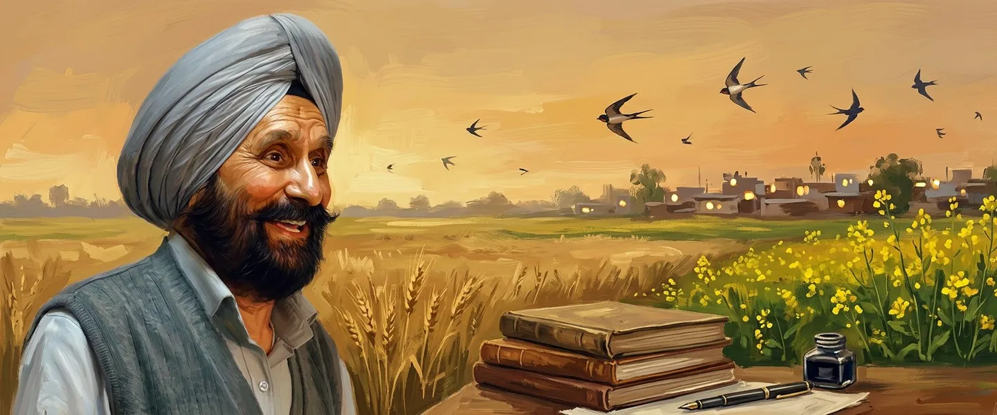
People from Tarn Taran

Nearby


Tarn Taran ਖ਼ਬਰਾਂ ਵਿੱਚ
ਸਾਰੀਆਂ ਖ਼ਬਰਾਂ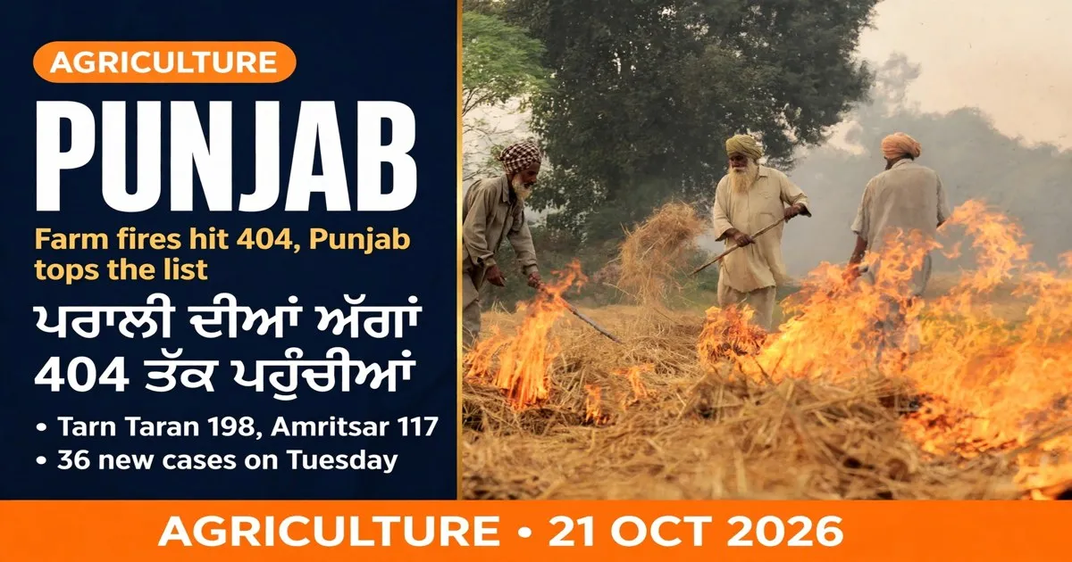 ਪੰਜਾਬ ਵਿੱਚ ਪਰਾਲੀ ਦੀਆਂ ਅੱਗਾਂ 404 ਤੱਕ ਪਹੁੰਚੀਆਂਪੰਜਾਬ ਵਿੱਚ ਪਰਾਲੀ ਦੀਆਂ ਅੱਗਾਂ 404 ਤੱਕ ਪਹੁੰਚੀਆਂ, ਤਰਨ ਤਾਰਨ ਸਭ ਤੋਂ ਅੱਗੇ
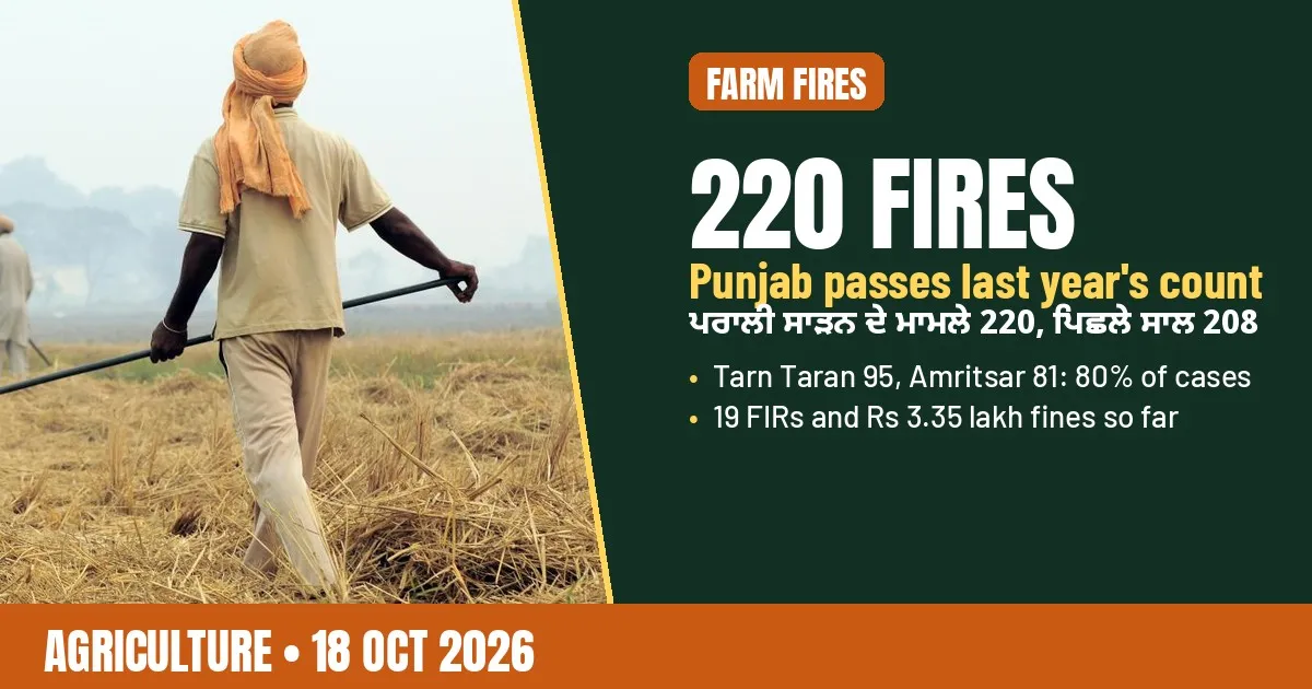 ਪੰਜਾਬ ਵਿੱਚ ਪਰਾਲੀ ਸਾੜਨ ਦੇ 220 ਮਾਮਲੇ, ਪਿਛਲੇ ਸਾਲ ਤੋਂ ਵੱਧ; ਤਰਨ ਤਾਰਨ-ਅੰਮ੍ਰਿਤਸਰ ਦਾ ਹਿੱਸਾ 80 ਫ਼ੀਸਦੀਪੰਜਾਬ ਵਿੱਚ ਪਰਾਲੀ ਸਾੜਨ ਦੇ 220 ਮਾਮਲੇ, ਪਿਛਲੇ ਸਾਲ ਤੋਂ ਵੱਧ; ਤਰਨ ਤਾਰਨ-ਅੰਮ੍ਰਿਤਸਰ ਦਾ ਹਿੱਸਾ 80 ਫ਼ੀਸਦੀ
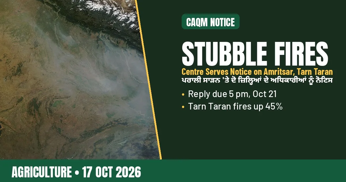 ਪਰਾਲੀ ਸਾੜਨ 'ਤੇ ਸੀਏਕਿਊਐੱਮ ਵੱਲੋਂ ਅੰਮ੍ਰਿਤਸਰ, ਤਰਨ ਤਾਰਨ ਦੇ ਅਧਿਕਾਰੀਆਂ ਨੂੰ ਨੋਟਿਸਪਰਾਲੀ ਸਾੜਨ 'ਤੇ ਸੀਏਕਿਊਐੱਮ ਵੱਲੋਂ ਅੰਮ੍ਰਿਤਸਰ, ਤਰਨ ਤਾਰਨ ਦੇ ਅਧਿਕਾਰੀਆਂ ਨੂੰ ਨੋਟਿਸ
All places in Tarn Taran district
483 places in 3 tehsils · 477 ਪਿੰਡ
Tehsils of Tarn Taran
- ਅਹਿਮਦਪੁਰਅਹਿਮਦਪੁਰ
- ਐਅਮਪੁਰਐਅਮਪੁਰ
- ਐਮਾ ਕਲਾਂਐਮਾ ਕਲਾਂ
- ਐਮਾ ਖੁਰਦਐਮਾ ਖੁਰਦ
- ਐਮਾ ਮਾਲੀਆਂਐਮਾ ਮਾਲੀਆਂ
- ਅਕਬਰਪੁਰਅਕਬਰਪੁਰ
- ਅਕਬਰਪੁਰਾਅਕਬਰਪੁਰਾ
- ਅਲਡਿਨਪੁਰਅਲਡਿਨਪੁਰ
- ਅਲਗੋਨਅਲਗੋਨ
- ਅਲਿਆਅਲਿਆ
- ਅਲੀਪੁਰਅਲੀਪੁਰ
- ਅੱਲਵਲਪੁਰਅੱਲਵਲਪੁਰ
- ਅੱਲੋਵਾਲਅੱਲੋਵਲ
- ਅਮਿਨ ਸ਼ਾਹਅਮਿਨ ਸ਼ਾਹ
- ਅਮਿਰਕੇਅਮਿਰਕੇ
- ਅਨਿਆਟਪੁਰਅਨਿਆਟਪੁਰ
- ਅਸਲਅਸਲ
- ਅਸਲ ਉੱਤਰਅਸਲ ਉੱਤਰ
- ਬਚਰਹੇਬਚਰਹੇ
- ਬਗਰਿਆਂਬਗਰਿਆਂ
- ਬਹਧਰ ਨਗਰਬਹਧਰ ਨਗਰ
- ਬਹਾਦਰਪੁਰਬਹਾਦਰਪੁਰ
- ਬਹਲਰਕੇਬਹਲਰਕੇ
- ਬਹਮਨੀਵਾਲਾਬਹਮਨੀਵਾਲਾ
- ਬਕੀਪੁਰਬਕੀਪੁਰ
- ਬਲਾ ਚੱਕਬਲਾ ਚੱਕ
- ਬਲੈਰਬਲੈਰ
- ਬੱਲਿਆਂਵਾਲਾਬੱਲਿਆਂਵਾਲਾ
- ਬਂਗਲਾ ਰਾਏਬਂਗਲਾ ਰਾਏ
- ਬਨੀਆਂਬਨਿਆਂ
- ਬਨਵਾਲੀਪੁਰਬਨਵਾਲੀਪੁਰ
- ਬਰਗਰੀਬਰਗਰੀ
- ਬਰਵਾਲਾਬਰਵਾਲਾ
- ਬਸਰਕੇਬਸਰਕੇ
- ਬਥਬਥ
- ਬਥਲ ਭੈਕੇਬਥਲ ਭੈਕੇ
- ਬਥਲ ਸੇਹਜਾ ਸਿੰਘਬਥਲ ਸੇਹਜਾ ਸਿੰਘ
- ਬਥੇ ਭੈਣੀਬਥੇ ਭੈਣੀ
- ਬੇਗਮਪੁਰਬੇਗਮਪੁਰ
- ਬੇਗੇਪੁਰਬੇਗੇਪੁਰ
- ਬੇਹਰਵਾਲਬੇਹਰਵਲ
- ਬੇਹਲਾਬੇਹਲਾ
- ਬੇਂਕਾਬੇਂਕਾ
- ਭਡਲਭਡਲ
- ਭਾਗੂਪੁਰਾਭਾਗੂਪੁਰਾ
- ਭਗਵਾਨਪੁਰਾਭਗਵਨਪੁਰਾ
- ਭੈਲ ਢਾਏਵਾਲਾਭੈਲ ਢਾਏਵਾਲਾ
- ਭੈਣੀ ਗੁਰਮੁਖ ਸਿੰਘਭੈਣੀ ਗੁਰਮੁਖ ਸਿੰਘ
- ਭੈਣੀ ਮੱਸਾ ਸਿੰਘਭੈਣੀ ਮੱਸਾ ਸਿੰਘ
- ਭੈਣੀ ਮੱਟੂਆਂਭੈਣੀ ਮੱਟੂਆਂ
- ਭੈਣੀ ਸਿੱਧਵਾਂਭੈਣੀ ਸਿੱਧਵਾਂ
- ਭਜੋਵਾਲੀਭਜੋਵਾਲੀ
- ਭਲੈਪੁਰ ਦੋਗਰਾਭਲੈਪੁਰ ਦੋਗਰਾ
- ਭਲੋਜਲਾਭਲੋਜਲਾ
- ਭਂਗਲਾਭਂਗਲਾ
- ਭਨਿਕੇਭਨਿਕੇ
- ਭਾਓਵਲਭਓਵਲ
- ਭਰੋਵਾਲਭਰੋਵਾਲ
- ਭਿੱਖੀਵਿੰਡਭਿੱਖੀਵਿੰਡ
- ਭੋਿਆਂਭੋਿਆਂ
- ਭੋਜਿਆਂਭੋਜਿਆਂ
- ਭੋਜੋਕੇਭੋਜੋਕੇ
- ਭੁਚਰ ਖੁਰਦਭੁਚਰ ਖੁਰਦ
- ਭੁੱਲਰਭੁੱਲਰ
- ਭੂਰਾ ਹਿਥਰਭੂਰਾ ਹਿਥਰ
- ਭੂਰਾ ਕਰੀਮਪੁਰਾਭੂਰਾ ਕਰੀਮਪੁਰਾ
- ਭੂਰਾ ਕੋਹਨਾਭੂਰਾ ਕੋਹਨਾ
- ਭੁਰੇਭੁਰੇ
- ਭੁੱਸੇਭੁੱਸੇ
- ਭੁਟ ਵਿੰਡਭੁਟ ਵਿੰਡ
- ਬਿਹਰੀਪੁਰਬਿਹਰੀਪੁਰ
- ਬਿਰ ਰਜਾ ਤੇਜਾ ਸਿੰਘਬਿਰ ਰਜਾ ਤੇਜਾ ਸਿੰਘ
- ਬੋਡੇਵਲਬੋਡੇਵਲ
- ਬੋਪਰੈਬੋਪਰੈ
- ਬਰਹਮਪੁਰਬਰਹਮਪੁਰ
- ਬੁਅਬੁਅ
- ਬੁਚਰ ਕਲਾਂਬੁਚਰ ਕਲਾਂ
- ਬੁਘਾਬੁਘਾ
- ਬੁਹਬੁਹ
- ਬੁਰ ਚੰਦਬੁਰ ਚੰਦ
- ਬੁਰਜਬੁਰਜ
- ਬੁਰਜ ਦੇਵਾ ਸਿੰਘਬੁਰਜ ਦੇਵਾ ਸਿੰਘ
- ਬੁਰਜ ਪੁਹਲਾਬੁਰਜ ਪੁਹਲਾ
- ਚਾਹਲਚਾਹਲ
- ਚੱਕ ਗਾਗਰੇਵਾਲਚੱਕ ਗਾਗਰੇਵਾਲ
- ਚੱਕ ਕਰੇ ਖਾਨਚੱਕ ਕਰੇ ਖਾਨ
- ਚੱਕ ਮੇਹਰਚੱਕ ਮੇਹਰ
- ਚੱਕ ਸਰਹਾਲੀਚੱਕ ਸਰਹਾਲੀ
- ਚੱਕ ਸਿਕਂਡੇਰਚੱਕ ਸਿਕਂਡੇਰ
- ਚੰਬਾ ਕਲਾਂਚੰਬਾ ਕਲਾਂ
- ਚੰਬਾ ਖੁਰਦਚੰਬਾ ਖੁਰਦ
- ਚਂਬਲਚਂਬਲ
- ਚਟਲਾਚਟਲਾ
- ਚੌਧਰੀਵਾਲਾਚੌਧਰੀਵਾਲਾ
- ਚੇੱਲਾਚੇੱਲਾ
- ਛੱਪਾਛੱਪਾ
- ਛਿਨਾ ਬਿਧੀ ਚੰਦਛਿਨਾ ਬਿਧੀ ਚੰਦ
- ਚਿਚਰੇਵਲਚਿਚਰੇਵਲ
- ਚੀਮਾ ਕਲਾਂਚੀਮਾ ਕਲਾਂ
- ਚੀਮਾ ਕਲਾਂ ਨੇਅਰ ਪੱਟੀਚੀਮਾ ਕਲਾਂ ਨੇਅਰ ਪੱਟੀ
- ਚੀਮਾ ਖੁਰਦਚੀਮਾ ਖੁਰਦ
- ਚੋਹਲਾ ਸਾਹਿਬਚੋਹਲਾ ਸਾਹਿਬ
- ਚੁਂਗਚੁਂਗ
- ਚੁਸਲੇਵਰਚੁਸਲੇਵਰ
- ਦਲਦਲ
- ਦਲੈਰੀਦਲੈਰੀ
- ਦਲਵਲਪੁਰਦਲਵਲਪੁਰ
- ਦਲੇਕੇਦਲੇਕੇ
- ਦਰਾਪੁਰਦਰਾਪੁਰ
- ਦਰਜ਼ਕੇਦਰਜ਼ਕੇ
- ਦੱਸੁਵਲਦੱਸੁਵਲ
- ਦੌਡਪੁਰਾਦੌਡਪੁਰਾ
- ਦੇਡੇਹਰ ਸਾਹਿਬਦੇਡੇਹਰ ਸਾਹਿਬ
- ਦੇਓਦੇਓ
- ਦੇਵਲਂਵਲਦੇਵਲਂਵਲ
- ਧਗਨਾਧਗਨਾ
- ਧਲਾਧਲਾ
- ਧਂਡਧਂਡ
- ਧਾਰੀਵਾਲਧਰਿਵਲ
- ਧੱਟਲਧੱਟਲ
ਸਰੋਤ (9)
- History, District Tarn Taran, Government of Punjab
- Tarn Taran District Population Census 2011, Census2011.co.in
- Tarn Taran Population, Census 2011 data, CensusOfIndia.net
- District Census Handbook Tarn Taran 2011, Part A, Census of India
- District Profile, Krishi Vigyan Kendra Booh, Tarn Taran
- Tarn Taran district, Wikipedia
- Harike Lake, Ramsar Sites Information Service, site 462
- Tarn Taran, SikhiWiki
- Guru Angad Dev, Sikh Missionary Society
ਜੁਗਤੀ ਮੁਫ਼ਤ ਅਤੇ ਸੁਤੰਤਰ ਹੈ। ਪਾਠਕਾਂ ਦਾ ਸਹਿਯੋਗ ਕੋਸ਼ ਨੂੰ ਵਧਾਉਂਦਾ ਹੈ।
ਸਹਿਯੋਗ