
Amritsar II Tehsil is a tehsil of Amritsar district in the Majha region of Punjab, India, headquartered in Amritsar city, home of the Golden Temple. It had 1,415,214 people at the Census of 2011, about 84 percent of them urban, in the city, its towns and 103 villages running west to the Attari Wagah border.
- ਪੰਜਾਬੀ ਨਾਂ
- ਅੰਮ੍ਰਿਤਸਰ II ਤਹਿਸੀਲ
- ਕਿਸਮ
- ਤਹਿਸੀਲ
- ਜ਼ਿਲ੍ਹਾ
- ਅੰਮ੍ਰਿਤਸਰ
- Headquarters
- Amritsar city, a Municipal Corporation and the district headquarters; the headquarters of both Amritsar I and Amritsar II are at Amritsar
- ਇਲਾਕਾ
- ਮਾਝਾ
- ਸੂਬਾ
- ਪੰਜਾਬ
All 24 facts
- ਦੇਸ਼
- ਭਾਰਤ
- ਆਬਾਦੀ
- 1,415,214 in 286,786 households (Census 2011, derived and verified: district 2,490,656 minus Amritsar I 312,240, Ajnala 442,711 and Baba Bakala 320,491 leaves exactly 1,415,214; the household count is derived the same way)
- Urban and rural
- Derived (Census 2011): urban 1,190,665 (84.13%) and rural 224,549 (15.87%); Amritsar city with outgrowths, 1,159,227 people, is about 82% of the tehsil
- ਰਕਬਾ
- About 562 sq km (derived, Census 2011 frame: district 2,683 sq km minus the other three tehsils)
- ਪਿੰਡ
- 103 villages (derived, Census 2011 frame: district 739 villages minus Amritsar I 140, Ajnala 343 and Baba Bakala 153)
- Towns
- 4 towns (derived, Census 2011 frame: district 15 towns minus the other three tehsils), headed by Amritsar Municipal Corporation, 1,132,383 people in 2011 (city with outgrowths 1,159,227; urban agglomeration 1,183,549)
- Sub tehsils and blocks
- District frame, not merged with the tehsil frame: the district lists 5 sub tehsils (Attari, Lopoke, Majitha, Ramdas, Tarsika) and 8 blocks (Ajnala, Chogawan, Harsha Chhina, Jandiala, Majitha, Rayya, Tarsika, Verka); Attari, in this tehsil, is one of the sub tehsils
- Density and sex ratio
- About 2,520 people per sq km on the derived area, and a derived sex ratio of 880 women per 1,000 men (Census 2011: 752,849 men and 662,365 women, derived)
- ਧਰਮ
- Derived (Census 2011, sums exactly to the tehsil total): Sikh 55.15% (780,436), Hindu 42.35% (599,399), Christian 1.19%, Muslim 0.50%; headquarters city on its own: Hindu 49.36%, Sikh 48.00%
- ਸਾਖਰਤਾ
- Derived effective literacy about 83% (Census 2011, worked out from the published district and tehsil literate counts; no directly published Amritsar II literacy table was found); headquarters city effective literacy 84.19%
- Scheduled Castes
- About 25.51%, about 361,048 people (derived, Census 2011); no Scheduled Tribe population recorded in the district
- Notable village
- Attari, also spelled Atari, 8,921 people in 1,670 households (Census 2011 village record for Amritsar II), about 3 km from the Wagah border and 25 km west of the city; a second smaller Attari record of 1,765 people also circulates in the listings
- ਨੇੜਲਾ ਸ਼ਹਿਰ
- 31.64 N, 74.86 E (headquarters city)
- Assembly and Lok Sabha
- Amritsar North, Amritsar West, Amritsar Central, Amritsar East, Amritsar South and Attari assembly constituencies (district list, 2017 electors), inside the Amritsar Lok Sabha constituency
- ਭਾਸ਼ਾ
- Punjabi in the Majhi dialect; district level at Census 2011: Punjabi 94.29% as first language, Hindi 4.80%; city level: Punjabi 91.12%, Hindi 7.90% (district and city figures, not a tehsil count)
- ਭਾਸ਼ਾ
- Lahore, Pakistan, about 47 km north west of the headquarters city across the border; Chandigarh about 217 km south east
- ਪ੍ਰਸਿੱਧੀ
- The Golden Temple (Sri Harmandir Sahib) and the Akal Takht, Jallianwala Bagh, the Attari Wagah border crossing, Gurdwara Chheharta Sahib, Amritsari food, and the city villages of the Bari Doab
- ਤਹਿਸੀਲ
- ਅੰਮ੍ਰਿਤਸਰ II
Where is Amritsar II Tehsil?
Amritsar II Tehsil is a tehsil of Amritsar district in the Majha region of Punjab, India, headquartered in Amritsar city, home of the Golden Temple. It is the largest tehsil of the district, counting 1,415,214 people at the Census of 2011, most of them in the city itself.
The tehsil covers the city of Amritsar and the country west and south of it, running to the international border with Pakistan. Amritsar district sits in the Bari Doab, the land between the Ravi river to the west and the Beas to the east, on a flat upland plain the district account puts at about 200 metres average elevation. Its sister tehsil Amritsar I covers a more rural belt of the district, while Ajnala tehsil lies to the north west and Baba Bakala tehsil to the east; Tarn Taran district lies to the south and Pakistan to the west. The headquarters of both Amritsar I and Amritsar II are at Amritsar city.
The old population figure on this page, 1,415,214 people in 2011, is verified, and it reconciles exactly: the district counted 2,490,656 people, and the other three census tehsils counted 312,240 in Amritsar I, 442,711 in Ajnala and 320,491 in Baba Bakala, which leaves exactly 1,415,214 for Amritsar II. The same subtraction gives its shape: 1,190,665 urban people, 84.13 percent, against 224,549 rural people, 15.87 percent, in 286,786 households. Amritsar city with its outgrowths, 1,159,227 people, is about 82 percent of the whole tehsil on its own. These split figures are derived from the published district and tehsil tables, and are labelled as derived wherever they are used.
From Guru Ram Das's town to the city tehsils
The city at the heart of the tehsil was founded in 1574 by Guru Ram Das Ji, the fourth Sikh Guru, around a pool that gave the place its name, Amritsar, the pool of nectar; the town was first called Guru Da Chakk and Ramdaspur. His son Guru Arjan Dev Ji built the Harmandir Sahib in the pool and installed the Sikh scripture there in 1604, and the town grew into a trading and pilgrimage city. In British times there was a single Amritsar Tahsil: the Imperial Gazetteer recorded it at 545 square miles with 488,383 people in 1901, the city as headquarters, the towns of Majitha and Jandiala Guru, and 373 villages.
Partition in 1947 put the new international border just west of the city and reshaped the tehsil: refugees from Lahore and western Punjab settled in Amritsar, and a claim recorded in the city article puts about 30 percent of the city population as descending from them. The historic single tahsil was later divided, and by the Census of 2011 the district had four tehsils, with the city and its western border belt in Amritsar II and a largely rural belt in Amritsar I. The district administration today lists four tehsils, five sub tehsils and eight blocks for the district as a whole, named in the facts box below.
The headquarters city and the tehsil towns
Amritsar city is a Municipal Corporation, the district headquarters and the second largest city of Punjab. Its census figures need care, because three totals circulate: the Municipal Corporation counted 1,132,383 people in 2011, the city with its outgrowths counted 1,159,227, and the wider urban agglomeration counted 1,183,549. The city covers 139 square kilometres at about 234 metres elevation, carries PIN 143001 and vehicle registration PB-02, and its people are called Amritsari. Its effective literacy in 2011 was 84.19 percent and its sex ratio 884. In the city, Hindus were 49.36 percent and Sikhs 48.00 percent in 2011.
By the same derived subtraction, the tehsil has 4 census towns alongside the city and 103 villages, against a district frame of 15 towns and 739 villages. West of the city on the Grand Trunk Road stands Chheharta Sahib, a suburban industrial town 7 kilometres out, named for the great well with six Persian wheels built under Guru Arjan Dev Ji, where Gurdwara Chheharta Sahib stands; its railway station is the first stop toward Attari and a busy goods terminal. The city wards themselves are counted inside Amritsar II, ward by ward in the census ward pages.
Villages, blocks and the people of the tehsil
The rural belt holds 224,549 people in 103 villages on the derived count, a farming ring around a great city. Village names recorded for Amritsar II include Kotla Dal Singh, Nangli, Basarke Bhaini, Khapar Kheri, Manawala, Loharka Kalan and Loharka Khurd, Chabba, Her and Mudhal, and the border village of Attari. Attari, also spelled Atari, counted 8,921 people in 1,670 households in 2011, with effective literacy of 69.95 percent and Scheduled Castes at 52.17 percent; a second, smaller Attari record of 1,765 people also circulates in the census listings, and this page uses the larger village record. Most villages are far smaller, and the Jugti directory below lists their pages.
The tehsil sex ratio, derived from the same tables, was 880 women per 1,000 men, with 752,849 men and 662,365 women. Children aged 0 to 6 numbered 151,083, or 10.68 percent. Scheduled Castes were about 361,048 people, about 25.51 percent on the derived count, with no Scheduled Tribe population recorded in the district. Faith, also derived and summing exactly to the tehsil total, was Sikh 780,436 people, 55.15 percent, Hindu 599,399, 42.35 percent, Christian 16,808, 1.19 percent, and Muslim 7,022, 0.50 percent: the city pulls the tehsil toward the city balance, while the villages stay strongly Sikh. Effective literacy for the tehsil works out at about 83 percent on the derived count, close to the city rate of 84.19 percent; no directly published tehsil literacy table was found. Punjabi is the tehsil language: at district level 94.29 percent spoke Punjabi as a first language in 2011 and 4.80 percent Hindi, and in the city itself 91.12 percent spoke Punjabi and 7.90 percent Hindi.
Shrines, landmarks and the border country
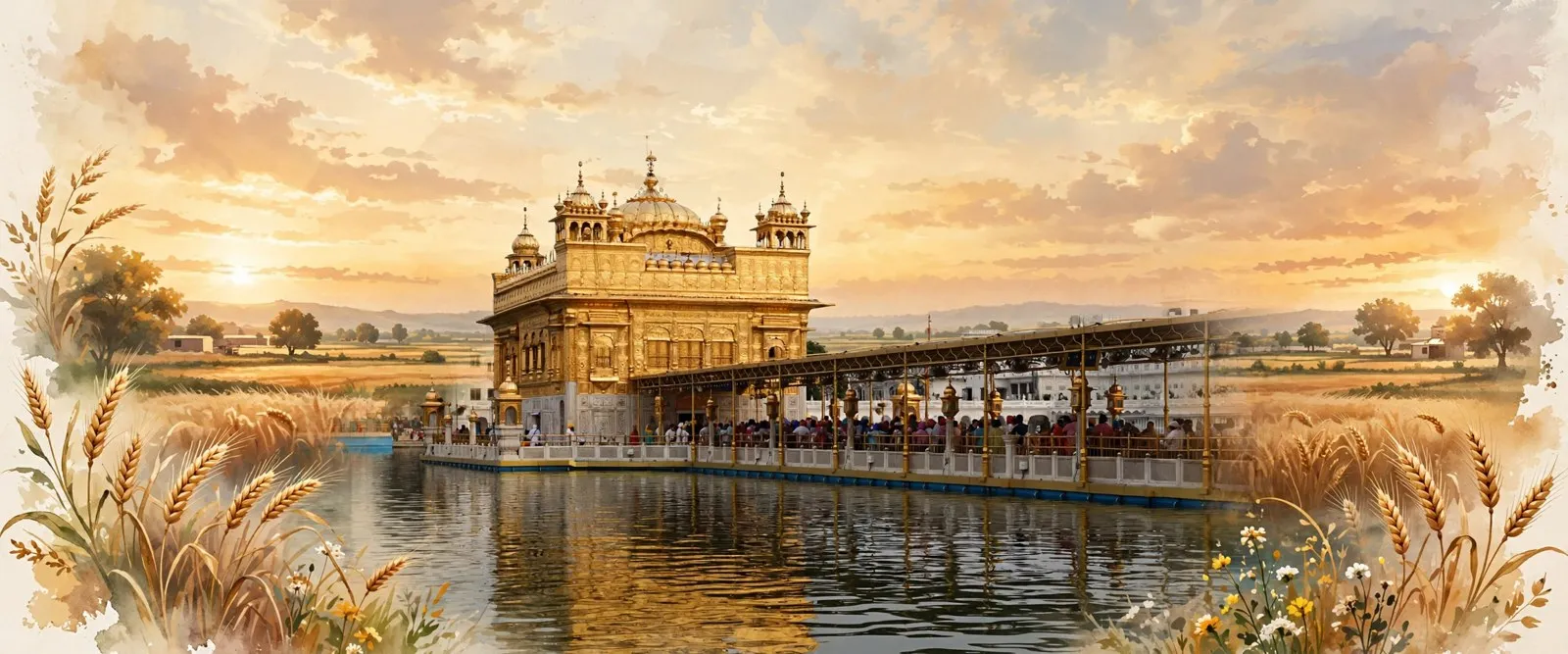
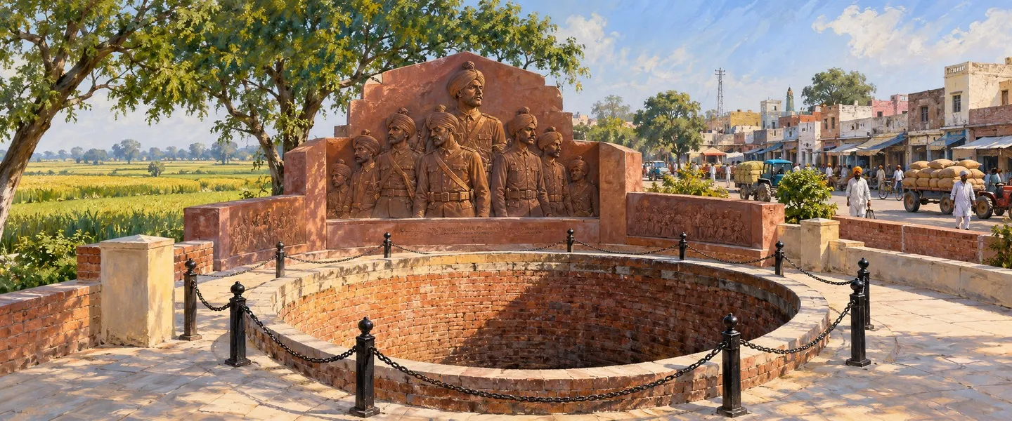
The tehsil holds the holiest ground in Sikhism. In the old city, the Golden Temple, Sri Harmandir Sahib, stands in the Amrit Sarovar, with the Akal Takht facing it; nearby are Jallianwala Bagh, where British troops fired on an unarmed gathering on 13 April 1919, Gobindgarh Fort, Ram Bagh and the Durgiana Mandir. The city draws nearly a hundred thousand visitors on an average day. On the western edge, Chheharta Sahib marks the Guru Arjan Dev Ji well tradition, and Valmiki Tirath at Ram Tirath, about 12 kilometres west of the city, is revered as the ashram of Rishi Valmiki; this page does not assign it to a tehsil beyond that western placement.
The western villages run to the border itself. Attari village stands about 3 kilometres from the border at Wagah and about 25 kilometres west of the city, the last Indian station on the rail route toward Lahore, and the Attari Wagah crossing is the famous road gate between India and Pakistan, known for its daily flag lowering ceremony. Attari is also one of the district five sub tehsils in the administration list. This page claims the border country for Amritsar II only where a source does so: the census village record places Attari village itself in Amritsar II tehsil, and the border checkpoint is described from the village, not the other way round.
Pilgrim economy, farms and getting there
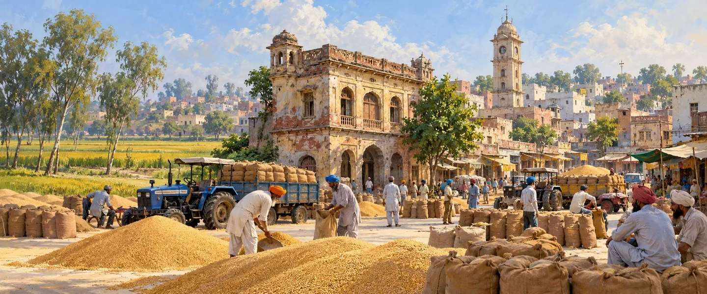
The tehsil lives from the city first: pilgrimage and tourism around the Golden Temple, trade, food and the famous Amritsari kitchen, textiles and wooden chessboard making. Around it, the villages farm the Bari Doab plain, irrigated in the old tahsil account by wells and the Bari Doab Canal, growing wheat, paddy and fodder; the district account names agriculture as the other mainstay beside tourism. Politically, the city gives the tehsil five assembly constituencies in the district list, Amritsar North, Amritsar West, Amritsar Central, Amritsar East and Amritsar South, plus the Attari seat for the border belt, all inside the Amritsar Lok Sabha constituency.
Getting there is the easiest in Punjab. The city stands on the Grand Trunk Road, 217 kilometres north west of Chandigarh and 455 kilometres north west of New Delhi, and 47 kilometres north east of Lahore. Amritsar Junction is a major railhead, with the line west through Chheharta to Attari station at the border. Sri Guru Ram Dass Jee International Airport at Rajasansi serves the city; the district account calls it the international airport of the state, and the weather station for the city sits at its civil aerodrome. Within the tehsil, the road west to Attari and the Wagah gate is the same Grand Trunk Road that has linked Amritsar and Lahore for centuries.
ਅੰਮ੍ਰਿਤਸਰ II ਤਹਿਸੀਲ ਕਿੱਥੇ ਹੈ?
ਅੰਮ੍ਰਿਤਸਰ II ਤਹਿਸੀਲ ਭਾਰਤ ਦੇ ਪੰਜਾਬ ਸੂਬੇ ਦੇ ਮਾਝਾ ਖੇਤਰ ਵਿੱਚ ਅੰਮ੍ਰਿਤਸਰ ਜ਼ਿਲ੍ਹੇ ਦੀ ਇੱਕ ਤਹਿਸੀਲ ਹੈ, ਜਿਸ ਦਾ ਸਦਰ ਮੁਕਾਮ ਅੰਮ੍ਰਿਤਸਰ ਸ਼ਹਿਰ ਹੈ, ਸ੍ਰੀ ਹਰਿਮੰਦਰ ਸਾਹਿਬ ਦਾ ਘਰ। ਇਹ ਜ਼ਿਲ੍ਹੇ ਦੀ ਸਭ ਤੋਂ ਵੱਡੀ ਤਹਿਸੀਲ ਹੈ, 2011 ਦੀ ਮਰਦਮਸ਼ੁਮਾਰੀ ਵਿੱਚ ਇਸ ਵਿੱਚ 1,415,214 ਲੋਕ ਸਨ, ਜਿਹਨਾਂ ਵਿੱਚੋਂ ਜ਼ਿਆਦਾਤਰ ਸ਼ਹਿਰ ਵਿੱਚ ਹੀ ਸਨ।
ਤਹਿਸੀਲ ਅੰਮ੍ਰਿਤਸਰ ਸ਼ਹਿਰ ਅਤੇ ਇਸ ਦੇ ਪੱਛਮ ਅਤੇ ਦੱਖਣ ਵੱਲ ਦੇ ਇਲਾਕੇ ਨੂੰ ਕਵਰ ਕਰਦੀ ਹੈ, ਪਾਕਿਸਤਾਨ ਨਾਲ ਲੱਗਦੀ ਅੰਤਰਰਾਸ਼ਟਰੀ ਸਰਹੱਦ ਤੱਕ। ਅੰਮ੍ਰਿਤਸਰ ਜ਼ਿਲ੍ਹਾ ਬਾਰੀ ਦੋਆਬ ਵਿੱਚ ਬੈਠਦਾ ਹੈ, ਪੱਛਮ ਵੱਲ ਰਾਵੀ ਦਰਿਆ ਅਤੇ ਪੂਰਬ ਵੱਲ ਬਿਆਸ ਦਰਿਆ ਵਿਚਕਾਰਲੀ ਧਰਤੀ, ਇੱਕ ਪੱਧਰੇ ਉੱਚੇ ਮੈਦਾਨ ਉੱਤੇ ਜਿਸ ਦੀ ਔਸਤ ਉਚਾਈ ਜ਼ਿਲ੍ਹਾ ਬਿਰਤਾਂਤ ਲਗਭਗ 200 ਮੀਟਰ ਦਿੰਦਾ ਹੈ। ਇਸ ਦੀ ਭੈਣ ਤਹਿਸੀਲ ਅੰਮ੍ਰਿਤਸਰ I ਜ਼ਿਲ੍ਹੇ ਦੇ ਵੱਧ ਪੇਂਡੂ ਹਿੱਸੇ ਨੂੰ ਕਵਰ ਕਰਦੀ ਹੈ, ਜਦਕਿ ਅਜਨਾਲਾ ਤਹਿਸੀਲ ਇਸ ਦੇ ਉੱਤਰ ਪੱਛਮ ਵੱਲ ਅਤੇ ਬਾਬਾ ਬਕਾਲਾ ਤਹਿਸੀਲ ਇਸ ਦੇ ਪੂਰਬ ਵੱਲ ਹੈ; ਤਰਨ ਤਾਰਨ ਜ਼ਿਲ੍ਹਾ ਦੱਖਣ ਵੱਲ ਅਤੇ ਪਾਕਿਸਤਾਨ ਪੱਛਮ ਵੱਲ ਪੈਂਦਾ ਹੈ। ਅੰਮ੍ਰਿਤਸਰ I ਅਤੇ ਅੰਮ੍ਰਿਤਸਰ II ਦੋਵਾਂ ਦੇ ਸਦਰ ਮੁਕਾਮ ਅੰਮ੍ਰਿਤਸਰ ਸ਼ਹਿਰ ਵਿਖੇ ਹਨ।
ਇਸ ਪੰਨੇ ਉੱਤੇ ਪਹਿਲਾਂ ਦਿੱਤਾ ਪੁਰਾਣਾ ਅੰਕੜਾ, 2011 ਵਿੱਚ 1,415,214 ਲੋਕ, ਤਸਦੀਕਸ਼ੁਦਾ ਹੈ, ਅਤੇ ਇਹ ਠੀਕ ਮਿਲਦਾ ਹੈ: ਜ਼ਿਲ੍ਹੇ ਨੇ 2,490,656 ਲੋਕ ਗਿਣੇ, ਅਤੇ ਬਾਕੀ ਤਿੰਨ ਮਰਦਮਸ਼ੁਮਾਰੀ ਤਹਿਸੀਲਾਂ ਨੇ ਅੰਮ੍ਰਿਤਸਰ I ਵਿੱਚ 312,240, ਅਜਨਾਲੇ ਵਿੱਚ 442,711 ਅਤੇ ਬਾਬਾ ਬਕਾਲੇ ਵਿੱਚ 320,491 ਗਿਣੇ, ਜਿਸ ਨਾਲ ਅੰਮ੍ਰਿਤਸਰ II ਲਈ ਠੀਕ 1,415,214 ਬਚਦੇ ਹਨ। ਉਹੀ ਘਟਾਓ ਇਸ ਦੀ ਸ਼ਕਲ ਦਿੰਦਾ ਹੈ: 1,190,665 ਸ਼ਹਿਰੀ ਲੋਕ, 84.13 ਫੀਸਦੀ, 224,549 ਪੇਂਡੂ ਲੋਕਾਂ ਦੇ ਮੁਕਾਬਲੇ, 15.87 ਫੀਸਦੀ, 286,786 ਘਰਾਂ ਵਿੱਚ। ਅੰਮ੍ਰਿਤਸਰ ਸ਼ਹਿਰ ਆਪਣੇ ਬਾਹਰੀ ਵਾਧਿਆਂ ਨਾਲ, 1,159,227 ਲੋਕ, ਇਕੱਲਾ ਸਾਰੀ ਤਹਿਸੀਲ ਦਾ ਲਗਭਗ 82 ਫੀਸਦੀ ਹੈ। ਇਹ ਵੰਡ ਵਾਲੇ ਅੰਕੜੇ ਛਪੀਆਂ ਜ਼ਿਲ੍ਹਾ ਅਤੇ ਤਹਿਸੀਲ ਸਾਰਣੀਆਂ ਤੋਂ ਕੱਢੇ ਗਏ ਹਨ, ਕਿਉਂਕਿ ਕੋਈ ਇੱਕ ਛਪੀ ਸਾਰਣੀ ਅੰਮ੍ਰਿਤਸਰ II ਦੀ ਕਤਾਰ ਇਕੱਲੀ ਨਹੀਂ ਦਿੰਦੀ; ਇਹ ਪੰਨਾ ਜਿੱਥੇ ਵੀ ਇਹ ਵਰਤੇ ਜਾਂਦੇ ਹਨ ਉਹਨਾਂ ਨੂੰ ਕੱਢੇ ਗਏ ਦੱਸ ਕੇ ਨਿਸ਼ਾਨ ਲਾਉਂਦਾ ਹੈ।
ਗੁਰੂ ਰਾਮ ਦਾਸ ਜੀ ਦੇ ਨਗਰ ਤੋਂ ਸ਼ਹਿਰੀ ਤਹਿਸੀਲਾਂ ਤੱਕ
ਤਹਿਸੀਲ ਦੇ ਦਿਲ ਵਾਲੇ ਸ਼ਹਿਰ ਦੀ ਨੀਂਹ 1574 ਵਿੱਚ ਚੌਥੇ ਸਿੱਖ ਗੁਰੂ, ਗੁਰੂ ਰਾਮ ਦਾਸ ਜੀ ਨੇ ਇੱਕ ਸਰੋਵਰ ਦੁਆਲੇ ਰੱਖੀ, ਜਿਸ ਨੇ ਥਾਂ ਨੂੰ ਇਸ ਦਾ ਨਾਂ ਦਿੱਤਾ, ਅੰਮ੍ਰਿਤਸਰ, ਅੰਮ੍ਰਿਤ ਦਾ ਸਰੋਵਰ; ਨਗਰ ਨੂੰ ਪਹਿਲਾਂ ਗੁਰੂ ਦਾ ਚੱਕ ਅਤੇ ਰਾਮਦਾਸਪੁਰ ਕਿਹਾ ਜਾਂਦਾ ਸੀ। ਉਹਨਾਂ ਦੇ ਪੁੱਤਰ ਗੁਰੂ ਅਰਜਨ ਦੇਵ ਜੀ ਨੇ ਸਰੋਵਰ ਵਿੱਚ ਸ੍ਰੀ ਹਰਿਮੰਦਰ ਸਾਹਿਬ ਬਣਾਇਆ ਅਤੇ 1604 ਵਿੱਚ ਉੱਥੇ ਸਿੱਖ ਗ੍ਰੰਥ ਦੀ ਸਥਾਪਨਾ ਕੀਤੀ, ਅਤੇ ਨਗਰ ਇੱਕ ਵਪਾਰਕ ਅਤੇ ਤੀਰਥ ਸ਼ਹਿਰ ਬਣ ਕੇ ਵਧਿਆ। ਅੰਗਰੇਜ਼ੀ ਸਮੇਂ ਵਿੱਚ ਇੱਕੋ ਅੰਮ੍ਰਿਤਸਰ ਤਹਿਸੀਲ ਸੀ: ਸ਼ਾਹੀ ਗਜ਼ਟੀਅਰ ਨੇ ਇਸ ਨੂੰ 545 ਵਰਗ ਮੀਲ ਵਿੱਚ 1901 ਵਿੱਚ 488,383 ਲੋਕਾਂ ਨਾਲ ਦਰਜ ਕੀਤਾ, ਸ਼ਹਿਰ ਨੂੰ ਸਦਰ ਮੁਕਾਮ, ਮਜੀਠਾ ਅਤੇ ਜੰਡਿਆਲਾ ਗੁਰੂ ਕਸਬਿਆਂ ਅਤੇ 373 ਪਿੰਡਾਂ ਨਾਲ।
1947 ਦੀ ਵੰਡ ਨੇ ਨਵੀਂ ਅੰਤਰਰਾਸ਼ਟਰੀ ਸਰਹੱਦ ਸ਼ਹਿਰ ਦੇ ਠੀਕ ਪੱਛਮ ਵੱਲ ਰੱਖ ਦਿੱਤੀ ਅਤੇ ਤਹਿਸੀਲ ਨੂੰ ਮੁੜ ਘੜਿਆ: ਲਾਹੌਰ ਅਤੇ ਪੱਛਮੀ ਪੰਜਾਬ ਤੋਂ ਸ਼ਰਨਾਰਥੀ ਅੰਮ੍ਰਿਤਸਰ ਵਿੱਚ ਆ ਵੱਸੇ, ਅਤੇ ਸ਼ਹਿਰ ਵਾਲਾ ਲੇਖ ਇੱਕ ਦਾਅਵਾ ਦਰਜ ਕਰਦਾ ਹੈ ਕਿ ਸ਼ਹਿਰ ਦੀ ਆਬਾਦੀ ਦਾ ਲਗਭਗ 30 ਫੀਸਦੀ ਵੰਡ ਸਮੇਂ ਦੇ ਸ਼ਰਨਾਰਥੀਆਂ ਤੋਂ ਉੱਤਰਿਆ ਹੈ, ਜਿਹਨਾਂ ਵਿੱਚੋਂ ਜ਼ਿਆਦਾਤਰ ਲਾਹੌਰ ਜ਼ਿਲ੍ਹੇ ਤੋਂ ਸਨ। ਇਤਿਹਾਸਕ ਇੱਕੋ ਤਹਿਸੀਲ ਬਾਅਦ ਵਿੱਚ ਵੰਡੀ ਗਈ, ਅਤੇ 2011 ਦੀ ਮਰਦਮਸ਼ੁਮਾਰੀ ਤੱਕ ਜ਼ਿਲ੍ਹੇ ਵਿੱਚ ਚਾਰ ਤਹਿਸੀਲਾਂ ਸਨ, ਸ਼ਹਿਰ ਅਤੇ ਇਸ ਦੀ ਪੱਛਮੀ ਸਰਹੱਦੀ ਪੱਟੀ ਅੰਮ੍ਰਿਤਸਰ II ਵਿੱਚ ਅਤੇ ਵੱਡੇ ਪੱਧਰ ਉੱਤੇ ਪੇਂਡੂ ਪੱਟੀ ਅੰਮ੍ਰਿਤਸਰ I ਵਿੱਚ। ਜ਼ਿਲ੍ਹਾ ਪ੍ਰਸ਼ਾਸਨ ਅੱਜ ਸਾਰੇ ਜ਼ਿਲ੍ਹੇ ਲਈ ਚਾਰ ਤਹਿਸੀਲਾਂ, ਪੰਜ ਉਪ ਤਹਿਸੀਲਾਂ, ਅਟਾਰੀ, ਲੋਪੋਕੇ, ਮਜੀਠਾ, ਰਾਮਦਾਸ ਅਤੇ ਤਰਸਿਕਾ, ਅਤੇ ਅੱਠ ਬਲਾਕ, ਅਜਨਾਲਾ, ਚੋਗਾਵਾਂ, ਹਰਸ਼ਾ ਛੀਨਾ, ਜੰਡਿਆਲਾ, ਮਜੀਠਾ, ਰਈਆ, ਤਰਸਿਕਾ ਅਤੇ ਵੇਰਕਾ, ਦਰਜ ਕਰਦਾ ਹੈ।
ਸਦਰ ਮੁਕਾਮ ਸ਼ਹਿਰ ਅਤੇ ਤਹਿਸੀਲ ਦੇ ਕਸਬੇ
ਅੰਮ੍ਰਿਤਸਰ ਸ਼ਹਿਰ ਇੱਕ ਨਗਰ ਨਿਗਮ ਹੈ, ਜ਼ਿਲ੍ਹਾ ਸਦਰ ਮੁਕਾਮ ਹੈ ਅਤੇ ਪੰਜਾਬ ਦਾ ਦੂਜਾ ਸਭ ਤੋਂ ਵੱਡਾ ਸ਼ਹਿਰ ਹੈ। ਇਸ ਦੇ ਮਰਦਮਸ਼ੁਮਾਰੀ ਅੰਕੜਿਆਂ ਵਿੱਚ ਸਾਵਧਾਨੀ ਚਾਹੀਦੀ ਹੈ, ਕਿਉਂਕਿ ਤਿੰਨ ਕੁੱਲ ਘੁੰਮਦੇ ਹਨ: ਨਗਰ ਨਿਗਮ ਨੇ 2011 ਵਿੱਚ 1,132,383 ਲੋਕ ਗਿਣੇ, ਸ਼ਹਿਰ ਨੇ ਆਪਣੇ ਬਾਹਰੀ ਵਾਧਿਆਂ ਨਾਲ 1,159,227 ਗਿਣੇ, ਅਤੇ ਵੱਡੇ ਸ਼ਹਿਰੀ ਸਮੂਹ ਨੇ 1,183,549 ਗਿਣੇ। ਸ਼ਹਿਰ 139 ਵਰਗ ਕਿਲੋਮੀਟਰ ਵਿੱਚ ਫੈਲਿਆ ਹੈ, ਲਗਭਗ 234 ਮੀਟਰ ਉਚਾਈ ਉੱਤੇ, ਇਸ ਦਾ ਪਿੰਨ 143001 ਅਤੇ ਵਾਹਨ ਰਜਿਸਟਰੇਸ਼ਨ PB-02 ਹੈ, ਅਤੇ ਇਸ ਦੇ ਲੋਕਾਂ ਨੂੰ ਅੰਮ੍ਰਿਤਸਰੀ ਕਿਹਾ ਜਾਂਦਾ ਹੈ। 2011 ਵਿੱਚ ਇਸ ਦੀ ਅਸਲ ਸਾਖਰਤਾ 84.19 ਫੀਸਦੀ ਅਤੇ ਲਿੰਗ ਅਨੁਪਾਤ 884 ਸੀ। ਸ਼ਹਿਰ ਵਿੱਚ 2011 ਵਿੱਚ ਹਿੰਦੂ 49.36 ਫੀਸਦੀ ਅਤੇ ਸਿੱਖ 48.00 ਫੀਸਦੀ ਸਨ, ਇੱਕ ਸੰਤੁਲਨ ਜੋ ਪੇਂਡੂ ਜ਼ਿਲ੍ਹੇ ਵਿੱਚ ਉਲਟ ਜਾਂਦਾ ਹੈ।
ਉਸੇ ਕੱਢੇ ਗਏ ਘਟਾਓ ਨਾਲ, ਤਹਿਸੀਲ ਵਿੱਚ ਸ਼ਹਿਰ ਨਾਲ 4 ਮਰਦਮਸ਼ੁਮਾਰੀ ਕਸਬੇ ਅਤੇ 103 ਪਿੰਡ ਹਨ, ਜ਼ਿਲ੍ਹੇ ਦੇ 15 ਕਸਬਿਆਂ ਅਤੇ 739 ਪਿੰਡਾਂ ਦੇ ਢਾਂਚੇ ਦੇ ਮੁਕਾਬਲੇ। ਸ਼ਹਿਰ ਦੇ ਪੱਛਮ ਵੱਲ ਗਰੈਂਡ ਟਰੰਕ ਰੋਡ ਉੱਤੇ ਛੇਹਰਟਾ ਸਾਹਿਬ ਖੜ੍ਹਾ ਹੈ, 7 ਕਿਲੋਮੀਟਰ ਬਾਹਰ ਇੱਕ ਉਪਨਗਰੀ ਉਦਯੋਗਿਕ ਕਸਬਾ, ਜਿਸ ਦਾ ਨਾਂ ਗੁਰੂ ਅਰਜਨ ਦੇਵ ਜੀ ਅਧੀਨ ਬਣੇ ਛੇ ਫ਼ਾਰਸੀ ਹਰਟਾਂ ਵਾਲੇ ਵੱਡੇ ਖੂਹ ਤੋਂ ਪਿਆ, ਜਿੱਥੇ ਗੁਰਦੁਆਰਾ ਛੇਹਰਟਾ ਸਾਹਿਬ ਖੜ੍ਹਾ ਹੈ; ਇਸ ਦਾ ਰੇਲਵੇ ਸਟੇਸ਼ਨ ਅਟਾਰੀ ਵੱਲ ਪਹਿਲਾ ਸਟਾਪ ਹੈ ਅਤੇ ਪਾਕਿਸਤਾਨ ਵਪਾਰ ਮਾਰਗ ਉੱਤੇ ਇੱਕ ਰੁੱਝਿਆ ਮਾਲ ਟਰਮੀਨਲ ਹੈ। ਸ਼ਹਿਰ ਦੇ ਵਾਰਡ ਆਪ ਵਿੱਚ ਅੰਮ੍ਰਿਤਸਰ II ਵਿੱਚ ਗਿਣੇ ਜਾਂਦੇ ਹਨ: ਨਗਰ ਨਿਗਮ ਲਈ ਵਾਰਡ ਪੰਨੇ ਵਾਰਡ ਦਰ ਵਾਰਡ ਵਾਰਡਾਂ ਨੂੰ ਅੰਮ੍ਰਿਤਸਰ II ਤਹਿਸੀਲ ਵਿੱਚ ਰੱਖਦੇ ਹਨ।
ਤਹਿਸੀਲ ਦੇ ਪਿੰਡ, ਬਲਾਕ ਅਤੇ ਲੋਕ
ਪੇਂਡੂ ਪੱਟੀ ਕੱਢੀ ਗਈ ਗਿਣਤੀ ਨਾਲ 103 ਪਿੰਡਾਂ ਵਿੱਚ 224,549 ਲੋਕ ਰੱਖਦੀ ਹੈ, ਇੱਕ ਵੱਡੇ ਸ਼ਹਿਰ ਦੁਆਲੇ ਖੇਤੀ ਵਾਲਾ ਘੇਰਾ। ਅੰਮ੍ਰਿਤਸਰ II ਲਈ ਦਰਜ ਪਿੰਡਾਂ ਦੇ ਨਾਂਵਾਂ ਵਿੱਚ ਕੋਟਲਾ ਦਾਲ ਸਿੰਘ, ਨੰਗਲੀ, ਬਸਰਕੇ ਭੈਣੀ, ਖਾਪੜ ਖੇੜੀ, ਮਾਨਾਵਾਲਾ, ਲੋਹੜਕਾ ਕਲਾਂ ਅਤੇ ਲੋਹੜਕਾ ਖੁਰਦ, ਛੱਬਾ, ਹੇਰ ਅਤੇ ਮੁਢਾਲ, ਅਤੇ ਸਰਹੱਦੀ ਪਿੰਡ ਅਟਾਰੀ ਸ਼ਾਮਲ ਹਨ। ਅਟਾਰੀ, ਜਿਸ ਨੂੰ ਅਟਾਰੀ ਵੀ ਲਿਖਿਆ ਜਾਂਦਾ ਹੈ, ਨੇ 2011 ਵਿੱਚ 1,670 ਘਰਾਂ ਵਿੱਚ 8,921 ਲੋਕ ਗਿਣੇ, 69.95 ਫੀਸਦੀ ਦੀ ਅਸਲ ਸਾਖਰਤਾ ਅਤੇ 52.17 ਫੀਸਦੀ ਅਨੁਸੂਚਿਤ ਜਾਤੀਆਂ ਨਾਲ; 1,765 ਲੋਕਾਂ ਦਾ ਇੱਕ ਦੂਜਾ, ਛੋਟਾ ਅਟਾਰੀ ਰਿਕਾਰਡ ਵੀ ਮਰਦਮਸ਼ੁਮਾਰੀ ਸੂਚੀਆਂ ਵਿੱਚ ਘੁੰਮਦਾ ਹੈ, ਅਤੇ ਇਹ ਪੰਨਾ ਵੱਡਾ ਪਿੰਡ ਰਿਕਾਰਡ ਵਰਤਦਾ ਹੈ, ਜੋ ਸਰਹੱਦੀ ਪਿੰਡ ਲਈ ਪਿੰਡ ਡਾਇਰੈਕਟਰੀ ਵਾਲਾ ਹੈ। ਜ਼ਿਆਦਾਤਰ ਪਿੰਡ ਇਸ ਤੋਂ ਕਿਤੇ ਛੋਟੇ ਹਨ, ਅਤੇ ਇਸ ਪੰਨੇ ਹੇਠਾਂ ਦਿੱਤੀ ਜੁਗਤੀ ਡਾਇਰੈਕਟਰੀ ਉਹਨਾਂ ਦੇ ਪੰਨੇ ਦਰਜ ਕਰਦੀ ਹੈ।
ਤਹਿਸੀਲ ਦਾ ਲਿੰਗ ਅਨੁਪਾਤ, ਉਹਨਾਂ ਹੀ ਸਾਰਣੀਆਂ ਤੋਂ ਕੱਢਿਆ ਗਿਆ, ਹਰ 1,000 ਮਰਦਾਂ ਪਿੱਛੇ 880 ਔਰਤਾਂ ਸੀ, 752,849 ਮਰਦਾਂ ਅਤੇ 662,365 ਔਰਤਾਂ ਨਾਲ। 0 ਤੋਂ 6 ਸਾਲ ਦੇ ਬੱਚੇ 151,083 ਸਨ, ਜਾਂ 10.68 ਫੀਸਦੀ। ਅਨੁਸੂਚਿਤ ਜਾਤੀਆਂ ਲਗਭਗ 361,048 ਲੋਕ ਸਨ, ਕੱਢੀ ਗਈ ਗਿਣਤੀ ਨਾਲ ਲਗਭਗ 25.51 ਫੀਸਦੀ, ਜ਼ਿਲ੍ਹੇ ਵਿੱਚ ਕੋਈ ਅਨੁਸੂਚਿਤ ਕਬੀਲਾ ਆਬਾਦੀ ਦਰਜ ਨਹੀਂ। ਧਰਮ, ਵੀ ਕੱਢਿਆ ਗਿਆ ਅਤੇ ਤਹਿਸੀਲ ਦੇ ਕੁੱਲ ਨਾਲ ਠੀਕ ਮਿਲਦਾ ਹੋਇਆ, ਸਿੱਖ 780,436 ਲੋਕ, 55.15 ਫੀਸਦੀ, ਹਿੰਦੂ 599,399, 42.35 ਫੀਸਦੀ, ਇਸਾਈ 16,808, 1.19 ਫੀਸਦੀ, ਅਤੇ ਮੁਸਲਮਾਨ 7,022, 0.50 ਫੀਸਦੀ ਸੀ: ਸ਼ਹਿਰ ਤਹਿਸੀਲ ਨੂੰ ਸ਼ਹਿਰੀ ਸੰਤੁਲਨ ਵੱਲ ਖਿੱਚਦਾ ਹੈ, ਜਦਕਿ ਪਿੰਡ ਤਗੜੇ ਸਿੱਖ ਰਹਿੰਦੇ ਹਨ। ਤਹਿਸੀਲ ਲਈ ਅਸਲ ਸਾਖਰਤਾ ਕੱਢੀ ਗਈ ਗਿਣਤੀ ਨਾਲ ਲਗਭਗ 83 ਫੀਸਦੀ ਬਣਦੀ ਹੈ, ਸ਼ਹਿਰ ਦੀ 84.19 ਫੀਸਦੀ ਦਰ ਦੇ ਨੇੜੇ; ਕੋਈ ਸਿੱਧੀ ਛਪੀ ਤਹਿਸੀਲ ਸਾਖਰਤਾ ਸਾਰਣੀ ਨਹੀਂ ਮਿਲੀ, ਇਸ ਲਈ ਅੰਕੜਾ ਕੱਢਿਆ ਗਿਆ ਅਤੇ ਲਗਭਗ ਦੱਸ ਕੇ ਦਿੱਤਾ ਗਿਆ ਹੈ। ਤਹਿਸੀਲ ਦੀ ਭਾਸ਼ਾ ਪੰਜਾਬੀ ਹੈ: ਜ਼ਿਲ੍ਹਾ ਪੱਧਰ ਉੱਤੇ 2011 ਵਿੱਚ 94.29 ਫੀਸਦੀ ਨੇ ਪੰਜਾਬੀ ਨੂੰ ਆਪਣੀ ਪਹਿਲੀ ਭਾਸ਼ਾ ਦੱਸਿਆ ਅਤੇ 4.80 ਫੀਸਦੀ ਨੇ ਹਿੰਦੀ, ਅਤੇ ਸ਼ਹਿਰ ਵਿੱਚ ਆਪ ਵਿੱਚ 91.12 ਫੀਸਦੀ ਨੇ ਪੰਜਾਬੀ ਅਤੇ 7.90 ਫੀਸਦੀ ਨੇ ਹਿੰਦੀ ਬੋਲੀ।
ਅਸਥਾਨ, ਨਿਸ਼ਾਨੀਆਂ ਅਤੇ ਸਰਹੱਦੀ ਇਲਾਕਾ
ਤਹਿਸੀਲ ਸਿੱਖ ਧਰਮ ਦੀ ਸਭ ਤੋਂ ਪਵਿੱਤਰ ਧਰਤੀ ਰੱਖਦੀ ਹੈ। ਪੁਰਾਣੇ ਸ਼ਹਿਰ ਵਿੱਚ, ਸ੍ਰੀ ਹਰਿਮੰਦਰ ਸਾਹਿਬ, ਸੁਨਹਿਰੀ ਮੰਦਰ, ਅੰਮ੍ਰਿਤ ਸਰੋਵਰ ਵਿੱਚ ਖੜ੍ਹਾ ਹੈ, ਇਸ ਦੇ ਸਾਹਮਣੇ ਅਕਾਲ ਤਖ਼ਤ ਨਾਲ; ਨੇੜੇ ਜਲ੍ਹਿਆਂਵਾਲਾ ਬਾਗ ਹੈ, ਜਿੱਥੇ 13 ਅਪ੍ਰੈਲ 1919 ਨੂੰ ਅੰਗਰੇਜ਼ ਫ਼ੌਜਾਂ ਨੇ ਇੱਕ ਨਿਹੱਥੇ ਇਕੱਠ ਉੱਤੇ ਗੋਲੀ ਚਲਾਈ, ਗੋਬਿੰਦਗੜ੍ਹ ਕਿਲ੍ਹਾ, ਰਾਮ ਬਾਗ ਅਤੇ ਦੁਰਗਿਆਣਾ ਮੰਦਰ ਹਨ। ਸ਼ਹਿਰ ਇੱਕ ਔਸਤ ਦਿਨ ਲਗਭਗ ਇੱਕ ਲੱਖ ਸੈਲਾਨੀਆਂ ਨੂੰ ਖਿੱਚਦਾ ਹੈ, ਅਤੇ ਜ਼ਿਲ੍ਹਾ ਬਿਰਤਾਂਤ ਸੈਰ ਸਪਾਟੇ ਨੂੰ ਸਥਾਨਕ ਲੋਕਾਂ ਲਈ ਆਮਦਨ ਦਾ ਵੱਡਾ ਸਰੋਤ ਕਹਿੰਦਾ ਹੈ। ਪੱਛਮੀ ਕਿਨਾਰੇ ਉੱਤੇ, ਛੇਹਰਟਾ ਸਾਹਿਬ ਗੁਰੂ ਅਰਜਨ ਦੇਵ ਜੀ ਖੂਹ ਪਰੰਪਰਾ ਨੂੰ ਦਰਸਾਉਂਦਾ ਹੈ, ਅਤੇ ਰਾਮ ਤੀਰਥ ਵਿਖੇ ਵਾਲਮੀਕਿ ਤੀਰਥ, ਸ਼ਹਿਰ ਤੋਂ ਲਗਭਗ 12 ਕਿਲੋਮੀਟਰ ਪੱਛਮ ਵੱਲ ਚੋਗਾਵਾਂ ਸੜਕ ਉੱਤੇ, ਰਿਸ਼ੀ ਵਾਲਮੀਕਿ ਦੇ ਆਸ਼ਰਮ ਵਜੋਂ ਪੂਜਿਆ ਜਾਂਦਾ ਹੈ; ਸ਼ਹਿਰ ਵਾਲਾ ਬਿਰਤਾਂਤ ਇਸ ਨੂੰ ਅੰਮ੍ਰਿਤਸਰ ਦੇ ਪੱਛਮ ਵੱਲ ਰੱਖਦਾ ਹੈ, ਅਤੇ ਇਹ ਪੰਨਾ ਇਸ ਨੂੰ ਉਸ ਤੋਂ ਅੱਗੇ ਕਿਸੇ ਤਹਿਸੀਲ ਵਿੱਚ ਨਹੀਂ ਰੱਖਦਾ।
ਪੱਛਮੀ ਪਿੰਡ ਸਰਹੱਦ ਤੱਕ ਜਾਂਦੇ ਹਨ। ਅਟਾਰੀ ਪਿੰਡ ਵਾਘਾ ਵਿਖੇ ਸਰਹੱਦ ਤੋਂ ਲਗਭਗ 3 ਕਿਲੋਮੀਟਰ ਅਤੇ ਸ਼ਹਿਰ ਤੋਂ ਲਗਭਗ 25 ਕਿਲੋਮੀਟਰ ਪੱਛਮ ਵੱਲ ਖੜ੍ਹਾ ਹੈ, ਲਾਹੌਰ ਵੱਲ ਰੇਲ ਮਾਰਗ ਉੱਤੇ ਆਖ਼ਰੀ ਭਾਰਤੀ ਸਟੇਸ਼ਨ, ਅਤੇ ਅਟਾਰੀ ਵਾਘਾ ਪਾਰ ਲਾਂਘਾ ਭਾਰਤ ਅਤੇ ਪਾਕਿਸਤਾਨ ਵਿਚਕਾਰ ਮਸ਼ਹੂਰ ਸੜਕ ਦਰਵਾਜ਼ਾ ਹੈ, ਆਪਣੀ ਰੋਜ਼ਾਨਾ ਝੰਡਾ ਉਤਾਰਨ ਰਸਮ ਲਈ ਜਾਣਿਆ ਜਾਂਦਾ। ਅਟਾਰੀ ਪ੍ਰਸ਼ਾਸਨ ਸੂਚੀ ਵਿੱਚ ਜ਼ਿਲ੍ਹੇ ਦੀਆਂ ਪੰਜ ਉਪ ਤਹਿਸੀਲਾਂ ਵਿੱਚੋਂ ਇੱਕ ਵੀ ਹੈ। ਇਹ ਪੰਨਾ ਸਰਹੱਦੀ ਇਲਾਕੇ ਦਾ ਦਾਅਵਾ ਅੰਮ੍ਰਿਤਸਰ II ਲਈ ਸਿਰਫ਼ ਉੱਥੇ ਕਰਦਾ ਹੈ ਜਿੱਥੇ ਕੋਈ ਸਰੋਤ ਕਰਦਾ ਹੈ: ਮਰਦਮਸ਼ੁਮਾਰੀ ਪਿੰਡ ਰਿਕਾਰਡ ਅਟਾਰੀ ਪਿੰਡ ਨੂੰ ਆਪ ਵਿੱਚ ਅੰਮ੍ਰਿਤਸਰ II ਤਹਿਸੀਲ ਵਿੱਚ ਰੱਖਦਾ ਹੈ, ਅਤੇ ਸਰਹੱਦੀ ਚੌਕੀ ਦਾ ਵਰਣਨ ਪਿੰਡ ਤੋਂ ਕੀਤਾ ਗਿਆ ਹੈ, ਉਲਟਾ ਨਹੀਂ।
ਤੀਰਥ ਆਰਥਿਕਤਾ, ਖੇਤ ਅਤੇ ਉੱਥੇ ਕਿਵੇਂ ਪਹੁੰਚੀਏ
ਤਹਿਸੀਲ ਪਹਿਲਾਂ ਸ਼ਹਿਰ ਤੋਂ ਜਿਉਂਦੀ ਹੈ: ਸ੍ਰੀ ਹਰਿਮੰਦਰ ਸਾਹਿਬ ਦੁਆਲੇ ਤੀਰਥ ਯਾਤਰਾ ਅਤੇ ਸੈਰ ਸਪਾਟਾ, ਵਪਾਰ, ਖਾਣਾ ਅਤੇ ਮਸ਼ਹੂਰ ਅੰਮ੍ਰਿਤਸਰੀ ਰਸੋਈ, ਕੱਪੜਾ ਅਤੇ ਲੱਕੜ ਦੇ ਸ਼ਤਰੰਜ ਬੋਰਡ ਅਤੇ ਮੋਹਰੇ ਬਣਾਉਣ ਦਾ ਕੰਮ ਜਿਸ ਲਈ ਸ਼ਹਿਰ ਜਾਣਿਆ ਜਾਂਦਾ ਹੈ। ਇਸ ਦੁਆਲੇ, ਪਿੰਡ ਬਾਰੀ ਦੋਆਬ ਮੈਦਾਨ ਵਿੱਚ ਖੇਤੀ ਕਰਦੇ ਹਨ, ਪੁਰਾਣੇ ਤਹਿਸੀਲ ਬਿਰਤਾਂਤ ਅਨੁਸਾਰ ਖੂਹਾਂ ਅਤੇ ਬਾਰੀ ਦੋਆਬ ਨਹਿਰ ਨਾਲ ਸਿੰਜਿਆ ਜਾਣ ਵਾਲਾ, ਪੰਜਾਬ ਦੀ ਕਣਕ, ਝੋਨੇ ਅਤੇ ਚਾਰੇ ਦੀ ਵਾਰੀ ਉਗਾਉਂਦੇ ਹੋਏ; ਜ਼ਿਲ੍ਹਾ ਬਿਰਤਾਂਤ ਸੈਰ ਸਪਾਟੇ ਦੇ ਨਾਲ ਖੇਤੀ ਨੂੰ ਜ਼ਿਲ੍ਹੇ ਦੀ ਆਰਥਿਕਤਾ ਦਾ ਦੂਜਾ ਥੰਮ੍ਹ ਕਹਿੰਦਾ ਹੈ। ਰਾਜਨੀਤੀ ਪੱਖੋਂ, ਸ਼ਹਿਰ ਤਹਿਸੀਲ ਨੂੰ ਜ਼ਿਲ੍ਹਾ ਸੂਚੀ ਵਿੱਚ ਪੰਜ ਵਿਧਾਨ ਸਭਾ ਹਲਕੇ ਦਿੰਦਾ ਹੈ, ਅੰਮ੍ਰਿਤਸਰ ਉੱਤਰੀ, ਅੰਮ੍ਰਿਤਸਰ ਪੱਛਮੀ, ਅੰਮ੍ਰਿਤਸਰ ਕੇਂਦਰੀ, ਅੰਮ੍ਰਿਤਸਰ ਪੂਰਬੀ ਅਤੇ ਅੰਮ੍ਰਿਤਸਰ ਦੱਖਣੀ, ਸਰਹੱਦੀ ਪੱਟੀ ਲਈ ਅਟਾਰੀ ਸੀਟ ਨਾਲ, ਸਾਰੇ ਅੰਮ੍ਰਿਤਸਰ ਲੋਕ ਸਭਾ ਹਲਕੇ ਅੰਦਰ।
ਉੱਥੇ ਪਹੁੰਚਣਾ ਪੰਜਾਬ ਵਿੱਚ ਸਭ ਤੋਂ ਸੌਖਾ ਹੈ। ਸ਼ਹਿਰ ਗਰੈਂਡ ਟਰੰਕ ਰੋਡ ਉੱਤੇ ਖੜ੍ਹਾ ਹੈ, ਚੰਡੀਗੜ੍ਹ ਤੋਂ 217 ਕਿਲੋਮੀਟਰ ਉੱਤਰ ਪੱਛਮ ਅਤੇ ਨਵੀਂ ਦਿੱਲੀ ਤੋਂ 455 ਕਿਲੋਮੀਟਰ ਉੱਤਰ ਪੱਛਮ, ਅਤੇ ਲਾਹੌਰ ਤੋਂ 47 ਕਿਲੋਮੀਟਰ ਉੱਤਰ ਪੂਰਬ। ਅੰਮ੍ਰਿਤਸਰ ਜੰਕਸ਼ਨ ਇੱਕ ਵੱਡਾ ਰੇਲ ਸਦਰ ਹੈ, ਪੱਛਮ ਵੱਲ ਲਾਈਨ ਛੇਹਰਟੇ ਰਾਹੀਂ ਸਰਹੱਦ ਉੱਤੇ ਅਟਾਰੀ ਸਟੇਸ਼ਨ ਤੱਕ ਜਾਂਦੀ ਹੈ। ਰਾਜਾਸਾਂਸੀ ਵਿਖੇ ਸ੍ਰੀ ਗੁਰੂ ਰਾਮ ਦਾਸ ਜੀ ਅੰਤਰਰਾਸ਼ਟਰੀ ਹਵਾਈ ਅੱਡਾ ਸ਼ਹਿਰ ਦੀ ਸੇਵਾ ਕਰਦਾ ਹੈ; ਜ਼ਿਲ੍ਹਾ ਬਿਰਤਾਂਤ ਇਸ ਨੂੰ ਸੂਬੇ ਦਾ ਅੰਤਰਰਾਸ਼ਟਰੀ ਹਵਾਈ ਅੱਡਾ ਕਹਿੰਦਾ ਹੈ, ਅਤੇ ਸ਼ਹਿਰ ਲਈ ਮੌਸਮ ਸਟੇਸ਼ਨ ਇਸ ਦੇ ਸਿਵਲ ਹਵਾਈ ਅੱਡੇ ਉੱਤੇ ਬੈਠਦਾ ਹੈ। ਤਹਿਸੀਲ ਅੰਦਰ, ਅਟਾਰੀ ਅਤੇ ਵਾਘਾ ਦਰਵਾਜ਼ੇ ਵੱਲ ਪੱਛਮੀ ਸੜਕ ਉਹੀ ਗਰੈਂਡ ਟਰੰਕ ਰੋਡ ਹੈ ਜੋ ਸਦੀਆਂ ਤੋਂ ਅੰਮ੍ਰਿਤਸਰ ਅਤੇ ਲਾਹੌਰ ਵਿਚਕਾਰ ਯਾਤਰੀਆਂ ਨੂੰ ਲੈ ਕੇ ਜਾਂਦੀ ਰਹੀ ਹੈ।
Landmarks

Nearby
Villages in Amritsar II tehsil (100)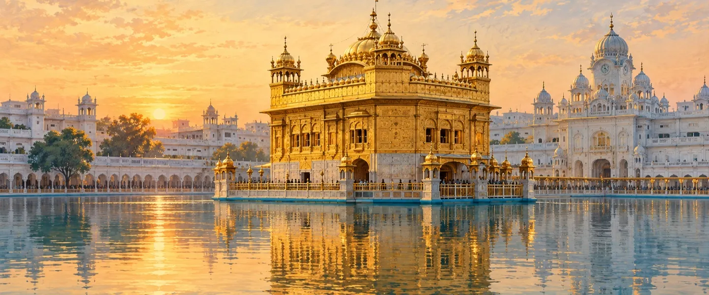
ਸਰੋਤ (13)
- Amritsar District Population, Census 2011, censusofindia.net (district total 2,490,656 verified, 1,318,408 men and 1,172,248 women, urban 1,334,611 plus rural 1,156,045, children 281,795, area 2,683 sq km, density 928, 15 towns, 739 villages, 488,898 households, religion table Sikh 1,716,935 and Hindu 690,939, SC 770,864, literacy 76.27%, language Punjabi 94.29% and Hindi 4.80% in the district account)
- Amritsar I Tehsil Population, Census 2011, censusofindia.net (tehsil total 312,240 verified, rural 254,532 plus urban 57,708, area 490.54 sq km, 140 villages, 3 towns, 58,952 households, religion Sikh 82.71% and Hindu 13.7%, SC 41.49%, literacy 72.66%, sex ratio 895; one of the three tehsils subtracted to derive the Amritsar II figures)
- Ajnala Tehsil Population, Census 2011, censusofindia.net (tehsil total 442,711, urban 47,219 plus rural 395,492, area 1,097.78 sq km, 343 villages, 4 towns, 81,132 households, religion and SC tables; subtracted to derive the Amritsar II figures)
- Baba Bakala Tehsil Population, Census 2011, censusindia2011.com (tehsil total 320,491, 62,028 households, area 533 sq km, 153 villages and 4 towns, urban table 39,019 plus rural table 281,472, religion Sikh 91.65%, SC 36.31%, literacy 66.79%; its summary line swaps the urban and rural shares against its own table, and the table values are used here; subtracted to derive the Amritsar II figures)
- Amritsar, Wikipedia (headquarters city: founded 1574 by Guru Ram Das, fourth Guru, coordinates 31.64 N 74.86 E, elevation 234 m, Municipal Corporation area 139 sq km, three city totals in print, municipality with outgrowths 1,159,227, corporation 1,132,383 in the census city table and urban agglomeration 1,183,549, city literacy and sex ratio, city religion Hindu 49.36% and Sikh 48.00%, city language Punjabi 91.12% and Hindi 7.90%, Jallianwala Bagh 13 April 1919, partition refugee claim, assembly seats Amritsar North, West, Central, East, South and Attari, distances to Chandigarh, New Delhi and Lahore, Valmiki Tirath 12 km west on Chogawan road)
- Amritsar City Population, Census 2011, census2011.co.in (city table: Municipal Corporation 1,132,383, city plus outgrowths 1,159,227, literates 855,415, effective literacy 84.19%, sex ratio 884, religion table Hindu 49.36% and Sikh 48.00%, metropolitan region 1,183,549 and its outgrowth list naming Amritsar II settlements such as Mudal, Nangli and Basarka Bhaini)
- Amritsar Tahsil, Wikipedia, from the Imperial Gazetteer of India (British era single tahsil: 545 square miles, population 488,383 in 1901 against 462,734 in 1891, city headquarters, towns Majitha 6,403 and Jandiala Guru 7,750, 373 villages, Beas boundary, Bari Doab Canal irrigation)
- The District of Amritsar, Total Punjab (district account: four tehsils Amritsar 1, Amritsar 2, Baba Bakala and Ajnala, five sub tehsils Attari, Lopoke, Majitha, Ramdas and Tarsika, eight blocks Ajnala, Chogawan, Harsha Chhina, Jandiala, Majitha, Rayya, Tarsika and Verka, eleven assembly constituencies, Bari Doab between Ravi and Beas, upland plain, Golden Temple drawing about 100,000 visitors a day, tourism and agriculture as the economy; its old district area and founder wording conflict with the census and city accounts and are not used)
- Villages in Amritsar, Punjab Data (four tehsils of the district and village names recorded under Amritsar 2, including Kotla Dal Singh, Nangli, Basarke Bhaini, Khapar Kheri, Manawala, Loharka Kalan and Loharka Khurd, Chabba, Her, Atari and Mudhal)
- Attari Village Population, Amritsar II, Census 2011, census2011.co.in (village placed in Amritsar II tehsil: 8,921 people in 1,670 households, children 1,140, sex ratio 855, effective literacy 69.95%, Scheduled Castes 4,654 or 52.17%, workers 3,003)
- Attari (392) Village Population, Amritsar II, censusindia2011.com (a second, smaller Attari record also placed in Amritsar II: 1,765 people in 283 households, literacy 52.01%, SC 26.06%; noted on the page as a conflicting record, not merged with the 8,921 village record)
- Chheharta Sahib, Wikipedia (suburban town 7 km west of Amritsar city on the Grand Trunk Road to the Pakistan border, name from the six Persian wheels of the Guru Arjan Dev Ji well, Gurdwara Chheharta Sahib, industrial township, Chheharta railway station the first stop toward Attari and a main goods terminal)
- Amritsar II tehsil directory, Jugti (places listed under the tehsil, counted October 2026)
ਜੁਗਤੀ ਮੁਫ਼ਤ ਅਤੇ ਸੁਤੰਤਰ ਹੈ। ਪਾਠਕਾਂ ਦਾ ਸਹਿਯੋਗ ਕੋਸ਼ ਨੂੰ ਵਧਾਉਂਦਾ ਹੈ।
ਸਹਿਯੋਗ