
Ludhiana East Tehsil is the eastern city tehsil of Ludhiana district in the Malwa region of Punjab, India, headquartered at Ludhiana, the largest city of Punjab. It had 1,934,225 people in 2011, most of them urban, across three towns including Sahnewal and Bhamian Kalan and 184 villages, 181 of them inhabited, on the Malwa plain south of the Sutlej.
- ਪੰਜਾਬੀ ਨਾਂ
- ਲੁਧਿਆਣਾ ਪੂਰਬੀ ਤਹਿਸੀਲ
- ਕਿਸਮ
- ਤਹਿਸੀਲ
- ਜ਼ਿਲ੍ਹਾ
- ਲੁਧਿਆਣਾ
- Headquarters
- Ludhiana city, the district headquarters; the census frame counts the tehsil as Ludhiana (East), sub district code 00227
- ਇਲਾਕਾ
- Malwa (central Punjab plain, south of the Sutlej)
- ਸੂਬਾ
- ਪੰਜਾਬ
All 25 facts
- ਦੇਸ਼
- ਭਾਰਤ
- ਆਬਾਦੀ
- 1,934,225 in 407,387 households (Census 2011), verified exactly: rural 279,688 (14.46%) in the villages plus urban 1,654,537 (85.54%) in the towns; men 1,043,012 and women 891,213. The old figure on this page is confirmed
- ਰਕਬਾ
- 634 sq km (Census 2011 tehsil frame in the census listing); village records alone cover 55,449.8 hectares (village directory)
- ਪਿੰਡ
- 184 village records in Census 2011, 181 inhabited, with 173 gram panchayats and 55,736 rural households (village directory); the handbook jurisdictional table shows the count falling from 185 villages in 2001 as one village became a census town. A district account summary says 181 villages, the inhabited count
- Towns
- 3 towns in the handbook frame (2 in 2001, 3 in 2011): Ludhiana (M Corp) 1,618,879, Sahnewal (NP) 22,484 and Bhamian Kalan (CT) 13,174, summing exactly to the urban total 1,654,537. The city account lists Ludhiana city under both East and West tehsils, and the Sahnewal town account prints 28,567 in its summary box against 22,484 in its demographics text and the City Population record (frames differ, not merged)
- Development blocks
- Villages of the tehsil sit in the Dehlon, Ludhiana-I, Ludhiana-II and Pakhowal CD blocks (Census 2011 village directory). District level: the handbook counts 12 blocks in the district, a current directory listing counts 14 blocks under partly different names (frames differ, not merged)
- Density and sex ratio
- 3,051 people per sq km (Census 2011); sex ratio 855 women per 1,000 men, urban 851 and rural 877; children aged 0 to 6 were 219,906 (11.37%), child sex ratio 863
- ਧਰਮ
- Tehsil level (Census 2011): Hindu 60.18% (1,164,055), Sikh 34.87% (674,520), Muslim 2.74%, Jain 0.88%, Christian 0.64%, Buddhist 0.09%
- ਸਾਖਰਤਾ
- 84.59% effective literacy aged 7 and above (men 87.99%, women 80.62%; urban about 85.7%, rural 78.04%, Census 2011 listing). Another listing prints town shares against the whole population instead, for example Bhamian Kalan 65.86% on that basis against 77.4% effective in a second listing (bases differ, not merged)
- Scheduled Castes
- 17.52% of the tehsil, 338,912 people (Census 2011); no Scheduled Tribe population recorded
- Largest village
- Jagirpur, 11,731 people in 2,396 households (Census 2011), named by the district handbook as the second largest village of Ludhiana district after Dhandra; largest by area is Qilla Raipur, 1,605 hectares with 6,205 people, home of the Kila Raipur Sports Festival
- Workers
- 706,474 workers, about 36.52% of the tehsil population (Census 2011 listing): 594,942 men and 111,532 women
- Headquarters city
- Ludhiana, most populous city of Punjab, 1,618,879 people in 2011, elevation 247 m, PIN 141001 to 141016, vehicle registration PB-10, known as the Manchester of India for hosiery and as Asia's largest hub for bicycle manufacturing
- ਸਥਿਤੀ
- 30.909 N, 75.852 E (headquarters city)
- Assembly seats
- District level: the tehsil city and towns sit among the district seats of Ludhiana East and Sahnewal, of the 14 assembly constituencies of Ludhiana district; Sahnewal sits in the Fatehgarh Sahib Lok Sabha constituency and the city seats in the Ludhiana Lok Sabha constituency
- ਭਾਸ਼ਾ
- Punjabi; district level at Census 2011: Punjabi 79.65% as first language in Ludhiana district and Hindi 18.19%; in the headquarters city Punjabi 67.00%, Hindi 29.24% and Bhojpuri 1.35% (district and city figures, not a tehsil count)
- Airport
- Ludhiana airport, also called Sahnewal airport (IATA LUH, ICAO VILD), beside Sahnewal town about 5 km south east of Ludhiana on the Grand Trunk Road, 130 acres, with Flybig scheduled flights to Hindon listed by the Airports Authority of India; Chandigarh airport about 90 km away
- ਪ੍ਰਸਿੱਧੀ
- The eastern and larger half of Ludhiana city and its hosiery and bicycle industries, Sahnewal town and Ludhiana airport, Bhamian Kalan census town, Jagirpur village and the Kila Raipur Sports Festival at Qilla Raipur village
- ਤਹਿਸੀਲ
- ਲੁਧਿਆਣਾ ਪੂਰਬੀ
Where is Ludhiana East Tehsil?
Ludhiana East Tehsil is the eastern city tehsil of Ludhiana district in the Malwa region of Punjab, India, headquartered at Ludhiana, the largest city of Punjab, holding the city corporation, Sahnewal town and Bhamian Kalan census town plus 181 inhabited villages, with 1,934,225 people counted in 2011.
The tehsil sits on the Malwa plain in the centre of Punjab. At district level the Sutlej river forms the northern boundary of Ludhiana district, separating it from Jalandhar district, with Rupnagar district to the east, Moga district to the west and Sangrur, Patiala and Barnala districts to the south. The district is an alluvial plain built by the Sutlej, divided between its flood plain and the upland plain, and the Buddha Nala runs parallel to the Sutlej before joining it in the north west of the district. Ludhiana city stands south of the Buddha Nala, on the old bank of the Sutlej.
The old population figure on this page, 1,934,225 people in 2011, is verified, and it reconciles exactly: 279,688 rural people plus 1,654,537 urban people equals 1,934,225, over 634 square kilometres at a density of 3,051 people per square kilometre. One caution runs through everything below: the sources do not all draw the same map or print the same figure for the same place, so this page keeps each frame under its own name and states the conflicts openly.
Seven tehsils in the handbook, and the East label today
The District Census Handbook for 2011 divides Ludhiana district into seven tehsils, all with sub divisional status: Samrala, Khanna, Payal, Ludhiana (East), Ludhiana (West), Raikot and Jagraon. It names Ludhiana (East) the most populous tahsil of the district, and its jurisdictional table shows this tehsil going from 185 villages in 2001 to 184 in 2011, and from two towns to three, as one village became a census town. The handbook gives the district area as 3,578 square kilometres; a district account prints 3,767 square kilometres, a different frame that this page does not merge into the census figures.
Below the tehsils sit the development blocks, and here too the frames must be kept apart. The village directory places the villages of this tehsil in four community development blocks, Dehlon, Ludhiana-I, Ludhiana-II and Pakhowal. The handbook counts twelve blocks in the district, a current directory listing counts fourteen under partly different names, and district accounts name seven sub tehsils, among them Dehlon, Koom Kalan and Sahnewal. None of these listings changes the census frame used for the figures on this page.
The headquarters city and the towns of the tehsil
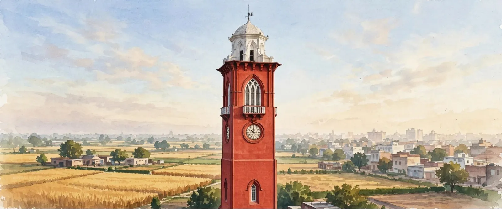
Ludhiana city, headquarters of both the tehsil and the district, is the most populous city of Punjab, with 1,618,879 people counted in 2011, at about 30.91 degrees north and 75.85 degrees east and 247 metres above sea level. The handbook tells how the town began under Sikander Lodhi: his general Nihang Khan settled at Mir Hota and called the place Lodhiana, the town of the Lodhis, and his grandson Jalal Khan built a fort on the bank of the Sutlej, which then flowed where the Buddha Nala now runs. The city account dates the founding to 1480, keeping the Lodhi Fort as its surviving monument.
The three towns of the census frame reconcile exactly with the urban total. Ludhiana corporation at 1,618,879 people, Sahnewal, a Nagar Panchayat town of 22,484 people, and Bhamian Kalan, a census town of 13,174 people, sum to 1,654,537, the urban population of the tehsil. Two cautions belong with that tidy sum. The city account lists Ludhiana city under both East and West tehsils, so the corporation figure is tallied whole here for 2011 while the living city spans both city tehsils. And the Sahnewal town account prints 28,567 in its summary box against 22,484 in its own demographics text and in the City Population record; this page uses 22,484, the figure that reconciles. Sahnewal, on the Grand Trunk Road, is the hometown of the Deol film family and the birthplace of Sunny Deol, and Ludhiana airport stands beside it.
One well known district town is deliberately not claimed for this tehsil. Doraha, a Municipal Council town of 25,424 people, appears in the handbook only as a district town and a district block name; no opened source places it inside Ludhiana East, so it is described at district level only. The same care is taken with Khanna and Samrala, neighbouring tehsil headquarters towns to the south east and east.
Villages, blocks and the people of the tehsil
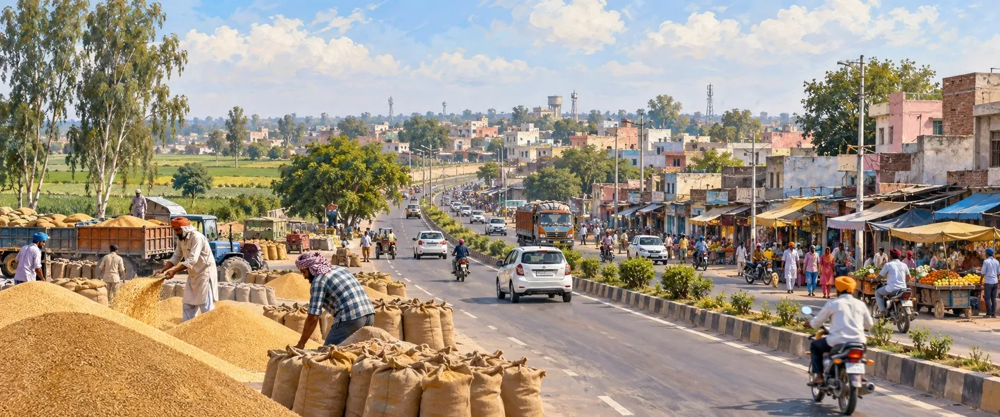
The village directory lists 184 village records for the tehsil, 181 of them inhabited, covering the 279,688 rural people in 55,736 households over 55,449.8 hectares, with 173 gram panchayats. The largest village is Jagirpur with 11,731 people in 2,396 households on 127 hectares beside the city; the handbook names Jagirpur the second largest village of the whole district, after Dhandra in the western tehsil. The largest village by area is Qilla Raipur at 1,605 hectares with 6,205 people. The directory reports a primary school, mobile coverage and domestic power in all 181 inhabited villages, and an all weather road in 155 of them.
In faith this is the city side of the district: Hindus were 60.18 percent in 2011, 1,164,055 people, followed by Sikhs at 34.87 percent, 674,520 people, Muslims at 2.74 percent, Jains at 0.88 percent, Christians at 0.64 percent and Buddhists at 0.09 percent. Scheduled Castes were 17.52 percent of the tehsil, 338,912 people, with no Scheduled Tribe population recorded. The sex ratio was 855 women per 1,000 men, 851 in the towns and 877 in the villages. Children aged 0 to 6 numbered 219,906, or 11.37 percent, with a child sex ratio of 863. Workers numbered 706,474, about 36.52 percent of the population, 594,942 of them men and 111,532 women.
A census listing gives tehsil literacy as 84.59 percent, men 87.99 percent and women 80.62 percent, urban about 85.7 percent and rural 78.04 percent, the effective rate counted against the population aged seven and above, and the basis matters. Town pages on another listing print lower shares counted against the whole population, Bhamian Kalan at 65.86 percent on that basis against 77.4 percent effective in a second listing, so the two bases must never be mixed. Punjabi is the tehsil language: at district level 79.65 percent spoke Punjabi as a first language in 2011 and 18.19 percent Hindi, while in the headquarters city the shares were 67.00 percent Punjabi, 29.24 percent Hindi and 1.35 percent Bhojpuri.
Hosiery, bicycles and the Kila Raipur games
The headquarters city carries an industry known around the world. The city account describes Ludhiana as a major industrial centre of northern India, called the Manchester of India by the BBC for its hosiery, and as Asia's largest hub for bicycle manufacturing, producing more than 50 percent of India's bicycle production each year, along with 60 percent of India's tractor parts and auto parts, mostly from small scale units. The World Bank ranked the city first in India for business environment in 2009 and 2013. That factory economy is the urban engine of this tehsil, and the same city holds Punjab Agricultural University, described in the city account as the largest agricultural university in Asia.
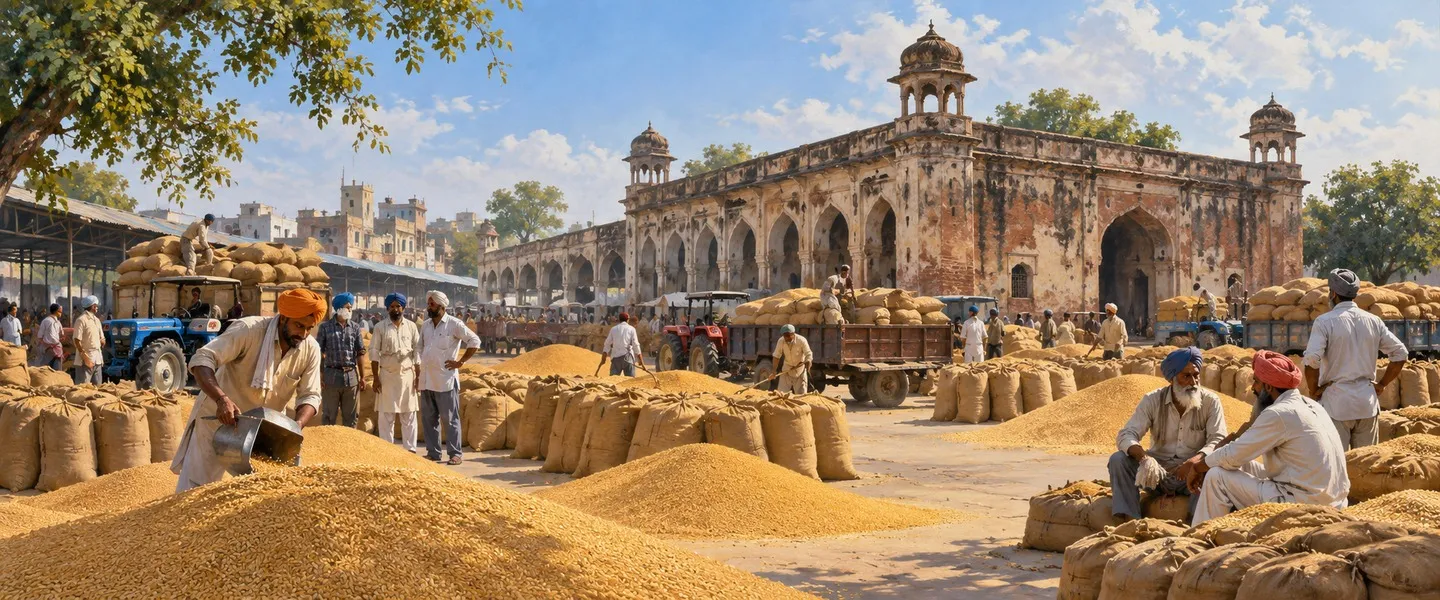
The rural half of the tehsil keeps its own famous name. At Qilla Raipur, the largest village of the tehsil by area, the Qila Raipur Sports Festival, the Rural Olympics, is held every year with gatka, bullock cart races and kabaddi, as the city account records. Around it, the villages are Malwa farmland on the upland plain, looking to Ludhiana and Sahnewal as their nearest towns. The assembly map follows the same mix at district level: the district fourteen seats include Ludhiana East and Sahnewal, which sits in the Fatehgarh Sahib Lok Sabha seat, alongside the city seats of Ludhiana Central, Ludhiana North, Ludhiana South, Atam Nagar and Gill.
Getting there
Ludhiana is one of the great junctions of Punjab. Ludhiana Junction railway station stands on the main Delhi to Amritsar route, with lines to Jalandhar, Ferozepur, Dhuri and Delhi, trains to most large cities of India, and a Chandigarh line opened in 2013; the city account also names Sahnewal, Dhandari Kalan and Kila Raipur among the district stations. By road the Grand Trunk Road runs through the city, and NH 44, NH 5 (the old NH 1 and NH 95) and state highway SH 11 connect it, with Punjab Roadways and private buses.
The tehsil air link stands beside its second town: Ludhiana airport, also called Sahnewal airport, IATA LUH and ICAO VILD, near Sahnewal about 5 kilometres south east of Ludhiana on the Grand Trunk Road. The Airports Authority of India gives it 130 acres, a terminal handling 70 incoming and 70 outgoing passengers, Flybig flights to Hindon at the time of its page, and Chandigarh airport about 90 kilometres away. Travellers should check current flights first, since services on its single route have started, paused and changed over the years.
ਲੁਧਿਆਣਾ ਪੂਰਬੀ ਤਹਿਸੀਲ ਕਿੱਥੇ ਹੈ?
ਲੁਧਿਆਣਾ ਪੂਰਬੀ ਤਹਿਸੀਲ ਭਾਰਤ ਦੇ ਪੰਜਾਬ ਸੂਬੇ ਦੇ ਮਾਲਵਾ ਖੇਤਰ ਵਿੱਚ ਲੁਧਿਆਣਾ ਜ਼ਿਲ੍ਹੇ ਦੀ ਪੂਰਬੀ ਸ਼ਹਿਰੀ ਤਹਿਸੀਲ ਹੈ, ਜਿਸ ਦਾ ਸਦਰ ਮੁਕਾਮ ਲੁਧਿਆਣਾ ਹੈ, ਪੰਜਾਬ ਦਾ ਸਭ ਤੋਂ ਵੱਡਾ ਸ਼ਹਿਰ, ਅਤੇ ਇਹ ਸ਼ਹਿਰ ਨਿਗਮ, ਸਾਹਨੇਵਾਲ ਕਸਬਾ ਅਤੇ ਭਾਮੀਆਂ ਕਲਾਂ ਮਰਦਮਸ਼ੁਮਾਰੀ ਕਸਬਾ ਸਮੇਤ 181 ਆਬਾਦ ਪਿੰਡ ਰੱਖਦੀ ਹੈ, 2011 ਵਿੱਚ ਗਿਣੇ ਗਏ 1,934,225 ਲੋਕਾਂ ਨਾਲ।
ਤਹਿਸੀਲ ਪੰਜਾਬ ਦੇ ਕੇਂਦਰ ਵਿੱਚ ਮਾਲਵੇ ਦੇ ਮੈਦਾਨ ਉੱਤੇ ਬੈਠਦੀ ਹੈ। ਜ਼ਿਲ੍ਹਾ ਪੱਧਰ ਉੱਤੇ ਸਤਲੁਜ ਦਰਿਆ ਲੁਧਿਆਣਾ ਜ਼ਿਲ੍ਹੇ ਦੀ ਉੱਤਰੀ ਸਰਹੱਦ ਬਣਾਉਂਦਾ ਹੈ, ਇਸ ਨੂੰ ਜਲੰਧਰ ਜ਼ਿਲ੍ਹੇ ਤੋਂ ਵੱਖ ਕਰਦਾ ਹੋਇਆ, ਪੂਰਬ ਵੱਲ ਰੂਪਨਗਰ ਜ਼ਿਲ੍ਹਾ, ਪੱਛਮ ਵੱਲ ਮੋਗਾ ਜ਼ਿਲ੍ਹਾ ਅਤੇ ਦੱਖਣ ਵੱਲ ਸੰਗਰੂਰ, ਪਟਿਆਲਾ ਅਤੇ ਬਰਨਾਲਾ ਜ਼ਿਲ੍ਹੇ। ਜ਼ਿਲ੍ਹਾ ਸਤਲੁਜ ਵੱਲੋਂ ਬਣਾਈ ਜਲੋੜ ਧਰਤੀ ਹੈ, ਇਸ ਦੇ ਹੜ੍ਹ ਵਾਲੇ ਮੈਦਾਨ ਅਤੇ ਉੱਚੀ ਧਰਤੀ ਵਾਲੇ ਮੈਦਾਨ ਵਿੱਚ ਵੰਡੀ ਹੋਈ, ਅਤੇ ਬੁੱਢਾ ਨਾਲਾ ਸਤਲੁਜ ਦੇ ਦੱਖਣੀ ਪਾਸੇ ਉਸ ਦੇ ਸਮਾਨਾਂਤਰ ਵਗਦਾ ਹੈ ਅਤੇ ਜ਼ਿਲ੍ਹੇ ਦੇ ਉੱਤਰ ਪੱਛਮ ਵਿੱਚ ਉਸ ਵਿੱਚ ਜਾ ਮਿਲਦਾ ਹੈ। ਲੁਧਿਆਣਾ ਸ਼ਹਿਰ ਬੁੱਢੇ ਨਾਲੇ ਦੇ ਦੱਖਣ ਵੱਲ ਖੜ੍ਹਾ ਹੈ, ਸਤਲੁਜ ਦੇ ਪੁਰਾਣੇ ਕੰਢੇ ਉੱਤੇ, ਜਿਸ ਦਾ ਮੌਜੂਦਾ ਵਹਾਅ ਹੁਣ ਹੋਰ ਉੱਤਰ ਵੱਲ ਹੈ।
ਇਸ ਪੰਨੇ ਉੱਤੇ ਪਹਿਲਾਂ ਦਿੱਤਾ ਪੁਰਾਣਾ ਅੰਕੜਾ, 2011 ਵਿੱਚ 1,934,225 ਲੋਕ, ਤਸਦੀਕਸ਼ੁਦਾ ਹੈ, ਅਤੇ ਇਹ ਠੀਕ ਮਿਲਦਾ ਹੈ, ਪਿੰਡਾਂ ਵਿੱਚ 279,688 ਪੇਂਡੂ ਲੋਕ ਅਤੇ ਕਸਬਿਆਂ ਵਿੱਚ 1,654,537 ਸ਼ਹਿਰੀ ਲੋਕ ਮਿਲ ਕੇ 1,934,225 ਬਣਦੇ ਹਨ, 634 ਵਰਗ ਕਿਲੋਮੀਟਰ ਉੱਤੇ 3,051 ਲੋਕ ਪ੍ਰਤੀ ਵਰਗ ਕਿਲੋਮੀਟਰ ਦੀ ਘਣਤਾ ਨਾਲ। ਇੱਕ ਸਾਵਧਾਨੀ ਹੇਠਾਂ ਹਰ ਥਾਂ ਲਾਗੂ ਹੈ, ਸਾਰੇ ਸਰੋਤ ਇੱਕੋ ਨਕਸ਼ਾ ਨਹੀਂ ਬਣਾਉਂਦੇ ਅਤੇ ਇੱਕੋ ਥਾਂ ਲਈ ਇੱਕੋ ਅੰਕੜਾ ਨਹੀਂ ਛਾਪਦੇ। ਇਹ ਪੰਨਾ ਹਰ ਢਾਂਚੇ ਨੂੰ ਉਸ ਦੇ ਆਪਣੇ ਨਾਂ ਅਤੇ ਤਾਰੀਖ਼ ਹੇਠ ਦੱਸਦਾ ਹੈ, ਅਤੇ ਮੱਤਭੇਦਾਂ ਨੂੰ ਖੁੱਲ੍ਹ ਕੇ ਦੱਸਦਾ ਹੈ।
ਹੈਂਡਬੁੱਕ ਵਿੱਚ ਸੱਤ ਤਹਿਸੀਲਾਂ, ਅਤੇ ਅੱਜ ਦਾ ਪੂਰਬੀ ਨਾਂ
2011 ਦੀ ਜ਼ਿਲ੍ਹਾ ਮਰਦਮਸ਼ੁਮਾਰੀ ਹੈਂਡਬੁੱਕ ਲੁਧਿਆਣਾ ਜ਼ਿਲ੍ਹੇ ਨੂੰ, ਆਮ ਅਤੇ ਮਾਲ ਪ੍ਰਸ਼ਾਸਨ ਲਈ, ਸੱਤ ਤਹਿਸੀਲਾਂ ਵਿੱਚ ਵੰਡਦੀ ਹੈ, ਸਾਰੀਆਂ ਉਪ ਮੰਡਲ ਦਰਜੇ ਵਾਲੀਆਂ, ਸਮਰਾਲਾ, ਖੰਨਾ, ਪਾਇਲ, ਲੁਧਿਆਣਾ (ਪੂਰਬੀ), ਲੁਧਿਆਣਾ (ਪੱਛਮੀ), ਰਾਏਕੋਟ ਅਤੇ ਜਗਰਾਉਂ। ਇਹ ਲੁਧਿਆਣਾ (ਪੂਰਬੀ) ਨੂੰ ਜ਼ਿਲ੍ਹੇ ਦੀ ਸਭ ਤੋਂ ਵੱਧ ਆਬਾਦੀ ਵਾਲੀ ਤਹਿਸੀਲ ਦੱਸਦੀ ਹੈ, ਅਤੇ ਇਸ ਦੀ ਅਧਿਕਾਰ ਖੇਤਰ ਵਾਲੀ ਸਾਰਣੀ ਇਸ ਤਹਿਸੀਲ ਨੂੰ 2001 ਵਿੱਚ 185 ਪਿੰਡਾਂ ਤੋਂ 2011 ਵਿੱਚ 184 ਪਿੰਡਾਂ ਉੱਤੇ, ਅਤੇ ਦੋ ਕਸਬਿਆਂ ਤੋਂ ਤਿੰਨ ਕਸਬਿਆਂ ਉੱਤੇ ਜਾਂਦੀ ਦਿਖਾਉਂਦੀ ਹੈ, ਕਿਉਂਕਿ ਇੱਕ ਪਿੰਡ ਨੂੰ ਮਰਦਮਸ਼ੁਮਾਰੀ ਕਸਬਾ ਮੰਨਿਆ ਗਿਆ। ਹੈਂਡਬੁੱਕ ਜ਼ਿਲ੍ਹੇ ਦਾ ਖੇਤਰ 3,578 ਵਰਗ ਕਿਲੋਮੀਟਰ ਦਿੰਦੀ ਹੈ, ਇੱਕ ਜ਼ਿਲ੍ਹਾ ਬਿਰਤਾਂਤ 3,767 ਵਰਗ ਕਿਲੋਮੀਟਰ ਛਾਪਦਾ ਹੈ, ਇੱਕ ਵੱਖਰਾ ਢਾਂਚਾ ਜਿਸ ਨੂੰ ਇਹ ਪੰਨਾ ਮਰਦਮਸ਼ੁਮਾਰੀ ਅੰਕੜਿਆਂ ਵਿੱਚ ਨਹੀਂ ਰਲਾਉਂਦਾ।
ਤਹਿਸੀਲਾਂ ਹੇਠਾਂ ਵਿਕਾਸ ਬਲਾਕ ਬੈਠਦੇ ਹਨ, ਅਤੇ ਇੱਥੇ ਵੀ ਢਾਂਚਿਆਂ ਨੂੰ ਵੱਖ ਰੱਖਣਾ ਪੈਂਦਾ ਹੈ। ਪਿੰਡ ਡਾਇਰੈਕਟਰੀ ਇਸ ਤਹਿਸੀਲ ਦੇ ਪਿੰਡਾਂ ਨੂੰ ਚਾਰ ਭਾਈਚਾਰਕ ਵਿਕਾਸ ਬਲਾਕਾਂ ਵਿੱਚ ਰੱਖਦੀ ਹੈ, ਡੇਹਲੋਂ, ਲੁਧਿਆਣਾ-I, ਲੁਧਿਆਣਾ-II ਅਤੇ ਪਖੋਵਾਲ। ਹੈਂਡਬੁੱਕ ਸਾਰੇ ਜ਼ਿਲ੍ਹੇ ਵਿੱਚ ਬਾਰਾਂ ਬਲਾਕ ਗਿਣਦੀ ਹੈ, ਜਦਕਿ ਇੱਕ ਮੌਜੂਦਾ ਸਰਕਾਰੀ ਡਾਇਰੈਕਟਰੀ ਸੂਚੀ ਕੁਝ ਵੱਖਰੇ ਨਾਵਾਂ ਹੇਠ ਚੌਦਾਂ ਬਲਾਕ ਗਿਣਦੀ ਹੈ, ਅਤੇ ਜ਼ਿਲ੍ਹਾ ਬਿਰਤਾਂਤ ਸੱਤ ਉਪ ਤਹਿਸੀਲਾਂ ਵੀ ਨਾਮਜ਼ਦ ਕਰਦੇ ਹਨ, ਜਿਹਨਾਂ ਵਿੱਚ ਡੇਹਲੋਂ, ਕੂਮ ਕਲਾਂ, ਮਾਛੀਵਾੜਾ ਅਤੇ ਸਾਹਨੇਵਾਲ ਸ਼ਾਮਲ ਹਨ। ਇਹਨਾਂ ਵਿੱਚੋਂ ਕੋਈ ਵੀ ਸੂਚੀ ਇਸ ਪੰਨੇ ਦੇ ਅੰਕੜਿਆਂ ਲਈ ਵਰਤੇ ਮਰਦਮਸ਼ੁਮਾਰੀ ਢਾਂਚੇ ਨੂੰ ਨਹੀਂ ਬਦਲਦੀ, ਉਪ ਜ਼ਿਲ੍ਹਾ ਕੋਡ 00227, 184 ਪਿੰਡ ਰਿਕਾਰਡ ਅਤੇ ਤਿੰਨ ਕਸਬੇ।
ਸਦਰ ਮੁਕਾਮ ਸ਼ਹਿਰ ਅਤੇ ਤਹਿਸੀਲ ਦੇ ਕਸਬੇ
ਲੁਧਿਆਣਾ ਸ਼ਹਿਰ, ਤਹਿਸੀਲ ਅਤੇ ਜ਼ਿਲ੍ਹੇ ਦੋਵਾਂ ਦਾ ਸਦਰ ਮੁਕਾਮ, ਪੰਜਾਬ ਦਾ ਸਭ ਤੋਂ ਵੱਧ ਆਬਾਦੀ ਵਾਲਾ ਸ਼ਹਿਰ ਹੈ, 2011 ਵਿੱਚ ਗਿਣੇ ਗਏ 1,618,879 ਲੋਕਾਂ ਨਾਲ, ਲਗਭਗ 30.91 ਡਿਗਰੀ ਉੱਤਰ ਅਤੇ 75.85 ਡਿਗਰੀ ਪੂਰਬ ਉੱਤੇ ਅਤੇ ਸਮੁੰਦਰ ਤਲ ਤੋਂ 247 ਮੀਟਰ ਉੱਚਾ। ਹੈਂਡਬੁੱਕ ਦੱਸਦੀ ਹੈ ਕਿ ਕਸਬਾ ਸਿਕੰਦਰ ਲੋਧੀ ਦੇ ਰਾਜ ਵਿੱਚ ਕਿਵੇਂ ਸ਼ੁਰੂ ਹੋਇਆ, ਉਸ ਦੇ ਸੈਨਾਪਤੀ ਯੂਸਫ਼ ਖ਼ਾਨ ਅਤੇ ਨਿਹੰਗ ਖ਼ਾਨ ਲੁੱਟਮਾਰ ਕਰਨ ਵਾਲੇ ਬਿਲੋਚੀਆਂ ਵਿਰੁੱਧ ਭੇਜੇ ਗਏ, ਨਿਹੰਗ ਖ਼ਾਨ ਮੀਰ ਹੋਟਾ ਵਿਖੇ ਵੱਸ ਗਿਆ ਅਤੇ ਥਾਂ ਨੂੰ ਲੋਧੀਆਣਾ ਕਿਹਾ, ਲੋਧੀਆਂ ਦਾ ਕਸਬਾ, ਅਤੇ ਉਸ ਦੇ ਪੋਤੇ ਜਲਾਲ ਖ਼ਾਨ ਨੇ ਸਤਲੁਜ ਦੇ ਕੰਢੇ ਉੱਤੇ ਕਿਲ੍ਹਾ ਬਣਾਇਆ, ਜੋ ਉਦੋਂ ਉੱਥੇ ਵਗਦਾ ਸੀ ਜਿੱਥੇ ਹੁਣ ਬੁੱਢਾ ਨਾਲਾ ਵਗਦਾ ਹੈ। ਸ਼ਹਿਰ ਵਾਲਾ ਬਿਰਤਾਂਤ ਨੀਂਹ ਨੂੰ 1480 ਵਿੱਚ ਰੱਖਦਾ ਹੈ ਅਤੇ ਲੋਧੀ ਕਿਲ੍ਹੇ ਨੂੰ ਉਸ ਸ਼ੁਰੂਆਤ ਦੀ ਬਚੀ ਨਿਸ਼ਾਨੀ ਮੰਨਦਾ ਹੈ।
ਮਰਦਮਸ਼ੁਮਾਰੀ ਢਾਂਚੇ ਦੇ ਤਿੰਨ ਕਸਬੇ ਸ਼ਹਿਰੀ ਕੁੱਲ ਨਾਲ ਠੀਕ ਮਿਲਦੇ ਹਨ। ਲੁਧਿਆਣਾ ਨਿਗਮ 1,618,879 ਲੋਕਾਂ ਨਾਲ, ਸਾਹਨੇਵਾਲ, 22,484 ਲੋਕਾਂ ਵਾਲਾ ਇੱਕ ਨਗਰ ਪੰਚਾਇਤ ਕਸਬਾ, ਅਤੇ ਭਾਮੀਆਂ ਕਲਾਂ, 13,174 ਲੋਕਾਂ ਵਾਲਾ ਇੱਕ ਮਰਦਮਸ਼ੁਮਾਰੀ ਕਸਬਾ, ਮਿਲ ਕੇ 1,654,537 ਬਣਦੇ ਹਨ, ਤਹਿਸੀਲ ਦੀ ਸ਼ਹਿਰੀ ਆਬਾਦੀ। ਉਸ ਸਾਫ਼ ਜੋੜ ਨਾਲ ਦੋ ਸਾਵਧਾਨੀਆਂ ਜੁੜੀਆਂ ਹਨ। ਸ਼ਹਿਰ ਵਾਲਾ ਬਿਰਤਾਂਤ ਲੁਧਿਆਣਾ ਸ਼ਹਿਰ ਨੂੰ ਲੁਧਿਆਣਾ ਪੂਰਬੀ ਅਤੇ ਲੁਧਿਆਣਾ ਪੱਛਮੀ ਦੋਵਾਂ ਤਹਿਸੀਲਾਂ ਹੇਠ ਦਰਜ ਕਰਦਾ ਹੈ, ਇਸ ਲਈ ਨਿਗਮ ਵਾਲਾ ਅੰਕੜਾ 2011 ਲਈ ਇਸ ਤਹਿਸੀਲ ਦੇ ਕਸਬਾ ਢਾਂਚੇ ਵਿੱਚ ਪੂਰਾ ਗਿਣਿਆ ਗਿਆ ਹੈ ਜਦਕਿ ਜੀਵੰਤ ਸ਼ਹਿਰ ਦੋਵਾਂ ਸ਼ਹਿਰੀ ਤਹਿਸੀਲਾਂ ਵਿੱਚ ਪ੍ਰਸ਼ਾਸਿਤ ਹੁੰਦਾ ਹੈ। ਅਤੇ ਸਾਹਨੇਵਾਲ ਕਸਬੇ ਵਾਲਾ ਬਿਰਤਾਂਤ ਆਪਣੇ ਸਾਰ ਬਕਸੇ ਵਿੱਚ 28,567 ਛਾਪਦਾ ਹੈ, ਆਪਣੇ ਹੀ ਜਨਸੰਖਿਆ ਪਾਠ ਅਤੇ ਸਿਟੀ ਪਾਪੂਲੇਸ਼ਨ ਕਸਬਾ ਰਿਕਾਰਡ ਵਿੱਚ ਦਿੱਤੇ 22,484 ਦੇ ਮੁਕਾਬਲੇ, ਇਹ ਪੰਨਾ 22,484 ਵਰਤਦਾ ਹੈ, ਉਹ ਅੰਕੜਾ ਜੋ ਜੋੜ ਨਾਲ ਮਿਲਦਾ ਹੈ। ਸਾਹਨੇਵਾਲ, ਸ਼ਹਿਰ ਦੇ ਦੱਖਣ ਪੂਰਬ ਵੱਲ ਗ੍ਰੈਂਡ ਟਰੰਕ ਰੋਡ ਉੱਤੇ, ਹਿੰਦੀ ਸਿਨੇਮਾ ਦੇ ਦਿਓਲ ਪਰਿਵਾਰ ਦਾ ਜੱਦੀ ਕਸਬਾ ਹੈ ਅਤੇ ਸੰਨੀ ਦਿਓਲ ਦਾ ਜਨਮ ਸਥਾਨ ਹੈ, ਅਤੇ ਲੁਧਿਆਣਾ ਹਵਾਈ ਅੱਡਾ ਇਸ ਦੇ ਕੋਲ ਖੜ੍ਹਾ ਹੈ।
ਜ਼ਿਲ੍ਹੇ ਦਾ ਇੱਕ ਜਾਣਿਆ ਪਛਾਣਿਆ ਕਸਬਾ ਜਾਣ ਬੁੱਝ ਕੇ ਇਸ ਤਹਿਸੀਲ ਲਈ ਦਾਅਵਾ ਨਹੀਂ ਕੀਤਾ ਗਿਆ। ਦੋਰਾਹਾ, 25,424 ਲੋਕਾਂ ਵਾਲਾ ਇੱਕ ਨਗਰ ਕੌਂਸਲ ਕਸਬਾ, ਹੈਂਡਬੁੱਕ ਵਿੱਚ ਸਿਰਫ਼ ਇੱਕ ਜ਼ਿਲ੍ਹਾ ਕਸਬੇ ਵਜੋਂ ਅਤੇ ਇੱਕ ਜ਼ਿਲ੍ਹਾ ਵਿਕਾਸ ਬਲਾਕ ਦੇ ਨਾਂ ਵਜੋਂ ਆਉਂਦਾ ਹੈ, ਕਿਸੇ ਖੋਲ੍ਹੇ ਗਏ ਸਰੋਤ ਨੇ ਕਸਬੇ ਨੂੰ ਲੁਧਿਆਣਾ ਪੂਰਬੀ ਅੰਦਰ ਨਹੀਂ ਰੱਖਿਆ, ਇਸ ਲਈ ਇਹ ਪੰਨਾ ਇਸ ਨੂੰ ਸਿਰਫ਼ ਜ਼ਿਲ੍ਹਾ ਪੱਧਰ ਉੱਤੇ ਦੱਸਦਾ ਹੈ। ਉਹੀ ਸਾਵਧਾਨੀ ਖੰਨਾ ਅਤੇ ਸਮਰਾਲਾ ਨਾਲ ਵਰਤੀ ਗਈ ਹੈ, ਦੱਖਣ ਪੂਰਬ ਅਤੇ ਪੂਰਬ ਵੱਲ ਗੁਆਂਢੀ ਤਹਿਸੀਲ ਸਦਰ ਮੁਕਾਮ ਕਸਬੇ।
ਤਹਿਸੀਲ ਦੇ ਪਿੰਡ, ਬਲਾਕ ਅਤੇ ਲੋਕ
ਤਹਿਸੀਲ ਲਈ ਪਿੰਡ ਡਾਇਰੈਕਟਰੀ, ਉਪ ਜ਼ਿਲ੍ਹਾ ਕੋਡ 00227, 184 ਪਿੰਡ ਰਿਕਾਰਡ ਦਰਜ ਕਰਦੀ ਹੈ, ਜਿਹਨਾਂ ਵਿੱਚੋਂ 181 ਆਬਾਦ ਹਨ, 55,736 ਘਰਾਂ ਵਿੱਚ 279,688 ਪੇਂਡੂ ਲੋਕਾਂ ਨੂੰ 55,449.8 ਹੈਕਟੇਅਰ ਉੱਤੇ ਕਵਰ ਕਰਦੀ ਹੋਈ, 173 ਗ੍ਰਾਮ ਪੰਚਾਇਤਾਂ ਨਾਲ। ਸਭ ਤੋਂ ਵੱਡਾ ਪਿੰਡ ਜਾਗੀਰਪੁਰ ਹੈ, ਸ਼ਹਿਰ ਦੇ ਕੋਲ ਸਿਰਫ਼ 127 ਹੈਕਟੇਅਰ ਉੱਤੇ 2,396 ਘਰਾਂ ਵਿੱਚ 11,731 ਲੋਕਾਂ ਨਾਲ, ਹੈਂਡਬੁੱਕ ਜਾਗੀਰਪੁਰ ਨੂੰ ਸਾਰੇ ਜ਼ਿਲ੍ਹੇ ਦਾ ਦੂਜਾ ਸਭ ਤੋਂ ਵੱਡਾ ਪਿੰਡ ਦੱਸਦੀ ਹੈ, ਪੱਛਮੀ ਤਹਿਸੀਲ ਵਿੱਚ ਢੰਡਰਾ ਤੋਂ ਬਾਅਦ। ਖੇਤਰ ਪੱਖੋਂ ਸਭ ਤੋਂ ਵੱਡਾ ਪਿੰਡ ਕਿਲ੍ਹਾ ਰਾਏਪੁਰ ਹੈ, 1,605 ਹੈਕਟੇਅਰ ਉੱਤੇ 6,205 ਲੋਕਾਂ ਨਾਲ। ਡਾਇਰੈਕਟਰੀ ਸਾਰੇ 181 ਆਬਾਦ ਪਿੰਡਾਂ ਵਿੱਚ ਪ੍ਰਾਇਮਰੀ ਸਕੂਲ, ਮੋਬਾਈਲ ਕਵਰੇਜ ਅਤੇ ਘਰੇਲੂ ਬਿਜਲੀ ਦੱਸਦੀ ਹੈ, ਅਤੇ ਇਹਨਾਂ ਵਿੱਚੋਂ 155 ਵਿੱਚ ਹਰ ਮੌਸਮ ਵਾਲੀ ਸੜਕ।
ਧਰਮ ਪੱਖੋਂ ਇਹ ਜ਼ਿਲ੍ਹੇ ਦਾ ਸ਼ਹਿਰੀ ਪੱਖ ਹੈ, ਇਸ ਦੇ ਪੇਂਡੂ ਇਲਾਕੇ ਦਾ ਉਲਟ, 2011 ਵਿੱਚ ਹਿੰਦੂ 60.18 ਫੀਸਦੀ ਸਨ, 1,164,055 ਲੋਕ, ਇਸ ਤੋਂ ਬਾਅਦ ਸਿੱਖ 34.87 ਫੀਸਦੀ, 674,520 ਲੋਕ, ਮੁਸਲਮਾਨ 2.74 ਫੀਸਦੀ, ਜੈਨ 0.88 ਫੀਸਦੀ, ਈਸਾਈ 0.64 ਫੀਸਦੀ ਅਤੇ ਬੋਧੀ 0.09 ਫੀਸਦੀ। ਅਨੁਸੂਚਿਤ ਜਾਤੀਆਂ ਤਹਿਸੀਲ ਦਾ 17.52 ਫੀਸਦੀ ਸਨ, 338,912 ਲੋਕ, ਕੋਈ ਅਨੁਸੂਚਿਤ ਕਬੀਲਾ ਆਬਾਦੀ ਦਰਜ ਨਹੀਂ। ਲਿੰਗ ਅਨੁਪਾਤ ਹਰ 1,000 ਮਰਦਾਂ ਪਿੱਛੇ 855 ਔਰਤਾਂ ਸੀ, ਕਸਬਿਆਂ ਵਿੱਚ 851 ਅਤੇ ਪਿੰਡਾਂ ਵਿੱਚ 877। 0 ਤੋਂ 6 ਸਾਲ ਦੇ ਬੱਚੇ 219,906 ਸਨ, ਜਾਂ 11.37 ਫੀਸਦੀ, 863 ਦੇ ਬਾਲ ਲਿੰਗ ਅਨੁਪਾਤ ਨਾਲ। ਮਜ਼ਦੂਰ 706,474 ਸਨ, ਆਬਾਦੀ ਦਾ ਲਗਭਗ 36.52 ਫੀਸਦੀ, ਜਿਹਨਾਂ ਵਿੱਚੋਂ 594,942 ਮਰਦ ਅਤੇ 111,532 ਔਰਤਾਂ ਸਨ।
ਤਹਿਸੀਲ ਲਈ ਸਾਖਰਤਾ ਦਾ ਇੱਕ ਅੰਕੜਾ ਪ੍ਰਕਾਸ਼ਿਤ ਹੈ ਅਤੇ ਇਸ ਦਾ ਆਧਾਰ ਮਾਇਨੇ ਰੱਖਦਾ ਹੈ। ਇੱਕ ਮਰਦਮਸ਼ੁਮਾਰੀ ਸੂਚੀ 84.59 ਫੀਸਦੀ ਦਿੰਦੀ ਹੈ, ਮਰਦ 87.99 ਫੀਸਦੀ ਅਤੇ ਔਰਤਾਂ 80.62 ਫੀਸਦੀ, ਸ਼ਹਿਰੀ ਲਗਭਗ 85.7 ਫੀਸਦੀ ਅਤੇ ਪੇਂਡੂ 78.04 ਫੀਸਦੀ ਨਾਲ, ਸੱਤ ਸਾਲ ਅਤੇ ਇਸ ਤੋਂ ਵੱਧ ਉਮਰ ਦੀ ਆਬਾਦੀ ਦੇ ਮੁਕਾਬਲੇ ਗਿਣੀ ਅਸਰਦਾਰ ਦਰ। ਇੱਕ ਹੋਰ ਸੂਚੀ ਦੇ ਕਸਬਾ ਪੰਨੇ ਸਾਰੀ ਆਬਾਦੀ ਦੇ ਮੁਕਾਬਲੇ ਗਿਣੇ ਘੱਟ ਹਿੱਸੇ ਛਾਪਦੇ ਹਨ, ਭਾਮੀਆਂ ਕਲਾਂ ਉਸ ਆਧਾਰ ਉੱਤੇ 65.86 ਫੀਸਦੀ, ਉਸੇ ਕਸਬੇ ਦੀ ਦੂਜੀ ਸੂਚੀ ਵਿੱਚ ਦਿੱਤੇ 77.4 ਫੀਸਦੀ ਅਸਰਦਾਰ ਦੇ ਮੁਕਾਬਲੇ, ਇਸ ਲਈ ਦੋਵਾਂ ਆਧਾਰਾਂ ਨੂੰ ਕਦੇ ਨਹੀਂ ਰਲਾਉਣਾ ਚਾਹੀਦਾ। ਤਹਿਸੀਲ ਦੀ ਭਾਸ਼ਾ ਪੰਜਾਬੀ ਹੈ, ਜ਼ਿਲ੍ਹਾ ਪੱਧਰ ਉੱਤੇ 2011 ਵਿੱਚ 79.65 ਫੀਸਦੀ ਲੋਕਾਂ ਨੇ ਪੰਜਾਬੀ ਨੂੰ ਆਪਣੀ ਪਹਿਲੀ ਭਾਸ਼ਾ ਦੱਸਿਆ ਅਤੇ 18.19 ਫੀਸਦੀ ਨੇ ਹਿੰਦੀ, ਜਦਕਿ ਸਦਰ ਮੁਕਾਮ ਸ਼ਹਿਰ ਵਿੱਚ ਹਿੱਸੇ 67.00 ਫੀਸਦੀ ਪੰਜਾਬੀ, 29.24 ਫੀਸਦੀ ਹਿੰਦੀ ਅਤੇ 1.35 ਫੀਸਦੀ ਭੋਜਪੁਰੀ ਸਨ, ਇੱਕ ਰਲੇਵਾਂ ਜੋ ਸਾਰੇ ਭਾਰਤ ਤੋਂ ਆਉਂਦੇ ਮਜ਼ਦੂਰਾਂ ਨਾਲ ਬਣਿਆ ਹੈ।
ਹੋਜ਼ਰੀ, ਸਾਈਕਲ ਅਤੇ ਕਿਲ੍ਹਾ ਰਾਏਪੁਰ ਖੇਡਾਂ
ਸਦਰ ਮੁਕਾਮ ਸ਼ਹਿਰ ਇੱਕ ਅਜਿਹਾ ਉਦਯੋਗ ਰੱਖਦਾ ਹੈ ਜੋ ਸਾਰੀ ਦੁਨੀਆਂ ਵਿੱਚ ਜਾਣਿਆ ਜਾਂਦਾ ਹੈ। ਸ਼ਹਿਰ ਵਾਲਾ ਬਿਰਤਾਂਤ ਲੁਧਿਆਣਾ ਨੂੰ ਉੱਤਰੀ ਭਾਰਤ ਦਾ ਵੱਡਾ ਉਦਯੋਗਿਕ ਕੇਂਦਰ ਦੱਸਦਾ ਹੈ, ਹੋਜ਼ਰੀ ਲਈ ਬੀ ਬੀ ਸੀ ਵੱਲੋਂ ਭਾਰਤ ਦਾ ਮਾਨਚੈਸਟਰ ਕਿਹਾ ਗਿਆ, ਅਤੇ ਸਾਈਕਲ ਨਿਰਮਾਣ ਲਈ ਏਸ਼ੀਆ ਦਾ ਸਭ ਤੋਂ ਵੱਡਾ ਕੇਂਦਰ, ਹਰ ਸਾਲ ਭਾਰਤ ਦੇ ਸਾਈਕਲ ਉਤਪਾਦਨ ਦਾ 50 ਫੀਸਦੀ ਤੋਂ ਵੱਧ ਪੈਦਾ ਕਰਦਾ ਹੋਇਆ, ਭਾਰਤ ਦੇ ਟਰੈਕਟਰ ਪੁਰਜ਼ਿਆਂ ਦੇ 60 ਫੀਸਦੀ, ਵਾਹਨ ਅਤੇ ਦੋਪਹੀਆ ਪੁਰਜ਼ਿਆਂ, ਸਿਲਾਈ ਮਸ਼ੀਨਾਂ ਅਤੇ ਹੱਥ ਔਜ਼ਾਰਾਂ ਸਮੇਤ, ਜ਼ਿਆਦਾਤਰ ਛੋਟੇ ਪੱਧਰ ਦੀਆਂ ਇਕਾਈਆਂ ਤੋਂ। ਵਿਸ਼ਵ ਬੈਂਕ ਨੇ 2009 ਅਤੇ 2013 ਵਿੱਚ ਸ਼ਹਿਰ ਨੂੰ ਕਾਰੋਬਾਰੀ ਮਾਹੌਲ ਲਈ ਭਾਰਤ ਵਿੱਚ ਪਹਿਲਾ ਦਰਜਾ ਦਿੱਤਾ। ਉਹ ਫ਼ੈਕਟਰੀ ਆਰਥਿਕਤਾ ਇਸ ਤਹਿਸੀਲ ਦਾ ਸ਼ਹਿਰੀ ਇੰਜਣ ਹੈ, ਅਤੇ ਉੱਪਰ ਗਿਣੇ ਪਿੰਡਾਂ ਤੋਂ ਵੀ ਮਜ਼ਦੂਰ ਖਿੱਚਦੀ ਹੈ ਅਤੇ ਸ਼ਹਿਰ ਦੇ ਵਾਰਡਾਂ ਤੋਂ ਵੀ, ਅਤੇ ਉਹੀ ਸ਼ਹਿਰ ਪੰਜਾਬ ਐਗਰੀਕਲਚਰਲ ਯੂਨੀਵਰਸਿਟੀ ਰੱਖਦਾ ਹੈ, ਜਿਸ ਨੂੰ ਸ਼ਹਿਰ ਵਾਲਾ ਬਿਰਤਾਂਤ ਏਸ਼ੀਆ ਦੀ ਸਭ ਤੋਂ ਵੱਡੀ ਖੇਤੀ ਯੂਨੀਵਰਸਿਟੀ ਦੱਸਦਾ ਹੈ।
ਤਹਿਸੀਲ ਦਾ ਪੇਂਡੂ ਅੱਧ ਆਪਣਾ ਮਸ਼ਹੂਰ ਨਾਂ ਰੱਖਦਾ ਹੈ। ਕਿਲ੍ਹਾ ਰਾਏਪੁਰ ਵਿਖੇ, ਖੇਤਰ ਪੱਖੋਂ ਤਹਿਸੀਲ ਦਾ ਸਭ ਤੋਂ ਵੱਡਾ ਪਿੰਡ, ਕਿਲਾ ਰਾਏਪੁਰ ਖੇਡ ਮੇਲਾ, ਜਿਸ ਨੂੰ ਪੇਂਡੂ ਓਲੰਪਿਕ ਕਿਹਾ ਜਾਂਦਾ ਹੈ, ਹਰ ਸਾਲ ਹੁੰਦਾ ਹੈ, ਗਤਕਾ, ਬਲਦ ਗੱਡੀਆਂ ਦੀਆਂ ਦੌੜਾਂ, ਟਰਾਲੀ ਦੌੜਾਂ ਅਤੇ ਕਬੱਡੀ ਨਾਲ, ਜਿਵੇਂ ਸ਼ਹਿਰ ਵਾਲਾ ਬਿਰਤਾਂਤ ਦਰਜ ਕਰਦਾ ਹੈ। ਇਸ ਦੇ ਆਲੇ ਦੁਆਲੇ, ਪਿੰਡ ਉੱਚੀ ਧਰਤੀ ਵਾਲੇ ਮੈਦਾਨ ਉੱਤੇ ਮਾਲਵੇ ਦੀ ਖੇਤੀ ਧਰਤੀ ਹਨ, ਪਿੰਡ ਡਾਇਰੈਕਟਰੀ ਵਿੱਚ ਲੁਧਿਆਣਾ, ਸਾਹਨੇਵਾਲ ਅਤੇ ਮੁੱਲਾਂਪੁਰ ਦਾਖਾ ਨੂੰ ਆਪਣੇ ਸਭ ਤੋਂ ਨੇੜਲੇ ਕਸਬੇ ਮੰਨਦੇ ਹੋਏ। ਵਿਧਾਨ ਸਭਾ ਨਕਸ਼ਾ ਜ਼ਿਲ੍ਹਾ ਪੱਧਰ ਉੱਤੇ ਉਹੀ ਰਲੇਵਾਂ ਦਿਖਾਉਂਦਾ ਹੈ, ਜ਼ਿਲ੍ਹੇ ਦੀਆਂ ਚੌਦਾਂ ਸੀਟਾਂ ਵਿੱਚ ਲੁਧਿਆਣਾ ਪੂਰਬੀ ਅਤੇ ਸਾਹਨੇਵਾਲ ਸ਼ਾਮਲ ਹਨ, ਸਾਹਨੇਵਾਲ ਫ਼ਤਹਿਗੜ੍ਹ ਸਾਹਿਬ ਲੋਕ ਸਭਾ ਸੀਟ ਵਿੱਚ ਬੈਠਦਾ ਹੋਇਆ, ਸ਼ਹਿਰ ਦੀਆਂ ਸੀਟਾਂ ਲੁਧਿਆਣਾ ਕੇਂਦਰੀ, ਲੁਧਿਆਣਾ ਉੱਤਰੀ, ਲੁਧਿਆਣਾ ਦੱਖਣੀ, ਆਤਮ ਨਗਰ ਅਤੇ ਗਿੱਲ ਸਮੇਤ।
ਉੱਥੇ ਕਿਵੇਂ ਪਹੁੰਚੀਏ
ਲੁਧਿਆਣਾ ਪੰਜਾਬ ਦੇ ਮਹਾਨ ਜੰਕਸ਼ਨਾਂ ਵਿੱਚੋਂ ਇੱਕ ਹੈ। ਲੁਧਿਆਣਾ ਜੰਕਸ਼ਨ ਰੇਲਵੇ ਸਟੇਸ਼ਨ ਮੁੱਖ ਦਿੱਲੀ ਤੋਂ ਅੰਮ੍ਰਿਤਸਰ ਰਸਤੇ ਉੱਤੇ ਖੜ੍ਹਾ ਹੈ, ਜਲੰਧਰ, ਫ਼ਿਰੋਜ਼ਪੁਰ, ਧੂਰੀ ਅਤੇ ਦਿੱਲੀ ਲਈ ਲਾਈਨਾਂ ਨਾਲ, ਭਾਰਤ ਦੇ ਜ਼ਿਆਦਾਤਰ ਵੱਡੇ ਸ਼ਹਿਰਾਂ ਲਈ ਗੱਡੀਆਂ ਨਾਲ, ਅਤੇ 2013 ਵਿੱਚ ਖੁੱਲ੍ਹੀ ਲੁਧਿਆਣਾ ਤੋਂ ਚੰਡੀਗੜ੍ਹ ਲਾਈਨ ਨਾਲ, ਸ਼ਹਿਰ ਵਾਲਾ ਬਿਰਤਾਂਤ ਸਾਹਨੇਵਾਲ, ਢੰਡਾਰੀ ਕਲਾਂ ਅਤੇ ਕਿਲਾ ਰਾਏਪੁਰ ਨੂੰ ਜ਼ਿਲ੍ਹਾ ਸਟੇਸ਼ਨਾਂ ਵਿੱਚ ਵੀ ਨਾਮਜ਼ਦ ਕਰਦਾ ਹੈ। ਸੜਕ ਰਾਹੀਂ ਇਤਿਹਾਸਕ ਗ੍ਰੈਂਡ ਟਰੰਕ ਰੋਡ ਸਦਰ ਮੁਕਾਮ ਸ਼ਹਿਰ ਵਿੱਚੋਂ ਲੰਘਦੀ ਹੈ, ਅਤੇ ਵੱਡੇ ਰਾਸ਼ਟਰੀ ਰਾਜਮਾਰਗ NH 44 ਅਤੇ NH 5, ਪੁਰਾਣੇ NH 1 ਅਤੇ NH 95, ਅਤੇ ਸੂਬਾ ਰਾਜਮਾਰਗ SH 11 ਸ਼ਹਿਰ ਨੂੰ ਜੋੜਦੇ ਹਨ, ਪੰਜਾਬ ਰੋਡਵੇਜ਼ ਅਤੇ ਨਿੱਜੀ ਬੱਸਾਂ ਸਾਰੇ ਪੰਜਾਬ ਵਿੱਚ ਅਤੇ ਇਸ ਤੋਂ ਅੱਗੇ ਚਲਦੀਆਂ ਹੋਈਆਂ।
ਤਹਿਸੀਲ ਦਾ ਹਵਾਈ ਲਿੰਕ ਇਸ ਦੇ ਦੂਜੇ ਕਸਬੇ ਕੋਲ ਖੜ੍ਹਾ ਹੈ, ਲੁਧਿਆਣਾ ਹਵਾਈ ਅੱਡਾ, ਜਿਸ ਨੂੰ ਸਾਹਨੇਵਾਲ ਹਵਾਈ ਅੱਡਾ ਵੀ ਕਿਹਾ ਜਾਂਦਾ ਹੈ, IATA LUH ਅਤੇ ICAO VILD, ਸਾਹਨੇਵਾਲ ਕੋਲ ਲੁਧਿਆਣਾ ਤੋਂ ਲਗਭਗ 5 ਕਿਲੋਮੀਟਰ ਦੱਖਣ ਪੂਰਬ ਵੱਲ ਗ੍ਰੈਂਡ ਟਰੰਕ ਰੋਡ ਉੱਤੇ। ਭਾਰਤੀ ਹਵਾਈ ਅੱਡਾ ਅਥਾਰਟੀ ਹਵਾਈ ਅੱਡੇ ਦਾ ਖੇਤਰ 130 ਏਕੜ ਦਿੰਦੀ ਹੈ, 70 ਆਉਂਦੇ ਅਤੇ 70 ਜਾਂਦੇ ਯਾਤਰੀਆਂ ਨੂੰ ਸੰਭਾਲਣ ਵਾਲਾ ਟਰਮੀਨਲ, ਆਪਣੇ ਪੰਨੇ ਦੇ ਸਮੇਂ ਫਲਾਈਬਿਗ ਨੂੰ ਹਿੰਡਨ ਲਈ ਨਿਯਤ ਉਡਾਣਾਂ ਚਲਾਉਂਦੀ ਏਅਰਲਾਈਨ ਵਜੋਂ, ਅਤੇ ਚੰਡੀਗੜ੍ਹ ਹਵਾਈ ਅੱਡੇ ਨੂੰ ਲਗਭਗ 90 ਕਿਲੋਮੀਟਰ ਦੂਰ। ਯਾਤਰੀਆਂ ਨੂੰ ਸਾਹਨੇਵਾਲ ਉੱਤੇ ਭਰੋਸਾ ਕਰਨ ਤੋਂ ਪਹਿਲਾਂ ਮੌਜੂਦਾ ਉਡਾਣਾਂ ਜਾਂਚ ਲੈਣੀਆਂ ਚਾਹੀਦੀਆਂ ਹਨ, ਕਿਉਂਕਿ ਇਸ ਦੇ ਛੋਟੇ ਟਰਮੀਨਲ ਅਤੇ ਇਕੱਲੇ ਰੂਟ ਨੇ ਸਾਲਾਂ ਵਿੱਚ ਸੇਵਾਵਾਂ ਸ਼ੁਰੂ ਹੁੰਦੀਆਂ, ਰੁਕਦੀਆਂ ਅਤੇ ਬਦਲਦੀਆਂ ਵੇਖੀਆਂ ਹਨ।
Nearby
Villages in Ludhiana East tehsil (181)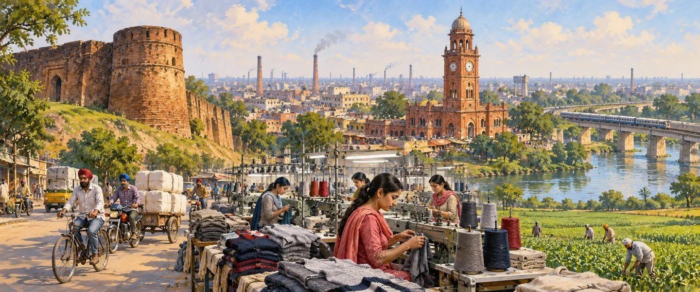
ਸਰੋਤ (11)
- Ludhiana (East) Tehsil Population, censusofindia.net, opened in full (tehsil total 1,934,225 verified: 1,043,012 men and 891,213 women, urban 1,654,537 at 85.54% and rural 279,688 at 14.46% reconciling exactly, households 407,387, area 634 sq km, density 3,051, 184 villages and 3 towns, sex ratio 855 with urban 851 and rural 877, children 219,906 at 11.37% with child sex ratio 863, SC 338,912 at 17.52% and ST 0, religion table Hindu 60.18% and Sikh 34.87%, effective literacy 84.59% with men 87.99% and women 80.62%, workers 706,474 at 36.52%)
- District Census Handbook Ludhiana, Census of India 2011, Part B, censusindia.gov.in, opened in full (district in Malwa in Patiala Division, seven tehsils Samrala, Khanna, Payal, Ludhiana (East), Ludhiana (West), Raikot and Jagraon all with sub divisional status, twelve CD blocks including Doraha, Machhiwara, Dehlon, Ludhiana-I, Ludhiana-II and Pakhowal, Ludhiana (East) the most populous tahsil of the district, jurisdictional change table: Ludhiana (East) villages 185 in 2001 to 184 in 2011 and towns 2 to 3 with one village treated as a census town, district area 3,578 sq km in the handbook statistics against 3,767 sq km in the district account, district highlights: Dhandra 14,972 the largest village of the district followed by Jagirpur 11,731, Ludhiana M Corp 1,618,879 in 2011, town founding under Sikander Lodhi by Yusaf Khan and Nihang Khan at Mir Hota with the Satluj then flowing where the Buddha Nala now runs)
- Ludhiana (East) Sub district Village List, vill.co.in, opened in full (184 village records, 181 inhabited, rural population 279,688 in 55,736 households over 55,449.8 hectares, 173 gram panchayats, villages in the Dehlon, Ludhiana-I, Ludhiana-II and Pakhowal CD blocks, largest village Jagirpur 11,731 in 2,396 households, largest by area Qilla Raipur 1,605 hectares with 6,205 people, primary school, mobile coverage and domestic power reported in all 181 inhabited villages and all weather road in 155)
- Ludhiana District Village Directory, vill.co.in, opened in full (district 907 village records across 7 sub districts, Ludhiana (East) code 00227 with 184 villages and the largest listed village population 279,688, district rural totals 1,429,031 people in 280,796 households)
- Bhamian Kalan (CT) Ward No 0001 Population, censusindia2011.com, opened in full (ward located in Bhamian Kalan city of Ludhiana (East) Tehsil, population 13,174 in 2,552 households, 7,092 men and 6,082 women, children 1,958, sex ratio 858, SC 25.28%; this listing prints literacy 65.86% counted against the whole population, against 77.4% effective in a second listing of the same town, the basis conflict stated on this page. Its Sahnewal town page on the same site prints the Bhamian Kalan figures under the Sahnewal name, so that page was not used for Sahnewal)
- Sahnewal town, City Population, citypopulation.de, opened in full (Sahnewal in Ludhiana East, Nagar Panchayat, population 17,293 in 2001 and 22,484 in 2011, 11,989 men and 10,495 women, SC 5,330; source Office of the Registrar General and Census Commissioner, towns and villages in the boundaries of 2011)
- Ludhiana district, Wikipedia, opened in full (district headquarters Ludhiana city, region Malwa, district total 3,498,739 in 2011, bounded on the north by the Satluj separating it from Jalandhar with Rupnagar east, Moga west and Sangrur, Patiala and Barnala south, alluvial plain of the Sutlej with flood plain and upland plain, Buddha Nala running parallel to the Sutlej and joining it at Gorsian Kadar Baksh with Ludhiana and Machhiwara south of it, seven tehsils and seven sub tehsils, tehsil religion table Ludhiana East Hindu 60.18% and Sikh 34.87%, district language Punjabi 79.65% and Hindi 18.19% in 2011, fourteen assembly constituencies including Ludhiana East and Sahnewal, Sahnewal in Fatehgarh Sahib Lok Sabha and the city seats in Ludhiana Lok Sabha; its administrative summary says Ludhiana East has 181 villages, the inhabited count against 184 records in the census frame)
- Ludhiana city, Wikipedia, opened in full (most populous city of Punjab, 1,618,879 people in 2011, coordinates 30.909 N and 75.852 E, elevation 247 m, PIN 141001 to 141016, founded 1480 under the Lodhi dynasty, infobox lists the city under both Ludhiana West and Ludhiana East tehsils, Manchester of India per the BBC, Asia's largest hub for bicycle manufacturing at over 50 percent of India's production and 60 percent of India's tractor parts, hosiery industry, World Bank best business environment ranking 2009 and 2013, Punjab Agricultural University the largest agricultural university in Asia, city language Punjabi 67.00%, Hindi 29.24% and Bhojpuri 1.35% in 2011, Ludhiana Junction on the Delhi to Amritsar route with lines to Jalandhar, Ferozepur, Dhuri and Delhi and the Chandigarh line opened 2013, NH 44 and NH 5 and SH 11, Sahnewal airport about 5 km south east of the city on the Grand Trunk Road, Qila Raipur Sports Festival at Kila Raipur)
- Sahnewal, Wikipedia, opened in full (town and municipal council in Ludhiana district, hometown of the Deol family and birthplace of Sunny Deol, Ludhiana Airport located near Sahnewal; demographics text gives 22,484 people in 2011, 11,989 men and 10,495 women, while its summary box prints 28,567, the conflict stated on this page)
- Ludhiana Airport, Airports Authority of India, aai.aero, opened in full (Ludhiana Airport, IATA LUH and ICAO VILD, a public airport serving Ludhiana, Flybig the only airline operating scheduled flights to and from Ludhiana to Hindon at the time of the page, airport spread over 130 acres, terminal of 1,150 square metres handling 70 incoming and 70 outgoing passengers, Chandigarh 90 km away)
- Ludhiana East tehsil directory, Jugti (places listed under the tehsil, counted October 2026)
ਜੁਗਤੀ ਮੁਫ਼ਤ ਅਤੇ ਸੁਤੰਤਰ ਹੈ। ਪਾਠਕਾਂ ਦਾ ਸਹਿਯੋਗ ਕੋਸ਼ ਨੂੰ ਵਧਾਉਂਦਾ ਹੈ।
ਸਹਿਯੋਗ