
Ludhiana West Tehsil is a tehsil of Ludhiana district in the Malwa region of Punjab, India, headquartered at Ludhiana city and covering its western and southern countryside, with Mullanpur Dakha and Gill towns. It had 362,602 people in 2011, mostly rural, across 127 villages and seven towns, while the city population itself was counted in Ludhiana East.
- ਪੰਜਾਬੀ ਨਾਂ
- ਲੁਧਿਆਣਾ ਪੱਛਮੀ ਤਹਿਸੀਲ
- ਕਿਸਮ
- ਤਹਿਸੀਲ
- ਜ਼ਿਲ੍ਹਾ
- ਲੁਧਿਆਣਾ
- ਮੁੱਖ ਦਫ਼ਤਰ
- Ludhiana city, the district headquarters, shared with Ludhiana East Tehsil; the census counted the whole city corporation population in the East, so this tehsil is the city western and southern countryside
- ਇਲਾਕਾ
- Malwa (Tihara sub region of Malwa at district level)
- ਰਾਜ
- ਪੰਜਾਬ
All 25 facts
- ਦੇਸ਼
- ਭਾਰਤ
- Census code
- Sub district code 00228 in Census 2011 (full code 0304100228 in the handbook household tables)
- ਆਬਾਦੀ
- 362,602 in 72,514 households (Census 2011), verified exactly: rural 272,489 (75.15%) in the villages plus urban 90,113 (24.85%) in the towns; men 191,203 and women 171,399. The old figure on this page is confirmed. One listing prose swaps the rural and urban shares against its own tables; the tables are followed here. The handbook household amenities tables count 71,387 households for the same tehsil (53,137 rural and 18,250 urban), a household series frame, not merged with the 72,514 above
- ਰਕਬਾ
- 543 sq km in the Census 2011 tehsil frame, density 668 per sq km; a geospatial reckoning gives 556.5 sq km and density 651.6 per sq km (frames differ, not merged). Village land alone is 58,297.16 hectares
- ਪਿੰਡ
- 127 village records in Census 2011, 125 inhabited, with 116 gram panchayats (village directory); the handbook jurisdictional table shows the count falling from 133 villages in 2001 as six villages were treated as census towns
- Towns
- 7 towns summing exactly to the urban 90,113: Gill (CT) 28,884, Mullanpur Dakha (NP) 16,356, Tharike (CT) 12,294, Bhattian (CT) 11,066, Partap Singhwala (CT) 10,843, Baddowal (CT) 6,825 and Jodhan (CT) 3,845. The tehsil had 1 town in 2001 and 7 in 2011 (handbook)
- Development blocks
- Villages of the tehsil sit in 7 CD blocks: Dehlon, Jagraon, Ludhiana I, Ludhiana II, Pakhowal, Sidhwan Bet and Sudhar (Census 2011 village directory). District level: the handbook counts 12 blocks in the district, a current directory listing counts 14 including Mullanpur and Koom Kalan (frames differ, not merged)
- Density and sex ratio
- 668 people per sq km on the census area (651.6 on the geospatial area); sex ratio 896 women per 1,000 men in one census listing and 897 in another, a rounding difference on the same count; rural 900, urban 886 to 887; children aged 0 to 6 were 40,233 (11.10%), child sex ratio 873
- ਧਰਮ
- Tehsil level (Census 2011): Sikh 68.68% (249,024), Hindu 28.75% (104,257), Muslim 1.39%, Christian 0.48%, Jain 0.13%, Buddhist 0.03%
- ਸਾਖਰਤਾ
- Two published bases, not merged: 71.82% counted against the whole population (men 75.36%, women 67.88%, one census listing) and 80.79% effective literacy aged 7 and above (men 84.90%, women 76.21%; urban 81.61%, rural 80.52%; 260,430 literate people among 322,369 aged 7 and above, another census listing and City Population), both Census 2011
- Scheduled Castes
- 37.46% of the tehsil, 135,813 people (Census 2011); no Scheduled Tribe population recorded
- Largest village
- Dhandra, 14,972 people in 3,050 households (Census 2011), named by the district handbook as the largest village of Ludhiana district; then Dad 9,932 and Phullanwal 9,927. Largest by area: Gujjarwal, 5,194 hectares, 4,947 people
- Workers
- 130,613 workers, about 36.02% of the tehsil population (Census 2011 listing): 104,976 men and 25,637 women
- Headquarters city
- Ludhiana, most populous city of Punjab, 1,618,879 people in 2011, all of them counted in Ludhiana East Tehsil at the census, elevation 247 m, PIN 141001 to 141016, vehicle registration PB 10 and PB 91, founded in 1480 under the Lodhi dynasty, known for bicycle manufacturing and hosiery
- ਸਥਿਤੀ
- 30.91 N, 75.85 E (headquarters city)
- Assembly seats
- District level: Ludhiana West, Gill and Dakha assembly constituencies carry names from this tehsil among the 14 assembly constituencies of Ludhiana district
- ਭਾਸ਼ਾ
- Punjabi; district level at Census 2011: Punjabi 79.65% as first language in Ludhiana district and Hindi 18.19%, with Hindi spoken mainly in urban areas (district figures, not a tehsil count)
- ਪ੍ਰਸਿੱਧੀ
- The rural western half of the Ludhiana city region: Mullanpur Dakha grain market town on the Ferozepur road, Gill census town, Dhandra, the largest village of Ludhiana district, Gujjarwal, the tehsil largest village by land, and Malwa farmland running towards Jagraon and Raikot
- ਤਹਿਸੀਲ
- ਲੁਧਿਆਣਾ ਪੱਛਮੀ
Where is Ludhiana West Tehsil?
Ludhiana West Tehsil is a tehsil of Ludhiana district in the Malwa region of Punjab, India, headquartered at Ludhiana city and covering its western and southern countryside, with 127 villages and seven small towns including Mullanpur Dakha and Gill. At the Census of 2011 it counted 362,602 people, mostly rural.
The tehsil sits on the Malwa alluvial plain south of the Sutlej river. At district level the river forms the northern boundary of Ludhiana district, separating it from Jalandhar and Hoshiarpur districts, with Moga district to the west, Rupnagar to the east and Sangrur and Patiala to the south. Inside the district, this tehsil runs from the western and southern edges of Ludhiana city out towards Jagraon on the Ferozepur road and south towards the Pakhowal and Raikot side, through close settled farming villages whose nearest towns, in the village directory, are Ludhiana, Mullanpur Dakha and Raikot.
The old population figure on this page, 362,602 people in 2011, is verified, and it reconciles exactly: 272,489 rural people plus 90,113 urban people equals 362,602, in 72,514 households. Two cautions run through everything below. One listing prose swaps the rural and urban shares, printing 75.15 percent as urban; the tables behind it show the opposite, 75.15 percent rural and 24.85 percent urban, and this page follows the tables. And the sources do not all measure the same ground the same way: the tehsil area is 543 square kilometres in the census frame and 556.5 in a geospatial reckoning, and the sex ratio prints as 896 in one listing and 897 in another. Each figure below is kept with its own frame, never merged.
Two Ludhianas: why East is five times West
Ludhiana district is divided into seven tehsils, Samrala, Khanna, Payal, Ludhiana East, Ludhiana West, Raikot and Jagraon, all with sub divisional status in the district handbook, alongside seven sub tehsils that include Mullanpur Dakha, which sits inside this tehsil. The two city tehsils look like twins on the map and are opposites in the census. Ludhiana East counted 1,934,225 people in 2011, more than five times this tehsil, and the handbook names it the most populous tahsil of the district.
The reason is where the city itself was counted. The whole Ludhiana Municipal Corporation, 1,618,879 people, was counted inside Ludhiana East: its urban total of 1,654,537 is exactly the corporation plus Sahnewal Nagar Panchayat at 22,484 and Bhamian Kalan census town at 13,174, against 279,688 rural people in 184 villages. Ludhiana West has no share of the corporation at all. Its urban population is only the 90,113 people of its seven small towns, so a tehsil that shares the headquarters city reads as a countryside tehsil: 75.15 percent rural, Sikh majority, with Ludhiana East at 85.54 percent urban and Hindu majority on the same district page. The city account lists both tehsils under Ludhiana city, because the city is the headquarters and market for both, but the census counted its people in the East.
Mullanpur Dakha, Gill and the towns of the tehsil
The seven towns sum exactly to the urban 90,113: Gill census town 28,884, Mullanpur Dakha Nagar Panchayat 16,356, Tharike census town 12,294, Bhattian census town 11,066, Partap Singhwala census town 10,843, Baddowal census town 6,825 and Jodhan census town 3,845. Six of the seven are new in census terms: the handbook jurisdictional table shows this tehsil going from one town in 2001 to seven in 2011, with six villages treated as census towns, while its village count fell from 133 to 127 for the same reason.
Mullanpur Dakha, also called Mandi Mullanpur, is the tehsil town with a name of its own: a nagar panchayat and grain market town on the Ferozepur road west of the city, at about 30.84 degrees north and 75.67 degrees east, PIN 141101, serving as a marketplace for the villages around it, among them Mullanpur, Dakha, Jangpur, Raqba and Mohi villages from this tehsil village list. Its account names Gurdwara Mashkiana Sahib as its best known gurdwara, and Guru Teg Bahadur National College at Dakha among its colleges. Gill, the largest town, is a census town on the city side of the tehsil, bigger than the nagar panchayat itself, a sign of how the city edge, not the old mandi town, now holds the tehsil largest urban crowd.
Villages, blocks and the people of the tehsil
The village directory for the tehsil, sub district code 00228 in the census frame used by the directory, lists 127 village records, of which 125 are inhabited, covering the 272,489 rural people in 54,288 households over 58,297.16 hectares, with 116 gram panchayats. Its villages sit in seven community development blocks, Dehlon, Jagraon, Ludhiana I, Ludhiana II, Pakhowal, Sidhwan Bet and Sudhar, which is why block and tehsil lines must not be confused: the handbook counts twelve blocks in the whole district, while a current directory listing counts fourteen, adding names such as Mullanpur and Koom Kalan. The largest village is Dhandra with 14,972 people in 3,050 households; the handbook names Dhandra the largest village of the whole district. Dad follows at 9,932 and Phullanwal at 9,927, and the largest village by land is Gujjarwal at 5,194 hectares with 4,947 people, its nearest town given as Raikot.
In faith this is the Sikh countryside of the district: Sikhs were 68.68 percent in 2011, 249,024 people, followed by Hindus at 28.75 percent, 104,257 people, Muslims at 1.39 percent, Christians at 0.48 percent and Jains at 0.13 percent. Scheduled Castes were 37.46 percent of the tehsil, 135,813 people, with no Scheduled Tribe population recorded. The sex ratio was 896 women per 1,000 men in one census listing and 897 in another, a rounding difference on the same count of 191,203 men and 171,399 women; the rural ratio was 900, against 886 or 887 in the towns. Children aged 0 to 6 numbered 40,233, or 11.10 percent, with a child sex ratio of 873. Workers numbered 130,613, about 36.02 percent of the population, 104,976 of them men and 25,637 women.
Two literacy figures circulate for this tehsil and both are given here with their basis. One census listing gives 71.82 percent, men 75.36 percent and women 67.88 percent, counted against the whole population; another gives 80.79 percent, men 84.90 percent and women 76.21 percent, the effective rate counted against the population aged seven and above, with 260,430 literate people among 322,369 residents of that age, urban literacy 81.61 percent and rural 80.52 percent on that basis. Punjabi is the tehsil language: at district level 79.65 percent of Ludhiana district spoke Punjabi as a first language in 2011 and 18.19 percent Hindi, with Hindi spoken mainly in urban areas.
Farming, industry and the headquarters city
The headquarters city shapes this tehsil even though its people were counted in the East. Ludhiana is the most populous city of Punjab, 1,618,879 people in 2011, at about 30.91 degrees north and 75.85 degrees east and 247 metres above sea level, founded in 1480 under the Lodhi dynasty on the old bank of the Sutlej, whose present course now runs about 13 kilometres north of the city. The district account names bicycle parts and hosiery as its main industries; the city account calls it Asia largest hub for bicycle manufacturing, producing more than half of India bicycles each year, with hosiery, apparel, auto and tractor parts beside it. Its factories and markets are the daily destination for workers, students and traders from the villages counted above.
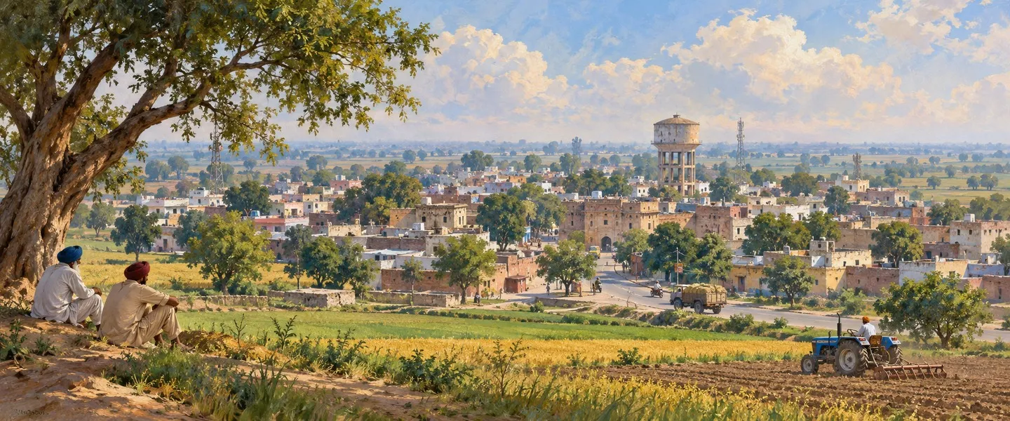
The tehsil itself is Malwa farmland on the Sutlej alluvial plain, the district topography of flood plain and upland plain levelled by its farmers, and its small towns work as the farm economy floor: Mullanpur Dakha as the grain mandi, Gill and the other census towns as the city edge settlements, and villages such as Dakha, Chhapar and Gujjarwal farming some of the closest settled land in Punjab. The assembly map carries the tehsil names at district level: among the fourteen assembly constituencies of Ludhiana district are Ludhiana West, Gill and Dakha, all three names drawn from this side of the district.
Getting there
Roads run west and south from the headquarters city through the tehsil. Mullanpur Dakha stands on National Highway 5, the Ferozepur road, with bus services to Ludhiana, Moga and Bathinda, and the same corridor carries traffic on towards Jagraon and Moga. The town has its own railway station, with Ludhiana Junction about 19 kilometres away by the town account. For flights the town account points to Chandigarh airport, about 134 kilometres away, and Amritsar airport, about 167 kilometres away; this page does not claim the district airport at Sahnewal for this tehsil, because the sources opened for this page place it on the eastern side of the city and no source opened here puts it in Ludhiana West.
ਲੁਧਿਆਣਾ ਪੱਛਮੀ ਤਹਿਸੀਲ ਕਿੱਥੇ ਹੈ?
ਲੁਧਿਆਣਾ ਪੱਛਮੀ ਤਹਿਸੀਲ ਭਾਰਤ ਦੇ ਪੰਜਾਬ ਰਾਜ ਦੇ ਮਾਲਵਾ ਖੇਤਰ ਵਿੱਚ ਲੁਧਿਆਣਾ ਜ਼ਿਲ੍ਹੇ ਦੀ ਇੱਕ ਤਹਿਸੀਲ ਹੈ, ਜਿਸ ਦਾ ਮੁੱਖ ਦਫ਼ਤਰ ਲੁਧਿਆਣਾ ਸ਼ਹਿਰ ਹੈ ਅਤੇ ਜੋ ਸ਼ਹਿਰ ਦੇ ਪੱਛਮੀ ਅਤੇ ਦੱਖਣੀ ਪੇਂਡੂ ਇਲਾਕੇ ਨੂੰ ਕਵਰ ਕਰਦੀ ਹੈ, ਜਿਸ ਵਿੱਚ 127 ਪਿੰਡ ਅਤੇ ਮੁੱਲਾਂਪੁਰ ਦਾਖਾ ਅਤੇ ਗਿੱਲ ਸਮੇਤ ਸੱਤ ਛੋਟੇ ਕਸਬੇ ਹਨ। 2011 ਦੀ ਮਰਦਮਸ਼ੁਮਾਰੀ ਵਿੱਚ ਇਸ ਦੀ ਆਬਾਦੀ 362,602 ਸੀ, ਜਿਸ ਵਿੱਚੋਂ ਜ਼ਿਆਦਾਤਰ ਪੇਂਡੂ ਸਨ।
ਇਹ ਤਹਿਸੀਲ ਸਤਲੁਜ ਦਰਿਆ ਦੇ ਦੱਖਣ ਵਿੱਚ ਮਾਲਵਾ ਦੇ ਜਲੋਢ ਮੈਦਾਨ ਉੱਤੇ ਵਸਦੀ ਹੈ। ਜ਼ਿਲ੍ਹਾ ਪੱਧਰ ਉੱਤੇ ਦਰਿਆ ਲੁਧਿਆਣਾ ਜ਼ਿਲ੍ਹੇ ਦੀ ਉੱਤਰੀ ਸਰਹੱਦ ਬਣਾਉਂਦਾ ਹੈ, ਜੋ ਇਸ ਨੂੰ ਜਲੰਧਰ ਅਤੇ ਹੁਸ਼ਿਆਰਪੁਰ ਜ਼ਿਲ੍ਹਿਆਂ ਤੋਂ ਵੱਖ ਕਰਦਾ ਹੈ, ਪੱਛਮ ਵਿੱਚ ਮੋਗਾ, ਪੂਰਬ ਵਿੱਚ ਰੂਪਨਗਰ ਅਤੇ ਦੱਖਣ ਵਿੱਚ ਸੰਗਰੂਰ ਅਤੇ ਪਟਿਆਲਾ ਹਨ। ਜ਼ਿਲ੍ਹੇ ਦੇ ਅੰਦਰ ਇਹ ਤਹਿਸੀਲ ਲੁਧਿਆਣਾ ਸ਼ਹਿਰ ਦੇ ਪੱਛਮੀ ਅਤੇ ਦੱਖਣੀ ਕਿਨਾਰਿਆਂ ਤੋਂ ਫਿਰੋਜ਼ਪੁਰ ਸੜਕ ਉੱਤੇ ਜਗਰਾਉਂ ਵੱਲ ਅਤੇ ਦੱਖਣ ਵਿੱਚ ਪੱਖੋਵਾਲ ਅਤੇ ਰਾਏਕੋਟ ਵਾਲੇ ਪਾਸੇ ਤੱਕ ਫੈਲੀ ਹੋਈ ਹੈ, ਘਣੇ ਵਸੇ ਖੇਤੀ ਪਿੰਡਾਂ ਵਿੱਚੋਂ ਲੰਘਦੀ ਹੋਈ ਜਿਨ੍ਹਾਂ ਦੇ ਸਭ ਤੋਂ ਨੇੜਲੇ ਕਸਬੇ, ਪਿੰਡ ਡਾਇਰੈਕਟਰੀ ਅਨੁਸਾਰ, ਲੁਧਿਆਣਾ, ਮੁੱਲਾਂਪੁਰ ਦਾਖਾ ਅਤੇ ਰਾਏਕੋਟ ਹਨ।
ਇਸ ਪੰਨੇ ਉੱਤੇ ਪੁਰਾਣੀ ਆਬਾਦੀ, 2011 ਵਿੱਚ 362,602, ਦੀ ਪੁਸ਼ਟੀ ਹੋ ਗਈ ਹੈ, ਅਤੇ ਇਹ ਬਿਲਕੁਲ ਮੇਲ ਖਾਂਦੀ ਹੈ: 272,489 ਪੇਂਡੂ ਲੋਕ ਅਤੇ 90,113 ਸ਼ਹਿਰੀ ਲੋਕ ਮਿਲ ਕੇ 362,602 ਬਣਦੇ ਹਨ, 72,514 ਘਰਾਂ ਵਿੱਚ। ਹੇਠਾਂ ਦਿੱਤੀ ਹਰ ਗੱਲ ਵਿੱਚ ਦੋ ਸਾਵਧਾਨੀਆਂ ਚੱਲਦੀਆਂ ਹਨ। ਇੱਕ ਸੂਚੀ ਦੀ ਲਿਖਤ ਪੇਂਡੂ ਅਤੇ ਸ਼ਹਿਰੀ ਹਿੱਸੇ ਉਲਟਾ ਦਿੰਦੀ ਹੈ, 75.15 ਫੀਸਦੀ ਨੂੰ ਸ਼ਹਿਰੀ ਛਾਪਦੀ ਹੈ; ਉਸ ਦੇ ਪਿੱਛੇ ਦੀਆਂ ਸਾਰਣੀਆਂ ਇਸ ਦੇ ਉਲਟ ਦਿਖਾਉਂਦੀਆਂ ਹਨ, 75.15 ਫੀਸਦੀ ਪੇਂਡੂ ਅਤੇ 24.85 ਫੀਸਦੀ ਸ਼ਹਿਰੀ, ਅਤੇ ਇਹ ਪੰਨਾ ਸਾਰਣੀਆਂ ਦੀ ਪਾਲਣਾ ਕਰਦਾ ਹੈ। ਅਤੇ ਸਰੋਤ ਸਾਰੇ ਇੱਕੋ ਜ਼ਮੀਨ ਨੂੰ ਇੱਕੋ ਤਰੀਕੇ ਨਾਲ ਨਹੀਂ ਮਾਪਦੇ: ਤਹਿਸੀਲ ਦਾ ਖੇਤਰਫਲ ਮਰਦਮਸ਼ੁਮਾਰੀ ਢਾਂਚੇ ਵਿੱਚ 543 ਵਰਗ ਕਿਲੋਮੀਟਰ ਹੈ ਅਤੇ ਭੂਗੋਲਿਕ ਗਿਣਤੀ ਵਿੱਚ 556.5, ਅਤੇ ਲਿੰਗ ਅਨੁਪਾਤ ਇੱਕ ਸੂਚੀ ਵਿੱਚ 896 ਅਤੇ ਦੂਜੀ ਵਿੱਚ 897 ਛਪਦਾ ਹੈ। ਹੇਠਾਂ ਹਰ ਅੰਕੜਾ ਆਪਣੇ ਢਾਂਚੇ ਨਾਲ ਰੱਖਿਆ ਗਿਆ ਹੈ, ਕਦੇ ਰਲਾਇਆ ਨਹੀਂ ਗਿਆ।
ਦੋ ਲੁਧਿਆਣੇ: ਪੂਰਬ ਪੱਛਮ ਨਾਲੋਂ ਪੰਜ ਗੁਣਾ ਕਿਉਂ ਹੈ
ਲੁਧਿਆਣਾ ਜ਼ਿਲ੍ਹਾ ਸੱਤ ਤਹਿਸੀਲਾਂ ਵਿੱਚ ਵੰਡਿਆ ਹੋਇਆ ਹੈ, ਸਮਰਾਲਾ, ਖੰਨਾ, ਪਾਇਲ, ਲੁਧਿਆਣਾ ਪੂਰਬੀ, ਲੁਧਿਆਣਾ ਪੱਛਮੀ, ਰਾਏਕੋਟ ਅਤੇ ਜਗਰਾਉਂ, ਜ਼ਿਲ੍ਹਾ ਹੈਂਡਬੁੱਕ ਵਿੱਚ ਸਭ ਨੂੰ ਸਬ ਡਵੀਜ਼ਨਲ ਦਰਜਾ ਮਿਲਿਆ ਹੈ, ਸੱਤ ਸਬ ਤਹਿਸੀਲਾਂ ਦੇ ਨਾਲ ਜਿਨ੍ਹਾਂ ਵਿੱਚ ਮੁੱਲਾਂਪੁਰ ਦਾਖਾ ਵੀ ਸ਼ਾਮਲ ਹੈ, ਜੋ ਇਸੇ ਤਹਿਸੀਲ ਵਿੱਚ ਪੈਂਦਾ ਹੈ। ਦੋਵੇਂ ਸ਼ਹਿਰੀ ਤਹਿਸੀਲਾਂ ਨਕਸ਼ੇ ਉੱਤੇ ਜੁੜਵਾਂ ਲੱਗਦੀਆਂ ਹਨ ਅਤੇ ਮਰਦਮਸ਼ੁਮਾਰੀ ਵਿੱਚ ਉਲਟ ਹਨ। ਲੁਧਿਆਣਾ ਪੂਰਬੀ ਵਿੱਚ 2011 ਵਿੱਚ 1,934,225 ਲੋਕ ਸਨ, ਇਸ ਤਹਿਸੀਲ ਨਾਲੋਂ ਪੰਜ ਗੁਣਾ ਤੋਂ ਵੱਧ, ਅਤੇ ਹੈਂਡਬੁੱਕ ਇਸ ਨੂੰ ਜ਼ਿਲ੍ਹੇ ਦੀ ਸਭ ਤੋਂ ਵੱਧ ਆਬਾਦੀ ਵਾਲੀ ਤਹਿਸੀਲ ਦੱਸਦੀ ਹੈ।
ਕਾਰਨ ਇਹ ਹੈ ਕਿ ਸ਼ਹਿਰ ਆਪ ਕਿੱਥੇ ਗਿਣਿਆ ਗਿਆ ਸੀ। ਪੂਰੀ ਲੁਧਿਆਣਾ ਨਗਰ ਨਿਗਮ, 1,618,879 ਲੋਕ, ਲੁਧਿਆਣਾ ਪੂਰਬੀ ਦੇ ਅੰਦਰ ਗਿਣੀ ਗਈ: ਉਸ ਦਾ ਸ਼ਹਿਰੀ ਕੁੱਲ 1,654,537 ਬਿਲਕੁਲ ਨਿਗਮ ਅਤੇ ਸਾਹਨੇਵਾਲ ਨਗਰ ਪੰਚਾਇਤ 22,484 ਅਤੇ ਭਾਮੀਆਂ ਕਲਾਂ ਸੈਂਸਸ ਟਾਊਨ 13,174 ਦਾ ਜੋੜ ਹੈ, 184 ਪਿੰਡਾਂ ਵਿੱਚ 279,688 ਪੇਂਡੂ ਲੋਕਾਂ ਦੇ ਮੁਕਾਬਲੇ। ਲੁਧਿਆਣਾ ਪੱਛਮੀ ਦਾ ਨਿਗਮ ਵਿੱਚ ਕੋਈ ਹਿੱਸਾ ਨਹੀਂ ਹੈ। ਉਸ ਦੀ ਸ਼ਹਿਰੀ ਆਬਾਦੀ ਸਿਰਫ਼ ਉਸ ਦੇ ਸੱਤ ਛੋਟੇ ਕਸਬਿਆਂ ਦੇ 90,113 ਲੋਕ ਹਨ, ਇਸ ਲਈ ਮੁੱਖ ਦਫ਼ਤਰ ਵਾਲਾ ਸ਼ਹਿਰ ਸਾਂਝਾ ਕਰਨ ਵਾਲੀ ਤਹਿਸੀਲ ਪੇਂਡੂ ਤਹਿਸੀਲ ਵਜੋਂ ਪੜ੍ਹੀ ਜਾਂਦੀ ਹੈ: 75.15 ਫੀਸਦੀ ਪੇਂਡੂ, ਸਿੱਖ ਬਹੁਗਿਣਤੀ, ਜਦੋਂ ਕਿ ਲੁਧਿਆਣਾ ਪੂਰਬੀ ਉਸੇ ਜ਼ਿਲ੍ਹਾ ਪੰਨੇ ਉੱਤੇ 85.54 ਫੀਸਦੀ ਸ਼ਹਿਰੀ ਅਤੇ ਹਿੰਦੂ ਬਹੁਗਿਣਤੀ ਹੈ। ਸ਼ਹਿਰ ਦਾ ਖਾਤਾ ਦੋਵੇਂ ਤਹਿਸੀਲਾਂ ਨੂੰ ਲੁਧਿਆਣਾ ਸ਼ਹਿਰ ਹੇਠ ਸੂਚੀਬੱਧ ਕਰਦਾ ਹੈ, ਕਿਉਂਕਿ ਸ਼ਹਿਰ ਦੋਵਾਂ ਦਾ ਮੁੱਖ ਦਫ਼ਤਰ ਅਤੇ ਮੰਡੀ ਹੈ, ਪਰ ਮਰਦਮਸ਼ੁਮਾਰੀ ਨੇ ਉਸ ਦੇ ਲੋਕ ਪੂਰਬ ਵਿੱਚ ਗਿਣੇ।
ਮੁੱਲਾਂਪੁਰ ਦਾਖਾ, ਗਿੱਲ ਅਤੇ ਤਹਿਸੀਲ ਦੇ ਕਸਬੇ
ਸੱਤ ਕਸਬੇ ਮਿਲ ਕੇ ਬਿਲਕੁਲ ਸ਼ਹਿਰੀ 90,113 ਬਣਦੇ ਹਨ: ਗਿੱਲ ਸੈਂਸਸ ਟਾਊਨ 28,884, ਮੁੱਲਾਂਪੁਰ ਦਾਖਾ ਨਗਰ ਪੰਚਾਇਤ 16,356, ਠਰੀਕੇ ਸੈਂਸਸ ਟਾਊਨ 12,294, ਭੱਟੀਆਂ ਸੈਂਸਸ ਟਾਊਨ 11,066, ਪ੍ਰਤਾਪ ਸਿੰਘ ਵਾਲਾ ਸੈਂਸਸ ਟਾਊਨ 10,843, ਬੱਦੋਵਾਲ ਸੈਂਸਸ ਟਾਊਨ 6,825 ਅਤੇ ਜੋਧਾਂ ਸੈਂਸਸ ਟਾਊਨ 3,845। ਸੱਤਾਂ ਵਿੱਚੋਂ ਛੇ ਮਰਦਮਸ਼ੁਮਾਰੀ ਦੇ ਹਿਸਾਬ ਨਾਲ ਨਵੇਂ ਹਨ: ਹੈਂਡਬੁੱਕ ਦੀ ਅਧਿਕਾਰ ਖੇਤਰ ਸਾਰਣੀ ਦਿਖਾਉਂਦੀ ਹੈ ਕਿ ਇਹ ਤਹਿਸੀਲ 2001 ਵਿੱਚ ਇੱਕ ਕਸਬੇ ਤੋਂ 2011 ਵਿੱਚ ਸੱਤ ਕਸਬਿਆਂ ਤੱਕ ਗਈ, ਛੇ ਪਿੰਡਾਂ ਨੂੰ ਸੈਂਸਸ ਟਾਊਨ ਮੰਨਿਆ ਗਿਆ, ਜਦੋਂ ਕਿ ਉਸ ਦੀ ਪਿੰਡ ਗਿਣਤੀ ਵੀ ਉਸੇ ਕਾਰਨ 133 ਤੋਂ ਘਟ ਕੇ 127 ਰਹਿ ਗਈ।
ਮੁੱਲਾਂਪੁਰ ਦਾਖਾ, ਜਿਸ ਨੂੰ ਮੰਡੀ ਮੁੱਲਾਂਪੁਰ ਵੀ ਕਿਹਾ ਜਾਂਦਾ ਹੈ, ਉਹ ਤਹਿਸੀਲ ਕਸਬਾ ਹੈ ਜਿਸ ਦਾ ਆਪਣਾ ਨਾਂ ਹੈ: ਸ਼ਹਿਰ ਦੇ ਪੱਛਮ ਵਿੱਚ ਫਿਰੋਜ਼ਪੁਰ ਸੜਕ ਉੱਤੇ ਇੱਕ ਨਗਰ ਪੰਚਾਇਤ ਅਤੇ ਅਨਾਜ ਮੰਡੀ ਕਸਬਾ, ਲਗਭਗ 30.84 ਡਿਗਰੀ ਉੱਤਰ ਅਤੇ 75.67 ਡਿਗਰੀ ਪੂਰਬ ਉੱਤੇ, ਪਿੰਨ 141101, ਆਪਣੇ ਆਲੇ ਦੁਆਲੇ ਦੇ ਪਿੰਡਾਂ ਲਈ ਮੰਡੀ ਦਾ ਕੰਮ ਕਰਦਾ ਹੈ, ਜਿਨ੍ਹਾਂ ਵਿੱਚ ਇਸ ਤਹਿਸੀਲ ਦੀ ਪਿੰਡ ਸੂਚੀ ਵਿੱਚੋਂ ਮੁੱਲਾਂਪੁਰ, ਦਾਖਾ, ਜੰਗਪੁਰ, ਰਕਬਾ ਅਤੇ ਮੋਹੀ ਪਿੰਡ ਹਨ। ਉਸ ਦਾ ਖਾਤਾ ਗੁਰਦੁਆਰਾ ਮਸ਼ਕੀਆਣਾ ਸਾਹਿਬ ਨੂੰ ਉਸ ਦਾ ਸਭ ਤੋਂ ਮਸ਼ਹੂਰ ਗੁਰਦੁਆਰਾ ਅਤੇ ਦਾਖਾ ਵਿਖੇ ਗੁਰੂ ਤੇਗ ਬਹਾਦਰ ਨੈਸ਼ਨਲ ਕਾਲਜ ਨੂੰ ਉਸ ਦੇ ਕਾਲਜਾਂ ਵਿੱਚੋਂ ਇੱਕ ਦੱਸਦਾ ਹੈ। ਗਿੱਲ, ਸਭ ਤੋਂ ਵੱਡਾ ਕਸਬਾ, ਤਹਿਸੀਲ ਦੇ ਸ਼ਹਿਰ ਵਾਲੇ ਪਾਸੇ ਇੱਕ ਸੈਂਸਸ ਟਾਊਨ ਹੈ, ਨਗਰ ਪੰਚਾਇਤ ਨਾਲੋਂ ਵੀ ਵੱਡਾ, ਇਸ ਗੱਲ ਦੀ ਨਿਸ਼ਾਨੀ ਕਿ ਸ਼ਹਿਰ ਦਾ ਕਿਨਾਰਾ, ਪੁਰਾਣਾ ਮੰਡੀ ਕਸਬਾ ਨਹੀਂ, ਹੁਣ ਤਹਿਸੀਲ ਦੀ ਸਭ ਤੋਂ ਵੱਡੀ ਸ਼ਹਿਰੀ ਭੀੜ ਰੱਖਦਾ ਹੈ।
ਪਿੰਡ, ਬਲਾਕ ਅਤੇ ਤਹਿਸੀਲ ਦੇ ਲੋਕ
ਤਹਿਸੀਲ ਲਈ ਪਿੰਡ ਡਾਇਰੈਕਟਰੀ, ਡਾਇਰੈਕਟਰੀ ਵੱਲੋਂ ਵਰਤੇ ਗਏ ਮਰਦਮਸ਼ੁਮਾਰੀ ਢਾਂਚੇ ਵਿੱਚ ਸਬ ਜ਼ਿਲ੍ਹਾ ਕੋਡ 00228, 127 ਪਿੰਡ ਰਿਕਾਰਡ ਸੂਚੀਬੱਧ ਕਰਦੀ ਹੈ, ਜਿਨ੍ਹਾਂ ਵਿੱਚੋਂ 125 ਵਸੇ ਹੋਏ ਹਨ, 58,297.16 ਹੈਕਟੇਅਰ ਉੱਤੇ 54,288 ਘਰਾਂ ਵਿੱਚ 272,489 ਪੇਂਡੂ ਲੋਕਾਂ ਨੂੰ ਕਵਰ ਕਰਦੀ ਹੈ, 116 ਗ੍ਰਾਮ ਪੰਚਾਇਤਾਂ ਦੇ ਨਾਲ। ਉਸ ਦੇ ਪਿੰਡ ਸੱਤ ਕਮਿਊਨਿਟੀ ਵਿਕਾਸ ਬਲਾਕਾਂ ਵਿੱਚ ਪੈਂਦੇ ਹਨ, ਦੇਹਲੋਂ, ਜਗਰਾਉਂ, ਲੁਧਿਆਣਾ ਪਹਿਲਾ, ਲੁਧਿਆਣਾ ਦੂਜਾ, ਪੱਖੋਵਾਲ, ਸਿਧਵਾਂ ਬੇਟ ਅਤੇ ਸੁਧਾਰ, ਇਸੇ ਲਈ ਬਲਾਕ ਅਤੇ ਤਹਿਸੀਲ ਰੇਖਾਵਾਂ ਨੂੰ ਰਲਾਉਣਾ ਨਹੀਂ ਚਾਹੀਦਾ: ਹੈਂਡਬੁੱਕ ਪੂਰੇ ਜ਼ਿਲ੍ਹੇ ਵਿੱਚ ਬਾਰਾਂ ਬਲਾਕ ਗਿਣਦੀ ਹੈ, ਜਦੋਂ ਕਿ ਇੱਕ ਮੌਜੂਦਾ ਡਾਇਰੈਕਟਰੀ ਸੂਚੀ ਚੌਦਾਂ ਗਿਣਦੀ ਹੈ, ਮੁੱਲਾਂਪੁਰ ਅਤੇ ਕੂੰਮ ਕਲਾਂ ਵਰਗੇ ਨਾਂ ਜੋੜ ਕੇ। ਸਭ ਤੋਂ ਵੱਡਾ ਪਿੰਡ ਢੰਡਰਾ ਹੈ, 3,050 ਘਰਾਂ ਵਿੱਚ 14,972 ਲੋਕ; ਹੈਂਡਬੁੱਕ ਢੰਡਰਾ ਨੂੰ ਪੂਰੇ ਜ਼ਿਲ੍ਹੇ ਦਾ ਸਭ ਤੋਂ ਵੱਡਾ ਪਿੰਡ ਦੱਸਦੀ ਹੈ। ਦਾਦ 9,932 ਅਤੇ ਫੁੱਲਾਂਵਾਲ 9,927 ਨਾਲ ਅੱਗੇ ਹਨ, ਅਤੇ ਜ਼ਮੀਨ ਪੱਖੋਂ ਸਭ ਤੋਂ ਵੱਡਾ ਪਿੰਡ ਗੁੱਜਰਵਾਲ ਹੈ, 5,194 ਹੈਕਟੇਅਰ ਅਤੇ 4,947 ਲੋਕ, ਜਿਸ ਦਾ ਸਭ ਤੋਂ ਨੇੜਲਾ ਕਸਬਾ ਰਾਏਕੋਟ ਦੱਸਿਆ ਗਿਆ ਹੈ।
ਧਰਮ ਪੱਖੋਂ ਇਹ ਜ਼ਿਲ੍ਹੇ ਦਾ ਸਿੱਖ ਪੇਂਡੂ ਇਲਾਕਾ ਹੈ: 2011 ਵਿੱਚ ਸਿੱਖ 68.68 ਫੀਸਦੀ ਸਨ, 249,024 ਲੋਕ, ਉਸ ਤੋਂ ਬਾਅਦ ਹਿੰਦੂ 28.75 ਫੀਸਦੀ, 104,257 ਲੋਕ, ਮੁਸਲਮਾਨ 1.39 ਫੀਸਦੀ, ਈਸਾਈ 0.48 ਫੀਸਦੀ ਅਤੇ ਜੈਨ 0.13 ਫੀਸਦੀ। ਅਨੁਸੂਚਿਤ ਜਾਤੀਆਂ ਤਹਿਸੀਲ ਦਾ 37.46 ਫੀਸਦੀ ਸਨ, 135,813 ਲੋਕ, ਅਤੇ ਕੋਈ ਅਨੁਸੂਚਿਤ ਕਬੀਲਾ ਆਬਾਦੀ ਦਰਜ ਨਹੀਂ ਹੋਈ। ਲਿੰਗ ਅਨੁਪਾਤ ਇੱਕ ਮਰਦਮਸ਼ੁਮਾਰੀ ਸੂਚੀ ਵਿੱਚ ਪ੍ਰਤੀ 1,000 ਮਰਦਾਂ ਪਿੱਛੇ 896 ਔਰਤਾਂ ਸੀ ਅਤੇ ਦੂਜੀ ਵਿੱਚ 897, 191,203 ਮਰਦਾਂ ਅਤੇ 171,399 ਔਰਤਾਂ ਦੀ ਇੱਕੋ ਗਿਣਤੀ ਉੱਤੇ ਗੋਲਾਈ ਦਾ ਫ਼ਰਕ; ਪੇਂਡੂ ਅਨੁਪਾਤ 900 ਸੀ, ਕਸਬਿਆਂ ਵਿੱਚ 886 ਜਾਂ 887 ਦੇ ਮੁਕਾਬਲੇ। 0 ਤੋਂ 6 ਸਾਲ ਦੇ ਬੱਚੇ 40,233 ਸਨ, ਜਾਂ 11.10 ਫੀਸਦੀ, ਬਾਲ ਲਿੰਗ ਅਨੁਪਾਤ 873 ਸੀ। ਕਾਮੇ 130,613 ਸਨ, ਆਬਾਦੀ ਦਾ ਲਗਭਗ 36.02 ਫੀਸਦੀ, ਜਿਨ੍ਹਾਂ ਵਿੱਚ 104,976 ਮਰਦ ਅਤੇ 25,637 ਔਰਤਾਂ ਸਨ।
ਇਸ ਤਹਿਸੀਲ ਲਈ ਸਾਖਰਤਾ ਦੇ ਦੋ ਅੰਕੜੇ ਚੱਲਦੇ ਹਨ ਅਤੇ ਦੋਵੇਂ ਇੱਥੇ ਆਪਣੇ ਆਧਾਰ ਨਾਲ ਦਿੱਤੇ ਗਏ ਹਨ। ਇੱਕ ਮਰਦਮਸ਼ੁਮਾਰੀ ਸੂਚੀ 71.82 ਫੀਸਦੀ ਦਿੰਦੀ ਹੈ, ਮਰਦ 75.36 ਫੀਸਦੀ ਅਤੇ ਔਰਤਾਂ 67.88 ਫੀਸਦੀ, ਪੂਰੀ ਆਬਾਦੀ ਦੇ ਮੁਕਾਬਲੇ ਗਿਣਿਆ ਗਿਆ; ਦੂਜੀ 80.79 ਫੀਸਦੀ ਦਿੰਦੀ ਹੈ, ਮਰਦ 84.90 ਫੀਸਦੀ ਅਤੇ ਔਰਤਾਂ 76.21 ਫੀਸਦੀ, ਸੱਤ ਸਾਲ ਅਤੇ ਉਸ ਤੋਂ ਵੱਧ ਉਮਰ ਦੀ ਆਬਾਦੀ ਦੇ ਮੁਕਾਬਲੇ ਗਿਣਿਆ ਗਿਆ ਅਸਰਦਾਰ ਦਰ, ਉਸ ਉਮਰ ਦੇ 322,369 ਵਾਸੀਆਂ ਵਿੱਚੋਂ 260,430 ਸਾਖਰ ਲੋਕਾਂ ਨਾਲ, ਉਸ ਆਧਾਰ ਉੱਤੇ ਸ਼ਹਿਰੀ ਸਾਖਰਤਾ 81.61 ਫੀਸਦੀ ਅਤੇ ਪੇਂਡੂ 80.52 ਫੀਸਦੀ। ਪੰਜਾਬੀ ਤਹਿਸੀਲ ਦੀ ਭਾਸ਼ਾ ਹੈ: ਜ਼ਿਲ੍ਹਾ ਪੱਧਰ ਉੱਤੇ 2011 ਵਿੱਚ ਲੁਧਿਆਣਾ ਜ਼ਿਲ੍ਹੇ ਦੇ 79.65 ਫੀਸਦੀ ਲੋਕ ਪਹਿਲੀ ਭਾਸ਼ਾ ਵਜੋਂ ਪੰਜਾਬੀ ਬੋਲਦੇ ਸਨ ਅਤੇ 18.19 ਫੀਸਦੀ ਹਿੰਦੀ, ਹਿੰਦੀ ਮੁੱਖ ਤੌਰ ਉੱਤੇ ਸ਼ਹਿਰੀ ਇਲਾਕਿਆਂ ਵਿੱਚ ਬੋਲੀ ਜਾਂਦੀ ਸੀ।
ਖੇਤੀ, ਉਦਯੋਗ ਅਤੇ ਮੁੱਖ ਦਫ਼ਤਰ ਵਾਲਾ ਸ਼ਹਿਰ
ਮੁੱਖ ਦਫ਼ਤਰ ਵਾਲਾ ਸ਼ਹਿਰ ਇਸ ਤਹਿਸੀਲ ਨੂੰ ਆਕਾਰ ਦਿੰਦਾ ਹੈ ਭਾਵੇਂ ਉਸ ਦੇ ਲੋਕ ਪੂਰਬ ਵਿੱਚ ਗਿਣੇ ਗਏ ਸਨ। ਲੁਧਿਆਣਾ ਪੰਜਾਬ ਦਾ ਸਭ ਤੋਂ ਵੱਧ ਆਬਾਦੀ ਵਾਲਾ ਸ਼ਹਿਰ ਹੈ, 2011 ਵਿੱਚ 1,618,879 ਲੋਕ, ਲਗਭਗ 30.91 ਡਿਗਰੀ ਉੱਤਰ ਅਤੇ 75.85 ਡਿਗਰੀ ਪੂਰਬ ਉੱਤੇ ਅਤੇ ਸਮੁੰਦਰ ਤਲ ਤੋਂ 247 ਮੀਟਰ ਉੱਚਾ, 1480 ਵਿੱਚ ਲੋਧੀ ਖ਼ਾਨਦਾਨ ਹੇਠ ਸਤਲੁਜ ਦੇ ਪੁਰਾਣੇ ਕੰਢੇ ਉੱਤੇ ਵਸਾਇਆ ਗਿਆ, ਜਿਸ ਦਾ ਮੌਜੂਦਾ ਵਹਾਅ ਹੁਣ ਸ਼ਹਿਰ ਤੋਂ ਲਗਭਗ 13 ਕਿਲੋਮੀਟਰ ਉੱਤਰ ਵੱਲ ਚੱਲਦਾ ਹੈ। ਜ਼ਿਲ੍ਹਾ ਖਾਤਾ ਸਾਈਕਲ ਪੁਰਜ਼ਿਆਂ ਅਤੇ ਹੋਜ਼ਰੀ ਨੂੰ ਉਸ ਦੇ ਮੁੱਖ ਉਦਯੋਗ ਦੱਸਦਾ ਹੈ; ਸ਼ਹਿਰ ਖਾਤਾ ਇਸ ਨੂੰ ਏਸ਼ੀਆ ਦਾ ਸਭ ਤੋਂ ਵੱਡਾ ਸਾਈਕਲ ਨਿਰਮਾਣ ਕੇਂਦਰ ਕਹਿੰਦਾ ਹੈ, ਹਰ ਸਾਲ ਭਾਰਤ ਦੇ ਅੱਧੇ ਤੋਂ ਵੱਧ ਸਾਈਕਲ ਬਣਾਉਂਦਾ ਹੈ, ਹੋਜ਼ਰੀ, ਕੱਪੜਿਆਂ, ਆਟੋ ਅਤੇ ਟਰੈਕਟਰ ਪੁਰਜ਼ਿਆਂ ਦੇ ਨਾਲ। ਉਸ ਦੀਆਂ ਫੈਕਟਰੀਆਂ ਅਤੇ ਮੰਡੀਆਂ ਉੱਪਰ ਦੱਸੇ ਪਿੰਡਾਂ ਤੋਂ ਕਾਮਿਆਂ, ਵਿਦਿਆਰਥੀਆਂ ਅਤੇ ਵਪਾਰੀਆਂ ਦੀ ਰੋਜ਼ਾਨਾ ਮੰਜ਼ਿਲ ਹਨ।
ਤਹਿਸੀਲ ਆਪ ਸਤਲੁਜ ਦੇ ਜਲੋਢ ਮੈਦਾਨ ਉੱਤੇ ਮਾਲਵਾ ਦੀ ਖੇਤੀ ਜ਼ਮੀਨ ਹੈ, ਜ਼ਿਲ੍ਹੇ ਦੀ ਹੜ੍ਹ ਮੈਦਾਨ ਅਤੇ ਉੱਚੀ ਜ਼ਮੀਨ ਵਾਲੀ ਬਣਤਰ ਜੋ ਉਸ ਦੇ ਕਿਸਾਨਾਂ ਨੇ ਪੱਧਰੀ ਕੀਤੀ ਹੈ, ਅਤੇ ਉਸ ਦੇ ਛੋਟੇ ਕਸਬੇ ਖੇਤੀ ਅਰਥਚਾਰੇ ਦੀ ਮੰਜ਼ਿਲ ਦਾ ਕੰਮ ਕਰਦੇ ਹਨ: ਮੁੱਲਾਂਪੁਰ ਦਾਖਾ ਅਨਾਜ ਮੰਡੀ ਵਜੋਂ, ਗਿੱਲ ਅਤੇ ਬਾਕੀ ਸੈਂਸਸ ਟਾਊਨ ਸ਼ਹਿਰ ਕਿਨਾਰੇ ਦੀਆਂ ਬਸਤੀਆਂ ਵਜੋਂ, ਅਤੇ ਦਾਖਾ, ਛਾਪੜ ਅਤੇ ਗੁੱਜਰਵਾਲ ਵਰਗੇ ਪਿੰਡ ਪੰਜਾਬ ਦੀ ਸਭ ਤੋਂ ਨੇੜਿਓਂ ਵਸੀ ਜ਼ਮੀਨ ਉੱਤੇ ਖੇਤੀ ਕਰਦੇ ਹਨ। ਵਿਧਾਨ ਸਭਾ ਨਕਸ਼ਾ ਜ਼ਿਲ੍ਹਾ ਪੱਧਰ ਉੱਤੇ ਤਹਿਸੀਲ ਨਾਂ ਰੱਖਦਾ ਹੈ: ਲੁਧਿਆਣਾ ਜ਼ਿਲ੍ਹੇ ਦੇ ਚੌਦਾਂ ਵਿਧਾਨ ਸਭਾ ਹਲਕਿਆਂ ਵਿੱਚ ਲੁਧਿਆਣਾ ਪੱਛਮੀ, ਗਿੱਲ ਅਤੇ ਦਾਖਾ ਹਨ, ਤਿੰਨੇ ਨਾਂ ਜ਼ਿਲ੍ਹੇ ਦੇ ਇਸੇ ਪਾਸੇ ਤੋਂ ਲਏ ਗਏ ਹਨ।
ਉੱਥੇ ਪਹੁੰਚਣਾ
ਸੜਕਾਂ ਮੁੱਖ ਦਫ਼ਤਰ ਵਾਲੇ ਸ਼ਹਿਰ ਤੋਂ ਪੱਛਮ ਅਤੇ ਦੱਖਣ ਵੱਲ ਤਹਿਸੀਲ ਵਿੱਚੋਂ ਲੰਘਦੀਆਂ ਹਨ। ਮੁੱਲਾਂਪੁਰ ਦਾਖਾ ਰਾਸ਼ਟਰੀ ਰਾਜਮਾਰਗ 5, ਫਿਰੋਜ਼ਪੁਰ ਸੜਕ, ਉੱਤੇ ਖੜ੍ਹਾ ਹੈ, ਲੁਧਿਆਣਾ, ਮੋਗਾ ਅਤੇ ਬਠਿੰਡਾ ਲਈ ਬੱਸ ਸੇਵਾਵਾਂ ਨਾਲ, ਅਤੇ ਉਹੀ ਗਲਿਆਰਾ ਜਗਰਾਉਂ ਅਤੇ ਮੋਗਾ ਵੱਲ ਆਵਾਜਾਈ ਲੈ ਜਾਂਦਾ ਹੈ। ਕਸਬੇ ਦਾ ਆਪਣਾ ਰੇਲਵੇ ਸਟੇਸ਼ਨ ਹੈ, ਕਸਬੇ ਦੇ ਖਾਤੇ ਅਨੁਸਾਰ ਲੁਧਿਆਣਾ ਜੰਕਸ਼ਨ ਲਗਭਗ 19 ਕਿਲੋਮੀਟਰ ਦੂਰ ਹੈ। ਉਡਾਣਾਂ ਲਈ ਕਸਬੇ ਦਾ ਖਾਤਾ ਚੰਡੀਗੜ੍ਹ ਹਵਾਈ ਅੱਡੇ ਵੱਲ ਇਸ਼ਾਰਾ ਕਰਦਾ ਹੈ, ਲਗਭਗ 134 ਕਿਲੋਮੀਟਰ ਦੂਰ, ਅਤੇ ਅੰਮ੍ਰਿਤਸਰ ਹਵਾਈ ਅੱਡਾ, ਲਗਭਗ 167 ਕਿਲੋਮੀਟਰ ਦੂਰ; ਇਹ ਪੰਨਾ ਸਾਹਨੇਵਾਲ ਵਿਖੇ ਜ਼ਿਲ੍ਹਾ ਹਵਾਈ ਅੱਡੇ ਨੂੰ ਇਸ ਤਹਿਸੀਲ ਲਈ ਨਹੀਂ ਮੰਨਦਾ, ਕਿਉਂਕਿ ਇਸ ਪੰਨੇ ਲਈ ਖੋਲ੍ਹੇ ਗਏ ਸਰੋਤ ਇਸ ਨੂੰ ਸ਼ਹਿਰ ਦੇ ਪੂਰਬੀ ਪਾਸੇ ਰੱਖਦੇ ਹਨ ਅਤੇ ਇੱਥੇ ਖੋਲ੍ਹਿਆ ਕੋਈ ਸਰੋਤ ਇਸ ਨੂੰ ਲੁਧਿਆਣਾ ਪੱਛਮੀ ਵਿੱਚ ਨਹੀਂ ਰੱਖਦਾ।
Nearby
Villages in Ludhiana West tehsil (125)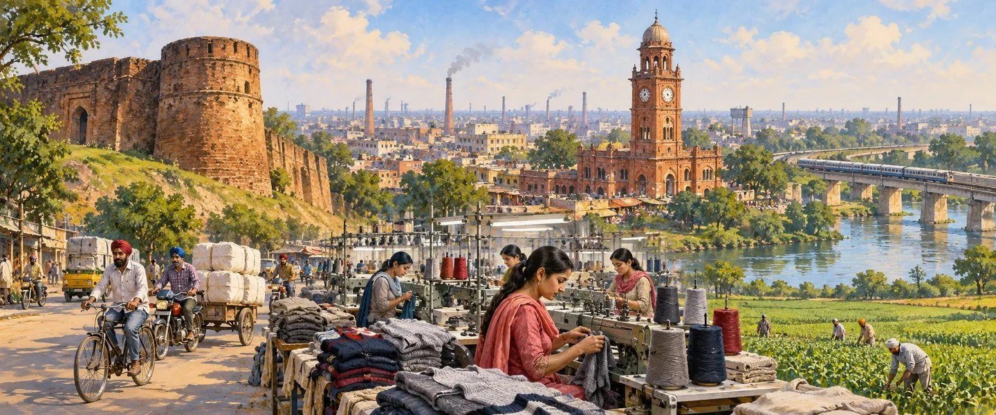

ਸਰੋਤ (10)
- Ludhiana (West) Tehsil Population, Census 2011, censusindia2011.com, opened in full (tehsil total 362,602 verified: 191,203 men and 171,399 women, 72,514 households, area 543 sq km, density 668, 127 villages and 7 towns, sex ratio 896, children 40,233 at 11.1%, SC 37.46% and ST 0, crude literacy 71.82% with men 75.36% and women 67.88%, religion table Sikh 249,024 at 68.68% and Hindu 104,257 at 28.75%, town list Gill 28,884, Mullanpur Dakha 16,356, Tharike 12,294, Bhattian 11,066, Partap Singhwala 10,843, Baddowal 6,825 and Jodhan 3,845 summing exactly to the urban 90,113, village list with Dhandra 14,972 largest; conflicts inside this source: its prose prints 75.15% as the urban share while its own tables give rural 272,489 and urban 90,113, and its urban and rural percentage column is garbled, so the tables are followed here)
- Ludhiana (West) Tehsil Population, censusofindia.net, opened in full (total 362,602 verified again, rural 272,489 at 75.15% with sex ratio 900 and urban 90,113 at 24.85% with sex ratio 887, sex ratio 897 as printed there against 896 in the other listing, child sex ratio 873, effective literacy 80.79% aged 7 and above, men 84.90% and women 76.21%, urban 81.61% and rural 80.52%, SC 135,813 at 37.46% and ST 0, workers 130,613 at 36.02%, 104,976 men and 25,637 women, area 543 sq km, 7 towns, 127 villages and 72,514 households)
- Ludhiana West (Tehsil, India), City Population, Thomas Brinkhoff, opened in full (tehsil total 362,602 verified a third time, geospatial area 556.5 sq km and density 651.6 per sq km against the census frame 543 and 668, males 191,203 and females 171,399, rural 272,489 and urban 90,113, Scheduled Castes 135,813, literate 260,430 and illiterate 61,939 among 322,369 aged 7 and above, children 0 to 6 numbered 40,233; source Office of the Registrar General and Census Commissioner)
- District Census Handbook Ludhiana, Census of India 2011, Part B, censusindia.gov.in, opened in full (district in Patiala Division with seven tehsils Samrala, Khanna, Payal, Ludhiana East, Ludhiana West, Raikot and Jagraon, all with sub divisional status, twelve CD blocks Doraha, Machhiwara, Samrala, Khanna, Dehlon, Ludhiana I, Ludhiana II, Pakhowal, Sidhwan Bet, Jagraon, Sudhar and Raikot, twenty towns of which eleven statutory and nine census towns including Gill, Tharike, Bhattian, Partap Singhwala, Baddowal and Jodhan, Ludhiana M Corp a million plus city of 1,618,879, jurisdictional table: Ludhiana West villages 133 in 2001 to 127 in 2011 and towns 1 to 7 with six villages treated as census towns, Ludhiana East the most populous tahsil, Dhandra 14,972 the largest village of the district, household amenities tables counting 71,387 households for Ludhiana West sub district code 0304100228 against 72,514 in the population listings)
- Ludhiana (West) Sub district Village List, vill.co.in, opened in full (127 village records, 125 inhabited, rural population 272,489 in 54,288 households over 58,297.16 hectares, 116 gram panchayats, villages in the Dehlon, Jagraon, Ludhiana I, Ludhiana II, Pakhowal, Sidhwan Bet and Sudhar CD blocks, largest village Dhandra 14,972, largest by area Gujjarwal 5,194 hectares with 4,947 people and nearest town Raikot, primary school, mobile coverage and domestic power reported in all 125 inhabited villages)
- Ludhiana (East) Tehsil Population, censusofindia.net, opened in full (the comparison tehsil: total 1,934,225, urban 1,654,537 at 85.54% and rural 279,688 at 14.46%, 184 villages, 3 towns, 407,387 households, area 634 sq km; its urban total is exactly Ludhiana M Corp 1,618,879 plus Sahnewal 22,484 plus Bhamian Kalan 13,174 from the district town lists, which is why East is more than five times West)
- Ludhiana district, Wikipedia, opened in full (district headquarters Ludhiana, the largest city of Punjab, district in Malwa in the Patiala Division, district total 3,498,739 in 2011, seven tehsils and seven sub tehsils including Mullanpur Dakha, current directory listing of fourteen blocks including Mullanpur and Koom Kalan, Sutlej forming the northern boundary with Jalandhar and Hoshiarpur, Moga to the west, Rupnagar to the east, alluvial plain of flood plain and upland plain, Buddha Nala joining the Sutlej in the north western corner of the district, main industries bicycle parts and hosiery, tehsil religion table Ludhiana West Sikh 68.68% and Hindu 28.75%, district language Punjabi 79.65% and Hindi 18.19% in 2011, fourteen assembly constituencies including Ludhiana West, Gill and Dakha)
- Ludhiana city, Wikipedia, opened in full (most populous city of Punjab, 1,618,879 people in 2011, coordinates 30.909 N and 75.8516 E, elevation 247 m, PIN 141001 to 141016, vehicle registration PB 10 and PB 91, tehsil field lists Ludhiana West and Ludhiana East, founded in 1480 under the Lodhi dynasty at Mir Hota, old bank of the Sutlej now about 13 km south of the river present course, Asia largest hub for bicycle manufacturing producing more than 50% of India bicycles, hosiery and apparel industries)
- Mullanpur Dakha, Wikipedia, opened in full (nagar panchayat town also called Mandi Mullanpur, 16,356 people in 2011, coordinates 30.84 N and 75.67 E, PIN 141101, grain and goods marketplace for surrounding villages including Mullanpur, Dakha, Jangpur, Raqba and Mohi, on National Highway 5 with bus services to Ludhiana, Moga and Bathinda, railway station with Ludhiana Junction about 19 km away, Chandigarh airport about 134 km and Amritsar airport about 167 km away, Gurdwara Mashkiana Sahib and Guru Teg Bahadur National College at Dakha)
- Ludhiana West tehsil directory, Jugti (places listed under the tehsil, counted October 2026)
ਜੁਗਤੀ ਮੁਫ਼ਤ ਅਤੇ ਸੁਤੰਤਰ ਹੈ। ਪਾਠਕਾਂ ਦਾ ਸਹਿਯੋਗ ਕੋਸ਼ ਨੂੰ ਵਧਾਉਂਦਾ ਹੈ।
ਸਹਿਯੋਗ