
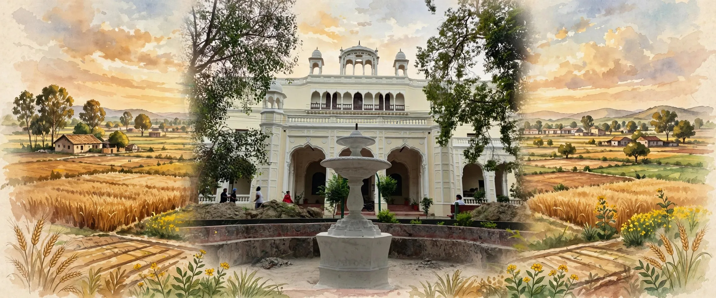
Sangrur district is a Malwa district of Punjab, India, with its headquarters at Sangrur city, once the capital of the princely state of Jind. It is a flat farming district of historic towns including Sunam, the birthplace of Shaheed Udham Singh, and counted 1,655,169 people in the 2011 census before Malerkotla district was separated in 2021.
- ਪੰਜਾਬੀ ਨਾਂ
- ਸੰਗਰੂਰ
- ਕਿਸਮ
- ਜ਼ਿਲ੍ਹਾ
- Headquarters
- Sangrur city
- ਇਲਾਕਾ
- Malwa, Punjab (India)
- Formed
- 1948, from Jind, Patiala and Nabha territories in PEPSU; reduced in 2006 (Barnala) and 2021 (Malerkotla)
- ਰਕਬਾ
- 3,685 sq km (2011 census, pre-bifurcation district)
All 15 facts
- ਆਬਾਦੀ
- 1,655,169 (2011 census, pre-bifurcation district)
- Population in present boundaries
- 1,225,415 (2011 census recomputed for present boundaries)
- ਸਿੱਖ ਆਬਾਦੀ
- 449 per sq km (2011 census, pre-bifurcation district)
- ਸਾਖਰਤਾ
- 67.99 per cent (2011 census)
- Sex ratio
- 885 women per 1,000 men (2011 census)
- Subdivisions
- Sangrur, Sunam, Dhuri, Bhawanigarh, Dirba, Lehragaga, Moonak
- ਭਾਸ਼ਾ
- ਪੰਜਾਬੀ (ਮਾਲਵਈ)
- ਪ੍ਰਸਿੱਧੀ
- Former capital of Jind state; Banasar Bagh; Sunam, birthplace of Shaheed Udham Singh; wheat and paddy mandis
- ਜ਼ਿਲ੍ਹਾ
- ਸੰਗਰੂਰ
Sangrur district is a district in the Malwa region of Punjab, India, with its headquarters at Sangrur city. Once the seat of the princely state of Jind, it is a flat, canal watered farming district of historic towns, among them Sunam, the birthplace of Shaheed Udham Singh. The 2011 census counted 1,655,169 people in the district as it then stood, before Malerkotla was separated in 2021.
Where is Sangrur district?
Sangrur district is in southern Punjab, in the heart of Malwa, on the level alluvial plain of the Punjab plains. Its neighbours are Malerkotla district to the north, Barnala to the west, Patiala to the east, Mansa to the south west, and the Haryana districts of Fatehabad and Jind to the south. The district belongs to the Patiala Division, and Sangrur city, its headquarters, stands at about 30.25 degrees north and 75.84 degrees east.
The district takes its name from the headquarters town. The district administration's history says the town is said to have been founded by one Sanghu, a Jat, about four hundred years ago, and named after him. That origin is tradition rather than record, but the name has stayed with the town as village, royal capital and now district headquarters. Sangrur city counted 88,043 people in 2011.
History: capital of Jind state
Settlement here is far older than the district. Excavations at Rohira have uncovered a mound about ten metres high with settlement layers dated to around 2300 BC, in the pre-Harappan period, and pottery linked to the Harappan and Kushan periods has been found at sites such as Mard Khera.
In the princely era the land that now forms the district was divided mainly among the Phulkian states. Most of it belonged to Patiala state, including Sunam, Dhuri, Dirba, Moonak, Longowal and Bhawanigarh, while Sangrur town, Badrukhan and 43 nearby villages belonged to Jind state, and some areas belonged to Nabha. Sangrur town itself was part of Nabha before 1773, then passed to Jind after a quarrel between the two states. In 1827 Raja Sangat Singh chose Sangrur as his capital, and later Jind rulers laid out its bazaars, gardens and four gates.
The modern district dates from 1948, when princely rule ended and Sangrur was created from territories of the Nabha, Jind and Patiala states as part of PEPSU, the Patiala and East Punjab States Union. It changed shape repeatedly afterwards. Barnala district was merged into it in 1953, PEPSU merged into Punjab in 1956, and in 1966 the Jind and Narwana tehsils went to the new state of Haryana. Barnala was separated again in 2006. The latest change came on 14 May 2021, when Malerkotla was declared Punjab's 23rd district, carved out of Sangrur with the Malerkotla and Ahmedgarh subdivisions and the Amargarh sub-tehsil. Today's Sangrur is therefore noticeably smaller than the district the 2011 census counted.
Geography and people
The district is almost entirely flat alluvial plain, and its life is organised around water: canals and tubewells watering field after field of wheat and paddy. The official district account describes a dry climate with a hot summer, a short monsoon and a cold winter, and gives average annual rainfall at about 590 millimetres, most of it falling between July and September.
Read the census figures with the 2021 split in mind. The 2011 census counted the old, undivided district: 1,655,169 people over 3,685 square kilometres, a density of 449 people per square kilometre, a literacy rate of 67.99 per cent and a sex ratio of 885 women for every 1,000 men, with growth of 12.3 per cent over the decade from 2001. In that old district, Sikhs formed about 65 per cent of the population, Hindus about 24 per cent and Muslims about 11 per cent, the Muslim share centred on Malerkotla. Punjabi, in its Malwai form, is the district's language, spoken at home, in the mandis and in its gurdwaras, temples and mosques.
For the district within its present boundaries, City Population recomputes the same 2011 census at 1,225,415 people. That is not a new count: it is the 2011 record rearranged to fit the post-2021 map. No newer official population figure for the present district exists.
Towns of the district
The district is administered in seven subdivisions: Sangrur, Sunam, Dhuri, Bhawanigarh, Dirba, Lehragaga and Moonak. Sangrur city, the headquarters, remains the administrative and market centre, with the district courts, the main bazaars and the old royal quarter around Banasar Bagh. Sunam, south of the headquarters and today also called Sunam Udham Singh Wala after its most famous son, is one of the district's oldest towns and a subdivision in its own right.
Dhuri, north of Sangrur city, is the district's railway junction and one of its industrial towns. Bhawanigarh lies east of the headquarters on the Patiala road, Dirba serves the farming belt beyond it, and Longowal is known across Punjab for the Sant Longowal Institute of Engineering and Technology. In the far south, Lehragaga and Moonak serve the Ghaggar side of the district: Moonak sits on the bank of the Ghaggar river, close to the Haryana border, and Khanauri and Cheema round out the towns that anchor local trade.
Places of interest
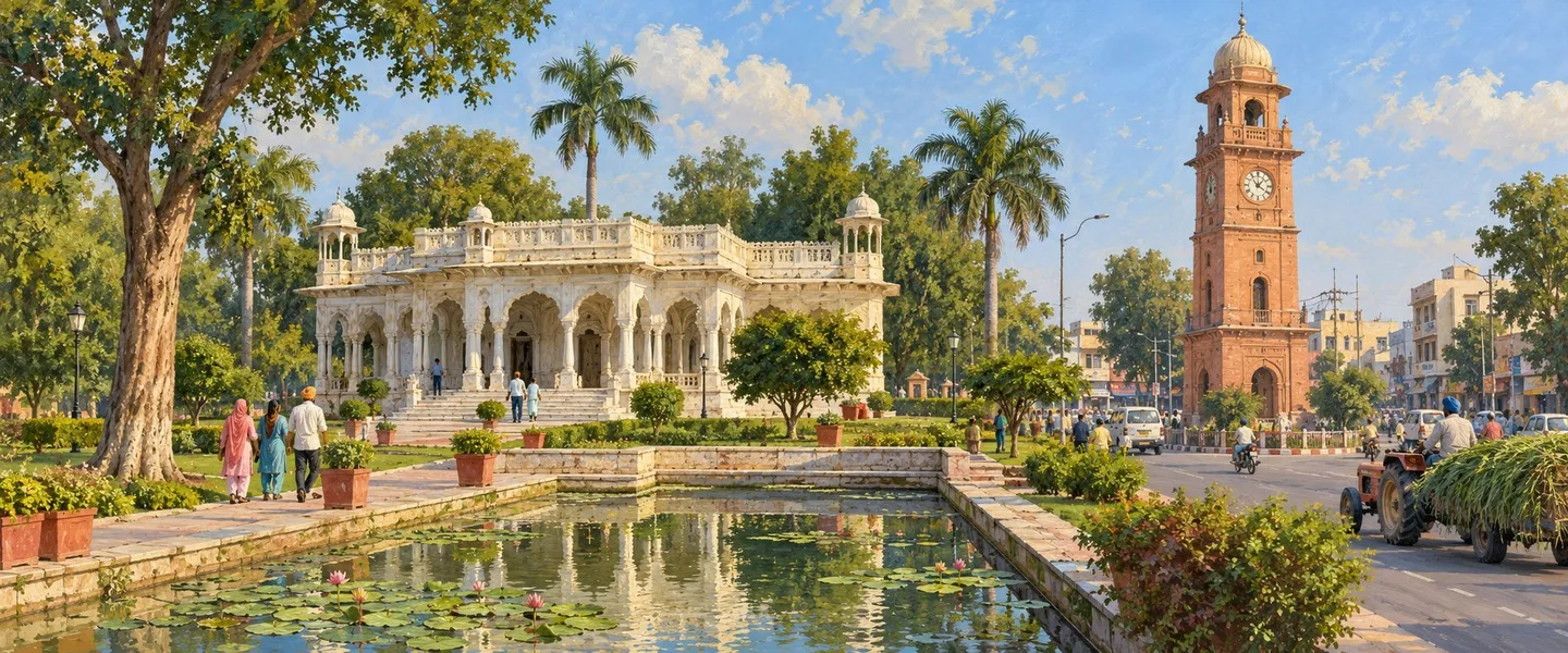
Banasar Bagh in Sangrur city is the district's best known sight. At its centre stands a marble Baradari, a pavilion with twelve doors, set in the middle of a pond and reached by a small bridge through a marble gate, with four towers, walkways, planting and a mini zoo around it. The rulers of Jind state used the garden buildings as a summer retreat. Beside the garden, the old Diwan Khana, where the Jind court sat, is now the Jind State Memorial Museum, displaying weapons and other articles of the princely period.
The royal layer of the city runs deeper. Outside the Nabha Gate stands the Shahi Samadhan, the tomb complex of the Jind rulers, among them Maharaja Gajpat Singh, the maternal grandfather of Maharaja Ranjit Singh. The heritage Clock Tower rises near the courts complex, and the old city still reads by its four gates: the Sunami Gate, Patiala Gate, Dhuri Gate and Nabha Gate, each named for the town the road leads to. About five kilometres from the Nabha Gate, Gurdwara Nankiana Sahib is associated in local tradition with visits by Guru Nanak and Guru Hargobind.
At Sunam, the ancestral house of Shaheed Udham Singh has been converted into a museum, with letters and objects connected to him on display, and his memorial draws visitors through the year. Udham Singh was born at Sunam in 1899 and was hanged in London on 31 July 1940 after shooting Michael O'Dwyer, the former lieutenant governor of Punjab, that March, an act he linked to the Jallianwala Bagh massacre of 1919. For many visitors, that story is their reason for coming to the district.
Economy and farming
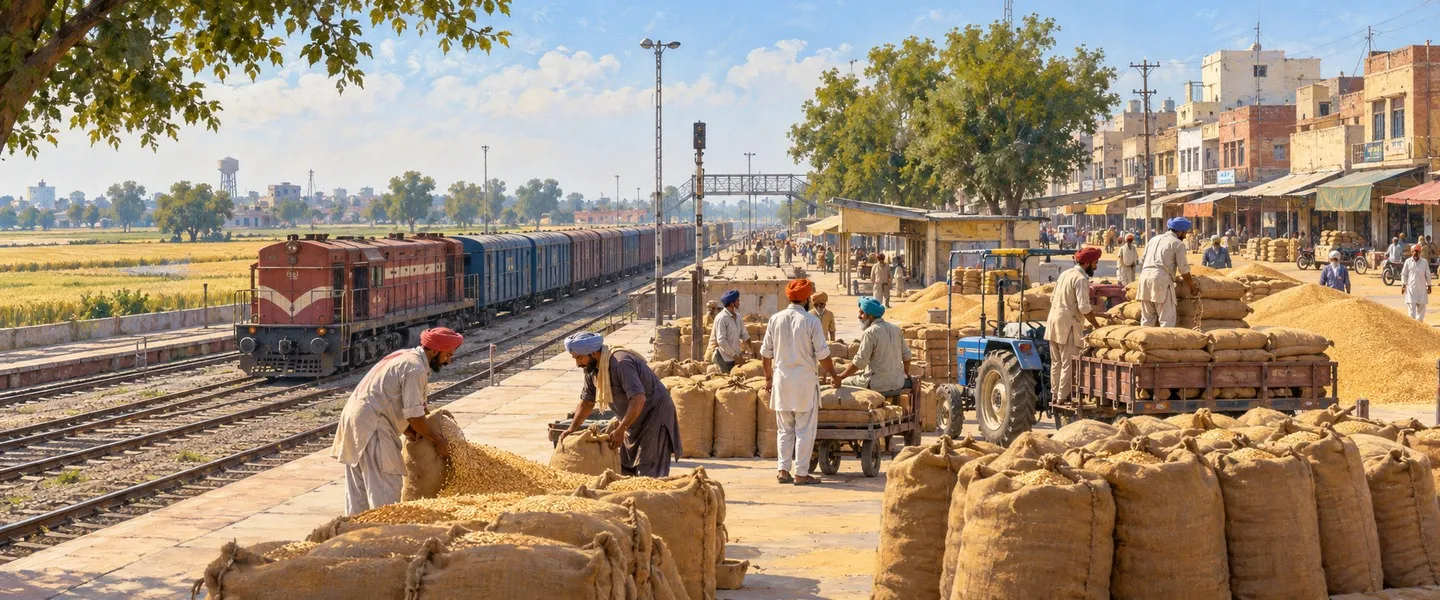
Farming is the district's economy first, and everything else arranges itself around the crop calendar. Wheat and paddy dominate the canal irrigated plain, with cotton, groundnut and bajra in the drier southern belt around Lehragaga, and the mandi towns exist to grade, weigh, store and move that grain.
Industry is mostly small scale and tied to the farm economy. A district count for 2009 to 2010 recorded 10,695 registered industrial units, of which 23 were large or medium units, with small scale industries employing 53,259 workers. Dhuri shows the pattern best: a cooperative sugar mill, workshops making agricultural implements, and a name for steel furniture. Sangrur city adds services and health care for the whole region, including the PGIMER Satellite Centre and the Homi Bhabha Cancer Hospital.
Getting there and today
Sangrur sits on the Ludhiana to Jakhal railway line, with direct rail links to Ludhiana and to Jakhal in Haryana. Dhuri is the bigger rail point, a junction where that line meets the Bathinda to Rajpura line. By road, the official district guide puts Sangrur city 56 kilometres from Patiala and 112 kilometres from Bathinda, with buses tying every subdivision town to the headquarters through the day.
Today's Sangrur is a mid sized Malwa district with an outsized past: a former royal capital, the home district of Udham Singh, and a farming heartland whose towns grew up around grain. The 2021 separation of Malerkotla made it smaller, but its structure did not change: Sangrur city at the centre, Sunam and Dhuri as its other poles, and hundreds of villages in between.
ਸੰਗਰੂਰ ਜ਼ਿਲ੍ਹਾ ਭਾਰਤ ਦੇ ਪੰਜਾਬ ਸੂਬੇ ਦੇ ਮਾਲਵਾ ਖੇਤਰ ਦਾ ਇੱਕ ਜ਼ਿਲ੍ਹਾ ਹੈ, ਜਿਸਦਾ ਸਦਰ ਮੁਕਾਮ ਸੰਗਰੂਰ ਸ਼ਹਿਰ ਹੈ। ਕਿਸੇ ਸਮੇਂ ਜੀਂਦ ਰਿਆਸਤ ਦਾ ਕੇਂਦਰ ਰਿਹਾ ਇਹ ਜ਼ਿਲ੍ਹਾ ਪੱਧਰਾ, ਨਹਿਰੀ ਪਾਣੀ ਵਾਲਾ ਖੇਤੀ ਜ਼ਿਲ੍ਹਾ ਹੈ, ਜਿਸਦੇ ਇਤਿਹਾਸਕ ਕਸਬਿਆਂ ਵਿੱਚ ਸੁਨਾਮ ਵੀ ਸ਼ਾਮਲ ਹੈ, ਜੋ ਸ਼ਹੀਦ ਊਧਮ ਸਿੰਘ ਦਾ ਜਨਮ ਅਸਥਾਨ ਹੈ। 2011 ਦੀ ਜਨਗਣਨਾ ਨੇ ਉਸ ਸਮੇਂ ਦੇ ਜ਼ਿਲ੍ਹੇ ਵਿੱਚ 1,655,169 ਲੋਕ ਗਿਣੇ ਸਨ, ਇਸ ਤੋਂ ਪਹਿਲਾਂ ਕਿ 2021 ਵਿੱਚ ਮਲੇਰਕੋਟਲਾ ਵੱਖਰਾ ਜ਼ਿਲ੍ਹਾ ਬਣਿਆ।
ਸੰਗਰੂਰ ਜ਼ਿਲ੍ਹਾ ਕਿੱਥੇ ਹੈ?
ਸੰਗਰੂਰ ਜ਼ਿਲ੍ਹਾ ਦੱਖਣੀ ਪੰਜਾਬ ਵਿੱਚ, ਮਾਲਵੇ ਦੇ ਦਿਲ ਵਿੱਚ, ਪੰਜਾਬ ਦੇ ਮੈਦਾਨਾਂ ਦੇ ਪੱਧਰੇ ਜਲੋੜ ਮੈਦਾਨ ਉੱਤੇ ਹੈ। ਇਸਦੇ ਗੁਆਂਢੀ ਉੱਤਰ ਵਿੱਚ ਮਲੇਰਕੋਟਲਾ ਜ਼ਿਲ੍ਹਾ, ਪੱਛਮ ਵਿੱਚ ਬਰਨਾਲਾ, ਪੂਰਬ ਵਿੱਚ ਪਟਿਆਲਾ, ਦੱਖਣ-ਪੱਛਮ ਵਿੱਚ ਮਾਨਸਾ ਅਤੇ ਦੱਖਣ ਵਿੱਚ ਹਰਿਆਣਾ ਦੇ ਫਤਿਹਾਬਾਦ ਅਤੇ ਜੀਂਦ ਜ਼ਿਲ੍ਹੇ ਹਨ। ਇਹ ਜ਼ਿਲ੍ਹਾ ਪਟਿਆਲਾ ਡਿਵੀਜ਼ਨ ਵਿੱਚ ਆਉਂਦਾ ਹੈ, ਅਤੇ ਇਸਦਾ ਸਦਰ ਮੁਕਾਮ ਸੰਗਰੂਰ ਸ਼ਹਿਰ ਲਗਭਗ 30.25 ਡਿਗਰੀ ਉੱਤਰ ਅਤੇ 75.84 ਡਿਗਰੀ ਪੂਰਬ ਵਿੱਚ ਹੈ।
ਜ਼ਿਲ੍ਹੇ ਦਾ ਨਾਂ ਇਸਦੇ ਸਦਰ ਮੁਕਾਮ ਵਾਲੇ ਕਸਬੇ ਤੋਂ ਪਿਆ ਹੈ। ਜ਼ਿਲ੍ਹਾ ਪ੍ਰਸ਼ਾਸਨ ਦੇ ਆਪਣੇ ਇਤਿਹਾਸ ਅਨੁਸਾਰ ਕਿਹਾ ਜਾਂਦਾ ਹੈ ਕਿ ਇਹ ਕਸਬਾ ਲਗਭਗ ਚਾਰ ਸੌ ਸਾਲ ਪਹਿਲਾਂ ਸੰਘੂ ਨਾਂ ਦੇ ਇੱਕ ਜੱਟ ਨੇ ਵਸਾਇਆ ਸੀ ਅਤੇ ਇਹ ਨਾਂ ਉਸੇ ਦੇ ਨਾਂ ਉੱਤੇ ਪਿਆ। ਇਹ ਮੂਲ ਕਥਾ ਰਵਾਇਤ ਹੈ, ਦਰਜ ਇਤਿਹਾਸ ਨਹੀਂ, ਪਰ ਇਹ ਨਾਂ ਪਿੰਡ, ਸ਼ਾਹੀ ਰਾਜਧਾਨੀ ਅਤੇ ਹੁਣ ਜ਼ਿਲ੍ਹਾ ਸਦਰ ਮੁਕਾਮ ਵਜੋਂ ਕਸਬੇ ਨਾਲ ਜੁੜਿਆ ਰਿਹਾ ਹੈ।
ਇਤਿਹਾਸ: ਜੀਂਦ ਰਿਆਸਤ ਦੀ ਰਾਜਧਾਨੀ
ਇੱਥੇ ਦੀ ਵਸੇਬਾ ਜ਼ਿਲ੍ਹੇ ਨਾਲੋਂ ਕਿਤੇ ਪੁਰਾਣੀ ਹੈ। ਰੋਹੀੜਾ ਵਿਖੇ ਖੁਦਾਈ ਵਿੱਚ ਲਗਭਗ ਦਸ ਮੀਟਰ ਉੱਚਾ ਟਿੱਬਾ ਮਿਲਿਆ ਹੈ, ਜਿਸਦੀਆਂ ਵਸੇਬਾ ਪਰਤਾਂ ਲਗਭਗ 2300 ਈਸਾ ਪੂਰਵ, ਪੂਰਵ-ਹੜੱਪਾ ਕਾਲ ਦੀਆਂ ਦੱਸੀਆਂ ਜਾਂਦੀਆਂ ਹਨ, ਅਤੇ ਮਰਦ ਖੇੜਾ ਵਰਗੇ ਥਾਵਾਂ ਤੋਂ ਹੜੱਪਾ ਅਤੇ ਕੁਸ਼ਾਣ ਕਾਲ ਨਾਲ ਜੁੜੇ ਮਿੱਟੀ ਦੇ ਭਾਂਡੇ ਮਿਲੇ ਹਨ। ਸਤਲੁਜ ਅਤੇ ਘੱਗਰ ਵਿਚਕਾਰਲਾ ਇਹ ਮੈਦਾਨ ਬਹੁਤ ਲੰਮੇ ਸਮੇਂ ਤੋਂ ਵਾਹਿਆ ਅਤੇ ਲੜਿਆ ਜਾਂਦਾ ਰਿਹਾ ਹੈ।
ਰਿਆਸਤੀ ਕਾਲ ਵਿੱਚ ਅੱਜ ਦੇ ਜ਼ਿਲ੍ਹੇ ਵਾਲੀ ਧਰਤੀ ਮੁੱਖ ਤੌਰ ਉੱਤੇ ਫੂਲਕੀਆਂ ਰਿਆਸਤਾਂ ਵਿੱਚ ਵੰਡੀ ਹੋਈ ਸੀ। ਇਸਦਾ ਵੱਡਾ ਹਿੱਸਾ ਪਟਿਆਲਾ ਰਿਆਸਤ ਵਿੱਚ ਸੀ, ਜਿਸ ਵਿੱਚ ਸੁਨਾਮ, ਧੂਰੀ, ਦਿੜ੍ਹਬਾ, ਮੂਣਕ, ਲੌਂਗੋਵਾਲ ਅਤੇ ਭਵਾਨੀਗੜ੍ਹ ਸ਼ਾਮਲ ਸਨ, ਜਦੋਂ ਕਿ ਸੰਗਰੂਰ ਕਸਬਾ, ਬਦਰੁੱਖਾਂ ਅਤੇ ਨੇੜਲੇ 43 ਪਿੰਡ ਜੀਂਦ ਰਿਆਸਤ ਵਿੱਚ ਸਨ ਅਤੇ ਕੁਝ ਇਲਾਕੇ ਨਾਭਾ ਵਿੱਚ ਸਨ। ਸੰਗਰੂਰ ਕਸਬਾ 1773 ਤੋਂ ਪਹਿਲਾਂ ਨਾਭਾ ਵਿੱਚ ਸੀ, ਫਿਰ ਦੋਹਾਂ ਰਿਆਸਤਾਂ ਵਿਚਕਾਰ ਝਗੜੇ ਤੋਂ ਬਾਅਦ ਜੀਂਦ ਵਿੱਚ ਚਲਾ ਗਿਆ। 1827 ਵਿੱਚ ਰਾਜਾ ਸੰਗਤ ਸਿੰਘ ਨੇ ਸੰਗਰੂਰ ਨੂੰ ਆਪਣੀ ਰਾਜਧਾਨੀ ਚੁਣਿਆ, ਜੋ ਪਟਿਆਲਾ ਅਤੇ ਨਾਭਾ, ਬਾਕੀ ਫੂਲਕੀਆਂ ਘਰਾਣਿਆਂ ਦੇ ਕੇਂਦਰਾਂ, ਦੇ ਨੇੜੇ ਸੀ, ਅਤੇ ਬਾਅਦ ਵਿੱਚ ਜੀਂਦ ਦੇ ਸ਼ਾਸਕਾਂ ਨੇ ਇਸਦੇ ਬਾਜ਼ਾਰ, ਬਾਗ਼ ਅਤੇ ਚਾਰ ਦਰਵਾਜ਼ੇ ਬਣਵਾਏ।
ਆਧੁਨਿਕ ਜ਼ਿਲ੍ਹਾ 1948 ਵਿੱਚ ਬਣਿਆ, ਜਦੋਂ ਰਿਆਸਤੀ ਰਾਜ ਖਤਮ ਹੋਇਆ ਅਤੇ ਸੰਗਰੂਰ ਨਾਭਾ, ਜੀਂਦ ਅਤੇ ਪਟਿਆਲਾ ਰਿਆਸਤਾਂ ਦੇ ਇਲਾਕਿਆਂ ਵਿੱਚੋਂ ਬਣ ਕੇ ਪੈਪਸੂ, ਭਾਵ ਪਟਿਆਲਾ ਅਤੇ ਪੂਰਬੀ ਪੰਜਾਬ ਰਾਜ ਸੰਘ, ਦਾ ਹਿੱਸਾ ਬਣਿਆ। ਇਸ ਤੋਂ ਬਾਅਦ ਇਸਦੀ ਸ਼ਕਲ ਵਾਰ ਵਾਰ ਬਦਲੀ। ਖਤਮ ਕੀਤਾ ਗਿਆ ਬਰਨਾਲਾ ਜ਼ਿਲ੍ਹਾ 1953 ਵਿੱਚ ਇਸ ਵਿੱਚ ਰਲਾਇਆ ਗਿਆ, ਪੈਪਸੂ ਆਪ 1956 ਵਿੱਚ ਪੰਜਾਬ ਵਿੱਚ ਰਲ ਗਿਆ, ਅਤੇ 1966 ਵਿੱਚ ਜੀਂਦ ਅਤੇ ਨਰਵਾਨਾ ਤਹਿਸੀਲਾਂ ਨਵੇਂ ਹਰਿਆਣਾ ਸੂਬੇ ਵਿੱਚ ਚਲੀਆਂ ਗਈਆਂ। ਬਰਨਾਲਾ 2006 ਵਿੱਚ ਫਿਰ ਵੱਖਰਾ ਜ਼ਿਲ੍ਹਾ ਬਣਿਆ। ਸਭ ਤੋਂ ਤਾਜ਼ਾ ਤਬਦੀਲੀ 14 ਮਈ 2021 ਨੂੰ ਆਈ, ਜਦੋਂ ਮਲੇਰਕੋਟਲਾ ਨੂੰ ਪੰਜਾਬ ਦਾ 23ਵਾਂ ਜ਼ਿਲ੍ਹਾ ਐਲਾਨਿਆ ਗਿਆ, ਜੋ ਸੰਗਰੂਰ ਵਿੱਚੋਂ ਮਲੇਰਕੋਟਲਾ ਅਤੇ ਅਹਿਮਦਗੜ੍ਹ ਸਬ-ਡਿਵੀਜ਼ਨਾਂ ਅਤੇ ਅਮਰਗੜ੍ਹ ਸਬ-ਤਹਿਸੀਲ ਨਾਲ ਕੱਟ ਕੇ ਬਣਾਇਆ ਗਿਆ। ਇਸ ਲਈ ਅੱਜ ਦਾ ਸੰਗਰੂਰ ਉਸ ਜ਼ਿਲ੍ਹੇ ਨਾਲੋਂ ਕਾਫ਼ੀ ਛੋਟਾ ਹੈ ਜਿਸਨੂੰ 2011 ਦੀ ਜਨਗਣਨਾ ਨੇ ਗਿਣਿਆ ਸੀ।
ਭੂਗੋਲ ਅਤੇ ਲੋਕ
ਇਹ ਜ਼ਿਲ੍ਹਾ ਲਗਭਗ ਪੂਰੀ ਤਰ੍ਹਾਂ ਪੱਧਰਾ ਜਲੋੜ ਮੈਦਾਨ ਹੈ, ਜੋ ਪੰਜਾਬ ਦੇ ਇਸ ਹਿੱਸੇ ਵਿੱਚੋਂ ਲੰਘਦੀਆਂ ਨਦੀਆਂ ਨਾਲਿਆਂ ਨੇ ਬਣਾਇਆ ਹੈ, ਅਤੇ ਇਸਦੀ ਜ਼ਿੰਦਗੀ ਪਾਣੀ ਦੁਆਲੇ ਘੁੰਮਦੀ ਹੈ: ਨਹਿਰਾਂ ਅਤੇ ਟਿਊਬਵੈੱਲ ਖੇਤ ਮਗਰ ਖੇਤ ਕਣਕ ਅਤੇ ਝੋਨੇ ਨੂੰ ਪਾਣੀ ਦਿੰਦੇ ਹਨ। ਜ਼ਿਲ੍ਹੇ ਦਾ ਅਧਿਕਾਰਤ ਵੇਰਵਾ ਖੁਸ਼ਕ ਮੌਸਮ ਦੱਸਦਾ ਹੈ, ਜਿਸ ਵਿੱਚ ਗਰਮ ਗਰਮੀ, ਛੋਟਾ ਮਾਨਸੂਨ ਅਤੇ ਠੰਢੀ ਸਰਦੀ ਹੁੰਦੀ ਹੈ, ਅਤੇ ਸਾਲਾਨਾ ਔਸਤ ਬਾਰਸ਼ ਲਗਭਗ 590 ਮਿਲੀਮੀਟਰ ਦਿੰਦਾ ਹੈ, ਜਿਸਦਾ ਵੱਡਾ ਹਿੱਸਾ ਜੁਲਾਈ ਤੋਂ ਸਤੰਬਰ ਵਿਚਕਾਰ ਪੈਂਦਾ ਹੈ। ਗਰਮੀਆਂ ਤੇਜ਼ ਹੁੰਦੀਆਂ ਹਨ, ਸਰਦੀਆਂ ਦੀਆਂ ਸਭ ਤੋਂ ਠੰਢੀਆਂ ਰਾਤਾਂ ਨੂੰ ਕੋਰਾ ਪੈ ਸਕਦਾ ਹੈ, ਅਤੇ ਗਰਮ ਰੁੱਤ ਵਿੱਚ ਧੂੜ ਵਾਲੀਆਂ ਹਨੇਰੀਆਂ ਆਉਂਦੀਆਂ ਹਨ।
ਜਨਗਣਨਾ ਦੇ ਅੰਕੜੇ 2021 ਦੀ ਵੰਡ ਨੂੰ ਧਿਆਨ ਵਿੱਚ ਰੱਖ ਕੇ ਪੜ੍ਹੋ। 2011 ਦੀ ਜਨਗਣਨਾ ਨੇ ਪੁਰਾਣਾ, ਅਣਵੰਡਿਆ ਜ਼ਿਲ੍ਹਾ ਗਿਣਿਆ ਸੀ: 3,685 ਵਰਗ ਕਿਲੋਮੀਟਰ ਵਿੱਚ 1,655,169 ਲੋਕ, ਘਣਤਾ 449 ਲੋਕ ਪ੍ਰਤੀ ਵਰਗ ਕਿਲੋਮੀਟਰ, ਸਾਖਰਤਾ ਦਰ 67.99 ਫੀਸਦੀ ਅਤੇ ਲਿੰਗ ਅਨੁਪਾਤ ਹਰ 1,000 ਮਰਦਾਂ ਪਿੱਛੇ 885 ਔਰਤਾਂ, ਅਤੇ 2001 ਤੋਂ ਦਹਾਕੇ ਵਿੱਚ 12.3 ਫੀਸਦੀ ਵਾਧਾ। ਉਸ ਪੁਰਾਣੇ ਜ਼ਿਲ੍ਹੇ ਵਿੱਚ ਸਿੱਖ ਆਬਾਦੀ ਦਾ ਲਗਭਗ 65 ਫੀਸਦੀ, ਹਿੰਦੂ ਲਗਭਗ 24 ਫੀਸਦੀ ਅਤੇ ਮੁਸਲਮਾਨ ਲਗਭਗ 11 ਫੀਸਦੀ ਸਨ, ਜਿਸ ਵਿੱਚ ਮੁਸਲਿਮ ਹਿੱਸਾ ਮੁੱਖ ਤੌਰ ਉੱਤੇ ਮਲੇਰਕੋਟਲਾ ਵਿੱਚ ਕੇਂਦਰਿਤ ਸੀ। ਪੰਜਾਬੀ, ਆਪਣੇ ਮਾਲਵਈ ਰੂਪ ਵਿੱਚ, ਜ਼ਿਲ੍ਹੇ ਦੀ ਭਾਸ਼ਾ ਹੈ, ਜੋ ਘਰਾਂ, ਮੰਡੀਆਂ ਅਤੇ ਇਸਦੇ ਗੁਰਦੁਆਰਿਆਂ, ਮੰਦਰਾਂ ਅਤੇ ਮਸਜਿਦਾਂ ਵਿੱਚ ਬੋਲੀ ਜਾਂਦੀ ਹੈ।
ਮੌਜੂਦਾ ਹੱਦਾਂ ਵਾਲੇ ਜ਼ਿਲ੍ਹੇ ਲਈ, ਸਿਟੀ ਪਾਪੂਲੇਸ਼ਨ ਉਸੇ 2011 ਦੀ ਜਨਗਣਨਾ ਨੂੰ ਮੁੜ ਗਿਣ ਕੇ 1,225,415 ਲੋਕ ਦਿੰਦਾ ਹੈ। ਇਹ ਨਵੀਂ ਗਿਣਤੀ ਨਹੀਂ ਹੈ: ਇਹ 2011 ਦਾ ਰਿਕਾਰਡ ਹੈ ਜੋ 2021 ਤੋਂ ਬਾਅਦ ਵਾਲੇ ਨਕਸ਼ੇ ਅਨੁਸਾਰ ਮੁੜ ਸਜਾਇਆ ਗਿਆ ਹੈ, ਅਤੇ ਨਵੀਂ ਜਨਗਣਨਾ ਹੋਣ ਤੱਕ ਇਹੀ ਸਭ ਤੋਂ ਠੀਕ ਤਸਵੀਰ ਹੈ। ਮੌਜੂਦਾ ਜ਼ਿਲ੍ਹੇ ਦੀ ਇਸ ਤੋਂ ਨਵੀਂ ਕੋਈ ਅਧਿਕਾਰਤ ਆਬਾਦੀ ਨਹੀਂ ਹੈ, ਅਤੇ ਇੱਥੇ ਕੋਈ ਦਾਅਵਾ ਨਹੀਂ ਕੀਤਾ ਗਿਆ।
ਜ਼ਿਲ੍ਹੇ ਦੇ ਕਸਬੇ
ਜ਼ਿਲ੍ਹੇ ਦਾ ਪ੍ਰਸ਼ਾਸਨ ਸੱਤ ਸਬ-ਡਿਵੀਜ਼ਨਾਂ ਵਿੱਚ ਚਲਦਾ ਹੈ: ਸੰਗਰੂਰ, ਸੁਨਾਮ, ਧੂਰੀ, ਭਵਾਨੀਗੜ੍ਹ, ਦਿੜ੍ਹਬਾ, ਲਹਿਰਾਗਾਗਾ ਅਤੇ ਮੂਣਕ। ਸਦਰ ਮੁਕਾਮ ਸੰਗਰੂਰ ਸ਼ਹਿਰ ਨੇ 2011 ਵਿੱਚ 88,043 ਲੋਕ ਗਿਣੇ ਸਨ ਅਤੇ ਇਹ ਪ੍ਰਸ਼ਾਸਨਿਕ ਅਤੇ ਮੰਡੀ ਕੇਂਦਰ ਬਣਿਆ ਹੋਇਆ ਹੈ, ਜਿੱਥੇ ਜ਼ਿਲ੍ਹਾ ਕਚਹਿਰੀਆਂ, ਮੁੱਖ ਬਾਜ਼ਾਰ ਅਤੇ ਬਨਾਸਰ ਬਾਗ਼ ਦੁਆਲੇ ਪੁਰਾਣਾ ਸ਼ਾਹੀ ਹਿੱਸਾ ਹੈ। ਸਦਰ ਮੁਕਾਮ ਤੋਂ ਦੱਖਣ ਵੱਲ ਸੁਨਾਮ, ਜਿਸਨੂੰ ਅੱਜ ਇਸਦੇ ਸਭ ਤੋਂ ਮਸ਼ਹੂਰ ਪੁੱਤਰ ਦੇ ਨਾਂ ਉੱਤੇ ਸੁਨਾਮ ਊਧਮ ਸਿੰਘ ਵਾਲਾ ਵੀ ਕਿਹਾ ਜਾਂਦਾ ਹੈ, ਜ਼ਿਲ੍ਹੇ ਦੇ ਸਭ ਤੋਂ ਪੁਰਾਣੇ ਕਸਬਿਆਂ ਵਿੱਚੋਂ ਇੱਕ ਹੈ ਅਤੇ ਆਪਣੀ ਸਬ-ਡਿਵੀਜ਼ਨ ਹੈ।
ਸੰਗਰੂਰ ਸ਼ਹਿਰ ਤੋਂ ਉੱਤਰ ਵੱਲ ਧੂਰੀ ਜ਼ਿਲ੍ਹੇ ਦਾ ਰੇਲਵੇ ਜੰਕਸ਼ਨ ਅਤੇ ਇਸਦੇ ਉਦਯੋਗਿਕ ਕਸਬਿਆਂ ਵਿੱਚੋਂ ਇੱਕ ਹੈ। ਭਵਾਨੀਗੜ੍ਹ ਸਦਰ ਮੁਕਾਮ ਤੋਂ ਪੂਰਬ ਵੱਲ ਪਟਿਆਲਾ ਸੜਕ ਉੱਤੇ ਹੈ, ਦਿੜ੍ਹਬਾ ਇਸ ਤੋਂ ਪੱਛਮ ਅਤੇ ਦੱਖਣ ਵਾਲੀ ਖੇਤੀ ਪੱਟੀ ਦੀ ਸੇਵਾ ਕਰਦਾ ਹੈ, ਅਤੇ ਲੌਂਗੋਵਾਲ, ਜੋ ਪਟਿਆਲਾ ਰਿਆਸਤ ਦੇ ਕਾਲ ਵਿੱਚ ਵਸਿਆ ਸੀ, ਸੰਤ ਲੌਂਗੋਵਾਲ ਇੰਸਟੀਚਿਊਟ ਆਫ਼ ਇੰਜੀਨੀਅਰਿੰਗ ਐਂਡ ਟੈਕਨਾਲੋਜੀ ਅਤੇ ਆਧੁਨਿਕ ਸਿੱਖ ਅਤੇ ਪੰਜਾਬ ਰਾਜਨੀਤੀ ਵਿੱਚ ਆਪਣੀ ਥਾਂ ਲਈ ਪੂਰੇ ਪੰਜਾਬ ਵਿੱਚ ਜਾਣਿਆ ਜਾਂਦਾ ਹੈ। ਦੂਰ ਦੱਖਣ ਵਿੱਚ ਲਹਿਰਾਗਾਗਾ ਅਤੇ ਮੂਣਕ ਜ਼ਿਲ੍ਹੇ ਦੇ ਘੱਗਰ ਵਾਲੇ ਪਾਸੇ ਦੀ ਸੇਵਾ ਕਰਦੇ ਹਨ: ਮੂਣਕ ਘੱਗਰ ਦਰਿਆ ਦੇ ਕੰਢੇ, ਹਰਿਆਣਾ ਸਰਹੱਦ ਦੇ ਨੇੜੇ ਹੈ, ਅਤੇ ਖਨੌਰੀ ਅਤੇ ਚੀਮਾ ਉਹਨਾਂ ਕਸਬਿਆਂ ਦੀ ਸੂਚੀ ਪੂਰੀ ਕਰਦੇ ਹਨ ਜੋ ਸਥਾਨਕ ਵਪਾਰ ਦੇ ਕੇਂਦਰ ਹਨ।
ਦੇਖਣਯੋਗ ਥਾਵਾਂ
ਸੰਗਰੂਰ ਸ਼ਹਿਰ ਵਿੱਚ ਬਨਾਸਰ ਬਾਗ਼ ਜ਼ਿਲ੍ਹੇ ਦੀ ਸਭ ਤੋਂ ਜਾਣੀ ਪਛਾਣੀ ਥਾਂ ਹੈ। ਇਸਦੇ ਵਿਚਕਾਰ ਸੰਗਮਰਮਰ ਦੀ ਬਾਰਾਂਦਰੀ ਹੈ, ਬਾਰਾਂ ਦਰਵਾਜ਼ਿਆਂ ਵਾਲਾ ਮੰਡਪ, ਜੋ ਇੱਕ ਤਲਾਅ ਦੇ ਵਿਚਕਾਰ ਹੈ ਅਤੇ ਸੰਗਮਰਮਰ ਦੇ ਦਰਵਾਜ਼ੇ ਵਿੱਚੋਂ ਲੰਘਦੇ ਛੋਟੇ ਪੁਲ ਰਾਹੀਂ ਪਹੁੰਚਿਆ ਜਾਂਦਾ ਹੈ, ਜਿਸਦੇ ਦੁਆਲੇ ਚਾਰ ਬੁਰਜ, ਸੈਰ ਵਾਲੇ ਰਾਹ, ਪੌਦੇ ਅਤੇ ਇੱਕ ਛੋਟਾ ਚਿੜੀਆਘਰ ਹੈ। ਜੀਂਦ ਰਿਆਸਤ ਦੇ ਸ਼ਾਸਕ ਬਾਗ਼ ਦੀਆਂ ਇਮਾਰਤਾਂ ਨੂੰ ਗਰਮੀਆਂ ਦੇ ਠਹਿਰਾਅ ਵਜੋਂ ਵਰਤਦੇ ਸਨ। ਬਾਗ਼ ਦੇ ਨਾਲ ਪੁਰਾਣਾ ਦੀਵਾਨ ਖਾਨਾ, ਉਹ ਦਰਬਾਰ ਹਾਲ ਜਿੱਥੇ ਜੀਂਦ ਦਾ ਦਰਬਾਰ ਲੱਗਦਾ ਸੀ, ਹੁਣ ਜੀਂਦ ਰਿਆਸਤ ਯਾਦਗਾਰੀ ਅਜਾਇਬ ਘਰ ਹੈ, ਜਿਸ ਵਿੱਚ ਹਥਿਆਰ ਅਤੇ ਰਿਆਸਤੀ ਕਾਲ ਦੀਆਂ ਹੋਰ ਵਸਤਾਂ ਰੱਖੀਆਂ ਹਨ।
ਸ਼ਹਿਰ ਦੀ ਸ਼ਾਹੀ ਪਰਤ ਇਸ ਤੋਂ ਵੀ ਡੂੰਘੀ ਹੈ। ਨਾਭਾ ਦਰਵਾਜ਼ੇ ਦੇ ਬਾਹਰ ਸ਼ਾਹੀ ਸਮਾਧਾਂ ਹੈ, ਜੀਂਦ ਸ਼ਾਸਕਾਂ ਦਾ ਸਮਾਧ ਕੰਪਲੈਕਸ, ਜਿਨ੍ਹਾਂ ਵਿੱਚ ਮਹਾਰਾਜਾ ਰਣਜੀਤ ਸਿੰਘ ਦੇ ਨਾਨਾ ਮਹਾਰਾਜਾ ਗਜਪਤ ਸਿੰਘ ਵੀ ਸ਼ਾਮਲ ਹਨ। ਵਿਰਾਸਤੀ ਘੰਟਾ ਘਰ ਕਚਹਿਰੀਆਂ ਦੇ ਕੰਪਲੈਕਸ ਨੇੜੇ ਖੜ੍ਹਾ ਹੈ, ਅਤੇ ਪੁਰਾਣਾ ਸ਼ਹਿਰ ਅਜੇ ਵੀ ਆਪਣੇ ਚਾਰ ਦਰਵਾਜ਼ਿਆਂ ਨਾਲ ਪੜ੍ਹਿਆ ਜਾਂਦਾ ਹੈ: ਸੁਨਾਮੀ ਦਰਵਾਜ਼ਾ, ਪਟਿਆਲਾ ਦਰਵਾਜ਼ਾ, ਧੂਰੀ ਦਰਵਾਜ਼ਾ ਅਤੇ ਨਾਭਾ ਦਰਵਾਜ਼ਾ, ਹਰ ਇੱਕ ਦਾ ਨਾਂ ਉਸ ਕਸਬੇ ਦੇ ਨਾਂ ਉੱਤੇ ਹੈ ਜਿਸ ਵੱਲ ਸੜਕ ਜਾਂਦੀ ਹੈ। ਨਾਭਾ ਦਰਵਾਜ਼ੇ ਤੋਂ ਲਗਭਗ ਪੰਜ ਕਿਲੋਮੀਟਰ ਦੂਰ, ਗੁਰਦੁਆਰਾ ਨਾਨਕਿਆਣਾ ਸਾਹਿਬ ਸਥਾਨਕ ਰਵਾਇਤ ਵਿੱਚ ਗੁਰੂ ਨਾਨਕ ਅਤੇ ਗੁਰੂ ਹਰਗੋਬਿੰਦ ਜੀ ਦੀਆਂ ਫੇਰੀਆਂ ਨਾਲ ਜੁੜਿਆ ਹੈ।
ਸੁਨਾਮ ਵਿਖੇ ਸ਼ਹੀਦ ਊਧਮ ਸਿੰਘ ਦਾ ਜੱਦੀ ਘਰ ਨਵਿਆ ਕੇ ਅਜਾਇਬ ਘਰ ਵਿੱਚ ਬਦਲਿਆ ਗਿਆ ਹੈ, ਜਿੱਥੇ ਉਨ੍ਹਾਂ ਨਾਲ ਜੁੜੀਆਂ ਚਿੱਠੀਆਂ ਅਤੇ ਵਸਤਾਂ ਰੱਖੀਆਂ ਹਨ, ਅਤੇ ਉਨ੍ਹਾਂ ਦੀ ਯਾਦਗਾਰ ਸਾਲ ਭਰ ਯਾਤਰੀਆਂ ਨੂੰ ਖਿੱਚਦੀ ਹੈ। ਊਧਮ ਸਿੰਘ 1899 ਵਿੱਚ ਸੁਨਾਮ ਵਿੱਚ ਪੈਦਾ ਹੋਏ ਸਨ ਅਤੇ 31 ਜੁਲਾਈ 1940 ਨੂੰ ਲੰਡਨ ਵਿੱਚ ਫਾਂਸੀ ਦਿੱਤੀ ਗਈ, ਇਸ ਤੋਂ ਪਹਿਲਾਂ ਉਸੇ ਸਾਲ ਮਾਰਚ ਵਿੱਚ ਉਨ੍ਹਾਂ ਨੇ ਪੰਜਾਬ ਦੇ ਸਾਬਕਾ ਲੈਫਟੀਨੈਂਟ ਗਵਰਨਰ ਮਾਈਕਲ ਓਡਵਾਇਰ ਨੂੰ ਗੋਲੀ ਮਾਰੀ ਸੀ, ਜਿਸ ਕਾਰਜ ਨੂੰ ਉਨ੍ਹਾਂ ਨੇ 1919 ਦੇ ਜਲ੍ਹਿਆਂਵਾਲਾ ਬਾਗ਼ ਸਾਕੇ ਨਾਲ ਜੋੜਿਆ ਸੀ। ਬਹੁਤ ਸਾਰੇ ਯਾਤਰੀਆਂ ਲਈ ਇਹ ਇੱਕ ਕਹਾਣੀ ਹੀ ਜ਼ਿਲ੍ਹੇ ਵਿੱਚ ਆਉਣ ਦਾ ਕਾਰਨ ਹੈ, ਅਤੇ ਸੁਨਾਮ ਇਸਨੂੰ ਉਨ੍ਹਾਂ ਗਲੀਆਂ ਵਿੱਚ ਦੱਸਦਾ ਹੈ ਜਿੱਥੇ ਉਹ ਵੱਡੇ ਹੋਏ।
ਆਰਥਿਕਤਾ ਅਤੇ ਖੇਤੀ
ਖੇਤੀ ਜ਼ਿਲ੍ਹੇ ਦੀ ਆਰਥਿਕਤਾ ਵਿੱਚ ਪਹਿਲਾਂ ਆਉਂਦੀ ਹੈ, ਅਤੇ ਬਾਕੀ ਸਭ ਕੁਝ ਫਸਲਾਂ ਦੇ ਕੈਲੰਡਰ ਦੁਆਲੇ ਸਜਦਾ ਹੈ। ਨਹਿਰੀ ਪਾਣੀ ਵਾਲੇ ਮੈਦਾਨ ਵਿੱਚ ਕਣਕ ਅਤੇ ਝੋਨਾ ਮੁੱਖ ਹਨ, ਲਹਿਰਾਗਾਗਾ ਦੁਆਲੇ ਸੁੱਕੀ ਦੱਖਣੀ ਪੱਟੀ ਵਿੱਚ ਕਪਾਹ, ਮੂੰਗਫਲੀ ਅਤੇ ਬਾਜਰਾ ਹੁੰਦਾ ਹੈ, ਅਤੇ ਮੰਡੀ ਕਸਬੇ, ਜਿਨ੍ਹਾਂ ਵਿੱਚ ਸੰਗਰੂਰ, ਸੁਨਾਮ, ਧੂਰੀ, ਭਵਾਨੀਗੜ੍ਹ, ਦਿੜ੍ਹਬਾ, ਮੂਣਕ ਅਤੇ ਲਹਿਰਾਗਾਗਾ ਸ਼ਾਮਲ ਹਨ, ਉਸ ਅਨਾਜ ਨੂੰ ਤੋਲਣ, ਸਾਂਭਣ ਅਤੇ ਅੱਗੇ ਭੇਜਣ ਲਈ ਹਨ। ਖੇਤੀ ਪਰਿਵਾਰਾਂ ਦੀਆਂ ਪੀੜ੍ਹੀਆਂ ਨੇ ਆਪਣੀਆਂ ਫਸਲਾਂ ਉਹਨਾਂ ਹੀ ਮੰਡੀਆਂ ਵਿੱਚ ਵੇਚੀਆਂ ਹਨ, ਅਤੇ ਜ਼ਿਲ੍ਹੇ ਦੀ ਰਾਜਨੀਤੀ, ਤਿਉਹਾਰ ਅਤੇ ਪਰਿਵਾਰਕ ਬਜਟ ਅਜੇ ਵੀ ਫਸਲਾਂ ਮਗਰ ਚਲਦੇ ਹਨ।
ਉਦਯੋਗ ਜ਼ਿਆਦਾਤਰ ਛੋਟੇ ਪੱਧਰ ਦਾ ਹੈ ਅਤੇ ਖੇਤੀ ਆਰਥਿਕਤਾ ਨਾਲ ਜੁੜਿਆ ਹੈ। 2009 ਤੋਂ 2010 ਲਈ ਜ਼ਿਲ੍ਹੇ ਦੀ ਇੱਕ ਗਿਣਤੀ ਨੇ 10,695 ਦਰਜ ਉਦਯੋਗਿਕ ਇਕਾਈਆਂ ਦਿੱਤੀਆਂ, ਜਿਨ੍ਹਾਂ ਵਿੱਚੋਂ 23 ਵੱਡੀਆਂ ਜਾਂ ਦਰਮਿਆਨੀਆਂ ਇਕਾਈਆਂ ਸਨ, ਅਤੇ ਛੋਟੇ ਉਦਯੋਗਾਂ ਵਿੱਚ 53,259 ਮਜ਼ਦੂਰ ਕੰਮ ਕਰਦੇ ਸਨ। ਧੂਰੀ ਇਹ ਤਸਵੀਰ ਸਭ ਤੋਂ ਚੰਗੀ ਤਰ੍ਹਾਂ ਦਿਖਾਉਂਦਾ ਹੈ: ਇੱਕ ਸਹਿਕਾਰੀ ਖੰਡ ਮਿੱਲ, ਖੇਤੀ ਸੰਦ ਬਣਾਉਣ ਵਾਲੀਆਂ ਵਰਕਸ਼ਾਪਾਂ, ਅਤੇ ਸਟੀਲ ਫਰਨੀਚਰ ਲਈ ਨਾਂ। ਸੰਗਰੂਰ ਸ਼ਹਿਰ ਪੂਰੇ ਖੇਤਰ ਲਈ ਸੇਵਾਵਾਂ ਅਤੇ ਸਿਹਤ ਸੰਭਾਲ ਜੋੜਦਾ ਹੈ, ਜਿਸ ਵਿੱਚ ਪੀਜੀਆਈਐਮਈਆਰ ਸੈਟੇਲਾਈਟ ਕੇਂਦਰ ਅਤੇ ਹੋਮੀ ਭਾਭਾ ਕੈਂਸਰ ਹਸਪਤਾਲ ਸ਼ਾਮਲ ਹਨ, ਜੋ ਜ਼ਿਲ੍ਹੇ ਤੋਂ ਬਾਹਰੋਂ ਵੀ ਮਰੀਜ਼ ਖਿੱਚਦੇ ਹਨ।
ਪਹੁੰਚ ਅਤੇ ਅੱਜ ਦਾ ਜ਼ਿਲ੍ਹਾ
ਸੰਗਰੂਰ ਲੁਧਿਆਣਾ ਤੋਂ ਜਾਖਲ ਰੇਲਵੇ ਲਾਈਨ ਉੱਤੇ ਹੈ, ਅਤੇ ਜ਼ਿਲ੍ਹਾ ਪ੍ਰਸ਼ਾਸਨ ਲੁਧਿਆਣਾ ਅਤੇ ਹਰਿਆਣਾ ਵਿੱਚ ਜਾਖਲ ਨਾਲ ਸਿੱਧੇ ਰੇਲ ਸੰਪਰਕ ਦੱਸਦਾ ਹੈ। ਧੂਰੀ ਵੱਡਾ ਰੇਲ ਕੇਂਦਰ ਹੈ, ਇੱਕ ਜੰਕਸ਼ਨ ਜਿੱਥੇ ਲੁਧਿਆਣਾ ਤੋਂ ਜਾਖਲ ਲਾਈਨ ਬਠਿੰਡਾ ਤੋਂ ਰਾਜਪੁਰਾ ਲਾਈਨ ਨਾਲ ਮਿਲਦੀ ਹੈ। ਸੜਕ ਰਾਹੀਂ, ਜ਼ਿਲ੍ਹੇ ਦੀ ਅਧਿਕਾਰਤ ਗਾਈਡ ਸੰਗਰੂਰ ਸ਼ਹਿਰ ਨੂੰ ਪਟਿਆਲਾ ਤੋਂ 56 ਕਿਲੋਮੀਟਰ ਅਤੇ ਬਠਿੰਡਾ ਤੋਂ 112 ਕਿਲੋਮੀਟਰ ਦੂਰ ਦੱਸਦੀ ਹੈ, ਅਤੇ ਬੱਸਾਂ ਅਤੇ ਸਾਂਝੀ ਆਵਾਜਾਈ ਹਰ ਸਬ-ਡਿਵੀਜ਼ਨ ਕਸਬੇ ਨੂੰ ਦਿਨ ਭਰ ਸਦਰ ਮੁਕਾਮ ਨਾਲ ਜੋੜਦੀ ਹੈ। ਜ਼ਿਲ੍ਹੇ ਦੇ ਜ਼ਿਆਦਾਤਰ ਨਗਰ ਕਸਬਿਆਂ ਦੇ ਆਪਣੇ ਰੇਲਵੇ ਸਟੇਸ਼ਨ ਹਨ।
ਅੱਜ ਦਾ ਸੰਗਰੂਰ ਇੱਕ ਦਰਮਿਆਨੇ ਆਕਾਰ ਦਾ ਮਾਲਵਾ ਜ਼ਿਲ੍ਹਾ ਹੈ, ਜਿਸਦਾ ਅਤੀਤ ਇਸਦੇ ਆਕਾਰ ਨਾਲੋਂ ਵੱਡਾ ਹੈ: ਇੱਕ ਸਾਬਕਾ ਸ਼ਾਹੀ ਰਾਜਧਾਨੀ, ਊਧਮ ਸਿੰਘ ਦਾ ਘਰ ਜ਼ਿਲ੍ਹਾ, ਅਤੇ ਇੱਕ ਖੇਤੀ ਦਿਲ ਜਿਸਦੇ ਕਸਬੇ ਅਨਾਜ ਦੁਆਲੇ ਵਧੇ। 2021 ਵਿੱਚ ਮਲੇਰਕੋਟਲਾ ਦੇ ਵੱਖ ਹੋਣ ਨਾਲ ਇਹ ਨਕਸ਼ੇ ਉੱਤੇ ਛੋਟਾ ਹੋ ਗਿਆ, ਪਰ ਇਸਦੀ ਬਣਤਰ ਨਹੀਂ ਬਦਲੀ: ਵਿਚਕਾਰ ਸੰਗਰੂਰ ਸ਼ਹਿਰ, ਇਸਦੇ ਦੂਜੇ ਧੁਰਿਆਂ ਵਜੋਂ ਸੁਨਾਮ ਅਤੇ ਧੂਰੀ, ਅਤੇ ਵਿਚਕਾਰ ਸੈਂਕੜੇ ਪਿੰਡ ਜਿਨ੍ਹਾਂ ਦੇ ਨਾਂ ਹਰ ਫਸਲ ਵਿੱਚ ਮੰਡੀ ਰਜਿਸਟਰਾਂ ਵਿੱਚ ਭਰਦੇ ਹਨ। ਜ਼ਿਲ੍ਹੇ ਨੂੰ ਪਹਿਲੀ ਵਾਰ ਮਿਲਣ ਵਾਲੇ ਪਾਠਕ ਲਈ, ਬਨਾਸਰ ਬਾਗ਼ ਤੋਂ ਸ਼ੁਰੂ ਕਰੋ, ਚਾਰ ਦਰਵਾਜ਼ੇ ਘੁੰਮੋ, ਫਿਰ ਦੱਖਣ ਵੱਲ ਸੁਨਾਮ ਜਾਓ: ਉਹ ਇੱਕ ਦਿਨ ਸੰਗਰੂਰ ਦਾ ਵੱਡਾ ਹਿੱਸਾ ਸਮੇਟ ਲੈਂਦਾ ਹੈ।
Nearby



All places in Sangrur district
10 places in 7 tehsils · 10 ਪਿੰਡ
Tehsils of Sangrur
ਸਰੋਤ (7)
- About District: name, boundaries, climate and rainfall, District Sangrur, Government of Punjab
- Places of Interest: Sangrur city, Banasar Bagh, Dhuri, Bhawanigarh, Longowal, Moonak, District Sangrur, Government of Punjab
- Sangrur district population, tehsils, area and Census 2011 figures
- Sangrur district: history, 1948 formation, 2006 and 2021 changes, census demographics and subdivisions
- Sangrur city: headquarters, Banasar Bagh, Jind State Memorial Museum, Shahi Samadhan and Clock Tower
- Sangrur district in present boundaries: 2011 population recomputed at 1,225,415, City Population
- Punjab CM declares Malerkotla as the state's 23rd district, 14 May 2021, Punjab Government release
ਜੁਗਤੀ ਮੁਫ਼ਤ ਅਤੇ ਸੁਤੰਤਰ ਹੈ। ਪਾਠਕਾਂ ਦਾ ਸਹਿਯੋਗ ਕੋਸ਼ ਨੂੰ ਵਧਾਉਂਦਾ ਹੈ।
ਸਹਿਯੋਗ