

Tanda, officially Urmar Tanda, is a municipal council town in Hoshiarpur district, Punjab, on the Jalandhar to Jammu railway line. It counted 23,419 residents in the 2011 census across 13 wards, and serves the surrounding Doaba villages as a grain market, railway station and service town.
History at a glance
- 1947Partition; Tanda remains in Hoshiarpur district, East Punjab.
- 1966Punjab's reorganisation confirms Tanda in Hoshiarpur district.
- 2011Census records a population of 23,419.
- Punjabi name
- ਟਾਂਡਾ ਉੜਮੁੜ
- Type
- Town (municipal council)
- District
- Hoshiarpur
- Region
- Doaba, Punjab (India)
- Official name
- Urmar Tanda
- Population
- 23,419 (2011 census)
All 14 facts
- Wards
- 13
- Literacy
- 86.79% (2011 census)
- Elevation
- 232 metres
- Railway station
- Tanda Urmar (TDO), Jalandhar to Jammu line
- PIN
- 144204
- Language
- Punjabi
- Known for
- Grain mandi, railway station, Shimla Pahari Park
- Tehsil
- Dasua
Tanda, officially Urmar Tanda, is a municipal council town in Hoshiarpur district of Punjab, India, in the Doaba region between Jalandhar and Pathankot. A railway and grain market town on the Jalandhar to Jammu line, it counted 23,419 residents in the 2011 census across 13 wards and about 16.5 square kilometres.
Where is Tanda?
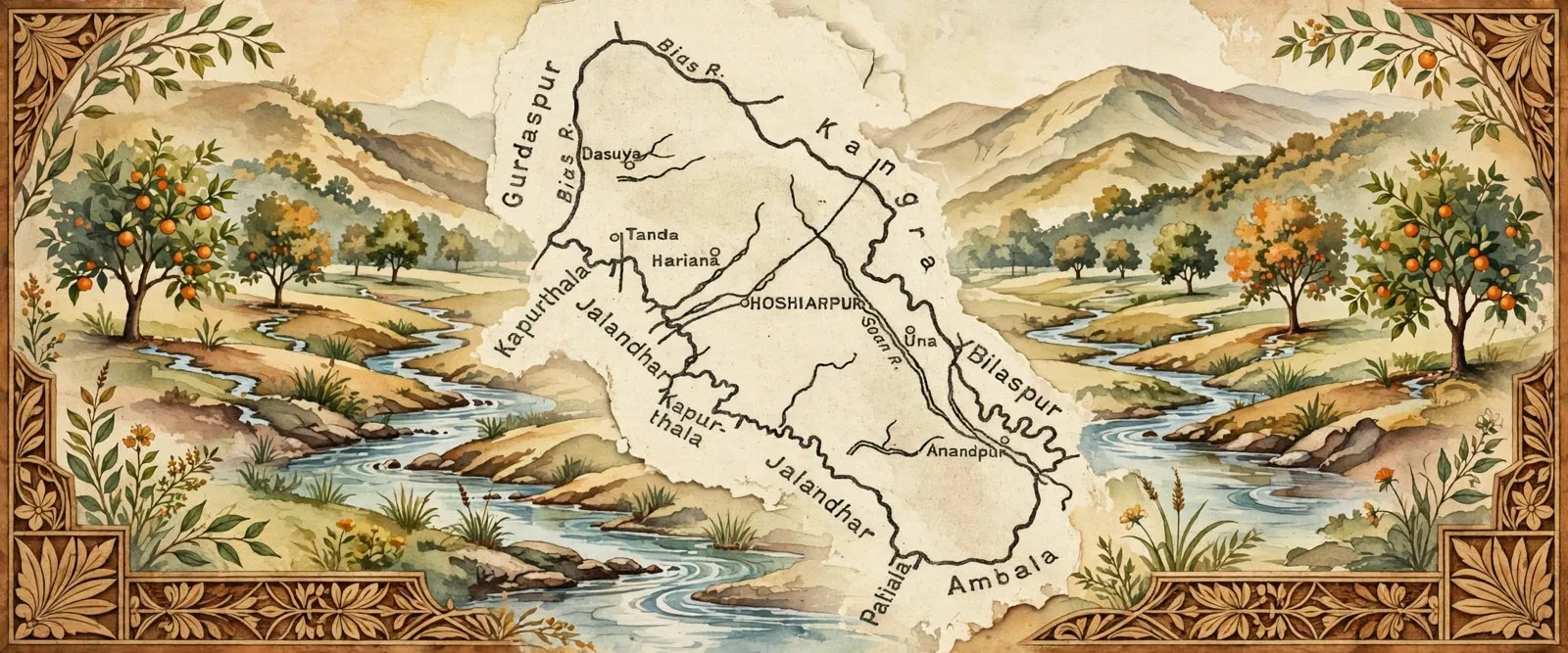
Tanda is in the west of Hoshiarpur district, in Dasua tehsil, on the flat Doaba plain between the Beas and the Sutlej. Dasuya lies a short drive to the north, Mukerian to the north west and Hoshiarpur city to the south east, while Jalandhar is about 42 kilometres away by rail to the south west. The town stands about 232 metres above sea level. Its full official name, Urmar Tanda, joins two settlements, Urmar and Tanda, which grew together into a single municipal council town.
History: a roadside market that became a twin town
Tanda grew where the old road north from Jalandhar towards Pathankot and Jammu met the farming villages of the western Doaba. Grain, fodder and everyday goods changed hands here, and the settlement of Urmar beside it gave the combined town its official name. The railway on the Jalandhar to Jammu line fixed that market role in place: with a station of its own, Tanda became the place where the villages around it loaded produce, bought supplies and caught trains to the cities.
Local tradition connects the area with Guru Hargobind, the sixth Sikh Guru. Accounts repeated in local listings say he visited Pull Pukhta and Munak Kalan near the town, and Gurdwara Pull Pukhta Sahib and Gurdwara Tahli Sahib keep that memory alive. A second, older layer of story links the village of Jaja nearby with Bhima of the Mahabharata and the slaying of the demon Bakasura: legend, not recorded history, but part of how the area tells its own past. In modern politics the town gives its name to the Urmar assembly constituency, constituency number 41 of the Punjab Legislative Assembly, within the Hoshiarpur Lok Sabha seat.
Geography and people
The 2011 census counted 23,419 people in Urmar Tanda, 11,938 men and 11,481 women, in 4,965 houses across 13 wards, on about 16.5 square kilometres: a density of about 1,419 people per square kilometre. The town had grown from 18,786 in 1991 and 22,048 in 2001. Its sex ratio was 962 women for every 1,000 men, above the Punjab average of 895 in the same census. Children under six numbered 2,382, about a tenth of the town. Literacy was 86.79 percent, well above the state average of 75.84 percent, at 90.20 percent for men and 83.29 percent for women.
ਟਾਂਡਾ, ਜਿਸਦਾ ਸਰਕਾਰੀ ਨਾਮ ਉੜਮੁੜ ਟਾਂਡਾ ਹੈ, ਪੰਜਾਬ, ਭਾਰਤ ਦੇ ਹੁਸ਼ਿਆਰਪੁਰ ਜ਼ਿਲ੍ਹੇ ਦਾ ਇੱਕ ਨਗਰ ਕੌਂਸਲ ਕਸਬਾ ਹੈ, ਜੋ ਦੋਆਬਾ ਇਲਾਕੇ ਵਿੱਚ ਜਲੰਧਰ ਅਤੇ ਪਠਾਨਕੋਟ ਦੇ ਵਿਚਕਾਰ ਹੈ। ਜਲੰਧਰ ਤੋਂ ਜੰਮੂ ਰੇਲ ਲਾਈਨ ਉੱਤੇ ਸਥਿਤ ਇਹ ਰੇਲਵੇ ਅਤੇ ਅਨਾਜ ਮੰਡੀ ਵਾਲਾ ਕਸਬਾ 2011 ਦੀ ਮਰਦਮਸ਼ੁਮਾਰੀ ਵਿੱਚ 13 ਵਾਰਡਾਂ ਅਤੇ ਲਗਭਗ 16.5 ਵਰਗ ਕਿਲੋਮੀਟਰ ਵਿੱਚ 23,419 ਵਾਸੀਆਂ ਦਾ ਘਰ ਸੀ।
ਟਾਂਡਾ ਕਿੱਥੇ ਹੈ?
ਟਾਂਡਾ ਹੁਸ਼ਿਆਰਪੁਰ ਜ਼ਿਲ੍ਹੇ ਦੇ ਪੱਛਮ ਵਿੱਚ, ਦਸੂਹਾ ਤਹਿਸੀਲ ਵਿੱਚ, ਬਿਆਸ ਅਤੇ ਸਤਲੁਜ ਵਿਚਕਾਰਲੀ ਸਮਤਲ ਦੋਆਬਾ ਧਰਤੀ ਉੱਤੇ ਹੈ। ਉੱਤਰ ਵੱਲ ਥੋੜ੍ਹੀ ਦੂਰੀ ਉੱਤੇ ਦਸੂਹਾ ਹੈ, ਉੱਤਰ ਪੱਛਮ ਵੱਲ ਮੁਕੇਰੀਆਂ ਅਤੇ ਦੱਖਣ ਪੂਰਬ ਵੱਲ ਹੁਸ਼ਿਆਰਪੁਰ ਸ਼ਹਿਰ, ਜਦਕਿ ਜਲੰਧਰ ਰੇਲ ਰਾਹੀਂ ਦੱਖਣ ਪੱਛਮ ਵੱਲ ਲਗਭਗ 42 ਕਿਲੋਮੀਟਰ ਦੂਰ ਹੈ। ਕਸਬਾ ਸਮੁੰਦਰ ਤਲ ਤੋਂ ਲਗਭਗ 232 ਮੀਟਰ ਉੱਚਾ ਹੈ। ਇਸਦਾ ਪੂਰਾ ਸਰਕਾਰੀ ਨਾਮ, ਉੜਮੁੜ ਟਾਂਡਾ, ਦੋ ਵਸੋਂਆਂ, ਉੜਮੁੜ ਅਤੇ ਟਾਂਡਾ, ਨੂੰ ਜੋੜਦਾ ਹੈ, ਜੋ ਵਧ ਕੇ ਇੱਕੋ ਨਗਰ ਕੌਂਸਲ ਕਸਬਾ ਬਣ ਗਈਆਂ।
ਇਤਿਹਾਸ: ਸੜਕ ਕਿਨਾਰੇ ਦੀ ਮੰਡੀ ਜੋ ਜੌੜਾ ਕਸਬਾ ਬਣ ਗਈ
ਟਾਂਡਾ ਉੱਥੇ ਵੱਸਿਆ ਜਿੱਥੇ ਜਲੰਧਰ ਤੋਂ ਪਠਾਨਕੋਟ ਅਤੇ ਜੰਮੂ ਵੱਲ ਜਾਂਦੀ ਪੁਰਾਣੀ ਸੜਕ ਪੱਛਮੀ ਦੋਆਬੇ ਦੇ ਖੇਤੀ ਪਿੰਡਾਂ ਨੂੰ ਮਿਲਦੀ ਸੀ। ਅਨਾਜ, ਚਾਰਾ ਅਤੇ ਰੋਜ਼ਾਨਾ ਦਾ ਸਮਾਨ ਇੱਥੇ ਵਿਕਦਾ ਸੀ, ਅਤੇ ਨਾਲ ਲੱਗਦੀ ਉੜਮੁੜ ਦੀ ਵਸੋਂ ਨੇ ਜੁੜਵੇਂ ਕਸਬੇ ਨੂੰ ਇਸਦਾ ਸਰਕਾਰੀ ਨਾਮ ਦਿੱਤਾ। ਜਲੰਧਰ ਤੋਂ ਜੰਮੂ ਰੇਲ ਲਾਈਨ ਨੇ ਉਸ ਮੰਡੀ ਵਾਲੇ ਰੋਲ ਨੂੰ ਪੱਕਾ ਕਰ ਦਿੱਤਾ: ਆਪਣਾ ਸਟੇਸ਼ਨ ਹੋਣ ਨਾਲ ਟਾਂਡਾ ਉਹ ਥਾਂ ਬਣ ਗਿਆ ਜਿੱਥੋਂ ਆਲੇ-ਦੁਆਲੇ ਦੇ ਪਿੰਡ ਆਪਣੀ ਉਪਜ ਲੱਦਦੇ, ਸਮਾਨ ਖਰੀਦਦੇ ਅਤੇ ਸ਼ਹਿਰਾਂ ਨੂੰ ਗੱਡੀਆਂ ਫੜਦੇ ਸਨ।
ਸਥਾਨਕ ਮਾਨਤਾ ਇਸ ਇਲਾਕੇ ਨੂੰ ਛੇਵੇਂ ਸਿੱਖ ਗੁਰੂ, ਗੁਰੂ ਹਰਿਗੋਬਿੰਦ ਜੀ, ਨਾਲ ਜੋੜਦੀ ਹੈ। ਸਥਾਨਕ ਵਰਣਨਾਂ ਵਿੱਚ ਆਉਂਦੀਆਂ ਗੱਲਾਂ ਅਨੁਸਾਰ ਉਹ ਕਸਬੇ ਦੇ ਨੇੜੇ ਪੁੱਲ ਪੁਖਤਾ ਅਤੇ ਮੁਨੱਕ ਕਲਾਂ ਆਏ ਸਨ, ਅਤੇ ਗੁਰਦੁਆਰਾ ਪੁੱਲ ਪੁਖਤਾ ਸਾਹਿਬ ਅਤੇ ਗੁਰਦੁਆਰਾ ਟਾਹਲੀ ਸਾਹਿਬ ਉਸ ਯਾਦ ਨੂੰ ਜਿਉਂਦਾ ਰੱਖਦੇ ਹਨ। ਕਹਾਣੀਆਂ ਦੀ ਇੱਕ ਦੂਜੀ, ਪੁਰਾਣੀ ਪਰਤ ਨੇੜਲੇ ਪਿੰਡ ਜਾਜਾ ਨੂੰ ਮਹਾਭਾਰਤ ਦੇ ਭੀਮ ਅਤੇ ਬਕਾਸੁਰ ਦੇ ਵਧ ਨਾਲ ਜੋੜਦੀ ਹੈ: ਇਹ ਲੋਕ ਕਥਾ ਹੈ, ਦਰਜ ਇਤਿਹਾਸ ਨਹੀਂ, ਪਰ ਇਹ ਇਸ ਗੱਲ ਦਾ ਹਿੱਸਾ ਹੈ ਕਿ ਇਲਾਕਾ ਆਪਣਾ ਅਤੀਤ ਕਿਵੇਂ ਦੱਸਦਾ ਹੈ। ਆਧੁਨਿਕ ਰਾਜਨੀਤੀ ਵਿੱਚ ਕਸਬਾ ਉੜਮੁੜ ਵਿਧਾਨ ਸਭਾ ਹਲਕੇ ਨੂੰ ਆਪਣਾ ਨਾਮ ਦਿੰਦਾ ਹੈ, ਜੋ ਪੰਜਾਬ ਵਿਧਾਨ ਸਭਾ ਦਾ ਹਲਕਾ ਨੰਬਰ 41 ਹੈ ਅਤੇ ਹੁਸ਼ਿਆਰਪੁਰ ਲੋਕ ਸਭਾ ਹਲਕੇ ਵਿੱਚ ਆਉਂਦਾ ਹੈ।
ਭੂਗੋਲ ਅਤੇ ਲੋਕ
2011 ਦੀ ਮਰਦਮਸ਼ੁਮਾਰੀ ਵਿੱਚ ਉੜਮੁੜ ਟਾਂਡਾ ਦੀ ਆਬਾਦੀ 23,419 ਸੀ, 11,938 ਮਰਦ ਅਤੇ 11,481 ਔਰਤਾਂ, ਜੋ 13 ਵਾਰਡਾਂ ਵਿੱਚ 4,965 ਘਰਾਂ ਵਿੱਚ, ਲਗਭਗ 16.5 ਵਰਗ ਕਿਲੋਮੀਟਰ ਉੱਤੇ ਰਹਿੰਦੇ ਸਨ: ਹਰ ਵਰਗ ਕਿਲੋਮੀਟਰ ਵਿੱਚ ਲਗਭਗ 1,419 ਲੋਕਾਂ ਦੀ ਘਣਤਾ। ਕਸਬੇ ਦੀ ਆਬਾਦੀ 1991 ਵਿੱਚ 18,786 ਅਤੇ 2001 ਵਿੱਚ 22,048 ਤੋਂ ਵਧ ਕੇ ਇੱਥੇ ਪਹੁੰਚੀ ਸੀ। ਇਸਦਾ ਲਿੰਗ ਅਨੁਪਾਤ ਹਰ 1,000 ਮਰਦਾਂ ਪਿੱਛੇ 962 ਔਰਤਾਂ ਸੀ, ਜੋ ਉਸੇ ਮਰਦਮਸ਼ੁਮਾਰੀ ਵਿੱਚ ਪੰਜਾਬ ਦੀ 895 ਦੀ ਔਸਤ ਤੋਂ ਉੱਪਰ ਸੀ। ਛੇ ਸਾਲ ਤੋਂ ਛੋਟੇ ਬੱਚੇ 2,382 ਸਨ, ਜੋ ਕਸਬੇ ਦਾ ਲਗਭਗ ਦਸਵਾਂ ਹਿੱਸਾ ਹੈ। ਸਾਖਰਤਾ 86.79 ਫ਼ੀਸਦੀ ਸੀ, ਜੋ ਰਾਜ ਦੀ 75.84 ਫ਼ੀਸਦੀ ਔਸਤ ਤੋਂ ਕਾਫ਼ੀ ਉੱਪਰ ਸੀ, ਮਰਦਾਂ ਵਿੱਚ 90.20 ਫ਼ੀਸਦੀ ਅਤੇ ਔਰਤਾਂ ਵਿੱਚ 83.29 ਫ਼ੀਸਦੀ।
Hindus formed 59.26 percent of the town in 2011 and Sikhs 38.20 percent, with small Christian, Muslim and Jain communities. Scheduled Castes formed 30.51 percent of residents, 7,145 people. Punjabi is the everyday and official language. Of the whole population, 7,866 people were recorded as workers, and most of them, 87.64 percent of workers, were in main work through the year: in the grain market and shops, in transport and services, in schools and offices, and on the farms that ring the town. Like the rest of the Doaba, Tanda has strong family links abroad, and diaspora money has rebuilt many of its houses and colonies.
What is Tanda known for?
Tanda is known first as a working market town: its grain mandi in the harvest seasons, its railway station on the line to Jammu, and its bazaars serving the villages of the Tanda and Bhunga side of Hoshiarpur district. It is known second for its places of worship and its park: the Shimla Pahari Park is the town's best known open space, and its gurdwaras and temples, among them Gurdwara Pull Pukhta Sahib, Gurdwara Tahli Sahib and the Bheem Mandir, draw visitors from the villages around it.
Places of interest
A short visit to Tanda starts at Shimla Pahari Park and the Shaheed Chowk area, then takes in the town's religious places: Gurdwara Pull Pukhta Sahib, linked in local tradition to Guru Hargobind, Gurdwara Tahli Sahib, the Mahadev and Bheem temples, and the Jahara Peer shrine, which reflect the town's mixed Hindu and Sikh population. The grain market is at its busiest, and most colourful, in the wheat and paddy seasons. Further afield, Dasuya and Mukerian are short drives north, Sri Hargobindpur lies to the west across the Beas side of the district, and Hoshiarpur city is the nearest larger centre for shopping and services.
Getting there
By rail, Tanda Urmar station, code TDO, stands on the Jalandhar to Jammu line in the Firozpur division of Northern Railway, on a double, electrified track with three platforms. Express trains that halt here include the Hemkunt Express, the Jammu Mail and the Ahmedabad to Jammu Tawi services, alongside DEMU and passenger trains to Jalandhar City and Pathankot. By road, state highways and district roads link Tanda with Jalandhar, Hoshiarpur, Dasuya, Mukerian, Sri Hargobindpur and Pathankot, and buses run through the day. The town PIN code is 144204 and its telephone code is 01886.
Tanda today
Today Tanda is a compact municipal town whose life still turns on the mandi, the railway and the schools and services it provides for a wide rural hinterland. Its census growth has slowed, from the faster decades of the last century to under one percent a year between 2001 and 2011, but its literacy is among the higher figures for Punjab towns of its size, and its position between Jalandhar and Pathankot keeps traffic, trade and students passing through. For its own people it remains what it has long been: the market and station town of the western Doaba plain.
2011 ਵਿੱਚ ਕਸਬੇ ਵਿੱਚ ਹਿੰਦੂ 59.26 ਫ਼ੀਸਦੀ ਅਤੇ ਸਿੱਖ 38.20 ਫ਼ੀਸਦੀ ਸਨ, ਨਾਲ ਛੋਟੇ ਈਸਾਈ, ਮੁਸਲਮਾਨ ਅਤੇ ਜੈਨ ਭਾਈਚਾਰੇ ਵੀ ਸਨ। ਅਨੁਸੂਚਿਤ ਜਾਤੀਆਂ ਵਾਸੀਆਂ ਦਾ 30.51 ਫ਼ੀਸਦੀ ਸਨ, ਕੁੱਲ 7,145 ਲੋਕ। ਪੰਜਾਬੀ ਇੱਥੋਂ ਦੀ ਰੋਜ਼ਾਨਾ ਅਤੇ ਸਰਕਾਰੀ ਬੋਲੀ ਹੈ। ਕੁੱਲ ਆਬਾਦੀ ਵਿੱਚੋਂ 7,866 ਲੋਕ ਕਾਮੇ ਦਰਜ ਹੋਏ, ਅਤੇ ਉਨ੍ਹਾਂ ਵਿੱਚੋਂ ਬਹੁਤੇ, ਕਾਮਿਆਂ ਦਾ 87.64 ਫ਼ੀਸਦੀ, ਸਾਲ ਭਰ ਦੇ ਮੁੱਖ ਕੰਮ ਵਿੱਚ ਸਨ: ਅਨਾਜ ਮੰਡੀ ਅਤੇ ਦੁਕਾਨਾਂ ਵਿੱਚ, ਟਰਾਂਸਪੋਰਟ ਅਤੇ ਸੇਵਾਵਾਂ ਵਿੱਚ, ਸਕੂਲਾਂ ਅਤੇ ਦਫ਼ਤਰਾਂ ਵਿੱਚ, ਅਤੇ ਕਸਬੇ ਦੇ ਆਲੇ-ਦੁਆਲੇ ਦੇ ਖੇਤਾਂ ਵਿੱਚ। ਬਾਕੀ ਦੋਆਬੇ ਵਾਂਗ ਟਾਂਡੇ ਦੇ ਵੀ ਵਿਦੇਸ਼ਾਂ ਨਾਲ ਮਜ਼ਬੂਤ ਪਰਿਵਾਰਕ ਨਾਤੇ ਹਨ, ਅਤੇ ਪਰਵਾਸੀਆਂ ਦੇ ਪੈਸੇ ਨੇ ਇਸਦੇ ਬਹੁਤ ਸਾਰੇ ਘਰ ਅਤੇ ਕਲੋਨੀਆਂ ਮੁੜ ਬਣਾਈਆਂ ਹਨ।
ਟਾਂਡਾ ਕਿਸ ਲਈ ਜਾਣਿਆ ਜਾਂਦਾ ਹੈ?
ਟਾਂਡਾ ਸਭ ਤੋਂ ਪਹਿਲਾਂ ਇੱਕ ਕੰਮਕਾਜੀ ਮੰਡੀ ਕਸਬੇ ਵਜੋਂ ਜਾਣਿਆ ਜਾਂਦਾ ਹੈ: ਵਾਢੀ ਦੇ ਮੌਸਮਾਂ ਵਿੱਚ ਇਸਦੀ ਅਨਾਜ ਮੰਡੀ, ਜੰਮੂ ਵੱਲ ਜਾਂਦੀ ਲਾਈਨ ਉੱਤੇ ਇਸਦਾ ਰੇਲਵੇ ਸਟੇਸ਼ਨ, ਅਤੇ ਹੁਸ਼ਿਆਰਪੁਰ ਜ਼ਿਲ੍ਹੇ ਦੇ ਟਾਂਡਾ ਅਤੇ ਭੁੰਗਾ ਵਾਲੇ ਪਾਸੇ ਦੇ ਪਿੰਡਾਂ ਦੀ ਸੇਵਾ ਕਰਦੇ ਇਸਦੇ ਬਾਜ਼ਾਰ। ਦੂਜਾ, ਇਹ ਆਪਣੀਆਂ ਧਾਰਮਿਕ ਥਾਵਾਂ ਅਤੇ ਆਪਣੇ ਪਾਰਕ ਲਈ ਜਾਣਿਆ ਜਾਂਦਾ ਹੈ: ਸ਼ਿਮਲਾ ਪਹਾੜੀ ਪਾਰਕ ਕਸਬੇ ਦੀ ਸਭ ਤੋਂ ਜਾਣੀ ਖੁੱਲ੍ਹੀ ਥਾਂ ਹੈ, ਅਤੇ ਇਸਦੇ ਗੁਰਦੁਆਰੇ ਅਤੇ ਮੰਦਰ, ਜਿਨ੍ਹਾਂ ਵਿੱਚ ਗੁਰਦੁਆਰਾ ਪੁੱਲ ਪੁਖਤਾ ਸਾਹਿਬ, ਗੁਰਦੁਆਰਾ ਟਾਹਲੀ ਸਾਹਿਬ ਅਤੇ ਭੀਮ ਮੰਦਰ ਸ਼ਾਮਲ ਹਨ, ਆਲੇ-ਦੁਆਲੇ ਦੇ ਪਿੰਡਾਂ ਤੋਂ ਸੰਗਤਾਂ ਖਿੱਚਦੇ ਹਨ।
ਦੇਖਣਯੋਗ ਥਾਵਾਂ
ਟਾਂਡੇ ਦੀ ਛੋਟੀ ਫੇਰੀ ਸ਼ਿਮਲਾ ਪਹਾੜੀ ਪਾਰਕ ਅਤੇ ਸ਼ਹੀਦ ਚੌਕ ਇਲਾਕੇ ਤੋਂ ਸ਼ੁਰੂ ਹੁੰਦੀ ਹੈ, ਫਿਰ ਕਸਬੇ ਦੀਆਂ ਧਾਰਮਿਕ ਥਾਵਾਂ ਵੱਲ ਜਾਂਦੀ ਹੈ: ਗੁਰਦੁਆਰਾ ਪੁੱਲ ਪੁਖਤਾ ਸਾਹਿਬ, ਜੋ ਸਥਾਨਕ ਮਾਨਤਾ ਵਿੱਚ ਗੁਰੂ ਹਰਿਗੋਬਿੰਦ ਜੀ ਨਾਲ ਜੁੜਿਆ ਹੈ, ਗੁਰਦੁਆਰਾ ਟਾਹਲੀ ਸਾਹਿਬ, ਮਹਾਦੇਵ ਅਤੇ ਭੀਮ ਮੰਦਰ, ਅਤੇ ਜਹਾਰਾ ਪੀਰ ਦੀ ਥਾਂ, ਜੋ ਕਸਬੇ ਦੀ ਮਿਲੀ-ਜੁਲੀ ਹਿੰਦੂ ਅਤੇ ਸਿੱਖ ਆਬਾਦੀ ਨੂੰ ਦਰਸਾਉਂਦੀਆਂ ਹਨ। ਕਣਕ ਅਤੇ ਝੋਨੇ ਦੇ ਮੌਸਮਾਂ ਵਿੱਚ ਅਨਾਜ ਮੰਡੀ ਸਭ ਤੋਂ ਰੁੱਝੀ ਅਤੇ ਰੰਗ ਭਰੀ ਹੁੰਦੀ ਹੈ। ਅੱਗੇ ਜਾ ਕੇ, ਦਸੂਹਾ ਅਤੇ ਮੁਕੇਰੀਆਂ ਉੱਤਰ ਵੱਲ ਥੋੜ੍ਹੀ ਡਰਾਈਵ ਉੱਤੇ ਹਨ, ਸ੍ਰੀ ਹਰਗੋਬਿੰਦਪੁਰ ਜ਼ਿਲ੍ਹੇ ਦੇ ਬਿਆਸ ਵਾਲੇ ਪਾਸੇ ਪੱਛਮ ਵੱਲ ਹੈ, ਅਤੇ ਹੁਸ਼ਿਆਰਪੁਰ ਸ਼ਹਿਰ ਖਰੀਦਦਾਰੀ ਅਤੇ ਸੇਵਾਵਾਂ ਲਈ ਸਭ ਤੋਂ ਨੇੜਲਾ ਵੱਡਾ ਕੇਂਦਰ ਹੈ।
ਪਹੁੰਚਣ ਦੇ ਸਾਧਨ
ਰੇਲ ਰਾਹੀਂ, ਟਾਂਡਾ ਉੜਮੁੜ ਸਟੇਸ਼ਨ, ਕੋਡ ਟੀਡੀਓ, ਜਲੰਧਰ ਤੋਂ ਜੰਮੂ ਲਾਈਨ ਉੱਤੇ ਉੱਤਰੀ ਰੇਲਵੇ ਦੇ ਫਿਰੋਜ਼ਪੁਰ ਡਿਵੀਜ਼ਨ ਵਿੱਚ ਹੈ, ਜਿੱਥੇ ਦੋਹਰੀ, ਬਿਜਲੀ ਵਾਲੀ ਪਟੜੀ ਅਤੇ ਤਿੰਨ ਪਲੇਟਫਾਰਮ ਹਨ। ਇੱਥੇ ਰੁਕਣ ਵਾਲੀਆਂ ਐਕਸਪ੍ਰੈਸ ਗੱਡੀਆਂ ਵਿੱਚ ਹੇਮਕੁੰਟ ਐਕਸਪ੍ਰੈਸ, ਜੰਮੂ ਮੇਲ ਅਤੇ ਅਹਿਮਦਾਬਾਦ ਤੋਂ ਜੰਮੂ ਤਵੀ ਸੇਵਾਵਾਂ ਸ਼ਾਮਲ ਹਨ, ਨਾਲ ਜਲੰਧਰ ਸ਼ਹਿਰ ਅਤੇ ਪਠਾਨਕੋਟ ਲਈ ਡੀਐਮਯੂ ਅਤੇ ਪੈਸੇਂਜਰ ਗੱਡੀਆਂ ਵੀ ਹਨ। ਸੜਕ ਰਾਹੀਂ, ਰਾਜ ਸ਼ਾਹਰਾਹ ਅਤੇ ਜ਼ਿਲ੍ਹਾ ਸੜਕਾਂ ਟਾਂਡੇ ਨੂੰ ਜਲੰਧਰ, ਹੁਸ਼ਿਆਰਪੁਰ, ਦਸੂਹਾ, ਮੁਕੇਰੀਆਂ, ਸ੍ਰੀ ਹਰਗੋਬਿੰਦਪੁਰ ਅਤੇ ਪਠਾਨਕੋਟ ਨਾਲ ਜੋੜਦੀਆਂ ਹਨ, ਅਤੇ ਦਿਨ ਭਰ ਬੱਸਾਂ ਚੱਲਦੀਆਂ ਹਨ। ਕਸਬੇ ਦਾ ਪਿੰਨ ਕੋਡ 144204 ਹੈ ਅਤੇ ਟੈਲੀਫੋਨ ਕੋਡ 01886 ਹੈ।
ਅੱਜ ਦਾ ਟਾਂਡਾ
ਅੱਜ ਟਾਂਡਾ ਇੱਕ ਛੋਟਾ ਨਗਰ ਕਸਬਾ ਹੈ ਜਿਸਦੀ ਜ਼ਿੰਦਗੀ ਅਜੇ ਵੀ ਮੰਡੀ, ਰੇਲਵੇ ਅਤੇ ਉਨ੍ਹਾਂ ਸਕੂਲਾਂ ਅਤੇ ਸੇਵਾਵਾਂ ਦੁਆਲੇ ਘੁੰਮਦੀ ਹੈ ਜੋ ਇਹ ਵੱਡੇ ਪੇਂਡੂ ਇਲਾਕੇ ਨੂੰ ਦਿੰਦਾ ਹੈ। ਪਿਛਲੀ ਸਦੀ ਦੇ ਤੇਜ਼ ਦਹਾਕਿਆਂ ਦੇ ਮੁਕਾਬਲੇ ਇਸਦੀ ਮਰਦਮਸ਼ੁਮਾਰੀ ਵਾਧਾ ਧੀਮਾ ਹੋ ਗਿਆ ਹੈ, 2001 ਅਤੇ 2011 ਵਿਚਕਾਰ ਸਾਲ ਵਿੱਚ ਇੱਕ ਫ਼ੀਸਦੀ ਤੋਂ ਵੀ ਘੱਟ, ਪਰ ਇਸਦੀ ਸਾਖਰਤਾ ਇਸ ਆਕਾਰ ਦੇ ਪੰਜਾਬੀ ਕਸਬਿਆਂ ਵਿੱਚ ਉੱਚੇ ਅੰਕੜਿਆਂ ਵਿੱਚੋਂ ਹੈ, ਅਤੇ ਜਲੰਧਰ ਅਤੇ ਪਠਾਨਕੋਟ ਵਿਚਕਾਰ ਇਸਦੀ ਥਾਂ ਆਵਾਜਾਈ, ਵਪਾਰ ਅਤੇ ਵਿਦਿਆਰਥੀਆਂ ਨੂੰ ਇੱਥੋਂ ਲੰਘਦਾ ਰੱਖਦੀ ਹੈ। ਆਪਣੇ ਲੋਕਾਂ ਲਈ ਇਹ ਉਹੀ ਹੈ ਜੋ ਇਹ ਚਿਰਾਂ ਤੋਂ ਹੈ: ਪੱਛਮੀ ਦੋਆਬੇ ਦੇ ਮੈਦਾਨ ਦਾ ਮੰਡੀ ਅਤੇ ਸਟੇਸ਼ਨ ਵਾਲਾ ਕਸਬਾ।
Nearby
 DasuyaTown, Doaba
 MukerianTown, Doaba
 HoshiarpurCity, Doaba
 JalandharCity, Doaba
 Hoshiarpur DistrictDistrict, Doaba
Sources (5)
Jugti is free and independent. Reader support keeps the Kosh growing.
Support