

Ahmedgarh is a market town in Malerkotla district, Punjab, nicknamed "Mandi" for its grain markets. Laid out before independence on the model of Lyallpur (now Faisalabad), it has a railway station on the Ludhiana–Jakhal line and belonged to Sangrur district until Malerkotla became Punjab's 23rd district in 2021. The 2011 census counted 31,302 residents.
ਇਤਿਹਾਸ ਇੱਕ ਨਜ਼ਰ ਵਿੱਚ
- 1657Bayazid Khan founds the fort of Malerkotla — the princely state in whose orbit Ahmedgarh grows as a qasba market town.
- 1705Nawab Sher Mohammed Khan of Malerkotla protests the sentencing of Guru Gobind Singh's young sons at Sirhind — the act behind the region's lasting communal harmony.
- 2021Malerkotla district is carved out of Sangrur as Punjab's 23rd district, with Ahmedgarh among its principal towns.
- ਪੰਜਾਬੀ ਨਾਂ
- ਅਹਿਮਦਗੜ੍ਹ
- ਕਿਸਮ
- ਕਸਬਾ
- ਜ਼ਿਲ੍ਹਾ
- ਮਲੇਰਕੋਟਲਾ
- ਇਲਾਕਾ
- Malwa, Punjab (India)
- ਸਥਾਪਨਾ
- Planned market town (qasba) of the Malerkotla region; pre-independence layout
- ਆਬਾਦੀ
- 31,302 (2011 census)
All 11 facts
- PIN
- 148021
- ਨੇੜਲਾ ਸ਼ਹਿਰ
- Malerkotla, 18 km
- Railway
- Station on the Ludhiana–Jakhal line
- ਭਾਸ਼ਾ
- ਪੰਜਾਬੀ
- ਪ੍ਰਸਿੱਧੀ
- Grain markets ("Mandi"); agricultural implements
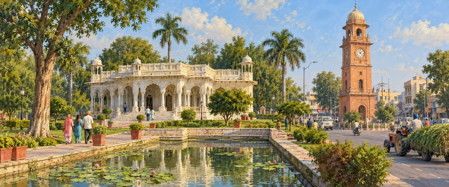
Ahmedgarh is a market town in Punjab's Malwa region, nicknamed "Mandi" for its grain trade. Eighteen kilometres north of Malerkotla on the Ludhiana–Sangrur corridor, it grew up as a planned qasba under the shadow of the former princely state of Malerkotla, and now sits in Malerkotla district, Punjab's newest district, carved out of Sangrur in 2021.
Where is Ahmedgarh?
Ahmedgarh lies about 18 km north of Malerkotla, the district headquarters, on Punjab State Highway 11. It is roughly 26 km from Ludhiana, 50 km from Sangrur and 98 km from Chandigarh. The town has its own railway station on the Ludhiana–Jakhal line and a bus stand, which is why it functions as the commercial centre for the villages around it. Its postal PIN is 148021 and the telephone code is 01675.
ਇਤਿਹਾਸ
Ahmedgarh's history belongs to the story of Malerkotla, one of the few Muslim-ruled princely states of the Punjab. The area known as Maler was granted as a jagir to the Afghan saint Sheikh Sadruddin-i-Jahan in 1454, and in 1657 Bayazid Khan raised a fort here and founded the state that took its name from the fort, Malerkotla. Its rulers were of Afghan Sarwani-Lodi origin, and the state survived through the 18th century surrounded by Sikh states.
The Nawabs of Malerkotla are remembered most for an act of conscience in 1705: when the governor of Sirhind, Wazir Khan, ordered Guru Gobind Singh's two youngest sons, Baba Zorawar Singh (9) and Baba Fateh Singh (6), to be bricked alive, Nawab Sher Mohammed Khan, who was present in the court, protested vehemently and walked out. Guru Gobind Singh thanked him and blessed the town with peace, a blessing the region's people credit for Malerkotla being the one corner of Punjab that saw no communal violence during the Partition in 1947.
Ahmedgarh itself grew as a qasba, a market town, in the orbit of this courtly town. Its bazaars served the grain and livestock trade of the surrounding villages, and its position on the routes between Ludhiana and Sangrur gave it a steady commercial life through the 19th and 20th centuries.
After independence the state joined PEPSU and merged into Punjab in 1956, and Ahmedgarh became part of Sangrur district. On 14 May 2021, Malerkotla was carved out of Sangrur as Punjab's 23rd district, with the subdivisions of Malerkotla and Ahmedgarh and the sub-tehsil of Amargarh. Ahmedgarh is now one of the new district's principal towns.
The planned mandi
Ahmedgarh is a rare example of pre-independence town planning in Punjab. It was laid out as a market town on the model of Lyallpur, now Faisalabad in Pakistan, around a cross-axis of two main avenues where grain and agricultural goods were auctioned, sold and stored. The four quadrants between the avenues were residential quarters.
The town was enclosed by a fasil, a brick arched wall, with only four staffed entry points for security, and each of the four mohallas could be reached through gated structures from the main avenues. At the intersection of the two avenues stood a public well; the crossing is now known as Gandhi Chowk.
Plots along the market avenues were 16 feet wide and 150 to 240 feet deep, each built with a facade of three Mughal arches forming a colonnade on both sides of the avenues. Later the avenues were split down the middle with shops along the median, creating the eight streets that meet at Gandhi Chowk. The wide avenues have since been encroached from both sides, and only a few buildings still show the arched facades, often hidden behind later additions.
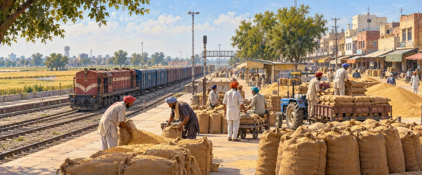
The plan was built for one purpose, trade. Ahmedgarh carries the nickname "Mandi" to this day, and it has two grain markets, one in the town and one on the outskirts.
Economy & work today
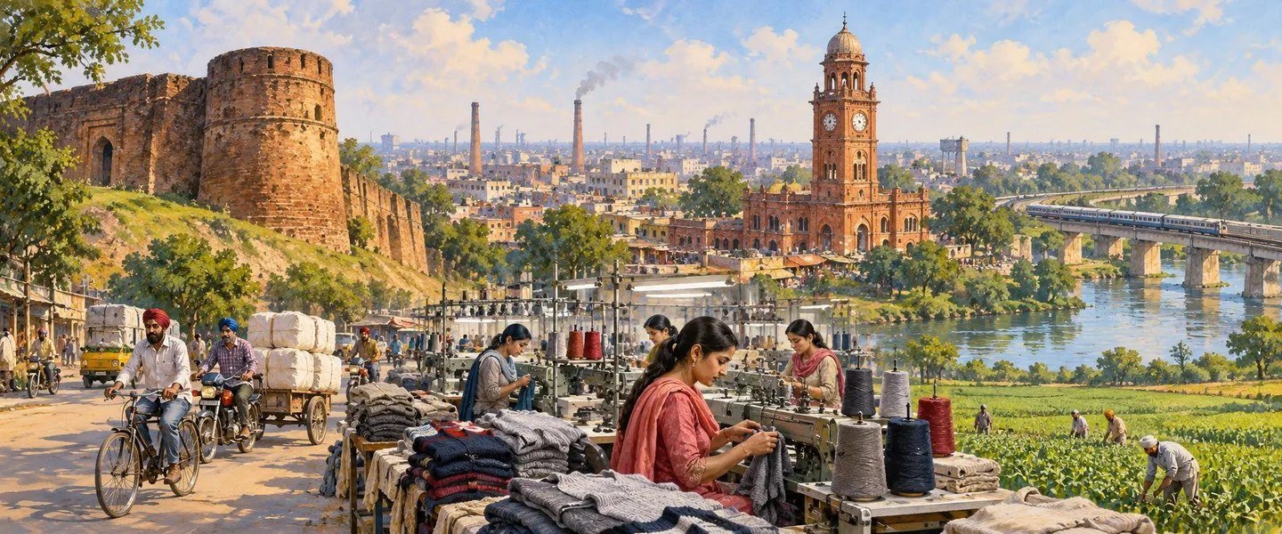
The grain market remains the engine of Ahmedgarh's economy. Paddy, wheat and cotton are the main crops that arrive at its mandis, and the town is known for the manufacture of agricultural implements, diggers, ploughs and sickles, alongside small-scale industry, helped by its closeness to the industrial cities of Ludhiana and Malerkotla. The town is also reported to host dry-port facilities for container cargo.
The 2011 census counted 10,522 workers in the town, about a third of the population, and almost all of them, over 97 per cent, in main, year-round work.
Geography & people
Between the 2001 and 2011 censuses Ahmedgarh's population grew from 28,022 to 31,302; a 2023 estimate put it near 42,000, though only a fresh census can confirm that. The municipal council covers 6 sq km, divided into 15 wards, with 6,425 households.
Hindus form the majority at about 56 per cent, followed by Sikhs at about 30 per cent and Muslims at about 13 per cent, a reflection of the area's Malerkotla heritage, the one pocket of East Punjab where a large Muslim community never left. There is also a small Jain community. The sex ratio is 901 females per 1,000 males, and Scheduled Castes make up about 17 per cent of the population. Literacy stands at about 83 per cent of the population aged seven and above, above the Punjab average. Punjabi is the town's everyday language.
ਸਿੱਖਿਆ
Ahmedgarh serves as a school town for its villages. The best-known school is GHG Khalsa Senior Secondary School, a private co-educational institution established in 1956 and affiliated to the CBSE. Other schools named locally include DAV Senior Secondary School, Guru Nanak Kanya Maha Vidyalaya, Anand Isher Senior Secondary Public School, Green Valley Public School and Victoria Public School. For higher studies, the town has colleges including Victoria Girls College and Janta College for Women, alongside Sant Ayurvedic College.
What is Ahmedgarh known for?
Ahmedgarh is known, above all, as a mandi town, a planned grain market of pre-independence vintage, with its twin mandis, its Mughal-arched bazaar avenues and Gandhi Chowk at its heart. Beyond trade, it is the educational centre of its part of Malerkotla district, and its civic life, the railway station, the bus stand, the municipal park on Chhapar Road and the public park near the civil hospital, gives it the feel of a small, self-contained Punjabi town. Its gurdwaras, temples and mosques stand side by side, a living picture of the Malerkotla region's shared culture: the one corner of Punjab that Partition's violence never touched.
ਅਹਿਮਦਗੜ੍ਹ ਪੰਜਾਬ ਦੇ ਮਾਲਵਾ ਖੇਤਰ ਦਾ ਇੱਕ ਮੰਡੀ-ਕਸਬਾ ਹੈ, ਜਿਸਨੂੰ ਅਨਾਜ ਦੇ ਵਪਾਰ ਕਰਕੇ "ਮੰਡੀ" ਦੇ ਨਾਂ ਨਾਲ ਵੀ ਜਾਣਿਆ ਜਾਂਦਾ ਹੈ। ਮਲੇਰਕੋਟਲਾ ਤੋਂ 18 ਕਿਲੋਮੀਟਰ ਉੱਤਰ ਵੱਲ, ਲੁਧਿਆਣਾ–ਸੰਗਰੂਰ ਮਾਰਗ 'ਤੇ ਵਸਿਆ ਇਹ ਸ਼ਹਿਰ ਪਹਿਲਾਂ ਮਲੇਰਕੋਟਲਾ ਰਿਆਸਤ ਦੇ ਸਾਏ ਹੇਠ ਇੱਕ ਯੋਜਨਾਬੱਧ ਕਸਬੇ ਵਜੋਂ ਵਿਕਸਿਆ, ਅਤੇ ਅੱਜ ਮਲੇਰਕੋਟਲਾ ਜ਼ਿਲ੍ਹੇ, 2021 ਵਿੱਚ ਸੰਗਰੂਰ ਵਿੱਚੋਂ ਕੱਢ ਕੇ ਬਣਾਏ ਪੰਜਾਬ ਦੇ ਨਵੇਂ ਜ਼ਿਲ੍ਹੇ, ਦਾ ਹਿੱਸਾ ਹੈ।
ਅਹਿਮਦਗੜ੍ਹ ਕਿੱਥੇ ਹੈ?
ਅਹਿਮਦਗੜ੍ਹ ਜ਼ਿਲ੍ਹਾ ਹੈੱਡਕੁਆਰਟਰ ਮਲੇਰਕੋਟਲਾ ਤੋਂ ਲਗਭਗ 18 ਕਿਲੋਮੀਟਰ ਉੱਤਰ ਵੱਲ, ਪੰਜਾਬ ਰਾਜ ਮਾਰਗ 11 'ਤੇ ਸਥਿਤ ਹੈ। ਇਹ ਲੁਧਿਆਣਾ ਤੋਂ ਲਗਭਗ 26 ਕਿਲੋਮੀਟਰ, ਸੰਗਰੂਰ ਤੋਂ 50 ਕਿਲੋਮੀਟਰ ਅਤੇ ਚੰਡੀਗੜ੍ਹ ਤੋਂ 98 ਕਿਲੋਮੀਟਰ ਦੀ ਦੂਰੀ 'ਤੇ ਹੈ। ਸ਼ਹਿਰ ਦਾ ਆਪਣਾ ਰੇਲਵੇ ਸਟੇਸ਼ਨ ਲੁਧਿਆਣਾ–ਜਾਖਲ ਲਾਈਨ 'ਤੇ ਹੈ ਅਤੇ ਇੱਥੇ ਬੱਸ ਅੱਡਾ ਵੀ ਹੈ, ਇਸੇ ਕਰਕੇ ਇਹ ਆਸ-ਪਾਸ ਦੇ ਪਿੰਡਾਂ ਦਾ ਵਪਾਰਕ ਕੇਂਦਰ ਹੈ। ਇਸਦਾ ਡਾਕ ਪਿਨ ਕੋਡ 148021 ਅਤੇ ਟੈਲੀਫ਼ੋਨ ਕੋਡ 01675 ਹੈ।
ਇਤਿਹਾਸ
ਅਹਿਮਦਗੜ੍ਹ ਦਾ ਇਤਿਹਾਸ ਮਲੇਰਕੋਟਲਾ ਦੀ ਕਹਾਣੀ ਨਾਲ ਜੁੜਿਆ ਹੈ, ਮਲੇਰਕੋਟਲਾ ਪੰਜਾਬ ਦੀਆਂ ਉਨ੍ਹਾਂ ਗਿਣੀਆਂ-ਚੁਣੀਆਂ ਰਿਆਸਤਾਂ ਵਿੱਚੋਂ ਇੱਕ ਸੀ ਜਿਨ੍ਹਾਂ ਦੇ ਹੁਕਮਰਾਨ ਮੁਸਲਮਾਨ ਸਨ। 1454 ਵਿੱਚ ਮਲੇਰ ਦਾ ਇਲਾਕਾ ਅਫ਼ਗ਼ਾਨ ਸੂਫ਼ੀ ਸ਼ੇਖ ਸਦਰੁੱਦੀਨ-ਏ-ਜਹਾਂ ਨੂੰ ਜਾਗੀਰ ਵਜੋਂ ਮਿਲਿਆ, ਅਤੇ 1657 ਵਿੱਚ ਬਾਯਜ਼ੀਦ ਖ਼ਾਨ ਨੇ ਇੱਥੇ ਕਿਲ੍ਹਾ ਬਣਾ ਕੇ ਉਸ ਰਿਆਸਤ ਦੀ ਨੀਂਹ ਰੱਖੀ ਜਿਸਨੂੰ ਉਸਦੇ ਕਿਲ੍ਹੇ ਦੇ ਨਾਂ 'ਤੇ ਮਲੇਰਕੋਟਲਾ ਕਿਹਾ ਗਿਆ। ਇਸਦੇ ਹੁਕਮਰਾਨ ਅਫ਼ਗ਼ਾਨ ਸਰਵਾਨੀ-ਲੋਧੀ ਖ਼ਾਨਦਾਨ ਦੇ ਸਨ, ਅਤੇ ਇਹ ਰਿਆਸਤ 18ਵੀਂ ਸਦੀ ਵਿੱਚ ਸਿੱਖ ਰਿਆਸਤਾਂ ਨਾਲ ਘਿਰੀ ਹੋਣ ਦੇ ਬਾਵਜੂਦ ਕਾਇਮ ਰਹੀ।
ਮਲੇਰਕੋਟਲਾ ਦੇ ਨਵਾਬ ਸਭ ਤੋਂ ਵੱਧ 1705 ਦੇ ਇੱਕ ਇਨਸਾਫ਼ਪਸੰਦ ਕਦਮ ਕਰਕੇ ਯਾਦ ਕੀਤੇ ਜਾਂਦੇ ਹਨ: ਜਦੋਂ ਸਰਹਿੰਦ ਦੇ ਸੂਬੇਦਾਰ ਵਜ਼ੀਰ ਖ਼ਾਨ ਨੇ ਗੁਰੂ ਗੋਬਿੰਦ ਸਿੰਘ ਜੀ ਦੇ ਦੋ ਛੋਟੇ ਸਾਹਿਬਜ਼ਾਦਿਆਂ, ਬਾਬਾ ਜ਼ੋਰਾਵਰ ਸਿੰਘ (9 ਸਾਲ) ਅਤੇ ਬਾਬਾ ਫ਼ਤਹਿ ਸਿੰਘ (6 ਸਾਲ) ਨੂੰ ਕੰਧ ਵਿੱਚ ਚਿਣਵਾ ਕੇ ਸ਼ਹੀਦ ਕਰਨ ਦਾ ਹੁਕਮ ਦਿੱਤਾ, ਤਾਂ ਦਰਬਾਰ ਵਿੱਚ ਮੌਜੂਦ ਮਲੇਰਕੋਟਲਾ ਦੇ ਨਵਾਬ ਸ਼ੇਰ ਮੁਹੰਮਦ ਖ਼ਾਨ ਨੇ ਇਸਦਾ ਸਖ਼ਤ ਵਿਰੋਧ ਕੀਤਾ ਅਤੇ ਦਰਬਾਰ ਛੱਡ ਕੇ ਚਲੇ ਗਏ। ਗੁਰੂ ਗੋਬਿੰਦ ਸਿੰਘ ਜੀ ਨੇ ਉਨ੍ਹਾਂ ਦਾ ਧੰਨਵਾਦ ਕੀਤਾ ਅਤੇ ਸ਼ਹਿਰ ਨੂੰ ਅਮਨ ਦੀ ਬਖ਼ਸ਼ਿਸ਼ ਦਿੱਤੀ, ਇਲਾਕੇ ਦੇ ਲੋਕ ਅੱਜ ਵੀ ਇਸੇ ਬਖ਼ਸ਼ਿਸ਼ ਨੂੰ ਸਿਹਰਾ ਦਿੰਦੇ ਹਨ ਕਿ 1947 ਦੀ ਵੰਡ ਵੇਲੇ ਪੰਜਾਬ ਦਾ ਇਹ ਇਕੱਲਾ ਕੋਨਾ ਫ਼ਿਰਕੂ ਹਿੰਸਾ ਤੋਂ ਬਚਿਆ ਰਿਹਾ।
ਅਹਿਮਦਗੜ੍ਹ ਖ਼ੁਦ ਇਸੇ ਦਰਬਾਰੀ ਸ਼ਹਿਰ ਦੇ ਦਾਇਰੇ ਵਿੱਚ ਇੱਕ ਕਸਬੇ, ਮੰਡੀ-ਕਸਬੇ, ਵਜੋਂ ਵਿਕਸਿਆ। ਇਸਦੇ ਬਾਜ਼ਾਰ ਆਸ-ਪਾਸ ਦੇ ਪਿੰਡਾਂ ਦੇ ਅਨਾਜ ਅਤੇ ਪਸ਼ੂ-ਵਪਾਰ ਦੀ ਸੇਵਾ ਕਰਦੇ ਸਨ, ਅਤੇ ਲੁਧਿਆਣਾ–ਸੰਗਰੂਰ ਮਾਰਗਾਂ 'ਤੇ ਹੋਣ ਕਰਕੇ 19ਵੀਂ ਅਤੇ 20ਵੀਂ ਸਦੀ ਵਿੱਚ ਇਸਦੀ ਵਪਾਰਕ ਜ਼ਿੰਦਗੀ ਲਗਾਤਾਰ ਚੱਲਦੀ ਰਹੀ।
ਆਜ਼ਾਦੀ ਤੋਂ ਬਾਅਦ ਇਹ ਰਿਆਸਤ ਪੈਪਸੂ ਵਿੱਚ ਸ਼ਾਮਲ ਹੋਈ ਅਤੇ 1956 ਵਿੱਚ ਪੰਜਾਬ ਵਿੱਚ ਵਿਲੀਨ ਹੋ ਗਈ, ਅਤੇ ਅਹਿਮਦਗੜ੍ਹ ਸੰਗਰੂਰ ਜ਼ਿਲ੍ਹੇ ਦਾ ਹਿੱਸਾ ਬਣ ਗਿਆ। 14 ਮਈ 2021 ਨੂੰ ਮਲੇਰਕੋਟਲਾ ਨੂੰ ਸੰਗਰੂਰ ਵਿੱਚੋਂ ਕੱਢ ਕੇ ਪੰਜਾਬ ਦਾ 23ਵਾਂ ਜ਼ਿਲ੍ਹਾ ਬਣਾਇਆ ਗਿਆ, ਜਿਸ ਵਿੱਚ ਮਲੇਰਕੋਟਲਾ ਅਤੇ ਅਹਿਮਦਗੜ੍ਹ ਸਬ-ਡਿਵੀਜ਼ਨਾਂ ਅਤੇ ਅਮਰਗੜ੍ਹ ਸਬ-ਤਹਿਸੀਲ ਸ਼ਾਮਲ ਹਨ। ਅਹਿਮਦਗੜ੍ਹ ਅੱਜ ਇਸ ਨਵੇਂ ਜ਼ਿਲ੍ਹੇ ਦੇ ਮੁੱਖ ਸ਼ਹਿਰਾਂ ਵਿੱਚੋਂ ਇੱਕ ਹੈ।
ਯੋਜਨਾਬੱਧ ਮੰਡੀ
ਅਹਿਮਦਗੜ੍ਹ ਪੰਜਾਬ ਵਿੱਚ ਆਜ਼ਾਦੀ ਤੋਂ ਪਹਿਲਾਂ ਦੀ ਸ਼ਹਿਰੀ ਯੋਜਨਾਬੰਦੀ ਦੀ ਦੁਰਲੱਭ ਮਿਸਾਲ ਹੈ। ਇਸਨੂੰ ਲਾਇਲਪੁਰ, ਅੱਜ ਦੇ ਪਾਕਿਸਤਾਨ ਦਾ ਫ਼ੈਸਲਾਬਾਦ, ਦੇ ਨਮੂਨੇ 'ਤੇ ਇੱਕ ਮੰਡੀ-ਕਸਬੇ ਵਜੋਂ ਵਸਾਇਆ ਗਿਆ ਸੀ, ਜਿੱਥੇ ਦੋ ਮੁੱਖ ਸੜਕਾਂ ਦੇ ਕਰਾਸ-ਅਕਸ ਦੇ ਆਲੇ-ਦੁਆਲੇ ਅਨਾਜ ਅਤੇ ਖੇਤੀਬਾੜੀ ਵਸਤੂਆਂ ਦੀ ਨਿਲਾਮੀ, ਵਿੱਕਰੀ ਅਤੇ ਭੰਡਾਰਨ ਹੁੰਦਾ ਸੀ। ਇਨ੍ਹਾਂ ਸੜਕਾਂ ਵਿਚਕਾਰਲੇ ਚਾਰ ਹਿੱਸੇ ਰਿਹਾਇਸ਼ੀ ਮੁਹੱਲੇ ਸਨ।
ਸ਼ਹਿਰ ਨੂੰ ਫ਼ਸੀਲ, ਇੱਟਾਂ ਦੀ ਮੇਹਰਾਬਦਾਰ ਕੰਧ, ਨਾਲ ਘੇਰਿਆ ਗਿਆ ਸੀ, ਜਿਸ ਵਿੱਚ ਸੁਰੱਖਿਆ ਲਈ ਸਿਰਫ਼ ਚਾਰ ਪਹਿਰੇਦਾਰ ਦਰਵਾਜ਼ੇ ਸਨ, ਅਤੇ ਹਰ ਮੁਹੱਲੇ ਤੱਕ ਮੁੱਖ ਸੜਕਾਂ ਤੋਂ ਦਰਵਾਜ਼ੇਦਾਰ ਰਸਤਿਆਂ ਰਾਹੀਂ ਪਹੁੰਚਿਆ ਜਾ ਸਕਦਾ ਸੀ। ਦੋਵਾਂ ਸੜਕਾਂ ਦੇ ਚੌਂਕ 'ਤੇ ਇੱਕ ਸਾਂਝਾ ਖੂਹ ਸੀ; ਇਹ ਚੌਂਕ ਅੱਜ ਗਾਂਧੀ ਚੌਂਕ ਵਜੋਂ ਜਾਣਿਆ ਜਾਂਦਾ ਹੈ।
ਮੰਡੀ ਦੀਆਂ ਸੜਕਾਂ ਨਾਲ ਲੱਗਦੇ ਪਲਾਟ 16 ਫੁੱਟ ਚੌੜੇ ਅਤੇ 150 ਤੋਂ 240 ਫੁੱਟ ਲੰਬੇ ਸਨ, ਅਤੇ ਹਰ ਇਮਾਰਤ ਦੇ ਮੁਹਾਂਦਰੇ 'ਤੇ ਤਿੰਨ ਮੁਗ਼ਲ ਮੇਹਰਾਬਾਂ ਸਨ ਜੋ ਸੜਕਾਂ ਦੇ ਦੋਵੇਂ ਪਾਸੇ ਛੱਜੇ ਵਰਗਾ ਦ੍ਰਿਸ਼ ਬਣਾਉਂਦੀਆਂ ਸਨ। ਬਾਅਦ ਵਿੱਚ ਸੜਕਾਂ ਨੂੰ ਵਿਚੋਂ ਵੰਡ ਕੇ ਮੱਧ ਵਿੱਚ ਦੁਕਾਨਾਂ ਬਣਾ ਦਿੱਤੀਆਂ ਗਈਆਂ, ਜਿਸ ਨਾਲ ਗਾਂਧੀ ਚੌਂਕ 'ਤੇ ਮਿਲਣ ਵਾਲੀਆਂ ਅੱਠ ਗਲੀਆਂ ਬਣੀਆਂ। ਚੌੜੀਆਂ ਸੜਕਾਂ 'ਤੇ ਹੁਣ ਦੋਵੇਂ ਪਾਸਿਓਂ ਕਬਜ਼ੇ ਹੋ ਗਏ ਹਨ, ਅਤੇ ਸਿਰਫ਼ ਕੁਝ ਇਮਾਰਤਾਂ ਵਿੱਚ ਹੀ ਮੇਹਰਾਬਦਾਰ ਮੁਹਾਂਦਰੇ ਬਚੇ ਹਨ, ਜੋ ਅਕਸਰ ਬਾਅਦ ਵਿੱਚ ਬਣੇ ਕਮਰਿਆਂ ਪਿੱਛੇ ਛੁਪੇ ਹੋਏ ਹਨ।
ਇਹ ਯੋਜਨਾ ਇੱਕੋ ਮਕਸਦ ਲਈ ਬਣੀ ਸੀ, ਵਪਾਰ। ਅਹਿਮਦਗੜ੍ਹ ਨੂੰ ਅੱਜ ਵੀ "ਮੰਡੀ" ਦੇ ਨਾਂ ਨਾਲ ਜਾਣਿਆ ਜਾਂਦਾ ਹੈ, ਅਤੇ ਇੱਥੇ ਦੋ ਅਨਾਜ ਮੰਡੀਆਂ ਹਨ, ਇੱਕ ਸ਼ਹਿਰ ਵਿੱਚ ਅਤੇ ਇੱਕ ਸ਼ਹਿਰ ਦੇ ਬਾਹਰਵਾਰ।
ਅਰਥ-ਵਿਵਸਥਾ ਅਤੇ ਅੱਜ ਦਾ ਕੰਮ-ਕਾਜ
ਅਨਾਜ ਮੰਡੀ ਅੱਜ ਵੀ ਅਹਿਮਦਗੜ੍ਹ ਦੀ ਆਰਥਿਕਤਾ ਦਾ ਇੰਜਣ ਹੈ। ਇੱਥੋਂ ਦੀਆਂ ਮੰਡੀਆਂ ਵਿੱਚ ਝੋਨਾ, ਕਣਕ ਅਤੇ ਨਰਮਾ ਮੁੱਖ ਫ਼ਸਲਾਂ ਵਜੋਂ ਆਉਂਦੇ ਹਨ, ਅਤੇ ਇਹ ਸ਼ਹਿਰ ਖੇਤੀਬਾੜੀ ਸੰਦਾਂ, ਖੁਦਾਈ ਦੇ ਯੰਤਰਾਂ, ਹਲਾਂ ਅਤੇ ਦਾਤੀਆਂ, ਦੇ ਨਿਰਮਾਣ ਲਈ ਜਾਣਿਆ ਜਾਂਦਾ ਹੈ; ਲੁਧਿਆਣਾ ਅਤੇ ਮਲੇਰਕੋਟਲਾ ਵਰਗੇ ਉਦਯੋਗਿਕ ਸ਼ਹਿਰਾਂ ਦੀ ਨੇੜਤਾ ਕਰਕੇ ਇੱਥੇ ਛੋਟੇ ਉਦਯੋਗ ਵੀ ਚੱਲਦੇ ਹਨ। ਸ਼ਹਿਰ ਵਿੱਚ ਡਰਾਈ-ਪੋਰਟ ਸਹੂਲਤਾਂ ਹੋਣ ਦੀ ਵੀ ਜਾਣਕਾਰੀ ਮਿਲਦੀ ਹੈ।
2011 ਦੀ ਮਰਦਮਸ਼ੁਮਾਰੀ ਅਨੁਸਾਰ ਸ਼ਹਿਰ ਵਿੱਚ 10,522 ਕਾਮੇ ਸਨ, ਅਬਾਦੀ ਦਾ ਲਗਭਗ ਤੀਜਾ ਹਿੱਸਾ, ਅਤੇ ਇਨ੍ਹਾਂ ਵਿੱਚੋਂ ਲਗਭਗ ਸਾਰੇ, 97 ਫ਼ੀਸਦੀ ਤੋਂ ਵੱਧ, ਸਾਲ ਭਰ ਦੇ ਮੁੱਖ ਕੰਮ ਵਿੱਚ ਲੱਗੇ ਹੋਏ ਸਨ।
ਭੂਗੋਲ ਅਤੇ ਲੋਕ
2001 ਤੋਂ 2011 ਦੀਆਂ ਮਰਦਮਸ਼ੁਮਾਰੀਆਂ ਵਿਚਕਾਰ ਅਹਿਮਦਗੜ੍ਹ ਦੀ ਅਬਾਦੀ 28,022 ਤੋਂ ਵਧ ਕੇ 31,302 ਹੋ ਗਈ; 2023 ਦੇ ਇੱਕ ਅੰਦਾਜ਼ੇ ਅਨੁਸਾਰ ਇਹ ਲਗਭਗ 42,000 ਤੱਕ ਪਹੁੰਚ ਗਈ ਸੀ, ਹਾਲਾਂਕਿ ਇਸਦੀ ਪੁਸ਼ਟੀ ਸਿਰਫ਼ ਨਵੀਂ ਮਰਦਮਸ਼ੁਮਾਰੀ ਹੀ ਕਰੇਗੀ। ਸ਼ਹਿਰ ਦੀ 6 ਵਰਗ ਕਿਲੋਮੀਟਰ ਦੀ ਨਗਰ ਕੌਂਸਲ 15 ਵਾਰਡਾਂ ਵਿੱਚ ਵੰਡੀ ਹੋਈ ਹੈ, ਜਿਸ ਵਿੱਚ 6,425 ਘਰ ਹਨ।
ਹਿੰਦੂ ਲਗਭਗ 56 ਫ਼ੀਸਦੀ ਨਾਲ ਬਹੁਗਿਣਤੀ ਵਿੱਚ ਹਨ, ਫਿਰ ਸਿੱਖ ਲਗਭਗ 30 ਫ਼ੀਸਦੀ ਅਤੇ ਮੁਸਲਮਾਨ ਲਗਭਗ 13 ਫ਼ੀਸਦੀ, ਇਹ ਮਲੇਰਕੋਟਲਾ ਇਲਾਕੇ ਦੀ ਵਿਰਾਸਤ ਦਾ ਪ੍ਰਤੀਬਿੰਬ ਹੈ, ਪੂਰਬੀ ਪੰਜਾਬ ਦਾ ਉਹ ਇਕੱਲਾ ਖੇਤਰ ਜਿੱਥੋਂ ਵੱਡਾ ਮੁਸਲਿਮ ਭਾਈਚਾਰਾ ਕਦੇ ਨਹੀਂ ਗਿਆ। ਇੱਥੇ ਛੋਟਾ ਜੈਨ ਭਾਈਚਾਰਾ ਵੀ ਹੈ। ਲਿੰਗ ਅਨੁਪਾਤ 1,000 ਮਰਦਾਂ ਪਿੱਛੇ 901 ਔਰਤਾਂ ਹੈ, ਅਤੇ ਅਨੁਸੂਚਿਤ ਜਾਤੀਆਂ ਅਬਾਦੀ ਦਾ ਲਗਭਗ 17 ਫ਼ੀਸਦੀ ਹਨ। ਸੱਤ ਸਾਲ ਤੋਂ ਵੱਧ ਉਮਰ ਦੀ ਅਬਾਦੀ ਵਿੱਚ ਸਾਖਰਤਾ ਦਰ ਲਗਭਗ 83 ਫ਼ੀਸਦੀ ਹੈ, ਜੋ ਪੰਜਾਬ ਦੀ ਔਸਤ ਤੋਂ ਵੱਧ ਹੈ। ਸ਼ਹਿਰ ਦੀ ਰੋਜ਼ਾਨਾ ਦੀ ਭਾਸ਼ਾ ਪੰਜਾਬੀ ਹੈ।
ਸਿੱਖਿਆ
ਅਹਿਮਦਗੜ੍ਹ ਆਪਣੇ ਪਿੰਡਾਂ ਲਈ ਸਕੂਲੀ ਸ਼ਹਿਰ ਦਾ ਕੰਮ ਕਰਦਾ ਹੈ। ਸਭ ਤੋਂ ਜਾਣਿਆ-ਪਛਾਣਿਆ ਸਕੂਲ ਜੀ.ਐਚ.ਜੀ. ਖ਼ਾਲਸਾ ਸੀਨੀਅਰ ਸੈਕੰਡਰੀ ਸਕੂਲ ਹੈ, 1956 ਵਿੱਚ ਸਥਾਪਤ ਇੱਕ ਨਿੱਜੀ ਸਹਿ-ਸਿੱਖਿਆ ਸੰਸਥਾ ਜੋ ਸੀ.ਬੀ.ਐਸ.ਈ. ਨਾਲ ਸਬੰਧਤ ਹੈ। ਹੋਰ ਸਕੂਲਾਂ ਵਿੱਚ ਡੀ.ਏ.ਵੀ. ਸੀਨੀਅਰ ਸੈਕੰਡਰੀ ਸਕੂਲ, ਗੁਰੂ ਨਾਨਕ ਕੰਨਿਆ ਮਹਾਂਵਿਦਿਆਲਾ, ਆਨੰਦ ਈਸ਼ਰ ਸੀਨੀਅਰ ਸੈਕੰਡਰੀ ਪਬਲਿਕ ਸਕੂਲ, ਗ੍ਰੀਨ ਵੈਲੀ ਪਬਲਿਕ ਸਕੂਲ ਅਤੇ ਵਿਕਟੋਰੀਆ ਪਬਲਿਕ ਸਕੂਲ ਸ਼ਾਮਲ ਹਨ। ਉੱਚ ਸਿੱਖਿਆ ਲਈ ਸ਼ਹਿਰ ਵਿੱਚ ਵਿਕਟੋਰੀਆ ਗਰਲਜ਼ ਕਾਲਜ ਅਤੇ ਜਨਤਾ ਕਾਲਜ ਫ਼ਾਰ ਵੂਮੈਨ ਸਮੇਤ ਸੰਤ ਆਯੁਰਵੈਦਿਕ ਕਾਲਜ ਵਰਗੇ ਕਾਲਜ ਹਨ।
ਅਹਿਮਦਗੜ੍ਹ ਕਿਸ ਲਈ ਮਸ਼ਹੂਰ ਹੈ?
ਅਹਿਮਦਗੜ੍ਹ ਸਭ ਤੋਂ ਵੱਧ ਇੱਕ ਮੰਡੀ-ਸ਼ਹਿਰ ਵਜੋਂ ਜਾਣਿਆ ਜਾਂਦਾ ਹੈ, ਆਜ਼ਾਦੀ ਤੋਂ ਪਹਿਲਾਂ ਦੀ ਯੋਜਨਾਬੰਦੀ ਵਾਲੀ ਅਨਾਜ ਮੰਡੀ, ਜਿਸਦੀਆਂ ਦੋ ਮੰਡੀਆਂ, ਮੁਗ਼ਲ ਮੇਹਰਾਬਾਂ ਵਾਲੇ ਬਾਜ਼ਾਰ ਅਤੇ ਦਿਲ ਵਿੱਚ ਗਾਂਧੀ ਚੌਂਕ ਹਨ। ਵਪਾਰ ਤੋਂ ਇਲਾਵਾ, ਇਹ ਮਲੇਰਕੋਟਲਾ ਜ਼ਿਲ੍ਹੇ ਦੇ ਇਸ ਹਿੱਸੇ ਦਾ ਸਿੱਖਿਆ ਕੇਂਦਰ ਹੈ, ਅਤੇ ਇਸਦਾ ਨਾਗਰਿਕ ਜੀਵਨ, ਰੇਲਵੇ ਸਟੇਸ਼ਨ, ਬੱਸ ਅੱਡਾ, ਛਾਪੜ ਰੋਡ 'ਤੇ ਨਗਰ ਪਾਰਕ ਅਤੇ ਸਿਵਲ ਹਸਪਤਾਲ ਨੇੜੇ ਜਨਤਕ ਪਾਰਕ, ਇਸਨੂੰ ਇੱਕ ਛੋਟੇ, ਸਵੈ-ਨਿਰਭਰ ਪੰਜਾਬੀ ਸ਼ਹਿਰ ਦਾ ਅਹਿਸਾਸ ਦਿੰਦਾ ਹੈ। ਇੱਥੋਂ ਦੇ ਗੁਰਦੁਆਰੇ, ਮੰਦਰ ਅਤੇ ਮਸਜਿਦਾਂ ਨਾਲੋ-ਨਾਲ ਖੜ੍ਹੇ ਹਨ, ਮਲੇਰਕੋਟਲਾ ਖੇਤਰ ਦੀ ਸਾਂਝੀ ਸੱਭਿਆਚਾਰ ਦੀ ਜਿਉਂਦੀ ਤਸਵੀਰ: ਪੰਜਾਬ ਦਾ ਉਹ ਇਕੱਲਾ ਕੋਨਾ ਜਿਸਨੂੰ ਵੰਡ ਦੀ ਹਿੰਸਾ ਨੇ ਕਦੇ ਨਹੀਂ ਛੂਹਿਆ।
Nearby
Villages in Malerkotla tehsil (81)
ਸਰੋਤ (6)
ਜੁਗਤੀ ਮੁਫ਼ਤ ਅਤੇ ਸੁਤੰਤਰ ਹੈ। ਪਾਠਕਾਂ ਦਾ ਸਹਿਯੋਗ ਕੋਸ਼ ਨੂੰ ਵਧਾਉਂਦਾ ਹੈ।
ਸਹਿਯੋਗ