

Malerkotla is a city in Malwa, Punjab, and headquarters of Malerkotla district, the state's only Muslim majority district. It was the capital of a princely state whose Nawab, Sher Mohammed Khan, protested the execution of the younger Sahibzadas in 1705 and, by tradition, won Guru Gobind Singh's blessing. The 2011 census counted 135,424 people.
ਇਤਿਹਾਸ ਇੱਕ ਨਜ਼ਰ ਵਿੱਚ
- 1454Sheikh Sadruddin settles at Malerkotla; the princely state traces its origin to this settlement.
- 1705Nawab Sher Mohammed Khan protests the execution of the younger Sahibzadas: the Haa da Naara.
- 187265 Namdhari prisoners are executed by cannon at Malerkotla without trial.
- 1947Malerkotla stays comparatively peaceful through Partition.
- 1948The princely state accedes to India and joins PEPSU.
- 2021Malerkotla becomes Punjab's 23rd district on 2 June, with the town as headquarters.
- ਪੰਜਾਬੀ ਨਾਂ
- ਮਲੇਰਕੋਟਲਾ
- ਕਿਸਮ
- City (Municipal Council)
- ਜ਼ਿਲ੍ਹਾ
- ਮਲੇਰਕੋਟਲਾ
- ਤਹਿਸੀਲ
- ਮਲੇਰਕੋਟਲਾ
- ਇਲਾਕਾ
- Malwa, Punjab (India)
- ਆਬਾਦੀ
- 135,424 (2011 census)
All 11 facts
- District formed
- 2 June 2021, as Punjab's 23rd district
- ਪਿੰਨ ਕੋਡ
- 148023
- ਭਾਸ਼ਾ
- Sangrur, about 35 km
- ਭਾਸ਼ਾ
- Punjabi; Urdu also taught and spoken
- ਪ੍ਰਸਿੱਧੀ
- Haa da Naara of 1705; Shahi Eidgah; hand embroidered badges for the armed forces
Malerkotla is a city in Malwa, Punjab, India, and the headquarters of Malerkotla district, the state's only Muslim majority district. It was the capital of a small princely state whose Nawab protested the execution of the younger Sahibzadas in 1705. The 2011 census counted 135,424 people in the city.
Where is Malerkotla?
Malerkotla is in the Malwa plain of southern Punjab, about 35 kilometres north of Sangrur and about 40 kilometres south of Ludhiana, with Khanna about 45 kilometres away. Since 2 June 2021 it has headed its own district, carved out of Sangrur district as the 23rd district of Punjab and placed in the Patiala division. The district has three subdivisions, Malerkotla, Amargarh and Ahmedgarh, covers 684 square kilometres and counted 429,754 people in 2011 across 192 villages and its towns, with about 40.5 per cent living in urban areas. The city stands on the Sangrur to Ludhiana state highway and on the Ludhiana to Delhi railway line. Its PIN code is 148023 and its vehicle registration is PB-28.
History: a princely state and the Haa da Naara
Local and district accounts trace the state to 1454, when Sheikh Sadruddin, an Afghan holy man, settled here. His Sherwani descendants ruled as Nawabs through the Sikh and British periods, keeping a small state alive between larger neighbours. The event that fixed the town in Punjab's memory came in the winter of 1704 to 1705. When Wazir Khan of Sirhind ordered Guru Gobind Singh's younger sons, Zorawar Singh and Fateh Singh, aged nine and seven, to be bricked alive, Nawab Sher Mohammed Khan of Malerkotla, who was present in the court and was related to Wazir Khan, protested that the act went against the tenets of Islam and walked out. His cry of anguish is remembered as the Haa da Naara. Sikh tradition holds that the Guru, on hearing of the protest, blessed the Nawab's house and the town.
The blessing is the explanation residents themselves give for what followed. In January 1872, after a Namdhari rising, the British deputy commissioner of Ludhiana and the commissioner of Ambala ordered 65 captured Namdharis to be executed by cannon without trial at Malerkotla, an episode the town remembers through its Kuka Martyrs Memorial. In 1947, when communal violence swept Punjab, the state stayed comparatively peaceful, and most of its Muslim residents stayed in India. The last Nawab, Iftikhar Ali Khan, remained in Malerkotla and died in 1982. His tomb stands in the Shahi graveyard at Sirhandi Gate. The state acceded to India in 1948, joined PEPSU, became part of Punjab in 1956 and then a tehsil of Sangrur district, until district status returned in 2021.
Geography and people
The municipal council counted 135,424 people in 2011, up from 107,009 in 2001 and 88,600 in 1991, on 31.16 square kilometres, a density of about 4,346 people per square kilometre. There were 71,376 men and 64,048 women. Scheduled Castes numbered 8,893, a small share for Punjab, and 81,937 residents were recorded as literate, an effective literacy rate of about 69 per cent among those aged seven and above. By faith the city is unlike any other in Indian Punjab: Muslims formed 68.50 per cent in 2011, Hindus 20.71 per cent, Sikhs 9.50 per cent and Jains 1.11 per cent. The wider district tells a different story, with Sikhs at 50.89 per cent, Muslims at 33.26 per cent and Hindus at 15.19 per cent, because the villages around the city are largely Sikh. Punjabi is the first language of 94.69 per cent of the district, with Urdu at 4.21 per cent, and Urdu is taught alongside Punjabi in the city's schools.
Places of interest
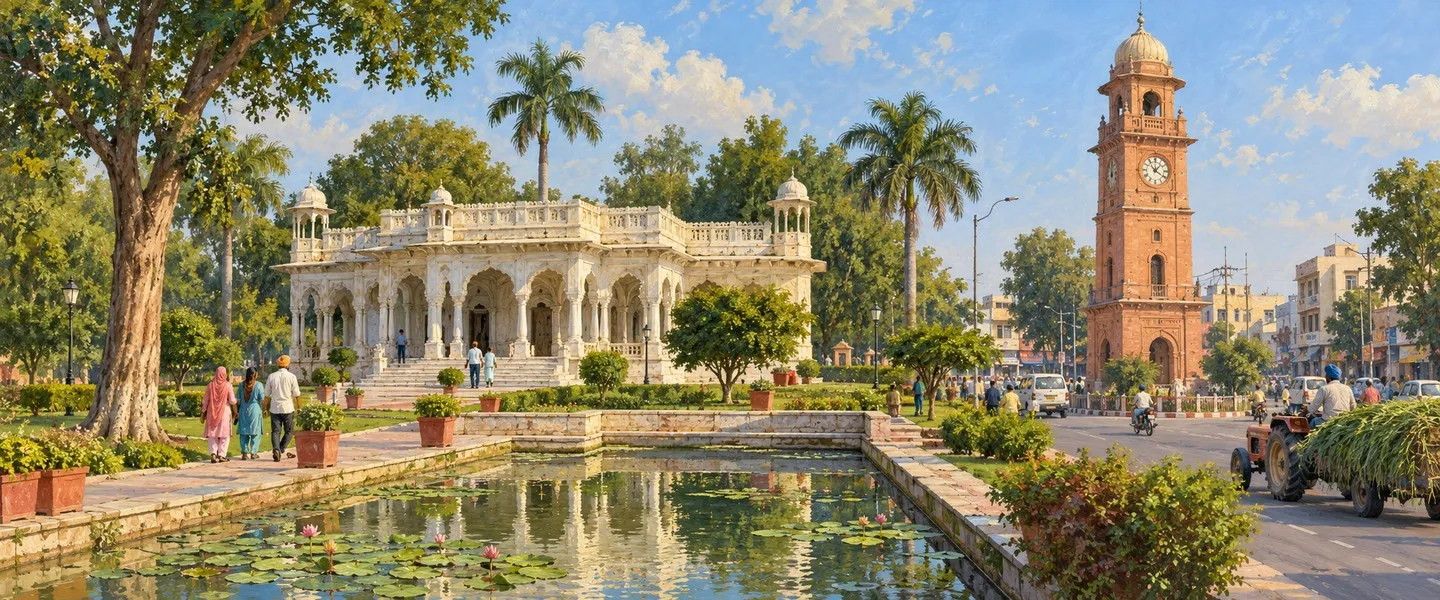
The Shahi Eidgah is the city's great open prayer ground and its best known monument. Gurdwara Haa Da Naara Sahib, in Sajida Colony, was built by Sikhs to honour the Nawab's protest and keeps the 1705 story at the centre of the city's shared life. The Mubarak Manzil Palace and the old Qila recall the Nawabi court, and the Shahi graveyard at Sirhandi Gate holds the ornate tombs of the princely rulers, including the last Nawab. The shrine of Baba Haidar Sheikh, the Sufi saint linked in local tradition with the town's founding more than five centuries ago, draws devotees across faiths, as do the city's mosques, its Jama Masjid and its dargahs. A walk through the old Nawabi quarter ties these places together better than any single visit.
Work, food and learning
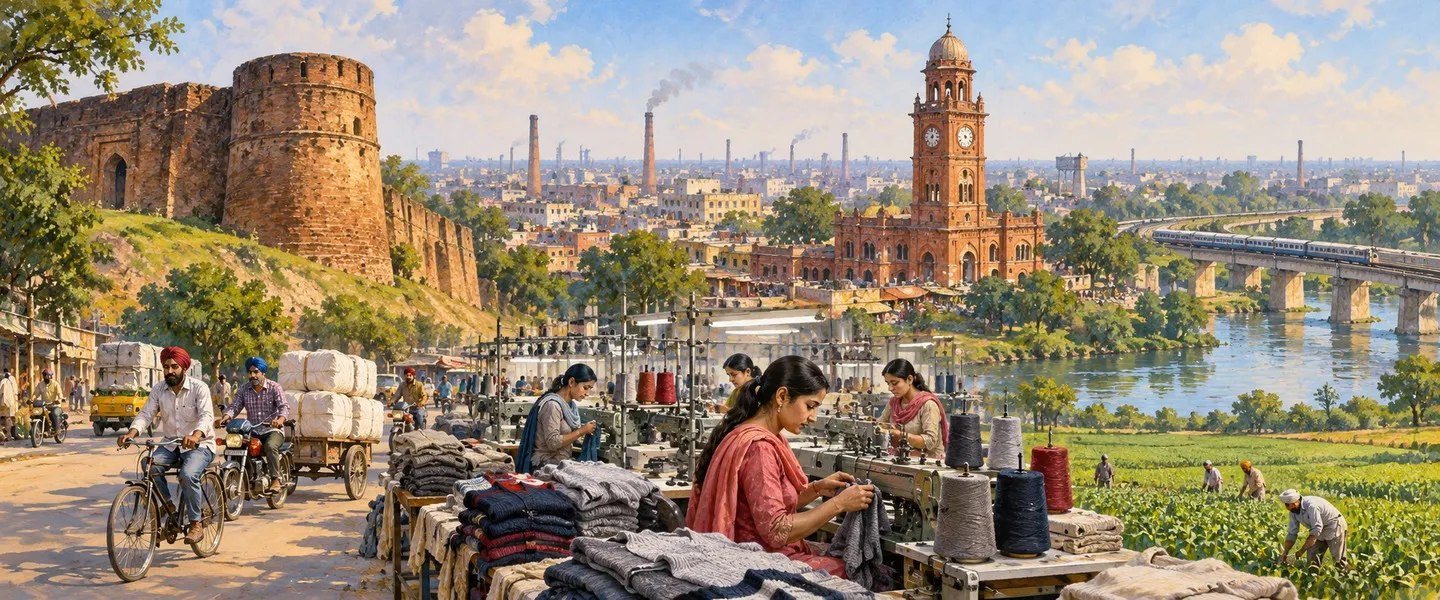
The district administration describes Malerkotla as a major supplier of vegetables to this part of Punjab, and its bazaars carry that trade daily. Its artisans are known for hand embroidered badges and insignia made for the armed forces, a cottage industry unlike any other in the state, alongside a metal industry and the manufacture of agricultural machinery. The town is also known for its food, its mosques and its poets, a reputation the district portal itself records. For learning, the Nawab Sher Mohammad Khan Institute of Advanced Studies, part of Punjabi University, Patiala, supports research in Urdu, Persian and Arabic up to PhD level and runs postgraduate and certificate courses, giving the small city an outsized place in Urdu scholarship in Punjab.
Getting there and Malerkotla today
By rail the city stands at kilometre 45 of the Ludhiana to Jakhal line, which was commissioned in 1901 after an 1893 agreement between the British and the Jind, Malerkotla and Patiala states, through whose territories it ran. Malerkotla station, code MET, sits on the Delhi to Jakhal to Dhuri to Ludhiana route, with Dhuri junction about 18 kilometres away. By road, regular buses link the city with Ludhiana, Sangrur, Khanna and Jagraon. The nearest airport is Ludhiana's Sahnewal Airport, about 50 kilometres away, with Chandigarh's international airport about 120 kilometres away. Today Malerkotla is a district headquarters still building the offices and infrastructure its new status needs, and a city whose identity rests on a single act of protest in 1705 and on the peace that residents believe followed from it.
ਮਲੇਰਕੋਟਲਾ ਭਾਰਤ ਦੇ ਪੰਜਾਬ ਸੂਬੇ ਦੇ ਮਾਲਵਾ ਖੇਤਰ ਦਾ ਇੱਕ ਸ਼ਹਿਰ ਹੈ ਅਤੇ ਮਲੇਰਕੋਟਲਾ ਜ਼ਿਲ੍ਹੇ ਦਾ ਮੁੱਖ ਦਫ਼ਤਰ ਹੈ, ਜੋ ਸੂਬੇ ਦਾ ਇੱਕੋ-ਇੱਕ ਮੁਸਲਿਮ ਬਹੁਗਿਣਤੀ ਵਾਲਾ ਜ਼ਿਲ੍ਹਾ ਹੈ। ਇਹ ਇੱਕ ਛੋਟੀ ਰਿਆਸਤ ਦੀ ਰਾਜਧਾਨੀ ਸੀ, ਜਿਸਦੇ ਨਵਾਬ ਨੇ 1705 ਵਿੱਚ ਛੋਟੇ ਸਾਹਿਬਜ਼ਾਦਿਆਂ ਨੂੰ ਸ਼ਹੀਦ ਕਰਨ ਦਾ ਵਿਰੋਧ ਕੀਤਾ ਸੀ। 2011 ਦੀ ਜਨਗਣਨਾ ਨੇ ਸ਼ਹਿਰ ਵਿੱਚ 135,424 ਲੋਕ ਗਿਣੇ।
ਮਲੇਰਕੋਟਲਾ ਕਿੱਥੇ ਹੈ?
ਮਲੇਰਕੋਟਲਾ ਦੱਖਣੀ ਪੰਜਾਬ ਦੇ ਮਾਲਵਾ ਮੈਦਾਨ ਵਿੱਚ ਹੈ, ਸੰਗਰੂਰ ਤੋਂ ਲਗਭਗ 35 ਕਿਲੋਮੀਟਰ ਉੱਤਰ ਵੱਲ ਅਤੇ ਲੁਧਿਆਣੇ ਤੋਂ ਲਗਭਗ 40 ਕਿਲੋਮੀਟਰ ਦੱਖਣ ਵੱਲ, ਖੰਨਾ ਲਗਭਗ 45 ਕਿਲੋਮੀਟਰ ਦੂਰ ਹੈ। 2 ਜੂਨ 2021 ਤੋਂ ਇਹ ਆਪਣੇ ਜ਼ਿਲ੍ਹੇ ਦਾ ਮੁੱਖ ਦਫ਼ਤਰ ਹੈ, ਜੋ ਸੰਗਰੂਰ ਜ਼ਿਲ੍ਹੇ ਵਿੱਚੋਂ ਕੱਢ ਕੇ ਪੰਜਾਬ ਦਾ 23ਵਾਂ ਜ਼ਿਲ੍ਹਾ ਬਣਾਇਆ ਗਿਆ ਅਤੇ ਪਟਿਆਲਾ ਡਿਵੀਜ਼ਨ ਵਿੱਚ ਰੱਖਿਆ ਗਿਆ। ਜ਼ਿਲ੍ਹੇ ਦੀਆਂ ਤਿੰਨ ਸਬ-ਡਿਵੀਜ਼ਨਾਂ ਹਨ, ਮਲੇਰਕੋਟਲਾ, ਅਮਰਗੜ੍ਹ ਅਤੇ ਅਹਿਮਦਗੜ੍ਹ, ਇਸਦਾ ਖੇਤਰ 684 ਵਰਗ ਕਿਲੋਮੀਟਰ ਹੈ ਅਤੇ 2011 ਵਿੱਚ ਇਸਦੇ 192 ਪਿੰਡਾਂ ਅਤੇ ਕਸਬਿਆਂ ਵਿੱਚ 429,754 ਲੋਕ ਗਿਣੇ ਗਏ, ਜਿਨ੍ਹਾਂ ਵਿੱਚੋਂ ਲਗਭਗ 40.5 ਫ਼ੀਸਦੀ ਸ਼ਹਿਰੀ ਖੇਤਰਾਂ ਵਿੱਚ ਰਹਿੰਦੇ ਸਨ। ਸ਼ਹਿਰ ਸੰਗਰੂਰ ਤੋਂ ਲੁਧਿਆਣਾ ਵਾਲੇ ਸੂਬਾ ਰਾਜਮਾਰਗ ਉੱਤੇ ਅਤੇ ਲੁਧਿਆਣਾ ਤੋਂ ਦਿੱਲੀ ਵਾਲੀ ਰੇਲਵੇ ਲਾਈਨ ਉੱਤੇ ਹੈ। ਇਸਦਾ ਪਿੰਨ ਕੋਡ 148023 ਹੈ ਅਤੇ ਵਾਹਨ ਰਜਿਸਟ੍ਰੇਸ਼ਨ PB-28 ਹੈ।
ਇਤਿਹਾਸ: ਰਿਆਸਤ ਅਤੇ ਹਾਅ ਦਾ ਨਾਅਰਾ
ਸਥਾਨਕ ਅਤੇ ਜ਼ਿਲ੍ਹਾ ਬਿਰਤਾਂਤ ਰਿਆਸਤ ਦੀ ਨੀਂਹ 1454 ਨਾਲ ਜੋੜਦੇ ਹਨ, ਜਦੋਂ ਸ਼ੇਖ਼ ਸਦਰੁੱਦੀਨ, ਇੱਕ ਅਫ਼ਗਾਨ ਧਾਰਮਿਕ ਹਸਤੀ, ਇੱਥੇ ਆ ਵੱਸੇ। ਉਨ੍ਹਾਂ ਦੇ ਸ਼ੇਰਵਾਨੀ ਵਾਰਸ ਸਿੱਖ ਅਤੇ ਅੰਗਰੇਜ਼ ਕਾਲ ਵਿੱਚ ਨਵਾਬ ਬਣ ਕੇ ਰਾਜ ਕਰਦੇ ਰਹੇ ਅਤੇ ਵੱਡੇ ਗੁਆਂਢੀਆਂ ਵਿਚਕਾਰ ਇੱਕ ਛੋਟੀ ਰਿਆਸਤ ਨੂੰ ਜਿਉਂਦਾ ਰੱਖਿਆ। ਪੰਜਾਬ ਦੀ ਯਾਦ ਵਿੱਚ ਸ਼ਹਿਰ ਨੂੰ ਅਮਰ ਕਰਨ ਵਾਲੀ ਘਟਨਾ 1704 ਤੋਂ 1705 ਦੀ ਸਰਦੀ ਵਿੱਚ ਵਾਪਰੀ। ਜਦੋਂ ਸਰਹਿੰਦ ਦੇ ਵਜ਼ੀਰ ਖ਼ਾਂ ਨੇ ਗੁਰੂ ਗੋਬਿੰਦ ਸਿੰਘ ਜੀ ਦੇ ਛੋਟੇ ਸਾਹਿਬਜ਼ਾਦਿਆਂ, ਨੌਂ ਸਾਲ ਦੇ ਜ਼ੋਰਾਵਰ ਸਿੰਘ ਅਤੇ ਸੱਤ ਸਾਲ ਦੇ ਫ਼ਤਹਿ ਸਿੰਘ, ਨੂੰ ਜਿਉਂਦੇ ਨੀਹਾਂ ਵਿੱਚ ਚਿਣਨ ਦਾ ਹੁਕਮ ਦਿੱਤਾ, ਤਾਂ ਦਰਬਾਰ ਵਿੱਚ ਹਾਜ਼ਰ ਅਤੇ ਵਜ਼ੀਰ ਖ਼ਾਂ ਦੇ ਰਿਸ਼ਤੇਦਾਰ, ਮਲੇਰਕੋਟਲੇ ਦੇ ਨਵਾਬ ਸ਼ੇਰ ਮੁਹੰਮਦ ਖ਼ਾਂ ਨੇ ਵਿਰੋਧ ਕੀਤਾ ਕਿ ਇਹ ਕੰਮ ਇਸਲਾਮ ਦੇ ਅਸੂਲਾਂ ਦੇ ਵਿਰੁੱਧ ਹੈ, ਅਤੇ ਉਹ ਦਰਬਾਰ ਵਿੱਚੋਂ ਉੱਠ ਕੇ ਚਲੇ ਗਏ। ਉਨ੍ਹਾਂ ਦੀ ਦੁੱਖ ਭਰੀ ਆਵਾਜ਼ ਨੂੰ ਹਾਅ ਦਾ ਨਾਅਰਾ ਕਿਹਾ ਜਾਂਦਾ ਹੈ। ਸਿੱਖ ਪਰੰਪਰਾ ਮੰਨਦੀ ਹੈ ਕਿ ਇਹ ਗੱਲ ਸੁਣ ਕੇ ਗੁਰੂ ਸਾਹਿਬ ਨੇ ਨਵਾਬ ਦੇ ਘਰ ਅਤੇ ਸ਼ਹਿਰ ਨੂੰ ਅਸੀਸ ਦਿੱਤੀ।
ਵਾਸੀ ਆਪ ਇਸ ਅਸੀਸ ਨੂੰ ਹੀ ਇਸ ਤੋਂ ਬਾਅਦ ਵਾਪਰੀਆਂ ਗੱਲਾਂ ਦੀ ਵਜ੍ਹਾ ਮੰਨਦੇ ਹਨ। ਜਨਵਰੀ 1872 ਵਿੱਚ, ਨਾਮਧਾਰੀ ਉਠਾਅ ਤੋਂ ਬਾਅਦ, ਲੁਧਿਆਣੇ ਦੇ ਅੰਗਰੇਜ਼ ਡਿਪਟੀ ਕਮਿਸ਼ਨਰ ਅਤੇ ਅੰਬਾਲੇ ਦੇ ਕਮਿਸ਼ਨਰ ਨੇ ਮਲੇਰਕੋਟਲੇ ਵਿਖੇ 65 ਫੜੇ ਨਾਮਧਾਰੀਆਂ ਨੂੰ ਬਿਨਾਂ ਮੁਕੱਦਮੇ ਤੋਪਾਂ ਨਾਲ ਉਡਾਉਣ ਦਾ ਹੁਕਮ ਦਿੱਤਾ, ਉਹ ਘਟਨਾ ਜਿਸਨੂੰ ਸ਼ਹਿਰ ਆਪਣੀ ਕੂਕਾ ਸ਼ਹੀਦੀ ਯਾਦਗਾਰ ਰਾਹੀਂ ਯਾਦ ਰੱਖਦਾ ਹੈ। 1947 ਵਿੱਚ, ਜਦੋਂ ਫ਼ਿਰਕੂ ਹਿੰਸਾ ਨੇ ਪੰਜਾਬ ਨੂੰ ਘੇਰ ਲਿਆ, ਰਿਆਸਤ ਤੁਲਨਾਤਮਕ ਤੌਰ ਉੱਤੇ ਸ਼ਾਂਤ ਰਹੀ ਅਤੇ ਇਸਦੇ ਬਹੁਤੇ ਮੁਸਲਿਮ ਵਾਸੀ ਭਾਰਤ ਵਿੱਚ ਹੀ ਰਹੇ। ਆਖ਼ਰੀ ਨਵਾਬ, ਇਫ਼ਤਿਖ਼ਾਰ ਅਲੀ ਖ਼ਾਂ, ਮਲੇਰਕੋਟਲੇ ਵਿੱਚ ਹੀ ਰਹੇ ਅਤੇ 1982 ਵਿੱਚ ਉਨ੍ਹਾਂ ਦਾ ਦੇਹਾਂਤ ਹੋਇਆ। ਉਨ੍ਹਾਂ ਦੀ ਕਬਰ ਸਰਹੰਦੀ ਦਰਵਾਜ਼ੇ ਕੋਲ ਸ਼ਾਹੀ ਕਬਰਿਸਤਾਨ ਵਿੱਚ ਹੈ। ਰਿਆਸਤ 1948 ਵਿੱਚ ਭਾਰਤ ਨਾਲ ਮਿਲੀ, ਪੈਪਸੂ ਦਾ ਹਿੱਸਾ ਬਣੀ, 1956 ਵਿੱਚ ਪੰਜਾਬ ਵਿੱਚ ਆ ਗਈ ਅਤੇ ਫਿਰ ਸੰਗਰੂਰ ਜ਼ਿਲ੍ਹੇ ਦੀ ਤਹਿਸੀਲ ਰਹੀ, ਜਦੋਂ ਤੱਕ 2021 ਵਿੱਚ ਇਸਨੂੰ ਮੁੜ ਜ਼ਿਲ੍ਹੇ ਦਾ ਦਰਜਾ ਨਹੀਂ ਮਿਲਿਆ।
ਭੂਗੋਲ ਅਤੇ ਲੋਕ
ਨਗਰ ਕੌਂਸਲ ਨੇ 2011 ਵਿੱਚ 135,424 ਲੋਕ ਗਿਣੇ, ਜੋ 2001 ਦੇ 107,009 ਅਤੇ 1991 ਦੇ 88,600 ਤੋਂ ਵੱਧ ਹਨ, 31.16 ਵਰਗ ਕਿਲੋਮੀਟਰ ਉੱਤੇ, ਘਣਤਾ ਹਰ ਵਰਗ ਕਿਲੋਮੀਟਰ ਲਗਭਗ 4,346 ਲੋਕ। 71,376 ਮਰਦ ਅਤੇ 64,048 ਔਰਤਾਂ ਸਨ। ਅਨੁਸੂਚਿਤ ਜਾਤੀਆਂ ਦੀ ਗਿਣਤੀ 8,893 ਸੀ, ਜੋ ਪੰਜਾਬ ਲਈ ਛੋਟਾ ਹਿੱਸਾ ਹੈ, ਅਤੇ 81,937 ਵਾਸੀ ਪੜ੍ਹੇ-ਲਿਖੇ ਦਰਜ ਹੋਏ, ਸੱਤ ਸਾਲ ਤੋਂ ਵੱਧ ਉਮਰ ਵਾਲਿਆਂ ਵਿੱਚ ਪ੍ਰਭਾਵੀ ਸਾਖਰਤਾ ਦਰ ਲਗਭਗ 69 ਫ਼ੀਸਦੀ। ਧਰਮ ਪੱਖੋਂ ਇਹ ਸ਼ਹਿਰ ਭਾਰਤੀ ਪੰਜਾਬ ਵਿੱਚ ਆਪਣੀ ਮਿਸਾਲ ਆਪ ਹੈ: 2011 ਵਿੱਚ ਮੁਸਲਿਮ 68.50 ਫ਼ੀਸਦੀ, ਹਿੰਦੂ 20.71 ਫ਼ੀਸਦੀ, ਸਿੱਖ 9.50 ਫ਼ੀਸਦੀ ਅਤੇ ਜੈਨ 1.11 ਫ਼ੀਸਦੀ ਸਨ। ਵੱਡਾ ਜ਼ਿਲ੍ਹਾ ਹੋਰ ਤਸਵੀਰ ਪੇਸ਼ ਕਰਦਾ ਹੈ, ਸਿੱਖ 50.89 ਫ਼ੀਸਦੀ, ਮੁਸਲਿਮ 33.26 ਫ਼ੀਸਦੀ ਅਤੇ ਹਿੰਦੂ 15.19 ਫ਼ੀਸਦੀ, ਕਿਉਂਕਿ ਸ਼ਹਿਰ ਦੇ ਆਲੇ-ਦੁਆਲੇ ਦੇ ਪਿੰਡ ਬਹੁਤੇ ਸਿੱਖ ਹਨ। ਜ਼ਿਲ੍ਹੇ ਦੀ ਮਾਂ-ਬੋਲੀ ਪੱਖੋਂ 94.69 ਫ਼ੀਸਦੀ ਲੋਕਾਂ ਦੀ ਪਹਿਲੀ ਭਾਸ਼ਾ ਪੰਜਾਬੀ ਹੈ ਅਤੇ 4.21 ਫ਼ੀਸਦੀ ਦੀ ਉਰਦੂ, ਅਤੇ ਸ਼ਹਿਰ ਦੇ ਸਕੂਲਾਂ ਵਿੱਚ ਪੰਜਾਬੀ ਨਾਲ ਉਰਦੂ ਵੀ ਪੜ੍ਹਾਈ ਜਾਂਦੀ ਹੈ।
ਵੇਖਣਯੋਗ ਥਾਵਾਂ
ਸ਼ਾਹੀ ਈਦਗਾਹ ਸ਼ਹਿਰ ਦਾ ਵੱਡਾ ਖੁੱਲ੍ਹਾ ਨਮਾਜ਼ ਮੈਦਾਨ ਹੈ ਅਤੇ ਇਸਦੀ ਸਭ ਤੋਂ ਜਾਣੀ-ਪਛਾਣੀ ਇਮਾਰਤ ਹੈ। ਸਾਜਿਦਾ ਕਲੋਨੀ ਵਿੱਚ ਗੁਰਦੁਆਰਾ ਹਾਅ ਦਾ ਨਾਅਰਾ ਸਾਹਿਬ ਸਿੱਖਾਂ ਨੇ ਨਵਾਬ ਦੇ ਵਿਰੋਧ ਦੀ ਯਾਦ ਵਿੱਚ ਬਣਾਇਆ ਅਤੇ ਇਹ 1705 ਦੀ ਕਹਾਣੀ ਨੂੰ ਸ਼ਹਿਰ ਦੀ ਸਾਂਝੀ ਜ਼ਿੰਦਗੀ ਦੇ ਕੇਂਦਰ ਵਿੱਚ ਰੱਖਦਾ ਹੈ। ਮੁਬਾਰਕ ਮੰਜ਼ਿਲ ਮਹਲ ਅਤੇ ਪੁਰਾਣਾ ਕਿਲ੍ਹਾ ਨਵਾਬੀ ਦਰਬਾਰ ਦੀ ਯਾਦ ਦਿਵਾਉਂਦੇ ਹਨ, ਅਤੇ ਸਰਹੰਦੀ ਦਰਵਾਜ਼ੇ ਕੋਲ ਸ਼ਾਹੀ ਕਬਰਿਸਤਾਨ ਵਿੱਚ ਰਿਆਸਤੀ ਹਾਕਮਾਂ ਦੀਆਂ ਸਜੀਆਂ ਕਬਰਾਂ ਹਨ, ਜਿਨ੍ਹਾਂ ਵਿੱਚ ਆਖ਼ਰੀ ਨਵਾਬ ਦੀ ਕਬਰ ਵੀ ਹੈ। ਬਾਬਾ ਹੈਦਰ ਸ਼ੇਖ਼ ਦੀ ਦਰਗਾਹ, ਜਿਨ੍ਹਾਂ ਨੂੰ ਸਥਾਨਕ ਪਰੰਪਰਾ ਪੰਜ ਸਦੀਆਂ ਤੋਂ ਵੱਧ ਪਹਿਲਾਂ ਸ਼ਹਿਰ ਦੀ ਨੀਂਹ ਨਾਲ ਜੋੜਦੀ ਹੈ, ਸਭ ਧਰਮਾਂ ਦੇ ਸ਼ਰਧਾਲੂਆਂ ਨੂੰ ਖਿੱਚਦੀ ਹੈ, ਜਿਵੇਂ ਸ਼ਹਿਰ ਦੀਆਂ ਮਸਜਿਦਾਂ, ਜਾਮਾ ਮਸਜਿਦ ਅਤੇ ਦਰਗਾਹਾਂ ਕਰਦੀਆਂ ਹਨ। ਪੁਰਾਣੇ ਨਵਾਬੀ ਮੁਹੱਲੇ ਦੀ ਸੈਰ ਇਨ੍ਹਾਂ ਸਾਰੀਆਂ ਥਾਵਾਂ ਨੂੰ ਕਿਸੇ ਇੱਕ ਮੁਲਾਕਾਤ ਨਾਲੋਂ ਵੱਧ ਚੰਗੀ ਤਰ੍ਹਾਂ ਜੋੜਦੀ ਹੈ।
ਕੰਮ, ਖਾਣਾ ਅਤੇ ਸਿੱਖਿਆ
ਜ਼ਿਲ੍ਹਾ ਪ੍ਰਸ਼ਾਸਨ ਮਲੇਰਕੋਟਲੇ ਨੂੰ ਪੰਜਾਬ ਦੇ ਇਸ ਹਿੱਸੇ ਲਈ ਸਬਜ਼ੀਆਂ ਦਾ ਵੱਡਾ ਸਪਲਾਇਰ ਦੱਸਦਾ ਹੈ, ਅਤੇ ਇਸਦੇ ਬਾਜ਼ਾਰ ਰੋਜ਼ ਉਸ ਵਪਾਰ ਨੂੰ ਚਲਾਉਂਦੇ ਹਨ। ਇਸਦੇ ਕਾਰੀਗਰ ਹਥਿਆਰਬੰਦ ਸੈਨਾਵਾਂ ਲਈ ਹੱਥੀਂ ਕਢਾਈ ਵਾਲੇ ਬਿੱਲੇ ਅਤੇ ਨਿਸ਼ਾਨ ਬਣਾਉਣ ਲਈ ਜਾਣੇ ਜਾਂਦੇ ਹਨ, ਜੋ ਸੂਬੇ ਵਿੱਚ ਆਪਣੀ ਤਰ੍ਹਾਂ ਦਾ ਇੱਕੋ ਘਰੇਲੂ ਉਦਯੋਗ ਹੈ, ਇਸ ਨਾਲ ਧਾਤ ਉਦਯੋਗ ਅਤੇ ਖੇਤੀ ਮਸ਼ੀਨਰੀ ਬਣਾਉਣ ਦਾ ਕੰਮ ਵੀ ਹੈ। ਸ਼ਹਿਰ ਆਪਣੇ ਖਾਣੇ, ਮਸਜਿਦਾਂ ਅਤੇ ਸ਼ਾਇਰਾਂ ਲਈ ਵੀ ਜਾਣਿਆ ਜਾਂਦਾ ਹੈ, ਉਹ ਸਾਖ ਜੋ ਜ਼ਿਲ੍ਹਾ ਪੋਰਟਲ ਆਪ ਦਰਜ ਕਰਦਾ ਹੈ। ਸਿੱਖਿਆ ਲਈ, ਪੰਜਾਬੀ ਯੂਨੀਵਰਸਿਟੀ, ਪਟਿਆਲਾ ਦਾ ਹਿੱਸਾ, ਨਵਾਬ ਸ਼ੇਰ ਮੁਹੰਮਦ ਖ਼ਾਂ ਇੰਸਟੀਚਿਊਟ ਆਫ਼ ਅਡਵਾਂਸਡ ਸਟੱਡੀਜ਼ ਉਰਦੂ, ਫ਼ਾਰਸੀ ਅਤੇ ਅਰਬੀ ਵਿੱਚ ਪੀ.ਐਚ.ਡੀ. ਪੱਧਰ ਤੱਕ ਦੀ ਖੋਜ ਨੂੰ ਸਹਾਰਾ ਦਿੰਦਾ ਹੈ ਅਤੇ ਸਨਾਤਕੋਤਰ ਅਤੇ ਸਰਟੀਫਿਕੇਟ ਕੋਰਸ ਚਲਾਉਂਦਾ ਹੈ, ਜਿਸ ਨਾਲ ਇਸ ਛੋਟੇ ਸ਼ਹਿਰ ਨੂੰ ਪੰਜਾਬ ਵਿੱਚ ਉਰਦੂ ਵਿਦਵਤਾ ਵਿੱਚ ਵੱਡੀ ਥਾਂ ਮਿਲਦੀ ਹੈ।
ਪਹੁੰਚ ਅਤੇ ਅੱਜ ਦਾ ਮਲੇਰਕੋਟਲਾ
ਰੇਲ ਰਾਹੀਂ ਸ਼ਹਿਰ ਲੁਧਿਆਣਾ ਤੋਂ ਜਾਖਲ ਵਾਲੀ ਲਾਈਨ ਦੇ 45ਵੇਂ ਕਿਲੋਮੀਟਰ ਉੱਤੇ ਹੈ, ਜੋ 1901 ਵਿੱਚ ਚਾਲੂ ਹੋਈ, 1893 ਦੇ ਉਸ ਸਮਝੌਤੇ ਤੋਂ ਬਾਅਦ ਜੋ ਅੰਗਰੇਜ਼ਾਂ ਅਤੇ ਜੀਂਦ, ਮਲੇਰਕੋਟਲਾ ਅਤੇ ਪਟਿਆਲਾ ਰਿਆਸਤਾਂ ਵਿਚਕਾਰ ਹੋਇਆ ਸੀ, ਜਿਨ੍ਹਾਂ ਦੇ ਇਲਾਕਿਆਂ ਵਿੱਚੋਂ ਇਹ ਲਾਈਨ ਲੰਘਦੀ ਸੀ। ਮਲੇਰਕੋਟਲਾ ਸਟੇਸ਼ਨ, ਕੋਡ MET, ਦਿੱਲੀ ਤੋਂ ਜਾਖਲ, ਧੂਰੀ, ਲੁਧਿਆਣਾ ਵਾਲੇ ਰਾਹ ਉੱਤੇ ਹੈ, ਧੂਰੀ ਜੰਕਸ਼ਨ ਲਗਭਗ 18 ਕਿਲੋਮੀਟਰ ਦੂਰ ਹੈ। ਸੜਕ ਰਾਹੀਂ ਨਿਯਮਤ ਬੱਸਾਂ ਸ਼ਹਿਰ ਨੂੰ ਲੁਧਿਆਣਾ, ਸੰਗਰੂਰ, ਖੰਨਾ ਅਤੇ ਜਗਰਾਓਂ ਨਾਲ ਜੋੜਦੀਆਂ ਹਨ। ਸਭ ਤੋਂ ਨੇੜਲਾ ਹਵਾਈ ਅੱਡਾ ਲੁਧਿਆਣੇ ਦਾ ਸਾਹਨੇਵਾਲ ਹਵਾਈ ਅੱਡਾ ਹੈ, ਲਗਭਗ 50 ਕਿਲੋਮੀਟਰ ਦੂਰ, ਅਤੇ ਚੰਡੀਗੜ੍ਹ ਦਾ ਅੰਤਰਰਾਸ਼ਟਰੀ ਹਵਾਈ ਅੱਡਾ ਲਗਭਗ 120 ਕਿਲੋਮੀਟਰ ਦੂਰ ਹੈ। ਅੱਜ ਮਲੇਰਕੋਟਲਾ ਇੱਕ ਜ਼ਿਲ੍ਹਾ ਮੁੱਖ ਦਫ਼ਤਰ ਹੈ ਜੋ ਅਜੇ ਆਪਣੇ ਨਵੇਂ ਦਰਜੇ ਲਈ ਲੋੜੀਂਦੇ ਦਫ਼ਤਰ ਅਤੇ ਢਾਂਚਾ ਬਣਾ ਰਿਹਾ ਹੈ, ਅਤੇ ਇੱਕ ਅਜਿਹਾ ਸ਼ਹਿਰ ਹੈ ਜਿਸਦੀ ਪਛਾਣ 1705 ਦੇ ਇੱਕ ਵਿਰੋਧ ਉੱਤੇ ਅਤੇ ਉਸ ਸ਼ਾਂਤੀ ਉੱਤੇ ਟਿਕੀ ਹੈ ਜੋ ਵਾਸੀ ਮੰਨਦੇ ਹਨ ਕਿ ਉਸ ਤੋਂ ਬਾਅਦ ਮਿਲੀ।
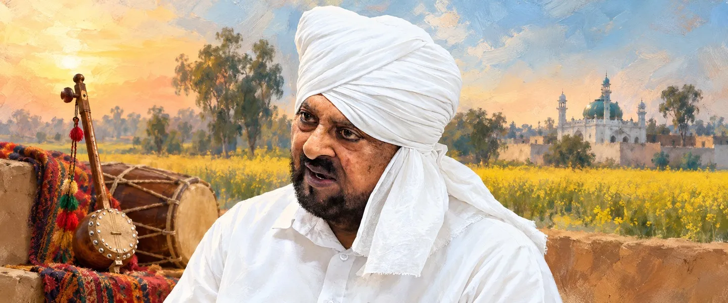
People from Malerkotla


Nearby
Villages in Malerkotla tehsil (81)

ਸਰੋਤ (6)
- Malerkotla: history, Haa da Naara, 1872 executions, demographics, institute and transport
- Malerkotla district: formation on 2 June 2021, subdivisions, population and religion
- About District Malerkotla: formation, boundaries, distances, vegetables, badges and metal industry
- How to Reach Malerkotla: rail line, junctions and airports
- Malerkotla (Municipal Council): Census 2011 population, area, gender and literacy totals
- Ludhiana to Jakhal line: 1893 agreement, opened 1901, Malerkotla at kilometre 45
ਜੁਗਤੀ ਮੁਫ਼ਤ ਅਤੇ ਸੁਤੰਤਰ ਹੈ। ਪਾਠਕਾਂ ਦਾ ਸਹਿਯੋਗ ਕੋਸ਼ ਨੂੰ ਵਧਾਉਂਦਾ ਹੈ।
ਸਹਿਯੋਗ