
Amargarh Tehsil is a tehsil of Malerkotla district in the Malwa region of Punjab, India, headquartered in Amargarh town on the Malerkotla to Patiala road. Upgraded from a sub tehsil in June 2021, when Malerkotla became Punjab's 23rd district, it covers the farming villages east of Malerkotla city toward Patiala.
- ਪੰਜਾਬੀ ਨਾਂ
- ਅਮਰਗੜ੍ਹ
- ਕਿਸਮ
- ਤਹਿਸੀਲ
- ਜ਼ਿਲ੍ਹਾ
- ਮਲੇਰਕੋਟਲਾ
- ਮੁੱਖ ਦਫ਼ਤਰ
- ਅਮਰਗੜ੍ਹ
- ਇਲਾਕਾ
- ਮਾਲਵਾ
- ਰਾਜ
- ਪੰਜਾਬ
All 19 facts
- ਦੇਸ਼
- ਭਾਰਤ
- ਬਣਿਆ
- Upgraded from sub tehsil to tehsil and sub division on 2 June 2021, when Malerkotla district was created out of Sangrur
- ਪਿੰਡ
- 192 villages in Malerkotla district as a whole; the Jugti tehsil directory lists 48 village pages under Amargarh (counted October 2026)
- ਆਬਾਦੀ
- No Census 2011 tehsil total exists, as the tehsil was formed in 2021; headquarters town 7,339 (Census 2011); Malerkotla district 429,754 in the Census 2011 frame
- Headquarters households
- 1,473 houses (Census 2011)
- ਸਾਖਰਤਾ
- 77.11% in the headquarters town (Census 2011)
- Sex ratio
- 899 women per 1,000 men in the headquarters town (Census 2011)
- Development block
- ਅਮਰਗੜ੍ਹ
- ਪਿੰਨ ਕੋਡ
- 148022 (headquarters)
- ਨਿਰਦੇਸ਼ ਅੰਕ
- 30.46 N, 76.01 E (headquarters town)
- ਭਾਸ਼ਾ
- ਪੰਜਾਬੀ (ਮਾਲਵਈ)
- ਨੇੜਲਾ ਸ਼ਹਿਰ
- Malerkotla, the district headquarters
- ਪ੍ਰਸਿੱਧੀ
- Its 2021 upgrade to a tehsil headquarters and its farming villages on the Malerkotla to Patiala road
Where is Amargarh Tehsil?
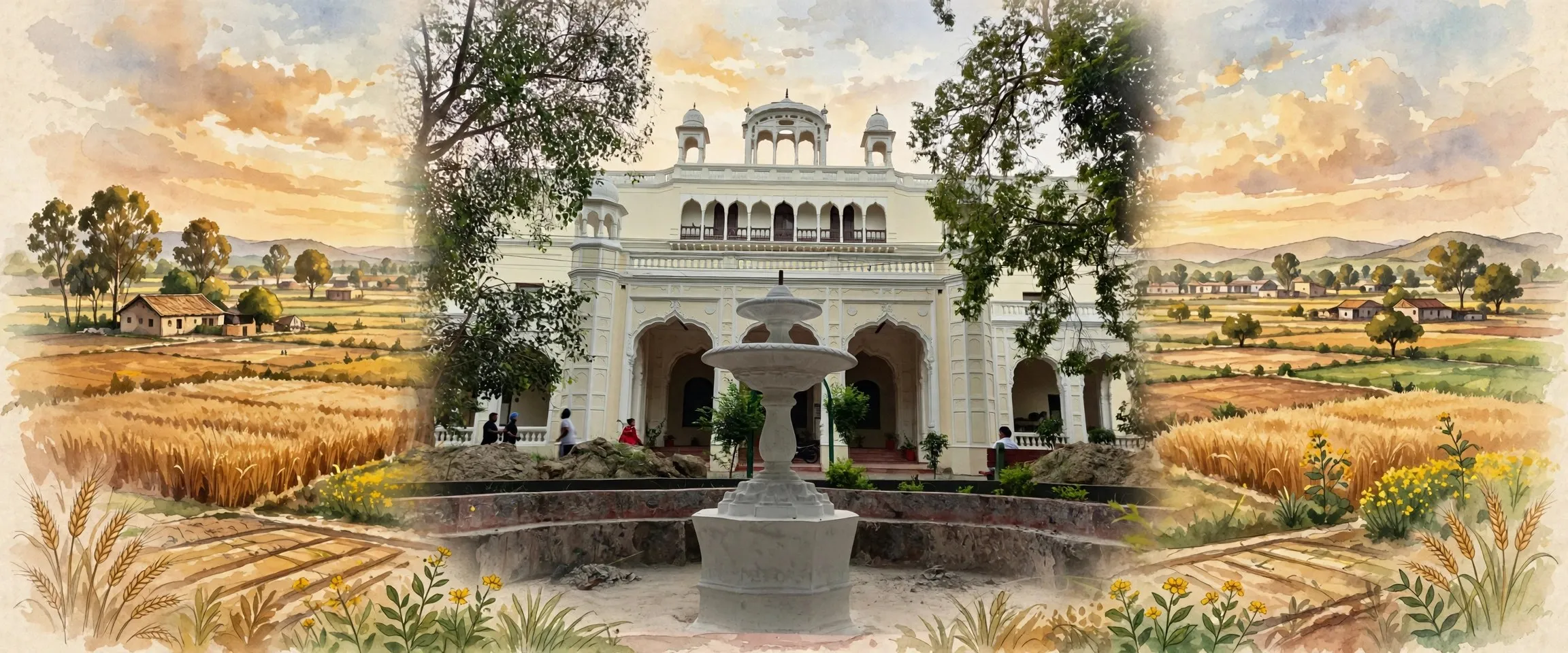
Amargarh Tehsil is a tehsil in the east of Malerkotla district in the Malwa region of Punjab, India, headquartered in the town of Amargarh on the Malerkotla to Patiala road. Raised from a sub tehsil in June 2021, when Malerkotla became the 23rd district of Punjab, it administers flat farming country of villages and grain markets.
Malerkotla district sits in the Patiala division of Punjab, bounded by Ludhiana district to the north, Barnala to the west, Patiala to the east and Sangrur to the south. Amargarh holds the eastern side of the district, toward Patiala, and its headquarters town stands at 30.46 degrees north and 76.01 degrees east, about 45 kilometres west of Patiala on the main road from Malerkotla. The district headquarters, Malerkotla city, lies to the north west of the tehsil. The countryside is flat Malwa farmland on the Indo-Gangetic alluvial plain, a patchwork of villages, fields and market roads, with no large river crossing the tehsil.
In administrative terms Amargarh is one of the three sub divisions of Malerkotla district, alongside Malerkotla and Ahmedgarh, and Amargarh is also the name of one of the district's three development blocks. It is a young tehsil in its present form. Because it was created in 2021, the Census of 2011 published no population total for it: in 2011 this country lay inside the Malerkotla tehsil of the old Sangrur district, and Amargarh itself was only a sub tehsil under the Malerkotla sub division. The present district as a whole counts 192 villages, and its Census 2011 population, counted in the old Sangrur frame, was 429,754 people. The Jugti tehsil directory currently lists 48 village pages under Amargarh, counted in October 2026.
The headquarters town of Amargarh
Amargarh town is a census town administered by a municipal council. At the Census of 2011 it counted 7,339 people, 3,864 men and 3,475 women, in 1,473 houses. Children under six numbered 802, or 10.93 percent of the town. Its sex ratio was 899 women per 1,000 men, close to the Punjab average of 895, and its child sex ratio was 835. Literacy in the town was 77.11 percent, above the Punjab average of 75.84 percent in the same census, with male literacy at 82.17 percent and female literacy at 71.54 percent. Scheduled Castes made up 30.86 percent of the town population, there was no Scheduled Tribe population, and 2,345 residents were recorded as workers, 96.12 percent of them in main work. In faith, the census counted the town as 53.45 percent Sikh, 39.35 percent Hindu and 6.85 percent Muslim.
For its villages, the town is where daily administration happens: the tehsil and sub division offices, the block development office and the municipal council all sit here, and the town's market serves the harvest trade of the surrounding fields. The town gives its name to the Amargarh assembly constituency of the Punjab Legislative Assembly. Its PIN code is 148022, its telephone code is 01675, and vehicles registered here carry the PB-92 series, the series allotted to Amargarh when the new district was formed.
From Patiala State to a tehsil of Malerkotla
The Amargarh country has a different princely past from its district headquarters. Malerkotla town was the seat of its own princely state, founded in 1454 and ruled by its Nawabs until 1948. The Amargarh region, by contrast, had been part of Patiala State before 1948. When the princely states were merged into the Patiala and East Punjab States Union, known as PEPSU, both the Malerkotla lands and the Amargarh country were placed inside Sangrur district. In 1956 PEPSU was dissolved and merged into the state of Punjab, and this arrangement lasted, with Amargarh as a sub tehsil of Malerkotla, for more than six decades.
The change came in 2021. On 14 May 2021, at the state level Eid-ul-Fitr celebration, Chief Minister Amarinder Singh announced that Malerkotla would become a district in its own right, a long standing local demand. On 2 June 2021 the Punjab cabinet gave formal approval, carving Malerkotla out of Sangrur as the 23rd district of Punjab, and approved upgrading Amargarh from a sub tehsil to a sub division and tehsil. The new district began with the three sub divisions of Malerkotla, Ahmedgarh and Amargarh, and new posts were sanctioned across twelve departments, from police and rural development to health and education, so that residents no longer had to travel to Sangrur for district level work.
Land, water and farming
The tehsil shares the climate the district administration describes for this part of Punjab: dry overall, with a short monsoon from July to mid September, a hot summer and a cold winter. District records for the old Sangrur frame put average annual rainfall at about 590 millimetres, rising toward the north east to about 670 millimetres at Malerkotla, with around 31 rainy days a year recorded at Malerkotla. Farming in Amargarh therefore depends on irrigation, through canals and groundwater, rather than on rainfall alone, and the flat alluvial fields are cropped intensively through the year under a large irrigated area.
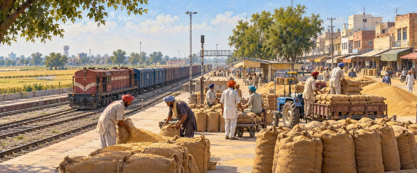
The principal crops recorded for the Sangrur area, of which this tehsil was long a part, are wheat, cotton, sugarcane, gram and millet, and the modern rotation adds paddy in the summer season across the Malwa plain. Malerkotla district is also known as a major supplier of vegetables to this part of Punjab, and vegetable growing sits alongside the grain rotation in villages near the towns. The headquarters town's market collects produce from the surrounding villages, making Amargarh a trading point for its countryside as well as an administrative one.
People, faith and villages
Punjabi is the language of the tehsil, in its Malwai form: at the Census of 2011, 94.69 percent of the present Malerkotla district spoke Punjabi as a first language and 4.21 percent spoke Urdu. Faith across the district in the same census was 50.89 percent Sikh, 33.26 percent Muslim and 15.19 percent Hindu, a mix that reflects Malerkotla's history as a Muslim ruled princely state whose people stayed through Partition. The headquarters town itself is Sikh majority, and village life runs through gram panchayats and the Amargarh panchayat samiti. Among the tehsil's larger villages are Chaunda and Bagrian, each close to five thousand people at the Census of 2011, along with Banbhaura and Bhurthla Mander, while smaller settlements such as Sampurangarh, about 14 kilometres from Malerkotla, show how closely the villages are spaced on this plain.
The wider district carries one of the most solemn chapters of Sikh history just north of this tehsil. At Kup, about 12 kilometres north of Malerkotla city, the Wadda Ghalughara, the great massacre of 5 February 1762, took place during Ahmad Shah Durrani's sixth invasion of India, when a Sikh caravan of some 40,000 people, including women, children and the elderly, was attacked on its way toward the Malwa country and, by the accounts preserved in Sikh tradition, some 25,000 to 30,000 Sikhs lost their lives. The memorial gurdwara at Kup Rohira keeps that memory in the district, and it is the historic ground most closely tied to the Malerkotla country as a whole.
Getting to Amargarh Tehsil
The road is the tehsil's lifeline. Amargarh town stands on the main road from Malerkotla to Patiala, about 45 kilometres west of Patiala, and regular public and private buses link the town with Malerkotla city, the district headquarters, and onward to Patiala, Sangrur, Dhuri and Ludhiana. Village roads feed into this highway from every side, and most daily travel in the tehsil, for school, markets and government offices, is by bus, car or two wheeler. Amargarh has no railway station of its own: VillageInfo records Malerkotla station, code MET, as the nearest station for villages of this tehsil, on the Ludhiana to Delhi secondary line that serves Malerkotla city, and rail travellers continue from there by road. Dhuri Junction, south west of the district, is the larger railhead for longer journeys.
ਅਮਰਗੜ੍ਹ ਤਹਿਸੀਲ ਕਿੱਥੇ ਹੈ?
ਅਮਰਗੜ੍ਹ ਤਹਿਸੀਲ ਭਾਰਤ ਦੇ ਪੰਜਾਬ ਸੂਬੇ ਦੇ ਮਾਲਵਾ ਖੇਤਰ ਵਿੱਚ ਮਾਲੇਰਕੋਟਲਾ ਜ਼ਿਲ੍ਹੇ ਦੇ ਪੂਰਬ ਵਿੱਚ ਇੱਕ ਤਹਿਸੀਲ ਹੈ, ਜਿਸ ਦਾ ਸਦਰ ਮੁਕਾਮ ਮਾਲੇਰਕੋਟਲਾ ਤੋਂ ਪਟਿਆਲਾ ਵਾਲੀ ਸੜਕ ਉੱਤੇ ਵਸਿਆ ਕਸਬਾ ਅਮਰਗੜ੍ਹ ਹੈ। ਇਹ ਜੂਨ 2021 ਵਿੱਚ ਇੱਕ ਉਪ ਤਹਿਸੀਲ ਤੋਂ ਤਰੱਕੀ ਪਾ ਕੇ ਬਣੀ, ਜਦੋਂ ਮਾਲੇਰਕੋਟਲਾ ਪੰਜਾਬ ਦਾ 23ਵਾਂ ਜ਼ਿਲ੍ਹਾ ਬਣਿਆ, ਅਤੇ ਇਹ ਪਿੰਡਾਂ ਅਤੇ ਅਨਾਜ ਮੰਡੀਆਂ ਵਾਲੀ ਸਮਤਲ ਖੇਤੀ ਧਰਤੀ ਦਾ ਪ੍ਰਸ਼ਾਸਨ ਸੰਭਾਲਦੀ ਹੈ।
ਮਾਲੇਰਕੋਟਲਾ ਜ਼ਿਲ੍ਹਾ ਪੰਜਾਬ ਦੀ ਪਟਿਆਲਾ ਡਿਵੀਜ਼ਨ ਵਿੱਚ ਪੈਂਦਾ ਹੈ, ਜਿਸ ਦੇ ਉੱਤਰ ਵੱਲ ਲੁਧਿਆਣਾ ਜ਼ਿਲ੍ਹਾ, ਪੱਛਮ ਵੱਲ ਬਰਨਾਲਾ, ਪੂਰਬ ਵੱਲ ਪਟਿਆਲਾ ਅਤੇ ਦੱਖਣ ਵੱਲ ਸੰਗਰੂਰ ਲੱਗਦਾ ਹੈ। ਅਮਰਗੜ੍ਹ ਜ਼ਿਲ੍ਹੇ ਦਾ ਪੂਰਬੀ ਪਾਸਾ ਸੰਭਾਲਦੀ ਹੈ, ਪਟਿਆਲਾ ਵੱਲ, ਅਤੇ ਇਸ ਦਾ ਸਦਰ ਮੁਕਾਮ ਕਸਬਾ 30.46 ਡਿਗਰੀ ਉੱਤਰ ਅਤੇ 76.01 ਡਿਗਰੀ ਪੂਰਬ ਉੱਤੇ ਹੈ, ਮਾਲੇਰਕੋਟਲਾ ਤੋਂ ਆਉਂਦੀ ਮੁੱਖ ਸੜਕ ਉੱਤੇ ਪਟਿਆਲਾ ਤੋਂ ਲਗਭਗ 45 ਕਿਲੋਮੀਟਰ ਪੱਛਮ ਵੱਲ। ਜ਼ਿਲ੍ਹਾ ਸਦਰ ਮੁਕਾਮ ਮਾਲੇਰਕੋਟਲਾ ਸ਼ਹਿਰ ਤਹਿਸੀਲ ਦੇ ਉੱਤਰ ਪੱਛਮ ਵੱਲ ਪੈਂਦਾ ਹੈ। ਇਸ ਦੇ ਆਲੇ ਦੁਆਲੇ ਦਾ ਇਲਾਕਾ ਸਿੰਧ ਗੰਗਾ ਦੇ ਜਲੋੜ ਮੈਦਾਨ ਉੱਤੇ ਸਮਤਲ ਮਾਲਵਾ ਖੇਤੀ ਧਰਤੀ ਹੈ, ਪਿੰਡਾਂ, ਖੇਤਾਂ ਅਤੇ ਮੰਡੀ ਸੜਕਾਂ ਦਾ ਜਾਲ, ਅਤੇ ਕੋਈ ਵੱਡਾ ਦਰਿਆ ਇਸ ਤਹਿਸੀਲ ਵਿੱਚੋਂ ਨਹੀਂ ਲੰਘਦਾ।
ਪ੍ਰਸ਼ਾਸਨ ਦੇ ਪੱਖ ਤੋਂ ਅਮਰਗੜ੍ਹ ਮਾਲੇਰਕੋਟਲਾ ਜ਼ਿਲ੍ਹੇ ਦੀਆਂ ਤਿੰਨ ਸਬ ਡਿਵੀਜ਼ਨਾਂ ਵਿੱਚੋਂ ਇੱਕ ਹੈ, ਮਾਲੇਰਕੋਟਲਾ ਅਤੇ ਅਹਿਮਦਗੜ੍ਹ ਦੇ ਨਾਲ, ਅਤੇ ਅਮਰਗੜ੍ਹ ਜ਼ਿਲ੍ਹੇ ਦੇ ਤਿੰਨ ਵਿਕਾਸ ਬਲਾਕਾਂ ਵਿੱਚੋਂ ਇੱਕ ਦਾ ਨਾਂ ਵੀ ਹੈ। ਮੌਜੂਦਾ ਰੂਪ ਵਿੱਚ ਇਹ ਇੱਕ ਨਵੀਂ ਤਹਿਸੀਲ ਹੈ। ਕਿਉਂਕਿ ਇਹ 2021 ਵਿੱਚ ਬਣੀ, 2011 ਦੀ ਮਰਦਮਸ਼ੁਮਾਰੀ ਵਿੱਚ ਇਸ ਦੀ ਵੱਖਰੀ ਆਬਾਦੀ ਨਹੀਂ ਛਪੀ: 2011 ਵਿੱਚ ਇਹ ਇਲਾਕਾ ਪੁਰਾਣੇ ਸੰਗਰੂਰ ਜ਼ਿਲ੍ਹੇ ਦੀ ਮਾਲੇਰਕੋਟਲਾ ਤਹਿਸੀਲ ਦੇ ਅੰਦਰ ਸੀ, ਅਤੇ ਅਮਰਗੜ੍ਹ ਆਪ ਮਾਲੇਰਕੋਟਲਾ ਸਬ ਡਿਵੀਜ਼ਨ ਹੇਠ ਸਿਰਫ਼ ਇੱਕ ਉਪ ਤਹਿਸੀਲ ਸੀ। ਮੌਜੂਦਾ ਜ਼ਿਲ੍ਹੇ ਵਿੱਚ ਕੁੱਲ 192 ਪਿੰਡ ਹਨ, ਅਤੇ ਪੁਰਾਣੇ ਸੰਗਰੂਰ ਢਾਂਚੇ ਵਿੱਚ ਗਿਣੀ ਗਈ ਇਸ ਦੀ 2011 ਦੀ ਆਬਾਦੀ 429,754 ਸੀ। ਜੁਗਤੀ ਤਹਿਸੀਲ ਡਾਇਰੈਕਟਰੀ ਵਿੱਚ ਇਸ ਸਮੇਂ ਅਮਰਗੜ੍ਹ ਹੇਠ 48 ਪਿੰਡ ਪੰਨੇ ਦਰਜ ਹਨ, ਜੋ ਅਕਤੂਬਰ 2026 ਵਿੱਚ ਗਿਣੇ ਗਏ।
ਸਦਰ ਮੁਕਾਮ ਕਸਬਾ ਅਮਰਗੜ੍ਹ
ਅਮਰਗੜ੍ਹ ਕਸਬਾ ਇੱਕ ਮਰਦਮਸ਼ੁਮਾਰੀ ਕਸਬਾ ਹੈ ਜਿਸ ਦਾ ਪ੍ਰਬੰਧ ਨਗਰ ਕੌਂਸਲ ਕਰਦੀ ਹੈ। 2011 ਦੀ ਮਰਦਮਸ਼ੁਮਾਰੀ ਵਿੱਚ ਇਸ ਦੀ ਆਬਾਦੀ 7,339 ਸੀ, ਜਿਸ ਵਿੱਚ 3,864 ਮਰਦ ਅਤੇ 3,475 ਔਰਤਾਂ ਸਨ, 1,473 ਘਰਾਂ ਵਿੱਚ। ਛੇ ਸਾਲ ਤੋਂ ਘੱਟ ਉਮਰ ਦੇ ਬੱਚੇ 802 ਸਨ, ਕਸਬੇ ਦਾ 10.93 ਫੀਸਦੀ। ਇਸ ਦਾ ਲਿੰਗ ਅਨੁਪਾਤ ਹਰ 1,000 ਮਰਦਾਂ ਪਿੱਛੇ 899 ਔਰਤਾਂ ਸੀ, ਪੰਜਾਬ ਦੀ ਔਸਤ 895 ਦੇ ਨੇੜੇ, ਅਤੇ ਬਾਲ ਲਿੰਗ ਅਨੁਪਾਤ 835 ਸੀ। ਕਸਬੇ ਦੀ ਸਾਖਰਤਾ 77.11 ਫੀਸਦੀ ਸੀ, ਉਸੇ ਮਰਦਮਸ਼ੁਮਾਰੀ ਵਿੱਚ ਪੰਜਾਬ ਦੀ ਔਸਤ 75.84 ਫੀਸਦੀ ਤੋਂ ਵੱਧ, ਜਿਸ ਵਿੱਚ ਮਰਦ ਸਾਖਰਤਾ 82.17 ਫੀਸਦੀ ਅਤੇ ਔਰਤ ਸਾਖਰਤਾ 71.54 ਫੀਸਦੀ ਸੀ। ਅਨੁਸੂਚਿਤ ਜਾਤੀਆਂ ਕਸਬੇ ਦੀ ਆਬਾਦੀ ਦਾ 30.86 ਫੀਸਦੀ ਸਨ, ਅਨੁਸੂਚਿਤ ਕਬੀਲੇ ਦੀ ਕੋਈ ਆਬਾਦੀ ਨਹੀਂ ਸੀ, ਅਤੇ 2,345 ਵਾਸੀ ਕਾਮੇ ਵਜੋਂ ਦਰਜ ਸਨ, ਜਿਨ੍ਹਾਂ ਵਿੱਚੋਂ 96.12 ਫੀਸਦੀ ਮੁੱਖ ਕੰਮ ਵਿੱਚ ਸਨ। ਧਰਮ ਪੱਖੋਂ ਮਰਦਮਸ਼ੁਮਾਰੀ ਨੇ ਕਸਬੇ ਨੂੰ 53.45 ਫੀਸਦੀ ਸਿੱਖ, 39.35 ਫੀਸਦੀ ਹਿੰਦੂ ਅਤੇ 6.85 ਫੀਸਦੀ ਮੁਸਲਿਮ ਗਿਣਿਆ।
ਇਸ ਦੇ ਪਿੰਡਾਂ ਲਈ ਕਸਬਾ ਉਹ ਥਾਂ ਹੈ ਜਿੱਥੇ ਰੋਜ਼ਾਨਾ ਪ੍ਰਸ਼ਾਸਨ ਚੱਲਦਾ ਹੈ: ਤਹਿਸੀਲ ਅਤੇ ਸਬ ਡਿਵੀਜ਼ਨ ਦਫ਼ਤਰ, ਬਲਾਕ ਵਿਕਾਸ ਦਫ਼ਤਰ ਅਤੇ ਨਗਰ ਕੌਂਸਲ ਸਭ ਇੱਥੇ ਹਨ, ਅਤੇ ਕਸਬੇ ਦੀ ਮੰਡੀ ਆਲੇ ਦੁਆਲੇ ਦੇ ਖੇਤਾਂ ਦੀ ਫ਼ਸਲ ਦਾ ਵਪਾਰ ਸੰਭਾਲਦੀ ਹੈ। ਕਸਬੇ ਦੇ ਨਾਂ ਉੱਤੇ ਪੰਜਾਬ ਵਿਧਾਨ ਸਭਾ ਦਾ ਅਮਰਗੜ੍ਹ ਹਲਕਾ ਬਣਿਆ ਹੈ। ਇਸ ਦਾ ਪਿਨ ਕੋਡ 148022 ਹੈ, ਟੈਲੀਫ਼ੋਨ ਕੋਡ 01675 ਹੈ, ਅਤੇ ਇੱਥੇ ਰਜਿਸਟਰ ਹੋਈਆਂ ਗੱਡੀਆਂ ਉੱਤੇ PB-92 ਲੜੀ ਲੱਗਦੀ ਹੈ, ਜੋ ਨਵਾਂ ਜ਼ਿਲ੍ਹਾ ਬਣਨ ਵੇਲੇ ਅਮਰਗੜ੍ਹ ਨੂੰ ਦਿੱਤੀ ਗਈ ਸੀ।
ਪਟਿਆਲਾ ਰਿਆਸਤ ਤੋਂ ਮਾਲੇਰਕੋਟਲਾ ਦੀ ਤਹਿਸੀਲ ਤੱਕ
ਅਮਰਗੜ੍ਹ ਇਲਾਕੇ ਦਾ ਰਿਆਸਤੀ ਅਤੀਤ ਇਸ ਦੇ ਜ਼ਿਲ੍ਹਾ ਸਦਰ ਮੁਕਾਮ ਨਾਲੋਂ ਵੱਖਰਾ ਹੈ। ਮਾਲੇਰਕੋਟਲਾ ਕਸਬਾ ਆਪਣੀ ਵੱਖਰੀ ਰਿਆਸਤ ਦੀ ਗੱਦੀ ਸੀ, ਜੋ 1454 ਵਿੱਚ ਸਥਾਪਿਤ ਹੋਈ ਅਤੇ 1948 ਤੱਕ ਇਸ ਦੇ ਨਵਾਬਾਂ ਦੇ ਰਾਜ ਹੇਠ ਰਹੀ। ਇਸ ਦੇ ਉਲਟ ਅਮਰਗੜ੍ਹ ਖੇਤਰ 1948 ਤੋਂ ਪਹਿਲਾਂ ਪਟਿਆਲਾ ਰਿਆਸਤ ਦਾ ਹਿੱਸਾ ਸੀ। ਜਦੋਂ ਰਿਆਸਤਾਂ ਨੂੰ ਪਟਿਆਲਾ ਅਤੇ ਪੂਰਬੀ ਪੰਜਾਬ ਰਿਆਸਤਾਂ ਸੰਘ, ਪੈਪਸੂ, ਵਿੱਚ ਮਿਲਾਇਆ ਗਿਆ, ਤਾਂ ਮਾਲੇਰਕੋਟਲਾ ਦੀਆਂ ਜ਼ਮੀਨਾਂ ਅਤੇ ਅਮਰਗੜ੍ਹ ਇਲਾਕਾ ਦੋਵੇਂ ਸੰਗਰੂਰ ਜ਼ਿਲ੍ਹੇ ਵਿੱਚ ਰੱਖੇ ਗਏ। 1956 ਵਿੱਚ ਪੈਪਸੂ ਖ਼ਤਮ ਹੋ ਕੇ ਪੰਜਾਬ ਸੂਬੇ ਵਿੱਚ ਮਿਲ ਗਿਆ, ਅਤੇ ਇਹ ਪ੍ਰਬੰਧ, ਅਮਰਗੜ੍ਹ ਮਾਲੇਰਕੋਟਲਾ ਦੀ ਉਪ ਤਹਿਸੀਲ ਵਜੋਂ, ਛੇ ਦਹਾਕਿਆਂ ਤੋਂ ਵੱਧ ਚੱਲਿਆ।
ਬਦਲਾਅ 2021 ਵਿੱਚ ਆਇਆ। 14 ਮਈ 2021 ਨੂੰ ਸੂਬਾ ਪੱਧਰੀ ਈਦ-ਉਲ-ਫ਼ਿਤਰ ਸਮਾਗਮ ਵਿੱਚ ਮੁੱਖ ਮੰਤਰੀ ਅਮਰਿੰਦਰ ਸਿੰਘ ਨੇ ਐਲਾਨ ਕੀਤਾ ਕਿ ਮਾਲੇਰਕੋਟਲਾ ਆਪਣੇ ਹੱਕ ਵਿੱਚ ਜ਼ਿਲ੍ਹਾ ਬਣੇਗਾ, ਜੋ ਸਥਾਨਕ ਲੋਕਾਂ ਦੀ ਚਿਰਾਂ ਦੀ ਮੰਗ ਸੀ। 2 ਜੂਨ 2021 ਨੂੰ ਪੰਜਾਬ ਮੰਤਰੀ ਮੰਡਲ ਨੇ ਰਸਮੀ ਮਨਜ਼ੂਰੀ ਦਿੱਤੀ, ਮਾਲੇਰਕੋਟਲਾ ਨੂੰ ਸੰਗਰੂਰ ਵਿੱਚੋਂ ਕੱਢ ਕੇ ਪੰਜਾਬ ਦਾ 23ਵਾਂ ਜ਼ਿਲ੍ਹਾ ਬਣਾਇਆ, ਅਤੇ ਅਮਰਗੜ੍ਹ ਨੂੰ ਉਪ ਤਹਿਸੀਲ ਤੋਂ ਸਬ ਡਿਵੀਜ਼ਨ ਅਤੇ ਤਹਿਸੀਲ ਵਿੱਚ ਤਰੱਕੀ ਦੇਣ ਦੀ ਮਨਜ਼ੂਰੀ ਦਿੱਤੀ। ਨਵਾਂ ਜ਼ਿਲ੍ਹਾ ਮਾਲੇਰਕੋਟਲਾ, ਅਹਿਮਦਗੜ੍ਹ ਅਤੇ ਅਮਰਗੜ੍ਹ ਤਿੰਨ ਸਬ ਡਿਵੀਜ਼ਨਾਂ ਨਾਲ ਸ਼ੁਰੂ ਹੋਇਆ, ਅਤੇ ਬਾਰਾਂ ਵਿਭਾਗਾਂ ਵਿੱਚ ਨਵੀਆਂ ਅਸਾਮੀਆਂ ਮਨਜ਼ੂਰ ਕੀਤੀਆਂ ਗਈਆਂ, ਪੁਲਿਸ ਅਤੇ ਪੇਂਡੂ ਵਿਕਾਸ ਤੋਂ ਲੈ ਕੇ ਸਿਹਤ ਅਤੇ ਸਿੱਖਿਆ ਤੱਕ, ਤਾਂ ਜੋ ਵਾਸੀਆਂ ਨੂੰ ਜ਼ਿਲ੍ਹਾ ਪੱਧਰ ਦੇ ਕੰਮਾਂ ਲਈ ਸੰਗਰੂਰ ਨਾ ਜਾਣਾ ਪਵੇ।
ਜ਼ਮੀਨ, ਪਾਣੀ ਅਤੇ ਖੇਤੀ
ਤਹਿਸੀਲ ਉਹੀ ਮੌਸਮ ਸਾਂਝਾ ਕਰਦੀ ਹੈ ਜੋ ਜ਼ਿਲ੍ਹਾ ਪ੍ਰਸ਼ਾਸਨ ਪੰਜਾਬ ਦੇ ਇਸ ਹਿੱਸੇ ਲਈ ਦੱਸਦਾ ਹੈ: ਕੁੱਲ ਮਿਲਾ ਕੇ ਖੁਸ਼ਕ, ਜੁਲਾਈ ਤੋਂ ਸਤੰਬਰ ਦੇ ਅੱਧ ਤੱਕ ਛੋਟਾ ਮੌਨਸੂਨ, ਗਰਮ ਗਰਮੀਆਂ ਅਤੇ ਠੰਢੀਆਂ ਸਰਦੀਆਂ ਨਾਲ। ਪੁਰਾਣੇ ਸੰਗਰੂਰ ਢਾਂਚੇ ਲਈ ਜ਼ਿਲ੍ਹਾ ਰਿਕਾਰਡ ਔਸਤ ਸਾਲਾਨਾ ਵਰਖਾ ਲਗਭਗ 590 ਮਿਲੀਮੀਟਰ ਦੱਸਦੇ ਹਨ, ਜੋ ਉੱਤਰ ਪੂਰਬ ਵੱਲ ਵਧ ਕੇ ਮਾਲੇਰਕੋਟਲਾ ਵਿਖੇ ਲਗਭਗ 670 ਮਿਲੀਮੀਟਰ ਹੋ ਜਾਂਦੀ ਹੈ, ਅਤੇ ਮਾਲੇਰਕੋਟਲਾ ਵਿਖੇ ਸਾਲ ਵਿੱਚ ਲਗਭਗ 31 ਮੀਂਹ ਵਾਲੇ ਦਿਨ ਦਰਜ ਹਨ। ਇਸ ਲਈ ਅਮਰਗੜ੍ਹ ਵਿੱਚ ਖੇਤੀ ਸਿਰਫ਼ ਵਰਖਾ ਉੱਤੇ ਨਹੀਂ, ਸਗੋਂ ਨਹਿਰਾਂ ਅਤੇ ਧਰਤੀ ਹੇਠਲੇ ਪਾਣੀ ਰਾਹੀਂ ਸਿੰਜਾਈ ਉੱਤੇ ਨਿਰਭਰ ਕਰਦੀ ਹੈ, ਅਤੇ ਸਮਤਲ ਜਲੋੜ ਖੇਤ ਵੱਡੇ ਸਿੰਜਿਤ ਖੇਤਰ ਹੇਠ ਸਾਰਾ ਸਾਲ ਘਣੀ ਖੇਤੀ ਹੇਠ ਰਹਿੰਦੇ ਹਨ।
ਸੰਗਰੂਰ ਇਲਾਕੇ ਲਈ ਦਰਜ ਮੁੱਖ ਫ਼ਸਲਾਂ, ਜਿਸ ਦਾ ਇਹ ਤਹਿਸੀਲ ਲੰਬੇ ਸਮੇਂ ਹਿੱਸਾ ਰਹੀ, ਕਣਕ, ਨਰਮਾ, ਗੰਨਾ, ਛੋਲੇ ਅਤੇ ਬਾਜਰਾ ਹਨ, ਅਤੇ ਆਧੁਨਿਕ ਚੱਕਰ ਮਾਲਵਾ ਮੈਦਾਨ ਭਰ ਵਿੱਚ ਗਰਮੀਆਂ ਦੇ ਮੌਸਮ ਵਿੱਚ ਝੋਨਾ ਵੀ ਜੋੜਦਾ ਹੈ। ਮਾਲੇਰਕੋਟਲਾ ਜ਼ਿਲ੍ਹਾ ਪੰਜਾਬ ਦੇ ਇਸ ਹਿੱਸੇ ਨੂੰ ਸਬਜ਼ੀਆਂ ਦਾ ਵੱਡਾ ਸਪਲਾਇਰ ਵਜੋਂ ਵੀ ਜਾਣਿਆ ਜਾਂਦਾ ਹੈ, ਅਤੇ ਕਸਬਿਆਂ ਦੇ ਨੇੜਲੇ ਪਿੰਡਾਂ ਵਿੱਚ ਸਬਜ਼ੀਆਂ ਦੀ ਖੇਤੀ ਅਨਾਜ ਚੱਕਰ ਦੇ ਨਾਲ ਨਾਲ ਚੱਲਦੀ ਹੈ। ਸਦਰ ਮੁਕਾਮ ਕਸਬੇ ਦੀ ਮੰਡੀ ਆਲੇ ਦੁਆਲੇ ਦੇ ਪਿੰਡਾਂ ਦੀ ਉਪਜ ਇਕੱਠੀ ਕਰਦੀ ਹੈ, ਜਿਸ ਨਾਲ ਅਮਰਗੜ੍ਹ ਆਪਣੇ ਇਲਾਕੇ ਲਈ ਪ੍ਰਸ਼ਾਸਨਕ ਕੇਂਦਰ ਦੇ ਨਾਲ ਨਾਲ ਵਪਾਰਕ ਕੇਂਦਰ ਵੀ ਬਣਦਾ ਹੈ।
ਲੋਕ, ਆਸਥਾ ਅਤੇ ਪਿੰਡ
ਤਹਿਸੀਲ ਦੀ ਭਾਸ਼ਾ ਪੰਜਾਬੀ ਹੈ, ਆਪਣੇ ਮਾਲਵਈ ਰੂਪ ਵਿੱਚ: 2011 ਦੀ ਮਰਦਮਸ਼ੁਮਾਰੀ ਵਿੱਚ ਮੌਜੂਦਾ ਮਾਲੇਰਕੋਟਲਾ ਜ਼ਿਲ੍ਹੇ ਦੇ 94.69 ਫੀਸਦੀ ਲੋਕਾਂ ਨੇ ਪੰਜਾਬੀ ਨੂੰ ਆਪਣੀ ਪਹਿਲੀ ਭਾਸ਼ਾ ਦੱਸਿਆ ਅਤੇ 4.21 ਫੀਸਦੀ ਨੇ ਉਰਦੂ। ਉਸੇ ਮਰਦਮਸ਼ੁਮਾਰੀ ਵਿੱਚ ਜ਼ਿਲ੍ਹੇ ਭਰ ਵਿੱਚ ਆਸਥਾ 50.89 ਫੀਸਦੀ ਸਿੱਖ, 33.26 ਫੀਸਦੀ ਮੁਸਲਿਮ ਅਤੇ 15.19 ਫੀਸਦੀ ਹਿੰਦੂ ਸੀ, ਇਹ ਮੇਲ ਮਾਲੇਰਕੋਟਲਾ ਦੇ ਉਸ ਇਤਿਹਾਸ ਨੂੰ ਦਰਸਾਉਂਦਾ ਹੈ ਜਿਸ ਵਿੱਚ ਇਹ ਮੁਸਲਿਮ ਰਾਜ ਵਾਲੀ ਰਿਆਸਤ ਸੀ ਜਿਸ ਦੇ ਲੋਕ ਵੰਡ ਵੇਲੇ ਵੀ ਇੱਥੇ ਹੀ ਰਹੇ। ਸਦਰ ਮੁਕਾਮ ਕਸਬਾ ਆਪ ਸਿੱਖ ਬਹੁਗਿਣਤੀ ਹੈ, ਅਤੇ ਪਿੰਡਾਂ ਦੀ ਜ਼ਿੰਦਗੀ ਗ੍ਰਾਮ ਪੰਚਾਇਤਾਂ ਅਤੇ ਅਮਰਗੜ੍ਹ ਪੰਚਾਇਤ ਸੰਮਤੀ ਰਾਹੀਂ ਚੱਲਦੀ ਹੈ। ਤਹਿਸੀਲ ਦੇ ਵੱਡੇ ਪਿੰਡਾਂ ਵਿੱਚ ਚੌਂਦਾ ਅਤੇ ਬਗਰਿਆਂ ਹਨ, 2011 ਦੀ ਮਰਦਮਸ਼ੁਮਾਰੀ ਵਿੱਚ ਹਰ ਇੱਕ ਪੰਜ ਹਜ਼ਾਰ ਦੇ ਨੇੜੇ, ਬਨਭੌਰਾ ਅਤੇ ਭੁਰਥਲਾ ਮੰਡੇਰ ਦੇ ਨਾਲ, ਜਦਕਿ ਸੰਪੂਰਨਗੜ੍ਹ ਵਰਗੀਆਂ ਛੋਟੀਆਂ ਬਸਤੀਆਂ, ਮਾਲੇਰਕੋਟਲਾ ਤੋਂ ਲਗਭਗ 14 ਕਿਲੋਮੀਟਰ, ਦੱਸਦੀਆਂ ਹਨ ਕਿ ਇਸ ਮੈਦਾਨ ਵਿੱਚ ਪਿੰਡ ਕਿੰਨੇ ਨੇੜੇ ਨੇੜੇ ਵਸੇ ਹਨ।
ਵੱਡਾ ਜ਼ਿਲ੍ਹਾ ਇਸ ਤਹਿਸੀਲ ਦੇ ਠੀਕ ਉੱਤਰ ਵੱਲ ਸਿੱਖ ਇਤਿਹਾਸ ਦਾ ਇੱਕ ਸਭ ਤੋਂ ਗੰਭੀਰ ਅਧਿਆਇ ਸਾਂਭਦਾ ਹੈ। ਮਾਲੇਰਕੋਟਲਾ ਸ਼ਹਿਰ ਤੋਂ ਲਗਭਗ 12 ਕਿਲੋਮੀਟਰ ਉੱਤਰ ਵੱਲ ਕੁੱਪ ਵਿਖੇ 5 ਫ਼ਰਵਰੀ 1762 ਨੂੰ ਵੱਡਾ ਘੱਲੂਘਾਰਾ ਵਾਪਰਿਆ, ਅਹਿਮਦ ਸ਼ਾਹ ਦੁਰਾਨੀ ਦੇ ਭਾਰਤ ਉੱਤੇ ਛੇਵੇਂ ਹਮਲੇ ਦੌਰਾਨ, ਜਦੋਂ ਔਰਤਾਂ, ਬੱਚਿਆਂ ਅਤੇ ਬਜ਼ੁਰਗਾਂ ਸਮੇਤ ਲਗਭਗ 40,000 ਲੋਕਾਂ ਦੇ ਸਿੱਖ ਕਾਫ਼ਲੇ ਉੱਤੇ ਮਾਲਵਾ ਇਲਾਕੇ ਵੱਲ ਜਾਂਦਿਆਂ ਹਮਲਾ ਹੋਇਆ ਅਤੇ, ਸਿੱਖ ਪਰੰਪਰਾ ਵਿੱਚ ਸਾਂਭੇ ਬਿਰਤਾਂਤਾਂ ਅਨੁਸਾਰ, ਲਗਭਗ 25,000 ਤੋਂ 30,000 ਸਿੱਖਾਂ ਨੇ ਜਾਨਾਂ ਗਵਾਈਆਂ। ਕੁੱਪ ਰੋਹੀੜਾ ਵਿਖੇ ਯਾਦਗਾਰੀ ਗੁਰਦੁਆਰਾ ਜ਼ਿਲ੍ਹੇ ਵਿੱਚ ਉਸ ਯਾਦ ਨੂੰ ਸਾਂਭਦਾ ਹੈ, ਅਤੇ ਇਹ ਉਹ ਇਤਿਹਾਸਕ ਧਰਤੀ ਹੈ ਜੋ ਸਮੁੱਚੇ ਮਾਲੇਰਕੋਟਲਾ ਇਲਾਕੇ ਨਾਲ ਸਭ ਤੋਂ ਨੇੜਿਓਂ ਜੁੜੀ ਹੈ।
ਅਮਰਗੜ੍ਹ ਤਹਿਸੀਲ ਤੱਕ ਕਿਵੇਂ ਪਹੁੰਚੀਏ
ਸੜਕ ਇਸ ਤਹਿਸੀਲ ਦੀ ਜਾਨ ਹੈ। ਅਮਰਗੜ੍ਹ ਕਸਬਾ ਮਾਲੇਰਕੋਟਲਾ ਤੋਂ ਪਟਿਆਲਾ ਵਾਲੀ ਮੁੱਖ ਸੜਕ ਉੱਤੇ ਖੜ੍ਹਾ ਹੈ, ਪਟਿਆਲਾ ਤੋਂ ਲਗਭਗ 45 ਕਿਲੋਮੀਟਰ ਪੱਛਮ ਵੱਲ, ਅਤੇ ਨਿਯਮਤ ਸਰਕਾਰੀ ਅਤੇ ਨਿੱਜੀ ਬੱਸਾਂ ਕਸਬੇ ਨੂੰ ਜ਼ਿਲ੍ਹਾ ਸਦਰ ਮੁਕਾਮ ਮਾਲੇਰਕੋਟਲਾ ਸ਼ਹਿਰ ਨਾਲ ਅਤੇ ਅੱਗੇ ਪਟਿਆਲਾ, ਸੰਗਰੂਰ, ਧੂਰੀ ਅਤੇ ਲੁਧਿਆਣਾ ਨਾਲ ਜੋੜਦੀਆਂ ਹਨ। ਪਿੰਡਾਂ ਦੀਆਂ ਸੜਕਾਂ ਹਰ ਪਾਸਿਓਂ ਇਸ ਰਾਜਮਾਰਗ ਨਾਲ ਆ ਮਿਲਦੀਆਂ ਹਨ, ਅਤੇ ਤਹਿਸੀਲ ਵਿੱਚ ਰੋਜ਼ਾਨਾ ਦੀ ਆਵਾਜਾਈ, ਸਕੂਲ, ਮੰਡੀਆਂ ਅਤੇ ਸਰਕਾਰੀ ਦਫ਼ਤਰਾਂ ਲਈ, ਬੱਸ, ਕਾਰ ਜਾਂ ਦੋਪਹੀਆ ਵਾਹਨ ਰਾਹੀਂ ਹੁੰਦੀ ਹੈ। ਅਮਰਗੜ੍ਹ ਦਾ ਆਪਣਾ ਕੋਈ ਰੇਲਵੇ ਸਟੇਸ਼ਨ ਨਹੀਂ ਹੈ: ਵਿਲੇਜਇਨਫੋ ਇਸ ਤਹਿਸੀਲ ਦੇ ਪਿੰਡਾਂ ਲਈ ਸਭ ਤੋਂ ਨੇੜਲਾ ਸਟੇਸ਼ਨ ਮਾਲੇਰਕੋਟਲਾ ਸਟੇਸ਼ਨ, ਕੋਡ MET, ਦਰਜ ਕਰਦਾ ਹੈ, ਜੋ ਮਾਲੇਰਕੋਟਲਾ ਸ਼ਹਿਰ ਨੂੰ ਸੇਵਾ ਦੇਣ ਵਾਲੀ ਲੁਧਿਆਣਾ ਤੋਂ ਦਿੱਲੀ ਵਾਲੀ ਸੈਕੰਡਰੀ ਲਾਈਨ ਉੱਤੇ ਹੈ, ਅਤੇ ਰੇਲ ਯਾਤਰੀ ਉੱਥੋਂ ਅੱਗੇ ਸੜਕ ਰਾਹੀਂ ਆਉਂਦੇ ਹਨ। ਜ਼ਿਲ੍ਹੇ ਦੇ ਦੱਖਣ ਪੱਛਮ ਵੱਲ ਧੂਰੀ ਜੰਕਸ਼ਨ ਲੰਬੀਆਂ ਯਾਤਰਾਵਾਂ ਲਈ ਵੱਡਾ ਰੇਲ ਕੇਂਦਰ ਹੈ।
ਨੇੜੇ
 ਮਾਲੇਰਕੋਟਲਾ ਜ਼ਿਲ੍ਹਾDistrict, Malwa
 ਮਲੇਰਕੋਟਲਾਸ਼ਹਿਰ, ਮਾਲਵਾ
 ਅਹਿਮਦਗੜ੍ਹTown, Malwa
 ਸੰਗਰੂਰDistrict, Malwa
 ਧੂਰੀਸ਼ਹਿਰ, ਮਾਲਵਾ
ਸਰੋਤ (10)
- Amargarh, Punjab, Wikipedia
- Malerkotla district, Wikipedia
- About District, District Malerkotla, Government of Punjab
- Amargarh Census Town City Population Census 2011, Census2011.co.in
- About District, District Sangrur, Government of Punjab
- Sangrur, Encyclopaedia Britannica
- State Cabinet nods to create Malerkotla as 23rd district of Punjab, Elets eGov
- Wadda Ghalughara, SikhiWiki
- Sampurangarh Village in Amargarh, Malerkotla, VillageInfo.in
- Amargarh tehsil directory, Jugti
ਜੁਗਤੀ ਮੁਫ਼ਤ ਅਤੇ ਸੁਤੰਤਰ ਹੈ। ਪਾਠਕਾਂ ਦਾ ਸਹਿਯੋਗ ਕੋਸ਼ ਨੂੰ ਵਧਾਉਂਦਾ ਹੈ।
ਸਹਿਯੋਗ