

Sujanpur is a municipal council town in Pathankot district, Punjab, 6 kilometres north of Pathankot city on the highway and railway towards Jammu. It counted 28,270 residents in the 2011 census and is the district's second city, a garment market and service town for the northern border belt. It joined the new Pathankot district when it was carved out of Gurdaspur in 2011.
- ਪੰਜਾਬੀ ਨਾਂ
- ਸੁਜਾਨਪੁਰ
- ਕਿਸਮ
- Town (municipal council)
- ਜ਼ਿਲ੍ਹਾ
- ਪਠਾਨਕੋਟ
- ਇਲਾਕਾ
- ਮਾਝਾ, ਪੰਜਾਬ (ਭਾਰਤ)
- ਆਬਾਦੀ
- 28,270 (2011 census)
- Area
- 10.50 sq km
All 14 facts
- Wards
- 13 (2011 census)
- Literacy
- 86.31% (2011 census)
- District formed
- 27 July 2011, from Gurdaspur
- Railway station
- Sujanpur (SJNP), Jalandhar to Jammu line
- PIN
- 145023
- Nearest city
- Pathankot, 6 km
- ਭਾਸ਼ਾ
- ਪੰਜਾਬੀ
- ਪ੍ਰਸਿੱਧੀ
- Garment market; second city of Pathankot district; Jammu road corridor
ਇਤਿਹਾਸ ਇੱਕ ਨਜ਼ਰ ਵਿੱਚ
Sujanpur is a municipal council town in Pathankot district of Punjab, India, six kilometres north of Pathankot city on the highway and railway towards Jammu. It counted 28,270 residents in the 2011 census and is the district's second urban centre, a market and garment town between the Ravi and the canals.
Where is Sujanpur?
Sujanpur is in the far north of Punjab, 6 kilometres from Pathankot city on the road and railway that run north to Jammu. It belongs to Pathankot district, the northernmost district of the state, which borders Kathua district of Jammu and Kashmir and the Kangra and Chamba districts of Himachal Pradesh, with the Pakistan border to the west. The town stands where the plains begin to rise towards the Shivalik foothills, near the Ravi river, and it is one of only two statutory cities in the district, the other being Pathankot itself.
History: a Gurdaspur market town on a new corridor
For most of its recorded life Sujanpur was a market town of Gurdaspur district, in the old Pathankot tehsil, serving the villages between Pathankot and the Ravi. It stayed in Gurdaspur through the British period, through Partition and through the 1966 reorganisation of Punjab. Its growth followed the corridor it sits on: the Jalandhar to Jammu railway reached Pathankot from Mukerian in 1952, and the Pathankot to Jammu Tawi section, begun after the 1965 war, opened in 1971, putting Sujanpur on a through line to Jammu for the first time. Before Partition, trains for Jammu had run through Sialkot, so the new line made this border corridor important in a way it had never been.
The town's administrative rank changed on 27 July 2011, when Pathankot district was formed as the 22nd district of Punjab, carved out of Gurdaspur. Sujanpur came into the new district as its second city, with its own municipal council, its own block and its own assembly constituency, also called Sujanpur. Travellers still confuse it with Tira Sujanpur, the old Katoch capital in Himachal Pradesh with its palace and fort, but the two towns share only a name: this Sujanpur is a plains town of the Ravi corridor, and its story is the quieter one of markets, canals and trains.
Geography and people
The municipal town covers 10.50 square kilometres. The Ravi flows past to the north west, crossed by the railway on the long bridge at Madhopur a few kilometres beyond the town, and two canals serve its countryside: the Upper Bari Doab Canal and the Beas Link, which water the wheat, maize and paddy fields around it. The doubling of the railway and its electrification, completed in 2014, underline how completely the town's geography is the geography of a corridor: highway, railway and canals all run the same way, towards Jammu.
The 2011 census counted 28,270 people in Sujanpur, up from 21,815 in 2001, fast growth for a small Punjab town: 14,843 men and 13,427 women, a sex ratio of 905 women for every 1,000 men, in 5,597 households across 13 wards. Literacy was high at 86.31 percent, 90.83 percent for men and 81.37 percent for women, and children under six numbered 2,779, just under a tenth of the town. Hindus formed 94.95 percent of residents, with Christians at 2.41 percent and Sikhs at 2.26 percent, and Scheduled Castes formed 34.93 percent. Workers numbered 8,807. Punjabi is the main language, the first language of about 90 percent of the district in 2011, with Hindi and a little Dogri also heard towards the hills and the border.
What is Sujanpur known for?
Sujanpur is known as Pathankot's second city, and as a working market town rather than a destination. Its large garment market draws shoppers from the villages and the wider Pathankot urban area, and its schools serve a broad rural catchment, which is why the town feels busier than its population suggests. It is also known as a stop: every road traveller and every train between Pathankot and Jammu passes through it, and its bazaar of dhabas, repair shops, cloth and grain merchants is built around that passing trade and the farming villages behind it. Its name carries weight in the district too: Sujanpur returns its own member to the Punjab assembly.
Places of interest
Sujanpur has no fort or famous shrine, and it does not pretend to be a tourist town. Its temples and gurdwaras serve their neighbourhoods, the grain market and the garment bazaar are its commercial heart, and the canal banks and the road towards Madhopur give it open, green edges. What it offers a traveller is position: Pathankot, with its markets, cantonment and the Chakki river, is minutes to the south, the Ravi at Madhopur is just north, and the same road and railway carry on to Kathua and Jammu, or turn at Pathankot towards Dalhousie, Dharamshala and the Kangra hills. Most visitors pass through Sujanpur on the way to somewhere else, and the town has built its life around exactly that.
Getting there
By road, Sujanpur stands on the Jalandhar to Jammu national highway, the old NH 1A and now part of the NH 44 corridor, 6 kilometres north of Pathankot. Public and private buses connect it with Pathankot, Jalandhar, Amritsar, Chandigarh, Delhi, Jammu, Dharamshala and Dalhousie. By rail, Sujanpur station, code SJNP, in the Northern Railway, stands at kilometre 121 of the Jalandhar to Katra line measured from Jalandhar City; it is a small station on a busy through line, and many travellers use Pathankot Junction, 6 kilometres south, where the Amritsar line and the Kangra Valley narrow gauge also meet. The nearest airport is Pathankot, about 14.5 kilometres away, and Amritsar's international airport is about 116 kilometres away. The town PIN code is 145023.
Sujanpur today
Today Sujanpur is a growing service town for the northern border belt: a municipal council town of traders, teachers, transport workers and the families of soldiers and farmers from the villages around it. Its population grew by nearly a third in the decade to 2011, faster than most Punjab towns of its size, as the Pathankot urban area spread north along the highway. It has produced no nationally famous names, and its distinction stays civic: the second city of a young district, holding its own market, its own council and its own assembly seat on one of the busiest corridors in northern India.
ਸੁਜਾਨਪੁਰ ਪੰਜਾਬ, ਭਾਰਤ ਦੇ ਪਠਾਨਕੋਟ ਜ਼ਿਲ੍ਹੇ ਦਾ ਇੱਕ ਨਗਰ ਕੌਂਸਲ ਕਸਬਾ ਹੈ, ਪਠਾਨਕੋਟ ਸ਼ਹਿਰ ਤੋਂ ਛੇ ਕਿਲੋਮੀਟਰ ਉੱਤਰ ਵੱਲ, ਜੰਮੂ ਵੱਲ ਜਾਂਦੀ ਸੜਕ ਅਤੇ ਰੇਲ ਲਾਈਨ ਉੱਤੇ। 2011 ਦੀ ਮਰਦਮਸ਼ੁਮਾਰੀ ਵਿੱਚ ਇਸਦੀ ਆਬਾਦੀ 28,270 ਸੀ ਅਤੇ ਇਹ ਜ਼ਿਲ੍ਹੇ ਦਾ ਦੂਜਾ ਸ਼ਹਿਰੀ ਕੇਂਦਰ ਹੈ, ਰਾਵੀ ਅਤੇ ਨਹਿਰਾਂ ਵਿਚਕਾਰ ਇੱਕ ਮੰਡੀ ਅਤੇ ਕੱਪੜਿਆਂ ਵਾਲਾ ਕਸਬਾ।
ਸੁਜਾਨਪੁਰ ਕਿੱਥੇ ਹੈ?
ਸੁਜਾਨਪੁਰ ਪੰਜਾਬ ਦੇ ਦੂਰ ਉੱਤਰ ਵਿੱਚ ਹੈ, ਪਠਾਨਕੋਟ ਸ਼ਹਿਰ ਤੋਂ 6 ਕਿਲੋਮੀਟਰ, ਉਸ ਸੜਕ ਅਤੇ ਰੇਲ ਲਾਈਨ ਉੱਤੇ ਜੋ ਉੱਤਰ ਵੱਲ ਜੰਮੂ ਨੂੰ ਜਾਂਦੀਆਂ ਹਨ। ਇਹ ਪਠਾਨਕੋਟ ਜ਼ਿਲ੍ਹੇ ਵਿੱਚ ਹੈ, ਜੋ ਸੂਬੇ ਦਾ ਸਭ ਤੋਂ ਉੱਤਰੀ ਜ਼ਿਲ੍ਹਾ ਹੈ, ਅਤੇ ਜਿਸਦੀ ਹੱਦ ਜੰਮੂ ਅਤੇ ਕਸ਼ਮੀਰ ਦੇ ਕਠੂਆ ਜ਼ਿਲ੍ਹੇ ਅਤੇ ਹਿਮਾਚਲ ਪ੍ਰਦੇਸ਼ ਦੇ ਕਾਂਗੜਾ ਅਤੇ ਚੰਬਾ ਜ਼ਿਲ੍ਹਿਆਂ ਨਾਲ ਲੱਗਦੀ ਹੈ, ਅਤੇ ਪੱਛਮ ਵੱਲ ਪਾਕਿਸਤਾਨ ਦੀ ਸਰਹੱਦ ਹੈ। ਕਸਬਾ ਉੱਥੇ ਖੜ੍ਹਾ ਹੈ ਜਿੱਥੇ ਮੈਦਾਨ ਸ਼ਿਵਾਲਕ ਦੀਆਂ ਤਲਹਟੀਆਂ ਵੱਲ ਉੱਠਣ ਲੱਗਦੇ ਹਨ, ਰਾਵੀ ਦਰਿਆ ਦੇ ਨੇੜੇ, ਅਤੇ ਇਹ ਜ਼ਿਲ੍ਹੇ ਦੇ ਸਿਰਫ਼ ਦੋ ਕਾਨੂੰਨੀ ਸ਼ਹਿਰਾਂ ਵਿੱਚੋਂ ਇੱਕ ਹੈ, ਦੂਜਾ ਆਪ ਪਠਾਨਕੋਟ ਹੈ।
ਇਤਿਹਾਸ: ਇੱਕ ਨਵੇਂ ਰਾਹ ਉੱਤੇ ਗੁਰਦਾਸਪੁਰ ਦਾ ਮੰਡੀ ਕਸਬਾ
ਆਪਣੇ ਦਰਜ ਇਤਿਹਾਸ ਦਾ ਜ਼ਿਆਦਾਤਰ ਸਮਾਂ ਸੁਜਾਨਪੁਰ ਗੁਰਦਾਸਪੁਰ ਜ਼ਿਲ੍ਹੇ ਦਾ ਮੰਡੀ ਕਸਬਾ ਰਿਹਾ, ਪੁਰਾਣੀ ਪਠਾਨਕੋਟ ਤਹਿਸੀਲ ਵਿੱਚ, ਪਠਾਨਕੋਟ ਅਤੇ ਰਾਵੀ ਵਿਚਕਾਰਲੇ ਪਿੰਡਾਂ ਦੀ ਸੇਵਾ ਕਰਦਾ। ਇਹ ਅੰਗਰੇਜ਼ਾਂ ਦੇ ਸਮੇਂ, ਵੰਡ ਅਤੇ 1966 ਵਿੱਚ ਪੰਜਾਬ ਦੀ ਮੁੜ ਵੰਡ ਵਿੱਚੋਂ ਲੰਘ ਕੇ ਗੁਰਦਾਸਪੁਰ ਵਿੱਚ ਹੀ ਰਿਹਾ। ਇਸਦਾ ਵਾਧਾ ਉਸ ਰਾਹ ਨਾਲ ਜੁੜਿਆ ਰਿਹਾ ਜਿਸ ਉੱਤੇ ਇਹ ਬੈਠਾ ਹੈ: ਜਲੰਧਰ ਤੋਂ ਜੰਮੂ ਰੇਲ ਲਾਈਨ 1952 ਵਿੱਚ ਮੁਕੇਰੀਆਂ ਤੋਂ ਪਠਾਨਕੋਟ ਪਹੁੰਚੀ, ਅਤੇ ਪਠਾਨਕੋਟ ਤੋਂ ਜੰਮੂ ਤਵੀ ਹਿੱਸਾ, ਜੋ 1965 ਦੀ ਜੰਗ ਤੋਂ ਬਾਅਦ ਸ਼ੁਰੂ ਹੋਇਆ, 1971 ਵਿੱਚ ਖੁੱਲ੍ਹਿਆ, ਜਿਸ ਨਾਲ ਸੁਜਾਨਪੁਰ ਪਹਿਲੀ ਵਾਰ ਜੰਮੂ ਤੱਕ ਦੀ ਸਿੱਧੀ ਲਾਈਨ ਉੱਤੇ ਆ ਗਿਆ। ਵੰਡ ਤੋਂ ਪਹਿਲਾਂ ਜੰਮੂ ਲਈ ਗੱਡੀਆਂ ਸਿਆਲਕੋਟ ਵਿੱਚੋਂ ਲੰਘਦੀਆਂ ਸਨ, ਇਸ ਲਈ ਨਵੀਂ ਲਾਈਨ ਨੇ ਇਸ ਸਰਹੱਦੀ ਰਾਹ ਨੂੰ ਅਜਿਹੀ ਮਹੱਤਤਾ ਦਿੱਤੀ ਜੋ ਇਸਨੂੰ ਪਹਿਲਾਂ ਕਦੇ ਨਹੀਂ ਮਿਲੀ ਸੀ।
ਕਸਬੇ ਦਾ ਪ੍ਰਬੰਧਕੀ ਦਰਜਾ 27 ਜੁਲਾਈ 2011 ਨੂੰ ਬਦਲਿਆ, ਜਦੋਂ ਪਠਾਨਕੋਟ ਜ਼ਿਲ੍ਹਾ ਪੰਜਾਬ ਦਾ 22ਵਾਂ ਜ਼ਿਲ੍ਹਾ ਬਣਿਆ, ਜੋ ਗੁਰਦਾਸਪੁਰ ਵਿੱਚੋਂ ਕੱਟਿਆ ਗਿਆ। ਸੁਜਾਨਪੁਰ ਨਵੇਂ ਜ਼ਿਲ੍ਹੇ ਵਿੱਚ ਉਸਦੇ ਦੂਜੇ ਸ਼ਹਿਰ ਵਜੋਂ ਆਇਆ, ਆਪਣੀ ਨਗਰ ਕੌਂਸਲ, ਆਪਣੇ ਬਲਾਕ ਅਤੇ ਆਪਣੇ ਵਿਧਾਨ ਸਭਾ ਹਲਕੇ ਨਾਲ, ਜਿਸਦਾ ਨਾਮ ਵੀ ਸੁਜਾਨਪੁਰ ਹੈ। ਯਾਤਰੀ ਅੱਜ ਵੀ ਇਸਨੂੰ ਟੀਰਾ ਸੁਜਾਨਪੁਰ ਨਾਲ ਰਲਾ ਲੈਂਦੇ ਹਨ, ਜੋ ਹਿਮਾਚਲ ਪ੍ਰਦੇਸ਼ ਵਿੱਚ ਕਟੋਚਾਂ ਦੀ ਪੁਰਾਣੀ ਰਾਜਧਾਨੀ ਹੈ ਜਿਸਦਾ ਮਹਿਲ ਅਤੇ ਕਿਲ੍ਹਾ ਹੈ, ਪਰ ਦੋਵੇਂ ਕਸਬਿਆਂ ਦਾ ਸਿਰਫ਼ ਨਾਮ ਸਾਂਝਾ ਹੈ: ਇਹ ਸੁਜਾਨਪੁਰ ਰਾਵੀ ਵਾਲੇ ਰਾਹ ਦਾ ਮੈਦਾਨੀ ਕਸਬਾ ਹੈ, ਅਤੇ ਇਸਦੀ ਕਹਾਣੀ ਮੰਡੀਆਂ, ਨਹਿਰਾਂ ਅਤੇ ਗੱਡੀਆਂ ਦੀ ਸ਼ਾਂਤ ਕਹਾਣੀ ਹੈ।
ਭੂਗੋਲ ਅਤੇ ਲੋਕ
ਨਗਰ ਕਸਬਾ 10.50 ਵਰਗ ਕਿਲੋਮੀਟਰ ਵਿੱਚ ਫੈਲਿਆ ਹੈ। ਰਾਵੀ ਉੱਤਰ ਪੱਛਮ ਵੱਲੋਂ ਲੰਘਦਾ ਹੈ, ਜਿਸਨੂੰ ਰੇਲ ਲਾਈਨ ਕਸਬੇ ਤੋਂ ਕੁਝ ਕਿਲੋਮੀਟਰ ਅੱਗੇ ਮਾਧੋਪੁਰ ਵਿਖੇ ਲੰਬੇ ਪੁਲ ਨਾਲ ਪਾਰ ਕਰਦੀ ਹੈ, ਅਤੇ ਦੋ ਨਹਿਰਾਂ ਇਸਦੇ ਪਿੰਡਾਂ ਨੂੰ ਪਾਣੀ ਦਿੰਦੀਆਂ ਹਨ: ਉੱਪਰਲੀ ਬਾਰੀ ਦੋਆਬ ਨਹਿਰ ਅਤੇ ਬਿਆਸ ਲਿੰਕ, ਜੋ ਇਸਦੇ ਆਲੇ-ਦੁਆਲੇ ਦੇ ਕਣਕ, ਮੱਕੀ ਅਤੇ ਝੋਨੇ ਦੇ ਖੇਤਾਂ ਨੂੰ ਸਿੰਜਦੀਆਂ ਹਨ। ਰੇਲ ਲਾਈਨ ਦਾ ਦੋਹਰਾ ਹੋਣਾ ਅਤੇ ਉਸਦਾ ਬਿਜਲੀਕਰਨ, ਜੋ 2014 ਵਿੱਚ ਪੂਰਾ ਹੋਇਆ, ਦੱਸਦਾ ਹੈ ਕਿ ਕਸਬੇ ਦਾ ਭੂਗੋਲ ਪੂਰੀ ਤਰ੍ਹਾਂ ਇੱਕ ਰਾਹ ਦਾ ਭੂਗੋਲ ਹੈ: ਸ਼ਾਹਰਾਹ, ਰੇਲ ਲਾਈਨ ਅਤੇ ਨਹਿਰਾਂ ਸਭ ਇੱਕੋ ਪਾਸੇ ਚਲਦੀਆਂ ਹਨ, ਜੰਮੂ ਵੱਲ।
2011 ਦੀ ਮਰਦਮਸ਼ੁਮਾਰੀ ਵਿੱਚ ਸੁਜਾਨਪੁਰ ਦੀ ਆਬਾਦੀ 28,270 ਸੀ, ਜੋ 2001 ਦੇ 21,815 ਤੋਂ ਵਧੀ ਸੀ, ਇੱਕ ਛੋਟੇ ਪੰਜਾਬੀ ਕਸਬੇ ਲਈ ਤੇਜ਼ ਵਾਧਾ: 14,843 ਮਰਦ ਅਤੇ 13,427 ਔਰਤਾਂ, ਹਰ 1,000 ਮਰਦਾਂ ਪਿੱਛੇ 905 ਔਰਤਾਂ, ਜੋ 13 ਵਾਰਡਾਂ ਵਿੱਚ 5,597 ਘਰਾਂ ਵਿੱਚ ਰਹਿੰਦੇ ਸਨ। ਸਾਖਰਤਾ ਉੱਚੀ ਸੀ, 86.31 ਫ਼ੀਸਦੀ, ਮਰਦਾਂ ਵਿੱਚ 90.83 ਫ਼ੀਸਦੀ ਅਤੇ ਔਰਤਾਂ ਵਿੱਚ 81.37 ਫ਼ੀਸਦੀ, ਅਤੇ ਛੇ ਸਾਲ ਤੋਂ ਛੋਟੇ ਬੱਚੇ 2,779 ਸਨ, ਜੋ ਕਸਬੇ ਦਾ ਦਸਵੇਂ ਹਿੱਸੇ ਤੋਂ ਥੋੜ੍ਹਾ ਘੱਟ ਹੈ। ਹਿੰਦੂ ਵਾਸੀਆਂ ਦਾ 94.95 ਫ਼ੀਸਦੀ ਸਨ, ਈਸਾਈ 2.41 ਫ਼ੀਸਦੀ ਅਤੇ ਸਿੱਖ 2.26 ਫ਼ੀਸਦੀ ਸਨ, ਅਤੇ ਅਨੁਸੂਚਿਤ ਜਾਤੀਆਂ 34.93 ਫ਼ੀਸਦੀ ਸਨ। ਕਾਮੇ 8,807 ਦਰਜ ਹੋਏ। ਪੰਜਾਬੀ ਮੁੱਖ ਬੋਲੀ ਹੈ, ਜੋ 2011 ਵਿੱਚ ਜ਼ਿਲ੍ਹੇ ਦੇ ਲਗਭਗ 90 ਫ਼ੀਸਦੀ ਲੋਕਾਂ ਦੀ ਪਹਿਲੀ ਬੋਲੀ ਸੀ, ਅਤੇ ਪਹਾੜਾਂ ਅਤੇ ਸਰਹੱਦ ਵੱਲ ਹਿੰਦੀ ਅਤੇ ਥੋੜ੍ਹੀ ਡੋਗਰੀ ਵੀ ਸੁਣਦੀ ਹੈ।
ਸੁਜਾਨਪੁਰ ਕਿਸ ਲਈ ਜਾਣਿਆ ਜਾਂਦਾ ਹੈ?
ਸੁਜਾਨਪੁਰ ਪਠਾਨਕੋਟ ਦੇ ਦੂਜੇ ਸ਼ਹਿਰ ਵਜੋਂ ਜਾਣਿਆ ਜਾਂਦਾ ਹੈ, ਅਤੇ ਸੈਰ ਵਾਲੀ ਥਾਂ ਦੀ ਬਜਾਏ ਇੱਕ ਕੰਮਕਾਜੀ ਮੰਡੀ ਕਸਬੇ ਵਜੋਂ। ਇਸਦੀ ਵੱਡੀ ਕੱਪੜਾ ਮੰਡੀ ਪਿੰਡਾਂ ਅਤੇ ਪੂਰੇ ਪਠਾਨਕੋਟ ਸ਼ਹਿਰੀ ਇਲਾਕੇ ਤੋਂ ਖਰੀਦਦਾਰ ਖਿੱਚਦੀ ਹੈ, ਅਤੇ ਇਸਦੇ ਸਕੂਲ ਵੱਡੇ ਪੇਂਡੂ ਇਲਾਕੇ ਦੀ ਸੇਵਾ ਕਰਦੇ ਹਨ, ਇਸੇ ਲਈ ਕਸਬਾ ਆਪਣੀ ਆਬਾਦੀ ਨਾਲੋਂ ਜ਼ਿਆਦਾ ਰੁੱਝਿਆ ਲੱਗਦਾ ਹੈ। ਇਹ ਇੱਕ ਠਹਿਰਾਅ ਵਜੋਂ ਵੀ ਜਾਣਿਆ ਜਾਂਦਾ ਹੈ: ਪਠਾਨਕੋਟ ਅਤੇ ਜੰਮੂ ਵਿਚਕਾਰ ਹਰ ਸੜਕ ਯਾਤਰੀ ਅਤੇ ਹਰ ਗੱਡੀ ਇਸ ਵਿੱਚੋਂ ਲੰਘਦੀ ਹੈ, ਅਤੇ ਇਸਦਾ ਢਾਬਿਆਂ, ਮੁਰੰਮਤ ਦੀਆਂ ਦੁਕਾਨਾਂ, ਕੱਪੜੇ ਅਤੇ ਅਨਾਜ ਵਪਾਰੀਆਂ ਦਾ ਬਾਜ਼ਾਰ ਉਸ ਲੰਘਦੇ ਵਪਾਰ ਅਤੇ ਪਿੱਛੇ ਵਾਲੇ ਖੇਤੀ ਪਿੰਡਾਂ ਦੇ ਆਲੇ-ਦੁਆਲੇ ਬਣਿਆ ਹੈ। ਜ਼ਿਲ੍ਹੇ ਵਿੱਚ ਇਸਦਾ ਨਾਮ ਵੀ ਭਾਰ ਰੱਖਦਾ ਹੈ: ਸੁਜਾਨਪੁਰ ਪੰਜਾਬ ਵਿਧਾਨ ਸਭਾ ਵਿੱਚ ਆਪਣਾ ਮੈਂਬਰ ਭੇਜਦਾ ਹੈ।
ਦੇਖਣਯੋਗ ਥਾਵਾਂ
ਸੁਜਾਨਪੁਰ ਕੋਲ ਕੋਈ ਕਿਲ੍ਹਾ ਜਾਂ ਮਸ਼ਹੂਰ ਧਾਰਮਿਕ ਸਥਾਨ ਨਹੀਂ ਹੈ, ਅਤੇ ਇਹ ਸੈਲਾਨੀ ਕਸਬਾ ਹੋਣ ਦਾ ਦਿਖਾਵਾ ਵੀ ਨਹੀਂ ਕਰਦਾ। ਇਸਦੇ ਮੰਦਰ ਅਤੇ ਗੁਰਦੁਆਰੇ ਆਪਣੇ ਮੁਹੱਲਿਆਂ ਦੀ ਸੇਵਾ ਕਰਦੇ ਹਨ, ਅਨਾਜ ਮੰਡੀ ਅਤੇ ਕੱਪੜਾ ਬਾਜ਼ਾਰ ਇਸਦਾ ਵਪਾਰਕ ਦਿਲ ਹਨ, ਅਤੇ ਨਹਿਰਾਂ ਦੇ ਕਿਨਾਰੇ ਅਤੇ ਮਾਧੋਪੁਰ ਵੱਲ ਦੀ ਸੜਕ ਇਸਨੂੰ ਖੁੱਲ੍ਹੇ, ਹਰੇ ਕਿਨਾਰੇ ਦਿੰਦੇ ਹਨ। ਯਾਤਰੀ ਨੂੰ ਇਹ ਜੋ ਦਿੰਦਾ ਹੈ ਉਹ ਹੈ ਇਸਦੀ ਥਾਂ: ਪਠਾਨਕੋਟ, ਆਪਣੇ ਬਾਜ਼ਾਰਾਂ, ਛਾਉਣੀ ਅਤੇ ਚੱਕੀ ਦਰਿਆ ਨਾਲ, ਦੱਖਣ ਵੱਲ ਮਿੰਟਾਂ ਦੀ ਦੂਰੀ ਉੱਤੇ ਹੈ, ਮਾਧੋਪੁਰ ਵਿਖੇ ਰਾਵੀ ਬਿਲਕੁਲ ਉੱਤਰ ਵੱਲ ਹੈ, ਅਤੇ ਉਹੀ ਸੜਕ ਅਤੇ ਰੇਲ ਲਾਈਨ ਅੱਗੇ ਕਠੂਆ ਅਤੇ ਜੰਮੂ ਨੂੰ ਜਾਂਦੀਆਂ ਹਨ, ਜਾਂ ਪਠਾਨਕੋਟ ਤੋਂ ਡਲਹੌਜ਼ੀ, ਧਰਮਸ਼ਾਲਾ ਅਤੇ ਕਾਂਗੜਾ ਦੀਆਂ ਪਹਾੜੀਆਂ ਵੱਲ ਮੁੜਦੀਆਂ ਹਨ। ਜ਼ਿਆਦਾਤਰ ਸੈਲਾਨੀ ਕਿਸੇ ਹੋਰ ਥਾਂ ਜਾਂਦੇ ਹੋਏ ਸੁਜਾਨਪੁਰ ਵਿੱਚੋਂ ਲੰਘਦੇ ਹਨ, ਅਤੇ ਕਸਬੇ ਨੇ ਆਪਣੀ ਜ਼ਿੰਦਗੀ ਬਿਲਕੁਲ ਇਸੇ ਗੱਲ ਦੇ ਆਲੇ-ਦੁਆਲੇ ਬਣਾਈ ਹੈ।
ਪਹੁੰਚਣ ਦੇ ਸਾਧਨ
ਸੜਕ ਰਾਹੀਂ, ਸੁਜਾਨਪੁਰ ਜਲੰਧਰ ਤੋਂ ਜੰਮੂ ਕੌਮੀ ਸ਼ਾਹਰਾਹ ਉੱਤੇ ਹੈ, ਪੁਰਾਣਾ ਐਨਐਚ 1ਏ ਅਤੇ ਹੁਣ ਐਨਐਚ 44 ਰਾਹ ਦਾ ਹਿੱਸਾ, ਪਠਾਨਕੋਟ ਤੋਂ 6 ਕਿਲੋਮੀਟਰ ਉੱਤਰ ਵੱਲ। ਸਰਕਾਰੀ ਅਤੇ ਪ੍ਰਾਈਵੇਟ ਬੱਸਾਂ ਇਸਨੂੰ ਪਠਾਨਕੋਟ, ਜਲੰਧਰ, ਅੰਮ੍ਰਿਤਸਰ, ਚੰਡੀਗੜ੍ਹ, ਦਿੱਲੀ, ਜੰਮੂ, ਧਰਮਸ਼ਾਲਾ ਅਤੇ ਡਲਹੌਜ਼ੀ ਨਾਲ ਜੋੜਦੀਆਂ ਹਨ। ਰੇਲ ਰਾਹੀਂ, ਸੁਜਾਨਪੁਰ ਸਟੇਸ਼ਨ, ਕੋਡ ਐਸਜੇਐਨਪੀ, ਉੱਤਰੀ ਰੇਲਵੇ ਵਿੱਚ, ਜਲੰਧਰ ਸ਼ਹਿਰ ਤੋਂ ਮਾਪੀ ਜਲੰਧਰ ਤੋਂ ਕਟੜਾ ਲਾਈਨ ਦੇ ਕਿਲੋਮੀਟਰ 121 ਉੱਤੇ ਹੈ; ਇਹ ਇੱਕ ਰੁੱਝੀ ਲੰਘਦੀ ਲਾਈਨ ਉੱਤੇ ਛੋਟਾ ਸਟੇਸ਼ਨ ਹੈ, ਅਤੇ ਬਹੁਤ ਸਾਰੇ ਯਾਤਰੀ 6 ਕਿਲੋਮੀਟਰ ਦੱਖਣ ਵੱਲ ਪਠਾਨਕੋਟ ਜੰਕਸ਼ਨ ਵਰਤਦੇ ਹਨ, ਜਿੱਥੇ ਅੰਮ੍ਰਿਤਸਰ ਲਾਈਨ ਅਤੇ ਕਾਂਗੜਾ ਵਾਦੀ ਦੀ ਛੋਟੀ ਲਾਈਨ ਵੀ ਮਿਲਦੀਆਂ ਹਨ। ਸਭ ਤੋਂ ਨੇੜਲਾ ਹਵਾਈ ਅੱਡਾ ਪਠਾਨਕੋਟ ਹੈ, ਲਗਭਗ 14.5 ਕਿਲੋਮੀਟਰ ਦੂਰ, ਅਤੇ ਅੰਮ੍ਰਿਤਸਰ ਦਾ ਅੰਤਰਰਾਸ਼ਟਰੀ ਹਵਾਈ ਅੱਡਾ ਲਗਭਗ 116 ਕਿਲੋਮੀਟਰ ਦੂਰ ਹੈ। ਕਸਬੇ ਦਾ ਪਿੰਨ ਕੋਡ 145023 ਹੈ।
ਅੱਜ ਦਾ ਸੁਜਾਨਪੁਰ
ਅੱਜ ਸੁਜਾਨਪੁਰ ਉੱਤਰੀ ਸਰਹੱਦੀ ਇਲਾਕੇ ਲਈ ਵਧਦਾ ਸੇਵਾ ਕਸਬਾ ਹੈ: ਵਪਾਰੀਆਂ, ਅਧਿਆਪਕਾਂ, ਟਰਾਂਸਪੋਰਟ ਕਾਮਿਆਂ ਅਤੇ ਆਲੇ-ਦੁਆਲੇ ਦੇ ਪਿੰਡਾਂ ਦੇ ਫ਼ੌਜੀਆਂ ਅਤੇ ਕਿਸਾਨਾਂ ਦੇ ਪਰਿਵਾਰਾਂ ਦਾ ਨਗਰ ਕੌਂਸਲ ਕਸਬਾ। 2011 ਤੱਕ ਦੇ ਦਹਾਕੇ ਵਿੱਚ ਇਸਦੀ ਆਬਾਦੀ ਲਗਭਗ ਤੀਜੇ ਹਿੱਸੇ ਜਿੰਨੀ ਵਧੀ, ਆਪਣੇ ਆਕਾਰ ਦੇ ਜ਼ਿਆਦਾਤਰ ਪੰਜਾਬੀ ਕਸਬਿਆਂ ਨਾਲੋਂ ਤੇਜ਼, ਜਿਵੇਂ ਪਠਾਨਕੋਟ ਦਾ ਸ਼ਹਿਰੀ ਇਲਾਕਾ ਸ਼ਾਹਰਾਹ ਦੇ ਨਾਲ ਉੱਤਰ ਵੱਲ ਫੈਲਿਆ। ਇਸਨੇ ਕੋਈ ਕੌਮੀ ਪੱਧਰ ਦਾ ਮਸ਼ਹੂਰ ਨਾਮ ਪੈਦਾ ਨਹੀਂ ਕੀਤਾ, ਅਤੇ ਇਸਦੀ ਪਛਾਣ ਸ਼ਹਿਰੀ ਹੀ ਰਹਿੰਦੀ ਹੈ: ਇੱਕ ਨੌਜਵਾਨ ਜ਼ਿਲ੍ਹੇ ਦਾ ਦੂਜਾ ਸ਼ਹਿਰ, ਜੋ ਉੱਤਰੀ ਭਾਰਤ ਦੇ ਸਭ ਤੋਂ ਰੁੱਝੇ ਰਾਹਾਂ ਵਿੱਚੋਂ ਇੱਕ ਉੱਤੇ ਆਪਣੀ ਮੰਡੀ, ਆਪਣੀ ਕੌਂਸਲ ਅਤੇ ਆਪਣੀ ਵਿਧਾਨ ਸਭਾ ਸੀਟ ਸੰਭਾਲੀ ਬੈਠਾ ਹੈ।
Nearby
Villages in Pathankot tehsil (336)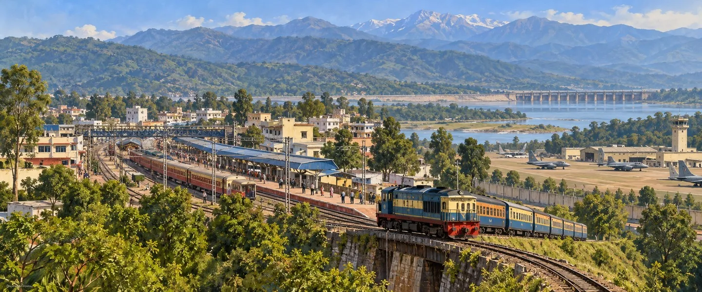



ਸਰੋਤ (6)
ਜੁਗਤੀ ਮੁਫ਼ਤ ਅਤੇ ਸੁਤੰਤਰ ਹੈ। ਪਾਠਕਾਂ ਦਾ ਸਹਿਯੋਗ ਕੋਸ਼ ਨੂੰ ਵਧਾਉਂਦਾ ਹੈ।
ਸਹਿਯੋਗ