
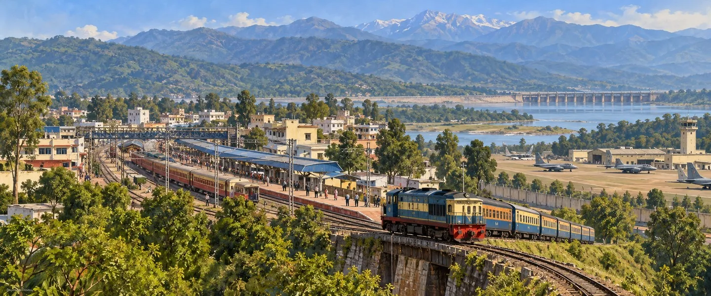
Pathankot is Punjab's northern gateway city, standing where the plains meet the Shivalik foothills near the borders of Himachal Pradesh and Jammu and Kashmir. A railway junction, cantonment and, since 2011, a district headquarters, it is the starting point of the Kangra Valley Railway and the road to Dalhousie, Dharamshala and Jammu.
- ਪੰਜਾਬੀ ਨਾਂ
- ਪਠਾਨਕੋਟ
- ਕਿਸਮ
- City (Municipal Corporation)
- ਜ਼ਿਲ੍ਹਾ
- Pathankot (district headquarters)
- Tehsil
- ਪਠਾਨਕੋਟ
- ਇਲਾਕਾ
- ਮਾਝਾ, ਪੰਜਾਬ (ਭਾਰਤ)
- Known as
- Gateway to Himachal and Jammu: meets Himachal Pradesh and J&K
All 15 facts
- District formed
- 27 July 2011, carved out of Gurdaspur
- ਆਬਾਦੀ
- 159,909 (urban agglomeration, 2011 census)
- District population
- 676,598 (2011 census)
- Elevation
- 332 metres
- ਭਾਸ਼ਾ
- Punjabi; Pahari and Hindi also spoken
- PIN code
- 145001
- Nearest city
- Gurdaspur, about 35 km; Amritsar, about 108 km
- Railway
- Junction; terminus of the Kangra Valley narrow gauge line (1929)
- ਪ੍ਰਸਿੱਧੀ
- Railway junction and cantonment; Kangra Valley Railway; litchi orchards
ਇਤਿਹਾਸ ਇੱਕ ਨਜ਼ਰ ਵਿੱਚ
Pathankot is a city in northern Punjab, India, where the plains meet the Shivalik foothills and the borders of Himachal Pradesh and Jammu and Kashmir. A major railway junction, cantonment and district headquarters since 2011, it is the gateway for Dalhousie, Dharamshala and Jammu. The 2011 census counted an urban agglomeration of 159,909 people.
Where is Pathankot?
Pathankot is in the far north of Punjab, at about 332 metres above sea level, where the plain begins to rise towards the Shivalik foothills. The Ravi river runs to its west and the Chakki stream passes close to the city, and on clear winter days the snow covered Himalayan ranges are visible to the north. Its district touches three neighbours at once: Narowal district of Pakistani Punjab across the international border to the west, Kathua district of Jammu and Kashmir, and the Chamba and Kangra districts of Himachal Pradesh. Amritsar is about 108 kilometres to the south, Jammu about 100 kilometres away, and the hill towns of Dharamshala and Dalhousie are roughly 88 and 100 kilometres respectively. Its PIN code is 145001.
History: from Audumbara to a border district
The country around Pathankot is old. The Mahabharata and the grammarian Panini both know this region as Audumbara, the land of a warrior people whose kings struck coins that have been found at sites around the modern city. In Mughal times the town was called Paithan, a shortened form of Pratishthana, and the district administration's history derives the modern name, following the historian Alexander Cunningham, from the Pathan settlers who came here in the medieval period. The Pathania Rajputs, the hill clan that ruled the Nurpur state, are also tied to the name, and Pathankot was the first capital of Nurpur before the seat moved into the hills at the end of the seventeenth century.
Under the Sikh Empire the town was taken from the Pathania rajas by Sardar Jai Singh Kanhaiya and absorbed into Maharaja Ranjit Singh's Punjab. After the First Anglo Sikh War the British placed it first under Kangra, and in 1853 it was merged into Gurdaspur district, an arrangement that lasted almost a century and a half. Partition in 1947 kept Pathankot in India with the rest of Gurdaspur district, a decision that preserved India's road and rail connection to Jammu and Kashmir and turned the town into a frontier city. On 27 July 2011 the Punjab government made Pathankot a district in its own right, carved out of Gurdaspur with the tehsils of Pathankot and Dhar Kalan and the city as its headquarters.
Geography and people
The district counted 676,598 people in the 2011 census, across about 951 square kilometres in its present boundaries, and the city's urban agglomeration counted 159,909 people: 84,145 men and 75,764 women, with a literacy rate of 88.71 per cent. Hindus formed 88.89 per cent of the city in 2011, Sikhs 8.05 per cent, Christians 1.73 per cent and Muslims 0.38 per cent. Punjabi is the first language of most residents, and Pahari and Hindi are also widely heard, a mix that reflects the hills at the city's back. The climate is generous with rain by Punjab standards, about 1,335 millimetres a year, most of it falling in the monsoon months of July and August. Summers are hot, winters are mild, and in 2012 the city saw snowfall for the first time in about 55 years. The surrounding farms grow wheat and maize, and Pathankot is one of Punjab's recognised litchi belts, its orchards feeding a seasonal trade each early summer.
The Kangra Valley Railway
Pathankot's second railway is the one travellers remember. The Kangra Valley Railway, planned in 1926 and commissioned in 1929, runs 164 kilometres from Pathankot to Jogindernagar in Himachal Pradesh on a narrow gauge of 762 millimetres, the longest narrow gauge line in India. The little trains wind through 484 curves, two tunnels and around a thousand bridges, climbing to Ahju station at 1,290 metres, and the route sits on UNESCO's tentative list of World Heritage Sites. Flood damage to the Chakki river bridge in 2022 suspended through services for nearly four years; a new bridge was built and the full route reopened on 2 June 2026. The whole journey takes about ten hours, through Kangra, Palampur and Baijnath, and for the valley's own people the line remains a lifeline as much as a scenic ride.
Places of interest
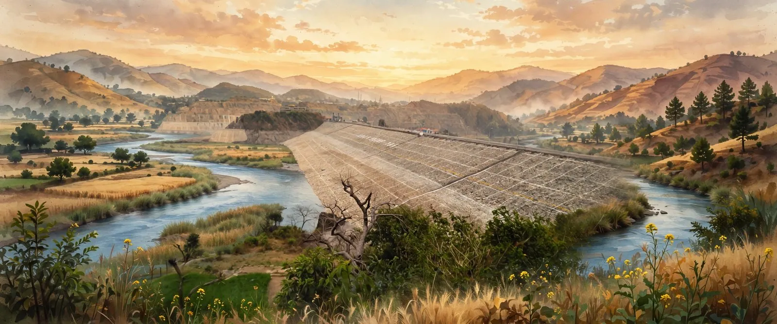
Most visitors pass through Pathankot on the way somewhere else, but the district rewards a pause. About 25 kilometres away in Kangra district stands Nurpur Fort, built by the Pathania Rajputs, with its Brij Raj Swami temple where the idols of Krishna and Mira Bai are worshipped together. North of the city, the reservoir of the Ranjit Sagar Dam on the Ravi has become a growing visitor circuit, and the environment ministry has cleared the development of its twin islands, Kalara and Palangi, for tourism. Closer to the fields, the Keshopur Chhamb wetland draws migratory birds each winter and is counted among the state's major natural wetlands. Within the city itself, the interest is in its working character: the broad avenues of Mamun Cantonment, the loco sheds and platforms of the junction, and the old town's markets.
People and public life
Pathankot's public identity is shaped by the uniform and the railway as much as by any single famous name. Mamun Cantonment, which the district administration describes as one of the largest military stations in Asia, and the air force station beside it have made generations of service families part of the city's population, and the junction's sheds and colonies did the same for railway families. In politics, the wider Gurdaspur parliamentary constituency, which includes Pathankot, was represented for years by the film actor Vinod Khanna and later by Sunny Deol. Traders complete the mix, for the city's bazaars have always served the hill districts behind it as much as the plains in front.
Getting there and Pathankot today
Pathankot has two broad gauge stations: Pathankot Junction in the city, and Pathankot Cantt, the old Chakki Bank station about four kilometres away, where most express trains for Jammu now stop. Every train to Jammu passes through the city, and direct trains link it with Delhi and Amritsar. A small domestic airport operates scheduled flights to Delhi under the UDAN regional scheme, and the nearest international airport is at Amritsar. By road, National Highway 44 runs through the city towards Jammu, National Highway 154 heads for Mandi, and buses leave through the day for Dharamshala, Dalhousie, Chamba and Jammu. Today Pathankot is a municipal corporation and district headquarters whose bazaars, hospitals, colleges and transport depots serve a wide border belt across three states, and whose old role, the gateway between the plains and the hills, is still the first thing to understand about it.
ਪਠਾਨਕੋਟ ਭਾਰਤ ਦੇ ਪੰਜਾਬ ਸੂਬੇ ਦੇ ਉੱਤਰ ਵਿੱਚ ਇੱਕ ਸ਼ਹਿਰ ਹੈ, ਜਿੱਥੇ ਮੈਦਾਨ ਸ਼ਿਵਾਲਿਕ ਪਹਾੜੀਆਂ ਨੂੰ ਮਿਲਦੇ ਹਨ ਅਤੇ ਹਿਮਾਚਲ ਪ੍ਰਦੇਸ਼ ਅਤੇ ਜੰਮੂ-ਕਸ਼ਮੀਰ ਦੀਆਂ ਹੱਦਾਂ ਲੱਗਦੀਆਂ ਹਨ। ਇੱਕ ਵੱਡਾ ਰੇਲਵੇ ਜੰਕਸ਼ਨ, ਛਾਉਣੀ ਵਾਲਾ ਸ਼ਹਿਰ ਅਤੇ 2011 ਤੋਂ ਜ਼ਿਲ੍ਹਾ ਮੁੱਖ ਦਫ਼ਤਰ, ਇਹ ਡਲਹੌਜ਼ੀ, ਧਰਮਸ਼ਾਲਾ ਅਤੇ ਜੰਮੂ ਜਾਣ ਵਾਲਾ ਦਰਵਾਜ਼ਾ ਹੈ। 2011 ਦੀ ਜਨਗਣਨਾ ਨੇ ਇੱਥੇ 159,909 ਲੋਕ ਗਿਣੇ।
ਪਠਾਨਕੋਟ ਕਿੱਥੇ ਹੈ?
ਪਠਾਨਕੋਟ ਪੰਜਾਬ ਦੇ ਬਿਲਕੁਲ ਉੱਤਰ ਵਿੱਚ ਹੈ, ਸਮੁੰਦਰ ਤਲ ਤੋਂ ਲਗਭਗ 332 ਮੀਟਰ ਉੱਚਾ, ਜਿੱਥੇ ਮੈਦਾਨ ਸ਼ਿਵਾਲਿਕ ਪਹਾੜੀਆਂ ਵੱਲ ਚੜ੍ਹਨ ਲੱਗਦੇ ਹਨ। ਰਾਵੀ ਦਰਿਆ ਇਸਦੇ ਪੱਛਮ ਵੱਲ ਵਗਦਾ ਹੈ ਅਤੇ ਚੱਕੀ ਨਦੀ ਸ਼ਹਿਰ ਦੇ ਨੇੜਿਓਂ ਲੰਘਦੀ ਹੈ, ਅਤੇ ਸਰਦੀਆਂ ਦੇ ਸਾਫ਼ ਦਿਨਾਂ ਵਿੱਚ ਉੱਤਰ ਵੱਲ ਬਰਫ਼ ਨਾਲ ਢਕੀਆਂ ਹਿਮਾਲਿਆ ਪਰਬਤਮਾਲਾਵਾਂ ਨਜ਼ਰ ਆਉਂਦੀਆਂ ਹਨ। ਇਸਦਾ ਜ਼ਿਲ੍ਹਾ ਇੱਕੋ ਵੇਲੇ ਤਿੰਨ ਗੁਆਂਢੀਆਂ ਨੂੰ ਛੂੰਹਦਾ ਹੈ: ਪੱਛਮ ਵੱਲ ਪਾਕਿਸਤਾਨੀ ਪੰਜਾਬ ਦੇ ਨਾਰੋਵਾਲ ਜ਼ਿਲ੍ਹੇ ਨੂੰ, ਜੰਮੂ-ਕਸ਼ਮੀਰ ਦੇ ਕਠੂਆ ਜ਼ਿਲ੍ਹੇ ਨੂੰ ਅਤੇ ਹਿਮਾਚਲ ਪ੍ਰਦੇਸ਼ ਦੇ ਚੰਬਾ ਅਤੇ ਕਾਂਗੜਾ ਜ਼ਿਲ੍ਹਿਆਂ ਨੂੰ। ਅੰਮ੍ਰਿਤਸਰ ਦੱਖਣ ਵੱਲ ਲਗਭਗ 108 ਕਿਲੋਮੀਟਰ, ਜੰਮੂ ਲਗਭਗ 100 ਕਿਲੋਮੀਟਰ ਅਤੇ ਧਰਮਸ਼ਾਲਾ ਤੇ ਡਲਹੌਜ਼ੀ ਕ੍ਰਮਵਾਰ ਲਗਭਗ 88 ਅਤੇ 100 ਕਿਲੋਮੀਟਰ ਦੂਰ ਹਨ। ਇਸਦਾ ਪਿੰਨ ਕੋਡ 145001 ਹੈ।
ਇਤਿਹਾਸ: ਔਦੁੰਬਰ ਤੋਂ ਸਰਹੱਦੀ ਜ਼ਿਲ੍ਹੇ ਤੱਕ
ਪਠਾਨਕੋਟ ਦੇ ਆਲੇ-ਦੁਆਲੇ ਦਾ ਇਲਾਕਾ ਪੁਰਾਣਾ ਹੈ। ਮਹਾਭਾਰਤ ਅਤੇ ਵਿਆਕਰਣਕਾਰ ਪਾਣਿਣੀ ਦੋਵੇਂ ਇਸ ਇਲਾਕੇ ਨੂੰ ਔਦੁੰਬਰ ਕਹਿੰਦੇ ਹਨ, ਉਸ ਯੋਧਾ ਜਾਤੀ ਦੀ ਧਰਤੀ ਜਿਸਦੇ ਰਾਜਿਆਂ ਦੇ ਸਿੱਕੇ ਅੱਜ ਦੇ ਸ਼ਹਿਰ ਦੇ ਆਸ-ਪਾਸ ਦੀਆਂ ਥਾਵਾਂ ਤੋਂ ਮਿਲੇ ਹਨ। ਮੁਗਲ ਕਾਲ ਵਿੱਚ ਇਸ ਕਸਬੇ ਦਾ ਨਾਂ ਪੈਠਾਨ ਸੀ, ਪ੍ਰਤਿਸ਼ਠਾਨ ਦਾ ਛੋਟਾ ਰੂਪ, ਅਤੇ ਜ਼ਿਲ੍ਹਾ ਪ੍ਰਸ਼ਾਸਨ ਦਾ ਇਤਿਹਾਸ ਇਸ ਨਵੇਂ ਨਾਂ ਦੀ ਜੜ੍ਹ ਇਤਿਹਾਸਕਾਰ ਅਲੈਗਜ਼ੈਂਡਰ ਕਨਿੰਘਮ ਮੁਤਾਬਕ ਉਨ੍ਹਾਂ ਪਠਾਣ ਬਸਤੀਆਂ ਵਿੱਚ ਦੱਸਦਾ ਹੈ ਜੋ ਮੱਧਕਾਲ ਵਿੱਚ ਇੱਥੇ ਆਈਆਂ। ਪਹਾੜੀ ਪਠਾਨੀਆ ਰਾਜਪੂਤ, ਜਿਨ੍ਹਾਂ ਦੀ ਨੂਰਪੁਰ ਰਿਆਸਤ ਸੀ, ਦਾ ਨਾਂ ਵੀ ਇਸੇ ਨਾਲ ਜੁੜਿਆ ਹੈ, ਅਤੇ ਸਤਾਰ੍ਹਵੀਂ ਸਦੀ ਦੇ ਅੰਤ ਵਿੱਚ ਰਾਜਧਾਨੀ ਪਹਾੜੀਆਂ ਵੱਲ ਜਾਣ ਤੋਂ ਪਹਿਲਾਂ ਪਠਾਨਕੋਟ ਨੂਰਪੁਰ ਦੀ ਪਹਿਲੀ ਰਾਜਧਾਨੀ ਸੀ।
ਸਿੱਖ ਰਾਜ ਵਿੱਚ ਇਹ ਕਸਬਾ ਸਰਦਾਰ ਜੈ ਸਿੰਘ ਕਨਹਈਆ ਨੇ ਪਠਾਨੀਆ ਰਾਜਿਆਂ ਤੋਂ ਖੋਹ ਕੇ ਮਹਾਰਾਜਾ ਰਣਜੀਤ ਸਿੰਘ ਦੇ ਪੰਜਾਬ ਵਿੱਚ ਮਿਲਾ ਲਿਆ। ਪਹਿਲੀ ਐਂਗਲੋ-ਸਿੱਖ ਜੰਗ ਤੋਂ ਬਾਅਦ ਅੰਗਰੇਜ਼ਾਂ ਨੇ ਇਸਨੂੰ ਪਹਿਲਾਂ ਕਾਂਗੜਾ ਹੇਠ ਰੱਖਿਆ, ਅਤੇ 1853 ਵਿੱਚ ਇਸਨੂੰ ਗੁਰਦਾਸਪੁਰ ਜ਼ਿਲ੍ਹੇ ਵਿੱਚ ਮਿਲਾ ਦਿੱਤਾ, ਇੱਕ ਪ੍ਰਬੰਧ ਜੋ ਲਗਭਗ ਡੇਢ ਸਦੀ ਚੱਲਿਆ। 1947 ਦੀ ਵੰਡ ਵਿੱਚ ਪਠਾਨਕੋਟ ਗੁਰਦਾਸਪੁਰ ਜ਼ਿਲ੍ਹੇ ਸਮੇਤ ਭਾਰਤ ਵਿੱਚ ਰਿਹਾ, ਇੱਕ ਫ਼ੈਸਲਾ ਜਿਸ ਨੇ ਜੰਮੂ-ਕਸ਼ਮੀਰ ਨਾਲ ਭਾਰਤ ਦਾ ਸੜਕ ਅਤੇ ਰੇਲ ਸੰਪਰਕ ਕਾਇਮ ਰੱਖਿਆ ਅਤੇ ਇਸ ਕਸਬੇ ਨੂੰ ਸਰਹੱਦੀ ਸ਼ਹਿਰ ਬਣਾ ਦਿੱਤਾ। 27 ਜੁਲਾਈ 2011 ਨੂੰ ਪੰਜਾਬ ਸਰਕਾਰ ਨੇ ਗੁਰਦਾਸਪੁਰ ਵਿੱਚੋਂ ਕੱਟ ਕੇ ਪਠਾਨਕੋਟ ਨੂੰ ਆਪਣਾ ਜ਼ਿਲ੍ਹਾ ਬਣਾ ਦਿੱਤਾ, ਜਿਸ ਵਿੱਚ ਪਠਾਨਕੋਟ ਅਤੇ ਧਾਰ ਕਲਾਂ ਤਹਿਸੀਲਾਂ ਹਨ ਅਤੇ ਸ਼ਹਿਰ ਇਸਦਾ ਮੁੱਖ ਦਫ਼ਤਰ ਹੈ।
ਭੂਗੋਲ ਅਤੇ ਲੋਕ
2011 ਦੀ ਜਨਗਣਨਾ ਨੇ ਜ਼ਿਲ੍ਹੇ ਵਿੱਚ 676,598 ਲੋਕ ਗਿਣੇ, ਇਸ ਦੀਆਂ ਅੱਜ ਦੀਆਂ ਹੱਦਾਂ ਵਿੱਚ ਲਗਭਗ 951 ਵਰਗ ਕਿਲੋਮੀਟਰ ਖੇਤਰ ਉੱਤੇ, ਅਤੇ ਸ਼ਹਿਰ ਦੀ ਨਗਰ ਬਸਤੀ ਵਿੱਚ 159,909 ਲੋਕ: 84,145 ਮਰਦ ਅਤੇ 75,764 ਔਰਤਾਂ, ਸਾਖਰਤਾ ਦਰ 88.71 ਫ਼ੀਸਦੀ। 2011 ਵਿੱਚ ਸ਼ਹਿਰ ਵਿੱਚ ਹਿੰਦੂ 88.89 ਫ਼ੀਸਦੀ, ਸਿੱਖ 8.05 ਫ਼ੀਸਦੀ, ਈਸਾਈ 1.73 ਫ਼ੀਸਦੀ ਅਤੇ ਮੁਸਲਿਮ 0.38 ਫ਼ੀਸਦੀ ਸਨ। ਜ਼ਿਆਦਾਤਰ ਵਾਸੀਆਂ ਦੀ ਪਹਿਲੀ ਭਾਸ਼ਾ ਪੰਜਾਬੀ ਹੈ, ਅਤੇ ਪਹਾੜੀ ਅਤੇ ਹਿੰਦੀ ਵੀ ਵਿਆਪਕ ਬੋਲੀਆਂ ਜਾਂਦੀਆਂ ਹਨ, ਇੱਕ ਮਿਸ਼ਰਣ ਜੋ ਸ਼ਹਿਰ ਦੇ ਪਿੱਛੇ ਵਾਲੀਆਂ ਪਹਾੜੀਆਂ ਨੂੰ ਦਰਸਾਉਂਦਾ ਹੈ। ਪੰਜਾਬ ਦੇ ਮਾਪਦੰਡਾਂ ਅਨੁਸਾਰ ਇੱਥੇ ਮੀਂਹ ਉਦਾਰ ਹੈ, ਸਾਲ ਵਿੱਚ ਲਗਭਗ 1,335 ਮਿਲੀਮੀਟਰ, ਜ਼ਿਆਦਾਤਰ ਜੁਲਾਈ ਅਤੇ ਅਗਸਤ ਦੇ ਮੌਨਸੂਨ ਮਹੀਨਿਆਂ ਵਿੱਚ। ਗਰਮੀਆਂ ਗਰਮ ਹੁੰਦੀਆਂ ਹਨ, ਸਰਦੀਆਂ ਨਰਮ, ਅਤੇ 2012 ਵਿੱਚ ਸ਼ਹਿਰ ਵਿੱਚ ਲਗਭਗ 55 ਸਾਲਾਂ ਵਿੱਚ ਪਹਿਲੀ ਵਾਰ ਬਰਫ਼ ਪਈ। ਆਲੇ-ਦੁਆਲੇ ਦੇ ਖੇਤਾਂ ਵਿੱਚ ਕਣਕ ਅਤੇ ਮੱਕੀ ਹੁੰਦੀ ਹੈ, ਅਤੇ ਪਠਾਨਕੋਟ ਪੰਜਾਬ ਦੇ ਮੰਨੇ-ਪ੍ਰਮੰਨੇ ਲੀਚੀ ਇਲਾਕਿਆਂ ਵਿੱਚੋਂ ਇੱਕ ਹੈ, ਜਿਸਦੇ ਬਾਗ ਹਰ ਗਰਮੀ ਦੇ ਮੌਸਮ ਵਿੱਚ ਇੱਕ ਮੌਸਮੀ ਵਪਾਰ ਖੜ੍ਹਾ ਕਰਦੇ ਹਨ।
ਕਾਂਗੜਾ ਘਾਟੀ ਰੇਲਵੇ
ਪਠਾਨਕੋਟ ਦੀ ਦੂਜੀ ਰੇਲਵੇ ਉਹ ਹੈ ਜੋ ਯਾਤਰੀ ਯਾਦ ਰੱਖਦੇ ਹਨ। ਕਾਂਗੜਾ ਘਾਟੀ ਰੇਲਵੇ, ਜਿਸਦੀ ਯੋਜਨਾ 1926 ਵਿੱਚ ਬਣੀ ਅਤੇ 1929 ਵਿੱਚ ਚੱਲੀ, ਪਠਾਨਕੋਟ ਤੋਂ ਹਿਮਾਚਲ ਪ੍ਰਦੇਸ਼ ਦੇ ਜੋਗਿੰਦਰਨਗਰ ਤੱਕ 164 ਕਿਲੋਮੀਟਰ 762 ਮਿਲੀਮੀਟਰ ਦੀ ਛੋਟੀ ਲਾਈਨ ਉੱਤੇ ਚਲਦੀ ਹੈ, ਭਾਰਤ ਦੀ ਸਭ ਤੋਂ ਲੰਬੀ ਛੋਟੀ ਲਾਈਨ। ਛੋਟੀਆਂ ਗੱਡੀਆਂ 484 ਮੋੜਾਂ, ਦੋ ਸੁਰੰਗਾਂ ਅਤੇ ਲਗਭਗ ਇੱਕ ਹਜ਼ਾਰ ਪੁਲਾਂ ਵਿੱਚੋਂ ਲੰਘਦੀਆਂ ਹਨ, ਆਹਜੂ ਸਟੇਸ਼ਨ ਤੱਕ 1,290 ਮੀਟਰ ਚੜ੍ਹਦੀਆਂ ਹਨ, ਅਤੇ ਇਹ ਰਾਹ ਯੂਨੈਸਕੋ ਦੀ ਵਿਸ਼ਵ ਵਿਰਾਸਤ ਦੀ ਸੰਭਾਵਿਤ ਸੂਚੀ ਵਿੱਚ ਹੈ। 2022 ਵਿੱਚ ਚੱਕੀ ਦਰਿਆ ਦੇ ਪੁਲ ਨੂੰ ਹੜ੍ਹਾਂ ਨੇ ਨੁਕਸਾਨ ਪਹੁੰਚਾਇਆ, ਜਿਸ ਨਾਲ ਲਗਭਗ ਚਾਰ ਸਾਲ ਸਿੱਧੀਆਂ ਸੇਵਾਵਾਂ ਬੰਦ ਰਹੀਆਂ; ਨਵਾਂ ਪੁਲ ਬਣਿਆ ਅਤੇ ਪੂਰਾ ਰਾਹ 2 ਜੂਨ 2026 ਨੂੰ ਫਿਰ ਖੁੱਲ੍ਹਿਆ। ਪੂਰਾ ਸਫ਼ਰ ਲਗਭਗ ਦਸ ਘੰਟੇ ਦਾ ਹੈ, ਕਾਂਗੜਾ, ਪਾਲਮਪੁਰ ਅਤੇ ਬੈਜਨਾਥ ਰਾਹੀਂ, ਅਤੇ ਘਾਟੀ ਦੇ ਆਪਣੇ ਲੋਕਾਂ ਲਈ ਇਹ ਲਾਈਨ ਸੈਰ-ਸਪਾਟੇ ਜਿੰਨੀ ਹੀ ਜ਼ਿੰਦਗੀ ਦੀ ਲੜੀ ਹੈ।
ਵੇਖਣਯੋਗ ਥਾਵਾਂ
ਜ਼ਿਆਦਾਤਰ ਯਾਤਰੀ ਪਠਾਨਕੋਟ ਵਿੱਚੋਂ ਕਿਤੇ ਹੋਰ ਜਾਂਦੇ ਹੋਏ ਲੰਘਦੇ ਹਨ, ਪਰ ਜ਼ਿਲ੍ਹਾ ਇੱਕ ਠਹਿਰਾਅ ਦਾ ਹੱਕਦਾਰ ਹੈ। ਕਾਂਗੜਾ ਜ਼ਿਲ੍ਹੇ ਵਿੱਚ ਲਗਭਗ 25 ਕਿਲੋਮੀਟਰ ਦੂਰ ਨੂਰਪੁਰ ਕਿਲ੍ਹਾ ਖੜ੍ਹਾ ਹੈ, ਜੋ ਪਠਾਨੀਆ ਰਾਜਪੂਤਾਂ ਨੇ ਬਣਾਇਆ, ਜਿਸਦੇ ਬ੍ਰਿਜ ਰਾਜ ਸਵਾਮੀ ਮੰਦਰ ਵਿੱਚ ਕ੍ਰਿਸ਼ਨ ਅਤੇ ਮੀਰਾ ਬਾਈ ਦੀਆਂ ਮੂਰਤੀਆਂ ਇਕੱਠੀਆਂ ਪੂਜੀਆਂ ਜਾਂਦੀਆਂ ਹਨ। ਸ਼ਹਿਰ ਦੇ ਉੱਤਰ ਵਿੱਚ, ਰਾਵੀ ਉੱਤੇ ਰਣਜੀਤ ਸਾਗਰ ਡੈਮ ਦਾ ਸਰੋਵਰ ਇੱਕ ਵਧਦਾ ਸੈਲਾਨੀ ਇਲਾਕਾ ਬਣ ਗਿਆ ਹੈ, ਅਤੇ ਵਾਤਾਵਰਣ ਮੰਤਰਾਲੇ ਨੇ ਇਸਦੇ ਜੁੜਵੇਂ ਟਾਪੂਆਂ, ਕਲਾਰਾ ਅਤੇ ਪਲੰਗੀ, ਨੂੰ ਸੈਰ-ਸਪਾਟੇ ਲਈ ਵਿਕਸਤ ਕਰਨ ਦੀ ਮਨਜ਼ੂਰੀ ਦੇ ਦਿੱਤੀ ਹੈ। ਖੇਤਾਂ ਦੇ ਨੇੜੇ, ਕੇਸ਼ੋਪੁਰ ਛੰਭ ਝੀਲ ਹਰ ਸਰਦੀ ਵਿੱਚ ਪਰਵਾਸੀ ਪੰਛੀਆਂ ਨੂੰ ਖਿੱਚਦੀ ਹੈ ਅਤੇ ਸੂਬੇ ਦੀਆਂ ਵੱਡੀਆਂ ਕੁਦਰਤੀ ਝੀਲਾਂ ਵਿੱਚ ਗਿਣੀ ਜਾਂਦੀ ਹੈ। ਸ਼ਹਿਰ ਵਿੱਚ ਹੀ, ਦਿਲਚਸਪੀ ਇਸਦੇ ਕੰਮਕਾਜੀ ਕਿਰਦਾਰ ਵਿੱਚ ਹੈ: ਮਮੂਨ ਛਾਉਣੀ ਦੀਆਂ ਚੌੜੀਆਂ ਸੜਕਾਂ, ਜੰਕਸ਼ਨ ਦੇ ਲੋਕੋ ਸ਼ੈੱਡ ਅਤੇ ਪਲੇਟਫਾਰਮ, ਅਤੇ ਪੁਰਾਣੇ ਸ਼ਹਿਰ ਦੇ ਬਾਜ਼ਾਰ।
ਲੋਕ ਅਤੇ ਜਨਤਕ ਜੀਵਨ
ਪਠਾਨਕੋਟ ਦੀ ਜਨਤਕ ਪਛਾਣ ਕਿਸੇ ਇੱਕ ਮਸ਼ਹੂਰ ਨਾਂ ਜਿੰਨੀ ਹੀ ਵਰਦੀ ਅਤੇ ਰੇਲਵੇ ਨੇ ਘੜੀ ਹੈ। ਮਮੂਨ ਛਾਉਣੀ, ਜਿਸਨੂੰ ਜ਼ਿਲ੍ਹਾ ਪ੍ਰਸ਼ਾਸਨ ਏਸ਼ੀਆ ਦੇ ਸਭ ਤੋਂ ਵੱਡੇ ਫ਼ੌਜੀ ਸਟੇਸ਼ਨਾਂ ਵਿੱਚੋਂ ਇੱਕ ਦੱਸਦਾ ਹੈ, ਅਤੇ ਇਸਦੇ ਨਾਲ ਵਾਲਾ ਹਵਾਈ ਫ਼ੌਜੀ ਸਟੇਸ਼ਨ ਸੇਵਾ ਪਰਿਵਾਰਾਂ ਦੀਆਂ ਪੀੜ੍ਹੀਆਂ ਨੂੰ ਸ਼ਹਿਰ ਦੀ ਆਬਾਦੀ ਦਾ ਹਿੱਸਾ ਬਣਾ ਚੁੱਕੇ ਹਨ, ਅਤੇ ਜੰਕਸ਼ਨ ਦੇ ਸ਼ੈੱਡਾਂ ਅਤੇ ਬਸਤੀਆਂ ਨੇ ਰੇਲਵੇ ਪਰਿਵਾਰਾਂ ਲਈ ਵੀ ਇਹੀ ਕੀਤਾ। ਸਿਆਸਤ ਵਿੱਚ, ਵੱਡਾ ਗੁਰਦਾਸਪੁਰ ਲੋਕ ਸਭਾ ਹਲਕਾ, ਜਿਸ ਵਿੱਚ ਪਠਾਨਕੋਟ ਆਉਂਦਾ ਹੈ, ਲੰਬੇ ਸਮੇਂ ਤੱਕ ਫ਼ਿਲਮੀ ਅਦਾਕਾਰ ਵਿਨੋਦ ਖੰਨਾ ਨੇ ਸੰਭਾਲਿਆ ਅਤੇ ਬਾਅਦ ਵਿੱਚ ਸੰਨੀ ਦਿਓਲ ਨੇ। ਮਿਸ਼ਰਣ ਨੂੰ ਵਪਾਰੀ ਪੂਰਾ ਕਰਦੇ ਹਨ, ਕਿਉਂਕਿ ਸ਼ਹਿਰ ਦੇ ਬਾਜ਼ਾਰ ਹਮੇਸ਼ਾ ਇਸਦੇ ਪਿੱਛੇ ਵਾਲੇ ਪਹਾੜੀ ਜ਼ਿਲ੍ਹਿਆਂ ਦੀ ਵੀ ਸੇਵਾ ਕਰਦੇ ਆਏ ਹਨ ਜਿੰਨੀ ਸਾਹਮਣੇ ਵਾਲੇ ਮੈਦਾਨਾਂ ਦੀ।
ਪਹੁੰਚ ਅਤੇ ਅੱਜ ਦਾ ਪਠਾਨਕੋਟ
ਪਠਾਨਕੋਟ ਦੇ ਦੋ ਵੱਡੇ ਲਾਈਨ ਸਟੇਸ਼ਨ ਹਨ: ਸ਼ਹਿਰ ਵਿੱਚ ਪਠਾਨਕੋਟ ਜੰਕਸ਼ਨ, ਅਤੇ ਪਠਾਨਕੋਟ ਛਾਉਣੀ, ਪੁਰਾਣਾ ਚੱਕੀ ਬੈਂਕ ਸਟੇਸ਼ਨ ਲਗਭਗ ਚਾਰ ਕਿਲੋਮੀਟਰ ਦੂਰ, ਜਿੱਥੇ ਹੁਣ ਜੰਮੂ ਜਾਣ ਵਾਲੀਆਂ ਜ਼ਿਆਦਾਤਰ ਐਕਸਪ੍ਰੈੱਸ ਗੱਡੀਆਂ ਰੁਕਦੀਆਂ ਹਨ। ਜੰਮੂ ਜਾਣ ਵਾਲੀ ਹਰ ਗੱਡੀ ਇਸ ਸ਼ਹਿਰ ਵਿੱਚੋਂ ਲੰਘਦੀ ਹੈ, ਅਤੇ ਸਿੱਧੀਆਂ ਗੱਡੀਆਂ ਇਸਨੂੰ ਦਿੱਲੀ ਅਤੇ ਅੰਮ੍ਰਿਤਸਰ ਨਾਲ ਜੋੜਦੀਆਂ ਹਨ। ਇੱਕ ਛੋਟਾ ਘਰੇਲੂ ਹਵਾਈ ਅੱਡਾ ਉਡਾਨ ਸਕੀਮ ਹੇਠ ਦਿੱਲੀ ਲਈ ਨਿਯਮਤ ਉਡਾਣਾਂ ਚਲਾਉਂਦਾ ਹੈ, ਅਤੇ ਸਭ ਤੋਂ ਨੇੜਲਾ ਅੰਤਰਰਾਸ਼ਟਰੀ ਹਵਾਈ ਅੱਡਾ ਅੰਮ੍ਰਿਤਸਰ ਵਿੱਚ ਹੈ। ਸੜਕ ਰਾਹੀਂ, ਕੌਮੀ ਰਾਜਮਾਰਗ 44 ਸ਼ਹਿਰ ਵਿੱਚੋਂ ਜੰਮੂ ਵੱਲ ਜਾਂਦਾ ਹੈ, ਕੌਮੀ ਰਾਜਮਾਰਗ 154 ਮੰਡੀ ਵੱਲ, ਅਤੇ ਧਰਮਸ਼ਾਲਾ, ਡਲਹੌਜ਼ੀ, ਚੰਬਾ ਅਤੇ ਜੰਮੂ ਲਈ ਬੱਸਾਂ ਸਾਰਾ ਦਿਨ ਨਿਕਲਦੀਆਂ ਹਨ। ਅੱਜ ਪਠਾਨਕੋਟ ਇੱਕ ਨਗਰ ਨਿਗਮ ਅਤੇ ਜ਼ਿਲ੍ਹਾ ਮੁੱਖ ਦਫ਼ਤਰ ਹੈ ਜਿਸਦੇ ਬਾਜ਼ਾਰ, ਹਸਪਤਾਲ, ਕਾਲਜ ਅਤੇ ਟਰਾਂਸਪੋਰਟ ਡਿਪੂ ਤਿੰਨ ਸੂਬਿਆਂ ਵਿੱਚ ਫੈਲੇ ਇੱਕ ਵੱਡੇ ਸਰਹੱਦੀ ਇਲਾਕੇ ਦੀ ਸੇਵਾ ਕਰਦੇ ਹਨ, ਅਤੇ ਇਸਦਾ ਪੁਰਾਣਾ ਕੰਮ, ਮੈਦਾਨਾਂ ਅਤੇ ਪਹਾੜੀਆਂ ਵਿਚਕਾਰ ਦਰਵਾਜ਼ਾ, ਅੱਜ ਵੀ ਇਸ ਬਾਰੇ ਸਮਝਣ ਵਾਲੀ ਪਹਿਲੀ ਗੱਲ ਹੈ।
Nearby
 ਗੁਰਡਸਪੁਰDistrict, Majha
 ਅੰਮ੍ਰਿਤਸਰਸ਼ਹਿਰ, ਮਾਝਾ
 ਸੁਜਨਪੁਰTown, Majha
 ਮੁਕੇਰੀਆਂਕਸਬਾ, ਦੋਆਬਾ
 ਪਠਾਨਕੋਟDistrict, Majha
Pathankot ਖ਼ਬਰਾਂ ਵਿੱਚ
ਸਾਰੀਆਂ ਖ਼ਬਰਾਂ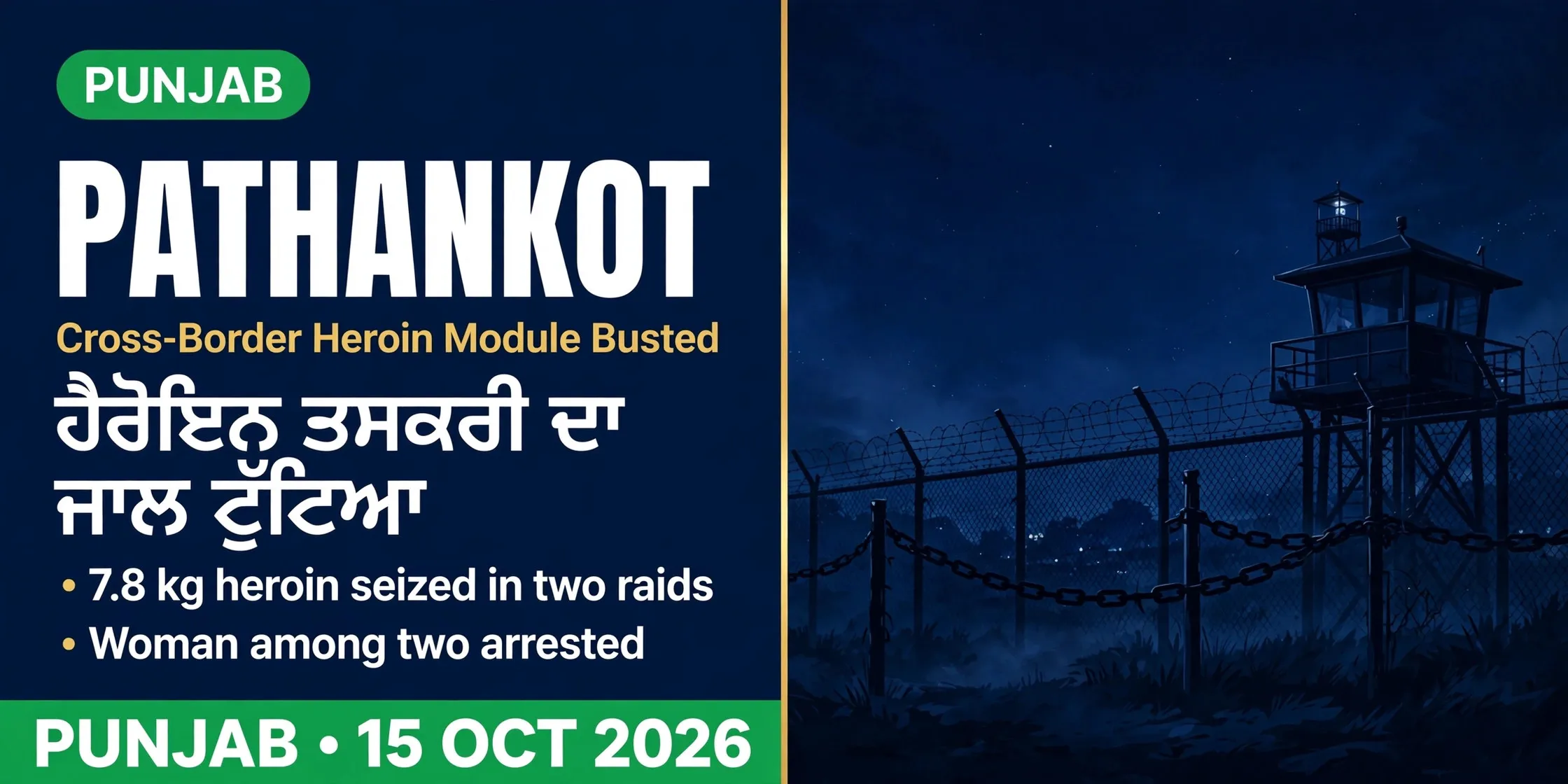 ਪਠਾਨਕੋਟ ਪੁਲਿਸ ਨੇ ਸਰਹੱਦ ਪਾਰ ਹੈਰੋਇਨ ਤਸਕਰੀ ਦਾ ਜਾਲ ਟੁੱਟਿਆ, ਔਰਤ ਸਣੇ ਦੋ ਗ੍ਰਿਫ਼ਤਾਰਪਠਾਨਕੋਟ ਪੁਲਿਸ ਨੇ ਸਰਹੱਦ ਪਾਰ ਹੈਰੋਇਨ ਤਸਕਰੀ ਦਾ ਜਾਲ ਟੁੱਟਿਆ, ਔਰਤ ਸਣੇ ਦੋ ਗ੍ਰਿਫ਼ਤਾਰ
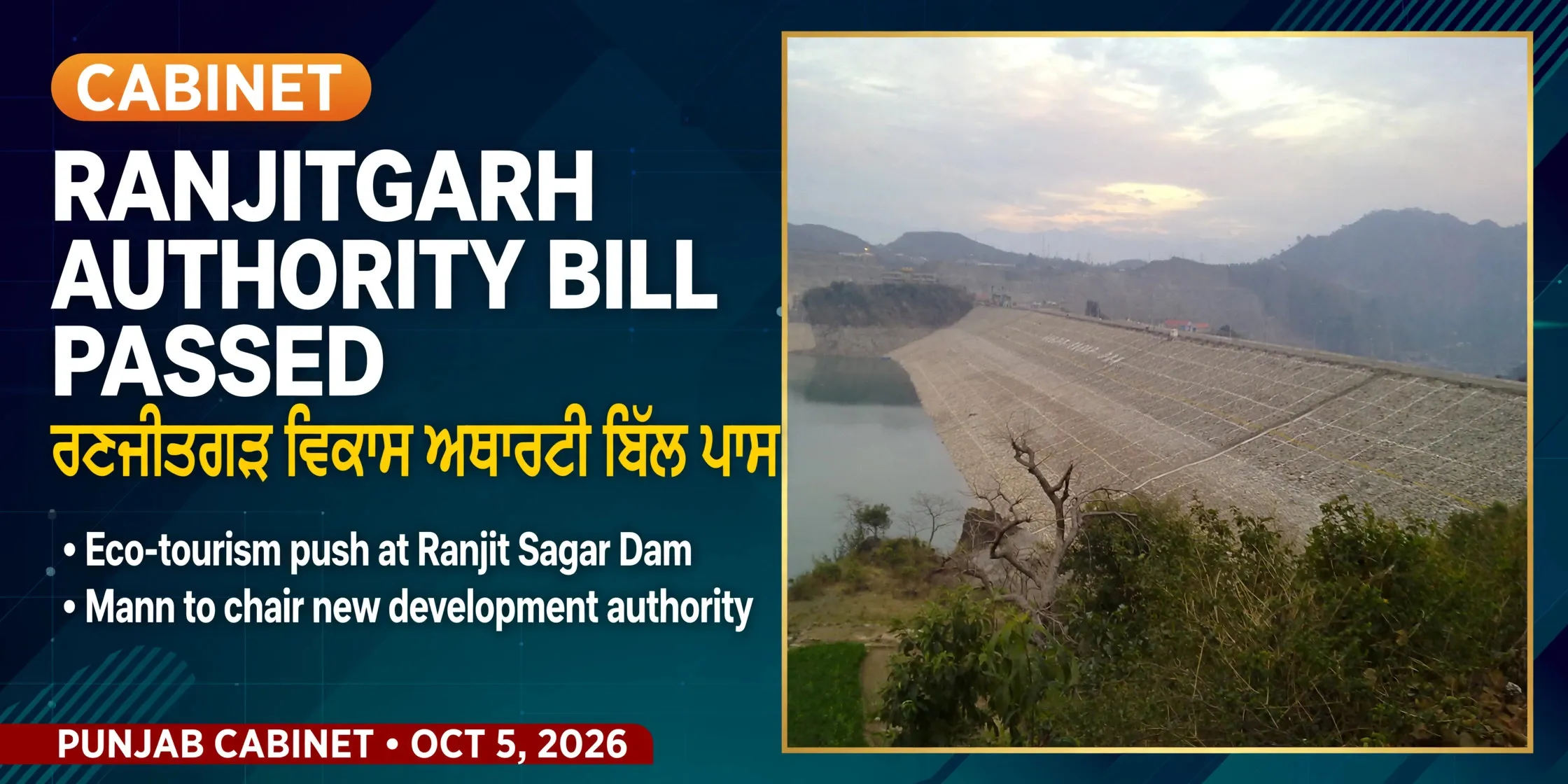 ਪੰਜਾਬ ਕੈਬਨਿਟ ਨੇ ਰਣਜੀਤਗੜ੍ਹ ਵਿਕਾਸ ਅਥਾਰਟੀ ਬਿੱਲ ਨੂੰ ਮਨਜ਼ੂਰੀ ਦਿੱਤੀਪੰਜਾਬ ਕੈਬਨਿਟ ਨੇ ਰਣਜੀਤਗੜ੍ਹ ਵਿਕਾਸ ਅਥਾਰਟੀ ਬਿੱਲ ਨੂੰ ਮਨਜ਼ੂਰੀ ਦਿੱਤੀ
ਸਰੋਤ (5)
- History | District Pathankot, Government of Punjab
- Pathankot city: history, geography, transport, demographics (Census 2011 UA 159,909)
- Pathankot District: Census 2011 population 676,598 (City Population)
- RBI circular: formation of Fazilka and Pathankot districts from 27 July 2011
- Kangra Valley Railway: reopened 2 June 2026 (Travel + Leisure Asia)
ਜੁਗਤੀ ਮੁਫ਼ਤ ਅਤੇ ਸੁਤੰਤਰ ਹੈ। ਪਾਠਕਾਂ ਦਾ ਸਹਿਯੋਗ ਕੋਸ਼ ਨੂੰ ਵਧਾਉਂਦਾ ਹੈ।
ਸਹਿਯੋਗ