

Pathankot district is the northernmost district of Punjab, India, formed on 27 July 2011 from Gurdaspur district with its headquarters at Pathankot city. Lying in the Shivalik foothills between the Ravi and the Beas, it is known for the Ranjit Sagar Dam, the Madhopur Headworks, a major army cantonment and the rail and road corridor to Jammu and the Himachal hills.
- ਪੰਜਾਬੀ ਨਾਂ
- ਪਠਾਨਕੋਟ
- ਕਿਸਮ
- ਜ਼ਿਲ੍ਹਾ
- District headquarters
- ਪਠਾਨਕੋਟ
- State
- Punjab, India
- ਇਲਾਕਾ
- ਮਾਝਾ
- Formed
- 27 July 2011, carved out of Gurdaspur district
All 15 facts
- Area
- 929 square kilometres
- ਆਬਾਦੀ
- 676,598 (Census 2011, present district boundaries)
- Literacy
- 84.65 percent (Census 2011, via NABARD district plan)
- Sex ratio
- 860 females per 1,000 males (Census 2011)
- Tehsils
- Pathankot and Dhar Kalan, with sub tehsils Narot Jaimal Singh and Bamial
- Blocks
- Bamial, Dhar Kalan, Gharota, Narot Jaimal Singh, Pathankot, Sujanpur
- Rivers
- Ravi and Beas, with the Chakki river at Pathankot city
- PIN
- 145001 (Pathankot city)
- ਪ੍ਰਸਿੱਧੀ
- Ranjit Sagar Dam, Madhopur Headworks, Kangra Valley Railway, Mamun cantonment, gateway to Jammu and the Himachal hills, litchi growing
Where is Pathankot district?
Pathankot district is in the far north of Punjab, India, where the plains rise toward the Shivalik foothills and the state meets Himachal Pradesh and Jammu and Kashmir. It is the northernmost district of Punjab, covers about 929 square kilometres, and has its headquarters in the city of Pathankot. For travellers it is the last large Punjab hub before the roads climb to Dalhousie and Dharamshala or run north to Jammu.
It borders Narowal in Pakistani Punjab to the west, Kathua in Jammu and Kashmir to the north, and Chamba and Kangra in Himachal Pradesh to the east. Gurdaspur lies south west and Hoshiarpur touches it south east. The Ravi runs along the north and west, the Beas touches its southern edge near Mirthal, and the Chakki flows past Pathankot city.
Administration is compact. There are two subdivisions, ਪਠਾਨਕੋਟ and Dhar Kalan, two sub tehsils at Narot Jaimal Singh and Bamial, and six development blocks: Bamial, Dhar Kalan, Gharota, Narot Jaimal Singh, Pathankot and ਸੁਜਨਪੁਰ. NABARD, drawing on census records, counts 421 inhabited villages in the district. The only two statutory towns are Pathankot, run by a municipal corporation, and Sujanpur, run by a municipal council.
History: from Audumbara to a district of its own
Tradition and early texts know this country as Audumbara, a name the district administration history links to the Mahabharata, and Audumbara coins have been found here. In Mughal records the town appears as Paithan, a shortened form of Pratishthana, and the Ain i Akbari lists it as a pargana headquarters. The name Pathankot is explained locally both through the Pathania clan and, in another district account, through medieval Pathan settlers.
For centuries the town was the first capital of the Nurpur hill state of the Pathania Rajputs, whose seat later moved to Nurpur in present day Himachal Pradesh. The Kanhaiya Misl took the area in the late eighteenth century, and it then passed into Maharaja Ranjit Singh's kingdom until British annexation in 1849.
Under British rule Pathankot was first attached to Kangra and then, from 1853, made a tehsil of Gurdaspur. At Partition in 1947 its tehsil went to India, keeping the Madhopur headworks and the route to Jammu on the Indian side. It grew as a cantonment, railhead and trucking centre until Punjab made it a separate district on 27 July 2011, carved out of Gurdaspur as the state's 22nd district at the time.
The Ravi, its dams and its canals
The Ravi leaves the Himachal hills, runs along the district, and is stored, divided and sent into canals by three works that together explain much of the local economy.
Highest is the Ranjit Sagar Dam, also called the Thein Dam, completed in 2001 after construction began in 1981. It is a 160 metre high earth fill dam, 617 metres long, on the Punjab and Jammu and Kashmir border, about 30 kilometres from Pathankot city. Its reservoir holds 3,280 million cubic metres, and its four 150 megawatt units give 600 megawatts, the largest hydroelectric capacity in Punjab.
Downstream, Shahpurkandi balances water released from Ranjit Sagar so canals can draw steadily. It is designed for 206 megawatts, from six 33 megawatt units and one 8 megawatt unit, and irrigation to about 5,000 hectares in Punjab and 32,173 hectares in Jammu and Kashmir. The dam was completed in February 2024, filling began in November 2024, and capacity testing was reported in May 2025.
Oldest is Madhopur Headworks, about 14 kilometres from Pathankot city, where the Upper Bari Doab Canal leaves the Ravi. A canal from Madhopur to Lahore was first built under Shah Jahan as the Hasli canal; the British rebuilt the system, opened it in 1859, and added the headworks weir in 1875 to 1879. A full barrage replaced it in the 1950s. Remodelled after Ranjit Sagar, the network now carries up to 9,000 cusecs, watering farms and supplying Pathankot, Gurdaspur, Batala and Amritsar.
People and economy
At the 2011 Census, the present district area had 676,598 people: 378,432 in villages and 298,166 in towns. The sex ratio was 860 women per 1,000 men, and Scheduled Castes were 207,032, about 30.6 percent. Hindus were 88.42 percent, Sikhs 7.81 percent, Muslims 2.12 percent and Christians 1.08 percent. Punjabi was the first language of 89.86 percent, Hindi 5.30 percent and Dogri 1.20 percent.
Literacy is a local strength: NABARD's district plan, using census figures, puts it at 84.65 percent. Pathankot city's schools and colleges draw students from the villages and nearby hills, and education, health, transport and trade employ many people alongside farming.
Farming remains the base away from the city: wheat and paddy across much of the district, with maize, sugarcane, mustard, pulses and vegetables also listed by NABARD, and dairy as the main side occupation. The district is also known for litchi growing around Pathankot and Sujanpur. Stone crushing, rice shelling and bazaars serving soldiers, truckers and hill travellers complete an economy built on farms, the cantonment and the road north.
Places of interest
The Ranjit Sagar lake is the biggest draw: a wide sheet of water in the foothills, reached through Shahpurkandi township. Shahpurkandi also has its old fort above the river, linked in tradition to the sixteenth century Pathania chiefs, part of which has served as a rest house.
About 22 kilometres from ਪਠਾਨਕੋਟ city, on the Shahpurkandi dam road above the Ravi, stands Mukteshwar Mahadev Temple, also called Mukesaran Mandir. It is a cave temple to Shiva with a white marble lingam, surrounded by images of Brahma, Vishnu, Parvati, Hanuman and Ganesha. Local belief holds that the Pandavas rested in these caves during their exile, and the Mukesran Da Mela at Baisakhi in April, together with Shivaratri, draws pilgrims from Punjab, Himachal Pradesh and Jammu and Kashmir.
Just across in Himachal Pradesh, Nurpur Fort is the closest great monument: a Pathania stronghold rebuilt under Raja Basu in the late sixteenth century, damaged by the British and the 1905 earthquake, and home to the Brij Raj Swami temple where Krishna and Mira Bai are worshipped together. Nearer home, the Kathgarh Shiva temple toward Indora and the Keshopur Chhamb wetland, noted for migratory birds, make Pathankot a base, not just a halt.
Getting there and the district today
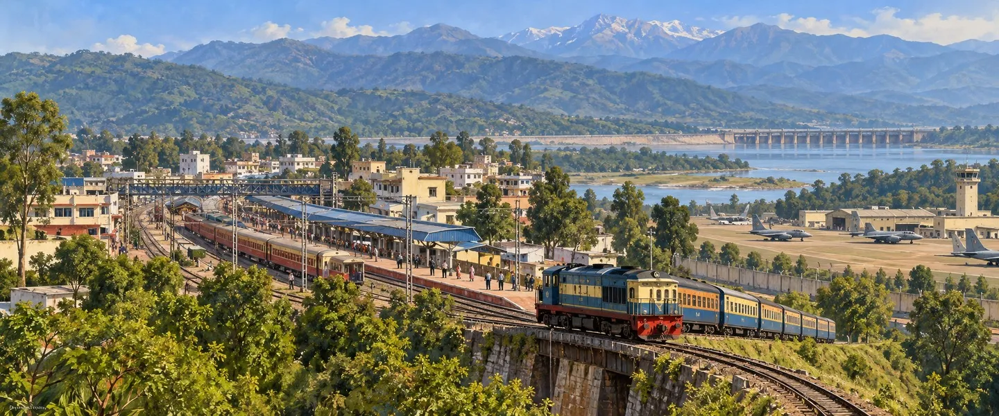
Pathankot is one of the easiest districts in Punjab to reach. Pathankot Junction, station code PTK, opened with the Amritsar to Pathankot line in 1884 and is where broad gauge lines from Amritsar and from Jalandhar via ਮੁਕੇਰੀਆਂ meet the line to Jammu, begun in 1965 and opened in 1971. Most long distance trains for Jammu now use Pathankot Cantonment station, the old Chakki Bank station about 4 kilometres away, renamed in 2013. From the same junction, the narrow gauge Kangra Valley Railway, commissioned in 1929, runs 164 kilometres to Joginder Nagar through Kangra and Palampur: slow, scenic, and unlike any other train ride in Punjab.
By road, National Highway 44 runs toward Jammu, National Highway 54 heads south, and National Highway 154 leaves for Mandi. Guide distances show the hub role: Gurdaspur about 35 kilometres, Dharamshala about 88, Dalhousie and Jammu about 100 each, and Amritsar about 108. Pathankot Airport, code IXP, is a civil enclave with limited services, including Delhi flights under the UDAN scheme; Amritsar is the nearest international airport.
Mamun cantonment, on the edge of Pathankot city, is one of the Indian Army's large cantonments, and the city also hosts an Indian Air Force station. Soldiers, families and defence workers shape housing, schools and markets, a major reason a small district carries national weight.
Today Pathankot is Punjab's smallest district by area, but its importance is out of proportion to its size. It guards the corridor to Jammu, stores and divides Ravi water for farms far south, and gives hill travellers their last plains stop.
ਪਠਾਨਕੋਟ ਜ਼ਿਲ੍ਹਾ ਕਿੱਥੇ ਹੈ?
ਪਠਾਨਕੋਟ ਜ਼ਿਲ੍ਹਾ ਪੰਜਾਬ ਦੇ ਉੱਤਰ ਵਿੱਚ ਹੈ, ਜਿੱਥੇ ਮੈਦਾਨ ਸ਼ਿਵਾਲਿਕ ਦੀਆਂ ਤਲਹੱਟੀਆਂ ਵੱਲ ਚੜ੍ਹਦੇ ਹਨ ਅਤੇ ਸੂਬਾ ਹਿਮਾਚਲ ਪ੍ਰਦੇਸ਼ ਅਤੇ ਜੰਮੂ ਕਸ਼ਮੀਰ ਨੂੰ ਮਿਲਦਾ ਹੈ। ਇਹ ਪੰਜਾਬ ਦਾ ਸਭ ਤੋਂ ਉੱਤਰੀ ਜ਼ਿਲ੍ਹਾ ਹੈ, ਇਸ ਦਾ ਰਕਬਾ ਲਗਭਗ 929 ਵਰਗ ਕਿਲੋਮੀਟਰ ਹੈ ਅਤੇ ਇਸ ਦਾ ਸਦਰ ਮੁਕਾਮ ਪਠਾਨਕੋਟ ਸ਼ਹਿਰ ਹੈ। ਯਾਤਰੀਆਂ ਲਈ ਇਹ ਡਲਹੌਜ਼ੀ ਅਤੇ ਧਰਮਸ਼ਾਲਾ ਵੱਲ ਚੜ੍ਹਨ ਜਾਂ ਜੰਮੂ ਵੱਲ ਜਾਣ ਤੋਂ ਪਹਿਲਾਂ ਪੰਜਾਬ ਦਾ ਆਖਰੀ ਵੱਡਾ ਕੇਂਦਰ ਹੈ।
ਇਸ ਜ਼ਿਲ੍ਹੇ ਦੇ ਪੱਛਮ ਵਿੱਚ ਪਾਕਿਸਤਾਨੀ ਪੰਜਾਬ ਦਾ ਨਾਰੋਵਾਲ ਜ਼ਿਲ੍ਹਾ, ਉੱਤਰ ਵਿੱਚ ਜੰਮੂ ਕਸ਼ਮੀਰ ਦਾ ਕਠੂਆ ਜ਼ਿਲ੍ਹਾ ਅਤੇ ਪੂਰਬ ਅਤੇ ਉੱਤਰ ਪੂਰਬ ਵਿੱਚ ਹਿਮਾਚਲ ਪ੍ਰਦੇਸ਼ ਦੇ ਚੰਬਾ ਅਤੇ ਕਾਂਗੜਾ ਜ਼ਿਲ੍ਹੇ ਹਨ। ਦੱਖਣ ਪੱਛਮ ਵਿੱਚ ਗੁਰਦਾਸਪੁਰ ਜ਼ਿਲ੍ਹਾ ਅਤੇ ਦੱਖਣ ਪੂਰਬ ਵਿੱਚ ਹੁਸ਼ਿਆਰਪੁਰ ਜ਼ਿਲ੍ਹਾ ਇਸ ਨੂੰ ਛੂੰਹਦਾ ਹੈ। ਦੋ ਦਰਿਆ ਇਸ ਧਰਤੀ ਨੂੰ ਘੜਦੇ ਹਨ: ਉੱਤਰ ਅਤੇ ਪੱਛਮ ਵੱਲ ਰਾਵੀ, ਅਤੇ ਦੱਖਣੀ ਕਿਨਾਰੇ ਮਿਰਥਲ ਕੋਲ ਬਿਆਸ, ਅਤੇ ਪਠਾਨਕੋਟ ਸ਼ਹਿਰ ਕੋਲੋਂ ਲੰਘਦੀ ਛੋਟੀ ਚੱਕੀ ਨਦੀ।
ਪ੍ਰਸ਼ਾਸਨ ਛੋਟਾ ਅਤੇ ਸੰਖੇਪ ਹੈ। ਇੱਥੇ ਦੋ ਸਬ ਡਵੀਜ਼ਨਾਂ ਹਨ, ਪਠਾਨਕੋਟ ਅਤੇ ਧਾਰ ਕਲਾਂ, ਦੋ ਸਬ ਤਹਿਸੀਲਾਂ ਨਰੋਟ ਜੈਮਲ ਸਿੰਘ ਅਤੇ ਬਮਿਆਲ ਹਨ, ਅਤੇ ਛੇ ਵਿਕਾਸ ਬਲਾਕ ਹਨ: ਬਮਿਆਲ, ਧਾਰ ਕਲਾਂ, ਘੜੋਟਾ, ਨਰੋਟ ਜੈਮਲ ਸਿੰਘ, ਪਠਾਨਕੋਟ ਅਤੇ ਸੁਜਾਨਪੁਰ। ਨਾਬਾਰਡ, ਜਨਗਣਨਾ ਦੇ ਅੰਕੜਿਆਂ ਦੇ ਆਧਾਰ ਉੱਤੇ, ਜ਼ਿਲ੍ਹੇ ਵਿੱਚ 421 ਵੱਸਦੇ ਪਿੰਡ ਗਿਣਦਾ ਹੈ। ਕੇਵਲ ਦੋ ਕਾਨੂੰਨੀ ਕਸਬੇ ਹਨ, ਪਠਾਨਕੋਟ ਜਿਸ ਨੂੰ ਨਗਰ ਨਿਗਮ ਚਲਾਉਂਦਾ ਹੈ, ਅਤੇ ਸੁਜਾਨਪੁਰ ਜਿਸ ਨੂੰ ਨਗਰ ਕੌਂਸਲ ਚਲਾਉਂਦੀ ਹੈ।
ਇਤਿਹਾਸ: ਔਦੁੰਬਰ ਤੋਂ ਆਪਣੇ ਜ਼ਿਲ੍ਹੇ ਤੱਕ
ਪਠਾਨਕੋਟ ਦੇ ਆਲੇ ਦੁਆਲੇ ਦੀ ਧਰਤੀ ਪੁਰਾਣੀ ਹੈ। ਪਰੰਪਰਾ ਅਤੇ ਪੁਰਾਣੇ ਗ੍ਰੰਥ ਇਸ ਨੂੰ ਔਦੁੰਬਰ ਨਾਂ ਨਾਲ ਜਾਣਦੇ ਹਨ, ਜਿਸ ਨਾਂ ਨੂੰ ਜ਼ਿਲ੍ਹਾ ਪ੍ਰਸ਼ਾਸਨ ਦਾ ਇਤਿਹਾਸ ਮਹਾਭਾਰਤ ਨਾਲ ਜੋੜਦਾ ਹੈ, ਅਤੇ ਔਦੁੰਬਰ ਲੋਕਾਂ ਦੇ ਸਿੱਕੇ ਇਸ ਇਲਾਕੇ ਵਿੱਚੋਂ ਮਿਲੇ ਹਨ। ਮੁਗਲ ਰਿਕਾਰਡ ਵਿੱਚ ਇਹ ਕਸਬਾ ਪੈਠਨ ਨਾਂ ਨਾਲ ਆਉਂਦਾ ਹੈ, ਜਿਸ ਨੂੰ ਪ੍ਰਤਿਸ਼ਠਾਨ ਦਾ ਛੋਟਾ ਰੂਪ ਸਮਝਿਆ ਜਾਂਦਾ ਹੈ, ਅਤੇ ਆਈਨ ਏ ਅਕਬਰੀ ਇਸ ਨੂੰ ਪਰਗਨਾ ਸਦਰ ਮੁਕਾਮ ਲਿਖਦੀ ਹੈ। ਪਠਾਨਕੋਟ ਨਾਂ ਬਾਰੇ ਥਾਂ ਥਾਂ ਵੱਖ ਵੱਖ ਵਿਆਖਿਆਵਾਂ ਮਿਲਦੀਆਂ ਹਨ, ਇੱਕ ਪਠਾਣੀਆ ਕਬੀਲੇ ਨਾਲ ਅਤੇ ਦੂਜੀ, ਜੋ ਜ਼ਿਲ੍ਹਾ ਪ੍ਰਸ਼ਾਸਨ ਨੇ ਦਰਜ ਕੀਤੀ ਹੈ, ਮੱਧ ਕਾਲ ਵਿੱਚ ਵੱਸੇ ਪਠਾਣਾਂ ਨਾਲ।
ਸਦੀਆਂ ਤੱਕ ਇਹ ਕਸਬਾ ਨੂਰਪੁਰ ਪਹਾੜੀ ਰਿਆਸਤ ਦੀ ਪਹਿਲੀ ਰਾਜਧਾਨੀ ਰਿਹਾ, ਜਿਸ ਉੱਤੇ ਪਠਾਣੀਆ ਰਾਜਪੂਤਾਂ ਦਾ ਰਾਜ ਸੀ। ਉਨ੍ਹਾਂ ਦੀ ਗੱਦੀ ਬਾਅਦ ਵਿੱਚ ਉੱਪਰ ਨੂਰਪੁਰ ਚਲੀ ਗਈ, ਜੋ ਅੱਜ ਦੇ ਹਿਮਾਚਲ ਪ੍ਰਦੇਸ਼ ਵਿੱਚ ਹੈ, ਜਿੱਥੇ ਢਮੇਰੀ ਦਾ ਕਿਲ੍ਹਾ, ਜਿਸ ਨੂੰ ਬਾਅਦ ਵਿੱਚ ਨੂਰਪੁਰ ਕਿਲ੍ਹਾ ਕਿਹਾ ਗਿਆ, ਪਠਾਨਕੋਟ ਤੋਂ ਲਗਭਗ 25 ਕਿਲੋਮੀਟਰ ਦੂਰ ਅੱਜ ਵੀ ਖੜ੍ਹਾ ਹੈ। ਅਠਾਰਵੀਂ ਸਦੀ ਦੇ ਅੰਤ ਵਿੱਚ ਕਨ੍ਹਈਆ ਮਿਸਲ ਨੇ ਇਹ ਇਲਾਕਾ ਲੈ ਲਿਆ, ਅਤੇ ਫਿਰ ਇਹ ਮਹਾਰਾਜਾ ਰਣਜੀਤ ਸਿੰਘ ਦੇ ਰਾਜ ਵਿੱਚ ਰਲ ਗਿਆ ਅਤੇ 1849 ਵਿੱਚ ਅੰਗਰੇਜ਼ਾਂ ਦੇ ਕਬਜ਼ੇ ਤੱਕ ਉਸੇ ਦਾ ਹਿੱਸਾ ਰਿਹਾ।
ਅੰਗਰੇਜ਼ੀ ਰਾਜ ਵਿੱਚ ਪਠਾਨਕੋਟ ਪਹਿਲਾਂ ਕਾਂਗੜਾ ਨਾਲ ਜੋੜਿਆ ਗਿਆ ਅਤੇ ਫਿਰ 1853 ਤੋਂ ਗੁਰਦਾਸਪੁਰ ਜ਼ਿਲ੍ਹੇ ਦੀ ਤਹਿਸੀਲ ਬਣਾਇਆ ਗਿਆ। 1947 ਦੀ ਵੰਡ ਵੇਲੇ ਪਠਾਨਕੋਟ ਸਮੇਤ ਗੁਰਦਾਸਪੁਰ ਦੀਆਂ ਤਹਿਸੀਲਾਂ ਭਾਰਤ ਨੂੰ ਮਿਲੀਆਂ, ਜਿਸ ਫੈਸਲੇ ਨਾਲ ਮਾਧੋਪੁਰ ਨਹਿਰ ਹੈੱਡਵਰਕਸ ਅਤੇ ਜੰਮੂ ਵੱਲ ਜਾਂਦਾ ਸੜਕ ਅਤੇ ਰੇਲ ਰਸਤਾ ਭਾਰਤ ਵਾਲੇ ਪਾਸੇ ਰਹਿ ਗਿਆ। ਪਠਾਨਕੋਟ ਛੇ ਦਹਾਕਿਆਂ ਤੱਕ ਤਹਿਸੀਲ ਕਸਬਾ ਰਿਹਾ ਅਤੇ ਛਾਉਣੀ, ਰੇਲ ਕੇਂਦਰ ਅਤੇ ਟਰੱਕਾਂ ਦੇ ਅੱਡੇ ਵਜੋਂ ਵਧਦਾ ਰਿਹਾ, ਜਦ ਤੱਕ ਪੰਜਾਬ ਨੇ 27 ਜੁਲਾਈ 2011 ਨੂੰ ਇਸ ਨੂੰ ਗੁਰਦਾਸਪੁਰ ਵਿੱਚੋਂ ਕੱਟ ਕੇ ਵੱਖਰਾ ਜ਼ਿਲ੍ਹਾ ਨਾ ਬਣਾ ਦਿੱਤਾ, ਉਸ ਸਮੇਂ ਇਹ ਸੂਬੇ ਦਾ 22ਵਾਂ ਜ਼ਿਲ੍ਹਾ ਸੀ।
ਰਾਵੀ, ਇਸ ਦੇ ਡੈਮ ਅਤੇ ਨਹਿਰਾਂ
ਪੰਜਾਬ ਦਾ ਕੋਈ ਹਿੱਸਾ ਇੱਕ ਦਰਿਆ ਨਾਲ ਓਨਾ ਨਹੀਂ ਘੜਿਆ ਗਿਆ ਜਿੰਨਾ ਪਠਾਨਕੋਟ ਰਾਵੀ ਨਾਲ ਘੜਿਆ ਗਿਆ ਹੈ। ਦਰਿਆ ਹਿਮਾਚਲ ਦੀਆਂ ਪਹਾੜੀਆਂ ਵਿੱਚੋਂ ਨਿਕਲ ਕੇ ਜ਼ਿਲ੍ਹੇ ਦੇ ਨਾਲ ਨਾਲ ਵਗਦਾ ਹੈ, ਅਤੇ ਤਿੰਨ ਉਸਾਰੀਆਂ ਇਸ ਦਾ ਪਾਣੀ ਰੋਕਦੀਆਂ, ਵੰਡਦੀਆਂ ਅਤੇ ਨਹਿਰਾਂ ਵਿੱਚ ਪਾਉਂਦੀਆਂ ਹਨ, ਜੋ ਮਿਲ ਕੇ ਸਥਾਨਕ ਅਰਥਚਾਰੇ ਦੀ ਵੱਡੀ ਤਸਵੀਰ ਸਮਝਾਉਂਦੀਆਂ ਹਨ। ਪਾਣੀ, ਬਿਜਲੀ ਅਤੇ ਸਿੰਜਾਈ ਇੱਥੇ ਪਿਛੋਕੜ ਨਹੀਂ ਹਨ: ਇਹ ਜ਼ਿਲ੍ਹੇ ਦਾ ਸਭ ਤੋਂ ਵੱਡਾ ਕੰਮ ਹੈ।
ਇਸ ਲੜੀ ਵਿੱਚ ਸਭ ਤੋਂ ਉੱਪਰ ਰਣਜੀਤ ਸਾਗਰ ਡੈਮ ਹੈ, ਜਿਸ ਨੂੰ ਥੀਨ ਡੈਮ ਵੀ ਕਹਿੰਦੇ ਹਨ, ਜੋ 1981 ਵਿੱਚ ਸ਼ੁਰੂ ਹੋਈ ਉਸਾਰੀ ਤੋਂ ਬਾਅਦ 2001 ਵਿੱਚ ਮੁਕੰਮਲ ਹੋਇਆ। ਇਹ 160 ਮੀਟਰ ਉੱਚਾ ਮਿੱਟੀ ਭਰਾਈ ਵਾਲਾ ਡੈਮ ਹੈ, 617 ਮੀਟਰ ਲੰਮਾ ਹੈ, ਪੰਜਾਬ ਅਤੇ ਜੰਮੂ ਕਸ਼ਮੀਰ ਦੀ ਹੱਦ ਉੱਤੇ ਹੈ ਅਤੇ ਪਠਾਨਕੋਟ ਸ਼ਹਿਰ ਤੋਂ ਲਗਭਗ 30 ਕਿਲੋਮੀਟਰ ਦੂਰ ਹੈ। ਇਸ ਦੇ ਸਰੋਵਰ ਵਿੱਚ ਕੁੱਲ 3,280 ਮਿਲੀਅਨ ਘਣ ਮੀਟਰ ਪਾਣੀ ਸਮਾਉਂਦਾ ਹੈ, ਅਤੇ ਇਸ ਦੀਆਂ ਚਾਰ 150 ਮੈਗਾਵਾਟ ਵਾਲੀਆਂ ਇਕਾਈਆਂ ਮਿਲ ਕੇ 600 ਮੈਗਾਵਾਟ ਬਿਜਲੀ ਦਿੰਦੀਆਂ ਹਨ, ਜੋ ਪੰਜਾਬ ਦੀ ਸਭ ਤੋਂ ਵੱਡੀ ਪਣ ਬਿਜਲੀ ਸਮਰੱਥਾ ਹੈ। ਇਸ ਦੇ ਪਿੱਛੇ ਬਣੀ ਝੀਲ ਸ਼ਿਵਾਲਿਕ ਦੀਆਂ ਤਲਹੱਟੀਆਂ ਵਿੱਚ ਫੈਲਦੀ ਹੈ ਅਤੇ ਇਸ ਦਾ ਵੱਡਾ ਹਿੱਸਾ ਜੰਮੂ ਕਸ਼ਮੀਰ ਵਿੱਚ ਪੈਂਦਾ ਹੈ।
ਹੇਠਾਂ ਵੱਲ, ਸ਼ਾਹਪੁਰਕੰਡੀ ਪ੍ਰੋਜੈਕਟ ਰਣਜੀਤ ਸਾਗਰ ਤੋਂ ਛੱਡੇ ਪਾਣੀ ਨੂੰ ਸੰਤੁਲਿਤ ਕਰਦਾ ਹੈ ਤਾਂ ਜੋ ਨਹਿਰਾਂ ਨੂੰ ਬਿਜਲੀ ਘਰ ਦੇ ਘੰਟਿਆਂ ਉੱਤੇ ਨਿਰਭਰ ਰਹਿਣ ਦੀ ਥਾਂ ਲਗਾਤਾਰ ਪਾਣੀ ਮਿਲੇ। ਇਸ ਦਾ ਡੈਮ 206 ਮੈਗਾਵਾਟ ਲਈ ਬਣਾਇਆ ਗਿਆ ਹੈ, ਛੇ 33 ਮੈਗਾਵਾਟ ਵਾਲੀਆਂ ਅਤੇ ਇੱਕ 8 ਮੈਗਾਵਾਟ ਵਾਲੀ ਇਕਾਈ ਨਾਲ, ਅਤੇ ਪੰਜਾਬ ਵਿੱਚ ਲਗਭਗ 5,000 ਹੈਕਟੇਅਰ ਅਤੇ ਜੰਮੂ ਕਸ਼ਮੀਰ ਵਿੱਚ 32,173 ਹੈਕਟੇਅਰ ਦੀ ਸਿੰਜਾਈ ਲਈ ਹੈ। ਡੈਮ ਵਾਲਾ ਹਿੱਸਾ ਫਰਵਰੀ 2024 ਵਿੱਚ ਮੁਕੰਮਲ ਹੋਇਆ, ਨਵੰਬਰ 2024 ਵਿੱਚ ਸਰੋਵਰ ਭਰਨਾ ਸ਼ੁਰੂ ਹੋਇਆ ਅਤੇ ਮਈ 2025 ਵਿੱਚ ਸਮਰੱਥਾ ਦੀ ਜਾਂਚ ਦੀ ਖਬਰ ਆਈ, ਇਸ ਲਈ ਪਾਠਕ ਇਸ ਦੇ ਬਿਜਲੀ ਘਰਾਂ ਨੂੰ ਪੂਰੀ ਵਰਤੋਂ ਵੱਲ ਵਧਦਾ ਪ੍ਰੋਜੈਕਟ ਸਮਝਣ, ਪੁਰਾਣੀ ਸਥਾਪਿਤ ਉਸਾਰੀ ਨਹੀਂ।
ਤਿੰਨਾਂ ਵਿੱਚੋਂ ਸਭ ਤੋਂ ਪੁਰਾਣਾ ਮਾਧੋਪੁਰ ਹੈੱਡਵਰਕਸ ਹੈ, ਪਠਾਨਕੋਟ ਸ਼ਹਿਰ ਤੋਂ ਲਗਭਗ 14 ਕਿਲੋਮੀਟਰ ਦੂਰ, ਜਿੱਥੋਂ ਉਪਰਲੀ ਬਾਰੀ ਦੋਆਬ ਨਹਿਰ ਰਾਵੀ ਵਿੱਚੋਂ ਨਿਕਲਦੀ ਹੈ। ਮਾਧੋਪੁਰ ਤੋਂ ਲਾਹੌਰ ਤੱਕ ਨਹਿਰ ਸਭ ਤੋਂ ਪਹਿਲਾਂ ਸ਼ਾਹ ਜਹਾਨ ਦੇ ਸਮੇਂ ਹਸਲੀ ਨਹਿਰ ਵਜੋਂ ਬਣੀ, ਅੰਗਰੇਜ਼ਾਂ ਨੇ 1849 ਤੋਂ ਬਾਅਦ ਇਹ ਪ੍ਰਣਾਲੀ ਮੁੜ ਬਣਾਈ ਅਤੇ 1859 ਵਿੱਚ ਖੋਲ੍ਹੀ, ਅਤੇ ਹੈੱਡਵਰਕਸ ਦਾ ਵੇਅਰ 1875 ਤੋਂ 1879 ਵਿੱਚ ਬਣਿਆ। 1950ਵਿਆਂ ਵਿੱਚ ਇਸ ਦੀ ਥਾਂ ਪੂਰਾ ਬੈਰਾਜ ਬਣ ਗਿਆ। ਰਣਜੀਤ ਸਾਗਰ ਬਣਨ ਤੋਂ ਬਾਅਦ ਮੁੜ ਸੁਧਾਰੀ ਗਈ ਨਹਿਰ ਪ੍ਰਣਾਲੀ ਹੁਣ ਸੱਤ ਸ਼ਾਖਾਵਾਂ ਅਤੇ ਸੈਂਕੜੇ ਛੋਟੀਆਂ ਨਹਿਰਾਂ ਰਾਹੀਂ 9,000 ਕਿਊਸਿਕ ਤੱਕ ਪਾਣੀ ਲੈ ਜਾਂਦੀ ਹੈ, ਖੇਤਾਂ ਨੂੰ ਸਿੰਜਦੀ ਹੈ ਅਤੇ ਪਠਾਨਕੋਟ, ਗੁਰਦਾਸਪੁਰ, ਬਟਾਲਾ ਅਤੇ ਅੰਮ੍ਰਿਤਸਰ ਨੂੰ ਪਾਣੀ ਦਿੰਦੀ ਹੈ।
ਲੋਕ ਅਤੇ ਅਰਥਚਾਰਾ
2011 ਦੀ ਜਨਗਣਨਾ ਵਿੱਚ, ਜੋ ਇਲਾਕਾ ਹੁਣ ਪਠਾਨਕੋਟ ਜ਼ਿਲ੍ਹਾ ਬਣਦਾ ਹੈ, ਉਸ ਵਿੱਚ 676,598 ਲੋਕ ਸਨ, ਜਿਨ੍ਹਾਂ ਵਿੱਚੋਂ 378,432 ਪਿੰਡਾਂ ਵਿੱਚ ਅਤੇ 298,166 ਕਸਬਿਆਂ ਵਿੱਚ ਰਹਿੰਦੇ ਸਨ। ਲਿੰਗ ਅਨੁਪਾਤ ਹਰ 1,000 ਮਰਦਾਂ ਪਿੱਛੇ 860 ਔਰਤਾਂ ਸੀ, ਅਤੇ ਅਨੁਸੂਚਿਤ ਜਾਤੀਆਂ ਦੇ ਲੋਕ 207,032 ਸਨ, ਕੁੱਲ ਦਾ ਲਗਭਗ 30.6 ਪ੍ਰਤੀਸ਼ਤ। ਹਿੰਦੂ ਕੁੱਲ ਆਬਾਦੀ ਦਾ 88.42 ਪ੍ਰਤੀਸ਼ਤ, ਸਿੱਖ 7.81 ਪ੍ਰਤੀਸ਼ਤ, ਮੁਸਲਮਾਨ 2.12 ਪ੍ਰਤੀਸ਼ਤ ਅਤੇ ਈਸਾਈ 1.08 ਪ੍ਰਤੀਸ਼ਤ ਸਨ। ਪੰਜਾਬੀ 89.86 ਪ੍ਰਤੀਸ਼ਤ ਲੋਕਾਂ ਦੀ ਪਹਿਲੀ ਭਾਸ਼ਾ ਸੀ, ਉਸ ਤੋਂ ਬਾਅਦ ਹਿੰਦੀ 5.30 ਪ੍ਰਤੀਸ਼ਤ ਅਤੇ ਡੋਗਰੀ 1.20 ਪ੍ਰਤੀਸ਼ਤ ਸੀ, ਜੋ ਮਿਸ਼ਰਣ ਦੱਸਦਾ ਹੈ ਕਿ ਇਹ ਮਾਝੇ ਦਾ ਜ਼ਿਲ੍ਹਾ ਡੋਗਰੀ ਅਤੇ ਪਹਾੜੀ ਬੋਲਣ ਵਾਲੀਆਂ ਪਹਾੜੀਆਂ ਨਾਲ ਲੱਗਦਾ ਹੈ।
ਸਾਖਰਤਾ ਇੱਥੋਂ ਦੀ ਤਾਕਤ ਹੈ। ਨਾਬਾਰਡ ਦੀ ਜ਼ਿਲ੍ਹਾ ਕਰਜ਼ਾ ਯੋਜਨਾ, ਜਨਗਣਨਾ ਦੇ ਅੰਕੜੇ ਵਰਤ ਕੇ, ਜ਼ਿਲ੍ਹੇ ਦੀ ਸਾਖਰਤਾ ਦਰ 84.65 ਪ੍ਰਤੀਸ਼ਤ ਦਿੰਦੀ ਹੈ, ਜੋ ਉਸ ਜਨਗਣਨਾ ਦੀ ਕੌਮੀ ਔਸਤ ਤੋਂ ਕਾਫੀ ਉੱਪਰ ਹੈ। ਪਠਾਨਕੋਟ ਸ਼ਹਿਰ ਦੇ ਸਕੂਲ ਅਤੇ ਕਾਲਜ ਜ਼ਿਲ੍ਹੇ ਦੇ ਪਿੰਡਾਂ ਅਤੇ ਨੇੜਲੇ ਪਹਾੜੀ ਇਲਾਕਿਆਂ ਦੇ ਵਿਦਿਆਰਥੀਆਂ ਨੂੰ ਖਿੱਚਦੇ ਹਨ, ਅਤੇ ਸਿੱਖਿਆ, ਸਿਹਤ ਸੇਵਾਵਾਂ, ਆਵਾਜਾਈ ਅਤੇ ਵਪਾਰ ਖੇਤੀ ਦੇ ਨਾਲ ਨਾਲ ਬਹੁਤ ਲੋਕਾਂ ਨੂੰ ਕੰਮ ਦਿੰਦੇ ਹਨ।
ਸ਼ਹਿਰ ਤੋਂ ਬਾਹਰ ਖੇਤੀ ਹੀ ਆਧਾਰ ਹੈ। ਜ਼ਿਲ੍ਹੇ ਦੇ ਵੱਡੇ ਹਿੱਸੇ ਵਿੱਚ ਕਣਕ ਅਤੇ ਝੋਨਾ ਉੱਗਦਾ ਹੈ, ਅਤੇ ਨਾਬਾਰਡ ਯੋਜਨਾ ਵਿੱਚ ਮੱਕੀ, ਗੰਨਾ, ਸਰ੍ਹੋਂ, ਦਾਲਾਂ ਅਤੇ ਸਬਜ਼ੀਆਂ ਵੀ ਦਰਜ ਹਨ, ਅਤੇ ਡੇਅਰੀ ਬਹੁਤ ਸਾਰੇ ਕਿਸਾਨ ਪਰਿਵਾਰਾਂ ਦਾ ਮੁੱਖ ਸਹਾਇਕ ਧੰਦਾ ਹੈ। ਇਹ ਜ਼ਿਲ੍ਹਾ ਪੰਜਾਬ ਵਿੱਚ ਪਠਾਨਕੋਟ ਅਤੇ ਸੁਜਾਨਪੁਰ ਦੇ ਆਲੇ ਦੁਆਲੇ ਲੀਚੀ ਦੀ ਖੇਤੀ ਲਈ ਵੀ ਜਾਣਿਆ ਜਾਂਦਾ ਹੈ, ਗਰਮੀਆਂ ਦੀ ਛੋਟੀ ਜਿਹੀ ਫਸਲ ਜਿਸ ਕਰਕੇ ਨਾਬਾਰਡ ਇਸ ਜ਼ਿਲ੍ਹੇ ਨੂੰ ਲੀਚੀ ਦਾ ਕੇਂਦਰ ਕਹਿੰਦਾ ਹੈ। ਪੱਥਰ ਤੋੜਨ ਦੇ ਕਾਰਖਾਨੇ, ਚਾਵਲ ਦੇ ਸ਼ੈਲਰ, ਛੋਟੀਆਂ ਵਰਕਸ਼ਾਪਾਂ ਅਤੇ ਫੌਜੀਆਂ, ਟਰੱਕ ਚਾਲਕਾਂ ਅਤੇ ਪਹਾੜਾਂ ਵੱਲ ਜਾਂਦੇ ਯਾਤਰੀਆਂ ਦੀ ਸੇਵਾ ਕਰਦੇ ਬਾਜ਼ਾਰ ਮਿਲ ਕੇ ਇੱਕ ਅਜਿਹਾ ਅਰਥਚਾਰਾ ਬਣਾਉਂਦੇ ਹਨ ਜੋ ਤਿੰਨ ਚੀਜ਼ਾਂ ਉੱਤੇ ਖੜ੍ਹਾ ਹੈ: ਖੇਤ, ਛਾਉਣੀ ਅਤੇ ਉੱਤਰ ਵੱਲ ਜਾਂਦੀ ਸੜਕ।
ਵੇਖਣ ਯੋਗ ਥਾਵਾਂ
ਜ਼ਿਆਦਾਤਰ ਯਾਤਰੀ ਪਠਾਨਕੋਟ ਵਿੱਚੋਂ ਕਿਤੇ ਹੋਰ ਜਾਂਦੇ ਹੋਏ ਲੰਘਦੇ ਹਨ, ਜੋ ਅਫਸੋਸ ਦੀ ਗੱਲ ਹੈ, ਕਿਉਂਕਿ ਇਹ ਜ਼ਿਲ੍ਹਾ ਹੌਲੀ ਰੁਕਣ ਦਾ ਮੁੱਲ ਪਾਉਂਦਾ ਹੈ। ਰਣਜੀਤ ਸਾਗਰ ਝੀਲ ਸਭ ਤੋਂ ਵੱਡਾ ਖਿੱਚ ਕੇਂਦਰ ਹੈ: ਤਲਹੱਟੀਆਂ ਵਿੱਚ ਰੋਕਿਆ ਪਾਣੀ ਦਾ ਵਿਸ਼ਾਲ ਫੈਲਾਅ, ਜਿੱਥੇ ਸ਼ਾਹਪੁਰਕੰਡੀ ਟਾਊਨਸ਼ਿਪ ਰਾਹੀਂ ਪਹੁੰਚਿਆ ਜਾਂਦਾ ਹੈ, ਅਤੇ ਡੈਮ ਵਾਲੀ ਸੜਕ ਰਾਵੀ ਦੇ ਪ੍ਰੋਜੈਕਟਾਂ ਦੇ ਆਕਾਰ ਦਾ ਸਭ ਤੋਂ ਸਾਫ ਅਹਿਸਾਸ ਦਿੰਦੀ ਹੈ। ਸ਼ਾਹਪੁਰਕੰਡੀ ਵਿੱਚ ਦਰਿਆ ਉੱਤੇ ਇਸ ਦਾ ਪੁਰਾਣਾ ਕਿਲ੍ਹਾ ਵੀ ਹੈ, ਜੋ ਸੋਲ੍ਹਵੀਂ ਸਦੀ ਵਿੱਚ ਪਠਾਣੀਆ ਸਰਦਾਰਾਂ ਨਾਲ ਜੋੜਿਆ ਜਾਂਦਾ ਹੈ ਅਤੇ ਜਿਸ ਦਾ ਇੱਕ ਹਿੱਸਾ ਆਰਾਮ ਘਰ ਵਜੋਂ ਵਰਤਿਆ ਗਿਆ ਹੈ।
ਪਠਾਨਕੋਟ ਸ਼ਹਿਰ ਤੋਂ ਲਗਭਗ 22 ਕਿਲੋਮੀਟਰ ਦੂਰ, ਸ਼ਾਹਪੁਰਕੰਡੀ ਡੈਮ ਵਾਲੀ ਸੜਕ ਉੱਤੇ ਰਾਵੀ ਦੇ ਉੱਪਰ, ਮੁਕਤੇਸ਼ਵਰ ਮਹਾਦੇਵ ਮੰਦਰ ਹੈ, ਜਿਸ ਨੂੰ ਮੁਕੇਸਰਾਂ ਮੰਦਰ ਵੀ ਕਹਿੰਦੇ ਹਨ। ਇਹ ਸ਼ਿਵ ਨੂੰ ਸਮਰਪਿਤ ਗੁਫਾ ਮੰਦਰ ਹੈ ਜਿਸ ਵਿੱਚ ਚਿੱਟੇ ਸੰਗਮਰਮਰ ਦਾ ਲਿੰਗ ਹੈ, ਜਿਸ ਦੇ ਆਲੇ ਦੁਆਲੇ ਬ੍ਰਹਮਾ, ਵਿਸ਼ਨੂੰ, ਪਾਰਵਤੀ, ਹਨੂੰਮਾਨ ਅਤੇ ਗਣੇਸ਼ ਦੀਆਂ ਮੂਰਤੀਆਂ ਹਨ। ਸਥਾਨਕ ਮਾਨਤਾ ਹੈ ਕਿ ਪਾਂਡਵ ਆਪਣੇ ਅਗਿਆਤਵਾਸ ਦੌਰਾਨ ਇਨ੍ਹਾਂ ਗੁਫਾਵਾਂ ਵਿੱਚ ਠਹਿਰੇ ਸਨ, ਅਤੇ ਅਪ੍ਰੈਲ ਵਿੱਚ ਵਿਸਾਖੀ ਉੱਤੇ ਲੱਗਦਾ ਮੁਕੇਸਰਾਂ ਦਾ ਮੇਲਾ ਅਤੇ ਸ਼ਿਵਰਾਤਰੀ ਪੰਜਾਬ, ਹਿਮਾਚਲ ਪ੍ਰਦੇਸ਼ ਅਤੇ ਜੰਮੂ ਕਸ਼ਮੀਰ ਤੋਂ ਸ਼ਰਧਾਲੂਆਂ ਨੂੰ ਖਿੱਚਦੇ ਹਨ।
ਹੱਦ ਪਾਰ ਹਿਮਾਚਲ ਪ੍ਰਦੇਸ਼ ਵਿੱਚ, ਨੂਰਪੁਰ ਕਿਲ੍ਹਾ ਇਸ ਜ਼ਿਲ੍ਹੇ ਦਾ ਸਭ ਤੋਂ ਨੇੜਲਾ ਵੱਡਾ ਸਮਾਰਕ ਹੈ: ਪਠਾਣੀਆ ਗੜ੍ਹ ਜੋ ਸਦੀਆਂ ਪਹਿਲਾਂ ਪਹਿਲੀ ਵਾਰ ਬਣਿਆ ਅਤੇ ਸੋਲ੍ਹਵੀਂ ਸਦੀ ਦੇ ਅੰਤ ਵਿੱਚ ਰਾਜਾ ਬਾਸੂ ਦੇ ਸਮੇਂ ਮੁੜ ਬਣਿਆ, ਅੰਗਰੇਜ਼ਾਂ ਹੱਥੋਂ ਅਤੇ 1905 ਦੇ ਭੂਚਾਲ ਵਿੱਚ ਨੁਕਸਾਨਿਆ ਗਿਆ, ਅਤੇ ਜਿਸ ਵਿੱਚ ਬ੍ਰਿਜ ਰਾਜ ਸੁਆਮੀ ਮੰਦਰ ਹੈ ਜਿੱਥੇ ਕ੍ਰਿਸ਼ਨ ਅਤੇ ਮੀਰਾ ਬਾਈ ਦੀ ਇਕੱਠਿਆਂ ਪੂਜਾ ਹੁੰਦੀ ਹੈ। ਘਰ ਦੇ ਨੇੜੇ, ਇੰਦੌਰਾ ਵੱਲ ਜਾ ਕੇ ਪਹੁੰਚਿਆ ਜਾਂਦਾ ਕਾਠਗੜ੍ਹ ਸ਼ਿਵ ਮੰਦਰ ਅਤੇ ਪ੍ਰਵਾਸੀ ਪੰਛੀਆਂ ਲਈ ਜਾਣੀ ਜਾਂਦੀ ਕੇਸ਼ੋਪੁਰ ਛੰਭ ਝੀਲ ਜ਼ਿਲ੍ਹੇ ਦੇ ਦੋ ਹੋਰ ਰੂਪ ਵਿਖਾਉਂਦੇ ਹਨ: ਪੁਰਾਣੀ ਭਗਤੀ ਅਤੇ ਦਰਿਆ ਕੰਢੇ ਦੀ ਕੁਦਰਤ। ਇਨ੍ਹਾਂ ਵਿੱਚੋਂ ਕੋਈ ਵੀ ਹਰ ਯਾਤਰੀ ਲਈ ਵੱਖਰੀ ਯਾਤਰਾ ਦਾ ਕਾਰਨ ਨਹੀਂ ਬਣਦਾ, ਪਰ ਇਕੱਠਿਆਂ ਇਹ ਪਠਾਨਕੋਟ ਨੂੰ ਕੇਵਲ ਠਹਿਰਾਅ ਨਹੀਂ, ਇੱਕ ਅੱਡਾ ਬਣਾਉਂਦੇ ਹਨ।
ਪਹੁੰਚ ਅਤੇ ਅੱਜ ਦਾ ਜ਼ਿਲ੍ਹਾ
ਪਠਾਨਕੋਟ ਪੰਜਾਬ ਦੇ ਸਭ ਤੋਂ ਸੌਖੇ ਪਹੁੰਚਣ ਵਾਲੇ ਜ਼ਿਲ੍ਹਿਆਂ ਵਿੱਚੋਂ ਇੱਕ ਹੈ। ਪਠਾਨਕੋਟ ਜੰਕਸ਼ਨ, ਸਟੇਸ਼ਨ ਕੋਡ PTK, 1884 ਵਿੱਚ ਅੰਮ੍ਰਿਤਸਰ ਤੋਂ ਪਠਾਨਕੋਟ ਲਾਈਨ ਨਾਲ ਖੁੱਲ੍ਹਿਆ ਅਤੇ ਇੱਥੇ ਅੰਮ੍ਰਿਤਸਰ ਵੱਲੋਂ ਅਤੇ ਮੁਕੇਰੀਆਂ ਰਾਹੀਂ ਜਲੰਧਰ ਵੱਲੋਂ ਆਉਂਦੀਆਂ ਬਰੌਡ ਗੇਜ ਲਾਈਨਾਂ ਜੰਮੂ ਵਾਲੀ ਲਾਈਨ ਨੂੰ ਮਿਲਦੀਆਂ ਹਨ, ਜੋ 1965 ਵਿੱਚ ਸ਼ੁਰੂ ਹੋਈ ਅਤੇ 1971 ਵਿੱਚ ਖੁੱਲ੍ਹੀ। ਜੰਮੂ ਲਈ ਜ਼ਿਆਦਾਤਰ ਲੰਮੀ ਦੂਰੀ ਦੀਆਂ ਗੱਡੀਆਂ ਹੁਣ ਪਠਾਨਕੋਟ ਛਾਉਣੀ ਸਟੇਸ਼ਨ ਵਰਤਦੀਆਂ ਹਨ, ਪੁਰਾਣਾ ਚੱਕੀ ਬੈਂਕ ਸਟੇਸ਼ਨ ਜੋ ਲਗਭਗ 4 ਕਿਲੋਮੀਟਰ ਦੂਰ ਹੈ ਅਤੇ 2013 ਵਿੱਚ ਜਿਸ ਦਾ ਨਾਂ ਬਦਲਿਆ ਗਿਆ। ਉਸੇ ਜੰਕਸ਼ਨ ਤੋਂ, 1929 ਵਿੱਚ ਚਾਲੂ ਹੋਈ ਨੈਰੋ ਗੇਜ ਕਾਂਗੜਾ ਘਾਟੀ ਰੇਲਵੇ 164 ਕਿਲੋਮੀਟਰ ਜੋਗਿੰਦਰ ਨਗਰ ਤੱਕ ਕਾਂਗੜਾ ਅਤੇ ਪਾਲਮਪੁਰ ਰਾਹੀਂ ਜਾਂਦੀ ਹੈ: ਹੌਲੀ, ਸੁੰਦਰ, ਅਤੇ ਪੰਜਾਬ ਦੀ ਕਿਸੇ ਹੋਰ ਰੇਲ ਯਾਤਰਾ ਤੋਂ ਵੱਖਰੀ।
ਸੜਕ ਰਾਹੀਂ, ਕੌਮੀ ਸ਼ਾਹਰਾਹ 44 ਜ਼ਿਲ੍ਹੇ ਵਿੱਚੋਂ ਜੰਮੂ ਵੱਲ ਜਾਂਦਾ ਹੈ, ਕੌਮੀ ਸ਼ਾਹਰਾਹ 54 ਦੱਖਣ ਵੱਲ ਅੰਮ੍ਰਿਤਸਰ ਅਤੇ ਬਠਿੰਡਾ ਇਲਾਕੇ ਵੱਲ ਜਾਂਦਾ ਹੈ, ਅਤੇ ਕੌਮੀ ਸ਼ਾਹਰਾਹ 154 ਮੰਡੀ ਅਤੇ ਹਿਮਾਚਲ ਦੀਆਂ ਪਹਾੜੀਆਂ ਵੱਲ ਨਿਕਲਦਾ ਹੈ। ਸ਼ਹਿਰ ਵਾਲਾ ਪੰਨਾ ਜੋ ਦੂਰੀਆਂ ਦਿੰਦਾ ਹੈ ਉਹ ਇਸ ਕੇਂਦਰੀ ਭੂਮਿਕਾ ਨੂੰ ਸਾਫ ਵਿਖਾਉਂਦੀਆਂ ਹਨ: ਗੁਰਦਾਸਪੁਰ ਲਗਭਗ 35 ਕਿਲੋਮੀਟਰ, ਧਰਮਸ਼ਾਲਾ ਲਗਭਗ 88 ਕਿਲੋਮੀਟਰ, ਡਲਹੌਜ਼ੀ ਲਗਭਗ 100 ਕਿਲੋਮੀਟਰ, ਜੰਮੂ ਲਗਭਗ 100 ਕਿਲੋਮੀਟਰ ਅਤੇ ਅੰਮ੍ਰਿਤਸਰ ਲਗਭਗ 108 ਕਿਲੋਮੀਟਰ। ਪਠਾਨਕੋਟ ਹਵਾਈ ਅੱਡਾ, ਕੋਡ IXP, ਹਵਾਈ ਫੌਜ ਸਟੇਸ਼ਨ ਵਿਖੇ ਇੱਕ ਸਿਵਲ ਐਨਕਲੇਵ ਹੈ ਜਿੱਥੇ ਸੀਮਤ ਤੈਅ ਸੇਵਾਵਾਂ ਹਨ, ਜਿਨ੍ਹਾਂ ਵਿੱਚ ਉਡਾਨ ਯੋਜਨਾ ਹੇਠ ਦਿੱਲੀ ਲਈ ਉਡਾਣਾਂ ਦੱਸੀਆਂ ਜਾਂਦੀਆਂ ਹਨ; ਅੰਮ੍ਰਿਤਸਰ ਹੀ ਸਭ ਤੋਂ ਨੇੜਲਾ ਅੰਤਰਰਾਸ਼ਟਰੀ ਹਵਾਈ ਅੱਡਾ ਹੈ।
ਫੌਜੀ ਮੌਜੂਦਗੀ ਰੋਜ਼ਾਨਾ ਜੀਵਨ ਦਾ ਹਿੱਸਾ ਹੈ ਅਤੇ ਇਸ ਨੂੰ ਸਾਦੇ ਸ਼ਬਦਾਂ ਵਿੱਚ ਦੱਸਣਾ ਚਾਹੀਦਾ ਹੈ। ਪਠਾਨਕੋਟ ਸ਼ਹਿਰ ਦੇ ਕਿਨਾਰੇ ਮਾਮੂਨ ਛਾਉਣੀ ਭਾਰਤੀ ਫੌਜ ਦੀਆਂ ਵੱਡੀਆਂ ਛਾਉਣੀਆਂ ਵਿੱਚੋਂ ਇੱਕ ਹੈ, ਅਤੇ ਸ਼ਹਿਰ ਵਿੱਚ ਭਾਰਤੀ ਹਵਾਈ ਫੌਜ ਦਾ ਸਟੇਸ਼ਨ ਵੀ ਹੈ। ਫੌਜੀ, ਉਨ੍ਹਾਂ ਦੇ ਪਰਿਵਾਰ ਅਤੇ ਰੱਖਿਆ ਕਰਮਚਾਰੀ ਪੂਰੇ ਜ਼ਿਲ੍ਹੇ ਵਿੱਚ ਰਿਹਾਇਸ਼, ਸਕੂਲਾਂ ਅਤੇ ਬਾਜ਼ਾਰਾਂ ਨੂੰ ਘੜਦੇ ਹਨ, ਅਤੇ ਇਹ ਛਾਉਣੀ ਇੱਕ ਵੱਡਾ ਕਾਰਨ ਹੈ ਕਿ ਇੱਕ ਛੋਟਾ ਜ਼ਿਲ੍ਹਾ ਕੌਮੀ ਭਾਰ ਰੱਖਦਾ ਹੈ।
ਅੱਜ ਪਠਾਨਕੋਟ ਜ਼ਿਲ੍ਹਾ ਰਕਬੇ ਪੱਖੋਂ ਪੰਜਾਬ ਦਾ ਸਭ ਤੋਂ ਛੋਟਾ ਜ਼ਿਲ੍ਹਾ ਹੈ, ਪਰ ਇਸ ਦੀ ਮਹੱਤਤਾ ਇਸ ਦੇ ਆਕਾਰ ਤੋਂ ਕਿਤੇ ਵੱਧ ਹੈ। ਇਹ ਜੰਮੂ ਵੱਲ ਜਾਂਦੇ ਸੜਕ ਅਤੇ ਰੇਲ ਗਲਿਆਰੇ ਦੀ ਰਾਖੀ ਕਰਦਾ ਹੈ, ਦੱਖਣ ਵੱਲ ਦੂਰ ਤੱਕ ਦੇ ਖੇਤਾਂ ਲਈ ਰਾਵੀ ਦਾ ਪਾਣੀ ਰੋਕਦਾ ਅਤੇ ਵੰਡਦਾ ਹੈ, ਆਪਣੇ ਬਾਜ਼ਾਰਾਂ ਵਿੱਚੋਂ ਵਿਦਿਆਰਥੀਆਂ ਅਤੇ ਫੌਜੀ ਪਰਿਵਾਰਾਂ ਨੂੰ ਲੰਘਾਉਂਦਾ ਹੈ, ਅਤੇ ਪਹਾੜੀ ਯਾਤਰੀਆਂ ਨੂੰ ਉਨ੍ਹਾਂ ਦਾ ਆਖਰੀ ਮੈਦਾਨੀ ਠਹਿਰਾਅ ਦਿੰਦਾ ਹੈ। ਕੋਸ਼ ਵਿੱਚ ਇਸ ਦੇ ਕਸਬਿਆਂ ਦੇ ਪੰਨਿਆਂ ਰਾਹੀਂ ਆਪਣੀ ਯਾਤਰਾ ਡੂੰਘੀ ਕਰੋ, ਪਠਾਨਕੋਟ ਸ਼ਹਿਰ ਅਤੇ ਸੁਜਾਨਪੁਰ ਤੋਂ ਸ਼ੁਰੂ ਕਰਕੇ, ਅਤੇ ਉਸ ਗੁਆਂਢੀ ਗੁਰਦਾਸਪੁਰ ਇਲਾਕੇ ਨਾਲ ਜਿਸ ਵਿੱਚੋਂ ਇਹ ਜ਼ਿਲ੍ਹਾ ਬਣਾਇਆ ਗਿਆ ਸੀ।
Nearby



All places in Pathankot district
367 places in 2 tehsils · 363 ਪਿੰਡ
Tehsils of Pathankot
- ਆਬਾਦਗੜ੍ਹਆਬਾਦਗੜ੍ਹ
- ਅਡਲਟਗੜ੍ਹਅਡਲਟਗੜ੍ਹ
- ਅਡਮ ਬਰਵਨਅਡਮ ਬਰਵਨ
- ਐਮਾ ਚਹਨਗਨਐਮਾ ਚਹਨਗਨ
- ਐਮਾ ਗੁੱਜਰਨਐਮਾ ਗੁੱਜਰਨ
- ਐਮਾ ਮੁਘਲਨਐਮਾ ਮੁਘਲਨ
- ਐਮਾ ਸੈਡਨਐਮਾ ਸੈਡਨ
- ਅਖਰੋਟਾਅਖਰੋਟਾ
- ਅਖਵਰਾਅਖਵਰਾ
- ਅਲਿਖਨਅਲਿਖਨ
- ਅਲਯਲਅਲਯਲ
- ਅਂਡੋਇਅਂਡੋਇ
- ਅਨੇਹਰਅਨੇਹਰ
- ਅਂਟੋਰਅਂਟੋਰ
- ਅਂਯਲਅਂਯਲ
- ਅਸਾ ਬਨੋਅਸਾ ਬਨੋ
- ਅੱਟਾਪੁਰਅੱਟਾਪੁਰ
- ਅਜ਼ੀਜ਼ਪੁਰ ਕਲਾਂਅਜ਼ੀਜ਼ਪੁਰ ਕਲਾਂ
- ਅਜ਼ੀਜ਼ਪੁਰ ਖੁਰਦਅਜ਼ੀਜ਼ਪੁਰ ਖੁਰਦ
- ਬਘਰਬਘਰ
- ਬਗਿਆਲਬਗਿਆਲ
- ਬਹਡਰ ਲਹਰੀਬਹਡਰ ਲਹਰੀ
- ਬਹਾਦਰਪੁਰਬਹਾਦਰਪੁਰ
- ਬਹਡੋ ਚੱਕਬਹਡੋ ਚੱਕ
- ਬਹਲਡਪੁਰਬਹਲਡਪੁਰ
- ਬਹਲੋਲਪੁਰਬਹਲੋਲਪੁਰ
- ਬੈਰੋਨਪੁਰਬੈਰੋਨਪੁਰ
- ਬਖਟਪੁਰਬਖਟਪੁਰ
- ਬਕਨੌਰਬਕਨੌਰ
- ਬੱਲਵਰਬੱਲਵਰ
- ਬਲੋਟਰਬਲੋਟਰ
- ਬਲਸੁਅਬਲਸੁਅ
- ਬਂਯਲਬਂਯਲ
- ਬਨੀ ਲੋਧੀਬਨੀ ਲੋਧੀ
- ਬਰਥਬਰਥ
- ਬਰਕਤਬਰਕਤ
- ਬਰਕੋਲਾਬਰਕੋਲਾ
- ਬਰੋਇਬਰੋਇ
- ਬਰਸੁਧਲਬਰਸੁਧਲ
- ਬਰਸੁਨਬਰਸੁਨ
- ਬਰਵਨਬਰਵਨ
- ਬਸੌ ਬਰਵਨਬਸੌ ਬਰਵਨ
- ਬਸਰੂਪਬਸਰੂਪ
- ਬੱਸੀ ਅਫ਼ਗ਼ਾਨਾਬੱਸੀ ਅਫ਼ਗ਼ਾਨਾ
- ਬੇਗੋਵਲਬੇਗੋਵਲ
- ਬੇਲੀ ਅਕਲਿਆਂਬੇਲੀ ਅਕਲਿਆਂ
- ਬੇਲੀ ਚਹਨਗਨਬੇਲੀ ਚਹਨਗਨ
- ਭਡਰਲੀਭਡਰਲੀ
- ਭਗਵਲਭਗਵਲ
- ਭਗਵਨਪੁਰਭਗਵਨਪੁਰ
- ਭਗਵਂਸਰਭਗਵਂਸਰ
- ਭਜੁਰਹਭਜੁਰਹ
- ਭਖਰੀਭਖਰੀ
- ਭਂਲਡਾਭਂਲਡਾ
- ਭਂਗੁਰੀਭਂਗੁਰੀ
- ਭਂਵਲਭਂਵਲ
- ਭਰਿਆਲਭਰਿਆਲ
- ਭਰਮਲ ਜੱਟਾਂਭਰਮਲ ਜੱਟਾਂ
- ਭਰੋਲੀ ਕਲਾਂਭਰੋਲੀ ਕਲਾਂ
- ਭਰੋਲੀ ਖੁਰਦਭਰੋਲੀ ਖੁਰਦ
- ਭਰਯਲ ਹਰਚਂਡਾਭਰਯਲ ਹਰਚਂਡਾ
- ਭਟੋਿਆਭਟੋਿਆ
- ਭਵਨੀਭਵਨੀ
- ਭੇਰੀ ਬਜ਼ੁਰਗਭੇਰੀ ਬਜ਼ੁਰਗ
- ਭਿਮਪੁਰਭਿਮਪੁਰ
- ਭੋਅਭੋਅ
- ਭੋਲ ਚੱਕਭੋਲ ਚੱਕ
- ਭੋਰਭੋਰ
- ਭੁਪਲਪੁਰਭੁਪਲਪੁਰ
- ਬਿਆਸ ਲਹਰੀਬਿਆਸ ਲਹਰੀ
- ਚੱਕ ਅਮਿਰਚੱਕ ਅਮਿਰ
- ਚੱਕ ਭਰੈਨਚੱਕ ਭਰੈਨ
- ਚੱਕ ਭਟਿਆਂਚੱਕ ਭਟਿਆਂ
- ਚੱਕ ਭੋਿਆਚੱਕ ਭੋਿਆ
- ਚੱਕ ਚਿਂਨਾਚੱਕ ਚਿਂਨਾ
- ਚੱਕ ਮਧੋ ਸਿੰਘਚੱਕ ਮਧੋ ਸਿੰਘ
- ਚੱਕ ਮਨ ਸਿੰਘਪੁਰਚੱਕ ਮਨ ਸਿੰਘਪੁਰ
- ਚੱਕ ਮਂਹਸਨਚੱਕ ਮਂਹਸਨ
- ਚੱਕ ਨਰੈਨਿਆਂਚੱਕ ਨਰੈਨਿਆਂ
- ਚੱਕ ਪਸਵਾਲਾਚੱਕ ਪਸਵਾਲਾ
- ਚੱਕ ਸਹੁਚੱਕ ਸਹੁ
- ਚੱਕ ਸੁਂਡਰਚੱਕ ਸੁਂਡਰ
- ਚਕਰਲਚਕਰਲ
- ਚਂਰੋਉਰਚਂਰੋਉਰ
- ਚਰਕਚਰਕ
- ਚਸ਼ਮਾਚਸ਼ਮਾ
- ਚਟਵਲਚਟਵਲ
- ਚੇਲਾ ਚੱਕਚੇਲਾ ਚੱਕ
- ਛਨਛਨ
- ਛਨੀਛਨੀ
- ਛਨੀ ਮਕਿਮਪੁਰਛਨੀ ਮਕਿਮਪੁਰ
- ਛਨੀ ਤੋਲਾਛਨੀ ਤੋਲਾ
- ਛੌਰਿਆਂਛੌਰਿਆਂ
- ਛਵਲਾਛਵਲਾ
- ਛੋਟੇਪੁਰਛੋਟੇਪੁਰ
- ਚੁਹਨਚੁਹਨ
- ਦਡਵਨਦਡਵਨ
- ਦਲੇਲਪੁਰਦਲੇਲਪੁਰ
- ਦੱਲਾ ਬਲਿਮਦੱਲਾ ਬਲਿਮ
- ਦਲਪਟ ਤਰਫ ਨਰੋਟਦਲਪਟ ਤਰਫ ਨਰੋਟ
- ਦਨੋਉਰਦਨੋਉਰ
- ਦਂਵਲਦਂਵਲ
- ਦਰਬਹਨਦਰਬਹਨ
- ਦਰਕੁਅ ਬਂਗਲਾਦਰਕੁਅ ਬਂਗਲਾ
- ਦਰਸੋਪੁਰਦਰਸੋਪੁਰ
- ਦਰਸੋਪੁਰਦਰਸੋਪੁਰ
- ਦਟਯਲਦਟਯਲ
- ਦਟਯਲਦਟਯਲ
- ਦੇਰੀਵਾਲਾਦੇਰੀਵਾਲਾ
- ਧਕੀ ਸ਼ਡਾਧਕੀ ਸ਼ਡਾ
- ਧਲਟਰਧਲਟਰ
- ਧਲੋਰਿਆਂਧਲੋਰਿਆਂ
- ਧਾਰ ਕਲਾਂਧਾਰ ਕਲਾਂ
- ਧਾਰ ਕਲਾਂ ਤਹਿਸੀਲਧਾਰ ਕਲਾਂ ਤਹਿਸੀਲ
- ਧਾਰ ਖੁਰਦਧਾਰ ਖੁਰਦ
- ਧਿਂਡਾਧਿਂਡਾ
- ਧੋਬਰਾਧੋਬਰਾ
- ਧੋਲੋਵਲਧੋਲੋਵਲ
- ਦਿਬਕੁਦਿਬਕੁ
- ਦੋਸਟਪੁਰਦੋਸਟਪੁਰ
ਸਰੋਤ (9)
- Pathankot district, Wikipedia
- History, District Pathankot, Government of Punjab
- Pathankot, Wikipedia
- Pathankot Junction railway station, Wikipedia
- Ranjit Sagar Dam, Wikipedia
- Shahpurkandi dam project, Wikipedia
- Madhopur Headworks, Wikipedia
- Mukteshwar Mahadev Temple, Wikipedia
- Potential Linked Credit Plan 2021-22, Pathankot, NABARD
ਜੁਗਤੀ ਮੁਫ਼ਤ ਅਤੇ ਸੁਤੰਤਰ ਹੈ। ਪਾਠਕਾਂ ਦਾ ਸਹਿਯੋਗ ਕੋਸ਼ ਨੂੰ ਵਧਾਉਂਦਾ ਹੈ।
ਸਹਿਯੋਗ