
Dhar Kalan Tehsil is a tehsil of Pathankot district in the Majha region of Punjab, India, headquartered in the village of Dhar Kalan in the Shivalik foothills. Entirely rural at the Census of 2011, with 27 villages and no town, it is the hill tehsil of the district, known for its Ravi river dam country at Shahpur Kandi.
- ਪੰਜਾਬੀ ਨਾਂ
- ਧਾਰ ਕਲਾਂ ਤਹਿਸੀਲ
- ਕਿਸਮ
- Tehsil
- ਜ਼ਿਲ੍ਹਾ
- ਪਠਾਨਕੋਟ
- Headquarters
- Dhar Kalan village
- ਇਲਾਕਾ
- ਮਾਝਾ
- State
- ਪੰਜਾਬ
All 25 facts
- ਦੇਸ਼
- ਭਾਰਤ
- ਆਬਾਦੀ
- 48,780 in 9,084 households in 27 villages (Census 2011 village directory, DCHB); City Population tehsil total 54,186 (Census 2011 tables), not reconciled with the village sum
- Area
- 24,291 hectares, about 242.91 sq km of village area, density about 201 people per sq km (Census 2011 village directory)
- ਪਿੰਡ
- 27 inhabited villages and no town (Census 2011); later LGD based listing counts 28 revenue villages and 65 gram panchayats
- Development block
- Dharkalan, one of six blocks in Pathankot district, alongside Bamial, Gharota, Narot Jaimal Singh, Pathankot and Sujanpur
- ਧਰਮ
- District pattern (Census 2011, Pathankot district): 88.42% Hindu, 7.81% Sikh, 2.12% Muslim, 1.08% Christian; no tehsil religion table in sources opened
- Literacy
- Headquarters village 82.67%, Hara 83.52%, Dunera 81.21% (Census 2011 village tables), each above the Punjab average of 75.84%
- Scheduled Castes
- 30.60% of Pathankot district (Census 2011); headquarters village 17.43%, Dunera 45.12%, Hara 14.18%
- Headquarters village
- Dhar Kalan, 1,411 people in 266 households over 803 ha (Census 2011 village table; its Wikipedia summary box gives 1,441); elevation 524 m
- Largest villages
- Tarhari, 6,871 people in 1,409 households; Hara, 6,800 people in 1,256 households over 3,722 ha, the largest village area (Census 2011)
- PIN code
- 145022 (headquarters village)
- Vehicle registration
- PB 68 (headquarters village)
- Telephone code
- 01870 (headquarters village)
- Coordinates
- 32.4107214 N, 75.7966358 E (headquarters village, Wikipedia)
- Assembly seat
- Pathankot assembly constituency, in the Gurdaspur Lok Sabha constituency (LGD based listing); district also has Bhoa and Sujanpur seats
- ਭਾਸ਼ਾ
- Punjabi; 89.86% of Pathankot district, with Hindi 5.30% and Dogri 1.20% (Census 2011)
- Nearest city
- Pathankot, the district headquarters, about 30 km west of the headquarters village
- ਪ੍ਰਸਿੱਧੀ
- Shivalik foothill villages with no town, the Ravi river dams at Shahpur Kandi, Ranjit Sagar (Thein) Dam and Shahpurkandi Dam, and forest and hill country on the Himachal border
- Tehsil
- ਧਾਰ ਕਲਾਂ
Where is Dhar Kalan Tehsil?
Dhar Kalan Tehsil is a tehsil of Pathankot district in the Majha region of Punjab, India, headquartered in the village of Dhar Kalan in the Shivalik foothills near Himachal Pradesh. Entirely rural at the Census of 2011, it covers hill and Ravi river country of villages, forests and the Shahpur Kandi dam area.
Pathankot is the northernmost district of Punjab, standing in the foothills of the Shivalik hills where Punjab meets two other states and a union territory. The district borders the Kathua district of Jammu and Kashmir and the Chamba and Kangra districts of Himachal Pradesh, with the Narowal district of Pakistani Punjab to the west and Gurdaspur district to the south, and the Ravi and Beas rivers pass through it. Dhar Kalan holds the district's eastern, hill side: where Pathankot tehsil runs west toward the Pakistan border and the Ravi plain, Dhar Kalan climbs toward the Himachal hills, and its headquarters village stands at an elevation of 524 metres, well above the district plain.
The tehsil is one of only two sub divisions in the district, alongside Pathankot, with the sub tehsils of Narot Jaimal Singh and Bamial completing the district's revenue map, and one of six development blocks in the district carries its name, spelled Dharkalan in block records. Its numbers need care, because the sources use three frames. The Census of 2011 village directory, built from the District Census Handbook, records 27 inhabited villages in the sub district with 48,780 people in 9,084 households over 24,291 hectares, a density of about 201 people per square kilometre, and the Jugti tehsil directory lists the same 27 village pages. A later Local Government Directory based listing counts 28 revenue villages and 65 gram panchayats, because several large census villages have since been split among multiple panchayats. The tehsil total of 54,186 people carried by City Population from the census tables is higher than the village directory sum, and this page gives both figures openly rather than choosing silently: the difference is not reconciled in the sources opened for this page.
From Gurdaspur district to Pathankot district
For most of its recorded life this country belonged to Gurdaspur district. The Census of 2011 still lists Dhar Kalan, sub district code 00200, under Gurdaspur, because the census was completed before the new district existed. Pathankot district was formed on 27 July 2011, carved out of Gurdaspur as the 22nd district of Punjab, in the Jalandhar division, and Dhar Kalan became one of its two sub divisions on that day. A study of population growth in the old Gurdaspur district, drawing on the District Census Handbook, singles Dhar Kalan out twice: it was the least populated tehsil of the old district, and the only one with no urban area at all, a fully rural tehsil in a district of towns.
That rural character still defines the place. The district's only statutory towns are Pathankot city and Sujanpur, both in the neighbouring tehsil, so Dhar Kalan has no municipal council and no town of its own: its headquarters is a village, its administration runs through the tehsil office, the Dharkalan block and the gram panchayats, and its people use Pathankot city, about 30 kilometres west, for the district courts, the big markets and the railway. Politically, the Local Government Directory based listing places the tehsil in the Pathankot assembly constituency, within the Gurdaspur Lok Sabha constituency, one of the district's three assembly seats alongside Bhoa and Sujanpur.
The headquarters village and the larger villages
Dhar Kalan village itself is small for a headquarters. The village directory record counts 1,411 people in 266 households over 803 hectares, with a sex ratio of 957 women per 1,000 men, literacy of 82.67 percent, above the Punjab average of 75.84 percent, and Scheduled Castes at 17.43 percent, with no Scheduled Tribe population recorded. Its own Wikipedia page gives the population as 1,441 in its summary box, a small conflict with the census village table's 1,411, and this page uses the table figure. The directory lists a government primary, middle, secondary and senior secondary school in the village, a primary health centre, treated tap water and public and private bus services, and its land tells the hill story: of the village's 803 hectares, 191 are forest and 303 barren and uncultivable, against 193 hectares sown, all of it irrigated, with wheat the recorded commodity.
The tehsil's weight sits in its larger villages, not its headquarters. Tarhari is the largest village by population, with 6,871 people in 1,409 households over 2,821 hectares, and Hara follows closely with 6,800 people in 1,256 households and the tehsil's largest village area, 3,722 hectares. Hara's literacy was 83.52 percent at the census, with Scheduled Castes at 14.18 percent. Dunera, on the road toward Pathankot, counted 2,502 people in 511 households, literacy of 81.21 percent and a Scheduled Caste share of 45.12 percent, the highest among the villages detailed here, while Sarti, Thara Uparla and Thara Jhikla, the paired upper and lower Thara villages above the Ravi side, each counted between about 3,600 and 3,960 people. Village amenities in the census directory frame were wide for a hill tehsil: a primary school, mobile coverage and domestic power supply in all 27 villages, and an all weather road in 26 of the 27.
Hills, forest and the Ravi dams
This is Kandi and Shivalik country, the broken foothill belt that runs along Punjab's north east, where seasonal streams cut the slopes and much of the land is forest, grazing or barren hill rather than the flat, fully cropped plain of central Punjab. The headquarters village's land figures, more forest and barren land together than sown land, repeat across the tehsil's northern villages, and farming here works smaller, terraced and stream fed fields between the hills, with wheat the crop the directory names for the headquarters village.
The Ravi gives the tehsil its second landscape. On the river's Punjab and Jammu and Kashmir border, upstream of the Madhopur barrage, stands the Ranjit Sagar Dam, also called the Thein Dam, at Shahpur Kandi township about 30 kilometres from Pathankot city: an earth fill dam 160 metres high, completed in March 2001, and at 600 megawatts the largest hydroelectric project in Punjab. Shahpur Kandi appears in this tehsil's own gram panchayat list in the Local Government Directory based listing, tying the dam township country to Dhar Kalan's village map. Downstream, the Shahpurkandi Dam project, a 206 megawatt balancing project designed to irrigate 5,000 hectares in Punjab and about 32,000 hectares in Jammu and Kashmir and to stop Ravi water flowing unused onward, had its dam component completed in February 2024, with reservoir filling begun in November 2024 and capacity testing carried out in May 2025.
People, faith and language
Punjabi is the language of the tehsil, with a hill colouring the closer a village stands to Himachal. At the Census of 2011, 89.86 percent of Pathankot district spoke Punjabi as a first language, with Hindi at 5.30 percent and Dogri at 1.20 percent, the Dogri share reflecting the same border with the Jammu hills that shapes this tehsil. No tehsil level language or religion table is reproduced in the sources opened for this page, so the district pattern is given as the district pattern and not dressed up as a tehsil count.
In faith the district is strongly Hindu, and Dhar Kalan's hill villages share that character rather than the Sikh majority pattern of central Punjab: at the Census of 2011 Pathankot district counted 88.42 percent Hindu, 7.81 percent Sikh, 2.12 percent Muslim and 1.08 percent Christian, with Scheduled Castes at 30.60 percent of the district. Literacy in the tehsil's detailed villages runs ahead of the state: the headquarters village at 82.67 percent, Hara at 83.52 percent and Dunera at 81.21 percent, each above the Punjab average of 75.84 percent, with female literacy between 75 and 79 percent in the same villages.
Getting to Dhar Kalan Tehsil
National Highway 154A passes through Dhar Kalan village, carrying the road east from Pathankot toward Himachal Pradesh, and the headquarters village is about 30 kilometres from Pathankot city and about 260 kilometres from Chandigarh. Buses, public and private, are recorded in the village directory for the headquarters, and the hill roads through Dunera and the Thara villages are the everyday links between the tehsil's settlements and the Pathankot markets.
There is no railway station in the tehsil. The nearest station to the headquarters village is Dalhousie Road, about 19 kilometres away on the line toward Pathankot Junction, one of Punjab's busiest border railheads, and the nearest airport named for the headquarters village is Sri Guru Ram Dass Jee International Airport at Amritsar, about 155 kilometres away, with Pathankot's own small airport serving the district city. Inside the tehsil, the tehsil office and block offices at Dhar Kalan, the gram panchayats, and the schools and health centres of the larger villages are the centres its 27 census villages use day to day.
ਧਾਰ ਕਲਾਂ ਤਹਿਸੀਲ ਕਿੱਥੇ ਹੈ?
ਧਾਰ ਕਲਾਂ ਤਹਿਸੀਲ ਭਾਰਤ ਦੇ ਪੰਜਾਬ ਸੂਬੇ ਦੇ ਮਾਝਾ ਖੇਤਰ ਵਿੱਚ ਪਠਾਨਕੋਟ ਜ਼ਿਲ੍ਹੇ ਦੀ ਇੱਕ ਤਹਿਸੀਲ ਹੈ, ਜਿਸ ਦਾ ਸਦਰ ਮੁਕਾਮ ਹਿਮਾਚਲ ਪ੍ਰਦੇਸ਼ ਨੇੜੇ ਸ਼ਿਵਾਲਿਕ ਤਲਹੱਟੀ ਵਿੱਚ ਧਾਰ ਕਲਾਂ ਪਿੰਡ ਹੈ। 2011 ਦੀ ਮਰਦਮਸ਼ੁਮਾਰੀ ਵਿੱਚ ਇਹ ਪੂਰੀ ਤਰ੍ਹਾਂ ਪੇਂਡੂ ਸੀ, ਅਤੇ ਇਹ ਪਿੰਡਾਂ, ਜੰਗਲਾਂ ਅਤੇ ਸ਼ਾਹਪੁਰ ਕੰਡੀ ਡੈਮ ਇਲਾਕੇ ਵਾਲੀ ਪਹਾੜੀ ਅਤੇ ਰਾਵੀ ਦਰਿਆ ਵਾਲੀ ਧਰਤੀ ਨੂੰ ਸੰਭਾਲਦੀ ਹੈ।
ਪਠਾਨਕੋਟ ਪੰਜਾਬ ਦਾ ਸਭ ਤੋਂ ਉੱਤਰੀ ਜ਼ਿਲ੍ਹਾ ਹੈ, ਜੋ ਸ਼ਿਵਾਲਿਕ ਪਹਾੜੀਆਂ ਦੀ ਤਲਹੱਟੀ ਵਿੱਚ ਖੜ੍ਹਾ ਹੈ, ਜਿੱਥੇ ਪੰਜਾਬ ਦੋ ਹੋਰ ਸੂਬਿਆਂ ਅਤੇ ਇੱਕ ਕੇਂਦਰ ਸ਼ਾਸਿਤ ਪ੍ਰਦੇਸ਼ ਨੂੰ ਮਿਲਦਾ ਹੈ। ਜ਼ਿਲ੍ਹੇ ਦੀਆਂ ਸਰਹੱਦਾਂ ਜੰਮੂ ਅਤੇ ਕਸ਼ਮੀਰ ਦੇ ਕਠੂਆ ਜ਼ਿਲ੍ਹੇ ਅਤੇ ਹਿਮਾਚਲ ਪ੍ਰਦੇਸ਼ ਦੇ ਚੰਬਾ ਅਤੇ ਕਾਂਗੜਾ ਜ਼ਿਲ੍ਹਿਆਂ ਨਾਲ ਲੱਗਦੀਆਂ ਹਨ, ਪੱਛਮ ਵੱਲ ਪਾਕਿਸਤਾਨੀ ਪੰਜਾਬ ਦਾ ਨਾਰੋਵਾਲ ਜ਼ਿਲ੍ਹਾ ਅਤੇ ਦੱਖਣ ਵੱਲ ਗੁਰਦਾਸਪੁਰ ਜ਼ਿਲ੍ਹਾ ਹੈ, ਅਤੇ ਰਾਵੀ ਅਤੇ ਬਿਆਸ ਦਰਿਆ ਇਸ ਵਿੱਚੋਂ ਵਗਦੇ ਹਨ। ਧਾਰ ਕਲਾਂ ਜ਼ਿਲ੍ਹੇ ਦਾ ਪੂਰਬੀ, ਪਹਾੜੀ ਪੱਖ ਸੰਭਾਲਦੀ ਹੈ: ਜਿੱਥੇ ਪਠਾਨਕੋਟ ਤਹਿਸੀਲ ਪੱਛਮ ਵੱਲ ਪਾਕਿਸਤਾਨ ਸਰਹੱਦ ਅਤੇ ਰਾਵੀ ਮੈਦਾਨ ਵੱਲ ਜਾਂਦੀ ਹੈ, ਧਾਰ ਕਲਾਂ ਹਿਮਾਚਲ ਦੀਆਂ ਪਹਾੜੀਆਂ ਵੱਲ ਚੜ੍ਹਦੀ ਹੈ, ਅਤੇ ਇਸ ਦਾ ਸਦਰ ਮੁਕਾਮ ਪਿੰਡ 524 ਮੀਟਰ ਉਚਾਈ ਉੱਤੇ ਖੜ੍ਹਾ ਹੈ, ਜ਼ਿਲ੍ਹੇ ਦੇ ਮੈਦਾਨ ਨਾਲੋਂ ਕਾਫ਼ੀ ਉੱਚਾ।
ਇਹ ਤਹਿਸੀਲ ਜ਼ਿਲ੍ਹੇ ਦੀਆਂ ਸਿਰਫ਼ ਦੋ ਉਪ ਮੰਡਲਾਂ ਵਿੱਚੋਂ ਇੱਕ ਹੈ, ਪਠਾਨਕੋਟ ਦੇ ਨਾਲ, ਨਰੋਟ ਜੈਮਲ ਸਿੰਘ ਅਤੇ ਬਮਿਆਲ ਉਪ ਤਹਿਸੀਲਾਂ ਜ਼ਿਲ੍ਹੇ ਦਾ ਮਾਲ ਨਕਸ਼ਾ ਪੂਰਾ ਕਰਦੀਆਂ ਹਨ, ਅਤੇ ਜ਼ਿਲ੍ਹੇ ਦੇ ਛੇ ਵਿਕਾਸ ਬਲਾਕਾਂ ਵਿੱਚੋਂ ਇੱਕ ਇਸ ਦਾ ਨਾਂ ਲੈਂਦਾ ਹੈ, ਜੋ ਬਲਾਕ ਰਿਕਾਰਡਾਂ ਵਿੱਚ ਧਾਰਕਲਾਂ ਲਿਖਿਆ ਜਾਂਦਾ ਹੈ। ਇਸ ਦੇ ਅੰਕੜਿਆਂ ਨੂੰ ਧਿਆਨ ਚਾਹੀਦਾ ਹੈ, ਕਿਉਂਕਿ ਸਰੋਤ ਤਿੰਨ ਢਾਂਚੇ ਵਰਤਦੇ ਹਨ। ਜ਼ਿਲ੍ਹਾ ਮਰਦਮਸ਼ੁਮਾਰੀ ਹੈਂਡਬੁੱਕ ਤੋਂ ਬਣੀ 2011 ਦੀ ਮਰਦਮਸ਼ੁਮਾਰੀ ਪਿੰਡ ਡਾਇਰੈਕਟਰੀ ਉਪ ਜ਼ਿਲ੍ਹੇ ਵਿੱਚ 27 ਵੱਸਦੇ ਪਿੰਡ ਦਰਜ ਕਰਦੀ ਹੈ, 9,084 ਘਰਾਂ ਵਿੱਚ 48,780 ਲੋਕ, 24,291 ਹੈਕਟੇਅਰ ਉੱਤੇ, ਘਣਤਾ ਲਗਭਗ 201 ਲੋਕ ਪ੍ਰਤੀ ਵਰਗ ਕਿਲੋਮੀਟਰ ਨਾਲ, ਅਤੇ ਜੁਗਤੀ ਤਹਿਸੀਲ ਡਾਇਰੈਕਟਰੀ ਵਿੱਚ ਵੀ ਉਹੀ 27 ਪਿੰਡ ਪੰਨੇ ਦਰਜ ਹਨ। ਸਥਾਨਕ ਸਰਕਾਰ ਡਾਇਰੈਕਟਰੀ ਉੱਤੇ ਆਧਾਰਿਤ ਇੱਕ ਬਾਅਦ ਵਾਲੀ ਸੂਚੀ 28 ਮਾਲ ਪਿੰਡ ਅਤੇ 65 ਗ੍ਰਾਮ ਪੰਚਾਇਤਾਂ ਗਿਣਦੀ ਹੈ, ਕਿਉਂਕਿ ਕਈ ਵੱਡੇ ਮਰਦਮਸ਼ੁਮਾਰੀ ਪਿੰਡ ਬਾਅਦ ਵਿੱਚ ਕਈ ਪੰਚਾਇਤਾਂ ਵਿੱਚ ਵੰਡੇ ਗਏ ਹਨ। ਮਰਦਮਸ਼ੁਮਾਰੀ ਸਾਰਣੀਆਂ ਤੋਂ ਸਿਟੀ ਪਾਪੂਲੇਸ਼ਨ ਵੱਲੋਂ ਦਿੱਤੀ ਤਹਿਸੀਲ ਦੀ ਕੁੱਲ ਆਬਾਦੀ 54,186 ਪਿੰਡ ਡਾਇਰੈਕਟਰੀ ਦੇ ਜੋੜ ਨਾਲੋਂ ਵੱਧ ਹੈ, ਅਤੇ ਇਹ ਪੰਨਾ ਦੋਵੇਂ ਅੰਕੜੇ ਖੁੱਲ੍ਹੇ ਤੌਰ ਉੱਤੇ ਦਿੰਦਾ ਹੈ, ਚੁੱਪ ਚਾਪ ਇੱਕ ਚੁਣਨ ਦੀ ਬਜਾਏ: ਇਸ ਪੰਨੇ ਲਈ ਖੋਲ੍ਹੇ ਸਰੋਤਾਂ ਵਿੱਚ ਇਹ ਫ਼ਰਕ ਸੁਲਝਿਆ ਨਹੀਂ ਮਿਲਦਾ।
ਗੁਰਦਾਸਪੁਰ ਜ਼ਿਲ੍ਹੇ ਤੋਂ ਪਠਾਨਕੋਟ ਜ਼ਿਲ੍ਹੇ ਤੱਕ
ਆਪਣੇ ਦਰਜ ਜੀਵਨ ਦੇ ਵੱਡੇ ਹਿੱਸੇ ਲਈ ਇਹ ਇਲਾਕਾ ਗੁਰਦਾਸਪੁਰ ਜ਼ਿਲ੍ਹੇ ਦਾ ਸੀ। 2011 ਦੀ ਮਰਦਮਸ਼ੁਮਾਰੀ ਅਜੇ ਵੀ ਧਾਰ ਕਲਾਂ, ਉਪ ਜ਼ਿਲ੍ਹਾ ਕੋਡ 00200, ਨੂੰ ਗੁਰਦਾਸਪੁਰ ਹੇਠ ਦਰਜ ਕਰਦੀ ਹੈ, ਕਿਉਂਕਿ ਮਰਦਮਸ਼ੁਮਾਰੀ ਨਵਾਂ ਜ਼ਿਲ੍ਹਾ ਬਣਨ ਤੋਂ ਪਹਿਲਾਂ ਪੂਰੀ ਹੋ ਗਈ ਸੀ। ਪਠਾਨਕੋਟ ਜ਼ਿਲ੍ਹਾ 27 ਜੁਲਾਈ 2011 ਨੂੰ ਬਣਿਆ, ਗੁਰਦਾਸਪੁਰ ਵਿੱਚੋਂ ਕੱਟ ਕੇ ਪੰਜਾਬ ਦਾ 22ਵਾਂ ਜ਼ਿਲ੍ਹਾ, ਜਲੰਧਰ ਡਵੀਜ਼ਨ ਵਿੱਚ, ਅਤੇ ਧਾਰ ਕਲਾਂ ਉਸੇ ਦਿਨ ਇਸ ਦੀਆਂ ਦੋ ਉਪ ਮੰਡਲਾਂ ਵਿੱਚੋਂ ਇੱਕ ਬਣ ਗਈ। ਪੁਰਾਣੇ ਗੁਰਦਾਸਪੁਰ ਜ਼ਿਲ੍ਹੇ ਵਿੱਚ ਆਬਾਦੀ ਵਾਧੇ ਉੱਤੇ ਇੱਕ ਅਧਿਐਨ, ਜੋ ਜ਼ਿਲ੍ਹਾ ਮਰਦਮਸ਼ੁਮਾਰੀ ਹੈਂਡਬੁੱਕ ਨੂੰ ਵਰਤਦਾ ਹੈ, ਧਾਰ ਕਲਾਂ ਨੂੰ ਦੋ ਵਾਰ ਵੱਖਰਾ ਦੱਸਦਾ ਹੈ: ਇਹ ਪੁਰਾਣੇ ਜ਼ਿਲ੍ਹੇ ਦੀ ਸਭ ਤੋਂ ਘੱਟ ਆਬਾਦੀ ਵਾਲੀ ਤਹਿਸੀਲ ਸੀ, ਅਤੇ ਇਕਲੌਤੀ ਅਜਿਹੀ ਜਿਸ ਵਿੱਚ ਕੋਈ ਸ਼ਹਿਰੀ ਇਲਾਕਾ ਹੀ ਨਹੀਂ ਸੀ, ਕਸਬਿਆਂ ਵਾਲੇ ਜ਼ਿਲ੍ਹੇ ਵਿੱਚ ਪੂਰੀ ਤਰ੍ਹਾਂ ਪੇਂਡੂ ਤਹਿਸੀਲ।
ਉਹ ਪੇਂਡੂ ਸੁਭਾਅ ਅਜੇ ਵੀ ਇਸ ਥਾਂ ਨੂੰ ਪਰਿਭਾਸ਼ਿਤ ਕਰਦਾ ਹੈ। ਜ਼ਿਲ੍ਹੇ ਦੇ ਸਿਰਫ਼ ਕਾਨੂੰਨੀ ਕਸਬੇ ਪਠਾਨਕੋਟ ਸ਼ਹਿਰ ਅਤੇ ਸੁਜਾਨਪੁਰ ਹਨ, ਦੋਵੇਂ ਗੁਆਂਢੀ ਤਹਿਸੀਲ ਵਿੱਚ, ਇਸ ਲਈ ਧਾਰ ਕਲਾਂ ਦੀ ਆਪਣੀ ਕੋਈ ਨਗਰ ਕੌਂਸਲ ਅਤੇ ਕੋਈ ਕਸਬਾ ਨਹੀਂ ਹੈ: ਇਸ ਦਾ ਸਦਰ ਮੁਕਾਮ ਇੱਕ ਪਿੰਡ ਹੈ, ਇਸ ਦਾ ਪ੍ਰਸ਼ਾਸਨ ਤਹਿਸੀਲ ਦਫ਼ਤਰ, ਧਾਰਕਲਾਂ ਬਲਾਕ ਅਤੇ ਗ੍ਰਾਮ ਪੰਚਾਇਤਾਂ ਰਾਹੀਂ ਚੱਲਦਾ ਹੈ, ਅਤੇ ਇਸ ਦੇ ਲੋਕ ਜ਼ਿਲ੍ਹਾ ਅਦਾਲਤਾਂ, ਵੱਡੀਆਂ ਮੰਡੀਆਂ ਅਤੇ ਰੇਲਵੇ ਲਈ ਲਗਭਗ 30 ਕਿਲੋਮੀਟਰ ਪੱਛਮ ਵੱਲ ਪਠਾਨਕੋਟ ਸ਼ਹਿਰ ਵਰਤਦੇ ਹਨ। ਰਾਜਨੀਤੀ ਪੱਖੋਂ ਸਥਾਨਕ ਸਰਕਾਰ ਡਾਇਰੈਕਟਰੀ ਉੱਤੇ ਆਧਾਰਿਤ ਸੂਚੀ ਇਸ ਤਹਿਸੀਲ ਨੂੰ ਪਠਾਨਕੋਟ ਵਿਧਾਨ ਸਭਾ ਹਲਕੇ ਵਿੱਚ ਰੱਖਦੀ ਹੈ, ਗੁਰਦਾਸਪੁਰ ਲੋਕ ਸਭਾ ਹਲਕੇ ਅੰਦਰ, ਜ਼ਿਲ੍ਹੇ ਦੀਆਂ ਤਿੰਨ ਵਿਧਾਨ ਸਭਾ ਸੀਟਾਂ ਵਿੱਚੋਂ ਇੱਕ, ਭੋਆ ਅਤੇ ਸੁਜਾਨਪੁਰ ਦੇ ਨਾਲ।
ਸਦਰ ਮੁਕਾਮ ਪਿੰਡ ਅਤੇ ਵੱਡੇ ਪਿੰਡ
ਧਾਰ ਕਲਾਂ ਪਿੰਡ ਆਪ ਸਦਰ ਮੁਕਾਮ ਲਈ ਛੋਟਾ ਹੈ। ਪਿੰਡ ਡਾਇਰੈਕਟਰੀ ਰਿਕਾਰਡ 803 ਹੈਕਟੇਅਰ ਵਿੱਚ 266 ਘਰਾਂ ਵਿੱਚ 1,411 ਲੋਕ ਗਿਣਦਾ ਹੈ, ਲਿੰਗ ਅਨੁਪਾਤ ਹਰ 1,000 ਮਰਦਾਂ ਪਿੱਛੇ 957 ਔਰਤਾਂ, ਸਾਖਰਤਾ 82.67 ਫੀਸਦੀ, ਪੰਜਾਬ ਦੀ ਔਸਤ 75.84 ਫੀਸਦੀ ਤੋਂ ਵੱਧ, ਅਤੇ ਅਨੁਸੂਚਿਤ ਜਾਤੀਆਂ 17.43 ਫੀਸਦੀ ਨਾਲ, ਕੋਈ ਅਨੁਸੂਚਿਤ ਕਬੀਲਾ ਆਬਾਦੀ ਦਰਜ ਨਹੀਂ। ਇਸ ਦਾ ਆਪਣਾ ਵਿਕੀਪੀਡੀਆ ਪੰਨਾ ਆਪਣੇ ਸਾਰ ਬਕਸੇ ਵਿੱਚ ਆਬਾਦੀ 1,441 ਦਿੰਦਾ ਹੈ, ਮਰਦਮਸ਼ੁਮਾਰੀ ਪਿੰਡ ਸਾਰਣੀ ਦੇ 1,411 ਨਾਲ ਛੋਟਾ ਟਕਰਾਅ, ਅਤੇ ਇਹ ਪੰਨਾ ਸਾਰਣੀ ਵਾਲਾ ਅੰਕੜਾ ਵਰਤਦਾ ਹੈ। ਡਾਇਰੈਕਟਰੀ ਪਿੰਡ ਵਿੱਚ ਇੱਕ ਸਰਕਾਰੀ ਪ੍ਰਾਇਮਰੀ, ਮਿਡਲ, ਸੈਕੰਡਰੀ ਅਤੇ ਸੀਨੀਅਰ ਸੈਕੰਡਰੀ ਸਕੂਲ, ਇੱਕ ਪ੍ਰਾਇਮਰੀ ਸਿਹਤ ਕੇਂਦਰ, ਸੋਧਿਆ ਟੂਟੀ ਪਾਣੀ ਅਤੇ ਸਰਕਾਰੀ ਅਤੇ ਨਿੱਜੀ ਬੱਸ ਸੇਵਾਵਾਂ ਦਰਜ ਕਰਦੀ ਹੈ, ਅਤੇ ਇਸ ਦੀ ਜ਼ਮੀਨ ਪਹਾੜੀ ਕਹਾਣੀ ਦੱਸਦੀ ਹੈ: ਪਿੰਡ ਦੇ 803 ਹੈਕਟੇਅਰ ਵਿੱਚੋਂ 191 ਜੰਗਲ ਅਤੇ 303 ਬੰਜਰ ਅਤੇ ਨਾ ਵਾਹੀ ਜਾ ਸਕਣ ਵਾਲੀ ਜ਼ਮੀਨ ਹਨ, 193 ਹੈਕਟੇਅਰ ਬੀਜੀ ਜ਼ਮੀਨ ਦੇ ਮੁਕਾਬਲੇ, ਜੋ ਸਾਰੀ ਸਿੰਜੀ ਜਾਂਦੀ ਹੈ, ਕਣਕ ਦਰਜ ਫ਼ਸਲ ਨਾਲ।
ਤਹਿਸੀਲ ਦਾ ਭਾਰ ਇਸ ਦੇ ਵੱਡੇ ਪਿੰਡਾਂ ਵਿੱਚ ਹੈ, ਸਦਰ ਮੁਕਾਮ ਵਿੱਚ ਨਹੀਂ। ਤਰਹਰੀ ਆਬਾਦੀ ਪੱਖੋਂ ਸਭ ਤੋਂ ਵੱਡਾ ਪਿੰਡ ਹੈ, 2,821 ਹੈਕਟੇਅਰ ਉੱਤੇ 1,409 ਘਰਾਂ ਵਿੱਚ 6,871 ਲੋਕਾਂ ਨਾਲ, ਅਤੇ ਹਰਾ ਉਸ ਦੇ ਬਿਲਕੁਲ ਨੇੜੇ ਹੈ, 1,256 ਘਰਾਂ ਵਿੱਚ 6,800 ਲੋਕਾਂ ਅਤੇ ਤਹਿਸੀਲ ਦੇ ਸਭ ਤੋਂ ਵੱਡੇ ਪਿੰਡ ਖੇਤਰ, 3,722 ਹੈਕਟੇਅਰ, ਨਾਲ। ਮਰਦਮਸ਼ੁਮਾਰੀ ਵਿੱਚ ਹਰਾ ਦੀ ਸਾਖਰਤਾ 83.52 ਫੀਸਦੀ ਸੀ, ਅਨੁਸੂਚਿਤ ਜਾਤੀਆਂ 14.18 ਫੀਸਦੀ ਨਾਲ। ਪਠਾਨਕੋਟ ਵੱਲ ਜਾਂਦੀ ਸੜਕ ਉੱਤੇ ਦੁਨੇਰਾ ਨੇ 511 ਘਰਾਂ ਵਿੱਚ 2,502 ਲੋਕ ਗਿਣੇ, ਸਾਖਰਤਾ 81.21 ਫੀਸਦੀ ਅਤੇ ਅਨੁਸੂਚਿਤ ਜਾਤੀ ਹਿੱਸਾ 45.12 ਫੀਸਦੀ, ਇੱਥੇ ਦੱਸੇ ਪਿੰਡਾਂ ਵਿੱਚੋਂ ਸਭ ਤੋਂ ਵੱਧ, ਜਦਕਿ ਸਰਟੀ, ਥਰਾ ਉਪਰਲਾ ਅਤੇ ਥਰਾ ਝਿਕਲਾ, ਰਾਵੀ ਵਾਲੇ ਪਾਸੇ ਉੱਪਰਲੇ ਅਤੇ ਹੇਠਲੇ ਥਰਾ ਪਿੰਡਾਂ ਦੀ ਜੋੜੀ, ਹਰੇਕ ਨੇ ਲਗਭਗ 3,600 ਤੋਂ 3,960 ਲੋਕ ਗਿਣੇ। ਮਰਦਮਸ਼ੁਮਾਰੀ ਡਾਇਰੈਕਟਰੀ ਢਾਂਚੇ ਵਿੱਚ ਪਿੰਡ ਸਹੂਲਤਾਂ ਪਹਾੜੀ ਤਹਿਸੀਲ ਲਈ ਵਿਆਪਕ ਸਨ: ਸਾਰੇ 27 ਪਿੰਡਾਂ ਵਿੱਚ ਪ੍ਰਾਇਮਰੀ ਸਕੂਲ, ਮੋਬਾਈਲ ਕਵਰੇਜ ਅਤੇ ਘਰੇਲੂ ਬਿਜਲੀ ਸਪਲਾਈ, ਅਤੇ 27 ਵਿੱਚੋਂ 26 ਪਿੰਡਾਂ ਵਿੱਚ ਹਰ ਮੌਸਮ ਵਾਲੀ ਸੜਕ।
ਪਹਾੜੀਆਂ, ਜੰਗਲ ਅਤੇ ਰਾਵੀ ਦੇ ਡੈਮ
ਇਹ ਕੰਢੀ ਅਤੇ ਸ਼ਿਵਾਲਿਕ ਇਲਾਕਾ ਹੈ, ਪੰਜਾਬ ਦੇ ਉੱਤਰ ਪੂਰਬ ਨਾਲ ਲੱਗਦੀ ਟੁੱਟੀ ਤਲਹੱਟੀ ਪੱਟੀ, ਜਿੱਥੇ ਮੌਸਮੀ ਖੱਡਾਂ ਢਲਾਣਾਂ ਨੂੰ ਕੱਟਦੀਆਂ ਹਨ ਅਤੇ ਜ਼ਮੀਨ ਦਾ ਵੱਡਾ ਹਿੱਸਾ ਜੰਗਲ, ਚਰਾਂਦ ਜਾਂ ਬੰਜਰ ਪਹਾੜੀ ਹੈ, ਕੇਂਦਰੀ ਪੰਜਾਬ ਦੇ ਸਮਤਲ, ਪੂਰੀ ਤਰ੍ਹਾਂ ਵਾਹੇ ਮੈਦਾਨ ਵਾਂਗ ਨਹੀਂ। ਸਦਰ ਮੁਕਾਮ ਪਿੰਡ ਦੇ ਜ਼ਮੀਨੀ ਅੰਕੜੇ, ਬੀਜੀ ਜ਼ਮੀਨ ਨਾਲੋਂ ਜੰਗਲ ਅਤੇ ਬੰਜਰ ਜ਼ਮੀਨ ਮਿਲ ਕੇ ਵੱਧ, ਤਹਿਸੀਲ ਦੇ ਉੱਤਰੀ ਪਿੰਡਾਂ ਵਿੱਚ ਦੁਹਰਾਉਂਦੇ ਹਨ, ਅਤੇ ਇੱਥੇ ਖੇਤੀ ਪਹਾੜੀਆਂ ਵਿਚਕਾਰ ਛੋਟੇ, ਛੱਤਾਂ ਵਰਗੇ ਅਤੇ ਖੱਡਾਂ ਤੋਂ ਸਿੰਜੇ ਖੇਤਾਂ ਵਿੱਚ ਹੁੰਦੀ ਹੈ, ਕਣਕ ਉਹ ਫ਼ਸਲ ਹੈ ਜਿਸ ਦਾ ਨਾਂ ਡਾਇਰੈਕਟਰੀ ਸਦਰ ਮੁਕਾਮ ਪਿੰਡ ਲਈ ਦਿੰਦੀ ਹੈ।
ਰਾਵੀ ਤਹਿਸੀਲ ਨੂੰ ਇਸ ਦਾ ਦੂਜਾ ਨਜ਼ਾਰਾ ਦਿੰਦਾ ਹੈ। ਦਰਿਆ ਦੀ ਪੰਜਾਬ ਅਤੇ ਜੰਮੂ ਅਤੇ ਕਸ਼ਮੀਰ ਸਰਹੱਦ ਉੱਤੇ, ਮਾਧੋਪੁਰ ਬੈਰਾਜ ਤੋਂ ਉੱਪਰ ਵੱਲ, ਰਣਜੀਤ ਸਾਗਰ ਡੈਮ ਖੜ੍ਹਾ ਹੈ, ਜਿਸ ਨੂੰ ਥੀਨ ਡੈਮ ਵੀ ਕਿਹਾ ਜਾਂਦਾ ਹੈ, ਪਠਾਨਕੋਟ ਸ਼ਹਿਰ ਤੋਂ ਲਗਭਗ 30 ਕਿਲੋਮੀਟਰ ਦੂਰ ਸ਼ਾਹਪੁਰ ਕੰਡੀ ਟਾਊਨਸ਼ਿਪ ਵਿਖੇ: 160 ਮੀਟਰ ਉੱਚਾ ਮਿੱਟੀ ਭਰਿਆ ਡੈਮ, ਮਾਰਚ 2001 ਵਿੱਚ ਪੂਰਾ ਹੋਇਆ, ਅਤੇ 600 ਮੈਗਾਵਾਟ ਨਾਲ ਪੰਜਾਬ ਦਾ ਸਭ ਤੋਂ ਵੱਡਾ ਪਣ ਬਿਜਲੀ ਪ੍ਰੋਜੈਕਟ। ਸ਼ਾਹਪੁਰ ਕੰਡੀ ਸਥਾਨਕ ਸਰਕਾਰ ਡਾਇਰੈਕਟਰੀ ਉੱਤੇ ਆਧਾਰਿਤ ਸੂਚੀ ਵਿੱਚ ਇਸ ਤਹਿਸੀਲ ਦੀ ਆਪਣੀ ਗ੍ਰਾਮ ਪੰਚਾਇਤ ਸੂਚੀ ਵਿੱਚ ਆਉਂਦਾ ਹੈ, ਜੋ ਡੈਮ ਟਾਊਨਸ਼ਿਪ ਇਲਾਕੇ ਨੂੰ ਧਾਰ ਕਲਾਂ ਦੇ ਪਿੰਡ ਨਕਸ਼ੇ ਨਾਲ ਜੋੜਦਾ ਹੈ। ਹੇਠਾਂ ਵੱਲ ਸ਼ਾਹਪੁਰਕੰਡੀ ਡੈਮ ਪ੍ਰੋਜੈਕਟ, 206 ਮੈਗਾਵਾਟ ਦਾ ਸੰਤੁਲਨ ਪ੍ਰੋਜੈਕਟ ਜੋ ਪੰਜਾਬ ਵਿੱਚ 5,000 ਹੈਕਟੇਅਰ ਅਤੇ ਜੰਮੂ ਅਤੇ ਕਸ਼ਮੀਰ ਵਿੱਚ ਲਗਭਗ 32,000 ਹੈਕਟੇਅਰ ਸਿੰਜਣ ਅਤੇ ਰਾਵੀ ਦਾ ਪਾਣੀ ਅੱਗੇ ਵਿਅਰਥ ਵਗਣ ਤੋਂ ਰੋਕਣ ਲਈ ਬਣਾਇਆ ਗਿਆ ਹੈ, ਦਾ ਡੈਮ ਹਿੱਸਾ ਫਰਵਰੀ 2024 ਵਿੱਚ ਪੂਰਾ ਹੋਇਆ, ਭੰਡਾਰ ਭਰਨਾ ਨਵੰਬਰ 2024 ਵਿੱਚ ਸ਼ੁਰੂ ਹੋਇਆ ਅਤੇ ਸਮਰੱਥਾ ਜਾਂਚ ਮਈ 2025 ਵਿੱਚ ਕੀਤੀ ਗਈ।
ਲੋਕ, ਆਸਥਾ ਅਤੇ ਭਾਸ਼ਾ
ਤਹਿਸੀਲ ਦੀ ਭਾਸ਼ਾ ਪੰਜਾਬੀ ਹੈ, ਜਿਸ ਵਿੱਚ ਪਹਾੜੀ ਰੰਗ ਓਨਾ ਹੀ ਵੱਧ ਹੁੰਦਾ ਹੈ ਜਿੰਨਾ ਕੋਈ ਪਿੰਡ ਹਿਮਾਚਲ ਦੇ ਨੇੜੇ ਖੜ੍ਹਾ ਹੁੰਦਾ ਹੈ। 2011 ਦੀ ਮਰਦਮਸ਼ੁਮਾਰੀ ਵਿੱਚ ਪਠਾਨਕੋਟ ਜ਼ਿਲ੍ਹੇ ਦੇ 89.86 ਫੀਸਦੀ ਲੋਕਾਂ ਨੇ ਪੰਜਾਬੀ ਨੂੰ ਆਪਣੀ ਪਹਿਲੀ ਭਾਸ਼ਾ ਦੱਸਿਆ, ਹਿੰਦੀ 5.30 ਫੀਸਦੀ ਅਤੇ ਡੋਗਰੀ 1.20 ਫੀਸਦੀ ਨਾਲ, ਡੋਗਰੀ ਹਿੱਸਾ ਜੰਮੂ ਪਹਾੜੀਆਂ ਨਾਲ ਉਸੇ ਸਰਹੱਦ ਨੂੰ ਦਰਸਾਉਂਦਾ ਹੈ ਜੋ ਇਸ ਤਹਿਸੀਲ ਨੂੰ ਘੜਦੀ ਹੈ। ਇਸ ਪੰਨੇ ਲਈ ਖੋਲ੍ਹੇ ਸਰੋਤਾਂ ਵਿੱਚ ਤਹਿਸੀਲ ਪੱਧਰ ਦੀ ਕੋਈ ਭਾਸ਼ਾ ਜਾਂ ਧਰਮ ਸਾਰਣੀ ਨਹੀਂ ਮਿਲਦੀ, ਇਸ ਲਈ ਜ਼ਿਲ੍ਹਾ ਢਾਂਚਾ ਜ਼ਿਲ੍ਹਾ ਢਾਂਚੇ ਵਜੋਂ ਹੀ ਦਿੱਤਾ ਗਿਆ ਹੈ, ਤਹਿਸੀਲ ਗਿਣਤੀ ਵਜੋਂ ਸਜਾ ਕੇ ਨਹੀਂ।
ਆਸਥਾ ਪੱਖੋਂ ਜ਼ਿਲ੍ਹਾ ਮਜ਼ਬੂਤ ਹਿੰਦੂ ਹੈ, ਅਤੇ ਧਾਰ ਕਲਾਂ ਦੇ ਪਹਾੜੀ ਪਿੰਡ ਕੇਂਦਰੀ ਪੰਜਾਬ ਦੇ ਸਿੱਖ ਬਹੁਗਿਣਤੀ ਢਾਂਚੇ ਦੀ ਬਜਾਏ ਉਹੀ ਸੁਭਾਅ ਸਾਂਝਾ ਕਰਦੇ ਹਨ: 2011 ਦੀ ਮਰਦਮਸ਼ੁਮਾਰੀ ਵਿੱਚ ਪਠਾਨਕੋਟ ਜ਼ਿਲ੍ਹਾ 88.42 ਫੀਸਦੀ ਹਿੰਦੂ, 7.81 ਫੀਸਦੀ ਸਿੱਖ, 2.12 ਫੀਸਦੀ ਮੁਸਲਿਮ ਅਤੇ 1.08 ਫੀਸਦੀ ਈਸਾਈ ਗਿਣਿਆ ਗਿਆ, ਅਨੁਸੂਚਿਤ ਜਾਤੀਆਂ ਜ਼ਿਲ੍ਹੇ ਦਾ 30.60 ਫੀਸਦੀ ਨਾਲ। ਤਹਿਸੀਲ ਦੇ ਵਿਸਤ੍ਰਿਤ ਪਿੰਡਾਂ ਵਿੱਚ ਸਾਖਰਤਾ ਸੂਬੇ ਨਾਲੋਂ ਅੱਗੇ ਹੈ: ਸਦਰ ਮੁਕਾਮ ਪਿੰਡ 82.67 ਫੀਸਦੀ, ਹਰਾ 83.52 ਫੀਸਦੀ ਅਤੇ ਦੁਨੇਰਾ 81.21 ਫੀਸਦੀ, ਹਰੇਕ ਪੰਜਾਬ ਦੀ ਔਸਤ 75.84 ਫੀਸਦੀ ਤੋਂ ਵੱਧ, ਉਹਨਾਂ ਹੀ ਪਿੰਡਾਂ ਵਿੱਚ ਔਰਤ ਸਾਖਰਤਾ 75 ਤੋਂ 79 ਫੀਸਦੀ ਵਿਚਕਾਰ ਨਾਲ।
ਧਾਰ ਕਲਾਂ ਤਹਿਸੀਲ ਤੱਕ ਕਿਵੇਂ ਪਹੁੰਚੀਏ
ਰਾਸ਼ਟਰੀ ਰਾਜਮਾਰਗ 154A ਧਾਰ ਕਲਾਂ ਪਿੰਡ ਵਿੱਚੋਂ ਲੰਘਦਾ ਹੈ, ਜੋ ਪਠਾਨਕੋਟ ਤੋਂ ਪੂਰਬ ਵੱਲ ਹਿਮਾਚਲ ਪ੍ਰਦੇਸ਼ ਵੱਲ ਸੜਕ ਲੈ ਜਾਂਦਾ ਹੈ, ਅਤੇ ਸਦਰ ਮੁਕਾਮ ਪਿੰਡ ਪਠਾਨਕੋਟ ਸ਼ਹਿਰ ਤੋਂ ਲਗਭਗ 30 ਕਿਲੋਮੀਟਰ ਅਤੇ ਚੰਡੀਗੜ੍ਹ ਤੋਂ ਲਗਭਗ 260 ਕਿਲੋਮੀਟਰ ਦੂਰ ਹੈ। ਸਦਰ ਮੁਕਾਮ ਲਈ ਪਿੰਡ ਡਾਇਰੈਕਟਰੀ ਵਿੱਚ ਸਰਕਾਰੀ ਅਤੇ ਨਿੱਜੀ ਬੱਸਾਂ ਦਰਜ ਹਨ, ਅਤੇ ਦੁਨੇਰਾ ਅਤੇ ਥਰਾ ਪਿੰਡਾਂ ਵਿੱਚੋਂ ਲੰਘਦੀਆਂ ਪਹਾੜੀ ਸੜਕਾਂ ਤਹਿਸੀਲ ਦੀਆਂ ਬਸਤੀਆਂ ਅਤੇ ਪਠਾਨਕੋਟ ਮੰਡੀਆਂ ਵਿਚਕਾਰ ਰੋਜ਼ਾਨਾ ਕੜੀਆਂ ਹਨ।
ਤਹਿਸੀਲ ਵਿੱਚ ਕੋਈ ਰੇਲਵੇ ਸਟੇਸ਼ਨ ਨਹੀਂ ਹੈ। ਸਦਰ ਮੁਕਾਮ ਪਿੰਡ ਦਾ ਸਭ ਤੋਂ ਨੇੜਲਾ ਸਟੇਸ਼ਨ ਡਲਹੌਜ਼ੀ ਰੋਡ ਹੈ, ਲਗਭਗ 19 ਕਿਲੋਮੀਟਰ ਦੂਰ, ਪਠਾਨਕੋਟ ਜੰਕਸ਼ਨ ਵੱਲ ਜਾਂਦੀ ਲਾਈਨ ਉੱਤੇ, ਜੋ ਪੰਜਾਬ ਦੇ ਸਭ ਤੋਂ ਵਿਅਸਤ ਸਰਹੱਦੀ ਰੇਲ ਕੇਂਦਰਾਂ ਵਿੱਚੋਂ ਇੱਕ ਹੈ, ਅਤੇ ਸਦਰ ਮੁਕਾਮ ਪਿੰਡ ਲਈ ਦਰਜ ਸਭ ਤੋਂ ਨੇੜਲਾ ਹਵਾਈ ਅੱਡਾ ਅੰਮ੍ਰਿਤਸਰ ਵਿਖੇ ਸ੍ਰੀ ਗੁਰੂ ਰਾਮ ਦਾਸ ਜੀ ਅੰਤਰਰਾਸ਼ਟਰੀ ਹਵਾਈ ਅੱਡਾ ਹੈ, ਲਗਭਗ 155 ਕਿਲੋਮੀਟਰ ਦੂਰ, ਜਦਕਿ ਪਠਾਨਕੋਟ ਦਾ ਆਪਣਾ ਛੋਟਾ ਹਵਾਈ ਅੱਡਾ ਜ਼ਿਲ੍ਹਾ ਸ਼ਹਿਰ ਨੂੰ ਸੇਵਾ ਦਿੰਦਾ ਹੈ। ਤਹਿਸੀਲ ਅੰਦਰ ਧਾਰ ਕਲਾਂ ਵਿਖੇ ਤਹਿਸੀਲ ਦਫ਼ਤਰ ਅਤੇ ਬਲਾਕ ਦਫ਼ਤਰ, ਗ੍ਰਾਮ ਪੰਚਾਇਤਾਂ, ਅਤੇ ਵੱਡੇ ਪਿੰਡਾਂ ਦੇ ਸਕੂਲ ਅਤੇ ਸਿਹਤ ਕੇਂਦਰ ਉਹ ਕੇਂਦਰ ਹਨ ਜੋ ਇਸ ਦੇ 27 ਮਰਦਮਸ਼ੁਮਾਰੀ ਪਿੰਡ ਰੋਜ਼ਾਨਾ ਵਰਤਦੇ ਹਨ।
Nearby
Villages in Dhar Kalan tehsil (27)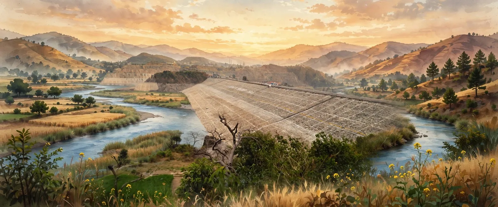

ਸਰੋਤ (13)
- Dhar Kalan Sub-district Village and Areas List, Gurdaspur, Punjab (Census 2011 and DCHB), vill.co.in
- Dhar Kalan (400) Village, Census 2011 and DCHB, vill.co.in
- Dhar Kalan, Wikipedia (headquarters village, NH 154A, Dalhousie Road station)
- Dhar Kalan Village Population, Census2011.co.in
- Dunera Village Population, Census2011.co.in
- Hara Village Population, Census2011.co.in
- Dunera, Punjab, Wikipedia
- Pathankot district, Wikipedia (formation 27 July 2011, Shivalik foothills, religion and language tables, sub divisions and blocks)
- Pathankot District, tehsils, blocks and assembly seats, punjabdata.com
- Dhar Kalan Taluka, LGD based directory (28 revenue villages, 65 gram panchayats, Pathankot assembly, Gurdaspur Lok Sabha), gramvikas.nskmultiservices.in
- Ranjit Sagar Dam, Wikipedia (Thein Dam, Ravi, 600 MW, completed March 2001)
- Shahpurkandi dam project, Wikipedia (206 MW, dam completed February 2024)
- Dhar Kalan tehsil directory, Jugti (27 village pages listed, counted October 2026)
ਜੁਗਤੀ ਮੁਫ਼ਤ ਅਤੇ ਸੁਤੰਤਰ ਹੈ। ਪਾਠਕਾਂ ਦਾ ਸਹਿਯੋਗ ਕੋਸ਼ ਨੂੰ ਵਧਾਉਂਦਾ ਹੈ।
ਸਹਿਯੋਗ