
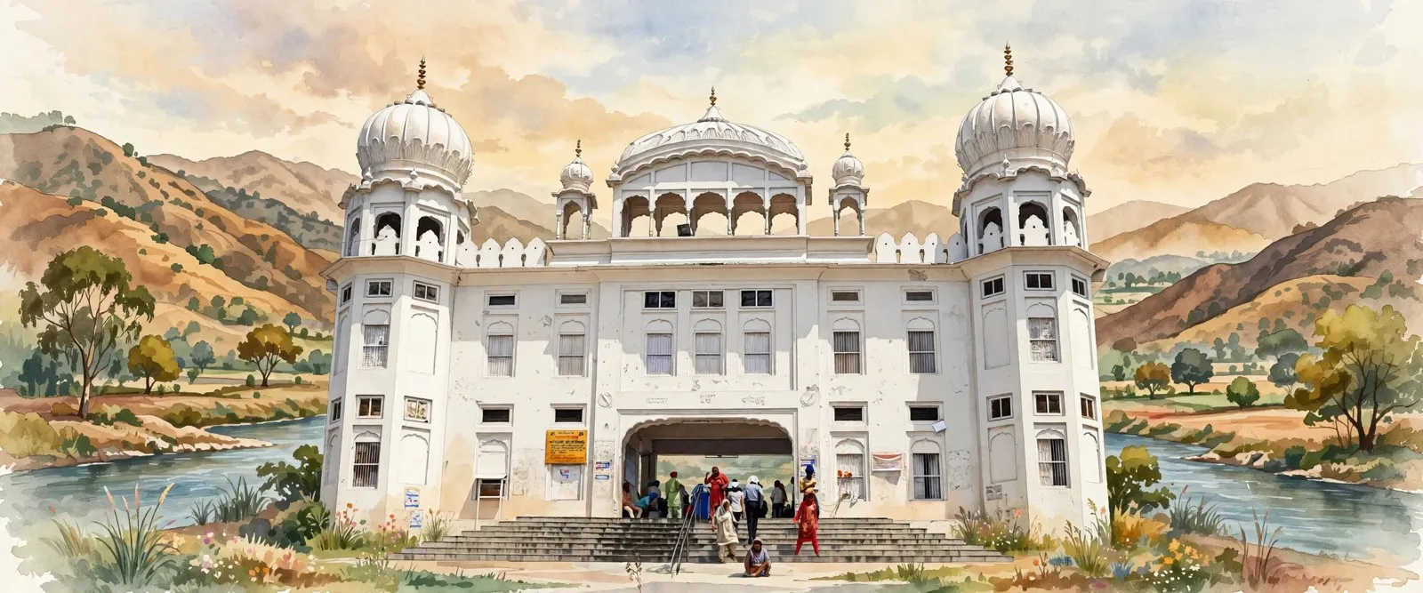
Rupnagar district, also called Ropar, is a district in the Puadh region of Punjab, India, with its headquarters at Rupnagar town on the Sutlej. It joins Harappan Ropar, among the oldest excavated sites in India, with Anandpur Sahib, where Guru Gobind Singh founded the Khalsa in 1699, and the dam and fertiliser town of Nangal.
- Punjabi name
- ਰੂਪਨਗਰ
- Type
- District
- Headquarters
- Rupnagar
- Region
- Puadh
- State
- Punjab
- Country
- India
All 15 facts
- Area
- 1,356 sq km (Census 2011)
- Population
- 684,627 (Census 2011)
- Density
- 505 per sq km (Census 2011)
- Literacy
- 82.19 percent (Census 2011)
- Sex ratio
- 915 females per 1,000 males (Census 2011)
- Tehsils
- 4: Rupnagar, Sri Anandpur Sahib, Sri Chamkaur Sahib and Nangal
- Blocks
- 5 development blocks
- Villages
- 617 villages
- Known for
- Anandpur Sahib and the founding of the Khalsa in 1699, Harappan Ropar, Nangal and the Bhakra project, IIT Ropar, Ropar Ramsar wetland
Rupnagar district, long known as Ropar, is a district in the Puadh region of eastern Punjab, India, where the Sutlej leaves the Shivalik hills for the plains. It holds Harappan Ropar, among the oldest excavated towns in India, and Anandpur Sahib, where Guru Gobind Singh founded the Khalsa in 1699, and its headquarters is Rupnagar town.
Where is Rupnagar district?
Rupnagar district is in the east of Punjab, in the Puadh region, and its headquarters is Rupnagar town, about 42 kilometres by road from Chandigarh, the state capital. Himachal Pradesh lies to its north and north east, Hoshiarpur, Shahid Bhagat Singh Nagar and Ludhiana districts to the west, Fatehgarh Sahib to the south and Mohali to the south east. The district sits where the Sutlej comes down from the hills, so its northern belt is Shivalik foothill country and its south is flat alluvial plain.
The Census of 2011 counted 684,627 people in the district, across 1,356 square kilometres, a density of 505 people per square kilometre. The sex ratio was 915 females for every 1,000 males, and literacy was 82.19 percent, with Punjabi the mother tongue of 92.6 percent of residents. Sikhs made up 52.74 percent of the population and Hindus 44.47 percent. For administration the district has four tehsils, Rupnagar, Sri Anandpur Sahib, Sri Chamkaur Sahib and Nangal, five development blocks and 617 villages, alongside towns that include Rupnagar, Anandpur Sahib, Nangal, Morinda, Chamkaur Sahib and Kiratpur Sahib.
From Harappan Ropar to the Ropar state
The ancient mound at Ropar rises about 21 metres on the left bank of the Sutlej, where the river enters the plains. Excavations led by Y. D. Sharma of the Archaeological Survey of India uncovered six cultural periods running, with some breaks, from Harappan times to the present day, and the district administration calls Ropar the first Harappan site excavated in independent India. The Harappans are thought to have reached the upper Sutlej towards the close of the third millennium BC. Finds from the mound include a steatite seal, Painted Grey Ware pottery, and material of the Saka, Kushana and Gupta ages, among them gold coins of Chandragupta.
The Archaeological Museum at Rupnagar, opened to the public in 1998, displays these finds in sequence, from Harappan antiquities to a Vina Vadini figure and a yakshi image. The town itself is said to have been founded in the 11th century by a Raja called Rokeshar, who named it after his son Rup Sen. The tract later passed under Mauryan and Gupta rule, then under the dynasties of Delhi and the Mughals. In 1763 the Sikh chief Hari Singh of Sialba conquered Ropar, and the later Ropar state of Raja Bhup Singh was confiscated by the British after the Anglo-Sikh wars of the 1840s. In October 1831 Maharaja Ranjit Singh met Lord William Bentinck, the Governor General, on the bank of the Sutlej at Rupnagar, a meeting that fixed relations between the two powers.
The modern district was carved out on 1 November 1966, when Punjab was reorganised. It shrank on 14 April 2006, when the Kharar and Majri blocks were moved into the new district of S.A.S. Nagar (Mohali).
Anandpur Sahib, Kiratpur Sahib and the Khalsa
The district holds some of the most sacred ground in Sikh history. Kiratpur Sahib, on the bank of the Sutlej, was established by Guru Hargobind, who bought the land from Raja Tara Chand of Kehloor through Baba Gurditta. Guru Har Rai and Guru Harkrishan were born at Kiratpur, and at its Gurdwara Patalpuri Sahib the ashes of the dead are immersed by Sikhs from across the world. Anandpur Sahib was founded by Guru Tegh Bahadur on land he bought at the village of Makhowal. It was from Anandpur that the Guru set out for Delhi after the Kashmiri Pandits appealed to him for protection, a journey that ended in his martyrdom, and the young Guru Gobind Singh spent his early years in its forts, including Kila Anandgarh.
On Vaisakhi of 1699, at the place now marked by Takht Sri Kesgarh Sahib, Guru Gobind Singh created the Khalsa, initiating the first five Sikhs and giving the community the names Singh and Kaur. Kesgarh Sahib is one of the five takhts, the seats of Sikh authority, and the tercentenary of the Khalsa was celebrated at Anandpur Sahib in April 1999 before crowds from around the world. The district also carries the memory of December 1704, when the Guru's family was separated during the crossing of the Sarsa river, remembered at Gurdwara Pariwar Vichora Sahib near the village of Nangal Sirsa, and the Guru went on to Chamkaur Sahib, where his two elder sons, Sahibzada Ajit Singh and Sahibzada Jujhar Singh, died fighting.
The Sutlej, the Shivaliks and the Ropar wetland
Four landforms run side by side across the district: the Siwalik hills, the intermontane valley of the Sutlej, the Kandi and Sirowal formations at the foot of the hills, and the alluvial plains in the south. The Sutlej enters the district near Nangal in the north, flows south east, then bends south and south west through the outermost Siwalik hills into the plains. Smaller hill streams, the Budki and Siswa among them, drain the south eastern part and join the Sutlej. The climate is dry apart from the monsoon: average annual rainfall is 775.6 mm, about 78 percent of it falling between June and September, and temperatures range from about 4 degrees Celsius in winter to 45 degrees in summer.
Where the Sutlej is held by the barrage built at Ropar in 1952 to divert water for drinking and irrigation, the river spreads into the Ropar wetland, a lake and river site of 1,365 hectares listed under the Ramsar Convention on 22 January 2002. The Ramsar listing records the wetland as a breeding place for the smooth Indian otter, hog deer and sambar, with the endangered Indian pangolin thought to be present, about 35 species of fish and around 150 species of local and migratory birds. Birdwatchers, swimmers and boaters visit through the year, and the Sadabarat forest patch on its edge keeps a piece of the old Shivalik foothill habitat alive.
Towns, work and study: Nangal, IIT Ropar and the farms
Farming remains the base of the district economy. The Central Ground Water Board puts the net sown area at 780 square kilometres, with rice and maize the main kharif crops and wheat the main rabi crop. Irrigation comes from tubewells and from canals fed by the Sutlej system, among them the Sirhind Canal, the Nangal Hydel Canal and the Anandpur Sahib Hydel Canal, though the Board also flags groundwater overuse in the Chamkaur Sahib, Nurpur Bedi and Morinda blocks.
Industry is anchored at Nangal, a town built on land acquired from 1948 for the Bhakra project on the Sutlej. The Bhakra Dam itself stands upstream in Himachal Pradesh, about 10 kilometres from Nangal, and the town grew in three parts: Nangal, Nangal Township and Naya Nangal. Naya Nangal is the planned colony of the fertiliser complex of National Fertilizers Limited, whose plant made the town a byword for fertiliser production in Punjab. Morinda, on the Chandigarh to Ludhiana road, is known as Baghwala, the city of gardens.
The district's best known modern institution is the Indian Institute of Technology Ropar. Established in 2008 as one of the new IITs, it held its first classes at IIT Delhi, moved to a transit campus in Rupnagar in August 2009, and shifted to its permanent 525 acre campus on the bank of the Sutlej in June 2018. The campus entrance carries stone pillars inspired by the Indus Valley civilisation, a deliberate nod to ancient Ropar a short distance away.
Hola Mohalla, visiting and getting there
The district's great festival is Hola Mohalla at Anandpur Sahib, instituted by Guru Gobind Singh in 1701, two years after the founding of the Khalsa. Held in March, a day after Holi, it replaces colour play with martial display: Nihang Sikhs in blue robes and tall turbans perform gatka, tent pegging, bareback riding and mock battles, processions led by the Panj Pyare move through the town, and langar is served to all. Hundreds of thousands of devotees gather at Anandpur Sahib, and the festival is the best single occasion to see the district's Sikh heritage in full public life.
Getting there is straightforward. Rupnagar town is about 42 kilometres from Chandigarh by road, the district headquarters has its own railway station, and most towns in the district, Chamkaur Sahib excepted, stand on the railway line. The nearest airport is at Chandigarh, about 56 kilometres from the district headquarters. Roads run west to Ludhiana through Morinda, and north through Anandpur Sahib and Nangal towards Himachal Pradesh, making the district an easy first stop on the way from the plains to the hills.
ਰੂਪਨਗਰ ਜ਼ਿਲ੍ਹਾ, ਜਿਸ ਨੂੰ ਲੰਮੇ ਸਮੇਂ ਤੋਂ ਰੋਪੜ ਕਿਹਾ ਜਾਂਦਾ ਹੈ, ਭਾਰਤ ਦੇ ਪੰਜਾਬ ਸੂਬੇ ਦੇ ਪੂਰਬੀ ਪੁਆਧ ਖਿੱਤੇ ਦਾ ਜ਼ਿਲ੍ਹਾ ਹੈ, ਜਿੱਥੇ ਸਤਲੁਜ ਸ਼ਿਵਾਲਿਕ ਪਹਾੜੀਆਂ ਤੋਂ ਉਤਰ ਕੇ ਮੈਦਾਨਾਂ ਵਿੱਚ ਆਉਂਦਾ ਹੈ। ਇੱਥੇ ਹੜੱਪਾ ਕਾਲੀ ਰੋਪੜ ਹੈ, ਜੋ ਭਾਰਤ ਦੇ ਸਭ ਤੋਂ ਪੁਰਾਣੇ ਖੁਦਾਈ ਕੀਤੇ ਕਸਬਿਆਂ ਵਿੱਚੋਂ ਇੱਕ ਹੈ, ਅਤੇ ਅਨੰਦਪੁਰ ਸਾਹਿਬ ਹੈ, ਜਿੱਥੇ ਗੁਰੂ ਗੋਬਿੰਦ ਸਿੰਘ ਜੀ ਨੇ 1699 ਵਿੱਚ ਖ਼ਾਲਸਾ ਸਾਜਿਆ, ਅਤੇ ਇਸ ਦਾ ਮੁੱਖ ਦਫ਼ਤਰ ਰੂਪਨਗਰ ਸ਼ਹਿਰ ਹੈ।
ਰੂਪਨਗਰ ਜ਼ਿਲ੍ਹਾ ਕਿੱਥੇ ਹੈ?
ਰੂਪਨਗਰ ਜ਼ਿਲ੍ਹਾ ਪੰਜਾਬ ਦੇ ਪੂਰਬ ਵਿੱਚ ਪੁਆਧ ਖਿੱਤੇ ਵਿੱਚ ਪੈਂਦਾ ਹੈ ਅਤੇ ਇਸ ਦਾ ਮੁੱਖ ਦਫ਼ਤਰ ਰੂਪਨਗਰ ਸ਼ਹਿਰ ਹੈ, ਜੋ ਰਾਜਧਾਨੀ ਚੰਡੀਗੜ੍ਹ ਤੋਂ ਸੜਕ ਰਾਹੀਂ ਲਗਭਗ 42 ਕਿਲੋਮੀਟਰ ਦੂਰ ਹੈ। ਇਸ ਦੇ ਉੱਤਰ ਅਤੇ ਉੱਤਰ ਪੂਰਬ ਵਿੱਚ ਹਿਮਾਚਲ ਪ੍ਰਦੇਸ਼, ਪੱਛਮ ਵਿੱਚ ਹੁਸ਼ਿਆਰਪੁਰ, ਸ਼ਹੀਦ ਭਗਤ ਸਿੰਘ ਨਗਰ ਅਤੇ ਲੁਧਿਆਣਾ ਜ਼ਿਲ੍ਹੇ, ਦੱਖਣ ਵਿੱਚ ਫ਼ਤਹਿਗੜ੍ਹ ਸਾਹਿਬ ਅਤੇ ਦੱਖਣ ਪੂਰਬ ਵਿੱਚ ਮੋਹਾਲੀ ਪੈਂਦਾ ਹੈ। ਇਹ ਜ਼ਿਲ੍ਹਾ ਉਸ ਥਾਂ ਬੈਠਾ ਹੈ ਜਿੱਥੇ ਸਤਲੁਜ ਪਹਾੜਾਂ ਤੋਂ ਉਤਰਦਾ ਹੈ, ਇਸ ਲਈ ਇਸ ਦਾ ਉੱਤਰੀ ਹਿੱਸਾ ਸ਼ਿਵਾਲਿਕ ਦੀਆਂ ਤਲਹੱਟੀਆਂ ਵਾਲਾ ਹੈ ਅਤੇ ਦੱਖਣੀ ਹਿੱਸਾ ਸਮਤਲ ਦਰਿਆਈ ਮੈਦਾਨ ਹੈ।
ਸਾਲ 2011 ਦੀ ਮਰਦਮਸ਼ੁਮਾਰੀ ਵਿੱਚ ਜ਼ਿਲ੍ਹੇ ਦੀ ਆਬਾਦੀ 684,627 ਗਿਣੀ ਗਈ, ਰਕਬਾ 1,356 ਵਰਗ ਕਿਲੋਮੀਟਰ ਸੀ ਅਤੇ ਘਣਤਾ 505 ਵਿਅਕਤੀ ਪ੍ਰਤੀ ਵਰਗ ਕਿਲੋਮੀਟਰ ਸੀ। ਲਿੰਗ ਅਨੁਪਾਤ ਹਰ 1,000 ਮਰਦਾਂ ਪਿੱਛੇ 915 ਔਰਤਾਂ ਸੀ ਅਤੇ ਸਾਖਰਤਾ ਦਰ 82.19 ਫ਼ੀਸਦੀ ਸੀ, ਜਦਕਿ 92.6 ਫ਼ੀਸਦੀ ਵਸਨੀਕਾਂ ਦੀ ਮਾਦਰੀ ਜ਼ੁਬਾਨ ਪੰਜਾਬੀ ਸੀ। ਆਬਾਦੀ ਵਿੱਚ ਸਿੱਖ 52.74 ਫ਼ੀਸਦੀ ਅਤੇ ਹਿੰਦੂ 44.47 ਫ਼ੀਸਦੀ ਸਨ। ਪ੍ਰਸ਼ਾਸਨ ਪੱਖੋਂ ਜ਼ਿਲ੍ਹੇ ਵਿੱਚ ਚਾਰ ਤਹਿਸੀਲਾਂ, ਰੂਪਨਗਰ, ਸ੍ਰੀ ਅਨੰਦਪੁਰ ਸਾਹਿਬ, ਸ੍ਰੀ ਚਮਕੌਰ ਸਾਹਿਬ ਅਤੇ ਨੰਗਲ, ਪੰਜ ਵਿਕਾਸ ਬਲਾਕ ਅਤੇ 617 ਪਿੰਡ ਹਨ, ਅਤੇ ਕਸਬਿਆਂ ਵਿੱਚ ਰੂਪਨਗਰ, ਅਨੰਦਪੁਰ ਸਾਹਿਬ, ਨੰਗਲ, ਮੋਰਿੰਡਾ, ਚਮਕੌਰ ਸਾਹਿਬ ਅਤੇ ਕੀਰਤਪੁਰ ਸਾਹਿਬ ਆਉਂਦੇ ਹਨ।
ਹੜੱਪਾ ਕਾਲੀ ਰੋਪੜ ਤੋਂ ਰੋਪੜ ਰਿਆਸਤ ਤੱਕ
ਰੋਪੜ ਦਾ ਪ੍ਰਾਚੀਨ ਟਿੱਬਾ ਸਤਲੁਜ ਦੇ ਖੱਬੇ ਕੰਢੇ ਉੱਤੇ ਲਗਭਗ 21 ਮੀਟਰ ਉੱਚਾ ਹੈ, ਜਿੱਥੇ ਦਰਿਆ ਮੈਦਾਨਾਂ ਵਿੱਚ ਦਾਖ਼ਲ ਹੁੰਦਾ ਹੈ। ਭਾਰਤੀ ਪੁਰਾਤੱਤਵ ਸਰਵੇਖਣ ਦੇ ਵਾਈ. ਡੀ. ਸ਼ਰਮਾ ਦੀ ਅਗਵਾਈ ਹੇਠ ਹੋਈਆਂ ਖੁਦਾਈਆਂ ਵਿੱਚ ਛੇ ਸੱਭਿਆਚਾਰਕ ਦੌਰ ਮਿਲੇ, ਜੋ ਕੁਝ ਵਕਫ਼ਿਆਂ ਨਾਲ ਹੜੱਪਾ ਕਾਲ ਤੋਂ ਅੱਜ ਤੱਕ ਚੱਲਦੇ ਹਨ, ਅਤੇ ਜ਼ਿਲ੍ਹਾ ਪ੍ਰਸ਼ਾਸਨ ਰੋਪੜ ਨੂੰ ਆਜ਼ਾਦ ਭਾਰਤ ਵਿੱਚ ਖੁਦਾਈ ਕੀਤਾ ਪਹਿਲਾ ਹੜੱਪਾ ਅਸਥਾਨ ਦੱਸਦਾ ਹੈ। ਮੰਨਿਆ ਜਾਂਦਾ ਹੈ ਕਿ ਹੜੱਪਾ ਵਾਸੀ ਤੀਜੀ ਸਹਿਸਰਾਬਦੀ ਈਸਾ ਪੂਰਵ ਦੇ ਅੰਤ ਵੱਲ ਉਪਰਲੇ ਸਤਲੁਜ ਤੱਕ ਪਹੁੰਚੇ ਸਨ। ਟਿੱਬੇ ਤੋਂ ਮਿਲੀਆਂ ਚੀਜ਼ਾਂ ਵਿੱਚ ਸਟੀਏਟਾਈਟ ਦੀ ਮੋਹਰ, ਰੰਗੀਨ ਸਲੇਟੀ ਮਿੱਟੀ ਦੇ ਭਾਂਡੇ ਅਤੇ ਸ਼ਕ, ਕੁਸ਼ਾਣ ਅਤੇ ਗੁਪਤ ਕਾਲ ਦੀ ਸਮੱਗਰੀ ਹੈ, ਜਿਸ ਵਿੱਚ ਚੰਦਰਗੁਪਤ ਦੇ ਸੋਨੇ ਦੇ ਸਿੱਕੇ ਵੀ ਹਨ।
ਰੂਪਨਗਰ ਦਾ ਪੁਰਾਤੱਤਵ ਅਜਾਇਬਘਰ, ਜੋ 1998 ਵਿੱਚ ਆਮ ਲੋਕਾਂ ਲਈ ਖੁੱਲ੍ਹਿਆ, ਇਨ੍ਹਾਂ ਖੋਜਾਂ ਨੂੰ ਕ੍ਰਮਵਾਰ ਦਿਖਾਉਂਦਾ ਹੈ, ਹੜੱਪਾ ਕਾਲ ਦੀਆਂ ਪੁਰਾਣੀਆਂ ਚੀਜ਼ਾਂ ਤੋਂ ਲੈ ਕੇ ਵੀਣਾ ਵਾਦਿਨੀ ਦੀ ਮੂਰਤੀ ਅਤੇ ਯਕਸ਼ੀ ਦੀ ਮੂਰਤੀ ਤੱਕ। ਕਿਹਾ ਜਾਂਦਾ ਹੈ ਕਿ ਇਹ ਕਸਬਾ 11ਵੀਂ ਸਦੀ ਵਿੱਚ ਰਾਜਾ ਰੋਕੇਸ਼ਰ ਨੇ ਵਸਾਇਆ ਅਤੇ ਇਸ ਦਾ ਨਾਂ ਆਪਣੇ ਪੁੱਤਰ ਰੂਪ ਸੇਨ ਦੇ ਨਾਂ ਉੱਤੇ ਰੱਖਿਆ। ਇਹ ਇਲਾਕਾ ਬਾਅਦ ਵਿੱਚ ਮੌਰੀਆ ਅਤੇ ਗੁਪਤ ਰਾਜ ਹੇਠ ਆਇਆ, ਫਿਰ ਦਿੱਲੀ ਦੇ ਵੰਸ਼ਾਂ ਅਤੇ ਮੁਗ਼ਲਾਂ ਹੇਠ ਰਿਹਾ। 1763 ਵਿੱਚ ਸਿਆਲਬਾ ਦੇ ਸਿੱਖ ਸਰਦਾਰ ਹਰੀ ਸਿੰਘ ਨੇ ਰੋਪੜ ਉੱਤੇ ਕਬਜ਼ਾ ਕੀਤਾ, ਅਤੇ ਬਾਅਦ ਵਾਲੀ ਰਾਜਾ ਭੂਪ ਸਿੰਘ ਦੀ ਰੋਪੜ ਰਿਆਸਤ 1840 ਦੇ ਦਹਾਕੇ ਦੀਆਂ ਐਂਗਲੋ-ਸਿੱਖ ਜੰਗਾਂ ਤੋਂ ਬਾਅਦ ਅੰਗਰੇਜ਼ਾਂ ਨੇ ਜ਼ਬਤ ਕਰ ਲਈ। ਅਕਤੂਬਰ 1831 ਵਿੱਚ ਮਹਾਰਾਜਾ ਰਣਜੀਤ ਸਿੰਘ ਨੇ ਰੂਪਨਗਰ ਵਿਖੇ ਸਤਲੁਜ ਦੇ ਕੰਢੇ ਗਵਰਨਰ ਜਨਰਲ ਲਾਰਡ ਵਿਲੀਅਮ ਬੈਂਟਿੰਕ ਨਾਲ ਮੁਲਾਕਾਤ ਕੀਤੀ, ਜਿਸ ਮੁਲਾਕਾਤ ਨੇ ਦੋਵਾਂ ਤਾਕਤਾਂ ਦੇ ਸੰਬੰਧ ਤੈਅ ਕੀਤੇ।
ਅਜੋਕਾ ਜ਼ਿਲ੍ਹਾ 1 ਨਵੰਬਰ 1966 ਨੂੰ ਬਣਿਆ, ਜਦੋਂ ਪੰਜਾਬ ਦਾ ਮੁੜ ਗਠਨ ਹੋਇਆ। 14 ਅਪ੍ਰੈਲ 2006 ਨੂੰ ਇਹ ਛੋਟਾ ਹੋ ਗਿਆ, ਜਦੋਂ ਖਰੜ ਅਤੇ ਮਾਜਰੀ ਬਲਾਕ ਨਵੇਂ ਐਸ.ਏ.ਐਸ. ਨਗਰ (ਮੋਹਾਲੀ) ਜ਼ਿਲ੍ਹੇ ਵਿੱਚ ਚਲੇ ਗਏ।
ਅਨੰਦਪੁਰ ਸਾਹਿਬ, ਕੀਰਤਪੁਰ ਸਾਹਿਬ ਅਤੇ ਖ਼ਾਲਸਾ
ਇਸ ਜ਼ਿਲ੍ਹੇ ਵਿੱਚ ਸਿੱਖ ਇਤਿਹਾਸ ਦੀ ਕੁਝ ਸਭ ਤੋਂ ਪਵਿੱਤਰ ਧਰਤੀ ਹੈ। ਸਤਲੁਜ ਕੰਢੇ ਕੀਰਤਪੁਰ ਸਾਹਿਬ ਗੁਰੂ ਹਰਿਗੋਬਿੰਦ ਸਾਹਿਬ ਜੀ ਨੇ ਵਸਾਇਆ, ਜਿਨ੍ਹਾਂ ਨੇ ਬਾਬਾ ਗੁਰਦਿੱਤਾ ਜੀ ਰਾਹੀਂ ਕੇਹਲੂਰ ਦੇ ਰਾਜਾ ਤਾਰਾ ਚੰਦ ਤੋਂ ਜ਼ਮੀਨ ਖ਼ਰੀਦੀ ਸੀ। ਗੁਰੂ ਹਰਿ ਰਾਇ ਜੀ ਅਤੇ ਗੁਰੂ ਹਰਿਕ੍ਰਿਸ਼ਨ ਜੀ ਦਾ ਜਨਮ ਕੀਰਤਪੁਰ ਵਿੱਚ ਹੋਇਆ, ਅਤੇ ਇੱਥੋਂ ਦੇ ਗੁਰਦੁਆਰਾ ਪਤਾਲਪੁਰੀ ਸਾਹਿਬ ਵਿੱਚ ਦੁਨੀਆ ਭਰ ਦੇ ਸਿੱਖ ਮ੍ਰਿਤਕਾਂ ਦੀਆਂ ਅਸਥੀਆਂ ਪ੍ਰਵਾਹ ਕਰਦੇ ਹਨ। ਅਨੰਦਪੁਰ ਸਾਹਿਬ ਗੁਰੂ ਤੇਗ਼ ਬਹਾਦਰ ਜੀ ਨੇ ਮਾਖੋਵਾਲ ਪਿੰਡ ਦੀ ਖ਼ਰੀਦੀ ਜ਼ਮੀਨ ਉੱਤੇ ਵਸਾਇਆ। ਇੱਥੋਂ ਹੀ ਗੁਰੂ ਜੀ ਕਸ਼ਮੀਰੀ ਪੰਡਿਤਾਂ ਦੀ ਫ਼ਰਿਆਦ ਸੁਣ ਕੇ ਦਿੱਲੀ ਲਈ ਰਵਾਨਾ ਹੋਏ, ਜਿਸ ਯਾਤਰਾ ਦਾ ਅੰਤ ਉਨ੍ਹਾਂ ਦੀ ਸ਼ਹਾਦਤ ਨਾਲ ਹੋਇਆ, ਅਤੇ ਨੌਜਵਾਨ ਗੁਰੂ ਗੋਬਿੰਦ ਸਿੰਘ ਜੀ ਨੇ ਆਪਣੇ ਮੁਢਲੇ ਸਾਲ ਇੱਥੋਂ ਦੇ ਕਿਲਿਆਂ, ਜਿਨ੍ਹਾਂ ਵਿੱਚ ਕਿਲਾ ਅਨੰਦਗੜ੍ਹ ਵੀ ਹੈ, ਵਿੱਚ ਬਿਤਾਏ।
1699 ਦੀ ਵਿਸਾਖੀ ਨੂੰ, ਉਸ ਥਾਂ ਜਿੱਥੇ ਅੱਜ ਤਖ਼ਤ ਸ੍ਰੀ ਕੇਸਗੜ੍ਹ ਸਾਹਿਬ ਹੈ, ਗੁਰੂ ਗੋਬਿੰਦ ਸਿੰਘ ਜੀ ਨੇ ਖ਼ਾਲਸਾ ਸਾਜਿਆ, ਪਹਿਲੇ ਪੰਜਾਂ ਨੂੰ ਅੰਮ੍ਰਿਤ ਛਕਾਇਆ ਅਤੇ ਕੌਮ ਨੂੰ ਸਿੰਘ ਅਤੇ ਕੌਰ ਨਾਂ ਦਿੱਤੇ। ਕੇਸਗੜ੍ਹ ਸਾਹਿਬ ਪੰਜ ਤਖ਼ਤਾਂ ਵਿੱਚੋਂ ਇੱਕ ਹੈ, ਅਤੇ ਖ਼ਾਲਸੇ ਦਾ ਤਿੰਨ ਸੌ ਸਾਲਾ ਜਸ਼ਨ ਅਪ੍ਰੈਲ 1999 ਵਿੱਚ ਅਨੰਦਪੁਰ ਸਾਹਿਬ ਵਿਖੇ ਦੁਨੀਆ ਭਰ ਦੀਆਂ ਭੀੜਾਂ ਵਿਚਕਾਰ ਮਨਾਇਆ ਗਿਆ। ਇਹ ਜ਼ਿਲ੍ਹਾ ਦਸੰਬਰ 1704 ਦੀ ਯਾਦ ਵੀ ਰੱਖਦਾ ਹੈ, ਜਦੋਂ ਸਰਸਾ ਦਰਿਆ ਪਾਰ ਕਰਦਿਆਂ ਗੁਰੂ ਜੀ ਦਾ ਪਰਿਵਾਰ ਵਿਛੜ ਗਿਆ, ਜਿਸ ਦੀ ਯਾਦ ਨੰਗਲ ਸਿਰਸਾ ਪਿੰਡ ਕੋਲ ਗੁਰਦੁਆਰਾ ਪਰਿਵਾਰ ਵਿਛੋੜਾ ਸਾਹਿਬ ਵਿੱਚ ਹੈ, ਅਤੇ ਗੁਰੂ ਜੀ ਅੱਗੇ ਚਮਕੌਰ ਸਾਹਿਬ ਗਏ, ਜਿੱਥੇ ਉਨ੍ਹਾਂ ਦੇ ਦੋ ਵੱਡੇ ਸਾਹਿਬਜ਼ਾਦੇ, ਸਾਹਿਬਜ਼ਾਦਾ ਅਜੀਤ ਸਿੰਘ ਅਤੇ ਸਾਹਿਬਜ਼ਾਦਾ ਜੁਝਾਰ ਸਿੰਘ, ਲੜਦੇ ਸ਼ਹੀਦ ਹੋਏ।
ਸਤਲੁਜ, ਸ਼ਿਵਾਲਿਕ ਅਤੇ ਰੋਪੜ ਝੀਲ
ਜ਼ਿਲ੍ਹੇ ਵਿੱਚ ਚਾਰ ਤਰ੍ਹਾਂ ਦੀ ਧਰਤੀ ਨਾਲੋ-ਨਾਲ ਚੱਲਦੀ ਹੈ: ਸ਼ਿਵਾਲਿਕ ਪਹਾੜੀਆਂ, ਸਤਲੁਜ ਦੀ ਪਹਾੜਾਂ ਵਿਚਕਾਰਲੀ ਵਾਦੀ, ਪਹਾੜੀਆਂ ਦੇ ਪੈਰਾਂ ਵਿੱਚ ਕੰਡੀ ਅਤੇ ਸਿਰੋਵਾਲ ਬਣਤਰਾਂ, ਅਤੇ ਦੱਖਣ ਵਿੱਚ ਦਰਿਆਈ ਮੈਦਾਨ। ਸਤਲੁਜ ਜ਼ਿਲ੍ਹੇ ਵਿੱਚ ਉੱਤਰ ਵੱਲ ਨੰਗਲ ਕੋਲ ਦਾਖ਼ਲ ਹੁੰਦਾ ਹੈ, ਦੱਖਣ ਪੂਰਬ ਵੱਲ ਵਗਦਾ ਹੈ, ਫਿਰ ਮੁੜ ਕੇ ਦੱਖਣ ਅਤੇ ਦੱਖਣ ਪੱਛਮ ਵੱਲ ਸ਼ਿਵਾਲਿਕ ਦੀਆਂ ਬਾਹਰਲੀਆਂ ਪਹਾੜੀਆਂ ਵਿੱਚੋਂ ਲੰਘਦਾ ਮੈਦਾਨਾਂ ਵਿੱਚ ਆ ਜਾਂਦਾ ਹੈ। ਛੋਟੀਆਂ ਪਹਾੜੀ ਨਦੀਆਂ, ਜਿਨ੍ਹਾਂ ਵਿੱਚ ਬੁਡਕੀ ਅਤੇ ਸਿਸਵਾ ਵੀ ਹਨ, ਦੱਖਣ ਪੂਰਬੀ ਹਿੱਸਾ ਸਿੰਜ ਕੇ ਸਤਲੁਜ ਵਿੱਚ ਜਾ ਮਿਲਦੀਆਂ ਹਨ। ਮੌਸਮ ਮੌਨਸੂਨ ਤੋਂ ਬਿਨਾਂ ਖੁਸ਼ਕ ਹੈ: ਔਸਤ ਸਾਲਾਨਾ ਵਰਖਾ 775.6 ਮਿਲੀਮੀਟਰ ਹੈ, ਜਿਸ ਦਾ ਲਗਭਗ 78 ਫ਼ੀਸਦੀ ਹਿੱਸਾ ਜੂਨ ਤੋਂ ਸਤੰਬਰ ਵਿਚਕਾਰ ਪੈਂਦਾ ਹੈ, ਅਤੇ ਤਾਪਮਾਨ ਸਰਦੀਆਂ ਵਿੱਚ ਲਗਭਗ 4 ਡਿਗਰੀ ਸੈਲਸੀਅਸ ਤੋਂ ਗਰਮੀਆਂ ਵਿੱਚ 45 ਡਿਗਰੀ ਤੱਕ ਰਹਿੰਦਾ ਹੈ।
ਜਿੱਥੇ 1952 ਵਿੱਚ ਰੋਪੜ ਵਿਖੇ ਬਣੇ ਬੰਨ੍ਹ ਨੇ ਪੀਣ ਅਤੇ ਸਿੰਜਾਈ ਲਈ ਪਾਣੀ ਮੋੜਨ ਵਾਸਤੇ ਸਤਲੁਜ ਨੂੰ ਰੋਕਿਆ, ਉੱਥੇ ਦਰਿਆ ਰੋਪੜ ਝੀਲ ਵਿੱਚ ਫੈਲ ਜਾਂਦਾ ਹੈ, ਜੋ 1,365 ਹੈਕਟੇਅਰ ਦੀ ਝੀਲ ਅਤੇ ਦਰਿਆ ਵਾਲੀ ਥਾਂ ਹੈ ਅਤੇ 22 ਜਨਵਰੀ 2002 ਨੂੰ ਰਾਮਸਰ ਸੂਚੀ ਵਿੱਚ ਦਰਜ ਹੋਈ। ਰਾਮਸਰ ਸੂਚੀ ਅਨੁਸਾਰ ਇਹ ਝੀਲ ਨਿਰਵਿਘਨ ਭਾਰਤੀ ਊਦਬਿਲਾਓ, ਹੋਗ ਹਿਰਨ ਅਤੇ ਸਾਂਭਰ ਦੇ ਪ੍ਰਜਨਣ ਦੀ ਥਾਂ ਹੈ, ਖ਼ਤਰੇ ਵਿੱਚ ਪਿਆ ਭਾਰਤੀ ਪੈਂਗੋਲਿਨ ਇੱਥੇ ਹੋਣ ਦਾ ਅਨੁਮਾਨ ਹੈ, ਅਤੇ ਇੱਥੇ ਲਗਭਗ 35 ਕਿਸਮਾਂ ਦੀਆਂ ਮੱਛੀਆਂ ਅਤੇ ਲਗਭਗ 150 ਕਿਸਮਾਂ ਦੇ ਸਥਾਨਕ ਅਤੇ ਪ੍ਰਵਾਸੀ ਪੰਛੀ ਮਿਲਦੇ ਹਨ। ਪੰਛੀ ਦੇਖਣ ਵਾਲੇ, ਤੈਰਾਕ ਅਤੇ ਕਿਸ਼ਤੀ ਚਲਾਉਣ ਵਾਲੇ ਸਾਲ ਭਰ ਇੱਥੇ ਆਉਂਦੇ ਹਨ, ਅਤੇ ਇਸ ਦੇ ਕੰਢੇ ਸਦਾਬਰਤ ਜੰਗਲ ਦਾ ਹਿੱਸਾ ਸ਼ਿਵਾਲਿਕ ਤਲਹੱਟੀਆਂ ਦੇ ਪੁਰਾਣੇ ਨਿਵਾਸ ਨੂੰ ਜਿੰਦਾ ਰੱਖਦਾ ਹੈ।
ਕਸਬੇ, ਕੰਮ ਅਤੇ ਪੜ੍ਹਾਈ: ਨੰਗਲ, ਆਈਆਈਟੀ ਰੋਪੜ ਅਤੇ ਖੇਤੀ
ਖੇਤੀ ਜ਼ਿਲ੍ਹੇ ਦੀ ਆਰਥਿਕਤਾ ਦੀ ਬੁਨਿਆਦ ਬਣੀ ਹੋਈ ਹੈ। ਕੇਂਦਰੀ ਭੂਗਰਭ ਜਲ ਬੋਰਡ ਅਨੁਸਾਰ ਸ਼ੁੱਧ ਬੀਜਿਆ ਰਕਬਾ 780 ਵਰਗ ਕਿਲੋਮੀਟਰ ਹੈ, ਜਿਸ ਵਿੱਚ ਝੋਨਾ ਅਤੇ ਮੱਕੀ ਮੁੱਖ ਸਾਉਣੀ ਫ਼ਸਲਾਂ ਹਨ ਅਤੇ ਕਣਕ ਮੁੱਖ ਹਾੜੀ ਫ਼ਸਲ ਹੈ। ਸਿੰਜਾਈ ਟਿਊਬਵੈੱਲਾਂ ਤੋਂ ਅਤੇ ਸਤਲੁਜ ਪ੍ਰਣਾਲੀ ਤੋਂ ਚੱਲਣ ਵਾਲੀਆਂ ਨਹਿਰਾਂ ਤੋਂ ਹੁੰਦੀ ਹੈ, ਜਿਨ੍ਹਾਂ ਵਿੱਚ ਸਰਹਿੰਦ ਨਹਿਰ, ਨੰਗਲ ਹਾਈਡਲ ਨਹਿਰ ਅਤੇ ਅਨੰਦਪੁਰ ਸਾਹਿਬ ਹਾਈਡਲ ਨਹਿਰ ਹਨ, ਪਰ ਬੋਰਡ ਚਮਕੌਰ ਸਾਹਿਬ, ਨੂਰਪੁਰ ਬੇਦੀ ਅਤੇ ਮੋਰਿੰਡਾ ਬਲਾਕਾਂ ਵਿੱਚ ਭੂਗਰਭ ਜਲ ਦੀ ਬਹੁਤੀ ਵਰਤੋਂ ਵੱਲ ਵੀ ਇਸ਼ਾਰਾ ਕਰਦਾ ਹੈ।
ਉਦਯੋਗ ਦੀ ਧੁਰੀ ਨੰਗਲ ਹੈ, ਜੋ ਸਤਲੁਜ ਉੱਤੇ ਭਾਖੜਾ ਯੋਜਨਾ ਲਈ 1948 ਤੋਂ ਲਈ ਗਈ ਜ਼ਮੀਨ ਉੱਤੇ ਵੱਸਿਆ ਕਸਬਾ ਹੈ। ਭਾਖੜਾ ਡੈਮ ਖ਼ੁਦ ਉਪਰਲੇ ਪਾਸੇ ਹਿਮਾਚਲ ਪ੍ਰਦੇਸ਼ ਵਿੱਚ ਹੈ, ਨੰਗਲ ਤੋਂ ਲਗਭਗ 10 ਕਿਲੋਮੀਟਰ ਦੂਰ, ਅਤੇ ਕਸਬਾ ਤਿੰਨ ਹਿੱਸਿਆਂ ਵਿੱਚ ਵਧਿਆ: ਨੰਗਲ, ਨੰਗਲ ਟਾਊਨਸ਼ਿਪ ਅਤੇ ਨਵਾਂ ਨੰਗਲ। ਨਵਾਂ ਨੰਗਲ ਨੈਸ਼ਨਲ ਫ਼ਰਟੀਲਾਈਜ਼ਰਜ਼ ਲਿਮਿਟਡ ਦੇ ਖਾਦ ਕਾਰਖ਼ਾਨੇ ਦੀ ਯੋਜਨਾਬੱਧ ਕਲੋਨੀ ਹੈ, ਜਿਸ ਕਾਰਖ਼ਾਨੇ ਨੇ ਕਸਬੇ ਨੂੰ ਪੰਜਾਬ ਵਿੱਚ ਖਾਦ ਉਤਪਾਦਨ ਦਾ ਨਾਂ ਦਿੱਤਾ। ਚੰਡੀਗੜ੍ਹ ਤੋਂ ਲੁਧਿਆਣਾ ਸੜਕ ਉੱਤੇ ਪੈਂਦਾ ਮੋਰਿੰਡਾ ਬਾਗਵਾਲਾ, ਬਾਗਾਂ ਦਾ ਸ਼ਹਿਰ, ਅਖਵਾਉਂਦਾ ਹੈ।
ਜ਼ਿਲ੍ਹੇ ਦੀ ਸਭ ਤੋਂ ਜਾਣੀ ਪਛਾਣੀ ਅਜੋਕੀ ਸੰਸਥਾ ਇੰਡੀਅਨ ਇੰਸਟੀਚਿਊਟ ਆਫ਼ ਟੈਕਨਾਲੋਜੀ ਰੋਪੜ ਹੈ। 2008 ਵਿੱਚ ਨਵੇਂ ਆਈਆਈਟੀਆਂ ਵਿੱਚੋਂ ਇੱਕ ਵਜੋਂ ਸਥਾਪਿਤ ਇਸ ਸੰਸਥਾ ਦੀਆਂ ਪਹਿਲੀਆਂ ਕਲਾਸਾਂ ਆਈਆਈਟੀ ਦਿੱਲੀ ਵਿੱਚ ਲੱਗੀਆਂ, ਇਹ ਅਗਸਤ 2009 ਵਿੱਚ ਰੂਪਨਗਰ ਦੇ ਆਰਜ਼ੀ ਕੈਂਪਸ ਵਿੱਚ ਆਈ, ਅਤੇ ਜੂਨ 2018 ਵਿੱਚ ਸਤਲੁਜ ਕੰਢੇ ਆਪਣੇ 525 ਏਕੜ ਦੇ ਸਥਾਈ ਕੈਂਪਸ ਵਿੱਚ ਚਲੀ ਗਈ। ਕੈਂਪਸ ਦੇ ਪ੍ਰਵੇਸ਼ ਦੁਆਰ ਉੱਤੇ ਸਿੰਧੂ ਘਾਟੀ ਸੱਭਿਅਤਾ ਤੋਂ ਪ੍ਰੇਰਿਤ ਪੱਥਰ ਦੇ ਥੰਮ੍ਹ ਹਨ, ਜੋ ਥੋੜ੍ਹੀ ਦੂਰੀ ਉੱਤੇ ਪਈ ਪ੍ਰਾਚੀਨ ਰੋਪੜ ਵੱਲ ਜਾਣ ਬੁੱਝ ਕੇ ਕੀਤਾ ਇਸ਼ਾਰਾ ਹਨ।
ਹੋਲਾ ਮਹੱਲਾ, ਯਾਤਰਾ ਅਤੇ ਪਹੁੰਚ
ਜ਼ਿਲ੍ਹੇ ਦਾ ਵੱਡਾ ਤਿਉਹਾਰ ਅਨੰਦਪੁਰ ਸਾਹਿਬ ਦਾ ਹੋਲਾ ਮਹੱਲਾ ਹੈ, ਜੋ ਗੁਰੂ ਗੋਬਿੰਦ ਸਿੰਘ ਜੀ ਨੇ ਖ਼ਾਲਸੇ ਦੀ ਸਾਜਨਾ ਤੋਂ ਦੋ ਸਾਲ ਬਾਅਦ 1701 ਵਿੱਚ ਸ਼ੁਰੂ ਕੀਤਾ। ਮਾਰਚ ਵਿੱਚ, ਹੋਲੀ ਤੋਂ ਇੱਕ ਦਿਨ ਬਾਅਦ ਮਨਾਇਆ ਜਾਂਦਾ ਇਹ ਤਿਉਹਾਰ ਰੰਗ ਖੇਡਣ ਦੀ ਥਾਂ ਜੰਗੀ ਪ੍ਰਦਰਸ਼ਨ ਦਿੰਦਾ ਹੈ: ਨੀਲੇ ਬਾਣੇ ਅਤੇ ਉੱਚੇ ਦੁਮਾਲਿਆਂ ਵਾਲੇ ਨਿਹੰਗ ਸਿੰਘ ਗਤਕਾ, ਨੇਜ਼ਾਬਾਜ਼ੀ, ਨੰਗੀ ਪਿੱਠ ਘੋੜਸਵਾਰੀ ਅਤੇ ਨਕਲੀ ਜੰਗਾਂ ਦਿਖਾਉਂਦੇ ਹਨ, ਪੰਜ ਪਿਆਰਿਆਂ ਦੀ ਅਗਵਾਈ ਵਿੱਚ ਨਗਰ ਕੀਰਤਨ ਸ਼ਹਿਰ ਵਿੱਚੋਂ ਲੰਘਦੇ ਹਨ, ਅਤੇ ਸਭ ਲਈ ਲੰਗਰ ਛਕਾਇਆ ਜਾਂਦਾ ਹੈ। ਲੱਖਾਂ ਸ਼ਰਧਾਲੂ ਅਨੰਦਪੁਰ ਸਾਹਿਬ ਇਕੱਠੇ ਹੁੰਦੇ ਹਨ, ਅਤੇ ਇਹ ਤਿਉਹਾਰ ਜ਼ਿਲ੍ਹੇ ਦੀ ਸਿੱਖ ਵਿਰਾਸਤ ਨੂੰ ਪੂਰੀ ਜਨਤਕ ਜ਼ਿੰਦਗੀ ਵਿੱਚ ਦੇਖਣ ਦਾ ਸਭ ਤੋਂ ਵਧੀਆ ਇੱਕੋ ਮੌਕਾ ਹੈ।
ਇੱਥੇ ਪਹੁੰਚਣਾ ਸੌਖਾ ਹੈ। ਰੂਪਨਗਰ ਸ਼ਹਿਰ ਚੰਡੀਗੜ੍ਹ ਤੋਂ ਸੜਕ ਰਾਹੀਂ ਲਗਭਗ 42 ਕਿਲੋਮੀਟਰ ਹੈ, ਜ਼ਿਲ੍ਹਾ ਮੁੱਖ ਦਫ਼ਤਰ ਦਾ ਆਪਣਾ ਰੇਲਵੇ ਸਟੇਸ਼ਨ ਹੈ, ਅਤੇ ਚਮਕੌਰ ਸਾਹਿਬ ਨੂੰ ਛੱਡ ਕੇ ਜ਼ਿਲ੍ਹੇ ਦੇ ਬਹੁਤੇ ਕਸਬੇ ਰੇਲਵੇ ਲਾਈਨ ਉੱਤੇ ਪੈਂਦੇ ਹਨ। ਸਭ ਤੋਂ ਨੇੜਲਾ ਹਵਾਈ ਅੱਡਾ ਚੰਡੀਗੜ੍ਹ ਹੈ, ਜੋ ਜ਼ਿਲ੍ਹਾ ਮੁੱਖ ਦਫ਼ਤਰ ਤੋਂ ਲਗਭਗ 56 ਕਿਲੋਮੀਟਰ ਦੂਰ ਹੈ। ਸੜਕਾਂ ਪੱਛਮ ਵੱਲ ਮੋਰਿੰਡਾ ਰਾਹੀਂ ਲੁਧਿਆਣੇ ਨੂੰ ਅਤੇ ਉੱਤਰ ਵੱਲ ਅਨੰਦਪੁਰ ਸਾਹਿਬ ਅਤੇ ਨੰਗਲ ਰਾਹੀਂ ਹਿਮਾਚਲ ਪ੍ਰਦੇਸ਼ ਨੂੰ ਜਾਂਦੀਆਂ ਹਨ, ਇਸ ਲਈ ਇਹ ਜ਼ਿਲ੍ਹਾ ਮੈਦਾਨਾਂ ਤੋਂ ਪਹਾੜਾਂ ਵੱਲ ਜਾਂਦਿਆਂ ਪਹਿਲਾ ਸੌਖਾ ਪੜਾਅ ਬਣਦਾ ਹੈ।
Nearby


All places in Rupnagar district
1 places in 5 tehsils · 1 villages
Tehsils of Rupnagar
Sources (11)
- Rupnagar District Population Census 2011, Census2011
- Ground Water Information Booklet, Ropar District, Central Ground Water Board
- Demography, Rupnagar Web Portal, District Administration Rupnagar
- Archeological Museum, Rupnagar Web Portal, District Administration Rupnagar
- RTI Manual, Office of the Deputy Commissioner, Rupnagar
- Rupnagar district, Wikipedia
- The District of Rupnagar, Total Punjab
- Ropar, Ramsar Sites Information Service
- IIT Ropar, Wikipedia
- Nangal, Wikipedia
- Hola Mohalla, GKToday
Jugti is free and independent. Reader support keeps the Kosh growing.
Support