

Makhu is a railway town in Ferozepur district, Punjab, on the edge of the Harike wetland where the Sutlej and Beas rivers meet. The 2011 census counted 14,658 people in this nagar panchayat, which serves as the market and rail link for the surrounding villages of Zira tehsil.
- ਪੰਜਾਬੀ ਨਾਂ
- ਮੱਖੂ
- ਕਿਸਮ
- Town (nagar panchayat)
- ਜ਼ਿਲ੍ਹਾ
- ਫੇਰੋਜ਼ੇਪੁਰ
- Tehsil
- ਜ਼ੀਰਾ
- ਇਲਾਕਾ
- Malwa, Punjab (India)
- ਆਬਾਦੀ
- 14,658 (2011 census)
All 14 facts
- Area
- 7.66 km²
- ਸਥਾਪਨਾ
- Nagar panchayat notified 1987
- Elevation
- 201 m
- PIN
- 142044
- Railway
- Makhu station (MXH), Jalandhar–Firozpur line
- Nearest airport
- Amritsar (~63 km)
- Assembly
- Zira (MLA Naresh Kataria, elected 2022)
- ਪ੍ਰਸਿੱਧੀ
- Gateway to the Harike wetland; grain market
ਇਤਿਹਾਸ ਇੱਕ ਨਜ਼ਰ ਵਿੱਚ
Where is Makhu?
Makhu is a railway town in Ferozepur district, in Punjab’s Malwa region, sitting on the edge of the Harike wetland where the Sutlej and Beas rivers meet. A nagar panchayat with a 2011 population of 14,658, it serves as the market and rail link for the surrounding villages of Zira tehsil.
The town stands at about 31.1°N, 75.0°E, at an elevation of 201 metres, roughly 5 kilometres from the Sutlej–Beas confluence at Harike. It lies around 42 kilometres northeast of Ferozepur city and about 17 kilometres from Zira, in a district that borders Pakistan. Three national highways, NH 54 (the old NH 15), NH 703A and NH 703B, pass through or near it.
ਇਤਿਹਾਸ
Makhu grew up around its railway station. The Jalandhar–Firozpur line, on which the town’s station stands, was laid in 1912, and the line made Makhu a small but steady transport point for grain and passengers moving through the Ferozepur belt. The wider railway history of the region goes back further: the Southern Punjab Railway opened its Delhi–Bhatinda–Samasatta line in 1897, and the Firozpur–Jalandhar branch followed in 1912.
The making of the nearby landscape came in 1952, when a barrage was built at the Sutlej–Beas confluence at Harike to make use of the eastern rivers’ waters. The barrage created the reservoir that became the Harike wetland, transforming irrigation and farming across this belt.
Makhu was notified as a nagar panchayat in 1987, giving the growing town its own elected municipal body of 13 wards. The town falls in the Zira assembly constituency; Naresh Kataria was elected its MLA in 2022.
Geography & people
The town covers about 7.66 square kilometres and is divided into 13 wards with 2,861 households. The 2011 census counted 14,658 people, 7,723 men and 6,935 women, up from 12,173 in 2001.
Literacy stands at 63.19%, the sex ratio at 898 women per 1,000 men, and about 28% of residents belong to Scheduled Castes. By religion, the town is roughly 47% Sikh, 39% Hindu and 13% Christian, with a small Muslim community. Punjabi is the official language.
The PIN code is 142044, the telephone code 01682, and vehicles carry the PB 47 registration. Farming dominates the surrounding countryside, wheat and paddy in their seasons, and Makhu works as the local mandi town, with its grain market on the Amritsar road. Fishing communities around the Harike wetland are also part of the local economy.
Harike wetland and places of interest
The Harike wetland is the largest man-made wetland in northern India. Created by the 1952 barrage at the Sutlej–Beas confluence, it spreads over about 41 square kilometres across Ferozepur, Tarn Taran and Kapurthala districts. Declared a wildlife sanctuary in 1982 and a Ramsar site of international importance in 1990, it shelters more than 360 bird species, along with the Indus river dolphin, the smooth-coated otter and several rare turtle species. Winter brings flocks of migratory waterfowl, and birdwatchers from across Punjab pass through Makhu to reach it. Pollution, encroachments and invasive weeds now threaten the wetland, and conservationists have been raising the alarm for years.
In town, the landmarks are everyday ones: Gurdwara Singh Sabha in the main bazaar and Gurdwara Baba Deep Singh on the Amritsar road, the Civil Hospital alongside private hospitals such as Kalra and City Hospital, and schools including Kinder Garden Senior Secondary School. Makhu also hosts kabaddi tournaments that draw teams from across the district.
Getting there
Makhu railway station (code MXH) sits on the Jalandhar–Firozpur line under the Firozpur division of Northern Railway, with trains to Firozpur, Ludhiana and Jalandhar. By road, NH 54 connects the town to Ferozepur in the southwest and Amritsar to the north, while NH 703A and NH 703B link it toward Jalandhar–Kapurthala–Sultanpur Lodhi and Moga respectively. NH 54 forms part of the larger Amritsar–Bathinda corridor, keeping the town tied to both Majha and Malwa. The nearest airport is Sri Guru Ram Das Ji International Airport at Amritsar, about 63 kilometres away.
Today
Makhu remains what the railway made it: a working market town for its villages, a small medical and schooling centre for the Zira belt, and the nearest town for visitors heading to the Harike wetland. The 13-ward nagar panchayat governs day-to-day civic life, and the town’s grain market, hospitals and station keep it tied closely to Ferozepur and the wider Malwa region.
ਮੱਖੂ ਕਿੱਥੇ ਹੈ?
ਮੱਖੂ ਫ਼ਿਰੋਜ਼ਪੁਰ ਜ਼ਿਲ੍ਹੇ ਦਾ ਇੱਕ ਰੇਲਵੇ ਕਸਬਾ ਹੈ, ਜੋ ਮਾਲਵਾ ਖੇਤਰ ਵਿੱਚ ਹਰੀਕੇ ਵੈਟਲੈਂਡ ਦੇ ਕੰਢੇ ਸਥਿਤ ਹੈ । ਉਹ ਥਾਂ ਜਿੱਥੇ ਸਤਲੁਜ ਅਤੇ ਬਿਆਸ ਦਰਿਆ ਮਿਲਦੇ ਹਨ। ਇਹ ਇੱਕ ਨਗਰ ਪੰਚਾਇਤ ਹੈ, ਜਿਸਦੀ 2011 ਦੀ ਮਰਦਮਸ਼ੁਮਾਰੀ ਅਨੁਸਾਰ ਆਬਾਦੀ 14,658 ਸੀ, ਅਤੇ ਇਹ ਜ਼ੀਰਾ ਤਹਿਸੀਲ ਦੇ ਆਲੇ-ਦੁਆਲੇ ਦੇ ਪਿੰਡਾਂ ਲਈ ਬਾਜ਼ਾਰ ਅਤੇ ਰੇਲ ਸੰਪਰਕ ਦਾ ਕੇਂਦਰ ਹੈ।
ਕਸਬਾ ਲਗਭਗ 31.1° ਉੱਤਰ, 75.0° ਪੂਰਬ ਉੱਤੇ, ਸਮੁੰਦਰ ਤਲ ਤੋਂ 201 ਮੀਟਰ ਦੀ ਉਚਾਈ ਉੱਤੇ ਹੈ, ਅਤੇ ਹਰੀਕੇ ਵਿਖੇ ਸਤਲੁਜ–ਬਿਆਸ ਸੰਗਮ ਤੋਂ ਲਗਭਗ 5 ਕਿਲੋਮੀਟਰ ਦੂਰ ਹੈ। ਇਹ ਫ਼ਿਰੋਜ਼ਪੁਰ ਸ਼ਹਿਰ ਤੋਂ ਲਗਭਗ 42 ਕਿਲੋਮੀਟਰ ਉੱਤਰ-ਪੂਰਬ ਅਤੇ ਜ਼ੀਰਾ ਤੋਂ ਲਗਭਗ 17 ਕਿਲੋਮੀਟਰ ਦੂਰ, ਪਾਕਿਸਤਾਨ ਦੀ ਸਰਹੱਦ ਨਾਲ ਲੱਗਦੇ ਜ਼ਿਲ੍ਹੇ ਵਿੱਚ ਸਥਿਤ ਹੈ। ਤਿੰਨ ਕੌਮੀ ਸ਼ਾਹਰਾਹਾਂ । ਐੱਨ।ਐੱਚ। 54 (ਪੁਰਾਣਾ ਐੱਨ।ਐੱਚ। 15), ਐੱਨ।ਐੱਚ। 703ਏ ਅਤੇ ਐੱਨ।ਐੱਚ। 703ਬੀ । ਕਸਬੇ ਵਿੱਚੋਂ ਜਾਂ ਨੇੜਿਓਂ ਲੰਘਦੀਆਂ ਹਨ।
ਇਤਿਹਾਸ
ਮੱਖੂ ਆਪਣੇ ਰੇਲਵੇ ਸਟੇਸ਼ਨ ਦੇ ਆਲੇ-ਦੁਆਲੇ ਵਧਿਆ। ਜਲੰਧਰ–ਫ਼ਿਰੋਜ਼ਪੁਰ ਰੇਲ ਲਾਈਨ, ਜਿਸ ਉੱਤੇ ਕਸਬੇ ਦਾ ਸਟੇਸ਼ਨ ਹੈ, 1912 ਵਿੱਚ ਵਿਛਾਈ ਗਈ ਸੀ, ਅਤੇ ਇਸ ਲਾਈਨ ਨੇ ਮੱਖੂ ਨੂੰ ਫ਼ਿਰੋਜ਼ਪੁਰ ਪੱਟੀ ਵਿੱਚ ਅਨਾਜ ਅਤੇ ਯਾਤਰੀਆਂ ਦੀ ਆਵਾਜਾਈ ਦਾ ਇੱਕ ਛੋਟਾ ਪਰ ਟਿਕਾਊ ਕੇਂਦਰ ਬਣਾ ਦਿੱਤਾ। ਇਲਾਕੇ ਦਾ ਰੇਲ ਇਤਿਹਾਸ ਇਸ ਤੋਂ ਵੀ ਪੁਰਾਣਾ ਹੈ: ਸਦਰਨ ਪੰਜਾਬ ਰੇਲਵੇ ਨੇ 1897 ਵਿੱਚ ਦਿੱਲੀ–ਭਟਿੰਡਾ–ਸਮਾਸਟਾ ਲਾਈਨ ਖੋਲ੍ਹੀ ਸੀ, ਅਤੇ ਫ਼ਿਰੋਜ਼ਪੁਰ–ਜਲੰਧਰ ਸ਼ਾਖਾ 1912 ਵਿੱਚ ਬਣੀ।
ਨੇੜਲੇ ਇਲਾਕੇ ਦੀ ਸ਼ਕਲ 1952 ਵਿੱਚ ਬਦਲੀ, ਜਦੋਂ ਹਰੀਕੇ ਵਿਖੇ ਸਤਲੁਜ–ਬਿਆਸ ਸੰਗਮ ਉੱਤੇ ਪੂਰਬੀ ਦਰਿਆਵਾਂ ਦੇ ਪਾਣੀ ਦੀ ਵਰਤੋਂ ਲਈ ਇੱਕ ਬੈਰਾਜ ਬਣਾਇਆ ਗਿਆ। ਇਸ ਬੈਰਾਜ ਨਾਲ ਉਹ ਜਲ ਭੰਡਾਰ ਬਣਿਆ ਜੋ ਬਾਅਦ ਵਿੱਚ ਹਰੀਕੇ ਵੈਟਲੈਂਡ ਵਜੋਂ ਜਾਣਿਆ ਗਿਆ, ਅਤੇ ਇਸ ਪੱਟੀ ਦੀ ਸਿੰਚਾਈ ਤੇ ਖੇਤੀ ਬਦਲ ਗਈ।
ਮੱਖੂ ਨੂੰ 1987 ਵਿੱਚ ਨਗਰ ਪੰਚਾਇਤ ਦਾ ਦਰਜਾ ਮਿਲਿਆ, ਜਿਸ ਨਾਲ ਵਧਦੇ ਕਸਬੇ ਨੂੰ 13 ਵਾਰਡਾਂ ਵਾਲੀ ਆਪਣੀ ਚੁਣੀ ਹੋਈ ਨਗਰ ਸੰਸਥਾ ਮਿਲੀ। ਇਹ ਕਸਬਾ ਜ਼ੀਰਾ ਵਿਧਾਨ ਸਭਾ ਹਲਕੇ ਵਿੱਚ ਪੈਂਦਾ ਹੈ; 2022 ਵਿੱਚ ਨਰੇਸ਼ ਕਟਾਰੀਆ ਇੱਥੋਂ ਦੇ ਵਿਧਾਇਕ ਚੁਣੇ ਗਏ।
ਭੂਗੋਲ ਅਤੇ ਲੋਕ
ਕਸਬਾ ਲਗਭਗ 7.66 ਵਰਗ ਕਿਲੋਮੀਟਰ ਵਿੱਚ ਫੈਲਿਆ ਹੈ ਅਤੇ 13 ਵਾਰਡਾਂ ਤੇ 2,861 ਘਰਾਂ ਵਿੱਚ ਵੰਡਿਆ ਹੋਇਆ ਹੈ। 2011 ਦੀ ਮਰਦਮਸ਼ੁਮਾਰੀ ਵਿੱਚ 14,658 ਲੋਕ ਗਿਣੇ ਗਏ । 7,723 ਮਰਦ ਅਤੇ 6,935 ਔਰਤਾਂ । ਜਦੋਂ ਕਿ 2001 ਵਿੱਚ ਆਬਾਦੀ 12,173 ਸੀ।
ਸਾਖਰਤਾ ਦਰ 63.19 ਪ੍ਰਤੀਸ਼ਤ ਹੈ, ਲਿੰਗ ਅਨੁਪਾਤ ਪ੍ਰਤੀ 1,000 ਮਰਦਾਂ ਪਿੱਛੇ 898 ਔਰਤਾਂ ਹੈ, ਅਤੇ ਲਗਭਗ 28 ਪ੍ਰਤੀਸ਼ਤ ਵਸਨੀਕ ਅਨੁਸੂਚਿਤ ਜਾਤੀਆਂ ਨਾਲ ਸਬੰਧ ਰੱਖਦੇ ਹਨ। ਧਰਮ ਪੱਖੋਂ ਕਸਬਾ ਲਗਭਗ 47 ਪ੍ਰਤੀਸ਼ਤ ਸਿੱਖ, 39 ਪ੍ਰਤੀਸ਼ਤ ਹਿੰਦੂ ਅਤੇ 13 ਪ੍ਰਤੀਸ਼ਤ ਈਸਾਈ ਹੈ, ਨਾਲ ਇੱਕ ਛੋਟਾ ਮੁਸਲਿਮ ਭਾਈਚਾਰਾ ਵੀ ਹੈ। ਪੰਜਾਬੀ ਸਰਕਾਰੀ ਭਾਸ਼ਾ ਹੈ।
ਪਿੰਨ ਕੋਡ 142044, ਟੈਲੀਫ਼ੋਨ ਕੋਡ 01682 ਹੈ, ਅਤੇ ਵਾਹਨਾਂ ਉੱਤੇ ਪੀ।ਬੀ। 47 ਨੰਬਰ ਲੱਗਦਾ ਹੈ। ਆਲੇ-ਦੁਆਲੇ ਦੇ ਇਲਾਕੇ ਵਿੱਚ ਖੇਤੀ ਪ੍ਰਧਾਨ ਹੈ । ਮੌਸਮ ਅਨੁਸਾਰ ਕਣਕ ਅਤੇ ਝੋਨਾ । ਅਤੇ ਮੱਖੂ ਸਥਾਨਕ ਮੰਡੀ ਕਸਬੇ ਵਜੋਂ ਕੰਮ ਕਰਦਾ ਹੈ, ਜਿਸਦੀ ਅਨਾਜ ਮੰਡੀ ਅੰਮ੍ਰਿਤਸਰ ਸੜਕ ਉੱਤੇ ਹੈ। ਹਰੀਕੇ ਵੈਟਲੈਂਡ ਦੇ ਆਲੇ-ਦੁਆਲੇ ਮੱਛੀ ਫੜਨ ਵਾਲੇ ਭਾਈਚਾਰੇ ਵੀ ਸਥਾਨਕ ਜੀਵਨ ਦਾ ਹਿੱਸਾ ਹਨ।
ਹਰੀਕੇ ਵੈਟਲੈਂਡ ਅਤੇ ਦੇਖਣਯੋਗ ਥਾਵਾਂ
ਹਰੀਕੇ ਵੈਟਲੈਂਡ ਉੱਤਰੀ ਭਾਰਤ ਦਾ ਸਭ ਤੋਂ ਵੱਡਾ ਮਨੁੱਖ-ਨਿਰਮਿਤ ਵੈਟਲੈਂਡ ਹੈ। ਸਤਲੁਜ–ਬਿਆਸ ਸੰਗਮ ਉੱਤੇ 1952 ਦੇ ਬੈਰਾਜ ਨਾਲ ਬਣਿਆ ਇਹ ਲਗਭਗ 41 ਵਰਗ ਕਿਲੋਮੀਟਰ ਵਿੱਚ ਫੈਲਿਆ ਹੈ । ਫ਼ਿਰੋਜ਼ਪੁਰ, ਤਰਨ ਤਾਰਨ ਅਤੇ ਕਪੂਰਥਲਾ ਜ਼ਿਲ੍ਹਿਆਂ ਵਿੱਚ। 1982 ਵਿੱਚ ਇਸਨੂੰ ਜੰਗਲੀ ਜੀਵ ਰੱਖ ਘੋਸ਼ਿਤ ਕੀਤਾ ਗਿਆ ਅਤੇ 1990 ਵਿੱਚ ਅੰਤਰਰਾਸ਼ਟਰੀ ਮਹੱਤਵ ਵਾਲਾ ਰਾਮਸਰ ਸਥਾਨ ਬਣਾਇਆ ਗਿਆ। ਇੱਥੇ 360 ਤੋਂ ਵੱਧ ਪੰਛੀਆਂ ਦੀਆਂ ਕਿਸਮਾਂ, ਸਿੰਧ ਦਰਿਆਈ ਡੌਲਫ਼ਿਨ, ਊਦਬਿਲਾਓ ਅਤੇ ਕੱਛੂਆਂ ਦੀਆਂ ਕਈ ਦੁਰਲੱਭ ਕਿਸਮਾਂ ਰਹਿੰਦੀਆਂ ਹਨ। ਸਰਦੀਆਂ ਵਿੱਚ ਪਰਵਾਸੀ ਪੰਛੀਆਂ ਦੇ ਝੁੰਡ ਆਉਂਦੇ ਹਨ, ਅਤੇ ਪੰਜਾਬ ਭਰ ਦੇ ਪੰਛੀ-ਪ੍ਰੇਮੀ ਇੱਥੇ ਪਹੁੰਚਣ ਲਈ ਮੱਖੂ ਵਿੱਚੋਂ ਲੰਘਦੇ ਹਨ। ਪ੍ਰਦੂਸ਼ਣ, ਕਬਜ਼ੇ ਅਤੇ ਪਰਦੇਸੀ ਬੂਟੀਆਂ ਹੁਣ ਇਸ ਵੈਟਲੈਂਡ ਲਈ ਖ਼ਤਰਾ ਬਣ ਗਈਆਂ ਹਨ, ਅਤੇ ਵਾਤਾਵਰਣ ਪ੍ਰੇਮੀ ਸਾਲਾਂ ਤੋਂ ਚਿਤਾਵਨੀ ਦੇ ਰਹੇ ਹਨ।
ਕਸਬੇ ਵਿੱਚ ਮੁੱਖ ਥਾਵਾਂ ਰੋਜ਼ਾਨਾ ਜੀਵਨ ਦੀਆਂ ਹਨ: ਮੁੱਖ ਬਾਜ਼ਾਰ ਵਿੱਚ ਗੁਰਦੁਆਰਾ ਸਿੰਘ ਸਭਾ ਅਤੇ ਅੰਮ੍ਰਿਤਸਰ ਸੜਕ ਉੱਤੇ ਗੁਰਦੁਆਰਾ ਬਾਬਾ ਦੀਪ ਸਿੰਘ, ਸਿਵਲ ਹਸਪਤਾਲ ਦੇ ਨਾਲ ਕਾਲੜਾ ਅਤੇ ਸਿਟੀ ਹਸਪਤਾਲ ਵਰਗੇ ਨਿੱਜੀ ਹਸਪਤਾਲ, ਅਤੇ ਕਿੰਡਰ ਗਾਰਡਨ ਸੀਨੀਅਰ ਸੈਕੰਡਰੀ ਸਕੂਲ ਸਮੇਤ ਕਈ ਸਕੂਲ। ਮੱਖੂ ਵਿੱਚ ਕਬੱਡੀ ਟੂਰਨਾਮੈਂਟ ਵੀ ਹੁੰਦੇ ਹਨ, ਜਿਨ੍ਹਾਂ ਵਿੱਚ ਜ਼ਿਲ੍ਹੇ ਭਰ ਦੀਆਂ ਟੀਮਾਂ ਆਉਂਦੀਆਂ ਹਨ।
ਇੱਥੇ ਕਿਵੇਂ ਪਹੁੰਚਿਆ ਜਾਵੇ
ਮੱਖੂ ਰੇਲਵੇ ਸਟੇਸ਼ਨ (ਕੋਡ MXH) ਉੱਤਰੀ ਰੇਲਵੇ ਦੇ ਫ਼ਿਰੋਜ਼ਪੁਰ ਮੰਡਲ ਅਧੀਨ ਜਲੰਧਰ–ਫ਼ਿਰੋਜ਼ਪੁਰ ਲਾਈਨ ਉੱਤੇ ਹੈ, ਜਿੱਥੋਂ ਫ਼ਿਰੋਜ਼ਪੁਰ, ਲੁਧਿਆਣਾ ਅਤੇ ਜਲੰਧਰ ਲਈ ਰੇਲ ਗੱਡੀਆਂ ਮਿਲਦੀਆਂ ਹਨ। ਸੜਕ ਰਾਹੀਂ ਐੱਨ।ਐੱਚ। 54 ਕਸਬੇ ਨੂੰ ਦੱਖਣ-ਪੱਛਮ ਵਿੱਚ ਫ਼ਿਰੋਜ਼ਪੁਰ ਅਤੇ ਉੱਤਰ ਵਿੱਚ ਅੰਮ੍ਰਿਤਸਰ ਨਾਲ ਜੋੜਦਾ ਹੈ, ਜਦੋਂ ਕਿ ਐੱਨ।ਐੱਚ। 703ਏ ਅਤੇ ਐੱਨ।ਐੱਚ। 703ਬੀ ਇਸਨੂੰ ਜਲੰਧਰ–ਕਪੂਰਥਲਾ–ਸੁਲਤਾਨਪੁਰ ਲੋਧੀ ਅਤੇ ਮੋਗਾ ਵੱਲ ਲੈ ਜਾਂਦੇ ਹਨ। ਨਜ਼ਦੀਕੀ ਹਵਾਈ ਅੱਡਾ ਅੰਮ੍ਰਿਤਸਰ ਦਾ ਸ੍ਰੀ ਗੁਰੂ ਰਾਮਦਾਸ ਜੀ ਅੰਤਰਰਾਸ਼ਟਰੀ ਹਵਾਈ ਅੱਡਾ ਹੈ, ਜੋ ਲਗਭਗ 63 ਕਿਲੋਮੀਟਰ ਦੂਰ ਹੈ।
ਅੱਜ ਦਾ ਮੱਖੂ
ਮੱਖੂ ਅੱਜ ਵੀ ਉਹੀ ਹੈ ਜੋ ਰੇਲਵੇ ਨੇ ਇਸਨੂੰ ਬਣਾਇਆ ਸੀ: ਆਪਣੇ ਪਿੰਡਾਂ ਲਈ ਇੱਕ ਕੰਮਕਾਜੀ ਮੰਡੀ ਕਸਬਾ, ਜ਼ੀਰਾ ਪੱਟੀ ਲਈ ਇੱਕ ਛੋਟਾ ਮੈਡੀਕਲ ਅਤੇ ਸਕੂਲੀ ਕੇਂਦਰ, ਅਤੇ ਹਰੀਕੇ ਵੈਟਲੈਂਡ ਵੱਲ ਜਾਣ ਵਾਲੇ ਸੈਲਾਨੀਆਂ ਲਈ ਨਜ਼ਦੀਕੀ ਕਸਬਾ। 13 ਵਾਰਡਾਂ ਵਾਲੀ ਨਗਰ ਪੰਚਾਇਤ ਰੋਜ਼ਾਨਾ ਨਗਰ ਜੀਵਨ ਚਲਾਉਂਦੀ ਹੈ, ਅਤੇ ਕਸਬੇ ਦੀ ਅਨਾਜ ਮੰਡੀ, ਹਸਪਤਾਲ ਅਤੇ ਸਟੇਸ਼ਨ ਇਸਨੂੰ ਫ਼ਿਰੋਜ਼ਪੁਰ ਅਤੇ ਵੱਡੇ ਮਾਲਵਾ ਖੇਤਰ ਨਾਲ ਜੋੜੀ ਰੱਖਦੇ ਹਨ।
Nearby
Villages in Zira tehsil (206)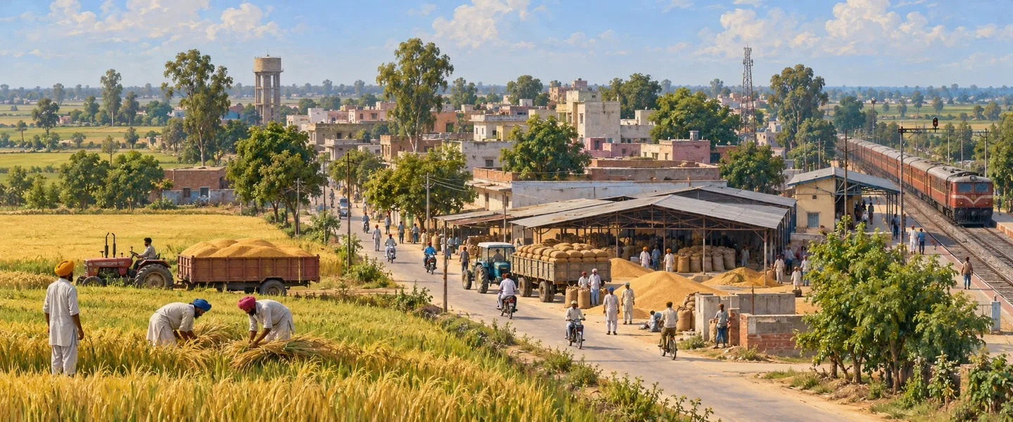

ਸਰੋਤ (9)
- ਮੱਖੂWikipedia
- Makhu Nagar Panchayat populationCensus 2011 (census2011.co.in)
- Makhu population statisticscitypopulation.de
- Jalandhar–Firozpur lineWikipedia
- Harike needs a handIndia Water Portal
- Harike, the wetland born of the Indus TreatyYourStory
- Wetlands of PunjabMashahur
- Gurudwaras in MakhuJustDial
- Makhu (Firozpur) Kabaddi Tournament 2021YouTube
ਜੁਗਤੀ ਮੁਫ਼ਤ ਅਤੇ ਸੁਤੰਤਰ ਹੈ। ਪਾਠਕਾਂ ਦਾ ਸਹਿਯੋਗ ਕੋਸ਼ ਨੂੰ ਵਧਾਉਂਦਾ ਹੈ।
ਸਹਿਯੋਗ