
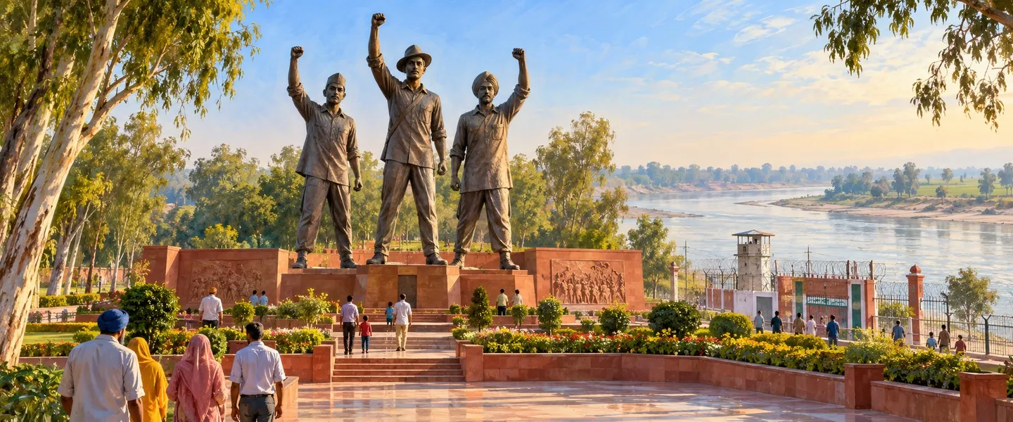
Ferozepur is a border district in the Malwa region of Punjab, India, with its headquarters in Ferozepur city on the Sutlej. It is known across India for the Hussainiwala National Martyrs Memorial, where Bhagat Singh, Rajguru and Sukhdev were cremated in 1931, and for its First Anglo-Sikh War battlefields and old cantonment.
- Punjabi name
- ਫ਼ਿਰੋਜ਼ਪੁਰ
- Type
- District
- Headquarters
- Ferozepur
- Region
- Malwa
- State
- Punjab
- Country
- India
All 15 facts
- Area
- 2,406.84 sq km
- Population
- 1,001,931 (Census 2011, present boundaries)
- Density
- 416 per sq km
- Literacy
- 68.92 percent (Census 2011)
- Sex ratio
- 893 females per 1,000 males (Census 2011)
- Tehsils
- 3 (Ferozepur, Zira and Guru Har Sahai)
- Blocks
- 6 development blocks
- Villages
- 689 (district administration)
- Known for
- Hussainiwala National Martyrs Memorial, Saragarhi Memorial, Anglo-Sikh War Memorial at Ferozeshah, Ferozepur Cantonment
Where is Ferozepur district?
Ferozepur is a border district in the Malwa region of Punjab, India, on the east bank of the Sutlej river, with Pakistan along its western edge. Its headquarters is Ferozepur city, and it is best known for Hussainiwala, where Bhagat Singh, Rajguru and Sukhdev were cremated in 1931.
The land is a flat alluvial plain sloping gently from the north east toward the south west, with the Sutlej along its northern and western sides. The district administration describes belts running parallel to the river: the low Bet land along the bank, called Hithar, with dark alluvial clay, and the lighter sandy Rohi and Mukhi plains inland, where well water can be brackish. About 69 percent of the soil is chestnut brown alluvial soil and the rest is desert soil. Pakistan lies to the west, Fazilka district to the south west, Muktsar to the south, and Faridkot and Moga to the east.
The climate is dry and sharp at both ends of the year. Summers are severe, June is the hottest month and daytime temperatures can reach about 47 degrees Celsius, while January nights can fall close to freezing. Around 70 percent of the rain arrives with the south west monsoon between July and the middle of September.
The headquarters is Ferozepur city, and the district is divided into three tehsils, Ferozepur, Zira and Guru Har Sahai, with six development blocks beneath them: Ferozepur, Ghall Khurd, Guru Har Sahai, Makhu, Mamdot and Zira. The district administration counts 689 villages and eight municipal towns, among them Zira, Guru Har Sahai, Makhu, Talwandi Bhai, Mudki and Mamdot, alongside Ferozepur City and Ferozepur Cantonment. Until 2011 the district was much larger: Fazilka, Abohar and part of Jalalabad tehsil were then separated to form Fazilka district, and the rest of Jalalabad became the new Guru Har Sahai tehsil.
A frontier town becomes a cantonment
Two traditions explain the name. One credits Firoz Shah Tughlaq, the Delhi Sultan who reigned from 1351 to 1388, and reads Ferozepur as the city of Firoz. The other credits a Bhatti chief named Feroze Khan in the sixteenth century. What is not in doubt is the pull of the place itself: a crossing town on the Sutlej at the edge of the Lahore kingdom, watched by every power that held Punjab or wanted it.
In 1763, troops of the Bhangi misl under Gujjar Singh crossed the Sutlej and took Ferozepur, and the town passed into the Sikh world of the misls. It later came to Dhanna Singh, who accepted British protection, a choice that kept Maharaja Ranjit Singh from expanding east of the river at this point. When Dhanna Singh's widow Lachhman Kaur died in 1835 without an heir, the Ferozepur jagir lapsed into direct British control.
The British turned the hexagonal fort into a garrison by 1839, on the orders of the Duke of Wellington, and Ferozepur grew into one of the oldest cantonments in India. The fort became an arsenal in 1858 and then a base depot supplying guns, ammunition and trained animals, a role it kept until the ammunition was moved to Kasubegu in 1941. The Army's Golden Arrow Division has now reopened the fort to the public for the first time in about 200 years, and the old walled city's ten gates still mark the headquarters town out from every other town in Punjab.
The First Anglo-Sikh War on Ferozepur soil
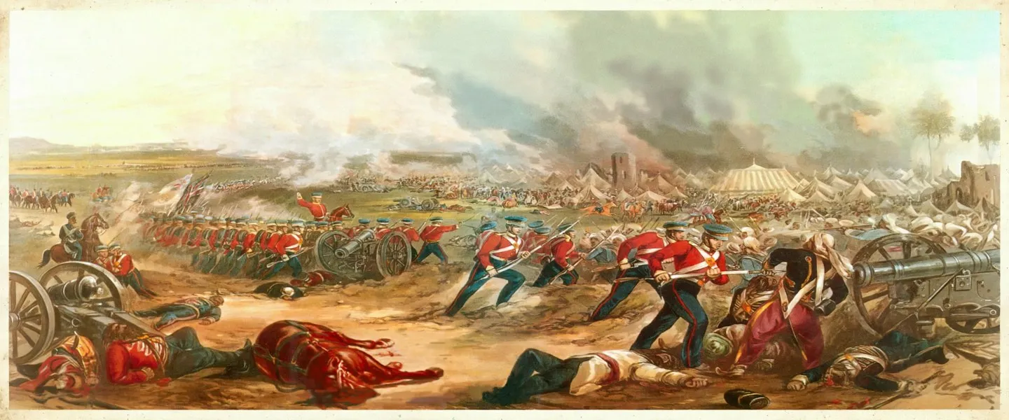
The First Anglo-Sikh War of 1845 and 1846 was fought mainly on this district's soil. After the Sikh Khalsa Army crossed the Sutlej in December 1845, the armies clashed at Mudki on 18 December 1845 and then at Ferozeshah on 21 and 22 December, where the British held on only narrowly. Fighting followed at Baddowal and Aliwal in January 1846, and the war was decided at Sobraon on 10 February 1846. The Treaty of Lahore in March 1846 reduced the Sikh army, imposed an indemnity and brought the land east of the Sutlej under British control.
The Punjab Government's Anglo-Sikh War Memorial at Ferozeshah, a three storey building near the Rajasthan Canal and the Sirhind Feeder, honours the Sikh soldiers of Mudki, Ferozeshah and Sobraon, and of Chillianwala in the second war of 1849. Its ground floor museum displays weapons of the wars. The village names of this plain, Mudki, Ferozeshah and Sobraon, are still the shorthand by which the fall of the Sikh Empire is remembered.
The people of the Sutlej plain
The Census of 2011 was taken months before the split, and it counted the undivided district at 2,029,074 people across 5,305 square kilometres, a density of 382 people per square kilometre. Reckoned in today's boundaries, the district holds 1,001,931 people on 2,406.84 square kilometres, about 416 people per square kilometre. The district administration's tehsil table shows a strongly rural district, with about 71.5 percent of people in villages and 28.5 percent in towns.
The census put literacy at 68.92 percent, with male literacy at 75.44 percent and female literacy at 61.69 percent, and the sex ratio at 893 females for every 1,000 males. In the present district, Sikhs form the largest share of the population at 68.59 percent, followed by Hindus at 28.83 percent and Christians at 1.83 percent, and Scheduled Castes make up 42.85 percent of the people. Punjabi is the official language and the language of daily life here, spoken in the Malwa form of the south western plain.
Farming, the cantonment and the border
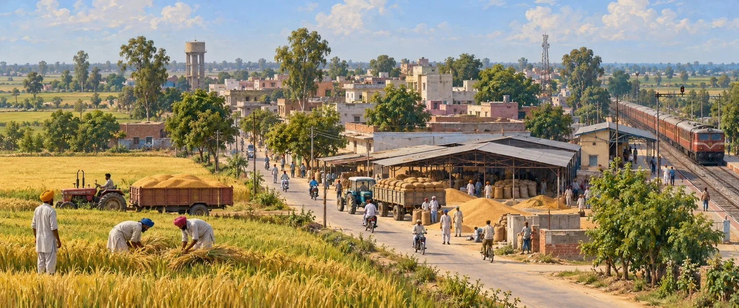
Farming carries the district. The Bet lands along the Sutlej are fertile alluvial fields, and wheat and cotton have long been the signature crops of this plain, watered by canals and tubewells. The Harike headworks, built in 1952 just below the point where the Beas joins the Sutlej at the district's northern edge, store and supply irrigation and drinking water to southern Punjab and to neighbouring Rajasthan. The grain markets of towns such as Zira, Makhu and Talwandi Bhai collect the harvest of the villages around them.
The cantonment is the second pillar of the local economy. Ferozepur Cantonment is a separate municipal town beside the city, and generations of soldiers have passed through its parade grounds, bazaars and churches. The border is the third pillar. Hussainiwala was once a working road crossing on the way toward Lahore; the crossing is closed to travellers today, but the daily flag lowering ceremony there, held jointly by India's Border Security Force and the Pakistan Rangers, keeps the frontier at the centre of the district's public life.
Places to see in Ferozepur district
Hussainiwala, a village on the Sutlej about a kilometre from the Pakistan border, holds the district's most sacred modern ground. On 23 March 1931, after Bhagat Singh, Sukhdev Thapar and Shivaram Rajguru were hanged in Lahore Central Jail, jail officials broke through the back wall of the jail and brought their bodies secretly to this riverbank, where they were cremated without any ceremony. The National Martyrs Memorial, built in 1968, marks the spot with statues of the three men. Batukeshwar Dutt, who had joined Bhagat Singh in the Assembly bombing and died in 1965, was cremated here at his own wish, as was Bhagat Singh's mother, Vidyawati. Every 23 March the Shaheedi Mela brings thousands to the memorial.
In Ferozepur Cantonment stands the Saragarhi Memorial Gurdwara, opened in 1904, with the names of 21 men carved on its walls. They were Sikh soldiers of the 36th Sikhs who, under Havildar Ishar Singh, held the signalling post of Saragarhi on the North West Frontier on 12 September 1897 against thousands of Afridi and Orakzai tribesmen, fighting to the last man rather than surrender. All 21 received the Indian Order of Merit, then the highest gallantry award open to an Indian soldier, and most of them hailed from this district. The Sikh Regiment still marks 12 September as Saragarhi Day.
The Anglo-Sikh War Memorial at Ferozeshah and the reopened hexagonal Ferozepur Fort carry the district's military centuries, from the Khalsa Army to the British arsenal. Nature keeps a memorial of its own at the northern edge, where the Beas meets the Sutlej. Harike Wetland, spread over about 8,739 hectares, was declared a wildlife sanctuary in 1982 and a Ramsar site of international importance in 1990. Winter brings large flocks of migratory birds from as far as Siberia, and rare Indus river dolphins have been sighted in its waters.
Getting to Ferozepur district
Trains serve Ferozepur Cantonment station, and roads link the headquarters town with Ludhiana and Chandigarh to the east and with Bathinda and Fazilka to the south. The district's sights make an easy circuit: Hussainiwala and the Saragarhi Memorial are in and around the headquarters town, Ferozeshah and Mudki lie a short drive out on the plain, and Harike sits at the northern tip where the two rivers meet. The nearest large airport is at Amritsar. Most visitors come for a morning at the martyrs' memorial and stay for the flag lowering ceremony at the border in the evening.
ਫ਼ਿਰੋਜ਼ਪੁਰ ਜ਼ਿਲ੍ਹਾ ਕਿੱਥੇ ਹੈ?
ਫ਼ਿਰੋਜ਼ਪੁਰ ਭਾਰਤ ਦੇ ਪੰਜਾਬ ਸੂਬੇ ਦੇ ਮਾਲਵਾ ਖੇਤਰ ਦਾ ਇੱਕ ਸਰਹੱਦੀ ਜ਼ਿਲ੍ਹਾ ਹੈ। ਇਹ ਸਤਲੁਜ ਦਰਿਆ ਦੇ ਪੂਰਬੀ ਕੰਢੇ ਉੱਤੇ ਵਸਿਆ ਹੈ ਅਤੇ ਇਸ ਦੇ ਪੱਛਮ ਵੱਲ ਪਾਕਿਸਤਾਨ ਹੈ। ਇਸ ਦਾ ਸਦਰ ਮੁਕਾਮ ਫ਼ਿਰੋਜ਼ਪੁਰ ਸ਼ਹਿਰ ਹੈ, ਅਤੇ ਇਹ ਸਭ ਤੋਂ ਵੱਧ ਹੁਸੈਨੀਵਾਲਾ ਲਈ ਜਾਣਿਆ ਜਾਂਦਾ ਹੈ, ਜਿੱਥੇ 1931 ਵਿੱਚ ਭਗਤ ਸਿੰਘ, ਰਾਜਗੁਰੂ ਅਤੇ ਸੁਖਦੇਵ ਦਾ ਸਸਕਾਰ ਕੀਤਾ ਗਿਆ ਸੀ।
ਇਹ ਜ਼ਮੀਨ ਸਮਤਲ ਜਲੋੜ ਮੈਦਾਨ ਹੈ ਜੋ ਉੱਤਰ ਪੂਰਬ ਤੋਂ ਦੱਖਣ ਪੱਛਮ ਵੱਲ ਹੌਲੀ ਹੌਲੀ ਢਲਦਾ ਹੈ, ਅਤੇ ਸਤਲੁਜ ਇਸ ਦੇ ਉੱਤਰੀ ਅਤੇ ਪੱਛਮੀ ਪਾਸਿਆਂ ਨਾਲ ਵਗਦਾ ਹੈ। ਜ਼ਿਲ੍ਹਾ ਪ੍ਰਸ਼ਾਸਨ ਦਰਿਆ ਦੇ ਨਾਲ ਨਾਲ ਚੱਲਦੀਆਂ ਪੱਟੀਆਂ ਦਾ ਜ਼ਿਕਰ ਕਰਦਾ ਹੈ: ਕੰਢੇ ਨਾਲ ਲੱਗਦੀ ਨੀਵੀਂ ਬੇਟ ਜ਼ਮੀਨ, ਜਿਸ ਨੂੰ ਹਿੱਠਾੜ ਕਿਹਾ ਜਾਂਦਾ ਹੈ, ਜਿੱਥੇ ਗੂੜ੍ਹੀ ਜਲੋੜ ਮਿੱਟੀ ਹੈ, ਅਤੇ ਅੰਦਰ ਵੱਲ ਹਲਕੀਆਂ ਰੇਤਲੀਆਂ ਰੋਹੀ ਅਤੇ ਮੁੱਖੀ ਮੈਦਾਨੀ ਜ਼ਮੀਨਾਂ, ਜਿੱਥੇ ਖੂਹਾਂ ਦਾ ਪਾਣੀ ਖਾਰਾ ਹੋ ਸਕਦਾ ਹੈ। ਮਿੱਟੀ ਦਾ ਲਗਭਗ 69 ਫ਼ੀਸਦੀ ਹਿੱਸਾ ਭੂਰੀ ਜਲੋੜ ਮਿੱਟੀ ਹੈ ਅਤੇ ਬਾਕੀ ਮਾਰੂਥਲੀ ਮਿੱਟੀ ਹੈ। ਪੱਛਮ ਵੱਲ ਪਾਕਿਸਤਾਨ, ਦੱਖਣ ਪੱਛਮ ਵੱਲ ਫ਼ਾਜ਼ਿਲਕਾ ਜ਼ਿਲ੍ਹਾ, ਦੱਖਣ ਵੱਲ ਮੁਕਤਸਰ ਅਤੇ ਪੂਰਬ ਵੱਲ ਫ਼ਰੀਦਕੋਟ ਅਤੇ ਮੋਗਾ ਜ਼ਿਲ੍ਹੇ ਲੱਗਦੇ ਹਨ।
ਇੱਥੇ ਦਾ ਮੌਸਮ ਖੁਸ਼ਕ ਹੈ ਅਤੇ ਸਾਲ ਦੇ ਦੋਵੇਂ ਸਿਰਿਆਂ ਉੱਤੇ ਸਖ਼ਤ ਹੈ। ਗਰਮੀਆਂ ਬਹੁਤ ਤੇਜ਼ ਹੁੰਦੀਆਂ ਹਨ, ਜੂਨ ਸਭ ਤੋਂ ਗਰਮ ਮਹੀਨਾ ਹੈ ਅਤੇ ਦਿਨ ਦਾ ਤਾਪਮਾਨ ਲਗਭਗ 47 ਡਿਗਰੀ ਸੈਲਸੀਅਸ ਤੱਕ ਪਹੁੰਚ ਸਕਦਾ ਹੈ, ਜਦੋਂ ਕਿ ਜਨਵਰੀ ਦੀਆਂ ਰਾਤਾਂ ਜੰਮਣ ਬਿੰਦੂ ਦੇ ਨੇੜੇ ਤੱਕ ਠੰਢੀਆਂ ਹੋ ਸਕਦੀਆਂ ਹਨ। ਸਾਲ ਦੀ ਲਗਭਗ 70 ਫ਼ੀਸਦੀ ਬਾਰਸ਼ ਦੱਖਣ ਪੱਛਮੀ ਮੌਨਸੂਨ ਨਾਲ ਜੁਲਾਈ ਤੋਂ ਸਤੰਬਰ ਦੇ ਮੱਧ ਵਿਚਕਾਰ ਪੈਂਦੀ ਹੈ।
ਸਦਰ ਮੁਕਾਮ ਫ਼ਿਰੋਜ਼ਪੁਰ ਸ਼ਹਿਰ ਹੈ, ਅਤੇ ਜ਼ਿਲ੍ਹਾ ਤਿੰਨ ਤਹਿਸੀਲਾਂ ਵਿੱਚ ਵੰਡਿਆ ਹੋਇਆ ਹੈ: ਫ਼ਿਰੋਜ਼ਪੁਰ, ਜ਼ੀਰਾ ਅਤੇ ਗੁਰੂ ਹਰ ਸਹਾਇ, ਅਤੇ ਇਨ੍ਹਾਂ ਦੇ ਹੇਠਾਂ ਛੇ ਵਿਕਾਸ ਬਲਾਕ ਹਨ: ਫ਼ਿਰੋਜ਼ਪੁਰ, ਘੱਲ ਖੁਰਦ, ਗੁਰੂ ਹਰ ਸਹਾਇ, ਮੱਖੂ, ਮਮਦੋਟ ਅਤੇ ਜ਼ੀਰਾ। ਜ਼ਿਲ੍ਹਾ ਪ੍ਰਸ਼ਾਸਨ 689 ਪਿੰਡ ਅਤੇ ਅੱਠ ਨਗਰ ਕੌਂਸਲ ਕਸਬੇ ਗਿਣਦਾ ਹੈ, ਜਿਨ੍ਹਾਂ ਵਿੱਚ ਫ਼ਿਰੋਜ਼ਪੁਰ ਸ਼ਹਿਰ ਅਤੇ ਫ਼ਿਰੋਜ਼ਪੁਰ ਛਾਉਣੀ ਦੇ ਨਾਲ ਜ਼ੀਰਾ, ਗੁਰੂ ਹਰ ਸਹਾਇ, ਮੱਖੂ, ਤਲਵੰਡੀ ਭਾਈ, ਮੁਦਕੀ ਅਤੇ ਮਮਦੋਟ ਸ਼ਾਮਲ ਹਨ। 2011 ਤੱਕ ਇਹ ਜ਼ਿਲ੍ਹਾ ਕਾਫ਼ੀ ਵੱਡਾ ਸੀ: ਫ਼ਾਜ਼ਿਲਕਾ, ਅਬੋਹਰ ਅਤੇ ਜਲਾਲਾਬਾਦ ਤਹਿਸੀਲ ਦਾ ਕੁਝ ਹਿੱਸਾ ਵੱਖ ਕਰ ਕੇ ਫ਼ਾਜ਼ਿਲਕਾ ਜ਼ਿਲ੍ਹਾ ਬਣਾਇਆ ਗਿਆ, ਅਤੇ ਜਲਾਲਾਬਾਦ ਦਾ ਬਾਕੀ ਹਿੱਸਾ ਨਵੀਂ ਗੁਰੂ ਹਰ ਸਹਾਇ ਤਹਿਸੀਲ ਬਣ ਗਿਆ।
ਇੱਕ ਸਰਹੱਦੀ ਕਸਬੇ ਤੋਂ ਛਾਉਣੀ ਤੱਕ
ਇਸ ਦੇ ਨਾਂ ਬਾਰੇ ਦੋ ਪਰੰਪਰਾਵਾਂ ਹਨ। ਇੱਕ ਪਰੰਪਰਾ ਇਸ ਨੂੰ ਦਿੱਲੀ ਦੇ ਸੁਲਤਾਨ ਫ਼ਿਰੋਜ਼ ਸ਼ਾਹ ਤੁਗ਼ਲਕ ਨਾਲ ਜੋੜਦੀ ਹੈ, ਜਿਸ ਨੇ 1351 ਤੋਂ 1388 ਤੱਕ ਰਾਜ ਕੀਤਾ, ਅਤੇ ਫ਼ਿਰੋਜ਼ਪੁਰ ਦਾ ਅਰਥ ਫ਼ਿਰੋਜ਼ ਦਾ ਸ਼ਹਿਰ ਮੰਨਦੀ ਹੈ। ਦੂਜੀ ਪਰੰਪਰਾ ਇਸ ਨੂੰ ਸੋਲ੍ਹਵੀਂ ਸਦੀ ਦੇ ਇੱਕ ਭੱਟੀ ਸਰਦਾਰ ਫ਼ਿਰੋਜ਼ ਖ਼ਾਨ ਨਾਲ ਜੋੜਦੀ ਹੈ। ਇਸ ਵਿੱਚ ਕੋਈ ਸ਼ੱਕ ਨਹੀਂ ਕਿ ਇਸ ਥਾਂ ਦੀ ਖਿੱਚ ਹਮੇਸ਼ਾ ਇਸ ਦੀ ਸਥਿਤੀ ਰਹੀ ਹੈ: ਲਾਹੌਰ ਰਾਜ ਦੇ ਕਿਨਾਰੇ ਉੱਤੇ ਸਤਲੁਜ ਦਾ ਲਾਂਘਾ ਕਸਬਾ, ਜਿਸ ਉੱਤੇ ਹਰ ਉਸ ਤਾਕਤ ਦੀ ਨਜ਼ਰ ਰਹੀ ਜਿਸ ਕੋਲ ਪੰਜਾਬ ਸੀ ਜਾਂ ਜੋ ਪੰਜਾਬ ਚਾਹੁੰਦੀ ਸੀ।
1763 ਵਿੱਚ ਭੰਗੀ ਮਿਸਲ ਦੀਆਂ ਫ਼ੌਜਾਂ ਨੇ ਗੁੱਜਰ ਸਿੰਘ ਦੀ ਅਗਵਾਈ ਹੇਠ ਸਤਲੁਜ ਪਾਰ ਕਰ ਕੇ ਫ਼ਿਰੋਜ਼ਪੁਰ ਉੱਤੇ ਕਬਜ਼ਾ ਕੀਤਾ, ਅਤੇ ਕਸਬਾ ਮਿਸਲਾਂ ਦੇ ਸਿੱਖ ਸੰਸਾਰ ਵਿੱਚ ਆ ਗਿਆ। ਬਾਅਦ ਵਿੱਚ ਇਹ ਧੰਨਾ ਸਿੰਘ ਕੋਲ ਆਇਆ, ਜਿਸ ਨੇ ਅੰਗਰੇਜ਼ਾਂ ਦੀ ਸਰਪ੍ਰਸਤੀ ਸਵੀਕਾਰ ਕਰ ਲਈ, ਅਤੇ ਇਸੇ ਚੋਣ ਨੇ ਮਹਾਰਾਜਾ ਰਣਜੀਤ ਸਿੰਘ ਨੂੰ ਇਸ ਥਾਂ ਤੋਂ ਦਰਿਆ ਦੇ ਪੂਰਬ ਵੱਲ ਵਧਣ ਤੋਂ ਰੋਕਿਆ। ਜਦੋਂ ਧੰਨਾ ਸਿੰਘ ਦੀ ਵਿਧਵਾ ਲਛਮਣ ਕੌਰ 1835 ਵਿੱਚ ਬਿਨਾਂ ਵਾਰਸ ਦੇ ਚਲਾਣਾ ਕਰ ਗਈ, ਤਾਂ ਫ਼ਿਰੋਜ਼ਪੁਰ ਦੀ ਜਗੀਰ ਸਿੱਧੀ ਅੰਗਰੇਜ਼ਾਂ ਦੇ ਕਬਜ਼ੇ ਵਿੱਚ ਆ ਗਈ।
ਅੰਗਰੇਜ਼ਾਂ ਨੇ ਛੇਭੁਜੀ ਕਿਲ੍ਹੇ ਨੂੰ 1839 ਤੱਕ ਡਿਊਕ ਆਫ਼ ਵੈਲਿੰਗਟਨ ਦੇ ਹੁਕਮਾਂ ਉੱਤੇ ਛਾਉਣੀ ਵਿੱਚ ਬਦਲ ਦਿੱਤਾ, ਅਤੇ ਫ਼ਿਰੋਜ਼ਪੁਰ ਭਾਰਤ ਦੀਆਂ ਸਭ ਤੋਂ ਪੁਰਾਣੀਆਂ ਛਾਉਣੀਆਂ ਵਿੱਚੋਂ ਇੱਕ ਬਣ ਗਿਆ। ਕਿਲ੍ਹਾ 1858 ਵਿੱਚ ਹਥਿਆਰਘਰ ਬਣਿਆ ਅਤੇ ਫਿਰ ਬੰਦੂਕਾਂ, ਗੋਲਾ ਬਾਰੂਦ ਅਤੇ ਸਿਖਲਾਈ ਪ੍ਰਾਪਤ ਜਾਨਵਰਾਂ ਦੀ ਸਪਲਾਈ ਵਾਲਾ ਅੱਡਾ ਬਣਿਆ ਰਿਹਾ, ਜਦੋਂ ਤੱਕ 1941 ਵਿੱਚ ਗੋਲਾ ਬਾਰੂਦ ਕਸੂਬੇਗੂ ਨਹੀਂ ਭੇਜ ਦਿੱਤਾ ਗਿਆ। ਫ਼ੌਜ ਦੀ ਗੋਲਡਨ ਐਰੋ ਡਵੀਜ਼ਨ ਨੇ ਹੁਣ ਲਗਭਗ 200 ਸਾਲਾਂ ਵਿੱਚ ਪਹਿਲੀ ਵਾਰ ਕਿਲ੍ਹਾ ਜਨਤਾ ਲਈ ਖੋਲ੍ਹ ਦਿੱਤਾ ਹੈ, ਅਤੇ ਪੁਰਾਣੇ ਕੋਟ ਵਾਲੇ ਸ਼ਹਿਰ ਦੇ ਦਸ ਦਰਵਾਜ਼ੇ ਅੱਜ ਵੀ ਸਦਰ ਮੁਕਾਮ ਵਾਲੇ ਕਸਬੇ ਨੂੰ ਪੰਜਾਬ ਦੇ ਹਰ ਹੋਰ ਕਸਬੇ ਤੋਂ ਵੱਖਰੀ ਪਛਾਣ ਦਿੰਦੇ ਹਨ।
ਫ਼ਿਰੋਜ਼ਪੁਰ ਦੀ ਮਿੱਟੀ ਉੱਤੇ ਪਹਿਲਾ ਐਂਗਲੋ-ਸਿੱਖ ਯੁੱਧ
1845 ਅਤੇ 1846 ਦਾ ਪਹਿਲਾ ਐਂਗਲੋ-ਸਿੱਖ ਯੁੱਧ ਮੁੱਖ ਤੌਰ ਉੱਤੇ ਇਸੇ ਜ਼ਿਲ੍ਹੇ ਦੀ ਮਿੱਟੀ ਉੱਤੇ ਲੜਿਆ ਗਿਆ। ਦਸੰਬਰ 1845 ਵਿੱਚ ਸਿੱਖ ਖਾਲਸਾ ਫ਼ੌਜ ਦੇ ਸਤਲੁਜ ਪਾਰ ਕਰਨ ਤੋਂ ਬਾਅਦ, ਫ਼ੌਜਾਂ 18 ਦਸੰਬਰ 1845 ਨੂੰ ਮੁਦਕੀ ਵਿਖੇ ਅਤੇ ਫਿਰ 21 ਅਤੇ 22 ਦਸੰਬਰ ਨੂੰ ਫ਼ਿਰੋਜ਼ਸ਼ਾਹ ਵਿਖੇ ਟਕਰਾਈਆਂ, ਜਿੱਥੇ ਅੰਗਰੇਜ਼ ਮੁਸ਼ਕਲ ਨਾਲ ਹੀ ਟਿਕੇ ਰਹੇ। ਜਨਵਰੀ 1846 ਵਿੱਚ ਬੱਦੋਵਾਲ ਅਤੇ ਅਲੀਵਾਲ ਵਿਖੇ ਲੜਾਈਆਂ ਹੋਈਆਂ, ਅਤੇ ਯੁੱਧ ਦਾ ਫ਼ੈਸਲਾ 10 ਫਰਵਰੀ 1846 ਨੂੰ ਸਬਰਾਓਂ ਵਿਖੇ ਹੋਇਆ। ਮਾਰਚ 1846 ਦੀ ਲਾਹੌਰ ਸੰਧੀ ਨੇ ਸਿੱਖ ਫ਼ੌਜ ਘਟਾ ਦਿੱਤੀ, ਜੰਗੀ ਹਰਜ਼ਾਨਾ ਲਾਇਆ ਅਤੇ ਸਤਲੁਜ ਦੇ ਪੂਰਬ ਵਾਲੀ ਜ਼ਮੀਨ ਅੰਗਰੇਜ਼ਾਂ ਦੇ ਕਬਜ਼ੇ ਹੇਠ ਕਰ ਦਿੱਤੀ।
ਫ਼ਿਰੋਜ਼ਸ਼ਾਹ ਵਿਖੇ ਪੰਜਾਬ ਸਰਕਾਰ ਦੀ ਐਂਗਲੋ-ਸਿੱਖ ਯੁੱਧ ਯਾਦਗਾਰ, ਜੋ ਰਾਜਸਥਾਨ ਨਹਿਰ ਅਤੇ ਸਰਹਿੰਦ ਫੀਡਰ ਦੇ ਨੇੜੇ ਤਿੰਨ ਮੰਜ਼ਿਲਾ ਇਮਾਰਤ ਹੈ, ਮੁਦਕੀ, ਫ਼ਿਰੋਜ਼ਸ਼ਾਹ ਅਤੇ ਸਬਰਾਓਂ ਦੇ ਸਿੱਖ ਸੈਨਿਕਾਂ ਦਾ ਸਨਮਾਨ ਕਰਦੀ ਹੈ, ਨਾਲ ਹੀ 1849 ਦੇ ਦੂਜੇ ਯੁੱਧ ਦੀ ਚਿੱਲਿਆਂਵਾਲਾ ਲੜਾਈ ਦੇ ਸੈਨਿਕਾਂ ਦਾ ਵੀ। ਇਸ ਦੀ ਹੇਠਲੀ ਮੰਜ਼ਿਲ ਦੇ ਅਜਾਇਬਘਰ ਵਿੱਚ ਉਨ੍ਹਾਂ ਯੁੱਧਾਂ ਦੇ ਹਥਿਆਰ ਰੱਖੇ ਹਨ। ਇਸ ਮੈਦਾਨ ਦੇ ਪਿੰਡਾਂ ਦੇ ਨਾਂ, ਮੁਦਕੀ, ਫ਼ਿਰੋਜ਼ਸ਼ਾਹ ਅਤੇ ਸਬਰਾਓਂ, ਅੱਜ ਵੀ ਉਹ ਸੰਖੇਪ ਨਾਂ ਹਨ ਜਿਨ੍ਹਾਂ ਨਾਲ ਸਿੱਖ ਸਾਮਰਾਜ ਦੇ ਪਤਨ ਨੂੰ ਯਾਦ ਕੀਤਾ ਜਾਂਦਾ ਹੈ।
ਸਤਲੁਜ ਦੇ ਮੈਦਾਨ ਦੇ ਲੋਕ
2011 ਦੀ ਮਰਦਮਸ਼ੁਮਾਰੀ ਵੰਡ ਤੋਂ ਕੁਝ ਮਹੀਨੇ ਪਹਿਲਾਂ ਹੋਈ ਸੀ, ਅਤੇ ਇਸ ਵਿੱਚ ਅਣਵੰਡੇ ਜ਼ਿਲ੍ਹੇ ਵਿੱਚ 5,305 ਵਰਗ ਕਿਲੋਮੀਟਰ ਉੱਤੇ 2,029,074 ਲੋਕ ਗਿਣੇ ਗਏ, ਭਾਵ ਘਣਤਾ 382 ਲੋਕ ਪ੍ਰਤੀ ਵਰਗ ਕਿਲੋਮੀਟਰ ਸੀ। ਅੱਜ ਦੀਆਂ ਹੱਦਾਂ ਅਨੁਸਾਰ ਗਿਣਿਆਂ, ਜ਼ਿਲ੍ਹੇ ਵਿੱਚ 2,406.84 ਵਰਗ ਕਿਲੋਮੀਟਰ ਉੱਤੇ 1,001,931 ਲੋਕ ਹਨ, ਭਾਵ ਲਗਭਗ 416 ਲੋਕ ਪ੍ਰਤੀ ਵਰਗ ਕਿਲੋਮੀਟਰ। ਜ਼ਿਲ੍ਹਾ ਪ੍ਰਸ਼ਾਸਨ ਦੀ ਤਹਿਸੀਲ ਸਾਰਣੀ ਦੱਸਦੀ ਹੈ ਕਿ ਇਹ ਜ਼ਿਲ੍ਹਾ ਜ਼ਿਆਦਾਤਰ ਪੇਂਡੂ ਹੈ, ਜਿੱਥੇ ਲਗਭਗ 71.5 ਫ਼ੀਸਦੀ ਲੋਕ ਪਿੰਡਾਂ ਵਿੱਚ ਅਤੇ 28.5 ਫ਼ੀਸਦੀ ਕਸਬਿਆਂ ਵਿੱਚ ਰਹਿੰਦੇ ਹਨ।
ਮਰਦਮਸ਼ੁਮਾਰੀ ਵਿੱਚ ਸਾਖਰਤਾ ਦਰ 68.92 ਫ਼ੀਸਦੀ ਦੱਸੀ ਗਈ, ਜਿਸ ਵਿੱਚ ਮਰਦ ਸਾਖਰਤਾ 75.44 ਫ਼ੀਸਦੀ ਅਤੇ ਔਰਤ ਸਾਖਰਤਾ 61.69 ਫ਼ੀਸਦੀ ਸੀ, ਅਤੇ ਲਿੰਗ ਅਨੁਪਾਤ ਹਰ 1,000 ਮਰਦਾਂ ਪਿੱਛੇ 893 ਔਰਤਾਂ ਸੀ। ਮੌਜੂਦਾ ਜ਼ਿਲ੍ਹੇ ਵਿੱਚ ਸਿੱਖ ਆਬਾਦੀ ਦਾ ਸਭ ਤੋਂ ਵੱਡਾ ਹਿੱਸਾ ਹਨ, 68.59 ਫ਼ੀਸਦੀ, ਉਸ ਤੋਂ ਬਾਅਦ ਹਿੰਦੂ 28.83 ਫ਼ੀਸਦੀ ਅਤੇ ਈਸਾਈ 1.83 ਫ਼ੀਸਦੀ ਹਨ, ਅਤੇ ਅਨੁਸੂਚਿਤ ਜਾਤੀਆਂ ਲੋਕਾਂ ਦਾ 42.85 ਫ਼ੀਸਦੀ ਹਿੱਸਾ ਹਨ। ਪੰਜਾਬੀ ਇੱਥੇ ਦੀ ਸਰਕਾਰੀ ਭਾਸ਼ਾ ਅਤੇ ਰੋਜ਼ਾਨਾ ਜੀਵਨ ਦੀ ਭਾਸ਼ਾ ਹੈ, ਜੋ ਦੱਖਣ ਪੱਛਮੀ ਮੈਦਾਨ ਦੇ ਮਾਲਵਈ ਰੂਪ ਵਿੱਚ ਬੋਲੀ ਜਾਂਦੀ ਹੈ।
ਖੇਤੀ, ਛਾਉਣੀ ਅਤੇ ਸਰਹੱਦ
ਜ਼ਿਲ੍ਹੇ ਦਾ ਸਹਾਰਾ ਖੇਤੀ ਹੈ। ਸਤਲੁਜ ਨਾਲ ਲੱਗਦੀਆਂ ਬੇਟ ਜ਼ਮੀਨਾਂ ਉਪਜਾਊ ਜਲੋੜ ਖੇਤ ਹਨ, ਅਤੇ ਕਣਕ ਅਤੇ ਕਪਾਹ ਲੰਮੇ ਸਮੇਂ ਤੋਂ ਇਸ ਮੈਦਾਨ ਦੀਆਂ ਪਛਾਣ ਵਾਲੀਆਂ ਫ਼ਸਲਾਂ ਹਨ, ਜਿਨ੍ਹਾਂ ਨੂੰ ਨਹਿਰਾਂ ਅਤੇ ਟਿਊਬਵੈੱਲਾਂ ਨਾਲ ਪਾਣੀ ਮਿਲਦਾ ਹੈ। ਹਰੀਕੇ ਹੈੱਡਵਰਕਸ, ਜੋ 1952 ਵਿੱਚ ਜ਼ਿਲ੍ਹੇ ਦੇ ਉੱਤਰੀ ਕਿਨਾਰੇ ਉੱਤੇ ਉਸ ਥਾਂ ਦੇ ਥੋੜ੍ਹਾ ਹੇਠਾਂ ਬਣਿਆ ਜਿੱਥੇ ਬਿਆਸ ਸਤਲੁਜ ਵਿੱਚ ਮਿਲਦਾ ਹੈ, ਦੱਖਣੀ ਪੰਜਾਬ ਅਤੇ ਗੁਆਂਢੀ ਰਾਜਸਥਾਨ ਲਈ ਸਿੰਜਾਈ ਅਤੇ ਪੀਣ ਵਾਲਾ ਪਾਣੀ ਸਾਂਭਦਾ ਅਤੇ ਸਪਲਾਈ ਕਰਦਾ ਹੈ। ਜ਼ੀਰਾ, ਮੱਖੂ ਅਤੇ ਤਲਵੰਡੀ ਭਾਈ ਵਰਗੇ ਕਸਬਿਆਂ ਦੀਆਂ ਅਨਾਜ ਮੰਡੀਆਂ ਆਸ ਪਾਸ ਦੇ ਪਿੰਡਾਂ ਦੀ ਫ਼ਸਲ ਇਕੱਠੀ ਕਰਦੀਆਂ ਹਨ।
ਛਾਉਣੀ ਸਥਾਨਕ ਆਰਥਿਕਤਾ ਦਾ ਦੂਜਾ ਥੰਮ੍ਹ ਹੈ। ਫ਼ਿਰੋਜ਼ਪੁਰ ਛਾਉਣੀ ਸ਼ਹਿਰ ਦੇ ਨਾਲ ਲੱਗਦਾ ਇੱਕ ਵੱਖਰਾ ਨਗਰ ਕਸਬਾ ਹੈ, ਅਤੇ ਸੈਨਿਕਾਂ ਦੀਆਂ ਪੀੜ੍ਹੀਆਂ ਇਸ ਦੇ ਪਰੇਡ ਮੈਦਾਨਾਂ, ਬਾਜ਼ਾਰਾਂ ਅਤੇ ਗਿਰਜਾਘਰਾਂ ਵਿੱਚੋਂ ਲੰਘੀਆਂ ਹਨ। ਸਰਹੱਦ ਤੀਜਾ ਥੰਮ੍ਹ ਹੈ। ਹੁਸੈਨੀਵਾਲਾ ਕਦੇ ਲਾਹੌਰ ਵੱਲ ਜਾਂਦਾ ਕੰਮਕਾਜੀ ਸੜਕੀ ਲਾਂਘਾ ਸੀ; ਅੱਜ ਇਹ ਲਾਂਘਾ ਯਾਤਰੀਆਂ ਲਈ ਬੰਦ ਹੈ, ਪਰ ਉੱਥੇ ਰੋਜ਼ ਹੋਣ ਵਾਲੀ ਝੰਡਾ ਉਤਾਰਨ ਦੀ ਰਸਮ, ਜੋ ਭਾਰਤ ਦੀ ਸੀਮਾ ਸੁਰੱਖਿਆ ਫ਼ੌਜ ਅਤੇ ਪਾਕਿਸਤਾਨ ਰੇਂਜਰਜ਼ ਸਾਂਝੇ ਤੌਰ ਉੱਤੇ ਕਰਦੇ ਹਨ, ਸਰਹੱਦ ਨੂੰ ਜ਼ਿਲ੍ਹੇ ਦੇ ਜਨਤਕ ਜੀਵਨ ਦੇ ਕੇਂਦਰ ਵਿੱਚ ਰੱਖਦੀ ਹੈ।
ਫ਼ਿਰੋਜ਼ਪੁਰ ਜ਼ਿਲ੍ਹੇ ਵਿੱਚ ਦੇਖਣ ਵਾਲੀਆਂ ਥਾਵਾਂ
ਹੁਸੈਨੀਵਾਲਾ, ਜੋ ਪਾਕਿਸਤਾਨ ਸਰਹੱਦ ਤੋਂ ਲਗਭਗ ਇੱਕ ਕਿਲੋਮੀਟਰ ਦੂਰ ਸਤਲੁਜ ਉੱਤੇ ਵੱਸਿਆ ਪਿੰਡ ਹੈ, ਜ਼ਿਲ੍ਹੇ ਦੀ ਸਭ ਤੋਂ ਪਵਿੱਤਰ ਆਧੁਨਿਕ ਧਰਤੀ ਰੱਖਦਾ ਹੈ। 23 ਮਾਰਚ 1931 ਨੂੰ, ਭਗਤ ਸਿੰਘ, ਸੁਖਦੇਵ ਥਾਪਰ ਅਤੇ ਸ਼ਿਵਰਾਮ ਰਾਜਗੁਰੂ ਨੂੰ ਲਾਹੌਰ ਕੇਂਦਰੀ ਜੇਲ੍ਹ ਵਿੱਚ ਫਾਂਸੀ ਦਿੱਤੇ ਜਾਣ ਤੋਂ ਬਾਅਦ, ਜੇਲ੍ਹ ਅਧਿਕਾਰੀਆਂ ਨੇ ਜੇਲ੍ਹ ਦੀ ਪਿਛਲੀ ਕੰਧ ਤੋੜ ਕੇ ਉਨ੍ਹਾਂ ਦੀਆਂ ਲਾਸ਼ਾਂ ਚੁੱਪ ਚਾਪ ਇਸ ਦਰਿਆ ਕੰਢੇ ਲਿਆਂਦੀਆਂ, ਜਿੱਥੇ ਬਿਨਾਂ ਕਿਸੇ ਰਸਮ ਦੇ ਉਨ੍ਹਾਂ ਦਾ ਸਸਕਾਰ ਕਰ ਦਿੱਤਾ ਗਿਆ। 1968 ਵਿੱਚ ਬਣੀ ਰਾਸ਼ਟਰੀ ਸ਼ਹੀਦ ਯਾਦਗਾਰ ਤਿੰਨਾਂ ਦੇ ਬੁੱਤਾਂ ਨਾਲ ਉਸ ਥਾਂ ਨੂੰ ਚਿੰਨ੍ਹਿਤ ਕਰਦੀ ਹੈ। ਬਟੁਕੇਸ਼ਵਰ ਦੱਤ, ਜੋ ਅਸੈਂਬਲੀ ਬੰਬ ਕਾਂਡ ਵਿੱਚ ਭਗਤ ਸਿੰਘ ਨਾਲ ਸ਼ਾਮਲ ਸਨ ਅਤੇ 1965 ਵਿੱਚ ਚਲਾਣਾ ਕਰ ਗਏ, ਦਾ ਸਸਕਾਰ ਉਨ੍ਹਾਂ ਦੀ ਆਪਣੀ ਇੱਛਾ ਅਨੁਸਾਰ ਇੱਥੇ ਹੀ ਹੋਇਆ, ਅਤੇ ਭਗਤ ਸਿੰਘ ਦੀ ਮਾਤਾ ਵਿਦਿਆਵਤੀ ਦਾ ਵੀ ਇੱਥੇ ਹੀ ਹੋਇਆ। ਹਰ 23 ਮਾਰਚ ਸ਼ਹੀਦੀ ਮੇਲਾ ਹਜ਼ਾਰਾਂ ਲੋਕਾਂ ਨੂੰ ਯਾਦਗਾਰ ਉੱਤੇ ਲਿਆਉਂਦਾ ਹੈ।
ਫ਼ਿਰੋਜ਼ਪੁਰ ਛਾਉਣੀ ਵਿੱਚ ਸਾਰਾਗੜ੍ਹੀ ਯਾਦਗਾਰ ਗੁਰਦੁਆਰਾ ਹੈ, ਜੋ 1904 ਵਿੱਚ ਖੁੱਲ੍ਹਿਆ, ਅਤੇ ਇਸ ਦੀਆਂ ਕੰਧਾਂ ਉੱਤੇ 21 ਬੰਦਿਆਂ ਦੇ ਨਾਂ ਉੱਕਰੇ ਹੋਏ ਹਨ। ਇਹ 36ਵੀਂ ਸਿੱਖ ਰੈਜੀਮੈਂਟ ਦੇ ਸਿੱਖ ਸੈਨਿਕ ਸਨ, ਜਿਨ੍ਹਾਂ ਨੇ ਹੌਲਦਾਰ ਈਸ਼ਰ ਸਿੰਘ ਦੀ ਅਗਵਾਈ ਹੇਠ 12 ਸਤੰਬਰ 1897 ਨੂੰ ਉੱਤਰ ਪੱਛਮੀ ਸਰਹੱਦ ਉੱਤੇ ਸਾਰਾਗੜ੍ਹੀ ਦੀ ਸਿਗਨਲ ਚੌਂਕੀ ਹਜ਼ਾਰਾਂ ਅਫ਼ਰੀਦੀ ਅਤੇ ਓਰਕਜ਼ਈ ਕਬੀਲਿਆਂ ਵਾਲਿਆਂ ਸਾਹਮਣੇ ਸੰਭਾਲੀ, ਅਤੇ ਹਥਿਆਰ ਸੁੱਟਣ ਦੀ ਬਜਾਏ ਆਖਰੀ ਬੰਦੇ ਤੱਕ ਲੜਦੇ ਰਹੇ। ਸਾਰੇ 21 ਸੈਨਿਕਾਂ ਨੂੰ ਇੰਡੀਅਨ ਆਰਡਰ ਆਫ਼ ਮੈਰਿਟ ਮਿਲਿਆ, ਜੋ ਉਸ ਸਮੇਂ ਕਿਸੇ ਭਾਰਤੀ ਸੈਨਿਕ ਨੂੰ ਮਿਲਣ ਵਾਲਾ ਸਭ ਤੋਂ ਵੱਡਾ ਬਹਾਦਰੀ ਸਨਮਾਨ ਸੀ, ਅਤੇ ਉਨ੍ਹਾਂ ਵਿੱਚੋਂ ਜ਼ਿਆਦਾਤਰ ਇਸੇ ਜ਼ਿਲ੍ਹੇ ਦੇ ਸਨ। ਸਿੱਖ ਰੈਜੀਮੈਂਟ ਅੱਜ ਵੀ 12 ਸਤੰਬਰ ਨੂੰ ਸਾਰਾਗੜ੍ਹੀ ਦਿਵਸ ਵਜੋਂ ਮਨਾਉਂਦੀ ਹੈ।
ਫ਼ਿਰੋਜ਼ਸ਼ਾਹ ਵਿਖੇ ਐਂਗਲੋ-ਸਿੱਖ ਯੁੱਧ ਯਾਦਗਾਰ ਅਤੇ ਮੁੜ ਖੁੱਲ੍ਹਿਆ ਛੇਭੁਜੀ ਫ਼ਿਰੋਜ਼ਪੁਰ ਕਿਲ੍ਹਾ ਜ਼ਿਲ੍ਹੇ ਦੀਆਂ ਫ਼ੌਜੀ ਸਦੀਆਂ ਨੂੰ ਸਾਂਭਦੇ ਹਨ, ਖਾਲਸਾ ਫ਼ੌਜ ਤੋਂ ਲੈ ਕੇ ਅੰਗਰੇਜ਼ਾਂ ਦੇ ਹਥਿਆਰਘਰ ਤੱਕ। ਕੁਦਰਤ ਨੇ ਆਪਣੀ ਯਾਦਗਾਰ ਉੱਤਰੀ ਕਿਨਾਰੇ ਉੱਤੇ ਰੱਖੀ ਹੈ, ਜਿੱਥੇ ਬਿਆਸ ਸਤਲੁਜ ਵਿੱਚ ਮਿਲਦਾ ਹੈ। ਹਰੀਕੇ ਝੀਲ, ਜੋ ਲਗਭਗ 8,739 ਹੈਕਟੇਅਰ ਵਿੱਚ ਫੈਲੀ ਹੈ, 1982 ਵਿੱਚ ਜੰਗਲੀ ਜੀਵ ਰੱਖ ਐਲਾਨੀ ਗਈ ਅਤੇ 1990 ਵਿੱਚ ਅੰਤਰਰਾਸ਼ਟਰੀ ਮਹੱਤਤਾ ਵਾਲੀ ਰਾਮਸਰ ਥਾਂ ਬਣੀ। ਸਰਦੀਆਂ ਵਿੱਚ ਸਾਇਬੇਰੀਆ ਜਿੰਨੀ ਦੂਰੋਂ ਪਰਵਾਸੀ ਪੰਛੀਆਂ ਦੇ ਵੱਡੇ ਝੁੰਡ ਆਉਂਦੇ ਹਨ, ਅਤੇ ਇਸ ਦੇ ਪਾਣੀਆਂ ਵਿੱਚ ਦੁਰਲੱਭ ਸਿੰਧ ਦਰਿਆਈ ਡੌਲਫਿਨ ਵੀ ਦੇਖੀਆਂ ਗਈਆਂ ਹਨ।
ਫ਼ਿਰੋਜ਼ਪੁਰ ਜ਼ਿਲ੍ਹੇ ਤੱਕ ਕਿਵੇਂ ਪਹੁੰਚੀਏ
ਰੇਲ ਗੱਡੀਆਂ ਫ਼ਿਰੋਜ਼ਪੁਰ ਛਾਉਣੀ ਸਟੇਸ਼ਨ ਉੱਤੇ ਰੁਕਦੀਆਂ ਹਨ, ਅਤੇ ਸੜਕਾਂ ਸਦਰ ਮੁਕਾਮ ਵਾਲੇ ਕਸਬੇ ਨੂੰ ਪੂਰਬ ਵੱਲ ਲੁਧਿਆਣਾ ਅਤੇ ਚੰਡੀਗੜ੍ਹ ਨਾਲ ਅਤੇ ਦੱਖਣ ਵੱਲ ਬਠਿੰਡਾ ਅਤੇ ਫ਼ਾਜ਼ਿਲਕਾ ਨਾਲ ਜੋੜਦੀਆਂ ਹਨ। ਜ਼ਿਲ੍ਹੇ ਦੀਆਂ ਦੇਖਣ ਵਾਲੀਆਂ ਥਾਵਾਂ ਆਸਾਨ ਚੱਕਰ ਵਿੱਚ ਆਉਂਦੀਆਂ ਹਨ: ਹੁਸੈਨੀਵਾਲਾ ਅਤੇ ਸਾਰਾਗੜ੍ਹੀ ਯਾਦਗਾਰ ਸਦਰ ਮੁਕਾਮ ਵਾਲੇ ਕਸਬੇ ਵਿੱਚ ਅਤੇ ਇਸ ਦੇ ਆਸ ਪਾਸ ਹਨ, ਫ਼ਿਰੋਜ਼ਸ਼ਾਹ ਅਤੇ ਮੁਦਕੀ ਮੈਦਾਨ ਵਿੱਚ ਥੋੜ੍ਹੀ ਦੂਰੀ ਉੱਤੇ ਹਨ, ਅਤੇ ਹਰੀਕੇ ਉੱਤਰੀ ਸਿਰੇ ਉੱਤੇ ਹੈ ਜਿੱਥੇ ਦੋਵੇਂ ਦਰਿਆ ਮਿਲਦੇ ਹਨ। ਸਭ ਤੋਂ ਨੇੜਲਾ ਵੱਡਾ ਹਵਾਈ ਅੱਡਾ ਅੰਮ੍ਰਿਤਸਰ ਵਿਖੇ ਹੈ। ਜ਼ਿਆਦਾਤਰ ਸੈਲਾਨੀ ਸਵੇਰੇ ਸ਼ਹੀਦਾਂ ਦੀ ਯਾਦਗਾਰ ਉੱਤੇ ਆਉਂਦੇ ਹਨ ਅਤੇ ਸ਼ਾਮ ਨੂੰ ਸਰਹੱਦ ਉੱਤੇ ਝੰਡਾ ਉਤਾਰਨ ਦੀ ਰਸਮ ਲਈ ਰੁਕਦੇ ਹਨ।
Landmarks


People from Ferozepur

Nearby



Ferozepur in the news
All stories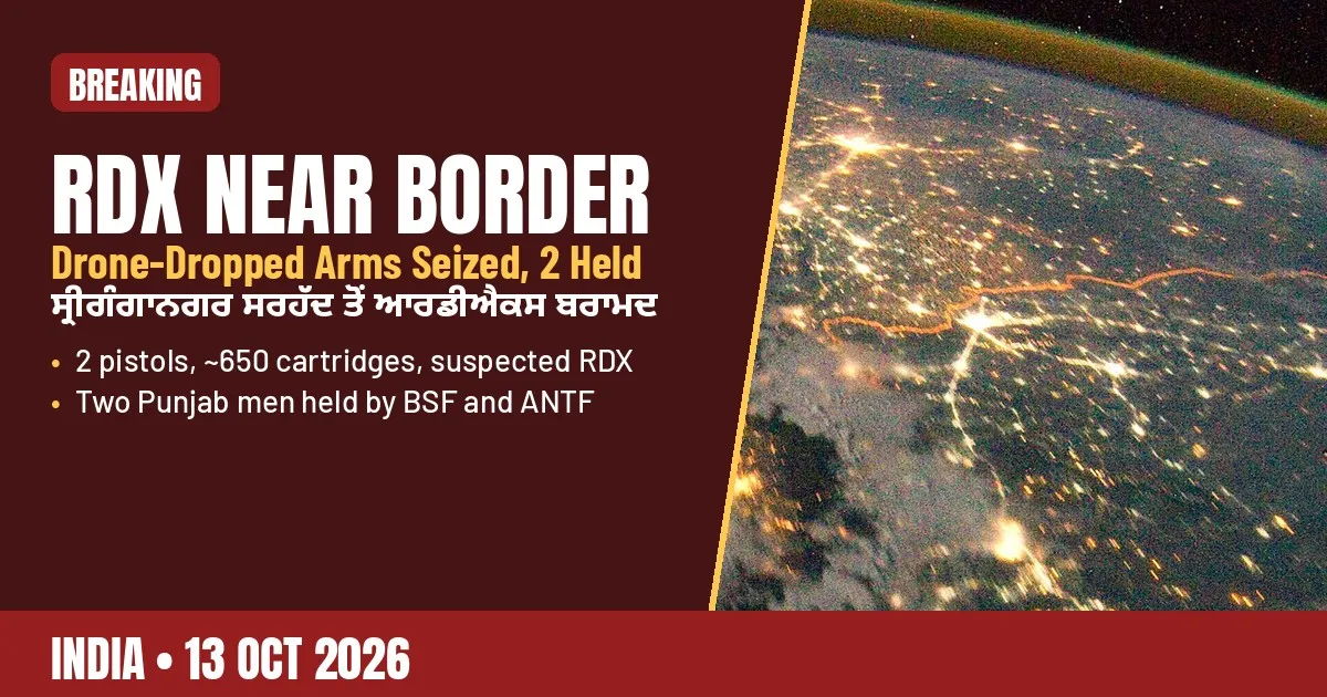 RDX, Pistols Dropped by Drone Near Rajasthan Border; Two Punjab Men Heldਰਾਜਸਥਾਨ ਸਰਹੱਦ ਨੇੜੇ ਡਰੋਨ ਨਾਲ ਸੁੱਟੇ ਆਰਡੀਐਕਸ, ਪਿਸਤੌਲ ਬਰਾਮਦ; ਪੰਜਾਬ ਦੇ ਦੋ ਨੌਜਵਾਨ ਕਾਬੂ
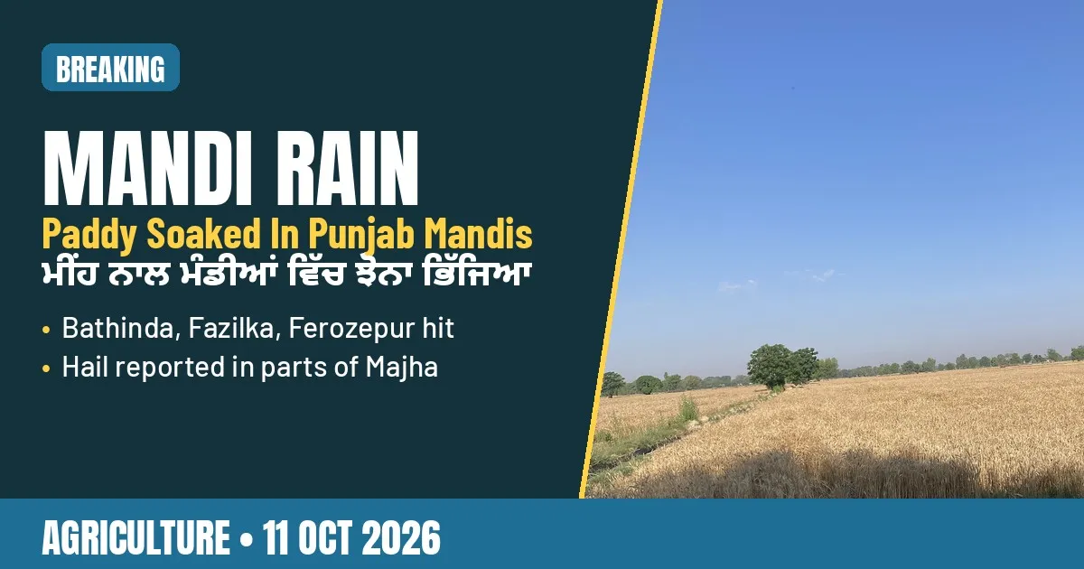 Rain Soaks Paddy at Punjab Mandis: Bathinda, Fazilka, Ferozepur Hitਮੀਂਹ ਨਾਲ ਪੰਜਾਬ ਦੀਆਂ ਮੰਡੀਆਂ ਵਿੱਚ ਝੋਨਾ ਭਿੱਜਿਆ: ਬਠਿੰਡਾ, ਫ਼ਾਜ਼ਿਲਕਾ, ਫ਼ਿਰੋਜ਼ਪੁਰ ਪ੍ਰਭਾਵਿਤ
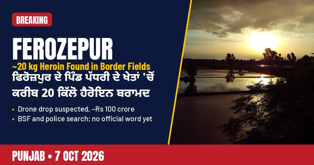 About 20 kg Heroin Reportedly Found in Ferozepur Fields Near Padhriਫਿਰੋਜ਼ਪੁਰ ਦੇ ਪੱਧਰੀ ਨੇੜੇ ਖੇਤਾਂ 'ਚੋਂ ਕਰੀਬ 20 ਕਿੱਲੋ ਹੈਰੋਇਨ ਮਿਲਣ ਦੀ ਖ਼ਬਰ
All places in Ferozepur district
619 places in 3 tehsils · 610 villages
Tehsils of Ferozepur
- Achhewalaਅਛੇਵਾਲਾ
- Ahmad Dhandiਅਹਮਡ ਧਂਡੀ
- Akbarwalaਅਕਬਰਵਾਲਾ
- Aku Mastu Keਅਕੁ ਮਸਟੁ ਕੇ
- Akuwalaਅਕੁਵਾਲਾ
- Ala Dhuttaਅਲਾ ਧੁੱਟਾ
- Alewalaਅਲੇਵਾਲਾ
- Alewalaਅਲੇਵਾਲਾ
- Alfookeਅਲਫੂਕੇ
- Alike Jhungianਅਲਿਕੇ ਝੁਂਗਿਆਂ
- Alipurਅਲੀਪੁਰ
- Aliwalaਅਲੀਵਾਲਾ
- Amargarh Bandianਅਮਰਗੜ੍ਹ ਬਂਡਿਆਂ
- Ambarharਅਂਬਰਹਰ
- Aminwalaਅਮੀਨਵਾਲਾ
- Amir Shahwalaਅਮਿਰ ਸ਼ਾਹਵਾਲਾ
- Anglo-Sikh War Memorial, Ferozeshahਐਂਗਲੋ-ਸਿੱਖ ਜੰਗ ਯਾਦਗਾਰ, ਫਿਰੋਜ਼ਸ਼ਾਹ
- Arazi Katoriaਅਰਜ਼ੀ ਕਟੋਰਿਆ
- Arazi Sabrahਅਰਜ਼ੀ ਸਬਰਹ
- Arif Keਅਰਿਫ ਕੇ
- Asafwalaਅਸਫਵਾਲਾ
- Asalਅਸਲ
- Ashiekeਅਸ਼ਿਏਕੇ
- Asman Randhawaਅਸਮਨ ਰੰਧਾਵਾ
- Attariਅਟਾਰੀ
- Atuwala Hitharਅਟੁਵਾਲਾ ਹਿਠਾੜ
- Atuwala Uttarਅਟੁਵਾਲਾ ਉੱਤਰ
- Aulakeਔਲਕੇ
- Aulakh (460ਔਲਖ
- Awanਅਵਾਨ
- Awanਅਵਨ
- Badhni Gulab Singhਬਧਨੀ ਗੁਲਬ ਸਿੰਘ
- Badhni Jaimal Singhਬਧਨੀ ਜੈਮਲ ਸਿੰਘ
- Bage Ke Pipalਬਗੇ ਕੇ ਪਿਪਲ
- Baggewalaਬੱਗੇਵਾਲਾ
- Baggi Patni Alias Mohkamwalaਬੱਗੀ ਪਟਨੀ ਅਲਿਆਸ ਮੋਹਕਮਵਾਲਾ
- Bagguwalaਬੱਗੁਵਾਲਾ
- Baghel Singhwalaਬਘੇਲ ਸਿੰਘਵਾਲਾ
- Baghelwalaਬਘੇਲਵਾਲਾ
- Baghewalaਬਘੇਵਾਲਾ
- Baghuwalaਬਘੁਵਾਲਾ
- Bahadurwalaਬਹਾਦਰਵਾਲਾ
- Baharwaliਬਹਰਵਾਲੀ
- Bahawalpurਬਹਵਲਪੁਰ
- Baje Keਬਜੇ ਕੇ
- Balਬਾਲ
- Bandalaਬਂਡਲਾ
- Bare Keਬਰੇ ਕੇ
- Basti Pathanawaliਬਸਤੀ ਪਥਨਾਵਾਲੀ
- Bazewalaਬਜ਼ੇਵਾਲਾ
- Bazidpurਬਜ਼ਿਡਪੁਰ
- Begu Mahuਬੇਗੁ ਮਹੁ
- Behbalwalaਬਹਿਬਲਵਾਲਾ
- Behk Fattuਬੇਹਕ ਫੱਟੁ
- Behk Gujranਬੇਹਕ ਗੁਜਰਨ
- Behk Pasarianਬੇਹਕ ਪਸਰਿਆਂ
- Behk Walayat Shahਬੇਹਕ ਵਲਯਟ ਸ਼ਾਹ
- Beri Qadarabadਬੇਰੀ ਕਡਰਆਬਾਦ
- Betu Qadimਬੇਟੁ ਕਡਿਮ
- Bhabra Azam Shahwalaਭਬਰਾ ਅਜ਼ਮ ਸ਼ਾਹਵਾਲਾ
- Bhadruਭਡਰੁ
- Bhagokeਭਗੋਕੇ
- Bhagwanpuraਭਗਵਨਪੁਰਾ
- Bhamba Hajiਭਂਬਾ ਹਜੀ
- Bhamba Singhwalaਭਂਬਾ ਸਿੰਘਵਾਲਾ
- Bhambawala Urf Landaਭਂਬਾਵਾਲਾ ਉਰਫ ਲਂਡਾ
- Bhangaliਭਂਗਲੀ
- Bhangarਭਂਗਰ
- Bharanaਭਰਨਾ
- Bharoli Bhannਭਰੋਲੀ ਭੱਨ
- Bhoghewalaਭੋਘੇਵਾਲਾ
- Bholluwalaਭੋੱਲੁਵਾਲਾ
- Bhupewalaਭੁਪੇਵਾਲਾ
- Bhure Kalanਭੁਰੇ ਕਲਾਂ
- Bhure Khurdਭੁਰੇ ਖੁਰਦ
- Bhutiwalaਭੁਟੀਵਾਲਾ
- Bilimarਬਿਲਿਮਰ
- Bir Sarkarਬੀੜ ਸਰਕਰ
- Bir Sarkarਬੀੜ ਸਰਕਰ
- Bodalਬੋਡਲ
- Boolaਬੂਲਾ
- Borawaliਬੋਰਾਵਾਲੀ
- Botianwalaਬੋਟਿਆਂਵਾਲਾ
- Buh Gujranਬੁਹ ਗੁਜਰਨ
- Buianwalaਬੁਿਆਂਵਾਲਾ
- Bukan Khanwalaਬੁਕਨ ਖਾਨਵਾਲਾ
- Bula Rai Hitharਬੁਲਾ ਰਾਏ ਹਿਠਾੜ
- Bula Rai Uttarਬੁਲਾ ਰਾਏ ਉੱਤਰ
- Bundala Nauਬੁਂਡਲਾ ਨੌ
- Bundala Puranaਬੁਂਡਲਾ ਪੁਰਨਾ
- Burewalaਬੁਰੇਵਾਲਾ
- Burj Makhan Singhਬੁਰਜ ਮਖਨ ਸਿੰਘ
- Burj Mohamad Shahwalaਬੁਰਜ ਮੋਹਮਡ ਸ਼ਾਹਵਾਲਾ
- Butewalaਬੁਟੇਵਾਲਾ
- Butewalaਬੁਟੇਵਾਲਾ
- Buttarਬੁੱਟਰ
- Chabbaਚੱਬਾ
- Chak Bhangewalaਚੱਕ ਭਂਗੇਵਾਲਾ
- Chak Dona Rahime Keਚੱਕ ਦੋਨਾ ਰਹਿਮੇ ਕੇ
- Chak Ghobai Alias Tanganਚੱਕ ਘੋਬੈ ਅਲਿਆਸ ਤਂਗਨ
- Chak Ghobai Urf Taranwalaਚੱਕ ਘੋਬੈ ਉਰਫ ਤਾਰਨਵਾਲਾ
- Chak Harajਚੱਕ ਹਰਜ
- Chak Jamiat Singhwalaਚੱਕ ਜਮੀਅਤ ਸਿੰਘਵਾਲਾ
- Chak Kandhe Shahਚੱਕ ਕਂਧੇ ਸ਼ਾਹ
- Chak Khannaਚੱਕ ਖੱਨਾ
- Chak Khundarਚੱਕ ਖੁਂਡਰ
- Chak Mabain Hardo Dhandiਚੱਕ ਮਬੈਨ ਹਰਡੋ ਧਂਡੀ
- Chak Maddikeਚੱਕ ਮੱਡਿਕੇ
- Chak Mahantanwalaਚੱਕ ਮਹਂਟਨਵਾਲਾ
- Chak Mahranaਚੱਕ ਮਹਰਨਾ
- Chak Malha Kariਚੱਕ ਮਲਹਾ ਕਰੀ
- Chak Megha Raiਚੱਕ ਮੇਘਾ ਰਾਏ
- Chak Megha Wiranਚੱਕ ਮੇਘਾ ਵਿਰਨ
- Chak Nidanaਚੱਕ ਨਿਡਨਾ
- Chak Panje Keਚੱਕ ਪਂਜੇ ਕੇ
- Chak Rao ke Hitharਚੱਕ ਰਓ ਕੇ ਹਿਠਾੜ
- Chak Roranwalaਚੱਕ ਰੋਰਨਵਾਲਾ
- Chak Sadhuwalaਚੱਕ ਸਧੁਵਾਲਾ
- Chak Sarkar Mahazi Bahadar Keਚੱਕ ਸਰਕਰ ਮਹਜ਼ੀ ਬਹਡਰ ਕੇ
- Chak Sawai Khurdਚੱਕ ਸਵੈ ਖੁਰਦ
Sources (11)
- Firozpur District Population Census 2011, Census2011.co.in
- Demography, District Ferozepur, Government of Punjab
- Firozpur district, Wikipedia
- Firozpur population, Census 2011 data, CensusOfIndia.net
- Hussainiwala National Martyrs Memorial, Wikipedia
- Battle of Saragarhi, Wikipedia
- Anglo-Sikh Wars, timeline, treaty and memorial, Vajiram and Ravi
- The District of Ferozepur, Total Punjab
- Characterization of change in the Harike wetland, a Ramsar site in India, PMC
- Firozpur Fort, Wikipedia
- Historic Ferozepur Fort opened for public after 200 years, The Daily Jagran
Jugti is free and independent. Reader support keeps the Kosh growing.
Support