
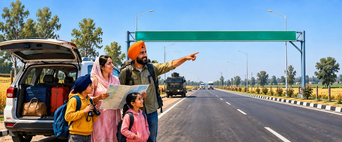
Gurdaspur is a border district in the Majha region of Punjab, India, between the Ravi and Beas rivers, with its headquarters in Gurdaspur city. It holds Dera Baba Nanak, the Indian end of the Kartarpur Corridor, historic Batala and Qadian, and counted 1,621,725 people in the 2011 Census.
- Punjabi name
- ਗੁਰਦਾਸਪੁਰ
- Type
- District
- Headquarters
- Gurdaspur
- Region
- Majha
- State
- Punjab
- Country
- India
All 15 facts
- Area
- 2,610 sq km
- Population
- 1,621,725 (Census 2011, present district)
- Sex ratio
- 907 females per 1,000 males (Census 2011, present district)
- Villages
- 1,157 inhabited (Census 2011)
- Density
- 621 per sq km (present district)
- Literacy
- 79.95 percent (Census 2011, undivided district)
- Tehsils
- 5 (Batala, Dera Baba Nanak, Dinanagar, Gurdaspur and Kalanaur)
- Blocks
- 11 development blocks
- Known for
- Dera Baba Nanak and the Kartarpur Corridor, Batala, Qadian, Akbar's coronation at Kalanaur
Where is Gurdaspur district?
Gurdaspur District is a border district in the Majha region of Punjab, India, set between the Ravi river in the west and the Beas in the east, below the Himalayan foothills. Its headquarters is the city of Gurdaspur, and the present district counted 1,621,725 people in the 2011 Census.
The district is the northernmost in Punjab. Pathankot district lies to its north, Hoshiarpur to the south east, and Kapurthala to the south across the Beas, while Amritsar district adjoins it to the south west and Pakistan, including Narowal district, lies across the Ravi to the north west. Two great rivers frame it: the Ravi, which forms much of the international border, and the Beas, which separates it from Kapurthala and Hoshiarpur. Most of the land is fertile alluvial plain, rising toward the foothills in the north east.
For administration the district is divided into six subdivisions, Batala, Dera Baba Nanak, Dinanagar, Fatehgarh Churian, Gurdaspur and Kalanaur, with eleven development blocks below them and 1,157 inhabited villages counted at the Census. Batala is its largest town and a municipal corporation. Gurdaspur city, the headquarters, stands on the Amritsar to Pathankot railway line and highway, 71 kilometres from Amritsar and 36 kilometres from Pathankot.
From Akbar's coronation to the Anglo-Sikh wars
The district takes its name from Gurdaspur city, which tradition links to the saint Guriya Ji, also remembered as Mahant Guriya Das. Its towns are old. Kalanaur, west of Gurdaspur city, entered imperial history on 14 February 1556, when the young Akbar was crowned Mughal emperor in a garden there after the death of his father Humayun. The coronation platform, the Takht-i-Akbari, still marks the spot.
In the early eighteenth century the Sikh leader Banda Singh Bahadur used this country as a base for raids toward Lahore. His last battle was fought at Gurdas Nangal, near Gurdaspur, where he was captured after a long siege. A generation later, on 17 May 1746, the Kahnuwan marshes saw the Chhota Ghallughara, the smaller of the two great massacres of Sikhs in that century, in which contemporary and later accounts put the dead between 10,000 and 15,000 in a single campaign.
The British annexed the district after the Second Anglo-Sikh War of 1848 to 1849, and it became a subdivision of the Lahore Division. In July 1857, during the first war of independence, rebel sepoys were defeated at the battle of Trimmu Ghat on the left bank of the Ravi, about nine miles west of Gurdaspur city.
Partition, and a district divided again
In 1947 the district's future was one of the most contested questions of Partition. The 1941 Census had recorded a narrow Muslim majority of 51.14 percent, and the Radcliffe Award in the end gave only the Shakargarh tehsil, across the Ravi, to Pakistan, leaving the rest in India. Families crossed the Ravi in both directions, and by the 1951 Census some 2,97,581 displaced persons had settled in the district, about 34.96 percent of its population, most of them from Sialkot district.
The modern district kept changing shape. A new Dera Baba Nanak tehsil was created in 1995. On 27 July 2011 the Pathankot and Dhar Kalan subdivisions were carved out to form the new Pathankot district, leaving Gurdaspur close to its present size, and Kalanaur and Dinanagar later became tehsils in their own right, in 2014 and 2018. In July 2015 Dinanagar suffered a terror attack in which seven people were killed, the first major attack of its kind in Punjab in two decades.
The people of the Ravi and Beas plain
The 2011 Census was taken just before the Pathankot separation, and its headline figures describe the undivided district: 2,298,323 people, a literacy rate of 79.95 percent, with male literacy at 84.56 percent and female literacy at 74.85 percent, and a sex ratio of 895 females for every 1,000 males. The residual district, the Gurdaspur of today, counted 1,621,725 people, of whom 1,260,572 lived in villages and 361,153 in towns, with a sex ratio of 907. Scheduled Castes numbered 373,544, or 23.03 percent, and Punjabi was the language of 98.27 percent of the people.
By faith, the undivided district's Census counted Hindus at 46.74 percent, Sikhs at 43.64 percent and Christians at 7.68 percent, one of the largest Christian shares of any Punjab district, a legacy of mission schools and churches across the Batala and Gurdaspur countryside. In the south of the district, the town of Qadian is the birthplace of Mirza Ghulam Ahmad and was the headquarters of the Ahmadiyya Muslim community until Partition in 1947, and its annual gatherings still draw visitors from many countries.
Farming, mills and the border economy
This is first of all a farming district, watered by the Ravi and the Beas and their canals. Wheat and paddy are the main crops, with sugarcane, maize, vegetables and fodder across the plain, and the grain markets of Batala, Gurdaspur and Dera Baba Nanak collect the harvest of more than a thousand villages. Dairy farming is woven into the same economy, supplying milk to Amritsar and Pathankot.
Industry grew up around the towns. Batala built its name on foundries and farm machinery, and its workshops still serve the agriculture of the whole Majha. At Dhariwal, the well known woollen mill gave the town an industrial identity unusual in a rural district, and generations of local families worked there. The border itself shapes livelihoods too: farming runs right up to the fence in the west, under the eye of the Border Security Force.
Places to see in Gurdaspur district
The district's spiritual centre is Dera Baba Nanak, on the left bank of the Ravi, the town that grew where Guru Nanak spent his last years across the river at Kartarpur, the settlement he founded in 1504. From the viewing point at Dera Baba Nanak, pilgrims long gazed across the fields at the white dome of Gurdwara Darbar Sahib Kartarpur, 4.7 kilometres inside Pakistan. On 9 November 2019 the Kartarpur Corridor opened for the 550th birth anniversary of Guru Nanak, letting Indian pilgrims cross visa-free to the gurdwara. Corridor services were suspended by India in May 2025, and pilgrims should check the current position before travelling.
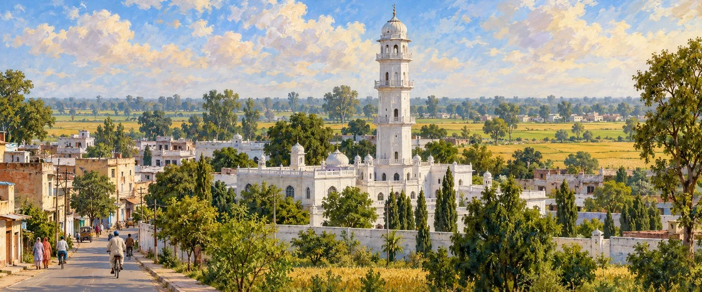
Batala rewards a slow visit: founded, by tradition, in 1465 by Raja Ram Deo, it was here that Guru Nanak married Mata Sulakhni in 1487, and Gurdwara Kandh Sahib preserves the wall associated with the wedding. Kalanaur holds the Takht-i-Akbari, where Akbar was crowned, and Qadian's white minaret and mosques mark its Ahmadiyya heritage. Sri Hargobindpur, on the Beas, is an old Sikh town founded by Guru Hargobind, the sixth Guru.
Getting to Gurdaspur district
Gurdaspur city stands on the railway line and the highway between Amritsar and Pathankot, 71 kilometres from Amritsar and 36 kilometres from Pathankot, and trains on the Amritsar to Jammu line stop at Gurdaspur, Batala and Dera Baba Nanak side routes. Batala is itself a rail junction for the branch to Qadian. The nearest airport is Sri Guru Ram Das Ji International Airport at Amritsar, and buses link every district town with Amritsar, Pathankot and Jalandhar.
ਗੁਰਦਾਸਪੁਰ ਜ਼ਿਲ੍ਹਾ ਕਿੱਥੇ ਹੈ?
ਗੁਰਦਾਸਪੁਰ ਜ਼ਿਲ੍ਹਾ ਭਾਰਤ ਦੇ ਪੰਜਾਬ ਸੂਬੇ ਦੇ ਮਾਝਾ ਖੇਤਰ ਦਾ ਇੱਕ ਸਰਹੱਦੀ ਜ਼ਿਲ੍ਹਾ ਹੈ। ਇਹ ਪੱਛਮ ਵੱਲ ਰਾਵੀ ਦਰਿਆ ਅਤੇ ਪੂਰਬ ਵੱਲ ਬਿਆਸ ਦਰਿਆ ਵਿਚਕਾਰ, ਹਿਮਾਲਿਆ ਦੀਆਂ ਤਲਹਟੀਆਂ ਹੇਠ ਸਥਿਤ ਹੈ। ਇਸ ਦਾ ਸਦਰ ਮੁਕਾਮ ਗੁਰਦਾਸਪੁਰ ਸ਼ਹਿਰ ਹੈ, ਅਤੇ 2011 ਦੀ ਮਰਦਮਸ਼ੁਮਾਰੀ ਵਿੱਚ ਮੌਜੂਦਾ ਜ਼ਿਲ੍ਹੇ ਵਿੱਚ 1,621,725 ਲੋਕ ਗਿਣੇ ਗਏ ਸਨ।
ਇਹ ਜ਼ਿਲ੍ਹਾ ਪੰਜਾਬ ਦਾ ਸਭ ਤੋਂ ਉੱਤਰੀ ਜ਼ਿਲ੍ਹਾ ਹੈ। ਇਸ ਦੇ ਉੱਤਰ ਵੱਲ ਪਠਾਨਕੋਟ ਜ਼ਿਲ੍ਹਾ, ਦੱਖਣ ਪੂਰਬ ਵੱਲ ਹੁਸ਼ਿਆਰਪੁਰ ਅਤੇ ਦੱਖਣ ਵੱਲ ਬਿਆਸ ਪਾਰ ਕਪੂਰਥਲਾ ਲੱਗਦਾ ਹੈ, ਜਦੋਂ ਕਿ ਦੱਖਣ ਪੱਛਮ ਵੱਲ ਅੰਮ੍ਰਿਤਸਰ ਜ਼ਿਲ੍ਹਾ ਅਤੇ ਉੱਤਰ ਪੱਛਮ ਵੱਲ ਰਾਵੀ ਪਾਰ ਪਾਕਿਸਤਾਨ, ਜਿਸ ਵਿੱਚ ਨਾਰੋਵਾਲ ਜ਼ਿਲ੍ਹਾ ਵੀ ਹੈ, ਸਥਿਤ ਹੈ। ਦੋ ਵੱਡੇ ਦਰਿਆ ਇਸ ਨੂੰ ਘੇਰਦੇ ਹਨ: ਰਾਵੀ, ਜੋ ਅੰਤਰਰਾਸ਼ਟਰੀ ਸਰਹੱਦ ਦਾ ਵੱਡਾ ਹਿੱਸਾ ਬਣਾਉਂਦਾ ਹੈ, ਅਤੇ ਬਿਆਸ, ਜੋ ਇਸ ਨੂੰ ਕਪੂਰਥਲਾ ਅਤੇ ਹੁਸ਼ਿਆਰਪੁਰ ਤੋਂ ਵੱਖ ਕਰਦਾ ਹੈ। ਜ਼ਿਆਦਾਤਰ ਜ਼ਮੀਨ ਉਪਜਾਊ ਜਲੋੜ ਮੈਦਾਨ ਹੈ, ਜੋ ਉੱਤਰ ਪੂਰਬ ਵੱਲ ਤਲਹਟੀਆਂ ਵੱਲ ਉੱਠਦਾ ਹੈ।
ਪ੍ਰਸ਼ਾਸਨ ਲਈ ਜ਼ਿਲ੍ਹਾ ਛੇ ਸਬ ਡਿਵੀਜ਼ਨਾਂ ਵਿੱਚ ਵੰਡਿਆ ਹੋਇਆ ਹੈ: ਬਟਾਲਾ, ਡੇਰਾ ਬਾਬਾ ਨਾਨਕ, ਦੀਨਾਨਗਰ, ਫਤਿਹਗੜ੍ਹ ਚੂੜੀਆਂ, ਗੁਰਦਾਸਪੁਰ ਅਤੇ ਕਲਾਨੌਰ, ਅਤੇ ਇਨ੍ਹਾਂ ਦੇ ਹੇਠਾਂ ਗਿਆਰਾਂ ਵਿਕਾਸ ਬਲਾਕ ਹਨ। ਮਰਦਮਸ਼ੁਮਾਰੀ ਵਿੱਚ 1,157 ਆਬਾਦ ਪਿੰਡ ਗਿਣੇ ਗਏ ਸਨ। ਬਟਾਲਾ ਇਸ ਦਾ ਸਭ ਤੋਂ ਵੱਡਾ ਕਸਬਾ ਅਤੇ ਨਗਰ ਨਿਗਮ ਹੈ। ਸਦਰ ਮੁਕਾਮ ਗੁਰਦਾਸਪੁਰ ਸ਼ਹਿਰ ਅੰਮ੍ਰਿਤਸਰ ਤੋਂ ਪਠਾਨਕੋਟ ਜਾਣ ਵਾਲੀ ਰੇਲ ਲਾਈਨ ਅਤੇ ਸੜਕ ਉੱਤੇ ਸਥਿਤ ਹੈ, ਅੰਮ੍ਰਿਤਸਰ ਤੋਂ 71 ਕਿਲੋਮੀਟਰ ਅਤੇ ਪਠਾਨਕੋਟ ਤੋਂ 36 ਕਿਲੋਮੀਟਰ ਦੂਰ।
ਅਕਬਰ ਦੀ ਤਾਜਪੋਸ਼ੀ ਤੋਂ ਅੰਗਰੇਜ਼ ਸਿੱਖ ਜੰਗਾਂ ਤੱਕ
ਜ਼ਿਲ੍ਹੇ ਦਾ ਨਾਂ ਗੁਰਦਾਸਪੁਰ ਸ਼ਹਿਰ ਤੋਂ ਪਿਆ ਹੈ, ਜਿਸ ਬਾਰੇ ਪਰੰਪਰਾ ਹੈ ਕਿ ਇਹ ਸੰਤ ਗੁਰੀਆ ਜੀ, ਜਿਨ੍ਹਾਂ ਨੂੰ ਮਹੰਤ ਗੁਰੀਆ ਦਾਸ ਵੀ ਕਿਹਾ ਜਾਂਦਾ ਹੈ, ਨਾਲ ਜੁੜਿਆ ਹੈ। ਇਸ ਦੇ ਕਸਬੇ ਪੁਰਾਣੇ ਹਨ। ਗੁਰਦਾਸਪੁਰ ਸ਼ਹਿਰ ਦੇ ਪੱਛਮ ਵੱਲ ਕਲਾਨੌਰ 14 ਫਰਵਰੀ 1556 ਨੂੰ ਇਤਿਹਾਸ ਵਿੱਚ ਆਇਆ, ਜਦੋਂ ਉੱਥੇ ਇੱਕ ਬਾਗ਼ ਵਿੱਚ ਨੌਜਵਾਨ ਅਕਬਰ ਨੂੰ ਉਸ ਦੇ ਪਿਤਾ ਹੁਮਾਯੂੰ ਦੀ ਮੌਤ ਤੋਂ ਬਾਅਦ ਮੁਗ਼ਲ ਬਾਦਸ਼ਾਹ ਵਜੋਂ ਤਾਜ ਪਹਿਨਾਇਆ ਗਿਆ। ਤਾਜਪੋਸ਼ੀ ਵਾਲਾ ਥੜ੍ਹਾ, ਤਖ਼ਤ-ਏ-ਅਕਬਰੀ, ਅੱਜ ਵੀ ਉਸ ਥਾਂ ਦੀ ਨਿਸ਼ਾਨੀ ਹੈ।
ਅਠਾਰਵੀਂ ਸਦੀ ਦੇ ਸ਼ੁਰੂ ਵਿੱਚ ਸਿੱਖ ਆਗੂ ਬਾਬਾ ਬੰਦਾ ਸਿੰਘ ਬਹਾਦਰ ਨੇ ਇਸ ਇਲਾਕੇ ਨੂੰ ਲਾਹੌਰ ਵੱਲ ਛਾਪਿਆਂ ਲਈ ਅੱਡਾ ਬਣਾਇਆ। ਉਸ ਦੀ ਆਖਰੀ ਲੜਾਈ ਗੁਰਦਾਸਪੁਰ ਦੇ ਨੇੜੇ ਗੁਰਦਾਸ ਨੰਗਲ ਵਿਖੇ ਲੜੀ ਗਈ, ਜਿੱਥੇ ਲੰਮੇ ਘੇਰੇ ਤੋਂ ਬਾਅਦ ਉਹ ਫੜਿਆ ਗਿਆ। ਇੱਕ ਪੀੜ੍ਹੀ ਬਾਅਦ, 17 ਮਈ 1746 ਨੂੰ, ਕਾਹਨੂੰਵਾਨ ਦੇ ਛੰਭਾਂ ਵਿੱਚ ਛੋਟਾ ਘੱਲੂਘਾਰਾ ਵਾਪਰਿਆ, ਜੋ ਉਸ ਸਦੀ ਵਿੱਚ ਸਿੱਖਾਂ ਦੇ ਦੋ ਵੱਡੇ ਕਤਲੇਆਮਾਂ ਵਿੱਚੋਂ ਛੋਟਾ ਸੀ, ਜਿਸ ਵਿੱਚ ਉਸ ਸਮੇਂ ਦੇ ਅਤੇ ਬਾਅਦ ਦੇ ਕਥਨਾਂ ਅਨੁਸਾਰ ਇੱਕੋ ਮੁਹਿੰਮ ਵਿੱਚ 10,000 ਤੋਂ 15,000 ਵਿਚਕਾਰ ਲੋਕ ਮਾਰੇ ਗਏ।
1848 ਤੋਂ 1849 ਦੀ ਦੂਜੀ ਅੰਗਰੇਜ਼ ਸਿੱਖ ਜੰਗ ਤੋਂ ਬਾਅਦ ਅੰਗਰੇਜ਼ਾਂ ਨੇ ਜ਼ਿਲ੍ਹੇ ਨੂੰ ਆਪਣੇ ਰਾਜ ਵਿੱਚ ਮਿਲਾ ਲਿਆ, ਅਤੇ ਇਹ ਲਾਹੌਰ ਡਿਵੀਜ਼ਨ ਦੀ ਇੱਕ ਸਬ ਡਿਵੀਜ਼ਨ ਬਣ ਗਿਆ। ਜੁਲਾਈ 1857 ਵਿੱਚ, ਆਜ਼ਾਦੀ ਦੀ ਪਹਿਲੀ ਜੰਗ ਦੌਰਾਨ, ਗੁਰਦਾਸਪੁਰ ਸ਼ਹਿਰ ਤੋਂ ਲਗਭਗ ਨੌਂ ਮੀਲ ਪੱਛਮ ਵੱਲ ਰਾਵੀ ਦੇ ਖੱਬੇ ਕੰਢੇ ਉੱਤੇ ਤ੍ਰਿਮੂੰ ਘਾਟ ਦੀ ਲੜਾਈ ਵਿੱਚ ਬਾਗ਼ੀ ਸਿਪਾਹੀ ਹਾਰ ਗਏ।
ਵੰਡ, ਅਤੇ ਫਿਰ ਇੱਕ ਵਾਰ ਜ਼ਿਲ੍ਹੇ ਦੀ ਵੰਡ
1947 ਵਿੱਚ ਜ਼ਿਲ੍ਹੇ ਦਾ ਭਵਿੱਖ ਵੰਡ ਦੇ ਸਭ ਤੋਂ ਵਿਵਾਦ ਵਾਲੇ ਸਵਾਲਾਂ ਵਿੱਚੋਂ ਇੱਕ ਸੀ। 1941 ਦੀ ਮਰਦਮਸ਼ੁਮਾਰੀ ਵਿੱਚ ਇੱਥੇ ਮੁਸਲਿਮ ਬਹੁਗਿਣਤੀ ਮਸਾਂ 51.14 ਫ਼ੀਸਦੀ ਦਰਜ ਸੀ, ਅਤੇ ਅੰਤ ਵਿੱਚ ਰੈਡਕਲਿਫ਼ ਫ਼ੈਸਲੇ ਨੇ ਰਾਵੀ ਪਾਰਲੀ ਸ਼ਕਰਗੜ੍ਹ ਤਹਿਸੀਲ ਹੀ ਪਾਕਿਸਤਾਨ ਨੂੰ ਦਿੱਤੀ, ਬਾਕੀ ਜ਼ਿਲ੍ਹਾ ਭਾਰਤ ਵਿੱਚ ਰਿਹਾ। ਪਰਿਵਾਰ ਦੋਵੇਂ ਪਾਸੇ ਰਾਵੀ ਪਾਰ ਕਰ ਗਏ, ਅਤੇ 1951 ਦੀ ਮਰਦਮਸ਼ੁਮਾਰੀ ਤੱਕ ਲਗਭਗ 2,97,581 ਉਜੜੇ ਹੋਏ ਲੋਕ ਜ਼ਿਲ੍ਹੇ ਵਿੱਚ ਵੱਸ ਚੁੱਕੇ ਸਨ, ਜੋ ਇਸ ਦੀ ਆਬਾਦੀ ਦਾ ਲਗਭਗ 34.96 ਫ਼ੀਸਦੀ ਸਨ, ਅਤੇ ਇਨ੍ਹਾਂ ਵਿੱਚੋਂ ਜ਼ਿਆਦਾਤਰ ਸਿਆਲਕੋਟ ਜ਼ਿਲ੍ਹੇ ਤੋਂ ਆਏ ਸਨ।
ਆਧੁਨਿਕ ਜ਼ਿਲ੍ਹੇ ਦੀ ਸ਼ਕਲ ਬਦਲਦੀ ਰਹੀ। 1995 ਵਿੱਚ ਡੇਰਾ ਬਾਬਾ ਨਾਨਕ ਦੀ ਨਵੀਂ ਤਹਿਸੀਲ ਬਣੀ। 27 ਜੁਲਾਈ 2011 ਨੂੰ ਪਠਾਨਕੋਟ ਅਤੇ ਧਾਰ ਕਲਾਂ ਸਬ ਡਿਵੀਜ਼ਨਾਂ ਨੂੰ ਕੱਟ ਕੇ ਨਵਾਂ ਪਠਾਨਕੋਟ ਜ਼ਿਲ੍ਹਾ ਬਣਾਇਆ ਗਿਆ, ਜਿਸ ਨਾਲ ਗੁਰਦਾਸਪੁਰ ਆਪਣੇ ਮੌਜੂਦਾ ਆਕਾਰ ਦੇ ਨੇੜੇ ਆ ਗਿਆ, ਅਤੇ ਬਾਅਦ ਵਿੱਚ ਕਲਾਨੌਰ 2014 ਵਿੱਚ ਅਤੇ ਦੀਨਾਨਗਰ 2018 ਵਿੱਚ ਆਪਣੇ ਆਪ ਵਿੱਚ ਤਹਿਸੀਲਾਂ ਬਣੇ। ਜੁਲਾਈ 2015 ਵਿੱਚ ਦੀਨਾਨਗਰ ਉੱਤੇ ਅੱਤਵਾਦੀ ਹਮਲਾ ਹੋਇਆ, ਜਿਸ ਵਿੱਚ ਸੱਤ ਲੋਕ ਮਾਰੇ ਗਏ। ਇਹ ਦੋ ਦਹਾਕਿਆਂ ਵਿੱਚ ਪੰਜਾਬ ਵਿੱਚ ਆਪਣੀ ਕਿਸਮ ਦਾ ਪਹਿਲਾ ਵੱਡਾ ਹਮਲਾ ਸੀ।
ਰਾਵੀ ਅਤੇ ਬਿਆਸ ਦੇ ਮੈਦਾਨ ਦੇ ਲੋਕ
2011 ਦੀ ਮਰਦਮਸ਼ੁਮਾਰੀ ਪਠਾਨਕੋਟ ਦੇ ਵੱਖ ਹੋਣ ਤੋਂ ਥੋੜ੍ਹਾ ਪਹਿਲਾਂ ਹੋਈ ਸੀ, ਇਸ ਲਈ ਇਸ ਦੇ ਮੁੱਖ ਅੰਕੜੇ ਅਣਵੰਡੇ ਜ਼ਿਲ੍ਹੇ ਦੇ ਹਨ: 2,298,323 ਲੋਕ, ਸਾਖਰਤਾ ਦਰ 79.95 ਫ਼ੀਸਦੀ, ਜਿਸ ਵਿੱਚ ਮਰਦ ਸਾਖਰਤਾ 84.56 ਫ਼ੀਸਦੀ ਅਤੇ ਔਰਤ ਸਾਖਰਤਾ 74.85 ਫ਼ੀਸਦੀ ਸੀ, ਅਤੇ ਲਿੰਗ ਅਨੁਪਾਤ ਹਰ 1,000 ਮਰਦਾਂ ਪਿੱਛੇ 895 ਔਰਤਾਂ ਸੀ। ਬਾਕੀ ਰਹਿ ਗਿਆ ਜ਼ਿਲ੍ਹਾ, ਅੱਜ ਦਾ ਗੁਰਦਾਸਪੁਰ, 1,621,725 ਲੋਕਾਂ ਦਾ ਸੀ, ਜਿਨ੍ਹਾਂ ਵਿੱਚੋਂ 1,260,572 ਪਿੰਡਾਂ ਵਿੱਚ ਅਤੇ 361,153 ਕਸਬਿਆਂ ਵਿੱਚ ਰਹਿੰਦੇ ਸਨ, ਅਤੇ ਲਿੰਗ ਅਨੁਪਾਤ 907 ਸੀ। ਅਨੁਸੂਚਿਤ ਜਾਤੀਆਂ ਦੀ ਗਿਣਤੀ 373,544, ਭਾਵ 23.03 ਫ਼ੀਸਦੀ ਸੀ, ਅਤੇ ਪੰਜਾਬੀ 98.27 ਫ਼ੀਸਦੀ ਲੋਕਾਂ ਦੀ ਭਾਸ਼ਾ ਸੀ।
ਧਰਮ ਅਨੁਸਾਰ, ਅਣਵੰਡੇ ਜ਼ਿਲ੍ਹੇ ਦੀ ਮਰਦਮਸ਼ੁਮਾਰੀ ਵਿੱਚ ਹਿੰਦੂ 46.74 ਫ਼ੀਸਦੀ, ਸਿੱਖ 43.64 ਫ਼ੀਸਦੀ ਅਤੇ ਈਸਾਈ 7.68 ਫ਼ੀਸਦੀ ਗਿਣੇ ਗਏ। ਇਹ ਪੰਜਾਬ ਦੇ ਕਿਸੇ ਵੀ ਜ਼ਿਲ੍ਹੇ ਵਿੱਚ ਈਸਾਈਆਂ ਦੇ ਸਭ ਤੋਂ ਵੱਡੇ ਹਿੱਸਿਆਂ ਵਿੱਚੋਂ ਇੱਕ ਹੈ, ਜੋ ਬਟਾਲਾ ਅਤੇ ਗੁਰਦਾਸਪੁਰ ਦੇ ਪੇਂਡੂ ਇਲਾਕੇ ਵਿੱਚ ਮਿਸ਼ਨ ਸਕੂਲਾਂ ਅਤੇ ਗਿਰਜਿਆਂ ਦੀ ਵਿਰਾਸਤ ਹੈ। ਜ਼ਿਲ੍ਹੇ ਦੇ ਦੱਖਣ ਵਿੱਚ ਕਾਦੀਆਂ ਕਸਬਾ ਮਿਰਜ਼ਾ ਗ਼ੁਲਾਮ ਅਹਿਮਦ ਦਾ ਜਨਮ ਸਥਾਨ ਹੈ ਅਤੇ 1947 ਦੀ ਵੰਡ ਤੱਕ ਅਹਿਮਦੀਆ ਮੁਸਲਿਮ ਭਾਈਚਾਰੇ ਦਾ ਸਦਰ ਮੁਕਾਮ ਰਿਹਾ ਹੈ, ਅਤੇ ਇਸ ਦੇ ਸਾਲਾਨਾ ਇਕੱਠਾਂ ਵਿੱਚ ਅੱਜ ਵੀ ਕਈ ਦੇਸ਼ਾਂ ਤੋਂ ਲੋਕ ਆਉਂਦੇ ਹਨ।
ਖੇਤੀ, ਮਿੱਲਾਂ ਅਤੇ ਸਰਹੱਦੀ ਆਰਥਿਕਤਾ
ਇਹ ਸਭ ਤੋਂ ਪਹਿਲਾਂ ਖੇਤੀ ਵਾਲਾ ਜ਼ਿਲ੍ਹਾ ਹੈ, ਜਿਸ ਨੂੰ ਰਾਵੀ ਅਤੇ ਬਿਆਸ ਅਤੇ ਇਨ੍ਹਾਂ ਦੀਆਂ ਨਹਿਰਾਂ ਸਿੰਜਦੀਆਂ ਹਨ। ਕਣਕ ਅਤੇ ਝੋਨਾ ਮੁੱਖ ਫ਼ਸਲਾਂ ਹਨ, ਨਾਲ ਸਾਰੇ ਮੈਦਾਨ ਵਿੱਚ ਕਮਾਦ, ਮੱਕੀ, ਸਬਜ਼ੀਆਂ ਅਤੇ ਚਾਰਾ ਹੁੰਦਾ ਹੈ, ਅਤੇ ਬਟਾਲਾ, ਗੁਰਦਾਸਪੁਰ ਅਤੇ ਡੇਰਾ ਬਾਬਾ ਨਾਨਕ ਦੀਆਂ ਅਨਾਜ ਮੰਡੀਆਂ ਹਜ਼ਾਰ ਤੋਂ ਵੱਧ ਪਿੰਡਾਂ ਦੀ ਫ਼ਸਲ ਇਕੱਠੀ ਕਰਦੀਆਂ ਹਨ। ਡੇਅਰੀ ਪਾਲਣ ਵੀ ਇਸੇ ਆਰਥਿਕਤਾ ਵਿੱਚ ਬੁਣਿਆ ਹੋਇਆ ਹੈ, ਜੋ ਅੰਮ੍ਰਿਤਸਰ ਅਤੇ ਪਠਾਨਕੋਟ ਨੂੰ ਦੁੱਧ ਪਹੁੰਚਾਉਂਦਾ ਹੈ।
ਉਦਯੋਗ ਕਸਬਿਆਂ ਦੁਆਲੇ ਵਧਿਆ। ਬਟਾਲਾ ਨੇ ਢਲਾਈਖਾਨਿਆਂ ਅਤੇ ਖੇਤੀ ਸੰਦਾਂ ਨਾਲ ਆਪਣਾ ਨਾਂ ਬਣਾਇਆ, ਅਤੇ ਇਸ ਦੀਆਂ ਵਰਕਸ਼ਾਪਾਂ ਅੱਜ ਵੀ ਸਾਰੇ ਮਾਝੇ ਦੀ ਖੇਤੀ ਦੀ ਸੇਵਾ ਕਰਦੀਆਂ ਹਨ। ਧਾਰੀਵਾਲ ਵਿਖੇ ਮਸ਼ਹੂਰ ਉੱਨ ਮਿੱਲ ਨੇ ਕਸਬੇ ਨੂੰ ਪੇਂਡੂ ਜ਼ਿਲ੍ਹੇ ਵਿੱਚ ਅਣਹੋਣੀ ਉਦਯੋਗਿਕ ਪਛਾਣ ਦਿੱਤੀ, ਅਤੇ ਸਥਾਨਕ ਪਰਿਵਾਰਾਂ ਦੀਆਂ ਪੀੜ੍ਹੀਆਂ ਉੱਥੇ ਕੰਮ ਕਰਦੀਆਂ ਰਹੀਆਂ। ਸਰਹੱਦ ਆਪ ਵੀ ਰੋਜ਼ੀ ਰੋਟੀ ਨੂੰ ਘੜਦੀ ਹੈ: ਪੱਛਮ ਵੱਲ ਖੇਤੀ ਕੰਡਿਆਲੀ ਵਾੜ ਤੱਕ ਹੁੰਦੀ ਹੈ, ਸੀਮਾ ਸੁਰੱਖਿਆ ਫ਼ੌਜ ਦੀ ਨਿਗਰਾਨੀ ਹੇਠ।
ਗੁਰਦਾਸਪੁਰ ਜ਼ਿਲ੍ਹੇ ਵਿੱਚ ਦੇਖਣ ਵਾਲੀਆਂ ਥਾਵਾਂ
ਜ਼ਿਲ੍ਹੇ ਦਾ ਅਧਿਆਤਮਿਕ ਕੇਂਦਰ ਡੇਰਾ ਬਾਬਾ ਨਾਨਕ ਹੈ, ਰਾਵੀ ਦੇ ਖੱਬੇ ਕੰਢੇ ਉੱਤੇ ਉਹ ਕਸਬਾ, ਜੋ ਉੱਥੇ ਵਧਿਆ ਜਿੱਥੋਂ ਦਰਿਆ ਪਾਰ ਕਰਤਾਰਪੁਰ ਸੀ, ਜਿੱਥੇ ਗੁਰੂ ਨਾਨਕ ਦੇਵ ਜੀ ਨੇ ਆਪਣੇ ਆਖਰੀ ਸਾਲ ਬਿਤਾਏ ਅਤੇ ਜਿਸ ਵਸੋਂ ਦੀ ਨੀਂਹ ਉਨ੍ਹਾਂ ਨੇ 1504 ਵਿੱਚ ਰੱਖੀ ਸੀ। ਡੇਰਾ ਬਾਬਾ ਨਾਨਕ ਦੇ ਦਰਸ਼ਨ ਵਾਲੇ ਥਾਂ ਤੋਂ ਸ਼ਰਧਾਲੂ ਲੰਮਾ ਸਮਾਂ ਖੇਤਾਂ ਪਾਰ ਪਾਕਿਸਤਾਨ ਦੇ ਅੰਦਰ 4.7 ਕਿਲੋਮੀਟਰ ਦੂਰ ਗੁਰਦੁਆਰਾ ਦਰਬਾਰ ਸਾਹਿਬ ਕਰਤਾਰਪੁਰ ਦੇ ਚਿੱਟੇ ਗੁੰਬਦ ਵੱਲ ਦੇਖਦੇ ਰਹੇ। 9 ਨਵੰਬਰ 2019 ਨੂੰ ਗੁਰੂ ਨਾਨਕ ਦੇਵ ਜੀ ਦੇ 550ਵੇਂ ਪ੍ਰਕਾਸ਼ ਪੁਰਬ ਲਈ ਕਰਤਾਰਪੁਰ ਲਾਂਘਾ ਖੁੱਲ੍ਹਿਆ, ਜਿਸ ਨਾਲ ਭਾਰਤੀ ਸ਼ਰਧਾਲੂ ਬਿਨਾਂ ਵੀਜ਼ੇ ਤੋਂ ਗੁਰਦੁਆਰੇ ਜਾ ਸਕੇ। ਲਾਂਘੇ ਦੀਆਂ ਸੇਵਾਵਾਂ ਮਈ 2025 ਵਿੱਚ ਭਾਰਤ ਵੱਲੋਂ ਮੁਅੱਤਲ ਕਰ ਦਿੱਤੀਆਂ ਗਈਆਂ ਸਨ, ਇਸ ਲਈ ਯਾਤਰੀਆਂ ਨੂੰ ਜਾਣ ਤੋਂ ਪਹਿਲਾਂ ਮੌਜੂਦਾ ਸਥਿਤੀ ਦੀ ਜਾਂਚ ਕਰਨੀ ਚਾਹੀਦੀ ਹੈ।
ਬਟਾਲਾ ਹੌਲੀ ਹੌਲੀ ਘੁੰਮਣ ਵਾਲੀ ਥਾਂ ਹੈ: ਪਰੰਪਰਾ ਅਨੁਸਾਰ ਇਸ ਦੀ ਨੀਂਹ 1465 ਵਿੱਚ ਰਾਜਾ ਰਾਮ ਦੇਉ ਨੇ ਰੱਖੀ ਸੀ। ਇੱਥੇ ਹੀ 1487 ਵਿੱਚ ਗੁਰੂ ਨਾਨਕ ਦੇਵ ਜੀ ਦਾ ਵਿਆਹ ਮਾਤਾ ਸੁਲੱਖਣੀ ਜੀ ਨਾਲ ਹੋਇਆ ਸੀ, ਅਤੇ ਗੁਰਦੁਆਰਾ ਕੰਧ ਸਾਹਿਬ ਉਸ ਵਿਆਹ ਨਾਲ ਜੁੜੀ ਕੰਧ ਨੂੰ ਸਾਂਭਦਾ ਹੈ। ਕਲਾਨੌਰ ਵਿੱਚ ਤਖ਼ਤ-ਏ-ਅਕਬਰੀ ਹੈ, ਜਿੱਥੇ ਅਕਬਰ ਨੂੰ ਤਾਜ ਪਹਿਨਾਇਆ ਗਿਆ ਸੀ, ਅਤੇ ਕਾਦੀਆਂ ਦੀ ਚਿੱਟੀ ਮੀਨਾਰ ਅਤੇ ਮਸਜਿਦਾਂ ਇਸ ਦੀ ਅਹਿਮਦੀਆ ਵਿਰਾਸਤ ਦੀ ਨਿਸ਼ਾਨੀ ਹਨ। ਬਿਆਸ ਉੱਤੇ ਸ੍ਰੀ ਹਰਗੋਬਿੰਦਪੁਰ ਛੇਵੇਂ ਗੁਰੂ, ਗੁਰੂ ਹਰਗੋਬਿੰਦ ਜੀ ਵੱਲੋਂ ਵਸਾਇਆ ਪੁਰਾਣਾ ਸਿੱਖ ਕਸਬਾ ਹੈ।
ਗੁਰਦਾਸਪੁਰ ਜ਼ਿਲ੍ਹੇ ਤੱਕ ਕਿਵੇਂ ਪਹੁੰਚੀਏ
ਗੁਰਦਾਸਪੁਰ ਸ਼ਹਿਰ ਅੰਮ੍ਰਿਤਸਰ ਅਤੇ ਪਠਾਨਕੋਟ ਵਿਚਕਾਰ ਰੇਲ ਲਾਈਨ ਅਤੇ ਸੜਕ ਉੱਤੇ ਸਥਿਤ ਹੈ, ਅੰਮ੍ਰਿਤਸਰ ਤੋਂ 71 ਕਿਲੋਮੀਟਰ ਅਤੇ ਪਠਾਨਕੋਟ ਤੋਂ 36 ਕਿਲੋਮੀਟਰ ਦੂਰ, ਅਤੇ ਅੰਮ੍ਰਿਤਸਰ ਤੋਂ ਜੰਮੂ ਲਾਈਨ ਉੱਤੇ ਚੱਲਣ ਵਾਲੀਆਂ ਗੱਡੀਆਂ ਗੁਰਦਾਸਪੁਰ ਅਤੇ ਬਟਾਲਾ ਰੁਕਦੀਆਂ ਹਨ। ਬਟਾਲਾ ਆਪ ਕਾਦੀਆਂ ਵਾਲੀ ਸ਼ਾਖਾ ਲਈ ਰੇਲ ਜੰਕਸ਼ਨ ਹੈ। ਸਭ ਤੋਂ ਨੇੜਲਾ ਹਵਾਈ ਅੱਡਾ ਅੰਮ੍ਰਿਤਸਰ ਵਿਖੇ ਸ੍ਰੀ ਗੁਰੂ ਰਾਮ ਦਾਸ ਜੀ ਅੰਤਰਰਾਸ਼ਟਰੀ ਹਵਾਈ ਅੱਡਾ ਹੈ, ਅਤੇ ਬੱਸਾਂ ਜ਼ਿਲ੍ਹੇ ਦੇ ਹਰ ਕਸਬੇ ਨੂੰ ਅੰਮ੍ਰਿਤਸਰ, ਪਠਾਨਕੋਟ ਅਤੇ ਜਲੰਧਰ ਨਾਲ ਜੋੜਦੀਆਂ ਹਨ।
People from Gurdaspur





Nearby



Gurdaspur in the news
All stories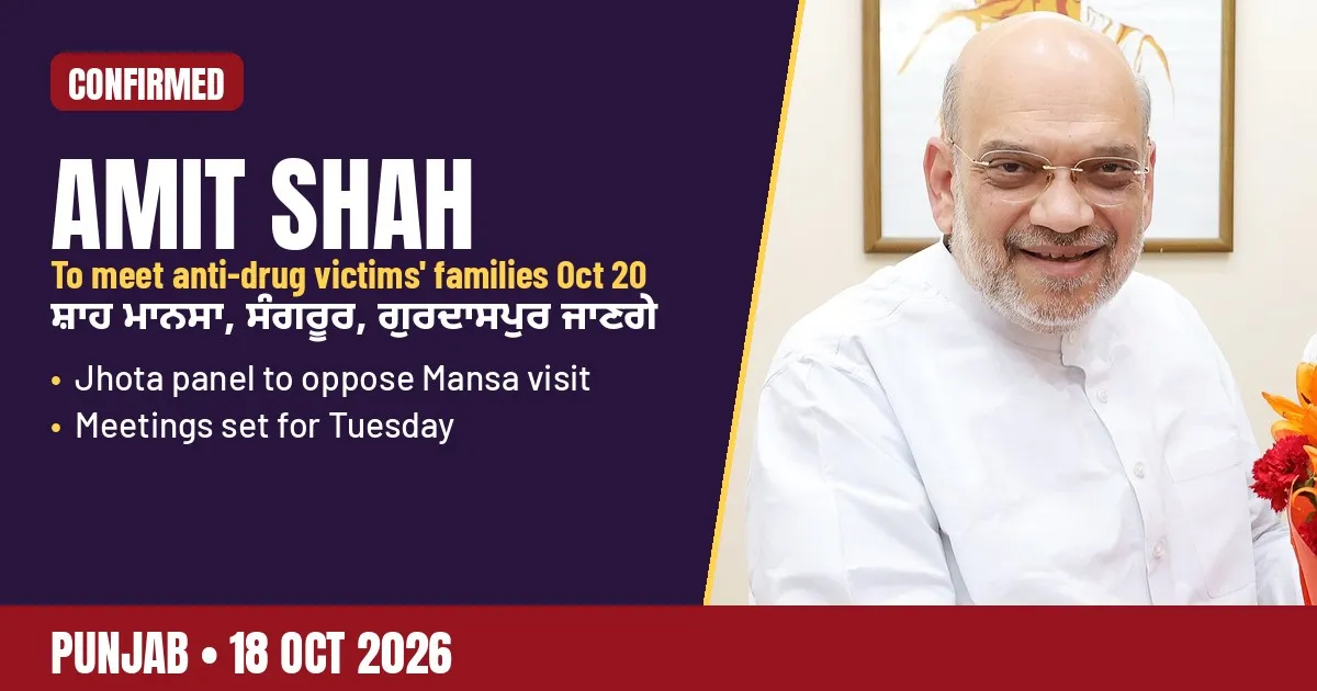 Shah Confirms Oct 20 Meetings With Anti-Drug Victims' Families; Jhota Panel Objectsਸ਼ਾਹ ਵੱਲੋਂ 20 ਅਕਤੂਬਰ ਨੂੰ ਪੀੜਤ ਪਰਿਵਾਰਾਂ ਨੂੰ ਮਿਲਣ ਦੀ ਪੁਸ਼ਟੀ; ਝੋਟਾ ਕਮੇਟੀ ਦਾ ਇਤਰਾਜ਼
 Four Held as Punjab Police Bust Interstate Arms Racketਪੰਜਾਬ ਪੁਲਿਸ ਦੀ ਵੱਡੀ ਕਾਰਵਾਈ: ਅੰਤਰ-ਰਾਜੀ ਹਥਿਆਰ ਤਸਕਰੀ ਰੈਕੇਟ ਦਾ ਭੰਡਾਫੋੜ, ਚਾਰ ਗ੍ਰਿਫ਼ਤਾਰ
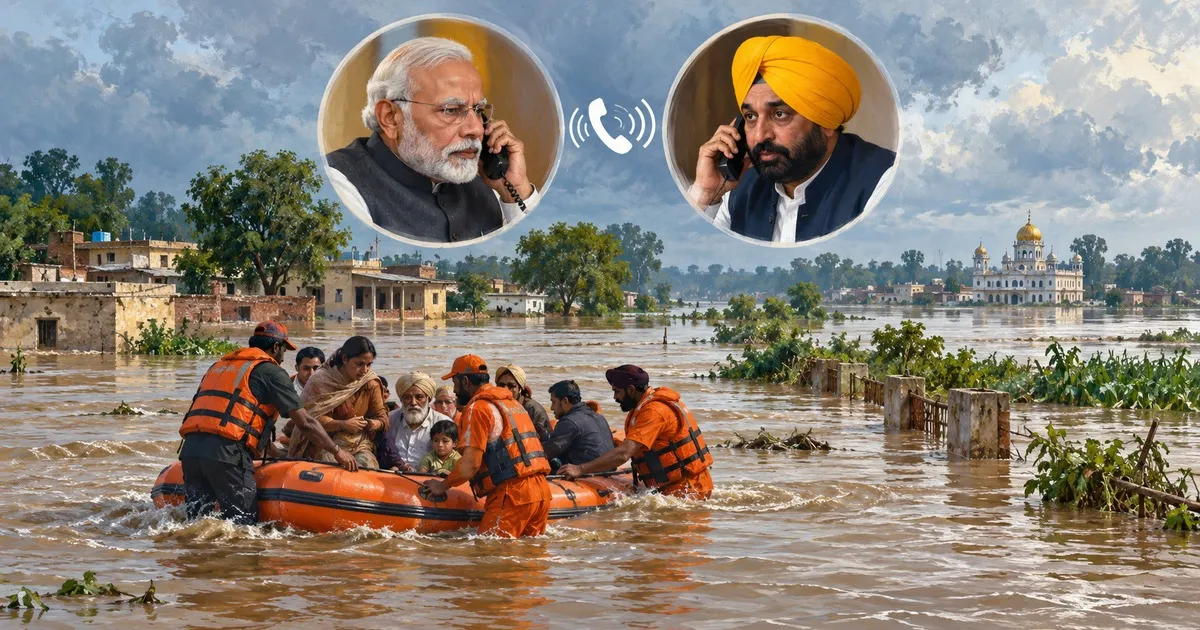 Punjab Floods: PM Modi Speaks to CM Mann as 1,044 Villages Hitਪੰਜਾਬ ਵਿੱਚ ਹੜ੍ਹ: 1,044 ਪਿੰਡ ਪ੍ਰਭਾਵਿਤ, PM ਮੋਦੀ ਨੇ CM ਮਾਨ ਨਾਲ ਕੀਤੀ ਗੱਲ
All places in Gurdaspur district
50 places in 6 tehsils · 50 villages
Tehsils of Gurdaspur
- Taharpurਤਹਰਪੁਰ
- Tajpurਤਜਪੁਰ
- Talabpurਤਲਬਪੁਰ
- Talwandiਤਲਵੰਡੀ
- Talwandi (288)ਤਲਵੰਡੀ
- Talwandi (370)ਤਲਵੰਡੀ
- Talwandi (Bathungarh)ਤਲਵੰਡੀ ਬਥੁਨਗੜ੍ਹ
- Talwandi Bakhtaਤਲਵੰਡੀ ਬਖਟਾ
- Talwandi Bha-rathਤਲਵੰਡੀ ਭਰਥ
- Talwandi Bhindranਤਲਵੰਡੀ ਭਿਂਡਰਨ
- Talwandi Gorayaਤਲਵੰਡੀ ਗੋਰਯਾ
- Talwandi Hinduanਤਲਵੰਡੀ ਹਿਂਡੂਆਂ
- Talwandi Jheuranਤਲਵੰਡੀ ਝੇਉਰਨ
- Talwandi Jhunglanਤਲਵੰਡੀ ਝੁਂਗਲਨ
- Talwandi Raja Dina Nathਤਲਵੰਡੀ ਰਜਾ ਦਿਨਾ ਨਥ
- Talwandi Ramaਤਲਵੰਡੀ ਰਮਾ
- Tandaਤਂਡਾ
- Tapalaਤਪਲਾ
- Taraਤਰਾ
- Taragarhਤਰਾਗੜ੍ਹ
- Taragarhਤਰਾਗੜ੍ਹ
- Tarowaliਤਰੋਵਾਲੀ
- Tarpalaਤਰਪਲਾ
- Taruwalਤਰੁਵਲ
- Tatleyਤਟਲੇਯ
- Tatleyਤਟਲੇਯ
- Tawandi Lal Singhਤਵਂਡੀ ਲਾਲ ਸਿੰਘ
- Teja Kalanਤੇਜਾ ਕਲਾਂ
- Teja Khurdਤੇਜਾ ਖੁਰਦ
- Tenaniwalਤੇਨਨਿਵਲ
- Thakar Sandhuਥਕਰ ਸੰਧੂ
- Thakarpurਥਕਰਪੁਰ
- Thakarwalਥਕਰਵਲ
- Thamanਥਮਨ
- Thanewalਥਨੇਵਲ
- Thathaਥਾਥਾ
- Thathiਠੱਠੀ
- Theh Gulam Nabiਠੇਹ ਗੁਲਮ ਨਬੀ
- Theh Mundianਠੇਹ ਮੁਂਡਿਆਂ
- Theh Tikhaਠੇਹ ਤਿਖਾ
- Thetharkeਥੇਥਰਕੇ
- Thikriwalaਥਿਕਰੀਵਾਲਾ
- Thindhਥਿਂਧ
- Thirriyewalਥਿਰਰਿਯੇਵਲ
- Thundiਥੁਂਡੀ
- Tibberਤਿੱਬੇਰ
- Toorਤੂਰ
- Tugalwalaਤੁਗਲਵਾਲਾ
- Tughialਤੁਘਿਆਲ
- Tungਤੁਂਗ
Sources (9)
- Gurdaspur district, Wikipedia
- Gurdaspur population, Census 2011 data, CensusOfIndia.net
- Gurdaspur District, Punjab Data
- Kartarpur Corridor, Wikipedia
- The District of Gurdaspur, Total Punjab
- Batala, The Sikh Encyclopedia
- Qadian, Wikipedia
- Sri Hargobindpur, Wikipedia
- First woollen mill and the Dhariwal mill of 1880, Testbook
Jugti is free and independent. Reader support keeps the Kosh growing.
Support