

Patiala district is a district of the Malwa region in south eastern Punjab, India, with its headquarters in the royal city of Patiala. Centred on the former Phulkian princely state founded by Baba Ala Singh in 1763, it is known for Qila Mubarak and its palaces, for Punjabi University and the National Institute of Sports, and for its wheat and paddy farming countryside.
- Punjabi name
- ਪਟਿਆਲਾ
- District
- Patiala
- State
- Punjab, India
- Region
- Malwa
- Headquarters
- Patiala city
- Area
- 3,325 sq km (Census 2011)
All 16 facts
- Population (Census 2011)
- 1,895,686
- Literacy
- 75.28% (Census 2011)
- Sex ratio
- 891 females per 1,000 males (Census 2011)
- Tehsils
- 6 (Patiala, Rajpura, Nabha, Samana, Patran, Dudhan Sadhan)
- Blocks
- 10
- Villages
- 912 (Census 2011)
- Language
- Punjabi (Puadhi); Hindi also spoken
- Known for
- Qila Mubarak, Sheesh Mahal, Punjabi University, NIS Patiala
- Founded
- 1763, by Baba Ala Singh (Patiala city and state)
- Population
- 1,895,686 (2011)
Patiala district is a district of south eastern Punjab in the Malwa region of India, centred on the royal city of Patiala. Once the heart of the largest cis-Sutlej princely state, it is known for Qila Mubarak, its palaces and gardens, Punjabi University, the National Institute of Sports, and a rich wheat and paddy countryside.
Where is Patiala district?
Patiala district is in the south east of Punjab, India, in the Malwa region south of the river Sutlej, and its headquarters is the city of Patiala. The district forms the south eastern corner of the state. Fatehgarh Sahib, Rupnagar and SAS Nagar lie to its north, Sangrur and Malerkotla to the west, and the Haryana districts of Ambala and Kurukshetra to the east, with Kaithal to the south. It spans from 29 degrees 49 minutes to 30 degrees 47 minutes north latitude and from 75 degrees 58 minutes to 76 degrees 54 minutes east longitude, while the headquarters city sits at about 30.34 degrees north and 76.38 degrees east. The district covers 3,325 square kilometres and is administered through six tehsils and ten development blocks, with Patiala city as its administrative, educational and commercial centre. Chandigarh, the state capital, is about 70 kilometres away, and Delhi about 250 kilometres.
History: from Phulkian state to PEPSU
The district takes its name and its shape from a princely state. Its rulers belonged to the Phulkian family, named for their ancestor Chaudhary Phul, whose descendants also founded the states of Nabha and Jind. Baba Ala Singh, who took up the leadership of his clan in 1714, built a small principality from about thirty villages around Barnala, dealing carefully with Mughal, Afghan and Maratha power as each rose and faded. In 1763 he laid the foundation of Qila Mubarak, a mud fort later rebuilt in brick, and the city that grew around it took its name from patti, a strip of land, joined to his own name: the land of Ala. Patiala grew into the largest of the cis-Sutlej princely states and the largest of the Phulkian states. In 1809 the state accepted British protection under a treaty, keeping its internal rule while the British handled its external security, and it later ranked as a 17 gun salute state. The nineteenth century maharajas gave the capital its palaces, gates and gardens, and its court became a noted patron of music, learning and sport. After independence the last maharaja, Yadavindra Singh, acceded to India. In 1948 Patiala became the capital of PEPSU, the Patiala and East Punjab States Union, formed by joining eight princely states of the region. On 1 November 1956 PEPSU was merged into Punjab, and Patiala continued as a district of the reorganised state. Later boundary changes on its northern side, where Fatehgarh Sahib and SAS Nagar are now separate districts, gave it the outline it has today.
Geography and people
Most of the district is a level alluvial plain of the Indo-Gangetic system, sloping gently and farmed intensively. The Ghaggar is its best known river, a seasonal stream that runs near the southern and eastern edges and can flood in heavy monsoon years, while a network of canals supports irrigation across the plain. The climate is of the tropical steppe type, semi arid and hot, with very hot summers, a cold winter and a monsoon that brings most of the rain. The district's normal annual rainfall is about 677 millimetres, most of it falling between late June and September. The Census of 2011 counted 1,895,686 people in the district, at a density of 570 people per square kilometre. About six in ten residents lived in villages and four in ten in towns. The sex ratio was 891 women for every 1,000 men, and the literacy rate was 75.28 per cent, at 80.20 per cent for men and 69.80 per cent for women. Sikhs formed 55.91 per cent of the population and Hindus 41.32 per cent, with Muslims at 2.11 per cent and smaller Christian, Jain and other communities. Punjabi is the main language, spoken locally in its Puadhi form, and Hindi is also widely understood.
Places of interest
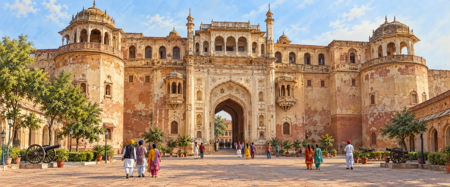
Qila Mubarak, the fort Baba Ala Singh founded in 1763, stands on about ten acres in the heart of the old city. Inside are the Qila Androon, the inner palace of painted chambers, the Ran Baas guest house and the Darbar Hall, ringed by bazaars that still sell jewellery, hand woven cloth and juttis. The Sheesh Mahal, the palace of mirrors, forms part of the Old Moti Bagh Palace complex. Its frescoes were painted under Maharaja Narinder Singh, a lake and the Lakshman Jhula bridge stand in front of it, and its museum is built around the medal collection of Maharaja Bhupinder Singh. Moti Bagh Palace itself, built in 1847 under Narinder Singh, now houses the National Institute of Sports and cultural offices, so a royal residence doubles as the training home of Indian sport. The Baradari Gardens, named for their twelve gates and laid out under Maharaja Rajinder Singh just outside the Sheranwala Gate, hold rare trees, colonial era buildings and the Rajindra Kothi. For worshippers, Gurdwara Dukh Nivaran Sahib at Lehal, now inside Patiala city, marks the place where, by the tradition preserved at the gurdwara, Guru Tegh Bahadur sat under a banyan tree by a pond on 24 January 1672 and the village's sickness lifted. Devotees keep faith in the waters of its sarovar. Six kilometres from the city, Bahadurgarh Fort holds a gurdwara recalling the Guru's stay there. Beyond the capital, Nabha draws visitors to its Hira Mahal and royal cenotaphs, and Samana is an old town of the Sirhind country. The celebrated gurdwaras of Fatehgarh Sahib stand in the neighbouring district of that name, an easy trip north, and not inside Patiala district.
Economy and education
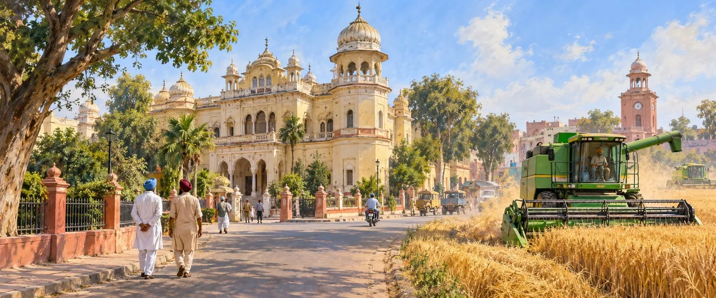
Farming is the district's base. Wheat and paddy are its signature crops, grown on the canal watered plain and traded through the mandis of its towns. Industry clusters where the transport is best. Rajpura, the district's highway and rail gateway, is its main industrial town. Nabha's workshops make farm machinery, a fitting industry for a farming district. Education is the capital's second industry. Punjabi University, established on 30 April 1962 to further the Punjabi language, art and literature, is only the second university in the world named after a language. With the Thapar Institute, the Rajiv Gandhi National University of Law, a government medical college and many colleges beside, Patiala teaches students from across Punjab. The National Institute of Sports, founded in 1961 and housed in the Old Moti Bagh Palace, trains the coaches of Indian sport and keeps a national sports museum.
Getting there and today
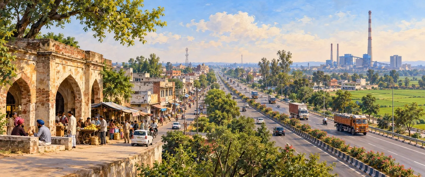
The district is well connected by road and rail. Rajpura is its great junction town, where routes divide for the rest of Punjab, and Patiala city has its own station and bus stand with services across the state and to Delhi. Chandigarh is about 70 kilometres from Patiala city, the nearest airport is at Mohali, about 70 kilometres away, and Delhi is about 250 kilometres away. Today the district works as three things at once: a farming countryside of wheat and paddy villages, a group of busy market and industrial towns, and a royal capital turned centre of universities, hospitals, courts and sport. Visitors come for the palaces and the gurdwara, students for the classrooms, and athletes for the institute in the palace, and all of them meet in the bazaars under the walls of Qila Mubarak.
ਪਟਿਆਲਾ ਜ਼ਿਲ੍ਹਾ ਭਾਰਤ ਦੇ ਪੰਜਾਬ ਸੂਬੇ ਦੇ ਦੱਖਣ ਪੂਰਬ ਵਿੱਚ ਮਾਲਵਾ ਇਲਾਕੇ ਦਾ ਜ਼ਿਲ੍ਹਾ ਹੈ, ਜਿਸਦਾ ਕੇਂਦਰ ਸ਼ਾਹੀ ਸ਼ਹਿਰ ਪਟਿਆਲਾ ਹੈ। ਕਦੇ ਸਤਲੁਜ ਤੋਂ ਦੱਖਣ ਵਾਲੀਆਂ ਰਿਆਸਤਾਂ ਵਿੱਚ ਸਭ ਤੋਂ ਵੱਡੀ ਰਿਆਸਤ ਦਾ ਦਿਲ ਰਿਹਾ ਇਹ ਜ਼ਿਲ੍ਹਾ ਕਿਲ੍ਹਾ ਮੁਬਾਰਕ, ਆਪਣੇ ਮਹਿਲਾਂ ਅਤੇ ਬਾਗਾਂ, ਪੰਜਾਬੀ ਯੂਨੀਵਰਸਿਟੀ, ਨੈਸ਼ਨਲ ਇੰਸਟੀਚਿਊਟ ਆਫ਼ ਸਪੋਰਟਸ ਅਤੇ ਕਣਕ ਤੇ ਝੋਨੇ ਵਾਲੇ ਅਮੀਰ ਪੇਂਡੂ ਇਲਾਕੇ ਲਈ ਜਾਣਿਆ ਜਾਂਦਾ ਹੈ।
ਪਟਿਆਲਾ ਜ਼ਿਲ੍ਹਾ ਕਿੱਥੇ ਹੈ?
ਪਟਿਆਲਾ ਜ਼ਿਲ੍ਹਾ ਭਾਰਤ ਦੇ ਪੰਜਾਬ ਸੂਬੇ ਦੇ ਦੱਖਣ ਪੂਰਬ ਵਿੱਚ ਹੈ, ਸਤਲੁਜ ਦਰਿਆ ਤੋਂ ਦੱਖਣ ਵਾਲੇ ਮਾਲਵਾ ਇਲਾਕੇ ਵਿੱਚ, ਅਤੇ ਇਸਦਾ ਸਦਰ ਮੁਕਾਮ ਪਟਿਆਲਾ ਸ਼ਹਿਰ ਹੈ। ਇਹ ਜ਼ਿਲ੍ਹਾ ਸੂਬੇ ਦਾ ਦੱਖਣ ਪੂਰਬੀ ਕੋਨਾ ਬਣਾਉਂਦਾ ਹੈ। ਇਸਦੇ ਉੱਤਰ ਵਿੱਚ ਫ਼ਤਹਿਗੜ੍ਹ ਸਾਹਿਬ, ਰੂਪਨਗਰ ਅਤੇ ਐਸ ਏ ਐਸ ਨਗਰ ਹਨ, ਪੱਛਮ ਵਿੱਚ ਸੰਗਰੂਰ ਅਤੇ ਮਲੇਰਕੋਟਲਾ, ਪੂਰਬ ਵਿੱਚ ਹਰਿਆਣਾ ਦੇ ਅੰਬਾਲਾ ਅਤੇ ਕੁਰੂਕਸ਼ੇਤਰ ਜ਼ਿਲ੍ਹੇ ਅਤੇ ਦੱਖਣ ਵਿੱਚ ਕੈਥਲ ਹੈ। ਇਹ 29 ਡਿਗਰੀ 49 ਮਿੰਟ ਤੋਂ 30 ਡਿਗਰੀ 47 ਮਿੰਟ ਉੱਤਰੀ ਅਕਸ਼ਾਂਸ਼ ਅਤੇ 75 ਡਿਗਰੀ 58 ਮਿੰਟ ਤੋਂ 76 ਡਿਗਰੀ 54 ਮਿੰਟ ਪੂਰਬੀ ਲੰਬਕਾਰ ਵਿਚਕਾਰ ਫੈਲਿਆ ਹੈ, ਜਦਕਿ ਸਦਰ ਮੁਕਾਮ ਸ਼ਹਿਰ ਲਗਭਗ 30.34 ਡਿਗਰੀ ਉੱਤਰ ਅਤੇ 76.38 ਡਿਗਰੀ ਪੂਰਬ ਉੱਤੇ ਹੈ। ਜ਼ਿਲ੍ਹਾ 3,325 ਵਰਗ ਕਿਲੋਮੀਟਰ ਵਿੱਚ ਫੈਲਿਆ ਹੈ ਅਤੇ ਛੇ ਤਹਿਸੀਲਾਂ ਅਤੇ ਦਸ ਵਿਕਾਸ ਬਲਾਕਾਂ ਰਾਹੀਂ ਚਲਾਇਆ ਜਾਂਦਾ ਹੈ, ਜਿਸ ਵਿੱਚ ਪਟਿਆਲਾ ਸ਼ਹਿਰ ਇਸਦਾ ਪ੍ਰਬੰਧਕੀ, ਵਿਦਿਅਕ ਅਤੇ ਵਪਾਰਕ ਕੇਂਦਰ ਹੈ। ਸੂਬੇ ਦੀ ਰਾਜਧਾਨੀ ਚੰਡੀਗੜ੍ਹ ਲਗਭਗ 70 ਕਿਲੋਮੀਟਰ ਦੂਰ ਹੈ ਅਤੇ ਦਿੱਲੀ ਲਗਭਗ 250 ਕਿਲੋਮੀਟਰ।
ਇਤਿਹਾਸ: ਫੂਲਕੀਆਂ ਰਿਆਸਤ ਤੋਂ ਪੈਪਸੂ ਤੱਕ
ਜ਼ਿਲ੍ਹੇ ਨੂੰ ਇਸਦਾ ਨਾਂ ਅਤੇ ਇਸਦੀ ਸ਼ਕਲ ਇੱਕ ਰਿਆਸਤ ਤੋਂ ਮਿਲੀ ਹੈ। ਇਸਦੇ ਹਾਕਮ ਫੂਲਕੀਆਂ ਪਰਿਵਾਰ ਨਾਲ ਸੰਬੰਧਿਤ ਸਨ, ਜਿਨ੍ਹਾਂ ਦਾ ਨਾਂ ਉਨ੍ਹਾਂ ਦੇ ਵਡੇਰੇ ਚੌਧਰੀ ਫੂਲ ਤੋਂ ਪਿਆ, ਜਿਨ੍ਹਾਂ ਦੇ ਵੰਸ਼ਜਾਂ ਨੇ ਨਾਭਾ ਅਤੇ ਜੀਂਦ ਦੀਆਂ ਰਿਆਸਤਾਂ ਵੀ ਬਣਾਈਆਂ। ਬਾਬਾ ਆਲਾ ਸਿੰਘ, ਜਿਨ੍ਹਾਂ ਨੇ 1714 ਵਿੱਚ ਆਪਣੇ ਕਬੀਲੇ ਦੀ ਅਗਵਾਈ ਸੰਭਾਲੀ, ਨੇ ਬਰਨਾਲੇ ਦੇ ਆਲੇ ਦੁਆਲੇ ਲਗਭਗ ਤੀਹ ਪਿੰਡਾਂ ਤੋਂ ਇੱਕ ਛੋਟੀ ਰਿਆਸਤ ਬਣਾਈ ਅਤੇ ਮੁਗਲ, ਅਫ਼ਗਾਨ ਅਤੇ ਮਰਾਠਾ ਤਾਕਤਾਂ ਨਾਲ ਸੂਝ ਬੂਝ ਨਾਲ ਨਿਬਾਹ ਕੀਤਾ। 1763 ਵਿੱਚ ਉਨ੍ਹਾਂ ਨੇ ਕਿਲ੍ਹਾ ਮੁਬਾਰਕ ਦੀ ਨੀਂਹ ਰੱਖੀ, ਇੱਕ ਮਿੱਟੀ ਦਾ ਕਿਲ੍ਹਾ ਜੋ ਬਾਅਦ ਵਿੱਚ ਪੱਕੀਆਂ ਇੱਟਾਂ ਵਿੱਚ ਮੁੜ ਬਣਿਆ, ਅਤੇ ਇਸਦੇ ਆਲੇ ਦੁਆਲੇ ਵਧੇ ਸ਼ਹਿਰ ਦਾ ਨਾਂ ਪੱਟੀ, ਜਿਸਦਾ ਅਰਥ ਹੈ ਜ਼ਮੀਨ ਦਾ ਟੁਕੜਾ, ਅਤੇ ਉਨ੍ਹਾਂ ਦੇ ਆਪਣੇ ਨਾਂ ਦੇ ਜੋੜ ਤੋਂ ਪਿਆ: ਆਲਾ ਦੀ ਧਰਤੀ। ਪਟਿਆਲਾ ਸਤਲੁਜ ਤੋਂ ਦੱਖਣ ਵਾਲੀਆਂ ਰਿਆਸਤਾਂ ਵਿੱਚ ਸਭ ਤੋਂ ਵੱਡੀ ਅਤੇ ਫੂਲਕੀਆਂ ਰਿਆਸਤਾਂ ਵਿੱਚ ਸਭ ਤੋਂ ਵੱਡੀ ਰਿਆਸਤ ਬਣ ਗਈ। 1809 ਵਿੱਚ ਰਿਆਸਤ ਨੇ ਇੱਕ ਸੰਧੀ ਰਾਹੀਂ ਅੰਗਰੇਜ਼ੀ ਸੁਰੱਖਿਆ ਸਵੀਕਾਰ ਕੀਤੀ, ਆਪਣਾ ਅੰਦਰੂਨੀ ਰਾਜ ਕਾਇਮ ਰੱਖਿਆ ਅਤੇ ਬਾਹਰੀ ਸੁਰੱਖਿਆ ਅੰਗਰੇਜ਼ਾਂ ਕੋਲ ਰਹੀ, ਅਤੇ ਬਾਅਦ ਵਿੱਚ ਇਹ 17 ਤੋਪਾਂ ਦੀ ਸਲਾਮੀ ਵਾਲੀ ਰਿਆਸਤ ਬਣੀ। ਉਨ੍ਹੀਵੀਂ ਸਦੀ ਦੇ ਮਹਾਰਾਜਿਆਂ ਨੇ ਰਾਜਧਾਨੀ ਨੂੰ ਇਸਦੇ ਮਹਿਲ, ਦਰਵਾਜ਼ੇ ਅਤੇ ਬਾਗ ਦਿੱਤੇ, ਅਤੇ ਇਸਦਾ ਦਰਬਾਰ ਸੰਗੀਤ, ਵਿਦਿਆ ਅਤੇ ਖੇਡ ਦਾ ਮਸ਼ਹੂਰ ਸਰਪ੍ਰਸਤ ਬਣਿਆ। ਆਜ਼ਾਦੀ ਤੋਂ ਬਾਅਦ ਆਖ਼ਰੀ ਮਹਾਰਾਜਾ ਯਾਦਵਿੰਦਰ ਸਿੰਘ ਨੇ ਭਾਰਤ ਨਾਲ ਰਲੇਵਾਂ ਕੀਤਾ। 1948 ਵਿੱਚ ਪਟਿਆਲਾ ਪੈਪਸੂ ਦੀ ਰਾਜਧਾਨੀ ਬਣਿਆ, ਉਹ ਪਟਿਆਲਾ ਅਤੇ ਪੂਰਬੀ ਪੰਜਾਬ ਰਿਆਸਤਾਂ ਦਾ ਸੰਘ ਜੋ ਇਲਾਕੇ ਦੀਆਂ ਅੱਠ ਰਿਆਸਤਾਂ ਨੂੰ ਮਿਲਾ ਕੇ ਬਣਿਆ ਸੀ। 1 ਨਵੰਬਰ 1956 ਨੂੰ ਪੈਪਸੂ ਪੰਜਾਬ ਵਿੱਚ ਮਿਲ ਗਿਆ ਅਤੇ ਪਟਿਆਲਾ ਮੁੜ ਬਣੇ ਸੂਬੇ ਦਾ ਜ਼ਿਲ੍ਹਾ ਬਣਿਆ ਰਿਹਾ। ਬਾਅਦ ਵਿੱਚ ਇਸਦੇ ਉੱਤਰੀ ਪਾਸੇ ਹੱਦਾਂ ਵਿੱਚ ਬਦਲਾਅ ਆਏ, ਜਿੱਥੇ ਫ਼ਤਹਿਗੜ੍ਹ ਸਾਹਿਬ ਅਤੇ ਐਸ ਏ ਐਸ ਨਗਰ ਹੁਣ ਵੱਖਰੇ ਜ਼ਿਲ੍ਹੇ ਹਨ, ਅਤੇ ਜ਼ਿਲ੍ਹੇ ਨੂੰ ਇਸਦੀ ਅੱਜ ਵਾਲੀ ਸ਼ਕਲ ਮਿਲੀ।
ਭੂਗੋਲ ਅਤੇ ਲੋਕ
ਜ਼ਿਲ੍ਹੇ ਦਾ ਬਹੁਤਾ ਹਿੱਸਾ ਗੰਗਾ ਦੇ ਮੈਦਾਨੀ ਤੰਤਰ ਦਾ ਪੱਧਰਾ ਜਲੋੜੀ ਮੈਦਾਨ ਹੈ, ਜੋ ਹੌਲੀ ਹੌਲੀ ਢਲਦਾ ਹੈ ਅਤੇ ਜਿੱਥੇ ਸੰਘਣੀ ਖੇਤੀ ਹੁੰਦੀ ਹੈ। ਘੱਗਰ ਇਸਦਾ ਸਭ ਤੋਂ ਜਾਣਿਆ ਦਰਿਆ ਹੈ, ਇੱਕ ਮੌਸਮੀ ਵਹਿਣ ਜੋ ਦੱਖਣੀ ਅਤੇ ਪੂਰਬੀ ਕਿਨਾਰਿਆਂ ਨੇੜੇ ਵਗਦਾ ਹੈ ਅਤੇ ਭਾਰੀ ਮੌਨਸੂਨ ਵਾਲੇ ਸਾਲਾਂ ਵਿੱਚ ਹੜ੍ਹ ਲਿਆ ਸਕਦਾ ਹੈ, ਜਦਕਿ ਨਹਿਰਾਂ ਦਾ ਜਾਲ ਸਾਰੇ ਮੈਦਾਨ ਵਿੱਚ ਸਿੰਜਾਈ ਦਾ ਸਹਾਰਾ ਹੈ। ਮੌਸਮ ਖੁਸ਼ਕ ਅਤੇ ਗਰਮ ਕਿਸਮ ਦਾ ਹੈ, ਬਹੁਤ ਗਰਮ ਗਰਮੀਆਂ, ਠੰਢੀ ਸਰਦੀ ਅਤੇ ਮੌਨਸੂਨ ਜੋ ਸਾਲ ਦਾ ਬਹੁਤਾ ਮੀਂਹ ਲਿਆਉਂਦਾ ਹੈ। ਜ਼ਿਲ੍ਹੇ ਦੀ ਆਮ ਸਾਲਾਨਾ ਵਰਖਾ ਲਗਭਗ 677 ਮਿਲੀਮੀਟਰ ਹੈ, ਜਿਸਦਾ ਬਹੁਤਾ ਹਿੱਸਾ ਜੂਨ ਦੇ ਅੰਤ ਤੋਂ ਸਤੰਬਰ ਵਿਚਕਾਰ ਪੈਂਦਾ ਹੈ। 2011 ਦੀ ਜਨਗਣਨਾ ਨੇ ਜ਼ਿਲ੍ਹੇ ਵਿੱਚ 1,895,686 ਲੋਕ ਗਿਣੇ, ਘਣਤਾ 570 ਲੋਕ ਪ੍ਰਤੀ ਵਰਗ ਕਿਲੋਮੀਟਰ। ਹਰ ਦਸ ਵਾਸੀਆਂ ਵਿੱਚੋਂ ਲਗਭਗ ਛੇ ਪਿੰਡਾਂ ਵਿੱਚ ਅਤੇ ਚਾਰ ਕਸਬਿਆਂ ਵਿੱਚ ਰਹਿੰਦੇ ਸਨ। ਲਿੰਗ ਅਨੁਪਾਤ ਹਰ 1,000 ਮਰਦਾਂ ਪਿੱਛੇ 891 ਔਰਤਾਂ ਸੀ, ਅਤੇ ਸਾਖਰਤਾ ਦਰ 75.28 ਫ਼ੀਸਦੀ ਸੀ, ਮਰਦਾਂ ਵਿੱਚ 80.20 ਫ਼ੀਸਦੀ ਅਤੇ ਔਰਤਾਂ ਵਿੱਚ 69.80 ਫ਼ੀਸਦੀ। ਸਿੱਖ ਆਬਾਦੀ ਦਾ 55.91 ਫ਼ੀਸਦੀ ਅਤੇ ਹਿੰਦੂ 41.32 ਫ਼ੀਸਦੀ ਸਨ, ਮੁਸਲਮਾਨ 2.11 ਫ਼ੀਸਦੀ ਅਤੇ ਈਸਾਈ, ਜੈਨ ਅਤੇ ਹੋਰ ਭਾਈਚਾਰੇ ਛੋਟੀ ਗਿਣਤੀ ਵਿੱਚ ਸਨ। ਪੰਜਾਬੀ ਮੁੱਖ ਭਾਸ਼ਾ ਹੈ, ਜੋ ਇੱਥੇ ਆਪਣੇ ਪੁਆਧੀ ਰੂਪ ਵਿੱਚ ਬੋਲੀ ਜਾਂਦੀ ਹੈ, ਅਤੇ ਹਿੰਦੀ ਵੀ ਆਮ ਸਮਝੀ ਜਾਂਦੀ ਹੈ।
ਵੇਖਣਯੋਗ ਥਾਵਾਂ
ਕਿਲ੍ਹਾ ਮੁਬਾਰਕ, ਜਿਸ ਕਿਲ੍ਹੇ ਦੀ ਨੀਂਹ ਬਾਬਾ ਆਲਾ ਸਿੰਘ ਨੇ 1763 ਵਿੱਚ ਰੱਖੀ, ਪੁਰਾਣੇ ਸ਼ਹਿਰ ਦੇ ਦਿਲ ਵਿੱਚ ਲਗਭਗ ਦਸ ਏਕੜ ਉੱਤੇ ਖੜ੍ਹਾ ਹੈ। ਅੰਦਰ ਕਿਲ੍ਹਾ ਅੰਦਰੂਨ ਹੈ, ਚਿੱਤਰਾਂ ਵਾਲੇ ਕਮਰਿਆਂ ਦਾ ਅੰਦਰੂਨੀ ਮਹਿਲ, ਰਣ ਬਾਸ ਮਹਿਮਾਨ ਖ਼ਾਨਾ ਅਤੇ ਦਰਬਾਰ ਹਾਲ, ਅਤੇ ਇਸਦੇ ਆਲੇ ਦੁਆਲੇ ਉਹ ਬਾਜ਼ਾਰ ਹਨ ਜੋ ਅੱਜ ਵੀ ਗਹਿਣੇ, ਹੱਥ ਬੁਣੇ ਕੱਪੜੇ ਅਤੇ ਜੁੱਤੀਆਂ ਵੇਚਦੇ ਹਨ। ਸ਼ੀਸ਼ ਮਹਿਲ, ਸ਼ੀਸ਼ਿਆਂ ਦਾ ਮਹਿਲ, ਪੁਰਾਣੇ ਮੋਤੀ ਬਾਗ ਮਹਿਲ ਸਮੂਹ ਦਾ ਹਿੱਸਾ ਹੈ। ਇਸਦੇ ਭਿੱਤੀ ਚਿੱਤਰ ਮਹਾਰਾਜਾ ਨਰਿੰਦਰ ਸਿੰਘ ਦੇ ਰਾਜ ਵਿੱਚ ਬਣੇ, ਇਸਦੇ ਸਾਹਮਣੇ ਇੱਕ ਝੀਲ ਅਤੇ ਲਛਮਣ ਝੂਲਾ ਪੁਲ ਹੈ, ਅਤੇ ਇਸਦਾ ਅਜਾਇਬਘਰ ਮਹਾਰਾਜਾ ਭੁਪਿੰਦਰ ਸਿੰਘ ਦੇ ਤਗਮਿਆਂ ਦੇ ਸੰਗ੍ਰਹਿ ਦੇ ਆਲੇ ਦੁਆਲੇ ਬਣਿਆ ਹੈ। ਮੋਤੀ ਬਾਗ ਮਹਿਲ ਆਪ, ਜੋ 1847 ਵਿੱਚ ਨਰਿੰਦਰ ਸਿੰਘ ਦੇ ਰਾਜ ਵਿੱਚ ਬਣਿਆ, ਹੁਣ ਨੈਸ਼ਨਲ ਇੰਸਟੀਚਿਊਟ ਆਫ਼ ਸਪੋਰਟਸ ਅਤੇ ਸੱਭਿਆਚਾਰਕ ਦਫ਼ਤਰਾਂ ਦਾ ਘਰ ਹੈ, ਇਸ ਲਈ ਇੱਕ ਸ਼ਾਹੀ ਰਿਹਾਇਸ਼ ਭਾਰਤੀ ਖੇਡ ਦੀ ਸਿਖਲਾਈ ਦਾ ਘਰ ਵੀ ਹੈ। ਬਾਰਾਦਰੀ ਬਾਗ, ਜਿਨ੍ਹਾਂ ਦਾ ਨਾਂ ਉਨ੍ਹਾਂ ਦੇ ਬਾਰਾਂ ਦਰਵਾਜ਼ਿਆਂ ਤੋਂ ਪਿਆ ਅਤੇ ਜੋ ਮਹਾਰਾਜਾ ਰਾਜਿੰਦਰ ਸਿੰਘ ਦੇ ਰਾਜ ਵਿੱਚ ਸ਼ੇਰਾਂਵਾਲਾ ਦਰਵਾਜ਼ੇ ਦੇ ਐਨ ਬਾਹਰ ਲਗਾਏ ਗਏ, ਵਿੱਚ ਦੁਰਲੱਭ ਰੁੱਖ, ਬਸਤੀਵਾਦੀ ਸਮੇਂ ਦੀਆਂ ਇਮਾਰਤਾਂ ਅਤੇ ਰਾਜਿੰਦਰਾ ਕੋਠੀ ਹਨ। ਸ਼ਰਧਾਲੂਆਂ ਲਈ, ਲਹਿਲ ਵਿਖੇ ਗੁਰਦੁਆਰਾ ਦੁੱਖ ਨਿਵਾਰਨ ਸਾਹਿਬ, ਜੋ ਹੁਣ ਪਟਿਆਲਾ ਸ਼ਹਿਰ ਦੇ ਅੰਦਰ ਹੈ, ਉਸ ਥਾਂ ਨੂੰ ਦਰਸਾਉਂਦਾ ਹੈ ਜਿੱਥੇ, ਗੁਰਦੁਆਰੇ ਵਿੱਚ ਸਾਂਭੀ ਪਰੰਪਰਾ ਅਨੁਸਾਰ, ਗੁਰੂ ਤੇਗ ਬਹਾਦਰ ਜੀ 24 ਜਨਵਰੀ 1672 ਨੂੰ ਇੱਕ ਤਲਾਅ ਕੰਢੇ ਬੋਹੜ ਹੇਠ ਬੈਠੇ ਅਤੇ ਪਿੰਡ ਦੀ ਬਿਮਾਰੀ ਦੂਰ ਹੋ ਗਈ। ਸ਼ਰਧਾਲੂ ਇਸਦੇ ਸਰੋਵਰ ਦੇ ਪਾਣੀ ਵਿੱਚ ਵਿਸ਼ਵਾਸ ਰੱਖਦੇ ਹਨ। ਸ਼ਹਿਰ ਤੋਂ ਛੇ ਕਿਲੋਮੀਟਰ ਦੂਰ ਬਹਾਦੁਰਗੜ੍ਹ ਕਿਲ੍ਹੇ ਵਿੱਚ ਇੱਕ ਗੁਰਦੁਆਰਾ ਹੈ ਜੋ ਗੁਰੂ ਜੀ ਦੇ ਉੱਥੋਂ ਦੇ ਠਹਿਰਾਅ ਦੀ ਯਾਦ ਦਿਵਾਉਂਦਾ ਹੈ। ਰਾਜਧਾਨੀ ਤੋਂ ਪਰੇ, ਨਾਭਾ ਆਪਣੇ ਹੀਰਾ ਮਹਿਲ ਅਤੇ ਸ਼ਾਹੀ ਸਮਾਧਾਂ ਲਈ ਸੈਲਾਨੀਆਂ ਨੂੰ ਖਿੱਚਦਾ ਹੈ, ਅਤੇ ਸਮਾਣਾ ਸਰਹਿੰਦ ਇਲਾਕੇ ਦਾ ਪੁਰਾਣਾ ਕਸਬਾ ਹੈ। ਫ਼ਤਹਿਗੜ੍ਹ ਸਾਹਿਬ ਦੇ ਮਸ਼ਹੂਰ ਗੁਰਦੁਆਰੇ ਇਸੇ ਨਾਂ ਦੇ ਗੁਆਂਢੀ ਜ਼ਿਲ੍ਹੇ ਵਿੱਚ ਹਨ, ਉੱਤਰ ਵੱਲ ਸੌਖੀ ਯਾਤਰਾ ਦੀ ਦੂਰੀ ਉੱਤੇ, ਅਤੇ ਪਟਿਆਲਾ ਜ਼ਿਲ੍ਹੇ ਦੇ ਅੰਦਰ ਨਹੀਂ ਹਨ।
ਅਰਥਵਿਵਸਥਾ ਅਤੇ ਸਿੱਖਿਆ
ਖੇਤੀ ਜ਼ਿਲ੍ਹੇ ਦਾ ਆਧਾਰ ਹੈ। ਕਣਕ ਅਤੇ ਝੋਨਾ ਇਸਦੀਆਂ ਪਛਾਣ ਵਾਲੀਆਂ ਫ਼ਸਲਾਂ ਹਨ, ਜੋ ਨਹਿਰੀ ਪਾਣੀ ਵਾਲੇ ਮੈਦਾਨ ਵਿੱਚ ਉੱਗਦੀਆਂ ਹਨ ਅਤੇ ਇਸਦੇ ਕਸਬਿਆਂ ਦੀਆਂ ਮੰਡੀਆਂ ਵਿੱਚ ਵਿਕਦੀਆਂ ਹਨ। ਉਦਯੋਗ ਉੱਥੇ ਇਕੱਠਾ ਹੁੰਦਾ ਹੈ ਜਿੱਥੇ ਆਵਾਜਾਈ ਸਭ ਤੋਂ ਚੰਗੀ ਹੈ। ਰਾਜਪੁਰਾ, ਜ਼ਿਲ੍ਹੇ ਦਾ ਰਾਜਮਾਰਗ ਅਤੇ ਰੇਲ ਦਰਵਾਜ਼ਾ, ਇਸਦਾ ਮੁੱਖ ਉਦਯੋਗਿਕ ਕਸਬਾ ਹੈ। ਨਾਭਾ ਦੀਆਂ ਵਰਕਸ਼ਾਪਾਂ ਖੇਤੀ ਮਸ਼ੀਨਾਂ ਬਣਾਉਂਦੀਆਂ ਹਨ, ਜੋ ਇੱਕ ਖੇਤੀ ਜ਼ਿਲ੍ਹੇ ਲਈ ਸੋਹਣਾ ਉਦਯੋਗ ਹੈ। ਸਿੱਖਿਆ ਰਾਜਧਾਨੀ ਦਾ ਦੂਜਾ ਉਦਯੋਗ ਹੈ। ਪੰਜਾਬੀ ਯੂਨੀਵਰਸਿਟੀ, ਜਿਸਦੀ ਸਥਾਪਨਾ 30 ਅਪ੍ਰੈਲ 1962 ਨੂੰ ਪੰਜਾਬੀ ਭਾਸ਼ਾ, ਕਲਾ ਅਤੇ ਸਾਹਿਤ ਨੂੰ ਅੱਗੇ ਵਧਾਉਣ ਲਈ ਹੋਈ, ਦੁਨੀਆ ਦੀ ਸਿਰਫ਼ ਦੂਜੀ ਯੂਨੀਵਰਸਿਟੀ ਹੈ ਜਿਸਦਾ ਨਾਂ ਕਿਸੇ ਭਾਸ਼ਾ ਉੱਤੇ ਰੱਖਿਆ ਗਿਆ ਹੈ। ਥਾਪਰ ਇੰਸਟੀਚਿਊਟ, ਰਾਜੀਵ ਗਾਂਧੀ ਨੈਸ਼ਨਲ ਯੂਨੀਵਰਸਿਟੀ ਆਫ਼ ਲਾਅ, ਇੱਕ ਸਰਕਾਰੀ ਮੈਡੀਕਲ ਕਾਲਜ ਅਤੇ ਨਾਲ ਕਈ ਕਾਲਜਾਂ ਨਾਲ, ਪਟਿਆਲਾ ਸਾਰੇ ਪੰਜਾਬ ਦੇ ਵਿਦਿਆਰਥੀਆਂ ਨੂੰ ਪੜ੍ਹਾਉਂਦਾ ਹੈ। ਨੈਸ਼ਨਲ ਇੰਸਟੀਚਿਊਟ ਆਫ਼ ਸਪੋਰਟਸ, ਜਿਸਦੀ ਸਥਾਪਨਾ 1961 ਵਿੱਚ ਹੋਈ ਅਤੇ ਜੋ ਪੁਰਾਣੇ ਮੋਤੀ ਬਾਗ ਮਹਿਲ ਵਿੱਚ ਹੈ, ਭਾਰਤੀ ਖੇਡ ਦੇ ਕੋਚਾਂ ਨੂੰ ਸਿਖਲਾਈ ਦਿੰਦਾ ਹੈ ਅਤੇ ਇੱਕ ਰਾਸ਼ਟਰੀ ਖੇਡ ਅਜਾਇਬਘਰ ਰੱਖਦਾ ਹੈ।
ਪਹੁੰਚ ਅਤੇ ਅੱਜ ਦਾ ਜ਼ਿਲ੍ਹਾ
ਜ਼ਿਲ੍ਹਾ ਸੜਕ ਅਤੇ ਰੇਲ ਰਾਹੀਂ ਚੰਗੀ ਤਰ੍ਹਾਂ ਜੁੜਿਆ ਹੈ। ਰਾਜਪੁਰਾ ਇਸਦਾ ਵੱਡਾ ਸੰਗਮ ਵਾਲਾ ਕਸਬਾ ਹੈ, ਜਿੱਥੋਂ ਰਾਹ ਪੰਜਾਬ ਦੇ ਬਾਕੀ ਹਿੱਸਿਆਂ ਲਈ ਵੰਡੇ ਜਾਂਦੇ ਹਨ, ਅਤੇ ਪਟਿਆਲਾ ਸ਼ਹਿਰ ਦਾ ਆਪਣਾ ਸਟੇਸ਼ਨ ਅਤੇ ਬੱਸ ਅੱਡਾ ਹੈ ਜਿੱਥੋਂ ਸਾਰੇ ਸੂਬੇ ਅਤੇ ਦਿੱਲੀ ਲਈ ਸੇਵਾਵਾਂ ਚੱਲਦੀਆਂ ਹਨ। ਪਟਿਆਲਾ ਸ਼ਹਿਰ ਤੋਂ ਚੰਡੀਗੜ੍ਹ ਲਗਭਗ 70 ਕਿਲੋਮੀਟਰ ਹੈ, ਸਭ ਤੋਂ ਨੇੜਲਾ ਹਵਾਈ ਅੱਡਾ ਮੋਹਾਲੀ ਵਿਖੇ ਲਗਭਗ 70 ਕਿਲੋਮੀਟਰ ਦੂਰ ਹੈ, ਅਤੇ ਦਿੱਲੀ ਲਗਭਗ 250 ਕਿਲੋਮੀਟਰ ਦੂਰ ਹੈ। ਅੱਜ ਜ਼ਿਲ੍ਹਾ ਇੱਕੋ ਸਮੇਂ ਤਿੰਨ ਚੀਜ਼ਾਂ ਹੈ: ਕਣਕ ਅਤੇ ਝੋਨੇ ਵਾਲੇ ਪਿੰਡਾਂ ਦਾ ਖੇਤੀ ਇਲਾਕਾ, ਰੁੱਝੇ ਮੰਡੀ ਅਤੇ ਉਦਯੋਗਿਕ ਕਸਬਿਆਂ ਦਾ ਸਮੂਹ, ਅਤੇ ਇੱਕ ਸ਼ਾਹੀ ਰਾਜਧਾਨੀ ਜੋ ਯੂਨੀਵਰਸਿਟੀਆਂ, ਹਸਪਤਾਲਾਂ, ਅਦਾਲਤਾਂ ਅਤੇ ਖੇਡ ਦਾ ਕੇਂਦਰ ਬਣ ਗਈ ਹੈ। ਸੈਲਾਨੀ ਮਹਿਲਾਂ ਅਤੇ ਗੁਰਦੁਆਰੇ ਲਈ ਆਉਂਦੇ ਹਨ, ਵਿਦਿਆਰਥੀ ਕਲਾਸਾਂ ਲਈ ਅਤੇ ਖਿਡਾਰੀ ਮਹਿਲ ਵਿੱਚ ਬਣੇ ਇੰਸਟੀਚਿਊਟ ਲਈ, ਅਤੇ ਸਾਰੇ ਕਿਲ੍ਹਾ ਮੁਬਾਰਕ ਦੀਆਂ ਕੰਧਾਂ ਹੇਠਲੇ ਬਾਜ਼ਾਰਾਂ ਵਿੱਚ ਮਿਲਦੇ ਹਨ।
Landmarks


Nearby

All places in Patiala district
108 places in 6 tehsils · 108 villages
Tehsils of Patiala
- Kabulpurਕਬੁਲਪੁਰ
- Kachhwaਕਛਵਾ
- Kachhwiਕਛਵੀ
- Kadrabadਕਡਰਆਬਾਦ
- Kahangarh Bhutnaਕਹਨਗੜ੍ਹ ਭੁਟਨਾ
- Kahangarh Gharachonਕਹਨਗੜ੍ਹ ਘਰਚੋਨ
- Kahna Heriਕਹਨਾ ਹੇੜੀ
- Kaidupurਕੈਦੂਪੁਰ
- Kakapurਕਕਾਪੁਰ
- Kakraਕਕਰਾ
- Kakralaਕਕਰਲਾ
- Kakrala (Nabha)ਕਕਰਲਾ
- Kakrala (Samana)ਕਕਰਲਾ
- Kalar Bhaini (Patiala)ਕਲਰ ਭੈਣੀ
- Kalar Bhaini (Patran)ਕਲਰ ਭੈਣੀ
- Kalar Majriਕਲਰ ਮਾਜਰੀ
- Kalbanoਕਲਬਨੋ
- Kalhanaਕਲਹਨਾ
- Kalhe majraਕਲਹੇ ਮਾਜਰਾ
- Kalo Majraਕਲੋ ਮਾਜਰਾ
- Kalsanaਕਲਸਨਾ
- Kalwaਕਲਵਾ
- Kalyanਕਲਿਆਣ
- Kamalpurਕਮਲਪੁਰ
- Kamalpurਕਮਲਪੁਰ
- Kamashpurਕਮਸ਼ਪੁਰ
- Kameliਕਮੇਲੀ
- Kami Kalanਕਮੀ ਕਲਾਂ
- Kami Khurdਕਮੀ ਖੁਰਦ
- Kansuha Kalanਕਂਸੁਹਾ ਕਲਾਂ
- Kansuha Khurdਕਂਸੁਹਾ ਖੁਰਦ
- Kanwarpurਕਂਵਰਪੁਰ
- Kapooriਕਪੂਰੀ
- Kapuriਕਪੁਰੀ
- Kar Heriਕਰ ਹੇੜੀ
- Karanpurਕਰਨਪੁਰ
- Karhaliਕਰਹਲੀ
- Karim Nagar Alias Chicharwalaਕਰੀਮ ਨਗਰ ਅਲਿਆਸ ਚਿਚਰਵਾਲਾ
- Kartarpurਕਰਤਾਰਪੁਰ
- Kasianaਕਸਿਆਨਾ
- Katak Jeriਕਟਕ ਜੇਰੀ
- Kath Mathiਕਥ ਮਥੀ
- Katlaherਕਟਲਹੇਰ
- Kaulਕੌਲ
- Kauliਕੌਲੀ
- Kehargarhਕੇਹਰਗੜ੍ਹ
- Khairpur Jattanਖੈਰਪੁਰ ਜੱਟਾਂ
- khairpur Sheikhanਖੈਰਪੁਰ ਸ਼ੇਖਾਂ
- Khaktan Kalanਖਕਟਨ ਕਲਾਂ
- Khaktan Khurdਖਕਟਨ ਖੁਰਦ
- Khalaspurਖਲਸਪੁਰ
- Khalaspurਖਲਸਪੁਰ
- Khandoliਖਂਡੋਲੀ
- Khanewalਖਨੇਵਲ
- Khangਖਂਗ
- Khanoraਖਨੋਰਾ
- Khanpur Baringਖਾਨਪੁਰ ਬਰਿਂਗ
- Khanpur Gahrianਖਾਨਪੁਰ ਗਹਰਿਆਂ
- Khanpur Gandeanਖਾਨਪੁਰ ਗਂਡੇਅਨ
- Khanpur khurdਖਾਨਪੁਰ ਖੁਰਦ
- Khansaਖਂਸਾ
- Khansanਖਂਸਨ
- Kharabgarhਖ਼ਰਾਬਗੜ੍ਹ
- Kharajpurਖਰਜਪੁਰ
- Kharolaਖਰੋਲਾ
- Khaspurਖਸਪੁਰ
- Khatauliਖਟੌਲੀ
- Khera Gajjuਖੇਰਾ ਗੱਜੁ
- Khera Jattanਖੇਰਾ ਜੱਟਾਂ
- Kheri Barnaਖੇੜੀ ਬਰਨਾ
- Kheri Bhimaਖੇੜੀ ਭਿਮਾ
- Kheri Fattanਖੇੜੀ ਫੱਟਨ
- Kheri Gandeanਖੇੜੀ ਗਂਡੇਅਨ
- kheri Gorianਖੇੜੀ ਗੋਰਿਆਂ
- Kheri Gujranਖੇੜੀ ਗੁਜਰਾਂ
- Kheri Guranaਖੇੜੀ ਗੁਰਨਾ
- Kheri Jattanਖੇੜੀ ਜੱਟਾਂ
- Kheri Malanਖੇੜੀ ਮਲਨ
- Kheri Mandlanਖੇੜੀ ਮਂਡਲਨ
- Kheri Manianਖੇੜੀ ਮਨਿਆਂ
- Kheri Musalmaniਖੇੜੀ ਮੁਸਲਮਨੀ
- Kheri Nagahiyaਖੇੜੀ ਨਗਹਿਯਾ
- Kheri Raju singhਖੇੜੀ ਰਜੁ ਸਿੰਘ
- Kheri Ranwanਖੇੜੀ ਰਂਵਨ
- Khizerpurਖਿਜ਼ੇਰਪੁਰ
- Khokhਖੋਖ
- Khuddaਖੁੱਡਾ
- Khurdਖੁਰਦ
- Khusropurਖੁਸਰੋਪੁਰ
- Kishangarhਕਿਸ਼ਨਗੜ੍ਹ
- Kishangarhਕਿਸ਼ਨਗੜ੍ਹ
- Kishanpurਕਿਸ਼ਨਪੁਰ
- Kishanpur urf Bakhshiwalaਕਿਸ਼ਨਪੁਰ ਉਰਫ ਬਖਸ਼ੀਵਾਲਾ
- Kohle Majraਕੋਹਲੇ ਮਾਜਰਾ
- Kookaਕੂਕਾ
- Kot Kalanਕੋਟ ਕਲਾਂ
- Kot Khurdਕੋਟ ਖੁਰਦ
- Kotlaਕੋਟਲਾ
- Kotla Gehruਕੋਟਲਾ ਗੇਹਰੁ
- Kotla Nasruਕੋਟਲਾ ਨਸਰੁ
- Kotliਕੋਟਲੀ
- Kotliਕੋਟਲੀ
- Kularanਕੁਲਰਨ
- Kularanਕੁਲਰਨ
- Kulburchhaਕੁਲਬੁਰਛਾ
- Kule Majraਕੁਲੇ ਮਾਜਰਾ
- Kutbanpurਕੁਟਬਨਪੁਰ
- Kutha Kheriਕੁਥਾ ਖੇੜੀ
Sources (11)
- District Survey Report, Patiala (2016), District Level Environment Impact Assessment Authority
- Aquifer Mapping and Management Plan, Patiala District, Central Ground Water Board
- Patiala Census 2011 data, Census of India compilation
- Patiala district tehsils and Census 2011 population, VillageInfo
- Development blocks in Patiala district, VillageInfo
- About Punjabi University, Punjabi University Patiala
- The Phulkian Narrative, Sahapedia
- Patiala, The Sikh Encyclopedia
- Patiala, Encyclopaedia article (Great Soviet Encyclopedia text)
- Moti Bagh Palace, Wikipedia
- Tourist attractions and markets of Patiala, Total Punjab
Jugti is free and independent. Reader support keeps the Kosh growing.
Support